
Maine - Vermont - New Hampshire
Unobtainable first state of one of the most influential maps of New England ever made.
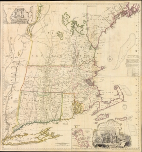
A MAP of the most INHABITED part of NEW ENGLAND, containing the PROVINCES of MASSACHUSETS BAY and NEW HAMPSHIRE, with the COLONIES of KONEKTIKUT AND RHODE ISLAND. Divided into Counties and Townships: The whole composed of Actual Surveys and its situation adjusted by ASTRONOMICAL OBSERVATIONS.
$55,000.00
Acquire
- Digital Map Information
- Suitable for large format printing
- File Size: 35.46 MB
- File Type: ZIP / TIFF
- ICC color profile embedded
- Delivered instantly via download link
This is the rare 1755 first state of Braddock Mead's French and Indian War Era map of New England - one of the most significant and iconic American maps ever produced. It is one of the first large-format regional maps of any part of North America and was the most comprehensively researched and detailed map of contemporary New England. (more details)
First printed English Nautical Chart of New York and New England. / First use of the name 'Connecticut' in any form.
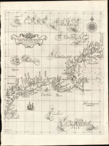
Carta particolare della nuova Belgia è parte della nuova Anglia La longitudiné Cominca da l'Isola di Pico d'Asores. D'America Carta II.
$40,000.00
Acquire
- Digital Map Information
- Suitable for large format printing
- File Size: 14.46 MB
- File Type: ZIP / TIFF
- ICC color profile embedded
- Delivered instantly via download link
This is a superb example of Robert Dudley's 1647 / 1661 nautical map of the coast of New York and New England - according to Burden, the 'first printed sea chart of New England and the New Netherlands.' Moreover, it is the first chart of New England to be produced by an Englishman. The chart's portolan-like lines and exquisite Florentine calligraphy distinguish it as one of the most beautiful works dedicated to the region. It is a rarity on the market, and a prize map for collectors of New York and New England. (more details)
Merrill's own manuscript draft of New Hampshire's first town plan.
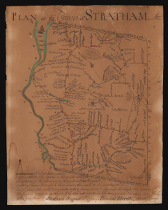
Plan of the Town of Stratham.
$25,000.00
Acquire
- Digital Map Information
- Suitable for large format printing
- File Size: 3.77 MB
- File Type: ZIP / TIFF
- ICC color profile embedded
- Delivered instantly via download link
An extraordinary discovery, this is Phinehas Merrill's 1792 original manuscript draft of his important Plan of the Town of Stratham, published a year later in 1793. Not only is this the first map of any New Hampshire town, it is a key example of early American mapmaking, comparable in many ways to Christopher Colles' 1789 Roads. Moreover, while the printed map is in and of itself significant - and rare, existing in just 12 known examples - this unprecedented example is Merrill's own working draft, drawn by his own hand and exhibiting signs of an evolving production. (more details)
Largest and Best Map of Lower Canada after the War of 1812.
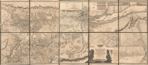
To His Royal Highness George Augustus Frederick, Prince of Wales, Duke of Cornwall ... and Prince Regent of the United Kingdom of Great Britain and Ireland; this Topographical map of the Province of Lower Canada, shewing its division into Districts, Counties, Seigniories, and Townships with all the Lands reserved both for the Crown and the Clergy ... Is with his Royal Hyghnes's Special Permission, Most gratefully dedicated by a Faithful and Zealous Canadian Subject, and His Royal Highnes's Most Obedient and Devoted Servant, Joseph Bouchette, His Majesty's Surveyor General of the Province and Lieutt. Colonel C.M.
$25,000.00
Acquire
- Digital Map Information
- Suitable for large format printing
- File Size: 317.57 MB
- File Type: ZIP / TIFF
- ICC color profile embedded
- Delivered instantly via download link
This is Joseph Bouchette's monumental 10-sheet map of Lower Canada. Appearing at the end of the War of 1812, this is the largest, best, and most influential map of Canada issued in the 19th century. David Rumsey correctly praises it, saying that the 'graphic elegance of the large map is the equal (or perhaps the superior) of any of the contemporary maps that I have seen'. In its pre-publication manuscript form, it played a significant role in the Treaty of Ghent, which ended the War of 1812 and began the establishment of formal U.S.-Canada borders. Due to its extreme rarity, the significance of this map is often overlooked, and it is poorly represented in scholarly literature. (more details)
Best map of the Hudson Valley at the outset of the American Revolution.
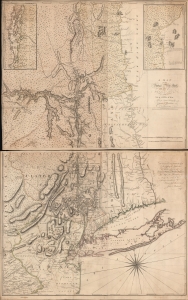
A Map of the Province of New-York, with Part of Pensilvania, and New England.
$16,000.00
Acquire
- Digital Map Information
- Suitable for large format printing
- Full resolution TIFF file
- ICC color profile embedded
- Delivered instantly via download link
This is John Montresor's striking 1775 map of New York and the surrounding regions - considered the best and most authoritative map of the region at the beginning of the American Revolutionary War (1775 - 1783). (more details)
Most important map in 18th century American history.
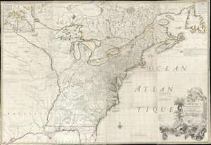
Amerique Septentrionale avec Les Routes, Distances et miles, Villages et Etablissements François et Anglois Par le Docteur Mitchel.
$12,000.00
Acquire
- Digital Map Information
- Suitable for large format printing
- Full resolution TIFF file
- ICC color profile embedded
- Delivered instantly via download link
This is the important 1777 Georges Le Rouge French edition of the seminal John Mitchell map of the eastern part of North America. The Mitchell map is considered the single most important map in 18th-century American history. It was used as a primary reference for nearly every treaty and boundary dispute in colonial North America from the French and Indian War (1754 - 1763) through the late 19th century. The map is all the more astounding because this is Mitchell's one and only map - a truly remarkable feat of virtuosity. (more details)
First large-scale map to show American postal routes.
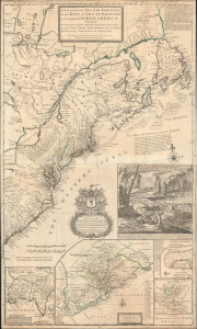
A New and Exact Map of the Dominions of the King of Great Britain on ye Continent of North America. Containing Newfoundland, New Scotland, New England, New York, New jersey, Pensilvania, Maryland, Virginia and Carolina.
$11,000.00
Acquire
- Digital Map Information
- Suitable for large format printing
- File Size: 44.83 MB
- File Type: ZIP / TIFF
- ICC color profile embedded
- Delivered instantly via download link
This is Herman Moll's 1715 'Beaver Map' of the British Colonies in America, here in its 1733 state (see below). In addition to its iconic and namesake image of Niagara Falls and the rich American peltries, this map is also significant as one of the most accurate maps of the period and the first large-scale map to show American postal routes. (more details)
A most important map of eastern Canada detailing British settlement and colonization in the early 19th century.
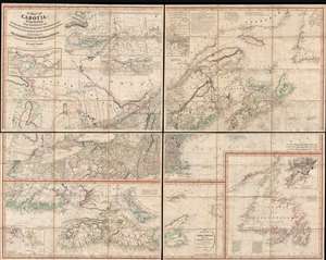
A Map of Cabotia; Comprehending The Provinces of Upper and Lower Canada, New-Brunswick And Nova-Scotia, with Breton Island, Newfoundland, &c. And Including also, The Adjacent Parts of the United States. Compiled from a great Variety of Original Documents. By John Purdy.
$10,500.00
Acquire
- Digital Map Information
- Suitable for large format printing
- DPI: 300
- File Size: 72.87 MB
- File Type: ZIP / TIFF
- ICC color profile embedded
- Delivered instantly via download link
A fine example of Purdy's important 1821 map of Cabotia or Canada and New England – at the time the largest and finest map of that region. Cabotia is Purdy's manufactured term for eastern Canada or those lands discovered by John Cabot in 1497. The map covers from Lake Michigan to Newfoundland and from Labrador to New York City. Within Canada, it includes all of Ontario, Quebec, Nova Scotia, New Brunswick and Nova Scotia, and Newfoundland. In the United States, it includes all of New England, Michigan, and New York, as well as parts of Ohio and Pennsylvania. There are no fewer than 10 inset detail maps including a map of the Great lakes, the environs of Quebec, the St. Lawrence River, Niagara and vicinity, Newfoundland, Nova Scotia, Halifax, St. John, and New York Harbor. (more details)
Ethan Allen's brother Ira: Mapping his way out of jail.
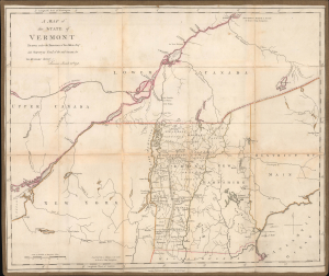
A Map of the State of Vermont Drawn under the Direction of Ira Allen Esq.
$7,500.00
Acquire
- Digital Map Information
- Suitable for large format printing
- Full resolution TIFF file
- ICC color profile embedded
- Delivered instantly via download link
A remarkable 1798 Ira Allen map of Vermont, northern New England, New York, and southern Canada, engraved in London during Allen's detention by British authorities. Although titled simply A Map of the State of Vermont, it is less a conventional state map than a calculated political and commercial argument. Allen, the younger brother of Ethan Allen, emphasizes Vermont's strategic position between the Hudson-Champlain corridor and the St. Lawrence River, illustrates his proposed canal into British Canada, and presents the young state as both the natural center of a potentially lucrative international trade network and a vulnerable frontier requiring military protection. (more details)
First Specific Map of Lakes Champlain and George.
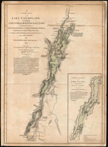
A Survey Of Lake Champlain, including Lake George, Crown Point And St. John. /A Particular Plan of Lake George.
$7,000.00
Acquire
- Digital Map Information
- Suitable for large format printing
- Full resolution TIFF file
- ICC color profile embedded
- Delivered instantly via download link
This is William Furness Brasier's 1762 map of Lakes Champlain and George, in its rare August 5, 1776, first state. It is the first separate map of Lake Champlain and Lake George. It would certainly have been in the hands of the British officers leading the Fall 1777 campaign during the American Revolutionary War (1775 - 1783), which culminated in the pivotal American victory at Saratoga. Most examples of this first state that we have seen on the market were issued in the so-called 'Holster Atlas,' and as such, exhibit significantly more folds and wear than this example, which appears to have been preserved in a larger-format book. (more details)
Celebrating the revival of Portland, Maine!
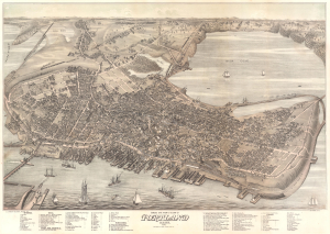
Bird's Eye View of the City of Portland Maine, 1876.
$5,000.00
Acquire
- Digital Map Information
- Suitable for large format printing
- DPI: 600
- File Size: 60.8 MB
- File Type: ZIP / TIFF
- ICC color profile embedded
- Delivered instantly via download link
An exceptional 1876 bird's-eye view map of Portland, Maine, by Joseph Warner - one of only three known views by Warner. It is considered to be the largest and best aerial view of Portland issued in the 19th century. (more details)
Home of Okemo Mountain.
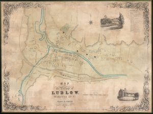
Map of the Village of Ludlow, Windsor Co. Vt.
$4,100.00
Acquire
- Digital Map Information
- Suitable for large format printing
- File Size: 38.51 MB
- File Type: ZIP / TIFF
- ICC color profile embedded
- Delivered instantly via download link
This is a rare 1853 Presdee and Edwards wall map of Ludlow, Vermont, home of Okemo Mountain, of New England's largest and most beloved ski resorts. When this map was issued, Ludlow was primarily an agricultural hub, but benefited as a stop on the Rutland and Burlington Railroad, leading it to develop a small but robust mill culture. (more details)
One of the few views of to show a walled New York.
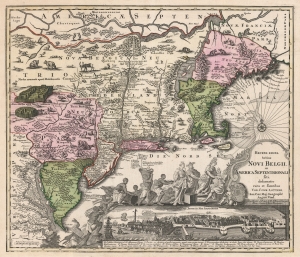
Recens Edita Totius Novi Belgii, in America Septentrionali siti, delineatio cura et sumtibus Tob. Conr. Lotteri, Sac. Caes. Maj. Geographi August. Vind.
$3,500.00
Acquire
- Digital Map Information
- Suitable for large format printing
- DPI: 600
- File Size: 74.88 MB
- File Type: ZIP / TIFF
- ICC color profile embedded
- Delivered instantly via download link
This is Conrad Tobias Lotter's 1757 map of New York, New England, and the mid-Atlantic colonies. It represents the final map in the Jansson-Visscher series. Despite the map's cartography being over a century old, this map continued to capture the idea of this part of the world for Europeans in general and a German audience in particular. (more details)
Powerhouse of American Shipbuilding.
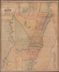
Map of the City of Bath Sagadahoc Co. Maine.
$3,500.00
Acquire
- Digital Map Information
- Suitable for large format printing
- Full resolution TIFF file
- ICC color profile embedded
- Delivered instantly via download link
This is a scarce 1873 wall map of Bath, Maine, prepared by local cartographers Frederick B. Roe and George N. Colby. The map is notable for documenting the city's importance as a center of the American shipbuilding industry. (more details)
Iron Rails across the Granite State.
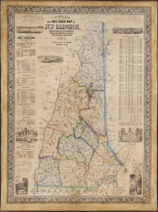
Township and Rail Road Map of New Hampshire.
$3,500.00
Acquire
- Digital Map Information
- Suitable for large format printing
- File Size: 4144.03 MB
- File Type: ZIP / TIFF
- ICC color profile embedded
- Delivered instantly via download link
This is Jacob Richard Dodge's 1860 wall map of New Hampshire, printed by L. H. Bradford. It provides a detailed overview of the state, highlighting its rail network and including statistics, geographical information, and vignette illustrations. (more details)
Heart of the White Mountains.
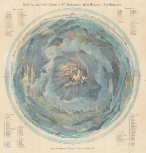
Bird's-Eye View from Summit of Mt. Washington; White Mountains, New-Hampshire.
$3,500.00
Acquire
- Digital Map Information
- Suitable for large format printing
- Full resolution TIFF file
- ICC color profile embedded
- Delivered instantly via download link
A dramatic 1902 top-down George H. Walker chromolithograph bird's-eye view of Mt. Washington and the White Mountains, New Hampshire. This view was issued for the Boston and Maine Railroad, which not only operated the best trains to get to the White Mountains, but also the famous Mount Washington Cog Railway. (more details)
Inset of Boston - first map of an English colonial city on a non-English map.
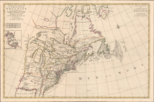
Carte Nouvelle De L'Amerique Angloise Contenant La Virginie, Maryland, Caroline, Pensylvania, Nouvelle Iorck, N. Iarsey, N.France, Et Les Terres Nouvellement Decouverte...
$3,200.00
Acquire
- Digital Map Information
- Suitable for large format printing
- Full resolution TIFF file
- ICC color profile embedded
- Delivered instantly via download link
An impressive large-scale Pierre Mortier 1700 map of the British Colonies in North America. The map features an important inset of Boston - the first map of a British colonial city on a non-British map (Burden). It was issued to capitalize on popular interest in King William's War (1689 - 1697). (more details)
Maine's Epic North Coast.
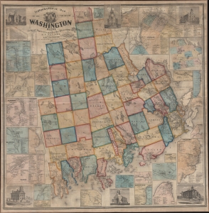
Topographical Map of the County of Washington Maine From Actual Surveys under the Direction of H. F. Walling.
$3,000.00
Acquire
- Digital Map Information
- Suitable for large format printing
- File Size: 275.71 MB
- File Type: ZIP / TIFF
- ICC color profile embedded
- Delivered instantly via download link
This is the 1861 Henry F. Walling map of Washington County, Maine. Washington County encompasses Maines's north coast, extending roughly from Mount Desert Island to the Canadian border. (more details)
First large scale map of the state to be issued after the Greenleaf third edition of 1844. - Rumsey
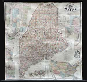
Map of the State of Maine.
$3,000.00
Acquire
- Digital Map Information
- Suitable for large format printing
- Full resolution TIFF file
- ICC color profile embedded
- Delivered instantly via download link
An impressive large-scale 1862 Civil War era wall map of Maine by Henry Francis Walling and Jacob Chace Jr. This the first major map of Maine to follow the 1844 map of Jeremiah Greenleaf. The map represents the culmination of Walling and Chace's decades of work in Maine. For years, they compiled and published Maine city and county maps, giving them access to unprecedented up-to-date cartographic data, all of which is represented here. (more details)
Rangeley Lakes Region.
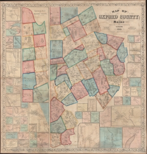
Map of Oxford County Maine.
$2,750.00
Acquire
- Digital Map Information
- Suitable for large format printing
- File Size: 500.18 MB
- File Type: ZIP / TIFF
- ICC color profile embedded
- Delivered instantly via download link
A superb example of H. F. Walling's 1858 wall map of Oxford County Maine. Composed of much of Maine's western border, the map embraces parts of the beautiful Rangeley Lakes Region, including Mooselookmeguntic Lake and the adjacent Richardson Lakes. (more details)
Prettiest village in Maine.
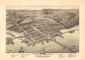
Bird's Eye View of the Village of Wiscasset, Lincoln Co. Maine 1878.
$2,750.00
Acquire
- Digital Map Information
- Suitable for large format printing
- File Size: 40.17 MB
- File Type: ZIP / TIFF
- ICC color profile embedded
- Delivered instantly via download link
A striking two-color 1878 chromolithograph bird's-eye view of Wiscasset, Maine, issued by J. J. Stoner and Albert Ruger. This is the only known bird's-eye view of Wiscasset. (more details)
Individual residences in and around Portsmouth.
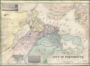
Map of the City of Portsmouth N. H. From Original Surveys Under the Direction of H. F. Walling, Civil Engineer.
$2,750.00
Acquire
- Digital Map Information
- Suitable for large format printing
- Full resolution TIFF file
- ICC color profile embedded
- Delivered instantly via download link
A scarce 1850 Henry Francis Walling map of Portsmouth, New Hampshire, and Kittery, Maine. Walling began publishing separately issued town plans on his own account in 1850, making this one of his earliest maps. Moreover, of Walling's nearly 150 separately issued town plans, this is one of the largest scale and most highly detailed. (more details)
One of only two known examples of Colby and Roe's map of Camden, Maine.
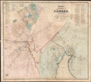
Map of the Town of Camden Knox Co. Maine.
$2,500.00
Acquire
- Digital Map Information
- Suitable for large format printing
- File Size: 43.9 MB
- File Type: ZIP / TIFF
- ICC color profile embedded
- Delivered instantly via download link
A discovery of exceptional rarity, this is Frederick B. Roe and George Nehemiah Colby's 1875 map of Camden, Maine. This is the best and finest map of Camden to appear in the 19th century. It superseded the 1856 E. M. Woodford map of the same region both in terms of size and level of detail. (more details)
Gateway to the White Mountains.
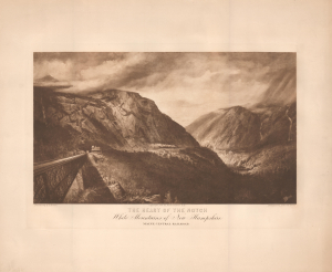
The Heart of the Notch White Mountains of New Hampshire. Maine Central Railroad.
$2,500.00
Acquire
- Digital Map Information
- Suitable for large format printing
- File Size: 18.59 MB
- File Type: ZIP / TIFF
- ICC color profile embedded
- Delivered instantly via download link
This is a striking 1890 photogravure view of Crawford Notch in the White Mountains of New Hampshire, based on a drawing by Harrison B. Brown, issued for the Maine Central Railroad. This work was published at the height of the tourist boom in the White Mountains, when posh hotels catered to wealthy East Coast urbanites on extended summer sojourns. (more details)
Moosehead Lake, Mount Katahdin, and lands given to Bowdoin College.
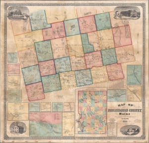
Map of Piscataquis County Maine.
$2,500.00
Acquire
- Digital Map Information
- Suitable for large format printing
- Full resolution TIFF file
- ICC color profile embedded
- Delivered instantly via download link
This is an 1858 Henry Francis Walling wall map of Piscataquis County, Maine. The map includes Moosehead Lake, Mount Katahdin (a very serious climb), and lands granted to Bowdoin College. The Katahdin Iron Works is labeled despite the fact that it ceased production one year earlier in 1857 (it would resume with the Civil War in 1861). (more details)
Beautiful View of a Bucolic Boomtown.
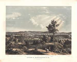
A View of Manchester, N. H., composed from Sketches taken near Rock Raymond by J. B. Bachelder, 1855.
$2,500.00
Acquire
- Digital Map Information
- Suitable for large format printing
- File Size: 80.93 MB
- File Type: ZIP / TIFF
- ICC color profile embedded
- Delivered instantly via download link
This rare, large and beautiful Bachelder / Endicott chromolithograph view illustrates Manchester, New Hampshire at a time when it was a thriving industrial powerhouse, and home to what in 1846 was the largest cotton mill in the world. It is among the earliest depictions of the city, is certainly the largest, and is arguably the most beautiful. The view is oriented to the east. In the middle distance, the thriving mill town is shown, dominated by the factories of the Amoskeag Manufacturing Company: a smoking hive of activity on the east bank of the Merrimack River. At the far left and right, railway trains wind through the countryside and along bridges crossing the River. Beyond the smokestacks of the waterfront, the city's buildings can be seen climbing up the valley and hills to the east.
The view was sketched from life by J. B. Bachelder, and committed to two-color lithograph by the New York lithographic firm of Endicott and Company. Endicott produced three other lithographs of Bachelder's sketches of Manchester, but they were all of a significantly smaller format and intended for inclusion in Endicott's 'Album of New England Scenery.' Bachelder lived in Manchester starting in 1854, so perhaps a certain civic pride in his new home led him to give the city more attention than his other subjects. (more details)
The view was sketched from life by J. B. Bachelder, and committed to two-color lithograph by the New York lithographic firm of Endicott and Company. Endicott produced three other lithographs of Bachelder's sketches of Manchester, but they were all of a significantly smaller format and intended for inclusion in Endicott's 'Album of New England Scenery.' Bachelder lived in Manchester starting in 1854, so perhaps a certain civic pride in his new home led him to give the city more attention than his other subjects. (more details)
German interest in the American Revolution.
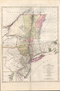
A Map of The Provinces of New-York and New-Jersey, with a part of Pennsylvania and the Province of Quebec from the Topographical Observations of C. J. Sauthier.
$2,250.00
Acquire
- Digital Map Information
- Suitable for large format printing
- DPI: 600
- File Size: 937.14 MB
- File Type: ZIP / TIFF
- ICC color profile embedded
- Delivered instantly via download link
An important 1777 Revolutionary War era map of New York and New Jersey by Claude Joseph Sauthier and Matthäus Albrecht Lotter. The map reflects significant German interest in the war related to widespread participation by Germans on both sides of the conflict. (more details)
One of the Most Decisive Battles of the War of 1812.
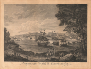
Macdonough's VIctory on Lake Champlain, and Defeat of the British Army at Plattsburg by Genl. Macomb, Septr. 11th. 1814.
$2,200.00
Acquire
- Digital Map Information
- Suitable for large format printing
- Full resolution TIFF file
- ICC color profile embedded
- Delivered instantly via download link
This is Benjamin Tanner's 1816 engraving of the Battle of Plattsburgh on Lake Champlain, based on a painting by Hugh Reinagle. A rather astonishing triumph against a superior force, the American victory at Plattsburgh proved to be one of the most decisive battles of the War of 1812 and hastened the war's conclusion. (more details)
Vignette view of the Phillips Exeter Academy.
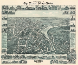
Exeter New Hampshire.
$2,000.00
Acquire
- Digital Map Information
- Suitable for large format printing
- File Size: 74.32 MB
- File Type: ZIP / TIFF
- ICC color profile embedded
- Delivered instantly via download link
This is an 1896 A.W. Moore two-color chromolithograph bird's-eye view map of Exeter, New Hampshire. The view illustrates Exeter as a small but thriving town well connected to via the Boston and Maine Railroad. The view also illustrates Phillips Exeter Academy, a prestigious and still-active boarding school founded in 1781. (more details)
Monumental Sea Chart of the Coast of the Northeastern United States.
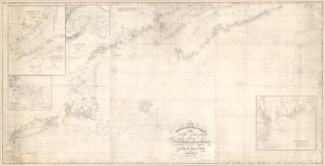
The north eastern coast of North America from New York to Cape Canso, including Sable Island.
$2,000.00
Acquire
- Digital Map Information
- Suitable for large format printing
- DPI: 600
- File Size: 102 MB
- File Type: ZIP / TIFF
- ICC color profile embedded
- Delivered instantly via download link
This is Edmund Blunt's rare, monumental 1840 nautical chart or map of the northeast United States, extending from New York to Cape Canso in Nova Scotia, and is the most authoritative American chart of these waters available at the time. It provides not only granular detail of the coastline, but also detailed soundings for the crucial sailing lanes from Halifax to Boston. It is a working chart - typically referred to as a 'blueback chart' due to the color of the reinforcing paper it was originally mounted to. Rather than contend with multiple charts, mariners typically preferred large charts composed of several sheets: hence the impressive expanse of the present chart. (more details)
Best 18th century map of the Ohio River Valley.
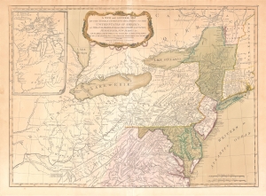
A New and General Map of the Middle Dominions Belonging to the United States of America, viz. Virginia, Maryland, the Delaware-Counties, Pennsylvania, New Jersey etc…
$1,850.00
Acquire
- Digital Map Information
- Suitable for large format printing
- DPI: 600
- File Size: 27.56 MB
- File Type: ZIP / TIFF
- ICC color profile embedded
- Delivered instantly via download link
This is the Laurie and Whittle 1794 updated edition of Lewis Evans' foundational 1755 map of the middle part of the British Colonies in North America. Evans' map was the earliest to accurately detail the American frontier at the time of its original publication. It exhibits superb detail in the northern Appalachian Mountains and the Ohio River Valley, providing information about Native American tribes and transport, French and English forts, and other details pertinent to the frontiersman, including sources of salt, roads, and trails. It was hailed by Schwartz and Ehrenberg as 'the most ambitious performance of its kind undertaken in America up to that time.' So widely was the excellence of Evans' map recognized that he was unable to make any money on it at all, as it was promptly pirated by Jefferys, Sayer, Kitchen, Bowles, Crevecoeur, and, as here, Laurie and Whittle. This 1794 edition, at least, updates the map to indicate the outcome of the American Revolution - it names the United States and includes the boundary line between the United States and Canada as determined by the 1783 Treaty of Paris. This is also the first edition of the Evans map to include the new state of Kentucky - although erroneously positioned north of the Ohio River. (more details)
Thirteen Colonies on the Brink of Revolution.
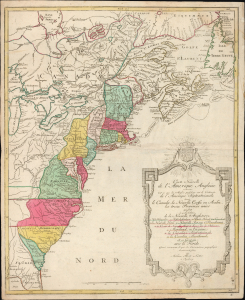
Carte Nouvelle de L'Amerique Angloise contenant tout ce que les Anglois possedent sur le Continent de L'Amerique Septentrionale savoir le Canada, la Nouvelle Ecosse ou Acadie, les treize Provinces unies
$1,800.00
Acquire
- Digital Map Information
- Suitable for large format printing
- Full resolution TIFF file
- ICC color profile embedded
- Delivered instantly via download link
This is an uncommon 1776 French-language map of the Thirteen Colonies and emerging United States by Augsburg cartographer Matthias Albrecht Lotter, published at the outbreak of the American Revolutionary War. Drawing heavily on French cartographic traditions, the map presents British North America at the very moment the colonies declared independence and the United States began to take shape. Issued two years before France formally entered the Revolutionary War on the American side, it captures the continent on the cusp of a geopolitical transformation that would redraw North America. (more details)