
New York City (sold)
The Colton Map - one of the largest and most beautiful maps of New York City pulished in the 19th century - in an unrecorded state.
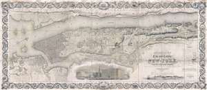
Topographical Map of the City and County of New-York, and the adjacent Country: With Views in the border of the principal Buildings and interesting Scenery of the Island.
sold
- Digital Map Information
- Suitable for large format printing
- DPI: 300
- File Size: 74.68 MB
- File Type: ZIP / TIFF
- ICC color profile embedded
- Delivered instantly via download link
Known as 'The Colton Map,' this is an unrecorded state of an 1840 map of New York City (Manhattan) by David H. Burr and John Hutchins Colton considered to be the finest and most decorative map of the city to appear in the 19th century. According to map historian ... (more details)
Significant pre-Revoutionary War map of Manhattan.
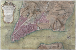
To His Excellency Sr. Henry Moore, Bart. Captain General and Governour in Chief in and over the Province of New York and the Territories depending thereon in America Chancellor and Vice admiral of the same, This Plan of the City of New York, is most HUmbly INscribed, by His Excellency's Most Obedient Servant, Bernd. Ratzen.
sold
- Digital Map Information
- Suitable for large format printing
- DPI: 300
- File Size: 28.36 MB
- File Type: ZIP / TIFF
- ICC color profile embedded
- Delivered instantly via download link
Known as the 'Ratzen Plan,' this is one of the most important, beautiful, and iconic colonial era maps of New York City, offered here in its rare first state. It is the among the most important pre-Revolutionary War maps of Manhattan. (more details)
One of the most beautiful, important, and enduring maps of Manhattan ever published.
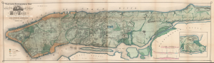
Sanitary and Topographical Map of the City and Island of New York Prepared for the Council of Hygiene and Public Health, of the Citizens Association.
sold
- Digital Map Information
- Suitable for large format printing
- Full resolution TIFF file
- ICC color profile embedded
- Delivered instantly via download link
This is Egbert L. Viele's large-format 1865 topography and waterways map of Manhattan, or the City of New York as it was then. It is one of the scarcest, most important, and most enduring maps of New York City ever published. This particular example is a rare variant appearing in the Report of the Council of Hygiene and Public Health of the Citizens' Association of New York upon the Sanitary Condition of the City and also has the esteemed provenance of being connected to the French Consulate in New York City. (more details)
One of the most beautiful, important, and enduring maps of Manhattan ever published.
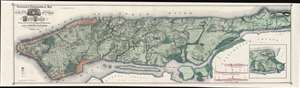
Topographical Map of the City of New York Showing Original Water Courses and Made Land.
sold
- Digital Map Information
- Suitable for large format printing
- File Size: 86.7 MB
- File Type: ZIP / TIFF
- ICC color profile embedded
- Delivered instantly via download link
This is a very beautiful and fine example of Egbert L. Viele's 1865 topography and waterways map of Manhattan, one of the scarcest, most important, and most enduring maps of New York City ever published. Covering the entirety of Manhattan Island, Viele's map details the canals, swamps, rivers, ditches, ponds, meadows, and drainage basins of Manhattan as they existed prior to the city's urban development. A version of the Viele map remains in use today by architects and contractors who need to be certain they are not building over underground rivers and swamps that may destabilize a new construction's foundation. (more details)
Earliest Acquirable, Separate Issue.
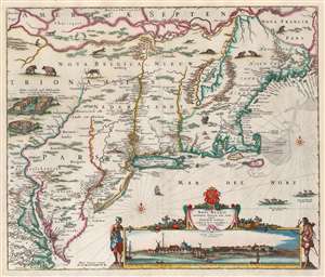
Novi Belgii Novaeque Angliae nec non Partis Virginiae Tabula multis in locis emendata a Nicolao Joannis Visschero.
sold
- Digital Map Information
- Suitable for large format printing
- Full resolution TIFF file
- ICC color profile embedded
- Delivered instantly via download link
This is the rare, c. 1656 second state of the Jansson/ Visscher map of the New Netherlands and New England. It is the earliest acquirable state of this work: the first, 'proof state', of this masterwork is an unobtainable rarity, known in only four examples in institutional and private collections. (more details)
The Earliest Acquirable, Separate Issue.

Novi Belgii Novaeque Angliae nec non Partis Virginiae Tabula multis in locis emendata a Nicolao Joannis Visschero.
sold
- Digital Map Information
- Suitable for large format printing
- Full resolution TIFF file
- ICC color profile embedded
- Delivered instantly via download link
This is the rare, c. 1656 second state of the Jansson/ Visscher map of the New Netherlands and New England. It is the earliest acquirable state of this work: the first, 'proof state', of this masterwork is an unobtainable rarity, known in only four examples in institutional and private collections. (more details)
A study in contrast.
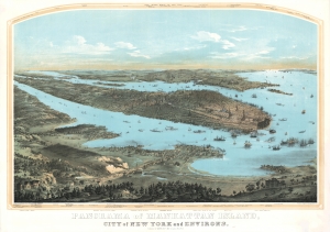
Panorama of Manhattan Island, City of New York and Environs.
sold
- Digital Map Information
- Suitable for large format printing
- DPI: 600
- File Size: 157.36 MB
- File Type: ZIP / TIFF
- ICC color profile embedded
- Delivered instantly via download link
John Bornet presents a sweeping panoramic bird's-eye view of New York City on the cusp of its monumental expansion northwards in the second half of the 19th century. The view looks east on Manhattan, Queens, and Brooklyn from a high point to the west of Hoboken, New Jersey. Bornet purports to have drawn the view 'from nature', likely from Bergen Hill, New Jersey, a popular high point used by other viewmakers of the period. (more details)
Exceptional early manuscript map of the Financial Center of the World - Wall Street!
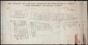
Map Shewing the Property Benefited by Widening Wall Street from Broadway to Nassau Street.
sold
- Digital Map Information
- Suitable for large format printing
- DPI: 300
- File Size: 11.96 MB
- File Type: ZIP / TIFF
- ICC color profile embedded
- Delivered instantly via download link
A unique once-in-a-lifetime discovery for the New York City collector, this is a one-of-a-kind 1851 manuscript cadastral survey map of New York City's Wall Street between Broadway and Pearl Street – including the site of the New York Stock Exchange and numerous ... (more details)
Iconic view of New York with Spectacular Chromolithograph Color.
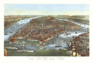
The City of New York.
sold
- Digital Map Information
- Suitable for large format printing
- File Size: 48.95 MB
- File Type: ZIP / TIFF
- ICC color profile embedded
- Delivered instantly via download link
This is a beautiful example of the iconic 1870 Currier and Ives chromolithograph view of New York City, specifically Manhattan. It is the first edition of this famous view to include the Brooklyn Bridge, in the year construction on the wonder began, but 13 years before it opened! This example also has the richest original chromolithograph color we have seen in any example. (more details)
Iconic view of New York with spectacular chromolithograph color.
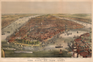
The City of New York.
sold
- Digital Map Information
- Suitable for large format printing
- File Size: 57.82 MB
- File Type: ZIP / TIFF
- ICC color profile embedded
- Delivered instantly via download link
This is a beautiful example of the iconic 1870 Currier and Ives chromolithograph view of New York City, specifically Manhattan. It is the first edition of this famous view to include the Brooklyn Bridge, in the year construction on the wonder began, but 13 years before it opened! (more details)
One of the most beautiful, important, and enduring maps of Manhattan ever published.
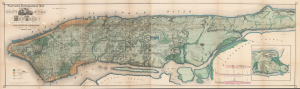
Topographical Map of the City of New York Showing Original Water Courses and Made Land.
sold
- Digital Map Information
- Suitable for large format printing
- Full resolution TIFF file
- ICC color profile embedded
- Delivered instantly via download link
This is a beautiful example of Egbert L. Viele's 1865 topography and waterways map of Manhattan, one of the scarcest, most important, and most enduring maps of New York City ever published. Viele's map details the canals, swamps, rivers, ditches, ponds, meadows, and drainage basins of Manhattan as they existed prior to the city's urban development. A version of the Viele map remains in use today by architects and contractors who need to be certain they are not building over underground rivers and swamps that may destabilize a new construction's foundation. (more details)
One of the most beautiful, important, and enduring maps of Manhattan ever published.
Topographical Map of the City of New York showing original water courses and made land.
sold
- Digital Map Information
- Suitable for large format printing
- Full resolution TIFF file
- ICC color profile embedded
- Delivered instantly via download link
This is a very beautiful and fine example of Egbert L. Viele's 1865 topography and waterways map of Manhattan, one of the scarcest, most important, and most enduring maps of New York City ever published. Covering the entirety of Manhattan Island, Viele's map details the canals, swamps, rivers, ditches, ponds, meadows, and drainage basins of Manhattan as they existed prior to the city's urban development. A version of the Viele map remains in use today by architects and contractors who need to be certain they are not building over underground rivers and swamps that may destabilize a new construction's foundation. (more details)
Possibly the only surviving example of this remarkable 19th century Manhattan Birds-Eye View.
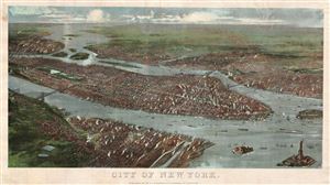
City of New York.
sold
- Digital Map Information
- Suitable for large format printing
- File Size: 4.87 MB
- File Type: ZIP / TIFF
- ICC color profile embedded
- Delivered instantly via download link
A rare possibly unique find, this is G. W. and C. B. Colton's magnificent 1897 panoramic birds-eye view of New York City. Presented in chromolithograph color this map reveals Manhattan, Brooklyn, and Queens as seen from high above Jersey City and Hoboken, which ... (more details)
One of the most beautiful, important, and enduring maps of Manhattan ever published.
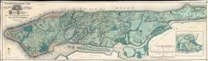
Sanitary and Topographical Map of the City and Island of New York Prepared for the Council of Hygiene and Public Health, of the Citizens Association.
sold
- Digital Map Information
- Suitable for large format printing
- File Size: 74.33 MB
- File Type: ZIP / TIFF
- ICC color profile embedded
- Delivered instantly via download link
This is a very beautiful and fine example of Egbert L. Viele's 1865 topography and waterways map of Manhattan, one of the scarcest, most important, and most enduring maps of New York City ever published. Covering the entirety of Manhattan Island, Viele's map details the canals, swamps, rivers, ditches, ponds, meadows, and drainage basins of Manhattan as they existed prior to the city's urban development. A version of the Viele map remains in use today by architects and contractors who need to be certain they are not building over underground rivers and swamps that may destabilize a new construction's foundation. (more details)
An even greater New York.
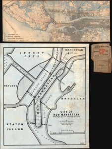
[New Manhattan] / City of New Manhattan.
sold
- Digital Map Information
- Suitable for large format printing
- Full resolution TIFF file
- ICC color profile embedded
- Delivered instantly via download link
This is a bold and futuristic 1911 - 1931 proposal to transform Manhattan with a landfill extending 8 miles into New York Harbor by T. Kennard Thomson, one of the founding fathers of American structural engineering and a pioneer of the Skyscraper Age. These two maps comprehend the first and last iteration of Kennard Thomson's 'New Manhattan': a preliminary partial manuscript plan dating to March 22, 1911 (predating the official release of the proposal in May) and the final 1930 iteration, in full manuscript. (more details)
The largest-scale pioneering aerial map of New York City.
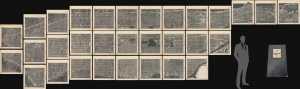
Hamilton Aerial Map Manhattan.
sold
- Digital Map Information
- Suitable for large format printing
- File Size: 164.67 MB
- File Type: ZIP / TIFF
- ICC color profile embedded
- Delivered instantly via download link
This is the rare William L. Hamilton 1927 aerial map of Manhattan, New York City. It is one of the earliest and certainly the largest aerial map of New York produced in the pioneering days of aerial cartography. The map was issued as a loose-leaf folio atlas of thirty-one sheets. (more details)
Rare Colton edition of an iconic New York City map.
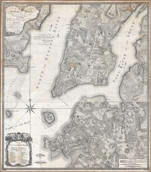
Plan of the city of New York in North America : surveyed in the years 1766 and 1767.
sold
- Digital Map Information
- Suitable for large format printing
- DPI: 300
- File Size: 61.52 MB
- File Type: ZIP / TIFF
- ICC color profile embedded
- Delivered instantly via download link
Known as the 'Ratzer Plan,' this is one of the most important, beautiful, and iconic colonial era maps of New York City, offered here in a stunning 1853 Colton restrike. This map was originally surveyed in 1767 by Bernard Ratzer, a lieutenant in the 'Royal American' regiment at the behest of Sir George Moore, governor of New York, who is sited in the cartouche. The map, which covers the southern part of Manhattan to about modern day 57th street, is a revision and expansion upon the flawed John Montresor plan of 1767. Across East River, a portion of Long Island is depicted, including most of Brooklyn and Parts of Long Island City. (more details)
One of the most beautiful, important, and enduring maps of Manhattan ever published.
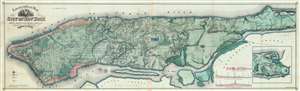
Topographical Map of the City of New York showing original water courses and made land.
sold
- Digital Map Information
- Suitable for large format printing
- File Size: 92.32 MB
- File Type: ZIP / TIFF
- ICC color profile embedded
- Delivered instantly via download link
This is Egbert L. Viele's 1865 topography and waterways map of Manhattan, one of the scarcest, most important, and most enduring maps of New York City ever published. Covering the entirety of Manhattan Island, Viele's map details the canals, swamps, rivers, ditches, ponds, meadows, and drainage basins of Manhattan as they existed prior to the city's urban development. A version of the Viele map remains in use today by architects and contractors who need to be certain they are not building over underground rivers and swamps that may destabilize a new construction's foundation. (more details)
The Eddy Map.' One of the most important early maps of New York City ever printed.
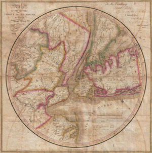
Map of the country Thirty Miles Round the City of New York.
sold
- Digital Map Information
- Suitable for large format printing
- DPI: 300
- File Size: 15.89 MB
- File Type: ZIP / TIFF
- ICC color profile embedded
- Delivered instantly via download link
Known as 'The Eddy Map,' this is an extremely rare and important circular map of New York City and vicinity, dated 1823. Covers the New York City area in roughly a thirty mile radius of Manhattan, extending north to Tarrytown, south to Monmouth, west to ... (more details)
One of the most beautiful, important, and enduring maps of Manhattan ever published.
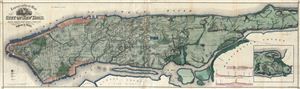
Topographical Map of the City of New York Showing Original Water Courses and Made Land.
sold
- Digital Map Information
- Suitable for large format printing
- File Size: 47.88 MB
- File Type: ZIP / TIFF
- ICC color profile embedded
- Delivered instantly via download link
This is Egbert L. Viele's 1865 topography and waterways map of Manhattan, one of the scarcest, most important and most enduring maps of New York City ever published. Covering the entirety of Manhattan Island, Viele's map details the canals, swamps, ... (more details)
One of the most beautiful, important, and enduring maps of Manhattan ever published.
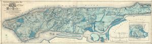
Sanitary and Topographical Map of the City and Island of New York Prepared for the Council of Hygene and Public Health, of the Citizens' Association under the direction of Egbert L. Viele, Topographical Engineer.
sold
- Digital Map Information
- Suitable for large format printing
- File Size: 51.42 MB
- File Type: ZIP / TIFF
- ICC color profile embedded
- Delivered instantly via download link
This is Egbert L. Viele's 1865 topography and waterways map of Manhattan, one of the scarcest, most important and most enduring maps of New York City ever published. Covering the entirety of Manhattan Island, Viele's map details the canals, swamps, ... (more details)
One of the earliest obtainable maps to focus on all of Manhattan Island.
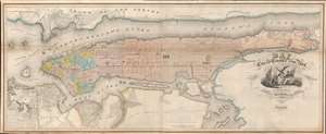
Map of the City and County of New York, with the adjacent country.
sold
- Digital Map Information
- Suitable for large format printing
- Full resolution TIFF file
- ICC color profile embedded
- Delivered instantly via download link
This is an example of David Burr's rare 1839 map of Manhattan, New York City. Burr's map is one of the earliest maps focused specifically on Manhattan to illustrate the entire island. Oriented to the northeast, the map roughly follows the layout and design of the 1811 Commissioner's Plan, wherein the geography of the island is sublimated by the city's iconic street grid. Burr's more commercial map also extends the coverage further east and west, to accommodate, Brooklyn, Bushwick, Williamsburg, Hoboken, and Jersey City. (more details)
The First Map to show New York Harbor; the First Map to name Canada.
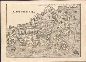
La Nuova Francia.
sold
- Digital Map Information
- Suitable for large format printing
- DPI: 600
- File Size: 14.84 MB
- File Type: ZIP / TIFF
- ICC color profile embedded
- Delivered instantly via download link
This is the seminal 1565 Giovanni Battista Ramusio map of the Northeast and Canada, 'The first printed map devoted to the New England region'(Osher) and the first map to apply a specific name to Canada. The map depicts the northeastern coast of North America from New York to the coast of Labrador, inclusive of New England and maritime Canada. In particular, it is the first map to reveal Giovanni da Verrazano's 1524 voyage to America and to depict his discoveries in what would become New York and New England. It is also among the most visually engaging early maps, being richly decorated with depictions of indigenous peoples, Europeans, flora and fauna, sailing ships, sea monsters, and demons. (more details)
First Map to show New York Harbor. The First Map to name Canada.
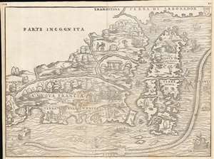
La Nuova Francia.
sold
- Digital Map Information
- Suitable for large format printing
- Full resolution TIFF file
- ICC color profile embedded
- Delivered instantly via download link
This is the seminal 1556 Giovanni Battista Ramusio map of the Northeast and Canada, 'the first printed map devoted to the New England region' (Osher), and the first map to apply a specific name to Canada. The map depicts the northeastern coast of North America from New York to the coast of Labrador, inclusive of New England and maritime Canada. It is the first map to reveal Giovanni da Verrazano's 1524 voyage to America and to depict his discoveries in what would become New York and New England. It is also among the most visually engaging early maps, being richly decorated with depictions of indigenous peoples, Europeans, flora and fauna, sailing ships, sea monsters, and demons. (more details)
Beers / Colton edition of the most important printed map of New York compiled during the Pre-Amercian Revolutionary War colonial period.
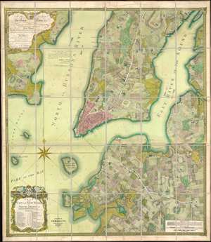
To his excellency Sr. Henry Moore, bart., captain general and governour in chief, in and over his majesty's province of New York and the territories depending thereon in America, chancellor and vice admiral of the same : This plan of the city of New York and its environs, survey'd and laid down ; is most humbly dedicated by his excellency's most obedt. humble servant B. Ratzer.
sold
- Digital Map Information
- Suitable for large format printing
- File Size: 111.61 MB
- File Type: ZIP / TIFF
- ICC color profile embedded
- Delivered instantly via download link
Known as the 'Ratzer Plan,' this is one of the most important, beautiful, and iconic colonial era maps of New York City, offered here in a stunning 1874 Colton / Beers restrike. This map was originally surveyed in 1767 by Bernard Ratzer, a lieutenant in the 'Royal American' regiment at the behest of Sir George Moore, governor of New York, who is sited in the cartouche. The map, which covers the southern part of Manhattan to about modern day 57th street, is a revision and expansion upon the flawed John Montresor plan of 1767. Across East River, a portion of Long Island is depicted, including most of Brooklyn and Parts of Long Island City. (more details)
First Map to detail New York Harbor; the First Map to name Canada.
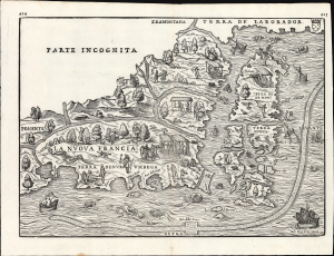
La Nuova Francia.
sold
- Digital Map Information
- Suitable for large format printing
- File Size: 13.96 MB
- File Type: ZIP / TIFF
- ICC color profile embedded
- Delivered instantly via download link
This is a superb example of the seminal 1565 Giovanni Battista Ramusio map of the Northeast and Canada, The first printed map devoted to the New England region (Osher) and the first map to apply a specific name to Canada. Significantly, it is the first map to focus specifically on Giovanni da Verrazzano's 1524 discoveries in what would become New York and New England - making it the first map to depict New York Bay and Harbor. (more details)
Only the fourth known example of the very first subway map for use by the public.
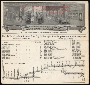
The Wanamaker Vest Pocket Subway Guide / The Wanamaker Station in the Subway at Astor Place.
sold
- Digital Map Information
- Suitable for large format printing
- Full resolution TIFF file
- ICC color profile embedded
- Delivered instantly via download link
This 1904-07 Wanamaker Vest Pocket Subway Guide is one of only four known surviving examples of the first subway map intended for public use. It was printed in 1904 on behalf of, or by, Wanamaker's department stores to promote their expanded New York City location, which featured an underground entrance to the Astor Place subway station. That busy subway platform is pictured here in an image entitled 'The Wanamaker Station in the Subway at Astor Place,' showing fashionably-dressed New Yorkers at the entrance to the Wanamaker's store (pointed out to the reader with the red, hand-stamped note, 'Direct Entrance from Subway to the Wanamaker Store Now Open.')andnbsp; A train, with its taillight shining, can be seen leaving on the uptown track. Below this vignette are a timetable and a map of the nascent subway (then extending from Brooklyn Bridge to 145th Street.) Special attention, naturally, is given on both the map and timetable to the Astor Place stop with its underground Wanamaker's storefront. Although Wanamaker's is long defunct, the same entrance is today used by the sole K-Mart in Manhattan. (more details)
One of the most beautiful, important, and enduring maps of Manhattan ever published.
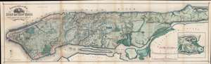
Topographical Map of the City of New York Showing Original Water Courses and Made Land.
sold
- Digital Map Information
- Suitable for large format printing
- File Size: 71.25 MB
- File Type: ZIP / TIFF
- ICC color profile embedded
- Delivered instantly via download link
This is a very beautiful and fine example of Egbert L. Viele's 1865 topography and waterways map of Manhattan, one of the scarcest, most important, and most enduring maps of New York City ever published. Covering the entirety of Manhattan Island, Viele's map details the canals, swamps, rivers, ditches, ponds, meadows, and drainage basins of Manhattan as they existed prior to the city's urban development. A version of the Viele map remains in use today by architects and contractors who need to be certain they are not building over underground rivers and swamps that may destabilize a new construction's foundation. (more details)
One of the most beautiful, important, and enduring maps of Manhattan ever published.
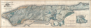
Sanitary & Topographical Map of the City and Island of New York Prepared for the Council of Hygene & Public Health, of the Citizens' Association under the direciton of Egbert L. Viele, Topographical Engineer.
sold
- Digital Map Information
- Suitable for large format printing
- File Size: 30.96 MB
- File Type: ZIP / TIFF
- ICC color profile embedded
- Delivered instantly via download link
This is Egbert L. Viele's 1865 topography and waterways map of Manhattan, one of the scarcest, most important, and most enduring maps of New York City ever published. Covering the entirety of Manhattan Island, Viele's map details the canals, ... (more details)
One of the most influential views of New York City ever published.
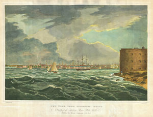
New York, From Governors Island. No.2 20 of theHudson River Port Folio. Published by Henry I. Megarey New York.
sold
- Digital Map Information
- Suitable for large format printing
- DPI: 300
- File Size: 17.84 MB
- File Type: ZIP / TIFF
- ICC color profile embedded
- Delivered instantly via download link
A rare find, this is plate no. 20 from William G. Wall, and Henry L. Megarey's important 1825 Hudson River Port Folio. The Hudson River Port Folio is considered to be the first and finest set of views of the Hudson River ever published. The ... (more details)
Heart of British Strategy in the Revolutionary War.
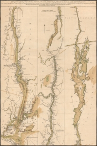
A Topographical Map of Hudsons River, with the channels depth of water, rocks, shoals etc. and the country adjacent, from Sandy-Hook, New York and bay to Fort Edward, also the communication with Canada by Lake George and Lake Champlain, as high as Fort Chambly on Sorel River.
sold
- Digital Map Information
- Suitable for large format printing
- Full resolution TIFF file
- ICC color profile embedded
- Delivered instantly via download link
This is Claude Joseph Sauthier's scarce, magnificent 1776 map of the Hudson River, Lake George, and Lake Champlain: the linchpin of Great Britain's strategy to swiftly achieve victory in the American Revolution. Control of the strategic New York - Montreal corridor would have divided the colonies effectively, allowing Britain to defeat the Revolution piecemeal. (more details)
A moment of explosive growth.
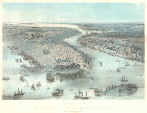
Birds Eye View of New-York and Brooklyn.
sold
- Digital Map Information
- Suitable for large format printing
- File Size: 46.8 MB
- File Type: ZIP / TIFF
- ICC color profile embedded
- Delivered instantly via download link
This is an 1850 John Bachmann rare bird's-eye view of New York City and Brooklyn. The work captures New York at a moment of explosive growth due to rapid industrialization and waves of new immigration - specifically, highly educated middle-class merchants and tradesmen from Germany and Central Europe (like Bachmann himself) fleeing in the wake of the failed Peoples Revolutions of 1848. (more details)