
New York City
Striking large-format map of New York City.
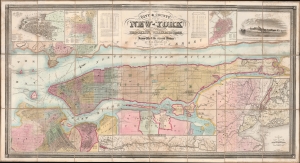
City and County Map of New-York Brooklyn, Williamsburgh, Jersey City and the adjacent Waters etc.
$15,000.00
Acquire
- Digital Map Information
- Suitable for large format printing
- File Size: 101.07 MB
- File Type: ZIP / TIFF
- ICC color profile embedded
- Delivered instantly via download link
This is J. H. Colton's large and impressive case map of New York City, including Brooklyn and Williamsburg. It is one of the largest and best maps of New York City to emerge in the mid-19th century. (more details)
One of the most beautiful, important, and enduring maps of Manhattan ever published.
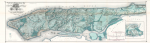
Sanitary and Topographical Map of the City and Island of New York Prepared for the Council of Hygine and Public Health, of the Citizens' Association.
$12,500.00
Acquire
- Digital Map Information
- Suitable for large format printing
- Full resolution TIFF file
- ICC color profile embedded
- Delivered instantly via download link
This is a beautiful example of Egbert L. Viele's 1865 topography and waterways map of Manhattan, one of the scarcest, most important, and most enduring maps of New York City ever published. Viele's map details the canals, swamps, rivers, ditches, ponds, meadows, and drainage basins of Manhattan as they existed prior to the city's urban development. A version of the Viele map remains in use today by architects and contractors who need to be certain they are not building over underground rivers and swamps that may destabilize a new construction's foundation. (more details)
The only contemporaneous view to illustrate Seneca Village, New York's first African American community.
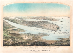
Panorama of Manhattan Island, City of New York and Environs.
$10,000.00
Acquire
- Digital Map Information
- Suitable for large format printing
- Full resolution TIFF file
- ICC color profile embedded
- Delivered instantly via download link
This is a gorgeous c. 1854 John Bornet panoramic bird's-eye view of the city on the cusp of its monumental expansion northwards in the second half of the 19th century. Among other points of interest, this is the only view we are aware of to show the buildings of Seneca Village, New York City's first African American community, in what is today Central Park. (more details)
Brooklyn equivalent of the 1811 Commissioners' Plan.
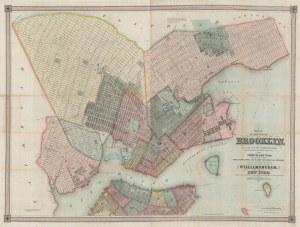
Map of the city of Brooklyn, as laid out by commissioners, and confirmed by acts of the Legislature of the state of New York, made from actual surveys the farm lines and names of original owners being accurately drawn from authentic sources. Containing also a map of the Village of Williamsburgh, and part of the city of New-York: compiled from accurate surveys and documents and showing the true relative position of all.
$8,500.00
Acquire
- Digital Map Information
- Suitable for large format printing
- DPI: 600
- File Size: 210.77 MB
- File Type: ZIP / TIFF
- ICC color profile embedded
- Delivered instantly via download link
This is J. H. Colton's impressive large-scale 1852 map of Brooklyn and Williamsburg. In its 1839 first edition, it is the Brooklyn equivalent to both the 1811 Commissioner' Plan and Colton's great 1836 map of Manhattan, and as such can reasonably be considered the most important and best map of Brooklyn to appear in the 19th century. The present map, 1852, is, in so far as we can tell, the third edition, retaining much of the significance of the first, while also featuring fascinating updates illustrating the break-neck pace with which Brooklyn was then urbanizing. (more details)
New York in the mid-19th century.
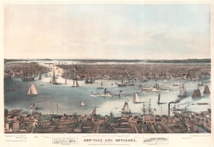
New-York and Environs, from Williamsburgh.
$8,000.00
Acquire
- Digital Map Information
- Suitable for large format printing
- DPI: 600
- File Size: 107.61 MB
- File Type: ZIP / TIFF
- ICC color profile embedded
- Delivered instantly via download link
This is an 1848 Edgar W. Foreman and Eliphalet M. Brown, Jr. bird's-eye view of New York City. Looking west over the East River and Manhattan from Williamsburg, ships navigating the East River, particularly several side-wheel steamers (one of which is named for Cornelius Vanderbilt) act as focal points. Manhattan's East River wharves, warehouses, and factories are also particularly well illustrated. Ships then pass between Manhattan and Brooklyn (with Brooklyn Heights and the Navy Yard well depicted) and into New York Harbor in the background. New Jersey and Staten Island appear along the horizon. (more details)
Best early map of Long Island.
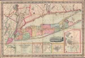
Map of Long Island, with the Environs of New-York and the Southern Part of Connecticut, compiled from Various Surveys and Documents.
$6,750.00
Acquire
- Digital Map Information
- Suitable for large format printing
- File Size: 203.5 MB
- File Type: ZIP / TIFF
- ICC color profile embedded
- Delivered instantly via download link
A fine example of John Calvin Smith and J. H. Colton's 1856 map of Long Island. This is the largest, most significant, and most beautiful map of Long Island to be issued in the 19th century. It is also very likely the first map published by American cartographic titan, J. H. Colton. (more details)
One of the earliest obtainable maps to focus on all of Manhattan Island.
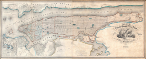
Map of the City and County of New York, with the adjacent country.
$6,500.00
Acquire
- Digital Map Information
- Suitable for large format printing
- Full resolution TIFF file
- ICC color profile embedded
- Delivered instantly via download link
This is an example of David Burr's rare 1840 map of New York City. This is one of the earliest commercial maps to specifically illustrate the full island of Manhattan. (more details)
Showcasing the Brooklyn Bridge.
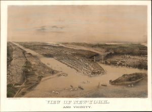
View of New-York. And Vicinity.
$5,500.00
Acquire
- Digital Map Information
- Suitable for large format printing
- File Size: 32.81 MB
- File Type: ZIP / TIFF
- ICC color profile embedded
- Delivered instantly via download link
This is a c. 1885 John Bachmann chromolithograph bird's-eye view of New York City and its vicinity, including Brooklyn, Jersey City, and Hoboken. The work captures the city flourishing as a hub of commerce as it roared towards the absorption of its neighbors: Brooklyn and Queens. The harbor is busy with steamships and sailboats, and the railheads in Jersey City are depicted with trains steaming west - engines of the Industrial Revolution. (more details)
New York in the mid-19th century.
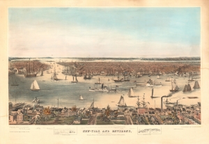
New-York and Environs, from Williamsburgh.
$5,500.00
Acquire
- Digital Map Information
- Suitable for large format printing
- File Size: 38.43 MB
- File Type: ZIP / TIFF
- ICC color profile embedded
- Delivered instantly via download link
This is an 1848 Edgar W. Foreman and Eliphalet M. Brown, Jr. bird's-eye view of New York City. The view looks west over the East River from Williamsburg towards lower Manhattan, offering a unique look at the Brooklyn waterfront life before the Civil War. (more details)
One of the Earliest Acquirable Views of New York City.
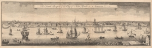
The South Prospect of the City of New York, in America.
$5,500.00
Acquire
- Digital Map Information
- Suitable for large format printing
- File Size: 10.15 MB
- File Type: ZIP / TIFF
- ICC color profile embedded
- Delivered instantly via download link
This is a superb example of the 1761 London Magazine edition of the famous Burgis view of New York City, one of the earliest generally acquirable dedicated views of the city. The bustling, nautical view shows the city as viewed from Brooklyn Heights. It illustrates from the battery in the south to the stockade of Wall Street. The East River teems with sailing ships, including three great warships. Fort George, the Exchange, City Hall, and a variety of churches can be seen, along with a shipyard. The Long Island terminus of the ferry across the East River is visible in the foreground. (more details)
'As for the Subways,' Dr. Thomson wrote, 'they should never have been built'.
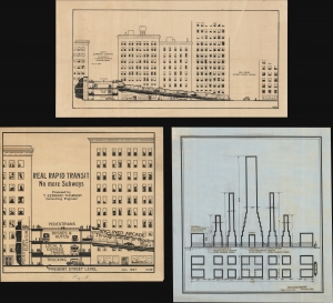
Real Rapid Transit No More Subways. / Plan to Eliminate Subways.
$5,500.00
Acquire
- Digital Map Information
- Suitable for large format printing
- Full resolution TIFF file
- ICC color profile embedded
- Delivered instantly via download link
These are the original 1927-1931 manuscript illustrations for T. Kennard Thomson's No More Subways initiative, intended to solve New York City's out-of-control traffic congestion. In line with the car-centric ideologies of Robert Moses (1888 - 1981), Thomson's plan called for the replacement of subways with segregated tiered roads, railroad tracks, and highways along New York's major avenues. (more details)
Iconic panorama of Manhattan.
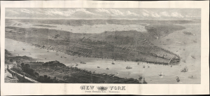
New York from Bergen Hill : Hoboken.
$5,000.00
Acquire
- Digital Map Information
- Suitable for large format printing
- Full resolution TIFF file
- ICC color profile embedded
- Delivered instantly via download link
This is a large-format (20.75 x 45.5 in.) bird's-eye view map of New York City published in 1876 as a supplement to the Illustrated London News. It captures the city the same year Central Park was completed, following decades of population growth and on the cusp of even greater transformation at the turn of the 20th century, which would bring skyscrapers, bridges, and the subway. (more details)
Ephemeral plans for a new Thirteenth Avenue.
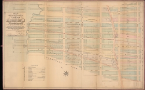
Map showing the perimeters of farms in Bloomingdale and the old roads and lanes as they existed one hundred years ago : belonging to the Cozine, Harson, Hopper, Hegeman, Stake, Stryker, Eden, Tevon, Haynes, Horsmanden, Reis, Kelly, Webber, Cutting, Astor, Emmett and other families.
$5,000.00
Acquire
- Digital Map Information
- Suitable for large format printing
- File Size: 68.07 MB
- File Type: ZIP / TIFF
- ICC color profile embedded
- Delivered instantly via download link
This is a John Bute Holmes 1879 cadastral map of Midtown West, including Times Square and the Theater District. It captures the area during a brief period of widespread development and redistricting. (more details)
A wonderful map of Little Italy, Nolita, and part of Soho that traces the history of these neighborhoods.
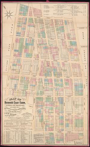
Map of Bayard's East Farm, Accurately Made from Old Maps, (not in Register's Office), From Conveyances on Record from NICHOLAS BAYARD, Sheriff's Sales, Lottery Lots, etc., etc.
$5,000.00
Acquire
- Digital Map Information
- Suitable for large format printing
- File Size: 44.82 MB
- File Type: ZIP / TIFF
- ICC color profile embedded
- Delivered instantly via download link
This is a John Bute Holmes 1869 cadastral map of modern day Little Italy and parts of the iconic neighborhoods of Nolita, Soho, and Chinatown in the borough of Manhattan in New York City - the only specific map of this area to appear in the 19th century. The map depicts the region from Broadway to Bowery and from Prince Street to Pell Street. Highly detailed, Holmes's map provides the viewer with a look at the neighborhood in 1869 and with an idea of how it developed. Streets area labeled, and Holmes provides both the former names of the streets and their current ones. Individual lots are identified by addresses, and those that fell victim to widening streets and a changing urban landscape are ghosted in using dashed lines. (more details)
Depicts the original boundaries of the Rutgers Farm, the first settlement on the Lower East Side.
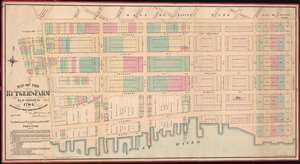
Map Of The Rutger's Farm As it existed in 1784, Accurately Made From Reliable Data
$5,000.00
Acquire
- Digital Map Information
- Suitable for large format printing
- File Size: 43.1 MB
- File Type: ZIP / TIFF
- ICC color profile embedded
- Delivered instantly via download link
This is a John Bute Holmes 1874 cadastral map of the Lower East Side and Two Bridges neighborhoods, which have historically been considered one neighborhood. A traditionally immigrant, working class neighborhood, the map depicts from Oliver Street to Montgomery Street and from Division Street to the East River. (more details)
Dramatic view of Long Island.
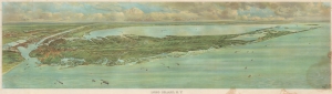
Long Island, N.Y.
$4,500.00
Acquire
- Digital Map Information
- Suitable for large format printing
- File Size: 43.06 MB
- File Type: ZIP / TIFF
- ICC color profile embedded
- Delivered instantly via download link
This is a dramatic 1902 F. W. Fells chromolithograph panoramic view of Long Island, New York. The stunning view was issued to promote the Long Island Railroad and Long Island in general, at the time undergoing an explosion of development and economic growth. (more details)
Soho.
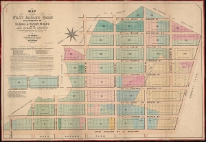
Map of the West Bayard Farm The Property of Nicholas and Stephen Bayard and the John Dyckman Dcd. Property.
$4,500.00
Acquire
- Digital Map Information
- Suitable for large format printing
- File Size: 49.42 MB
- File Type: ZIP / TIFF
- ICC color profile embedded
- Delivered instantly via download link
This is an 1866 John Bute Holmes cadastral maps of the western part of Soho, one of New York City's most interesting and vibrant neighborhoods. These lands were once part of the West Bayard Farm. (more details)
Depicts the neighborhood as it was in the 1790s: dominated by the Common Lands and long before Central Park was even conceived.
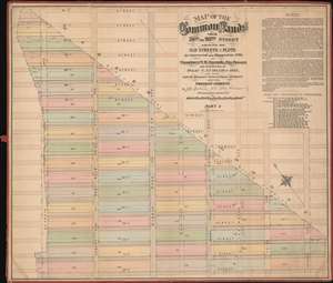
Map of the Common Lands from 76th to 93rd Street Showing the Old Streets and Plots As Surveyed and Mapped in 1796, by Cassimer T.H. Goerck, City Survey and resurveyed by Isaac T. Ludlam in 1822, (See Notes) And the Distance between these old Streets and our Present Streets.
$4,500.00
Acquire
- Digital Map Information
- Suitable for large format printing
- File Size: 36.96 MB
- File Type: ZIP / TIFF
- ICC color profile embedded
- Delivered instantly via download link
This is a John Bute Holmes 1874 cadastral map of the Upper East Side neighborhood of Manhattan - the only specific map of this area to appear in the 19th century. The map depicts the region from Seventh Avenue (or at least where it would be if Central Park hadn't been built) to Second Avenue and from 93rd Street to 76th Street. The bulk of the map is occupied by the northern reaches of the Common Lands, including the boundary between the Common Lands and the village of Harlem. This boundary was a diagonal line approximately from the intersection of today's Second Avenue and 79th Street to what would be the intersection of 92nd Street and Seventh Avenue, if Central Park had not been constructed. Also evident are the early planning stages of what would become Park Avenue - some of New York city's most covented real estate. (more details)
'Versailles of the Atlantic' - the epitome of steamship luxury in the post-Titanic age.
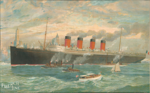
French Line.
$4,200.00
Acquire
- Digital Map Information
- Suitable for large format printing
- File Size: 78.32 MB
- File Type: ZIP / TIFF
- ICC color profile embedded
- Delivered instantly via download link
This is a rare c. 1912 Richard Rummell chromolithograph view of the French Line steamship France on the Hudson River with New York City in the background. The France was the epitome of luxury in the post-Titanic age, dubbed the 'Versailles of the Atlantic'. (more details)
Earliest obtainable example of the influential Goerck-Mangin Plan of New York City - published while it was still relevant.
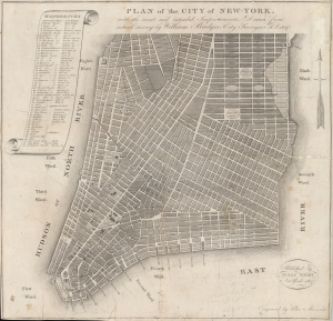
PLAN of the CITY OF NEW-YORK, with the recent and intended Improvements. New York, 1807.
$4,000.00
Acquire
- Digital Map Information
- Suitable for large format printing
- File Size: 10.32 MB
- File Type: ZIP / TIFF
- ICC color profile embedded
- Delivered instantly via download link
This important 1807 map of lower Manhattan, New York City, published by Isaac Riley, William Bridges, and Peter Maverick, is a most unusual piece with a confused and complex history. It predates the 1811 Commissioner's Plan, thus representing the definitive plan of New York City at the time of publication and exerting a profound influence on the developing street grid of Lower Manhattan. It is the earliest obtainable example of one of the most important founding cartographic documents relating to the development of New York's street grid - the Mangin-Goerck map. (more details)
Hellish Property Dispute at Hell Gate.
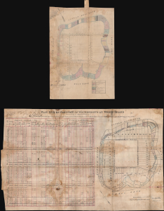
Map of Wards Island / Plan No. 3 of Partition of Waterrights at Ward's Island.
$4,000.00
Acquire
- Digital Map Information
- Suitable for large format printing
- Full resolution TIFF file
- ICC color profile embedded
- Delivered instantly via download link
This is a unique c. 1870 manuscript map and appraisal of property values on and around Wards Island (now part of Randalls and Wards Islands) in New York City prepared by surveyor Rudolph Rosa. It refers to an intense and consequential legal dispute over ownership of waters immediately surrounding the island, which at this time was primarily dedicated to hospitals and other institutions for people with physical and mental health problems. (more details)
A map of Hell's Kitchen that traces the development of the neighborhood.
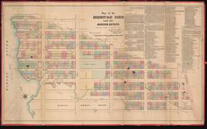
Map of the Hermitage Farm and the Norton Estate.
$4,000.00
Acquire
- Digital Map Information
- Suitable for large format printing
- File Size: 47.75 MB
- File Type: ZIP / TIFF
- ICC color profile embedded
- Delivered instantly via download link
This is an 1872 John Bute Holmes cadastral map of the modern-day neighborhood of Hell's Kitchen in the borough of Manhattan in New York City. The map depicts the neighborhood from the Hudson River to Broadway (labeled as Bloomingdale Road) and from 48th Street to 39th Street. Highly detailed, Holmes's map provides the viewer with a look at the neighborhood as it was in 1872 and also projects an image of how it developed. Streets are labeled, and individual lots are identified by their addresses. Some elements are ghosted in using dashed lines, including Twelfth Avenue and several wharves. (more details)
The important first plan of New York City's Central Park - predates Olmsted and Vaux.
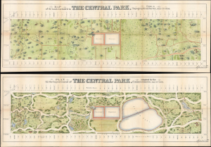
Map of the Lands Included in The Central Park, from a Topographical Survey, June 17th 1856. Plan for the Improvement of The Central Park, Adopted by the Commissioners, June 3rd 1856.
$3,950.00
Acquire
- Digital Map Information
- Suitable for large format printing
- Full resolution TIFF file
- ICC color profile embedded
- Delivered instantly via download link
These are two rare 1856 pre-Design Competition plans of Central Park drawn by the park project's first engineer-in-Chief Egbert Ludovicus Viele. Both plans extend from 59th street to 106th street, taking in the original grounds reserved for Central Park, as well as some of the adjacent streets and avenues. Viele's printed signature appears in the lower right quadrant of both maps. (more details)
Where the Verrazzano-Narrows Bridge Bridge now stands.
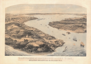
Panorama of the Harbor of New York, Staten Island and the Narrows.
$3,900.00
Acquire
- Digital Map Information
- Suitable for large format printing
- DPI: 600
- File Size: 64.26 MB
- File Type: ZIP / TIFF
- ICC color profile embedded
- Delivered instantly via download link
A most unusual 1854 Bornet chromolithograph bird's-eye view of the Verrazzano Narrows and New York City harbor. In addition to illustrating the Narrows, the view also depicts the site of the Staten Island Quarantine, a marine hospital used to house sick sailors before admitting them to New York Harbor. The hospital was controversial, resented by the Staten Island elite, whose mansions also appear here, leading to the Staten Island Quarantine War just four years after this view was issued. The war fully destroyed the Quarantine. (more details)
One of the earliest speciic maps to detail Manhattan Valley and the northern part of the Upper West Side.
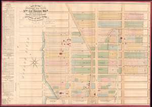
Map of the Strikers Bay Farm Estate of Mrs. Ann Rogers Decd. Part of the estate of John Glendining and part of the Herman Le Roy Farm.
$3,800.00
Acquire
- Digital Map Information
- Suitable for large format printing
- File Size: 27.98 MB
- File Type: ZIP / TIFF
- ICC color profile embedded
- Delivered instantly via download link
One of only 5 known examples of John Bute Holmes's c. 1874 cadastral map of the northern part of the Upper West Side and Manhattan Valley, New York City. The map covers from 96th street to 107th street and from the Hudson River to Central Park (8th Avenue / Central Park West). Today, with its proximity to both Riverside Park and Central Park, this is one of Manhattan's most desirable neighborhoods. (more details)
One of the few views of to show a walled New York.
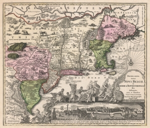
Recens Edita Totius Novi Belgii, in America Septentrionali siti, delineatio cura et sumtibus Tob. Conr. Lotteri, Sac. Caes. Maj. Geographi August. Vind.
$3,500.00
Acquire
- Digital Map Information
- Suitable for large format printing
- DPI: 600
- File Size: 74.88 MB
- File Type: ZIP / TIFF
- ICC color profile embedded
- Delivered instantly via download link
This is Conrad Tobias Lotter's 1757 map of New York, New England, and the mid-Atlantic colonies. It represents the final map in the Jansson-Visscher series. Despite the map's cartography being over a century old, this map continued to capture the idea of this part of the world for Europeans in general and a German audience in particular. (more details)
Electrifying Manhattan.
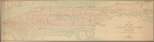
The United Electric Light and Power Company.
$3,500.00
Acquire
- Digital Map Information
- Suitable for large format printing
- File Size: 64.06 MB
- File Type: ZIP / TIFF
- ICC color profile embedded
- Delivered instantly via download link
An unrecorded 1903 wall map of Manhattan, New York City, prepared by William F. Monaghan for the United Electric Light and Power Company. The map illustrates the early days of Manhattan's electrification and debates over direct and alternating current. It also illustrates the early stages of the Interborough Rapid Transit System, a precursor to the modern Subway. (more details)
Some of the Most Expensive Real Estate in New York City.
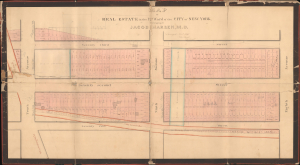
Map of Real Estate in the 12th Ward of the City of New York Belonging to Jacob Harsen, M.D.
$3,500.00
Acquire
- Digital Map Information
- Suitable for large format printing
- DPI: 600
- File Size: 60.42 MB
- File Type: ZIP / TIFF
- ICC color profile embedded
- Delivered instantly via download link
This is an 1848 John J. Serrell large-format manuscript plat map of a portion of the Upper West Side of Manhattan between 71st and 73rd Streets. Among other features, the map demonstrates the degree to which Manhattan's familiar grid pattern was misaligned with earlier properties in this portion of the island. (more details)
Socialism in America.
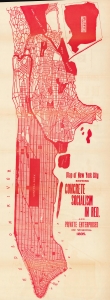
Map of New York City Showing Concrete Socialism in Red, and Private Enterprises in White, 1895.
$3,500.00
Acquire
- Digital Map Information
- Suitable for large format printing
- File Size: 60.93 MB
- File Type: ZIP / TIFF
- ICC color profile embedded
- Delivered instantly via download link
This is an 1895 Walter Vrooman map of New York City, accompanied by its original text volume, Government Ownership in Production and Distribution, inscribed by the author to the controversial Congregationalist minister Newell Dwight Hillis (1858 - 1921). The surprisingly modern map, printed in bright red, highlights Vrooman's theories about 'public lands' and 'socialism'. (more details)
Evolving relationship between New York City and Harlem.
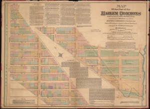
Map of that part of the Harlem Commons east of the 5th Ave. and Central Park copied from the original map made by Joseph F. Bridges, City Surveyor, January 1826, now in possession of a gentleman who purchased it through A.R. Morgan, Esq., from Mr. Bridges : showing also the boundaries given by Charles Clinton, Surveyor, Dec. 1825, and the inaccuracies of both the above-named maps, with other important information.
$3,500.00
Acquire
- Digital Map Information
- Suitable for large format printing
- Full resolution TIFF file
- ICC color profile embedded
- Delivered instantly via download link
This is an 1871 John Bute Holmes cadastral map of the Upper East Side in the borough of Manhattan in New York City. Constructed in an unusual manner, the map depicts the Upper East Side along a diagonal that stretches from Ninety-Sixth Street and Fifth Avenue to Seventy-Fourth Street and Avenue B. New York's now famous grid system acts as the base, along with the lots that were created by the 1811 Commissioner's Plan, which allows the neighborhood's evolution to be illustrated. One such detail is Fourth Avenue. Here, dashed lines mark the present sides of the avenue, several feet into the lots on either side. A large former estate is illustrated between Eightieth Street and Seventy-Eighth Street. (more details)
Large Scale map of Brooklyn and Queens w/ unique advertising.
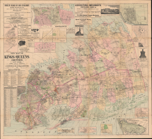
New Map of Kings and Queens Counties New York.
$3,250.00
Acquire
- Digital Map Information
- Suitable for large format printing
- File Size: 222.61 MB
- File Type: ZIP / TIFF
- ICC color profile embedded
- Delivered instantly via download link
A most intriguing large-scale 1886 J. B. Beers folding wall map of western Long Island, including Brooklyn, Queens, and Nassau County. The map reflects enthusiasm for Long Island at the height of the late 19th-century Long Island Real Estate Boom. It also notes Merrick Camp Grounds, underscoring the popularity of Third Awakening revivalism in Long Island. (more details)
New York City's grid swallows up The Parade.
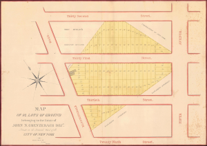
Map of 92 Lots of Ground belonging to the Estate of John N. Grenzebach Desd. Situate in the Sixteenth War of the City of New York.
$3,000.00
Acquire
- Digital Map Information
- Suitable for large format printing
- Full resolution TIFF file
- ICC color profile embedded
- Delivered instantly via download link
This is a finely executed 1838 Daniel Ewen manuscript map capturing the early evolution of NoMad and Koreatown, Manhattan, New York City. Today, this area is one of the most vibrant parts of New York, known for its bustling Koreatown and sleek restaurants. When this map was drawn, these properties were in the process of being broken out of the John Nicholas Grenzebach estate and lotted for sale. (more details)