
Covens and Mortier (sold)

Covens and Mortier (1721 - c. 1862) was an Amsterdam publishing firm, the successor to the extensive publishing empire built by Pierre Mortier (1661 - 1711). Covens and Mortier maps are often criticized as derivative - but this is not fully the case. Pierre Mortier lived in Paris from 1681 to 1685. There he established close relationships the the greatest French cartographers of the era, including De L'Isle and D'Anville. His business model was based upon leveraging Dutch printing technology and sophistication to co-publish state of the art French cartography. Upon Mortier's death in 1711 his firm was taken over by his son, Cornelius Mortier (1699 - 1783). Cornelius married the sister of Johannes Covens (1697 - 1774) in 1721 and, partnering with his brother in law, established the Covens and Mortier firm. Under the Covens and Mortier imprint, Cornelius and Johannes continued in Pierre's model of publishing the most up-to-date French works with permission. They quickly became one of the largest and most prolific Dutch publishing concerns of the 18th century. The firm and its successors published thousands of maps over a 120 year period from 1721 to the mid-1800s. During their long lifespan the Covens and Mortier firm published as Covens and Mortier (1721 - 1778), J. Covens and Son (1778 - 94) and Mortier, Covens and Son (1794 - c. 1862).
A most decorative early Map of Ireland.
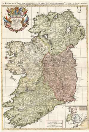
Le Royaume d'Irlande divisé en ses provinces, subdivisé en Shireries ou Comtes...
sold
- Digital Map Information
- Suitable for large format printing
- Full resolution TIFF file
- ICC color profile embedded
- Delivered instantly via download link
Hubert Jaillot's 1693 map of Ireland is among the largest and most beautiful atlas maps of Ireland produced in the 17th century. A sculptor-turned-mapmaker, Jaillot's maps were mostly based on geographical scholarship of the great French mapmaker Nicolas Sanson. Where Sanson's maps tended to be Spartan academic works, Jaillot intended his maps to be 'Bel et Utilite', beautiful as well as informative. Also, while Sanson's maps were printed to single folio sheets or smaller formats, Jaillot printed his maps to two folio sheets, meant to be joined into impressive large-scale maps. The map is superbly detailed, with towns, cities, and roads plainly visible. Topography is shown pictorially. An inset map in the lower right situates Ireland in relation to England, France, and the Netherlands, placing the island in the context of the greater conflict. (more details)
African Towns Represented in the Council of Nicaea.
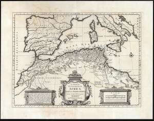
In Notitiam Ecclesiasticam Africae Tabula Geographica Auctore G. De L'Isle Geographo Amstelodami Apud I. Covens et C. Mortier cum Privilegio.
sold
- Digital Map Information
- Suitable for large format printing
- DPI: 600
- File Size: 48.34 MB
- File Type: ZIP / TIFF
- ICC color profile embedded
- Delivered instantly via download link
This is a 1742 Covens and Mortier edition of Guillaume de l'Isle's map of western North Africa at the time of the 325 CE First Council of Nicaea - the historic first ecumenical council of the Christian Church. (more details)
An influential map of North America considered, 'A Foundation Map.' Also, the first printed map to show the Sargasso Sea.
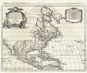
L'Amerique Septentrionale Dressee sur les Observations de Mes. De L'Academie Royale des Sciences… America Septentrionalis in Suas Praecipuas Partes Divisa, ad usum Serenissumu Burgundiae Ducis.
sold
- Digital Map Information
- Suitable for large format printing
- DPI: 300
- File Size: 17.25 MB
- File Type: ZIP / TIFF
- ICC color profile embedded
- Delivered instantly via download link
An extraordinary map, this is Covens and Mortier's 1708 reissue of De L'Isle's landmark 1700 mapping of North America. Covers the continent of North America from the Baffin Bay southwards as far as the Spanish Main, westwards to Cape Mendocino, and eastwards to ... (more details)
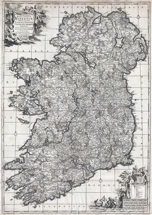
Novissima ac prae caeteris alus accuratissima Regni et Insulae Hiberniae delineatio in qua sunt Lagenia, Ultonia, Connachia et Momonia Provinciae divisae in triginta duos Comitatus qui et sunt divisi in omnes subjacentes Baronnatus.
sold
- Digital Map Information
- Suitable for large format printing
- DPI: 300
- File Size: 24.73 MB
- File Type: ZIP / TIFF
- ICC color profile embedded
- Delivered instantly via download link
An uncommon large format map of Ireland by Frederik de Witt. This is the c. 1721 Covens and Mortier edition of a map originally issued in 1690. The map covers the entirety of insular Ireland in considerable detail. Counties, roadways, rivers, swamps, forests, ... (more details)
Important and scarce map of Brazil, considered one of the finest maps of Brazil ever produced.
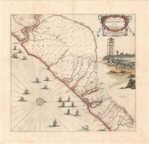
Praefectuae Paranambuae pars Meridionalis.
sold
- Digital Map Information
- Suitable for large format printing
- Full resolution TIFF file
- ICC color profile embedded
- Delivered instantly via download link
This is a scarce c.1721 Covens and Mortier edition of a map of the southeastern coast of Brazil. Oriented with north to the right, it covers the interior from around the Sao Paulo region south along the coast of Brazil from Rio Gujaraigacu to Rio de San Francisco. Earlier maps of the region were drawn from information based on Portuguese research. Unlike its predecessors, this important map is the first to focus on Dutch rather than Portuguese interests. The map is superbly detailed, with topography beautifully rendered. In the Atlantic we can see several sailing ships, a sea monster, and a boat. A decorative title cartouche appears in the top right quadrant. Below the title appears an illustration based on the design by Frans Post, featuring a fishing scene with a lookout tower with people below pulling in a net. (more details)
Map of Western Ukraine featuring the Carpathians.
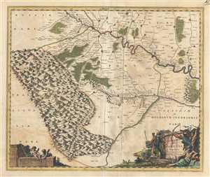
Ukrainae pars quae Pokutia Vulgo dicitur.
sold
- Digital Map Information
- Suitable for large format printing
- Full resolution TIFF file
- ICC color profile embedded
- Delivered instantly via download link
This is a scarce c.1721 Covens and Mortier edition of the map of the western parts of Ukraine and vicinity. It covers the historic area of East-Central Europe known at the time as Pokuttya or Pokkutia. It covers from the Carpathian Mountains east along the ... (more details)
The Dominant Mapping of Italy of the 17th Century, Updated and Amended.
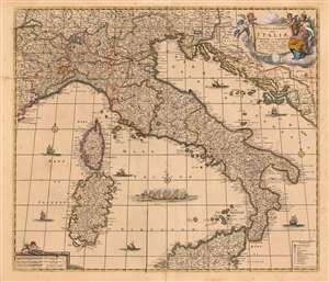
Novissima et Accuratissima totius Italiae, Corsicae et Sardiniae Descriptio Correcta, multis auct Locis et Viis editaque.
sold
- Digital Map Information
- Suitable for large format printing
- Full resolution TIFF file
- ICC color profile embedded
- Delivered instantly via download link
This is an attractive and scarce map of Italy, engraved c. 1680 by Frederik De Wit, but updated in 1721 by the Amsterdam publishers Covens and Mortier. Covens and Mortier added many place names and included the post road system first introduced on a 1695 map of Italy by Giacomo Cantelli da Vignola. The map covers the Italian Peninsula in its entirety including the Dalmatian coast, at the time controlled by the Republic of Venice, as well as the islands of Corsica, Sardinia, and part of Sicily. As with virtually every map of Italy produced in the seventeenth century, De Wit follows the model established by Magini's monumental 1608 Italia Nuova. Magini's map was justifiably influential, rendering the whole of Italy and its islands in magnificent detail with their river systems clearly presented and mountains shown pictorially. (more details)
Beautiful map of Brabant, part of modern day Belgium and the Netherlands.
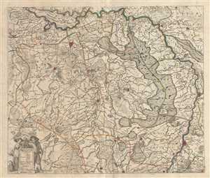
Brabantiae pars Orientalis.
sold
- Digital Map Information
- Suitable for large format printing
- Full resolution TIFF file
- ICC color profile embedded
- Delivered instantly via download link
This is an attractive c.1721 map of the Duchy of Brabant by Frederik De Wit. The map depicts part of modern day Belgium and the Netherlands, which were at the time this map was made, part of the Duchy of Brabant. It extends from Turnhout in modern day ... (more details)
Scarce early map of Tuscany and the Papal States.
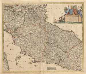
Status Ecclesiasticus et Magnus Ducatus Thoscanae.
sold
- Digital Map Information
- Suitable for large format printing
- Full resolution TIFF file
- ICC color profile embedded
- Delivered instantly via download link
This is an attractive c.1721 map of depicting central Italy and the regions of Tuscany and the States of the Church or the Papal States by Frederik De Wit. It covers from the Isle of Ariano south as far as Gaeta. The Island of Elba and part of Corsica ... (more details)
Early 18th century map of the Hesse-Kassel region of Germany.
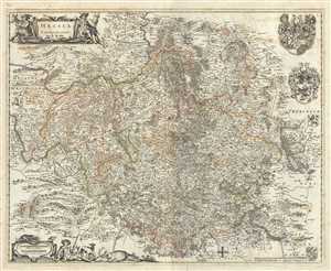
Hassia Landgraviatus.
sold
- Digital Map Information
- Suitable for large format printing
- Full resolution TIFF file
- ICC color profile embedded
- Delivered instantly via download link
This is a beautiful c.1721 map of the Hesse-Kassel region in Germany by Frederik De Wit. The map depicts the Landgraviate of Hesse with its capital Kassel (here noted Cassel), which forms the northern parts of the modern day German state of Hesse. The ... (more details)
Early decorative map of Italy.
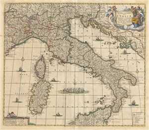
Novissima et Accuratissima totius Italiae, Corsicae et Sardiniae Descriptio Correcta, multis auct Locis et Viis editaque.
sold
- Digital Map Information
- Suitable for large format printing
- Full resolution TIFF file
- ICC color profile embedded
- Delivered instantly via download link
This is an attractive c.1721 map of Italy by Frederik De Wit. It covers Italian Peninsula in its entirety including the Dalmatian coast, at the time controlled by the Republic of Venice. Also includes the islands of Corsica and Sardinia and part of ... (more details)
Detailed map of southern Netherlands dating to the early 18th century.
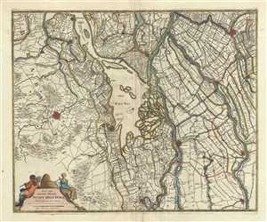
Nova atque emendata descriptio Suydt Hollandiae.
sold
- Digital Map Information
- Suitable for large format printing
- Full resolution TIFF file
- ICC color profile embedded
- Delivered instantly via download link
This is a beautiful c.1721 map of southern Holland or the Netherlands by Frederik De Wit. Oriented with north facing northwest, it extends from Gouda south to Breda and from Willemstad east as far as Culemborg. Important cities of Dordrecht, ... (more details)
Map of southwest Ukraine featuring the historic region of Podolia.
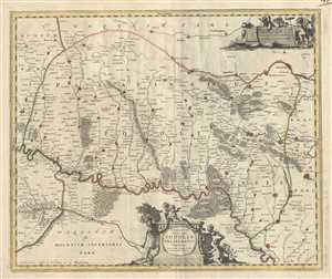
Ukrainae pars, quea Podolia Palatinatus Vulgo dicitur.
sold
- Digital Map Information
- Suitable for large format printing
- Full resolution TIFF file
- ICC color profile embedded
- Delivered instantly via download link
This is a scarce c.1721 Covens and Mortier edition of the map of the southwestern parts of Ukraine and vicinity. It covers the historic area of Eastern Europe known at the time as Podolia. It covers the regions around the Dniester River. ... (more details)
Beatifull map of the central and eastern provinces of the Netherlands.
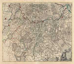
Comitatus Zutphaniae sive Geldriae Tetrachiae Zutphaniensis Isalae Fluvii.
sold
- Digital Map Information
- Suitable for large format printing
- Full resolution TIFF file
- ICC color profile embedded
- Delivered instantly via download link
This is a scarce c.1721 map of the provinces of Overijssel and Gelderland in Holland or the Netherlands by Frederik De Wit. Oriented with north in the east, it covers from Kampen south to Kleve in Germany and Arnhem east as far as ... (more details)
Early map representing the County of Moers, Germany.
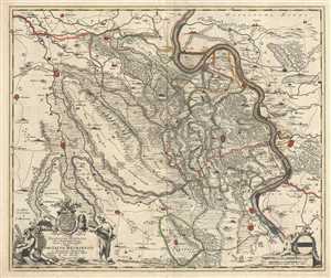
Illustrissimo Celsissmo Principi Guilielmo Henrico D.G. Arausionum Principi Domino suo Clementissimo Hanc Comitatus Meursensis et Annexarum Dinastiarum.
sold
- Digital Map Information
- Suitable for large format printing
- Full resolution TIFF file
- ICC color profile embedded
- Delivered instantly via download link
This is an attractive c.1721 map of the county of Moers, Germany by Frederik De Wit. The map depicts what was then the County of Moers, on the western bank of the Rhine River. The entire map is depicted in extraordinary detail, ... (more details)
Scarce map of the Electorate of Trier, Germany.
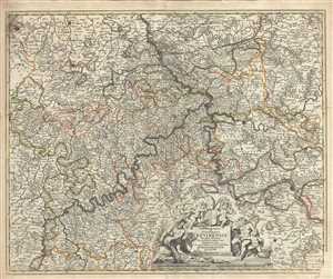
Archiepiscopatus et Electoratus Trevirensis Novissima delineatio Exacte divisa in omnes Suas Praefecturas
sold
- Digital Map Information
- Suitable for large format printing
- Full resolution TIFF file
- ICC color profile embedded
- Delivered instantly via download link
This is a beautiful c.1721 map of the Electorate of Trier, in Germany by Frederik De Wit. It covers from Duren to Trier and includes the important cities of Bonn, Mainz, Trier and Kolbenz. The entire region is depicted in ... (more details)
Detailed map of Netherlands dating to the early 18th century.
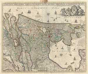
Comitatus Hollandiae tabula Pluribus Locis Recens.
sold
- Digital Map Information
- Suitable for large format printing
- Full resolution TIFF file
- ICC color profile embedded
- Delivered instantly via download link
A beautiful c.1721 map of Holland or the Netherlands by Frederik De Wit. Oriented with north on the right, the map extends from modern day Goeree-Overflakkee north to Texel and inland as far as Wageningen depicting Utrecht ... (more details)
Beautiful map depicting the flow of the Northern Dwina River in Russia.
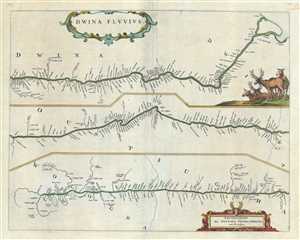
Dwina Fluvius.
sold
- Digital Map Information
- Suitable for large format printing
- Full resolution TIFF file
- ICC color profile embedded
- Delivered instantly via download link
This is a beautiful 1721 map of the Northern Dvina River in northern Russia by Frederik De Wit. The map is divided into three sections to follow the course of the river from its source in the Vologod Province as it empties ... (more details)
'A towering landmark along the path of Western cartographic development' - Wheat
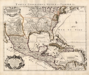
Carte du Mexique et de la Floride des Terres Angloises et des Isles Antilles... / Tabula Geographica Mexicae et Floridae etc.
sold
- Digital Map Information
- Suitable for large format printing
- Full resolution TIFF file
- ICC color profile embedded
- Delivered instantly via download link
This is the 1722 Covens and Mortier issue of Guillaume de L'Isle's groundbreaking map of North America, focusing on Mexico, the Mississippi watershed, and the West Indies. De L'Isle first published this map in 1703, at which point it was the most sophisticated map of the region obtainable: the first map to accurately denote the course of the Mississippi River, the first to accurately place the Great Lakes, and the first appearance on a map of updates from La Salle, Bienville, and D'Iberville. (more details)
'A towering landmark along the path of Western cartographic development' - Wheat
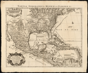
Carte du Mexique et de la Floride des Terres Angloises et des Isles Antilles... / Tabula Geographica Mexicae et Floridae etc.
sold
- Digital Map Information
- Suitable for large format printing
- DPI: 600
- File Size: 60.78 MB
- File Type: ZIP / TIFF
- ICC color profile embedded
- Delivered instantly via download link
This is the 1722 Covens and Mortier issue of Guillaume de L'Isle's groundbreaking map of North America, focusing on Mexico, the Mississippi watershed, and the West Indies. De L'Isle first published this map in 1703, at which point it was the most sophisticated map of the region obtainable: the first map to accurately denote the course of the Mississippi River, the first to accurately place the Great Lakes, and the first appearance on a map of updates from La Salle, Bienville, and D'Iberville. (more details)
Scotland, the Hebrides, and the Orkney Islands Beautifully Embellished.
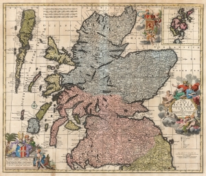
Novissima Regni Scotiæ Septentrionalis et Meridionalis Tabula divisae in Ducatus, Comitatus, Vice-Comitatus, Provincias, Praefecturas, Dominia et Insulas.
sold
- Digital Map Information
- Suitable for large format printing
- DPI: 600
- File Size: 69.71 MB
- File Type: ZIP / TIFF
- ICC color profile embedded
- Delivered instantly via download link
This is Carel Allard's 1697 map of the Kingdom of Scotland, in its 1725 Covens and Mortier edition. Between the superb engraving of the map and its ornate cartouches, it is one of the most richly decorative maps of Scotland produced in that era. (more details)
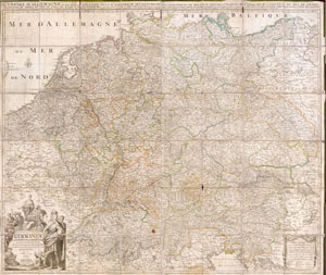
Germaniae L’Empire D’ Allemagne distingue suivant l’etendue tous les etats, principautes et souveradnettes qui passent ou qui ont passé jusque a present sous la nome D’Allemagne sur les Memoires les plus Nouveaux.
sold
- Digital Map Information
- Suitable for large format printing
- File Size: 13.05 MB
- File Type: ZIP / TIFF
- ICC color profile embedded
- Delivered instantly via download link
This is an extraordinary and gigantic c. 1730 map of Germany and the surrounding nations. Map is presented in case or pocket format on 48 linen backed panels. Covers most of what is today central Europe from eastern France ... (more details)
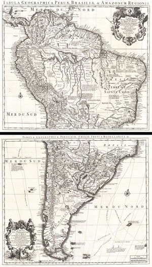
Tabula Geographica Peruae, Braziliae & Amazonum Regionis. / Carte de la Terre Ferme du Perou, du Bresil, et du Pays des Amazones. / Tabula Geographica Paragiae, Chilis, Freti a Magellanici & c. / Carte du Paraguay, Du Chili, du Detroit de Magellan & c.
sold
- Digital Map Information
- Suitable for large format printing
- DPI: 300
- File Size: 36.01 MB
- File Type: ZIP / TIFF
- ICC color profile embedded
- Delivered instantly via download link
An extraordinary example of a c. 1730 two map set depicting South America. This is Covens and Mortier's c. 1730 reissue of Guillaume de L'Isle's magnificent c. 1708 map of this region. The northern sheet covers from Costa ... (more details)
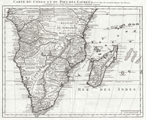
Carte du Congo et du Pays des Cafres. Par G. de l'Isle de l'Academie Royale des Sciences. A Amsterdam, Chez Jean Covens et Corneille Mortier, Geographes.
sold
- Digital Map Information
- Suitable for large format printing
- DPI: 300
- File Size: 18.12 MB
- File Type: ZIP / TIFF
- ICC color profile embedded
- Delivered instantly via download link
An extraordinary example of Covens and Mortier's c. 1730 issue of De L'Isle's important c. 1707 map of Africa south of the Equator. Depicts the southern Africa in stunning detail with numerous notations an comments ... (more details)
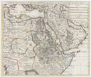
Carte de l'Egypte de la Nubie de L'Abissinie &c.
sold
- Digital Map Information
- Suitable for large format printing
- DPI: 300
- File Size: 18.98 MB
- File Type: ZIP / TIFF
- ICC color profile embedded
- Delivered instantly via download link
A fine example of the 1730 Covens and Mortier issue of Guillaume de L'Isle's important 1707 map of Arabia, egypt, Nubia, and Abyssinia. Centered on the Red Sea and the Nile Valley, this extraordinary Map covers from ... (more details)
The finest example of this map we have ever encountered.
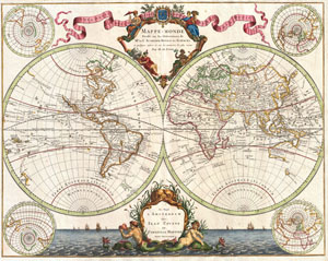
Mappe-Monde Dresse sur les Observations de Mrs. De L'Academie Royale des Sciences et quelque3s autres et sur les memoires les plus recens Par M. De L'Isle.
sold
- Digital Map Information
- Suitable for large format printing
- DPI: 300
- File Size: 19.55 MB
- File Type: ZIP / TIFF
- ICC color profile embedded
- Delivered instantly via download link
Published by the venerable Covens and Mortier firm, this is an exceptionally beautiful example of Guillaume de L'Isle's important c. 1730 map of the world in two hemispheres. The map consists of two central ... (more details)
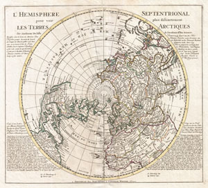
L'Hemisphere Septentrional pour voir pllus distinctement Les Terre Arctiques.
sold
- Digital Map Information
- Suitable for large format printing
- DPI: 300
- File Size: 14.46 MB
- File Type: ZIP / TIFF
- ICC color profile embedded
- Delivered instantly via download link
This is a stunning and important map of the Northern Hemisphere originally drawn by Guillaume de L'Isle in 1714 and updated by Coven's and Mortier in 1741. Covers from the North Pole south in all ... (more details)
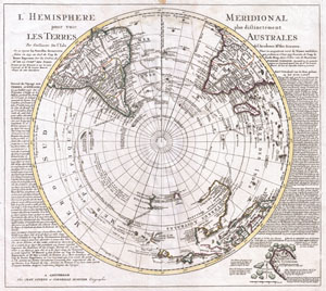
L'Hemisphere Meridional pour voir plus distinctement Les Terres Australes.
sold
- Digital Map Information
- Suitable for large format printing
- DPI: 300
- File Size: 14.78 MB
- File Type: ZIP / TIFF
- ICC color profile embedded
- Delivered instantly via download link
This is a stunning map of the Southern Hemisphere originally drawn by Guillaume de L'Isle and updated in 1739 by Covens and Mortier. Extends from the South Pole northwards in all directions as ... (more details)
The coat of arms of the short lived Kingdom of Corsica appears in the lower left corner.
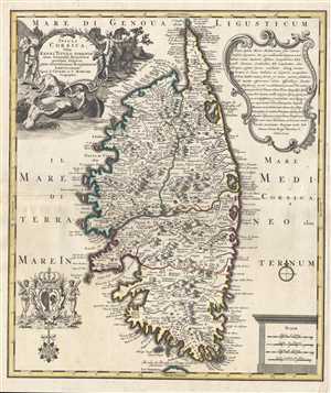
Insula Corsica, Olin Regni Titulo Insignis nunc Genuensis Reipublicae potestati sujecta, juxta reventissimam designationem.
sold
- Digital Map Information
- Suitable for large format printing
- DPI: 300
- File Size: 12.1 MB
- File Type: ZIP / TIFF
- ICC color profile embedded
- Delivered instantly via download link
This is a 1742 Covens and Mortier map of Corsica, France. The map depicts the entirety of the island in fantastic detail, labeling cities, towns, and villages, as well as rivers and mountain ... (more details)
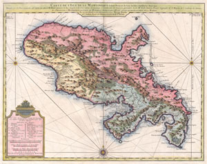
Carte de l'Isle de la Martinique, colonie francoise de l'une des Isles Antilles de l'Amerique. Dressee sur des plans manuscrits entr'autres sur celui de Mr. Houel, Ingenieur du Roy, assujetis a des observations astonomiques et concilies avec des memoires particuliers de feu Mr. Guill. Delisle, Premier Geographe de S. Majeste de l'Academie des Sciences. Et presentee a Monseigneur le Comte de Maurepas, Secretaire d'Etat ayant le departement de la Marine par ... Philippe Buache de l'Academie Royale des Sciences et Gendre du dit Sr. Delisle. A Amsterdam, Chez Jean Covens et Corneille Mortier, Geographes.
sold
- Digital Map Information
- Suitable for large format printing
- DPI: 300
- File Size: 11.81 MB
- File Type: ZIP / TIFF
- ICC color profile embedded
- Delivered instantly via download link
A beautiful example of Covens & Mortier's 1742 map of the French colony of Martinique in the West Indies. Depicts the Island of Martinique divided into three sections, two in the south and ... (more details)
Map illustrating the Bordeaux Wine Region and neighboring Armagnac Region.
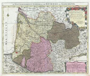
Le Gouvernement General de Guienne et Gascogne.
sold
- Digital Map Information
- Suitable for large format printing
- DPI: 300
- File Size: 21.52 MB
- File Type: ZIP / TIFF
- ICC color profile embedded
- Delivered instantly via download link
This is a fascinating 1742 map of the modern French departments of Gironde, Gascony (Gascogne), and Guyenne. This coastal region is the seat of the Bordeaux wine region and produces many ... (more details)
Map illustrating the Bordeaux Wine Region and neighboring Armagnac Region.
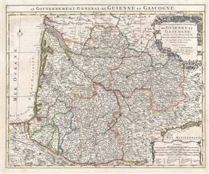
Le Gouvernement General de Guienne et Gascogne.
sold
- Digital Map Information
- Suitable for large format printing
- DPI: 300
- File Size: 17.11 MB
- File Type: ZIP / TIFF
- ICC color profile embedded
- Delivered instantly via download link
This is a fascinating 1742 map of the modern French departments of Gironde, Gascony (Gascogne), and Guyenne. This coastal region is the seat of the Bordeaux wine region and produces many ... (more details)
Map of West Africa issued at the height of the Atlantic Slave Trade.
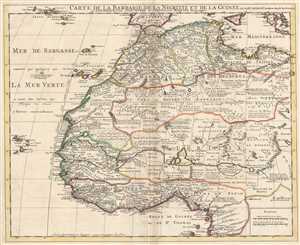
Carte de la Barbarie, de la Nigritie, et de la Guinée. Par Guillaume Delisle de l'Academie Royale de Sciences. A Amsterdam Chez Jean Covens et Corneille Mortier, Geographes.
sold
- Digital Map Information
- Suitable for large format printing
- DPI: 300
- File Size: 11.82 MB
- File Type: ZIP / TIFF
- ICC color profile embedded
- Delivered instantly via download link
This is an excellent example of Jean Covens' and Corneille Mortier's 1742 edition of Guillaume Delisle's influential map of western Africa. This map was issued at the height of the ... (more details)
Cutting-edge French Cartography, fine Dutch printing.
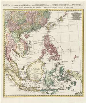
Carte d'une partie de la Chine, les isles Philippines, de la Sonde, Moluques, de Papoesi, etc.
sold
- Digital Map Information
- Suitable for large format printing
- DPI: 600
- File Size: 81.79 MB
- File Type: ZIP / TIFF
- ICC color profile embedded
- Delivered instantly via download link
This is a 1757 Covens and Mortier map of southern China, the Malay Peninsula, and the East Indies. It includes Taiwan (Formosa), the Philippines, Vietnam (Tonquin and Cochinchine), Laos, Cambodia, Thailand (Siam), Malay, Singapore, Sumatra, and Borneo, as well as most of modern-day Indonesia. The map replaces earlier Covens and Mortier maps based on the work of Guillaume De l'Isle, instead drawing on newer maps by Jean Baptiste Bourguignon d'Anville. (more details)