
NEW ACQUISITIONS
French mapping of the Spice Islands.
![1683 Sanson Map of the East Indies w/ the Spice Islands [Maluku Islands, Indonesia]](/mm5/graphics/00000001/L/Moluccas-sanson-1683.jpg "1683 Sanson Map of the East Indies w/ the Spice Islands [Maluku Islands, Indonesia]")
Les Isles Molucques; Celebes, Gilolo etc. Par le Sr. Sanson d'Abbeville, Geogr. du Roy.
$400.00
Acquire
- Digital Map Information
- Suitable for large format printing
- DPI: 600
- File Size: 3.9 MB
- File Type: ZIP / TIFF
- ICC color profile embedded
- Delivered instantly via download link
This is Nicolas Sanson's 1653 map of the East Indies, and specifically of the Maluku Islands, known then as the Moluccas or Spice Islands, here in its 1683 first Dutch edition. It covers the islands between Borneo and New Guinea, and includes inset maps of the Molucca Islands, Bachian Island, and Banda Island. (more details)
Shipping and Speculation.

Map of Louisiana.
$300.00
Acquire
- Digital Map Information
- Suitable for large format printing
- Full resolution TIFF file
- ICC color profile embedded
- Delivered instantly via download link
This is an unrecorded 1903 Kenyon Company pocket map of Louisiana, produced as a promotional piece for the E. C. Drew Investment Company. The map and promotional text reflect the prevalence of railroad and land speculation in the southern U.S. at the time. (more details)
Greece, the Balkans, and Turkey.

Turquie d'Europe et Partie de Celle d'Asie divisee par grandes Provinces et Gouvernements.
$200.00
Acquire
- Digital Map Information
- Suitable for large format printing
- File Size: 15.02 MB
- File Type: ZIP / TIFF
- ICC color profile embedded
- Delivered instantly via download link
This is a beautiful, bright example of Janvier's 1771 decorative map of Turkey in Europe. (more details)
Turkish Empire East of Crete.

Carte de la Turquie D'Asie Presque entiere Contenant l'Anatolie, La Georgie, l'Armenie, Le Curdistan, l'Alge-zira, l'Irak-Arabi, La Syrie etc.
$200.00
Acquire
- Digital Map Information
- Suitable for large format printing
- File Size: 12.62 MB
- File Type: ZIP / TIFF
- ICC color profile embedded
- Delivered instantly via download link
This is a beautiful, bright example of Rigobert Bonne's c. 1778 decorative map of Turkey in Asia. (more details)
First specific map of Vietnam.
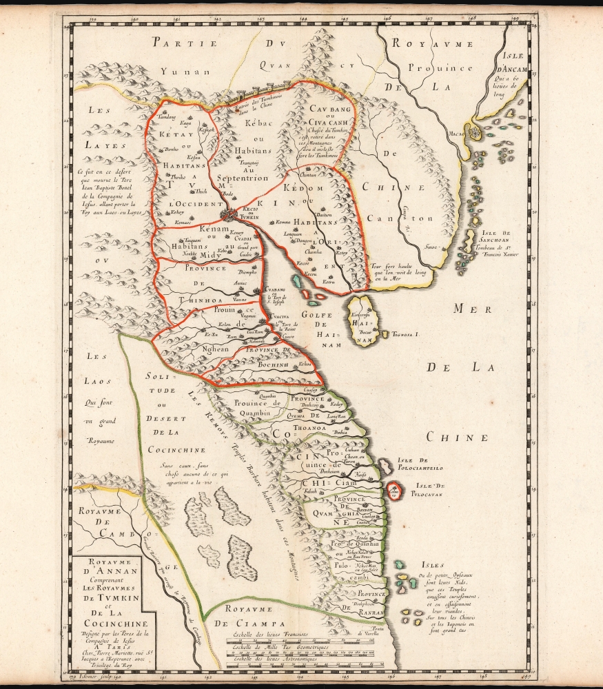
Carte du Royaume d'Annam, comprenant les Royaumes du Tumkin et de la Cocinchine.
$9,500.00
Acquire
- Digital Map Information
- Suitable for large format printing
- DPI: 600
- File Size: 12.7 MB
- File Type: ZIP / TIFF
- ICC color profile embedded
- Delivered instantly via download link
This is the Alexander de Rhodes and Pierre Mariette 1653 map of Vietnam, considered the first specific map of the Kingdom of Annam, or Tonkin, today's North Vietnam. This map represents a major milestone in the mapping of Vietnam and would prove the underpinning cartography of this region through the mid-19th century. (more details)
The 'Around the World in 80 Days' zeitgeist.

Voyage Dans Les Cinq Parties du Monde.
$5,500.00
Acquire
A rare French geographical game designed by J. X. Matenet and published by Bussière in Paris c. 1875. The game captures the French fascination with world travel at the height of the Around the World in Eighty Days era, when advances in infrastructure and technology made casual global voyages achievable. (more details)
First official map of Nicaragua in its first edition.
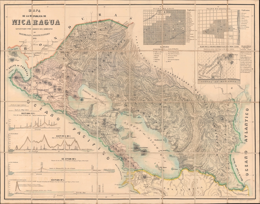
Mapa de la Republica de Nicaragua.
$5,000.00
Acquire
- Digital Map Information
- Suitable for large format printing
- Full resolution TIFF file
- ICC color profile embedded
- Delivered instantly via download link
This is Maximilian Sonnenstern's 1858 map of Nicaragua, the first official map of that state, here in its first edition. The map represents the first scientific survey of Nicaragua during a period when that nation held center stage as the most likely route for an interoceanic canal. It, moreover, is the earliest of Sonnenstern's seminal maps of the newly independent Central American republics. This map was followed by similarly significant maps of Guatemala and El Salvador. (more details)
One of the Earliest Obtainable Maps of the American Revolution

Map of the Environs of Boston. Drawn at Boston in June 1775. / The Remembrancer, or Impartial Repository of Public Events.
$4,500.00
Acquire
This is the scarce 1775 first volume of John Almon's The Remembrancer, which includes one of the earliest published maps of Boston following the Battle of Bunker Hill. Almon, who was a well-connected and informed reporter on the British Parliament, placed himself in danger of being fined or imprisoned by responding to public interest in events in America and publishing this work. (more details)
Early Japanese connections with San Francisco.
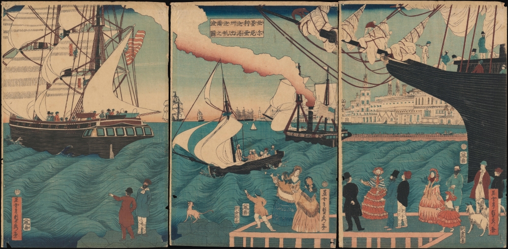
亜墨利迦州迦爾波爾尼亜港出帆之圖 / [View of Ships Departing from the Port of California, America].
$4,000.00
Acquire
- Digital Map Information
- Suitable for large format printing
- Full resolution TIFF file
- ICC color profile embedded
- Delivered instantly via download link
A magnificent Ukiyo-e woodblock triptych in the distinctive Yokohama-e style, produced in 1862 by the genre's most prolific master, Utagawa Sadahide. It portrays a group of American ships leaving the 'port of California,' almost certainly San Francisco, presumably bound for Japan. This work is especially notable as it depicts a purely foreign scene, rather than the more common illustrations of foreigners in Yokohama or elsewhere in Japan. (more details)
The United States - fully formed.
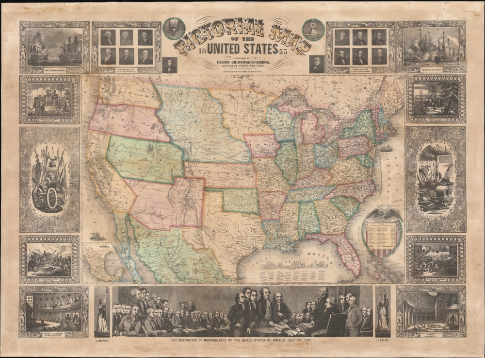
Pictorial Map of the United States.
$3,000.00
Acquire
- Digital Map Information
- Suitable for large format printing
- File Size: 1717.2 MB
- File Type: ZIP / TIFF
- ICC color profile embedded
- Delivered instantly via download link
A decorative 1855 wall map of the United States. Issued by Ensign, Bridgman and Fanning, this map covers from Atlantic to Pacific and from Canada to the Gulf of Mexico. This map illustrates an ephemeral period in the development of the American West with each of its many editions exhibiting significant changes and updates. (more details)
Oakland just before its industrial bo
om.
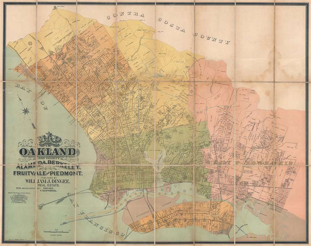
Map of Oakland and Vicinity. Alameda, Berkeley, Fruitvale, and Piedmont.
$3,000.00
Acquire
- Digital Map Information
- Suitable for large format printing
- Full resolution TIFF file
- ICC color profile embedded
- Delivered instantly via download link
This is a c. 1892 William J. Dingee city plan or map of Oakland, California, and the surrounding East Bay area. Published just before Oakland experienced a decades-long boom following the Panic of 1893 in which the city became in industrial center, streets are illustrated and labeled throughout Oakland, Berkeley, Albany (incorporated in 1908), Emeryville (incorporated in 1896), Piedmont, Alameda, and Brooklyn Township. (more details)
Scramble for Africa manuscript map.
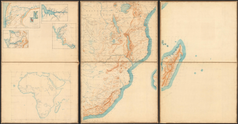
[Africa, West Africa.]
$2,500.00
Acquire
- Digital Map Information
- Suitable for large format printing
- File Size: 57.24 MB
- File Type: ZIP / TIFF
- ICC color profile embedded
- Delivered instantly via download link
A remarkable c. 1885 French manuscript map of Africa, drafted on six sheets and mounted on linen. Taken together, these maps represent a unique window to French colonial ambitions in Africa at the time of the 1886 Berlin Conference. (more details)
Rare Early State of an Elegant, French Map of the Western Hemisphere
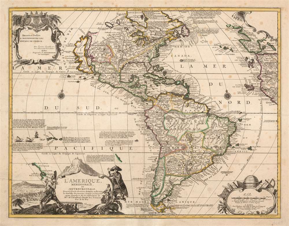
L'Amerique, meridionale, et septentrionale Dressée selon les Dernieres Relations et suivant les Nouvelles Decouvertes dont les pounts prin= cipaux sont placez sur les Observations de Mrs. de l'Academie Royale des Sciences.
$2,500.00
Acquire
- Digital Map Information
- Suitable for large format printing
- Full resolution TIFF file
- ICC color profile embedded
- Delivered instantly via download link
This is Nicolas de Fer's 1699 map of America, in a lovely old color example of the second state, printed in 1705. Both of the first two states of this map were separately issued, and are consequently rare. This detailed and richly annotated map, derived from De Fer's own 1698 L'Amerique Divisée Selon Letendue de set Principales Parties, shows the Americas during a period in which France was dominant in the exploration and mapping of North America. Its superb engraving is the work of Harmanus Van Loon, who also engraved De Fer's larger-scale work. (more details)
Beginning of the End of Pan-Arabism

الوطن العربي / [The Arab World].
$1,800.00
Acquire
This is a scarce 1962 Arabic-language wall map of the Arab World and environs, prepared by Dr. Muhammad Sobhi Abdel Hakim and colleagues and published by Dar al-Qalam in Cairo. The map was prepared at the height of the pan-Arab movement that emerged after World War II (1939 - 1945), shaped by the dynamics of Decolonization and the early Cold War (1947 - 1991). (more details)
Early look at Taiwan.
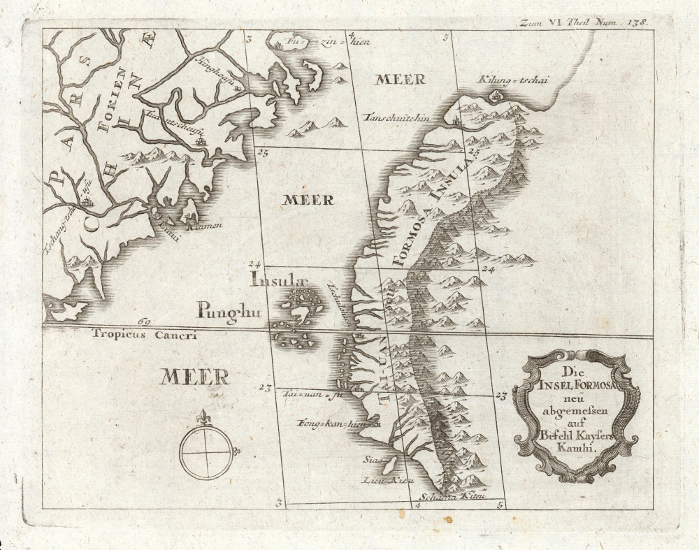
Die Insel Formosa neu abgemessen auf Befehl Kaysers Kamhi.
$1,450.00
Acquire
- Digital Map Information
- Suitable for large format printing
- DPI: 600
- File Size: 7.16 MB
- File Type: ZIP / TIFF
- ICC color profile embedded
- Delivered instantly via download link
This map is one of the earliest, if not the earliest, obtainable printed maps of Taiwan or Formosa Island. It appeared in Joseph Stöcklein's 1726 compilation of Jesuit missionary letters, which revealed much of what the Jesuit Fathers had learned of some of the remotest parts of the world. (more details)
French WWII propaganda from before the German invasion.
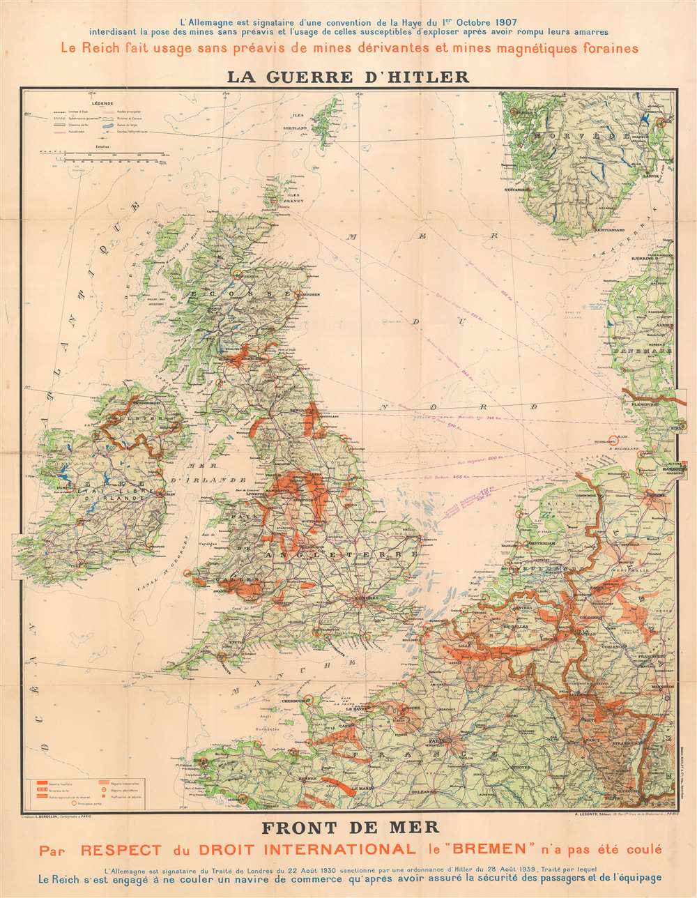
La Guerre d'Hitler. Front de Mer.
$1,200.00
Acquire
- Digital Map Information
- Suitable for large format printing
- File Size: 60.04 MB
- File Type: ZIP / TIFF
- ICC color profile embedded
- Delivered instantly via download link
This is a 1940 Bergelin propaganda map of the British Isles, northern France, and the North Sea at the beginning of World War II (1939 - 1945). The map details the critical effort to keep British and continental shipping lanes and supply lines open. Since this broadside is French, published in Pairs, and anti-German, it must predate the May 1940 German invasion of France. (more details)
One of the first western maps of Xinjiang, China, illustrating a Great Game Era British trade mission.
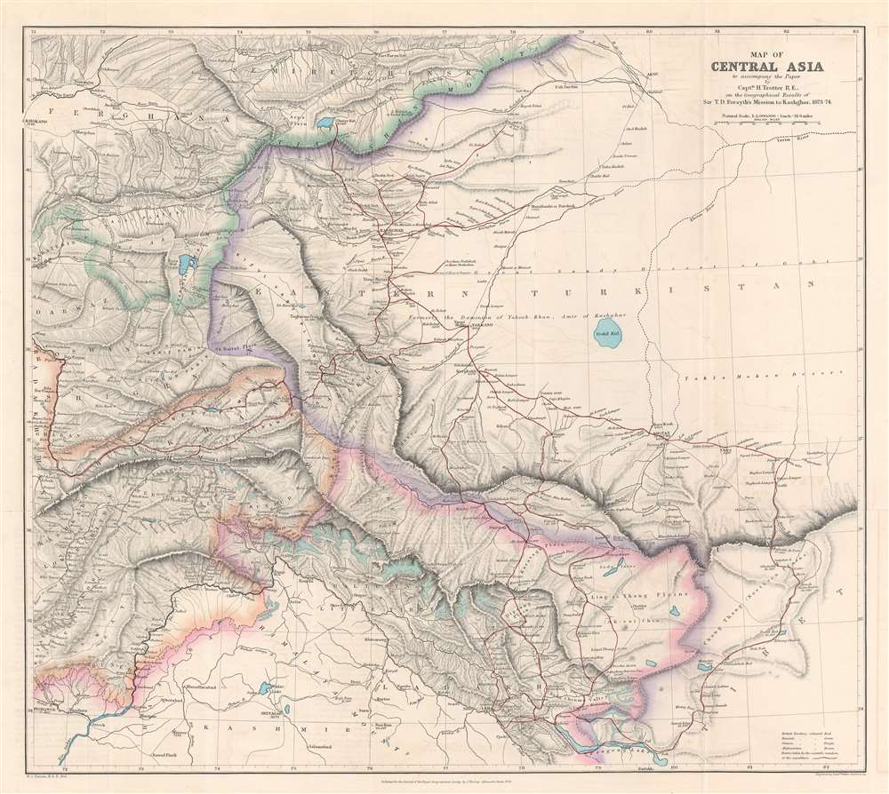
Map of Central Asia to accompany the Paper by Captain H. Trotter R.E., on the Geographical Results of Sir T.D. Forsyth's Mission to Kashgar, 1873 - 74.
$950.00
Acquire
- Digital Map Information
- Suitable for large format printing
- File Size: 24.76 MB
- File Type: ZIP / TIFF
- ICC color profile embedded
- Delivered instantly via download link
This is a 1878 William John Turner and Royal Geographical Society map of Xinjiang, China, that traces explorations of the 1873 - 1874 Forsyth Mission, making this one of the first detailed Western maps of the region. The map is a relic of the Great Game, a series of struggles between Britain and Russia to control Central Asia. (more details)
Supporting Vietnamese claims in the South China Sea.

Daniel Taverniers Land-Charte des Königreichs Tunqvin.
$850.00
Acquire
- Digital Map Information
- Suitable for large format printing
- DPI: 600
- File Size: 4.66 MB
- File Type: ZIP / TIFF
- ICC color profile embedded
- Delivered instantly via download link
This is an important 1684 map of Vietnam and the South China Sea by the French Huguenot merchant adventurer, Daniel Tavernier. This is one of several maps citied to support modern-day Vietnamese claims against China to soverignty over disputed island clusters in the South China Sea. (more details)
An imaginative depiction of the Strait of Magellan.
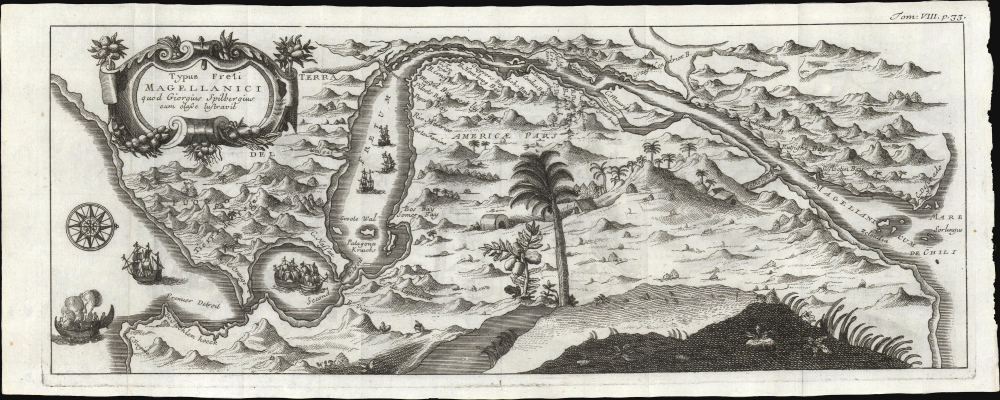
Typus Freti Magellanici quod Giorguis Spilbergius cum classe lustravit.
$850.00
Acquire
- Digital Map Information
- Suitable for large format printing
- DPI: 600
- File Size: 5.92 MB
- File Type: ZIP / TIFF
- ICC color profile embedded
- Delivered instantly via download link
This is a decorative 1725 map of the Strait of Magellan published by René-Auguste-Constantin de Renneville to illustrate his narrative of Joris van Spilbergen's 1615 navigation to the Pacific. Spilbergen's was part of a broader effort to undermine Spanish dominance over the Pacific, then still known as the 'Spanish Sea'. (more details)
Lovely Lake Geneva, with a city plan.

Carte du Lac de Genève et des Pays Circonvoisins...
$750.00
Acquire
- Digital Map Information
- Suitable for large format printing
- DPI: 600
- File Size: 41.06 MB
- File Type: ZIP / TIFF
- ICC color profile embedded
- Delivered instantly via download link
This beautiful engraving is Philippe Buache's 1740 map of Lake Geneva and environs, covering the northwestern end of the European Alpine region that today straddles the border between France and Switzerland. (more details)