
Ortelius, Abraham (sold)
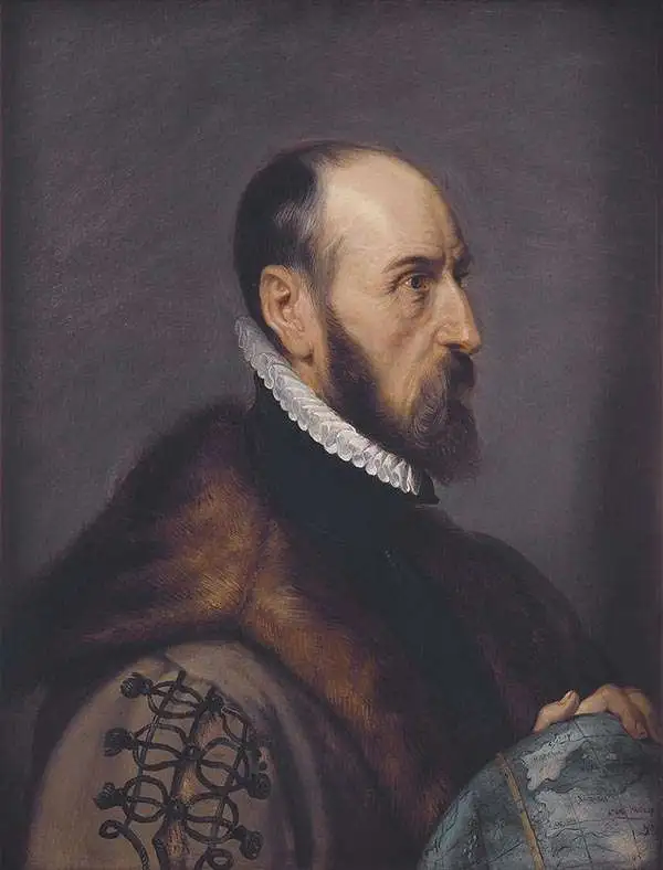
Abraham Ortelius (April 14, 1527 - June 28, 1598) also known as Ortels, was a cartographer, geographer, and cosmographer of Brabant, active in Antwerp. He was the creator of the first modern atlas, Theatrum Orbis Terrarum and is a seminal figure in the history of cartography. Along with Gerard Mercator and Gemma Frisius, he was a founder of the Netherlandish school of cartography. His connections with Spain - culminating in his 1575 appointment as Royal Cartographer to King Phillip II of Spain - gave him unmatched access to Spanish geographical knowledge during a crucial period of the Age of Discovery. Ortelius was born in 1527 in Antwerp. In 1547 he entered the Antwerp Guild of Saint Luke as an illuminator of maps. He began trading in books, prints, and maps, traveling regularly to the Frankfurt book and print fair, where in 1554 he met Mercator. He accompanied Mercator on journeys throughout France in 1560 and it was at this time, under Mercator's influence, that he appears to have chosen his career as a scientific geographer. His first published geographic work appeared in 1564, an eight-sheet cordiform world map. A handful of other maps preceded the 1570 publication of the first edition of the Theatrum Orbis Terrarum, which would prove to be his life work. Appearing with but 53 maps in its first edition, Ortelius' work expanded with new maps added regularly. By 1592, it had 134 maps. Many of Ortelius' maps remained the standard for nearly a century. He traveled extensively, but his genius was as a compiler, locating the best informed maps on which to base his own. His contacts throughout Europe and extending even (via the Portuguese) to the Far East were formidable. Moreover, many of his maps were based on his own scholarship, particularly his historical works. His theories of geography were particularly ahead of his time with respect to the notion of continental drift, the possibility of which he mused on as early as 1596, and which would be proven correct centuries later. In a sense his greatest achievement was his successful navigation of the religious and political violence endemic to his city throughout his adult life: The Dutch Revolt, or Eighty Years' War (1568 - 1648), fully embroiled Antwerp. Although outwardly and officially recognized as Catholic (Arias Montanus vouched for Ortelius' Catholic orthodoxy prior to his appointment as Royal Geographer), Ortelius was able to separate himself from the religious furor which characterized the war in the low countries. Ortelius showed a glimpse of himself in a letter to a friend, regarding humanist Justus Lipsius: 'I do not know whether he is an adherent of the Pope or a Calvinist, but if he has ears to hear, he will neither be one nor the other, for sins are committed on both sides'. Ortelius' own explorations of Biblical history in his maps, and the Christogram contained in his own motto, suggest him to be a religious man, but his abjuration of political religious authorities mark him as an individualist. His tombstone at St Michael's Præmonstratensian Abbey in Antwerp bears the inscription, Quietis cultor sine lite, uxore, prole. ('served quietly, without accusation, wife, and offspring.')
First atlas map of Europe.
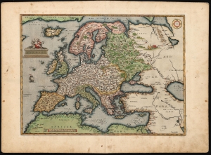
Europae.
sold
- Digital Map Information
- Suitable for large format printing
- Full resolution TIFF file
- ICC color profile embedded
- Delivered instantly via download link
This is a beautiful, original color example of Abraham Ortelius' 1570 map of Europe. It represents the first plate, first state of the map: thus it is the first map of Europe to appear in an atlas. (more details)
First Atlas Map of the North Parts of the World.
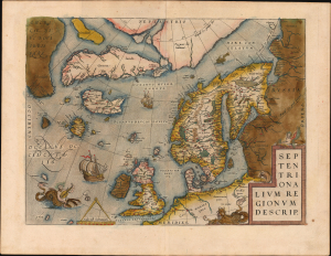
Septentrionalium Regionum Desrip.
sold
- Digital Map Information
- Suitable for large format printing
- Full resolution TIFF file
- ICC color profile embedded
- Delivered instantly via download link
A handsome example of one of Abraham Ortelius' most interesting maps, his 1570 map of Scandinavia and the Arctic. During the Age of Discovery, the Arctic was as remote and unfamiliar as the coasts of America, Africa, or Asia. This map played a role in propagating several cartographic fallacies, including the Zeno Fraud: Frisland, Estotiland, Drogeo. The present example features warm, original color. (more details)
Original color issue of one of the most influential maps of the 16th century.
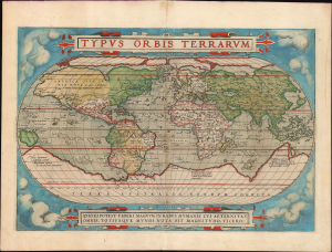
Typus Orbis Terrarum.
sold
- Digital Map Information
- Suitable for large format printing
- Full resolution TIFF file
- ICC color profile embedded
- Delivered instantly via download link
A superb old-color example of Abraham Ortelius' iconic 1570 map of the world, here in its 1579 edition. Of fundamental importance, this is the first world map to appear in an atlas and one of the most influential of the 16th century. (more details)
First Atlas Map of the North Parts of the World.
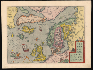
Septentrionalium Regionum Desrip.
sold
- Digital Map Information
- Suitable for large format printing
- Full resolution TIFF file
- ICC color profile embedded
- Delivered instantly via download link
A handsome example of one of Abraham Ortelius' most interesting maps, his 1570 map of Scandinavia and the Arctic. During the Age of Discovery, these northern parts of the world represented regions as remote and unfamiliar as the coasts of America, Africa, and Asia. (more details)
One of the first maps to show the Pacific Northwest.
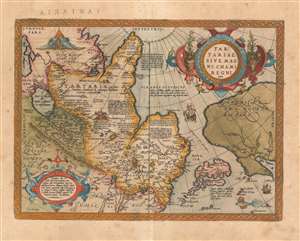
Tartariae Sive Magni Chami Regni typus.
sold
- Digital Map Information
- Suitable for large format printing
- Full resolution TIFF file
- ICC color profile embedded
- Delivered instantly via download link
A richly-colored example of Ortelius' seminal map of Tartary, this is one of the first maps to focus on the North Pacific. While the map is primarily intended to detail Asia as dominated by the Great Khan, it is also notable for what it shows of America. The map includes what is now the west coast of the United States, northwestern Canada and Alaska, bit was then almost entirely unknown lands. It is the earliest obtainable map to name California. It also displays a strait separating Asia and America - the Strait of Asian - appearing long before the existence of such a strait was proved by discovery. The map is based on a partial conic projection, and depicts from the Black Sea to the Gulf of California, and from the Arctic to southern China, what Europeans then considered the extent of the Tartar Kingdom. In fact, much of the content north of China is mythical or loosely derived from the journals of Marco Polo, the legends of Prester John, and Biblical sources. (more details)
An unusual separate issue without verso text.
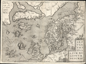
Septentrionalium Regionum Desrip.
sold
- Digital Map Information
- Suitable for large format printing
- File Size: 22.83 MB
- File Type: ZIP / TIFF
- ICC color profile embedded
- Delivered instantly via download link
A handsome example of one of Abraham Ortelius' most interesting maps, his 1570 map of Scandinavia and the Arctic. During the Age of Discovery, these northern parts of the world represented regions as remote and unfamiliar as the coasts of America, Africa, and Asia. (more details)
The earliest obtainable map to name California!
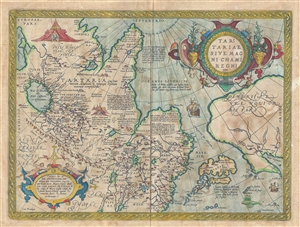
Tartariae Sive Magni Chami Regni typus.
sold
- Digital Map Information
- Suitable for large format printing
- DPI: 300
- File Size: 10.21 MB
- File Type: ZIP / TIFF
- ICC color profile embedded
- Delivered instantly via download link
The first state of Ortelius' important 1570 map of Tartary. Among other things, this map is notable as the earliest obtainable map to name California. The map covers from the Black Sea to the Gulf of California and from the arctic to southern China. The map ... (more details)
1641 Spanish Text Edition - only 25 printed.
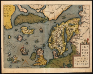
Septentrionalium Regionum Desrip.
sold
- Digital Map Information
- Suitable for large format printing
- Full resolution TIFF file
- ICC color profile embedded
- Delivered instantly via download link
One of Abraham Ortelius' most interesting maps, this is his 1570 map of Scandinavia and the Arctic. During the Age of Discovery, these northern parts of the world represented regions as remote and unfamiliar as the coasts of America, Africa, and Asia. (more details)
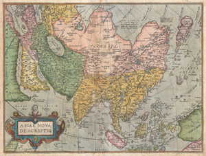
Asiae Nova Descriptio
sold
- Digital Map Information
- Suitable for large format printing
- DPI: 300
- File Size: 19.89 MB
- File Type: ZIP / TIFF
- ICC color profile embedded
- Delivered instantly via download link
A scarce and stunning first edition example of Abraham Ortelius' important 1572 map of Asia. Covers from Europe and Africa eastward to include all of Asia, the East Indies, Japan, and parts of New Guinea and Australia. From west to east, this map offers ... (more details)
First Modern Atlas Map of the British Isles in its First State.
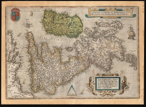
Angliae, Scotiae, et Hiberniae, Sive Britannicar: Insularum Descriptio.
sold
- Digital Map Information
- Suitable for large format printing
- Full resolution TIFF file
- ICC color profile embedded
- Delivered instantly via download link
This is Abraham Ortelius' 1570 map of the British Isles, the first atlas map of the British Isles, in a handsome example of the first state of the map, printed in 1571. (more details)
Dominant mapping of Poland of the 16th century.
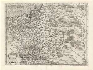
Poloniae finitimarumque locorum descriptio.
sold
- Digital Map Information
- Suitable for large format printing
- DPI: 600
- File Size: 46.51 MB
- File Type: ZIP / TIFF
- ICC color profile embedded
- Delivered instantly via download link
This is Abraham Ortelius' 1581 map of Poland, based on the c. 1556-58 Grodziecki. The map reaches from Szczecin and the Oder River in the west to the Dnieper River, thus embracing much of Ukraine as well as part of Russia and the Baltic. Mountains and forests are shown pictorially. (more details)
Dominant mapping of Poland of the 16th century.
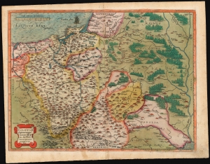
Poloniae finitimarumque locorum descriptio.
sold
- Digital Map Information
- Suitable for large format printing
- Full resolution TIFF file
- ICC color profile embedded
- Delivered instantly via download link
This is Abraham Ortelius' 1581 map of Poland, based on the c. 1556-58 Grodziecki map. (more details)
The Northern Limits of Geographical Knowledge in the Age of Discovery
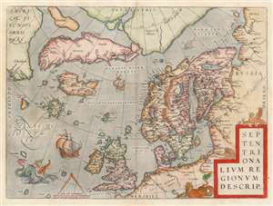
Septentrionalium Regionum Desrip.
sold
- Digital Map Information
- Suitable for large format printing
- DPI: 600
- File Size: 49.65 MB
- File Type: ZIP / TIFF
- ICC color profile embedded
- Delivered instantly via download link
One of Abraham Ortelius' most interesting maps, this is his 1570 map of Scandinavia and the Arctic. During the Age of Discovery, these north parts of the world represented regions as remote and unfamiliar as the coasts of America, Africa, and Asia. The map covers the northern regions from the English Channel to the just south of the North Pole and from America to Russia, including England, Scandinavia, Finland, Denmark, Iceland, and Greenland, as well as parts of America (Estotiland), the apocryphal island of Frisland, and Mercator's speculative Arctic islands. (more details)
The first map of the world in a standard Atlas - of fundamental importance to the history of cartography.
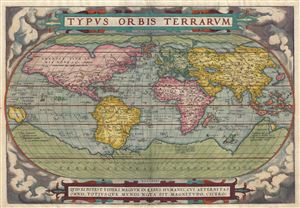
Typus Orbis Terrarum.
sold
- Digital Map Information
- Suitable for large format printing
- DPI: 300
- File Size: 10.46 MB
- File Type: ZIP / TIFF
- ICC color profile embedded
- Delivered instantly via download link
A fine first edition third printing example of Aberham Ortelius' iconic 1570 map of the world. This map is the first map of the world to appear in a standard atlas and is thus of fundamental importance to the history of cartography. Centered on the ... (more details)
First State, First Latin Edition of one of the Most Desirable Africa Maps.
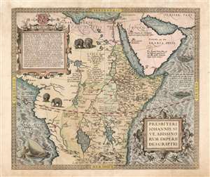
Presbiteri Iohannis, Sive, Abissionrum Imperii Descriptio.
sold
- Digital Map Information
- Suitable for large format printing
- Full resolution TIFF file
- ICC color profile embedded
- Delivered instantly via download link
This is Ortelius' famous map of the Kingdom of Prester John, in its first Latin edition of 1573 and original color. The map covers from the Bight of Benin to the Indian Ocean and from Arabia and the Red Sea to Mozambique. It includes two decorative cartouches as well as stylized images of African elephants. While the African coast exhibits considerable advances over earlier maps of the region, the interior reveals a cartography primarily based on the literature of antiquity and little changed from the days of Ptolemy. Superimposed on these speculative lands is the legendary Kingdom of Prester John (Presbiteri Ioannis) - a persistent and popular figure in European myth. Cartographically the map is derived from Gastaldi's 1564 eight-sheet wall map of Africa. (more details)
Beautiful early map of Africa showing the mythical Kingdom of Prester John.
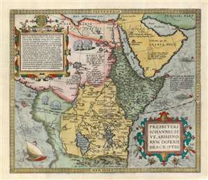
Presbiteri Iohannis, Sive, Abissionrum Imperii Descriptio.
sold
- Digital Map Information
- Suitable for large format printing
- DPI: 600
- File Size: 20.56 MB
- File Type: ZIP / TIFF
- ICC color profile embedded
- Delivered instantly via download link
A fascinating map of central Africa issued by Abraham Ortelius in 1598. The map covers from the Bight of Benin to the Indian Ocean and from Arabia and the Red Sea to Mozambique. It includes two decorative cartouches as well as stylized images of African elephants. While the African coast exhibits considerable advances over earlier maps of the region, the interior of Africa exhibits a cartography primarily based on the literature of antiquity and little changed from the days of Ptolemy. Superimposed on these speculative lands is the legendary Kingdom of Prester John (Presbiteri Ioannis) – a persistent and popular figure in European folklore. Cartographically the map is derived from Gastaldi's 1564 eight-sheet wall map of Africa. (more details)
First Atlas Map of the Western Hemisphere.
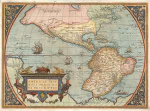
Americae Sive Novi Orbis Nova Descriptio.
sold
- Digital Map Information
- Suitable for large format printing
- Full resolution TIFF file
- ICC color profile embedded
- Delivered instantly via download link
This is Abraham Ortelius' map of the Western Hemisphere, considered to be the 'first map of the Americas to appear in a modern atlas' (Schwartz). Ortelius' success and the spread of his atlas made this fine map the standard - and best - representation of the Americas during the initial period its colonization. (more details)
One of the earliest maps to show Mercator's speculative Arctic islands, the apocryphal Friesland, and Zeno's fraudlent version of Labrador, Estotiland.
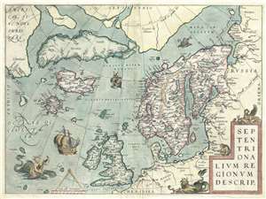
Septentrionalum Regionum Desrip.
sold
- Digital Map Information
- Suitable for large format printing
- DPI: 300
- File Size: 11.16 MB
- File Type: ZIP / TIFF
- ICC color profile embedded
- Delivered instantly via download link
One of Abraham Ortelius' most interesting maps, this is his 1570 map of Scandinavia and the Arctic. During the Age of Discovery, these northern parts of the world represented regions as remote and unfamiliar as the coasts of America, Africa, and Asia. (more details)
Early original color issue of one of the most influential maps of the 16th century.
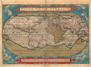
Typus Orbis Terrarum.
sold
- Digital Map Information
- Suitable for large format printing
- Full resolution TIFF file
- ICC color profile embedded
- Delivered instantly via download link
A superbly-colored example of Abraham Ortelius' iconic 1570 map of the world, here in a 1572 edition, still the first state of the first plate. This map is the first map of the world to appear in a standard atlas and is thus of fundamental importance to the history of cartography. It was one of the most widely-seen, and most influential printed maps of the world produced in the sixteenth century. (more details)
The first Atlas Map of the Western Hemisphere.
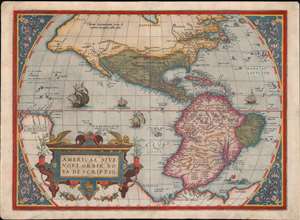
Americae Sive Novi Orbis Nova Descriptio.
sold
- Digital Map Information
- Suitable for large format printing
- Full resolution TIFF file
- ICC color profile embedded
- Delivered instantly via download link
This is Abraham Ortelius' map of the Western Hemisphere, 'first map of the Americas to appear in a modern atlas' (Schwartz). Ortelius' success and the spread of his atlas made this fine map the standard - and best - representation of the Americas during the initial period of the colonization of North America by Europeans. (more details)
North Part of the World Known to Europe in the Age of Discovery.
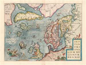
Septentrionalum Regionum Desrip.
sold
- Digital Map Information
- Suitable for large format printing
- Full resolution TIFF file
- ICC color profile embedded
- Delivered instantly via download link
One of Abraham Ortelius' most interesting maps, this is his 1570 map of the Arctic, here in a transitional example between the first and second states as recorded in van den Broecke. The map covers the northern regions from the English Channel to the just south of the North Pole and from America to Russia, including England, Scandinavia, Finland, Denmark, Iceland, and Greenland, as well as parts of America (Estotiland), the apocryphal island of Friesland, and Mercator's speculative Arctic islands. (more details)
Battleground of the French Wars of Religion.
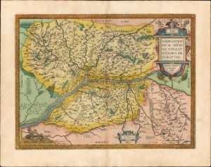
Andegavensium Ditionis Vera et Integra Descriptio.
sold
- Digital Map Information
- Suitable for large format printing
- Full resolution TIFF file
- ICC color profile embedded
- Delivered instantly via download link
A beautiful example, in superb original color, of Abraham Ortelius' 1579 map of the Duchy of Anjou, now largely consistent with the Department of Maine-et-Loire. Ortelius sourced his map from a now-lost map produced in 1573 by Lezin Guyet (1515 - 1580,) who lived in Anjou and whose map was dedicated to the Duke of Anjou. At the time the map was produced, the Dukes of Anjou were embroiled in the French Wars of Religion. This part of the Loire valley is known as the source of the Vignobles d'Anjou et Saumur. (more details)
Dominant 16th century Map of the Western Hemisphere in Original Color.
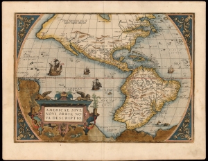
Americae Sive Novi Orbis Nova Descriptio.
sold
- Digital Map Information
- Suitable for large format printing
- Full resolution TIFF file
- ICC color profile embedded
- Delivered instantly via download link
This a striking original-color example of Abraham Ortelius' map of the Western Hemisphere, 'first map of the Americas to appear in a modern atlas' (Schwartz). Ortelius' success and the spread of his atlas made this map the standard - and best - representation of the Americas during the initial period of the European colonization. (more details)
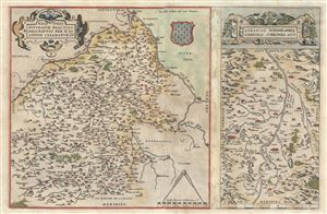
Regionis Biturigum Exactiss: Descriptio per D. Ioannem Calamaeum. Limaniae Topographia Gabriele Symeoneo Auct.
sold
- Digital Map Information
- Suitable for large format printing
- DPI: 300
- File Size: 10.49 MB
- File Type: ZIP / TIFF
- ICC color profile embedded
- Delivered instantly via download link
These are two rare 1579 regional Abraham Ortelius maps on a single folio sheet. The Left Map, centered on Bourges, depicts the Loire Valley region from Gian to St. Sebastian in the south and from Le Blanc east as far as Nevers. Several important ... (more details)
Burgundy Wine Region.
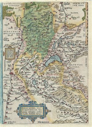
Sabaudiae, et Burgundiae Comitatus Descriptio.
sold
- Digital Map Information
- Suitable for large format printing
- DPI: 300
- File Size: 4.61 MB
- File Type: ZIP / TIFF
- ICC color profile embedded
- Delivered instantly via download link
This is a rare 1579 Abraham Ortelius map of Burgundy (Bourgogne), France. Centered on Lake Geneva, Ortelius' map covers from Lyon, France to La Chaux-de-Fonds, Switzerland and from Vesoul to Rivoli, Italy. The modern region of Haute-Savoie and ... (more details)
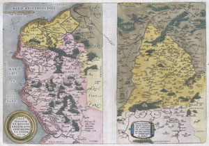
Caletensium et Bononiensium Ditionis Accurata Delinatio. / Veromanduorum Eorumque Confinium Exactissima Discriptio.
sold
- Digital Map Information
- Suitable for large format printing
- DPI: 300
- File Size: 5.07 MB
- File Type: ZIP / TIFF
- ICC color profile embedded
- Delivered instantly via download link
Two rare regional Abraham Ortelius maps on a single folio sheet. Left map, entitled Caletensium,depicts the French and Belgian coastline from Estables to Calais. Cartographically based upon a four sheet map issued by Nicholas de Nicolay. The ... (more details)
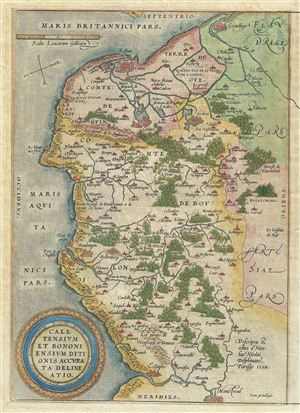
Caletensium et Bononiensium Ditionis Accurata Delinatio.
sold
- Digital Map Information
- Suitable for large format printing
- DPI: 300
- File Size: 5.83 MB
- File Type: ZIP / TIFF
- ICC color profile embedded
- Delivered instantly via download link
This is a rare 1579 Abraham Ortelius map of the French department of Pas-de-Calais. It covers the French and Belgian coastline from Estables to Calais. This area is known for producing Maroilles, a soft cheese made from cow's milk and with a ... (more details)
First Atlas Map of the Caribbean, and Northwestern Mexico.
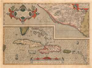
Culiacanae, America Regionis Descriptio./ Hispaniolae, Cubae, Aliarumque Insularum Circumiacentium, Delineatio./ Cum Imp. et Regio./ privilegio decennali 1579.
sold
- Digital Map Information
- Suitable for large format printing
- DPI: 600
- File Size: 19.89 MB
- File Type: ZIP / TIFF
- ICC color profile embedded
- Delivered instantly via download link
This is an attractive, original-color example of Ortelius' 1579 map of the Viceroyalty of Culiacan in Northwestern Mexico, and Ortelius' map of Cuba and the Caribbean. While Ortelius is generally most esteemed as an editor and compiler of maps, he was an accomplished mapmaker in his own right, and this map is among those of his Theatrum of his own composition, synthesizing data drawn from Mercator's 1569 world map, Gutierrez's 1562 America map and Alonso de Santa Cruz's 1560 Isolario (sources now unobtainable by the collector). These maps, both of essential areas of recent exploration in the New World, exemplify Ortelius' trail-blazing cartographic work. (more details)
First Atlas Map of the Caribbean, and Northwestern Mexico.
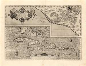
Culiacanae, America Regionis Descriptio./ Hispaniolae, Cubae, Aliarumque Insularum Circumiacentium, Delineatio./ Cum Imp. et Regio./ privilegio decennali 1579.
sold
- Digital Map Information
- Suitable for large format printing
- Full resolution TIFF file
- ICC color profile embedded
- Delivered instantly via download link
This is a beautiful, sharp example of Ortelius' 1579 map of the Viceroyalty of Culiacan in Northwestern Mexico, and Ortelius' map of Cuba and the Caribbean. While Ortelius is generally most esteemed as an editor and compiler of maps, he was an accomplished mapmaker in his own right, and this map is among those of his Theatrum of his own composition, synthesizing data drawn from Mercator's 1569 world map, Gutierrez's 1562 America map and Alonso de Santa Cruz's 1560 Isolario (sources now unobtainable by the collector). These maps, both of essential areas of recent exploration in the New World, exemplify Ortelius' trail-blazing cartographic work. (more details)
First Atlas Map of the Caribbean, and Northwestern Mexico.
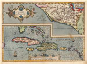
Culiacanae, America Regionis Descriptio./ Hispaniolae, Cubae, Aliarumque Insularum Circumiacentium, Delineatio./ Cum Imp. et Regio./ privilegio decennali 1579.
sold
- Digital Map Information
- Suitable for large format printing
- DPI: 600
- File Size: 51.8 MB
- File Type: ZIP / TIFF
- ICC color profile embedded
- Delivered instantly via download link
This is a beautiful, original-color example of Ortelius' 1579 map of the Viceroyalty of Culiacan in Northwestern Mexico, and Ortelius' map of Cuba and the Caribbean. Moreover, this is an example of the first state of the map. While Ortelius is generally most esteemed as an editor and compiler of maps, he was an accomplished mapmaker in his own right, and this map is among those of his Theatrum of his own composition, synthesizing data drawn from Mercator's 1569 world map, Gutierrez's 1562 America map and Alonso de Santa Cruz's 1560 Isolario (sources now unobtainable by the collector). These maps, both of essential areas of recent exploration in the New World, exemplify Ortelius' trail-blazing cartographic work. (more details)
First Specific Printed Maps of Florida and Peru.
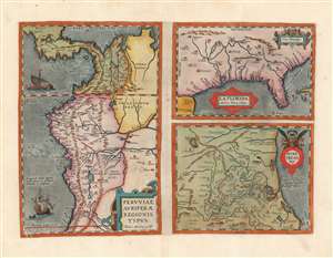
Peruviae Auriferae Regionis Typus./ La Florida./ Guastecan.
sold
- Digital Map Information
- Suitable for large format printing
- DPI: 600
- File Size: 53.05 MB
- File Type: ZIP / TIFF
- ICC color profile embedded
- Delivered instantly via download link
This is a beautiful, wide-margined example of Ortelius' 1584 engraving, including the first specific map of Florida, the earliest specific map of Peru, and the first map focusing on the Guastecan province of Mexico. The map is a prime example of Ortelius' strength not only as a mapmaker but also as a compiler. All these maps combined here are relevant to each other in that they all derive from Spanish sources, and reveal parts of the Spanish Empire in America, despite Spain forbidding the production and dissemination of such maps. That two of these maps credit specific Spanish sources suggests that Ortelius enjoyed an open connection with a member of the Spanish bureaucracy. Antwerp was part of the Spanish Empire at the time, but it is certainly testimony of Ortelius's far-reaching network of contacts throughout Europe that he was able to obtain maps such as these for publication. (more details)
The Danube below Vienna.
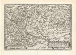
Ungariae Loca Praecipua Recens Emendata Atque Edita, per Ioannem Sambucum Pannonium, Imp. Ms. Historicum. 1579.
sold
- Digital Map Information
- Suitable for large format printing
- DPI: 600
- File Size: 47.53 MB
- File Type: ZIP / TIFF
- ICC color profile embedded
- Delivered instantly via download link
This is Ortelius' updated map of Hungary, derived from the similarly-titled and unacquirable 1571 map of János Zsámboky aka Johannes Sambucus. This new map supplemented Ortelius' earlier map of Hungary, based on the much older (1556) map of Wolfgang Lazio. (more details)
Maroilles Cheese Region.
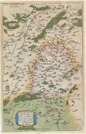
Veromanduorum Eorum Que Confinium Exactissima Descriptio.
sold
- Digital Map Information
- Suitable for large format printing
- DPI: 300
- File Size: 5.38 MB
- File Type: ZIP / TIFF
- ICC color profile embedded
- Delivered instantly via download link
This is a rare 1579 Abraham Ortelius map Oise, Picardy, Francy. Oriented to the South and centered on Saint Quentin, the map covers from Cambrai to Noyon (Noviomagus Veromanduorum) and from Guise to Perone. The cathedral of Cambrai, in the ... (more details)
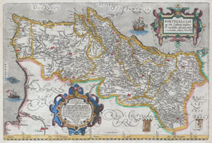
Portvgalliae que olim Lusitania, novissima & exactissima descriptio, Aucto re Vernando Aluaro Secco (A very new & exact depiction of Portugal, once called Lusitania, by Vernandus Alvarus Secco).
sold
- Digital Map Information
- Suitable for large format printing
- Full resolution TIFF file
- ICC color profile embedded
- Delivered instantly via download link
A rare and beautiful 1579 Abraham Ortelius map of the Kingdom of Portugal. Follows the extremely rare two sheet Alavaraz Secco map published by Michele Tramezzino in 1561. North oriented to the right. Sea decorated with monsters and sailing ... (more details)
Southern Rhone wine region.
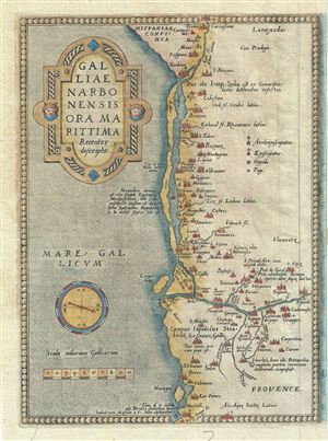
Galliae Narbonensis Ora Marittima Recenter Descripta.
sold
- Digital Map Information
- Suitable for large format printing
- DPI: 300
- File Size: 4.88 MB
- File Type: ZIP / TIFF
- ICC color profile embedded
- Delivered instantly via download link
This is a rare 1579 Abraham Ortelius map of the coast of Provence, France. Oriented to the west, this map covers the coastline from Narbonne to Marseille. Vaucluse (marked here just north of Marseille) is the center of wine production in ... (more details)
One of the most influential maps of the 16th century.
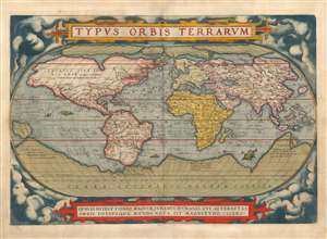
Typus Orbis Terrarum.
sold
- Digital Map Information
- Suitable for large format printing
- Full resolution TIFF file
- ICC color profile embedded
- Delivered instantly via download link
This is a beautiful example of Abraham Ortelius' iconic 1570 map of the world, here in a 1579 edition of the first plate. This map is the first map of the world to appear in a standard atlas and is thus of fundamental importance to the history of cartography. It was one of the most widely-seen, and most influential printed maps of the world produced in the sixteenth century. (more details)
Edge of the Dolomites.
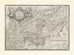
Veronae Urbis Territorium à Bernardo Brognoli.
sold
- Digital Map Information
- Suitable for large format printing
- DPI: 600
- File Size: 42.56 MB
- File Type: ZIP / TIFF
- ICC color profile embedded
- Delivered instantly via download link
This is Abraham Ortelius' 1581 map of Verona and vicinity, Italy, including Mantua, part of the Alps, and the Lago de Garda. The map is oriented to the east and the area's mountainous terrain is depicted pictorially. The strapwork cartouche is flanked by two Diana-like women blowing hunting horns and seated amongst copious produce. The whole is surmounted with the head of a vengeful deer. Ortelius credited this map to a Venetian, Bernardo Brognoli, who drew the map in 1564. Brognoli's map was first engraved and printed in 1574 by Forlani. (more details)
Ortelius, himself.
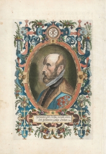
[Untitled Portrait].
sold
- Digital Map Information
- Suitable for large format printing
- Full resolution TIFF file
- ICC color profile embedded
- Delivered instantly via download link
This is Philip Galle's portrait of Abraham Ortelius, first appearing in the 1579 edition of Ortelius' Theatrum Orbis Terrarum, Galle's engraving is after a portrait by Flemish painter Adriaen Thomasz Key (1544 - 1589), one of Antwerp's most prolific and successful portrait painters, and a guild-member with Ortelius. Key is known for his precise, almost photorealistic portraits making Galle's engraving the most accurate representation of the pioneering mapmaker available to the collector.
The portrait, in left profile, is presented in an elaborately garlanded strapwork frame. At the top is Ortelius' personal symbol: the Chi-Rho, flanked with Alpha and Omega - a Christogram - and the motto 'Vitae Scopus' (The goal of life). At the base of the portrait is an elegiac couplet composed by Andreas de Pape (1542 - 1581), a poet and musician, and also one of Galle's editors. His Latin couplet translates as: Ortelius gave mortals the world to look at, and Galle gave the world Ortelius to look at. (more details)
The portrait, in left profile, is presented in an elaborately garlanded strapwork frame. At the top is Ortelius' personal symbol: the Chi-Rho, flanked with Alpha and Omega - a Christogram - and the motto 'Vitae Scopus' (The goal of life). At the base of the portrait is an elegiac couplet composed by Andreas de Pape (1542 - 1581), a poet and musician, and also one of Galle's editors. His Latin couplet translates as: Ortelius gave mortals the world to look at, and Galle gave the world Ortelius to look at. (more details)

Regni Neapolitani Verissima Secundum Antiquorum et Recentiorum Traditionem Descriptio, Pyrrho Ligorio Acut.
sold
- Digital Map Information
- Suitable for large format printing
- DPI: 300
- File Size: 14.7 MB
- File Type: ZIP / TIFF
- ICC color profile embedded
- Delivered instantly via download link
A very beautiful old color example of Abraham Ortelius's 1580 map of southern Italy. Oriented to the east, this map covers Italy from central Italy to northern Sicily, and from the Adriatic Sea to the Tyrrhenian Sea. The map identifies ... (more details)
Home Ports of the Spanish Treasure Fleet.
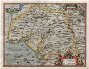
Hispalensis Conventus Delineatio Auctore Hieronÿmo Chiaves.
sold
- Digital Map Information
- Suitable for large format printing
- DPI: 600
- File Size: 45.23 MB
- File Type: ZIP / TIFF
- ICC color profile embedded
- Delivered instantly via download link
This is an attractive, first state example of Abraham Ortelius' 1581 map of Seville and its surroundings, Andalusia, Spain. This map details the most crucial home ports of the Spanish Empire, based on the report of Geronimo de Chavez, the chief geographer of Spain's Casa de Contratación at the peak of its power. It centers on a pictorial representation of the walled city of Seville and its cathedral on the Guadalquivir River. The vital port and city of Cadiz, home port of the Spanish treasure fleet, appears at bottom center. The region's mountainous terrain is dramatically and artfully depicted. Off the coast of Cadiz a sea battle rages, while hungry sea monsters prowl the waters. (more details)
Home Ports of the Spanish Treasure Fleet.
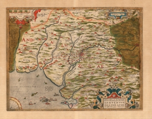
Hispalensis Conventus Delineatio Auctore Hieronÿmo Chiaves.
sold
- Digital Map Information
- Suitable for large format printing
- Full resolution TIFF file
- ICC color profile embedded
- Delivered instantly via download link
This is an attractive, original color example of Abraham Ortelius' 1581 map of Seville and its surroundings, Andalusia, Spain. This map details the most crucial home ports of the Spanish Empire, based on the report of Geronimo de Chavez (1523 - 1574), the chief geographer of Spain's Casa de Contratación at the peak of its power. It centers on a pictorial representation of the walled city of Seville and its cathedral on the Guadalquivir River. The vital port and city of Cadiz, home port of the Spanish treasure fleet, appears at bottom center. The region's mountainous terrain is dramatically and artfully depicted. Off the coast of Cadiz a sea battle rages, while hungry sea monsters prowl the waters. (more details)
First atlas map of Switzerland.
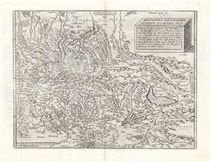
Helvetiae Descriptio Aegidio Tschudo Auct.
sold
- Digital Map Information
- Suitable for large format printing
- DPI: 600
- File Size: 53.28 MB
- File Type: ZIP / TIFF
- ICC color profile embedded
- Delivered instantly via download link
This is Abraham Ortelius' 1570 map of Switzerland, the first to appear in a modern atlas. This richly detailed, southern-oriented map provided the best delineation of the Swiss Confederation of the sixteenth century. (more details)
First atlas map of the Franche-Comte.
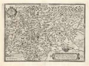
Burgundiae Comitatus Recentiss. Descriptio Dno. Ferdinando Lannoyo auctore.
sold
- Digital Map Information
- Suitable for large format printing
- DPI: 600
- File Size: 61.61 MB
- File Type: ZIP / TIFF
- ICC color profile embedded
- Delivered instantly via download link
This is Abraham Ortelius' 1579 map of the County of Burgundy in France - as distinct from the Duchy of Burgundy, which lay to the west. The map follows Ferdinand de Lannoy's unacquirable 1563 map, the first to depict Franche-Comté. Shortly after publication, De Lannoy's cartography was officially suppressed, so Ortelius' version is the earliest acquirable derivative. The map conforms to the eastern part of modern-day Bourgogne-Franche-Comté. (more details)
First European map specifically of China to appear in a modern atlas.
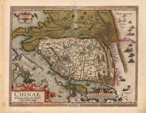
Chinae, olim Sinarum regionis, nova descriptio. auctore Ludovico Georgio.
sold
- Digital Map Information
- Suitable for large format printing
- Full resolution TIFF file
- ICC color profile embedded
- Delivered instantly via download link
This is Abraham Ortelius' 1584 map of China, the first specific map of China to appear in an atlas, here in a beautiful, original-color example of a 1602 Vrients edition. Based on reports of Portuguese missionaries, Ortelius' map was not substantially improved upon until the 1655 maps of Martino Martini (卫匡国; 1614 - 1661). The map is visually unique, with its western orientation and abundant decorative elements. (more details)
Covers the Burgundy Wine Regions of Chablis, Cote de Nuits, Cote de Beaune, and Cote Chalonnaise.
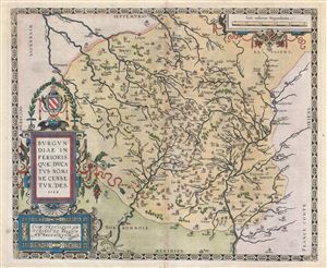
Burgundiae Inferioris Quae Ducatus Nomine Censetur, Des.
sold
- Digital Map Information
- Suitable for large format printing
- DPI: 300
- File Size: 14.15 MB
- File Type: ZIP / TIFF
- ICC color profile embedded
- Delivered instantly via download link
A stunning first edition first state example of the 1584 first edition of Ortelius' classic map of Burgundy, France. Although Ortelius references this region as 'Burgindiae Inferioris' or Lower Burgundy, it specifically covers those ... (more details)
A Mediterranean Isolario, on a single sheet!
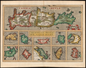
Candia Insula / Archipelagi Insularum Aliquot Descrip.
sold
- Digital Map Information
- Suitable for large format printing
- Full resolution TIFF file
- ICC color profile embedded
- Delivered instantly via download link
A beautiful example, in superb original color, of Abraham Ortelius' 1595 map of Crete and ten other Greek islands: Metellino (Mitiline, Lesbos), Cerigo, Scarpanto (Karpathos), Nicsia (Naxos), Santorini, Milo, Stalimene (Limnos), Negroponte (Euboea), Rodus (Rhodes, home of the Colossus of Rhodes), and Scio (Chios).Each of the various maps is produced at its own scale. In addition to having individual borders, each island map employs a different style of stippling or hachure for the water areas, visually setting apart these differently-scaled maps from one another. Ortelius was an assiduous compiler, drawing on the best local sources he could acquire for his maps. The main map of Crete he credits to Francesco Soranzo; the smaller maps are drawn from the Lafreri-type maps published in Venice and Rome; Meurer attributes these to Bertelli, Camocio and Porcacchi. (more details)
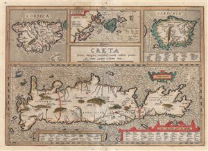
Creta Louis Magni Medio Iacet Insula Ponto.
sold
- Digital Map Information
- Suitable for large format printing
- DPI: 300
- File Size: 11.1 MB
- File Type: ZIP / TIFF
- ICC color profile embedded
- Delivered instantly via download link
A scarce 1606 old color Abraham Orteilus map of the Mediterranean island of Crete, Corsica, Sardinia, and the Ionian Islands in antiquity. Essentially four maps on one sheet. The upper left map details Corsica, the top center map ... (more details)
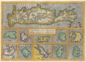
Candia Insula / Archipelagi Insularum Aliquot Descrip.
sold
- Digital Map Information
- Suitable for large format printing
- DPI: 300
- File Size: 8.68 MB
- File Type: ZIP / TIFF
- ICC color profile embedded
- Delivered instantly via download link
A rare and beautiful 1584 Abraham Ortelius map of Crete and ten other Greek islands: Metellino (Mitiline, Lesbos), Cerigo, Scarpanto (Karpathos), Nicsia (Naxos), Santorini, Milo, Stalimene (Limnos), Negroponte (Euboea), Rodus ... (more details)
Crete and the Greek Islands, as known to the Ancients.
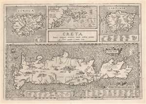
Creta Jovis Magni Medio Iacet Insula Ponto.
sold
- Digital Map Information
- Suitable for large format printing
- DPI: 600
- File Size: 56.85 MB
- File Type: ZIP / TIFF
- ICC color profile embedded
- Delivered instantly via download link
This is Abraham Ortelius' 1595 map of Crete and other Mediterranean islands as they were understood in antiquity and Greek mythology. The engraving is comprised of four separate maps of Corsica, Sardinia, Crete, and the Ionian Islands. (more details)
Old Color Early Atlas Map of Europe.
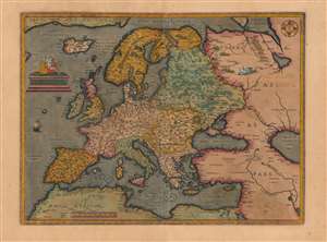
Europae.
sold
- Digital Map Information
- Suitable for large format printing
- DPI: 600
- File Size: 44.98 MB
- File Type: ZIP / TIFF
- ICC color profile embedded
- Delivered instantly via download link
This is a beautiful, original color example of Abraham Ortelius' general map of Europe. This is the second, 1584 plate of the map, notable for its superior engraving, and multiple corrections. The two are most easily distinguished by the calligraphic 'Africae Pars' labeling north Africa here (the first plate used Roman capitals instead.) (more details)