
Visscher, Claes Jansz (sold)

Claes Jansz Visscher (1587 - 1652) established the Visscher family publishing firm, which were prominent Dutch map publishers for nearly a century. The Visscher cartographic story beings with Claes Jansz Visscher who established the firm in Amsterdam near the offices of Pieter van den Keer and Jadocus Hondius. Many hypothesize that Visscher may have been one of Hondius's pupils and, under examination, this seems logical. The first Visscher maps appear around 1620 and include numerous individual maps as well as an atlas compiled of maps by various cartographers including Visscher himself. Upon the death of Claes, the firm fell into the hands of his son Nicholas Visscher I (1618 - 1679), who in 1677 received a privilege to publish from the States of Holland and West Friesland. The firm would in turn be passed on to his son, Nicholas Visscher II (1649 - 1702). Visscher II applied for his own privilege, receiving it in 1682. Most of the maps bearing the Visscher imprint were produced by these two men. Many Visscher maps also bear the imprint Piscator (a Latinized version of Visscher) and often feature the image of an elderly fisherman - an allusion to the family name. Upon the death of Nicholas Visscher II, the business was carried on by the widowed Elizabeth Verseyl Visscher (16?? - 1726). After her death, the firm and all of its plates was liquidated to Peter Schenk.
Best Acquirable View of London Prior to the Great Fire.
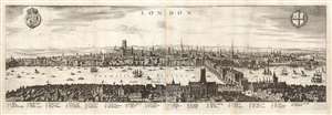
London.
sold
- Digital Map Information
- Suitable for large format printing
- Full resolution TIFF file
- ICC color profile embedded
- Delivered instantly via download link
This is a Matthäus Merian view of London, engraved in 1638 for inclusion in his Archontologia cosmica. It was based on an earlier, 1616 panorama of the city by Claes Visscher (1587 - 1652.) The four-sheet, nearly seven-foot-long Visscher is an all but unobtainable rarity, with only a handful of known copies in institutional and private hands. (An example sold at Christies in 2018 for nearly $150,000.) The Merian expertly reduces the image, preserving much of its detail and elegance. The detail and recognizability of the image are particularly remarkable, given that neither Merian nor Visscher ever had visited London; Visscher's view was based on traditional printed maps (possibly including John Norden's Civitas Londini, which survives in a single copy in the Royal Library in Stockholm) and the reports of visitors at the turn of the century. Visscher's publisher, Jodocus Hondius, lived in London from 1587 to 1593, and he may have been consulted. Thus, despite being engraved during the reign of Charles I, the view is a depiction of Elizabethan London c. 1600; it remains one of the very few acquirable views of the city as it stood prior to the 1666 Great Fire of London. (more details)
The Finest Dutch World Map Venice Could Offer.
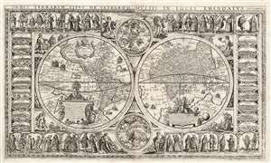
Orbis Terrarum Tipus de Integro Multis in Locis Emendatus.
sold
- Digital Map Information
- Suitable for large format printing
- Full resolution TIFF file
- ICC color profile embedded
- Delivered instantly via download link
This beautiful, extremely rare, separately-issued, double hemisphere carte á figures world map captures the most desirable elements of 17th century Dutch decorative cartography in one composition - including an Amsterdam imprint and the prominently displayed patronym of 'Willem Blaeu'. Both the imprint and the professed authorship were deliberately misleading: the map was engraved in Venice, not Amsterdam, and it has been attributed to the illustrator and printer Stefano Mozzi Scolari. The map is dated 1655. It is perhaps ironic that of the Dutch mapmakers from whom Scolari sourced this map, not one element appears to have been drawn from Blaeu, apart from his name. The engraver was not fully committed to deception: faintly in the lower right border is an additional, more honest imprint, 'in Venetia à S. Fosca'. Bifolco identifies this location as an engravers' shop associated with Scolari. (more details)
The Earliest Acquirable, Separate Issue.

Novi Belgii Novaeque Angliae nec non Partis Virginiae Tabula multis in locis emendata a Nicolao Joannis Visschero.
sold
- Digital Map Information
- Suitable for large format printing
- Full resolution TIFF file
- ICC color profile embedded
- Delivered instantly via download link
This is the rare, c. 1656 second state of the Jansson/ Visscher map of the New Netherlands and New England. It is the earliest acquirable state of this work: the first, 'proof state', of this masterwork is an unobtainable rarity, known in only four examples in institutional and private collections. (more details)
Earliest Acquirable, Separate Issue.
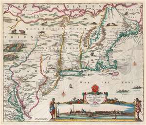
Novi Belgii Novaeque Angliae nec non Partis Virginiae Tabula multis in locis emendata a Nicolao Joannis Visschero.
sold
- Digital Map Information
- Suitable for large format printing
- Full resolution TIFF file
- ICC color profile embedded
- Delivered instantly via download link
This is the rare, c. 1656 second state of the Jansson/ Visscher map of the New Netherlands and New England. It is the earliest acquirable state of this work: the first, 'proof state', of this masterwork is an unobtainable rarity, known in only four examples in institutional and private collections. (more details)
Superbly decorative map of Asia.
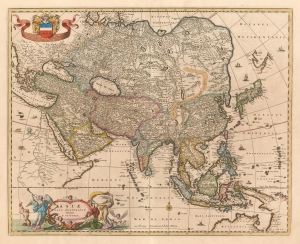
Asiae Nova Delineatio Auctore N. Visscher.
sold
- Digital Map Information
- Suitable for large format printing
- DPI: 600
- File Size: 21.69 MB
- File Type: ZIP / TIFF
- ICC color profile embedded
- Delivered instantly via download link
This is Nicolas Visscher's c. 1657 map of Asia, presenting an updated view of Pacific coast of the continent. The Visscher family generally employed larger plates and finer detail than the mapmakers of the first half of the 17th century, improving the clarity of the maps and allowing the addition of more geographical detail. The northern coast of Australia (Nova Hollandia on the map) and the coastline of New Guinea reflect the 1643 and 1644 voyages of Abel Tasman. (more details)
New take on the West Indies.
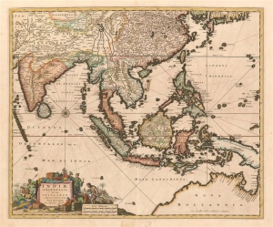
Indiae Orientalis, nec non Insularum Adiacenum Nova Descriptio per Nicolaum Visscher.
sold
- Digital Map Information
- Suitable for large format printing
- Full resolution TIFF file
- ICC color profile embedded
- Delivered instantly via download link
This is Nicolas Visscher's c. 1657 map of the East Indies, one of the defining Dutch maps of the primary source of Dutch wealth for the second half of the 17th century. The map shows India and the Indian Ocean, the East Indies, the north coast of Australia showing the Gulf of Carpentaria, and New Guinea. China is shown, as are the southern coasts of Korea and Japan. (more details)
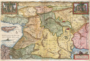
De Gelegentheyt van 't Paradys ende 't Land Canaan mitsgaders de eerste bewoonde landen Der Patriarchen, uyt de H. schrifture en verscheyden Auctoren bij een gestelt door Nicolaes Visscher
sold
- Digital Map Information
- Suitable for large format printing
- DPI: 300
- File Size: 4.62 MB
- File Type: ZIP / TIFF
- ICC color profile embedded
- Delivered instantly via download link
This is a splendid early example of Nicholas Visscher's important 1657 map of the Holy Land, or as it is titled (in rough translation) 'Paradise, or the Garden of Eden. With the Countries circumjacent Inhabited by the Patriarchs.' Covers the region between the ... (more details)
A highly influential early map of the Americas.
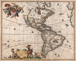
Novissima et Accuratissima Totius Americae Descriptio.
sold
- Digital Map Information
- Suitable for large format printing
- DPI: 300
- File Size: 12.66 MB
- File Type: ZIP / TIFF
- ICC color profile embedded
- Delivered instantly via download link
A striking first edition example of an extremely important and influential 1658 map of the Americas by Nicholas Janzoon Visscher. Covers all of the New World, the eastern extensions of Europe and Africa, and some Pacific Islands. This map proved extremely ... (more details)
A highly influential early map of the Americas.
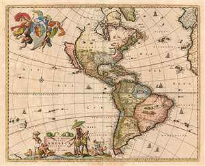
Novissima et accuratissima totius Americae Descriptio per N. Visscher
sold
- Digital Map Information
- Suitable for large format printing
- DPI: 600
- File Size: 35.24 MB
- File Type: ZIP / TIFF
- ICC color profile embedded
- Delivered instantly via download link
This is a c. 1677 example of Nicolas Visscher's 1658 map of America. The map embraces all of the New World, including part of the Atlantic coasts of Europe and Africa, and a scattering of Pacific Islands. This map would be hungrily copied by competing Dutch map publishers; it, itself was based on information drawn largely from the 1648 world map of Joan Blaeu. Thus Visscher's map would become the conduit for the spread of much of Blaeu's American geography throughout the map publishing world. By far this map's most strikinging cartographic elements deal with its unusual treatment of North America, with California represented as an island, the Great Lakes rendered as a single body of water open to the west, and the strait of Anian appearing far to the north. (more details)
A Classic Dutch map of America.
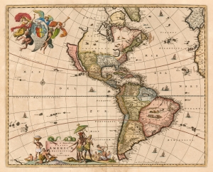
Novissima et accuratissima totius Americae Descriptio per N. Visscher.
sold
- Digital Map Information
- Suitable for large format printing
- Full resolution TIFF file
- ICC color profile embedded
- Delivered instantly via download link
This is a c. 1677 example of Nicolas Visscher's 1658 map of America. Depicting all of the New World, including part of the Atlantic coasts of Europe and Africa, and a scattering of Pacific Islands, this map enjoyed a long print run and was shamelessly copied by several competing Dutch publishers. The map itself is cartographically based on information drawn from the 1648 Joan Blaeu world map. Thus, Visscher's map was a conduit for Blaeu's American geography to spread throughout the map publishing world. By far this map's most striking cartographic elements deal with its unusual treatment of North America, with California represented as an island, the Great Lakes rendered as a single body of water open to the west, and the strait of Anian appearing far to the north. (more details)
Crete and Heraklion during the Longest Siege of the Great Turkish War.
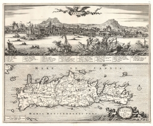
Candia. / Insula Candia olim Creta. N. Visscher exc.
sold
- Digital Map Information
- Suitable for large format printing
- File Size: 26.23 MB
- File Type: ZIP / TIFF
- ICC color profile embedded
- Delivered instantly via download link
This is Nicolas Visscher's 1670 map of Crete, accompanied by a dramatic panorama of the famous Siege of Candia (Heraklion). (more details)
A Classic, Beautiful Dutch Golden Age Map of Europe
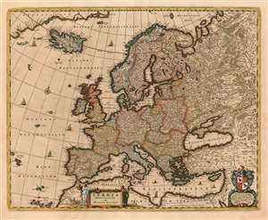
Europa delineata et recens edita per Nicolaum Visscher.
sold
- Digital Map Information
- Suitable for large format printing
- DPI: 600
- File Size: 23.17 MB
- File Type: ZIP / TIFF
- ICC color profile embedded
- Delivered instantly via download link
This is Nicolas Visscher's c. 1677 map of Europe, one of the defining Dutch maps of the continent for the second half of the 17th century. The maps of the Visscher family are prized for the superb quality of engraving and the high level of artistry in their compositions; this map is no exception - from the delicate plumes on the volcanoes of Stromboli, Aetna and Hekla, to the multiplicity of sailing ships decorating the seas, to the lovely dedicatory and title cartouches (see below.) (more details)
A Beautiful Map of the Contentious Borderland between Western Europe and the Turkish Empire
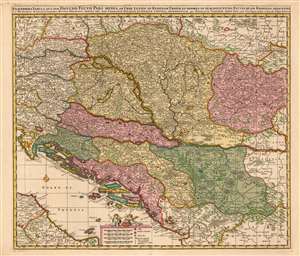
Exactissima Tabula qua tam Danubii Fluvii Pars Media, ab urbe Lentiae ad Bydenam Urbem et Minores in eum Influentes Fluvii, quam Regiones Adiacentes ut Hungaria, Slavonia, Croatia, Bosnia, Servia, nec non Germaniae, Poloniae, et Graeciae Confinia Ostenduntur. per Nicolaum Visscher.
sold
- Digital Map Information
- Suitable for large format printing
- DPI: 600
- File Size: 43.89 MB
- File Type: ZIP / TIFF
- ICC color profile embedded
- Delivered instantly via download link
This is a beautiful, contemporary-color example of Nicolas Visscher's c. 1677 map of the middle part of the Danube River. The map encompasses much of what would be considered the seat of war between Christian European powers and the Turkish Empire. Austria, Transylvania, Sclavonia, Croatia, Bosnia, Serbia and Dalmatia. Portions of Austria, Greece and Italy appear as well. Vienna, Buda and Pest, and Belgrade are among the major cities appearing here. (more details)
A map created using data from the first national survey of Denmark.
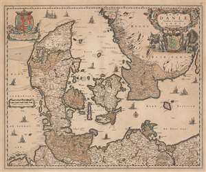
Regni Daniae, Novissima et Accuratissima Tabula.
sold
- Digital Map Information
- Suitable for large format printing
- DPI: 600
- File Size: 25.46 MB
- File Type: ZIP / TIFF
- ICC color profile embedded
- Delivered instantly via download link
This is a c. 1680 Nicholas Visscher map of Denmark. The map depicts the region from the North Sea to the Baltic Sea and from Norway to Germany. Beautifully engraved, numerous cities, towns, and villages are labeled throughout Denmark and the illustrated portions of Sweden and Germany, including Copenhagen and Hamburg. Rivers, lakes, and forests are also noted. A decorative title cartouche is situated on the upper right and is balanced by the coat of arms of King Christian V. The whole was based on a survey completed by the royal geographer Johannes Mejer (1606 - 1674) along with Johann Wilhelm Lauremberg (1590 - 1656). In 1662, the cartographer Joan Blaeu (1598 - 1673) was the first to publish a map using data collected from this national survey. (more details)
A Richly Decorative Dutch Map of the West Indies
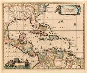
Insulae Americanae in Oceano Septentrionali ac regiones adiacentes: a C. de May usque ad Lineam Aequinoctialem.
sold
- Digital Map Information
- Suitable for large format printing
- DPI: 600
- File Size: 24.68 MB
- File Type: ZIP / TIFF
- ICC color profile embedded
- Delivered instantly via download link
This is Nicolas Visscher II's c. 1680 map of the West Indies, one of the first maps in the lineage of Dutch maps of the region to detail inland areas rather than strictly adhering to coastlines. The map shows the Caribbean Islands, the eastern part of Mexico, Central America, the northern part of South America, Florida, and an area now part of Georgia and South Carolina. Oddly, this area is named French Florida (Florida Galli) despite the reality that the French colonies in the area had been destroyed by the Spanish well before this map was drawn. The map extends as far north as Virginia and Delaware Bay. (more details)
Spectacular Dutch world map with iconic allegorical border work by Nicolaes Berchem.
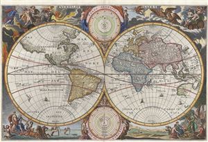
Werreldt Kaert
sold
- Digital Map Information
- Suitable for large format printing
- DPI: 300
- File Size: 11.42 MB
- File Type: ZIP / TIFF
- ICC color profile embedded
- Delivered instantly via download link
A fine 1682 world map was drawn by Nicolaas Visscher for publication in the 1682 edition of the Keur Bible. Based on Visscher's very similar map of 1658, this map depicts the world on a hemisphere projection surrounded by stunning allegorical border work. ... (more details)
Magnificent decorative map of the Holy Land showing the Exodus.
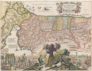
Perigrinatie ofte Veertich-Iarige Reyse der Kinderen Israels
sold
- Digital Map Information
- Suitable for large format printing
- Full resolution TIFF file
- ICC color profile embedded
- Delivered instantly via download link
An absolutely stunning 1682 first state of Keur and Stoopendaal's map of the Holy Land, Israel, or Palestine. This map, from Keur's important Dutch Bible of 1687, is oriented to west and covers from the Nile Delta, Cairo and Memphis, egypt, across the Red ... (more details)
The rare propaganda-ish 'Farm Animal' variant on the Visscher-Jansson Series map of New York, Virginia, and New England.
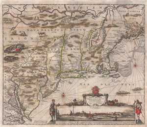
Novi Belgii Novaeque Angliae Nec Non Pennsylvaniae et Partis Virginiae Tabula multis in locis emendata.
sold
- Digital Map Information
- Suitable for large format printing
- Full resolution TIFF file
- ICC color profile embedded
- Delivered instantly via download link
An attractive old color example of Justus Danckerts' 1684 Novi Belgii or map of New York, New England, Pennsylvania, and Virginia. Some call this the 'farm animal map' for its novel incorporation of farm animals, ranging from horses and cows to chicken and ... (more details)
Iconic early map of New England and New York with 'Visscher View' of New Amsterdam.
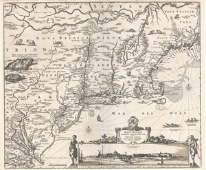
Novi Belgii Novaeque Angliae Nec Non Pennsylvaniae et Partis Virginiae Tabula multis in locis emendata.
sold
- Digital Map Information
- Suitable for large format printing
- DPI: 300
- File Size: 14.86 MB
- File Type: ZIP / TIFF
- ICC color profile embedded
- Delivered instantly via download link
A map of extreme importance, this is a fine example of Nicholaas Visscher's 1684 Novi Belgii or map of New York, New England, Pennsylvania, and Virginia. This is the first map in the Jansson-Visscher Series here presented in its 4th state (Burden, 315). ... (more details)
Iconic early map of New England and New York with 'Visscher View' of New Amsterdam.
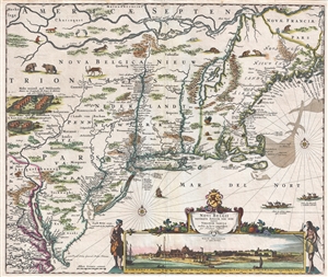
Novi Belgii Novaeque Angliae Nec Non Pennsylvaniae et Partis Virginiae Tabula multis in locis emendata.
sold
- Digital Map Information
- Suitable for large format printing
- DPI: 300
- File Size: 15.13 MB
- File Type: ZIP / TIFF
- ICC color profile embedded
- Delivered instantly via download link
A map of extreme importance, this is a fine example of Nicholaas Visscher's 1684 Novi Belgii or map of New York, New England, Pennsylvania, and Virginia. This is the first map in the Jansson-Visscher Series here presented in its 4th state (Burden, 315). ... (more details)
A rare variant on an important early Dutch map of the world.
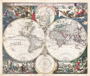
Nova Totius Terrarum Orbis Tabula. A. J. Bormeester.
sold
- Digital Map Information
- Suitable for large format printing
- DPI: 300
- File Size: 9.85 MB
- File Type: ZIP / TIFF
- ICC color profile embedded
- Delivered instantly via download link
An extremely scarce 1684 double hemisphere world by Dutch map publisher Joachim Bormeester. Depicts the world on hemisphere projection with polar projections to the top and bottom of the main map. Surrounded by allegorical images and border decorations ... (more details)
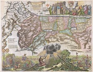
Perigrinatie oste Veertigh-Iarige Reyse der Kinderen Israels, Uyt Egypten door de Roode Zee endede Woestyne tot in't Beloof de Lande Canaan.
sold
- Digital Map Information
- Suitable for large format printing
- DPI: 300
- File Size: 12.61 MB
- File Type: ZIP / TIFF
- ICC color profile embedded
- Delivered instantly via download link
An absolutely stunning c. 1687 map of the Holy Land, Israel, or Palestine by N. Visscher and Jan van den Avelen. This map, from a Dutch Bible, is oriented to west and covers from the Nile Delta, Cairo and Memphis, egypt, across the Red Sea and along the ... (more details)
The rare propaganda-ish 'Farm Animal' variant on the Visscher-Jansson Series map of New York, Virginia, and New England.
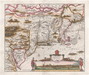
Novi Belgii Novaeque Angliae Nec Non Pennsylvaniae et Partis Virginiae Tabula multis in locis emendata.
sold
- Digital Map Information
- Suitable for large format printing
- DPI: 300
- File Size: 10.83 MB
- File Type: ZIP / TIFF
- ICC color profile embedded
- Delivered instantly via download link
A magnificent example of Justus Danckerts' 1690 Novi Belgii or map of New York, New England, Pennsylvania, and Virginia. Some call this the 'farm animal map' for its novel incorporation of farm animals, ranging from horses and cows to chicken and sheep, ... (more details)
Beautiful old color example of Visscher's map of Ireland.
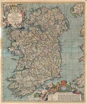
Hiberniae Regnum tam in praecipuas Ultoniae, Connaciae, Lageniae, et Momoniae, quam in minores earundem Provincias, et Ditiones subjacentes peraccurate divisum.
sold
- Digital Map Information
- Suitable for large format printing
- DPI: 300
- File Size: 16.07 MB
- File Type: ZIP / TIFF
- ICC color profile embedded
- Delivered instantly via download link
A beautiful example of Nicolas Visscher's c. 1690 map of Ireland in original old color. The map covers the entirety of Ireland and is subdivided into counties. Two impressive cartouches are rife with allegorical imagery, one appearing in the upper ... (more details)
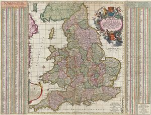
A New Mapp of the Kingdome of England, Representing the Princedome of Wales, and other Provinces, Cities, Market Towns, with the Roads from Town to Town.
sold
- Digital Map Information
- Suitable for large format printing
- DPI: 300
- File Size: 31.03 MB
- File Type: ZIP / TIFF
- ICC color profile embedded
- Delivered instantly via download link
A fine c. 1695 old color example of the deluxe John Overton edition of Visscher's stunning map of england and Wales. Constructed on the model established by the John Adams map of 1679, Anglia Totius Tabula , Visscher's map covers all of england and ... (more details)
Most Finely Detailed Dutch Map of the Northeast from the 17th Century.
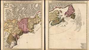
Nova Tabula Geographica Complectens Borealiorem Americae Partem: in qua Exacte Delineatae Sunt Canada sive Nova Francia, Nova Scotia, Nova Anglia, Novum Belgium, Pensylvania, Virginia, Carolina et Terra Nova, cum Omnibus Littorum. Pulvinorumque Profunditatibus. Amstelodami. à Nicolao Visscher. Cum Privilegio Ordinum Generalium Foederati Belgii./ Carte Nouvelle contenant la Partie d'Amerique la Plus Septentrionale, ou Sont Exactement Dècrites les Provinces Suivantes comme le Canada ou Nouvelle France, La Nouvelle Ecosse, la Nouvelle Angleterre, les Nouveaux Païs Bas, la Pensylvanie, la Virginie, la Caroline et l'Ile de Terre Neuve avec les profondeuis le Long des Côtes et sur les Bancs. Par Nicolas Visscher avec Privilege des Etats Géneraux.
sold
- Digital Map Information
- Suitable for large format printing
- DPI: 600
- File Size: 121.39 MB
- File Type: ZIP / TIFF
- ICC color profile embedded
- Delivered instantly via download link
This is Nicolas Visscher II's 1696 two-sheet map of the North American eastern seaboard and the Canadian Maritimes, in a beautiful example of its earliest acquirable state with rich original color. It represents the 17th century's most finely-detailed mapping of the coast from the Carolinas to Labrador. Also, it is the first Dutch map of the region to diverge from the 'Jansson-Visscher' precursor maps. (more details)
First edition of Visscher II's Portugal.
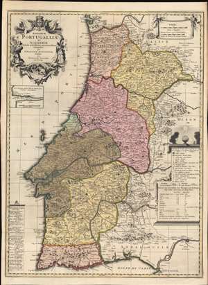
Regnorum Portugalliae et Algarbiae Tabula Novissima accuratissime Composita per P. Placidium Augustinum, et Edita par Nicolaum Visscher.
sold
- Digital Map Information
- Suitable for large format printing
- Full resolution TIFF file
- ICC color profile embedded
- Delivered instantly via download link
A striking c. 1700 old-color Nicholas Visscher II and Placide de Sainte Hélène map of Portugal, published at the height of Portugal's Golden Age, before the disastrous 1755 Great Lisbon Earthquake. The map depicts all of Portugal, including the Algarve and adjacent parts of Galicia, Leon, and Andalucía. An inset in the upper left quadrant illustrates the Duero River and Porto. Due to the contribution of the Augustinian geographer Placide de Sainte Hélène, this map is larger and considerably updated from previous Dutch maps of Portugal, including Visscher family maps. (more details)
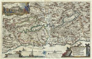
Geographische Beschreibung des Gelobten Landes Canaan, Welches unserem Herrn und Seeligmacher Jesu Christo und seinen Aposteln durchwandert worden.
sold
- Digital Map Information
- Suitable for large format printing
- DPI: 300
- File Size: 10.94 MB
- File Type: ZIP / TIFF
- ICC color profile embedded
- Delivered instantly via download link
This is a beautiful and uncommon c.1700 German variant of the Visscher Family's important map of the Holy Land or Palestine or Israel, or as it is titled (in rough translation) Geographical description of the Promised Land of Canaan, Which have ... (more details)
Early 18th century world map with decorative borders showing an insular California.
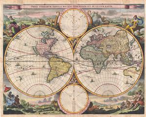
Orbis Terrarum Tabula Recens Emendata et in Lucem Edita.
sold
- Digital Map Information
- Suitable for large format printing
- DPI: 300
- File Size: 11.78 MB
- File Type: ZIP / TIFF
- ICC color profile embedded
- Delivered instantly via download link
A fine 1702 world map was drawn by Daniel Stoopendaal for publication in the Keur Bible. Based on Visscher's very similar map of 1663, this map depicts the world on a hemisphere projection surrounded by stunning allegorical cartouche work. The ... (more details)
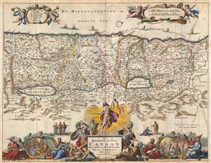
Het Beloofde Landt Canaan door wandelt van onsen Salichmaecker Iesu Christo nessens syne Apostelen.
sold
- Digital Map Information
- Suitable for large format printing
- DPI: 300
- File Size: 10.65 MB
- File Type: ZIP / TIFF
- ICC color profile embedded
- Delivered instantly via download link
This is a splendid early example of Bastiaan Stoopendaal and Jacob Keur's c. 1702 map of Canaan (Israel or Palestine). Oriented to the west, this map covers the Holy Land from the Mediteranean to just beyond the Jordan River. This map purports ... (more details)
Magnificent decorative map of the Holy Land showing the Exodus.
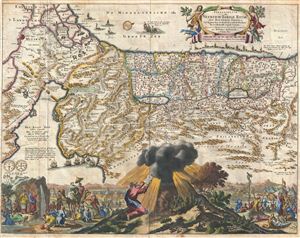
Perigrinatie ofte Veertich-Iarige Reyse der Kinderen Israels.
sold
- Digital Map Information
- Suitable for large format printing
- DPI: 300
- File Size: 11.33 MB
- File Type: ZIP / TIFF
- ICC color profile embedded
- Delivered instantly via download link
An absolutely stunning 1702 map of the Holy Land, Israel, or Palestine by N. Visscher and D. Stoopendaal. This map, from Keur's important Dutch Bible of 1702, is oriented to west and covers from the Nile Delta, Cairo and Memphis, Egypt, ... (more details)
An fascinating fictional plan of Jerusalem.
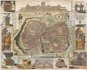
Ierusalem.
sold
- Digital Map Information
- Suitable for large format printing
- Full resolution TIFF file
- ICC color profile embedded
- Delivered instantly via download link
A remarkable imaginary 1702 plan of Jerusalem drawn by Daniel Stoopendaal but based upon an early work by Juan Bautista Villalpando. Villalpando's popular fictive view of Jerusalem first appeared in a 1604 commentary on Ezekiel ... (more details)
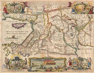
De Gelegentheyt van 't Paradys ende 't Land Canaan mitsgaders de eerste bewoonde landen Der Patriarchen, uyt de H. schrifture en verscheyden Auctoren bij een gestelt door
sold
- Digital Map Information
- Suitable for large format printing
- DPI: 300
- File Size: 10.54 MB
- File Type: ZIP / TIFF
- ICC color profile embedded
- Delivered instantly via download link
This is a splendid early example of Daniel Stoopendaal and Jacob Keur's 1702 map of the Holy Land, or as it is titled (in rough translation) 'Paradise, or the Garden of Eden, with the countries adjacent as inhabited by the ... (more details)
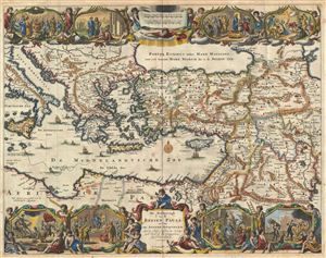
De Beschryvingh van de Reysen Pauli, en van de Andere Apostelen.
sold
- Digital Map Information
- Suitable for large format printing
- DPI: 300
- File Size: 11.32 MB
- File Type: ZIP / TIFF
- ICC color profile embedded
- Delivered instantly via download link
This is a splendid early example of Daniel Stoopendaal and Jacob Keur's 1702 map of the travels of the Apostle Paul. The map covers the eastern Mediterranean from Sicily to the Holy Land and inland as far as the Persian ... (more details)
Magnificent decorative map of the Holy Land showing the Exodus.

Perigrinatie ofte Veertich-Iarige Reyse der Kinderen Israels
sold
- Digital Map Information
- Suitable for large format printing
- DPI: 300
- File Size: 10.35 MB
- File Type: ZIP / TIFF
- ICC color profile embedded
- Delivered instantly via download link
An absolutely stunning 1702 map of the Holy Land, Israel, or Palestine by N. Visscher and D. Stoopendaal. This map, from Keur's important Dutch Bible of 1702, is oriented to west and covers from the Nile Delta, Cairo ... (more details)
Magnificent decorative map of the Holy Land showing the Exodus.
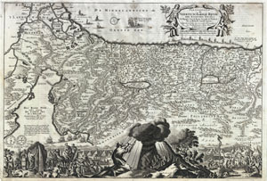
Perigrinatie ofte Veertich-Iarige Reyse der Kinderen Israels
sold
- Digital Map Information
- Suitable for large format printing
- DPI: 300
- File Size: 10.9 MB
- File Type: ZIP / TIFF
- ICC color profile embedded
- Delivered instantly via download link
An absolutely stunning 1702 map of the Holy Land, Israel, or Palestine by N. Visscher and D. Stoopendaal. This map, from Keur's important Dutch Bible of 1702, is oriented to west and covers from the Nile Delta, Cairo ... (more details)
Iconic 18th century map of Ireland.
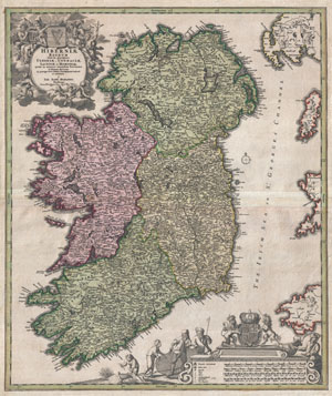
Hiberniae Regnum tam in Praecipuas Ultoniae, Connaciae, Laceniae et Momoniae quam in Minores Earundem Provincias
sold
- Digital Map Information
- Suitable for large format printing
- DPI: 300
- File Size: 20.41 MB
- File Type: ZIP / TIFF
- ICC color profile embedded
- Delivered instantly via download link
An iconic c. 1716 map of Ireland by Johann Baptist Homann. A fine example of Homann's work, this map bears all of the distinctive hallmarks of Homann's style at the height of his career: a strong dark impression, ... (more details)
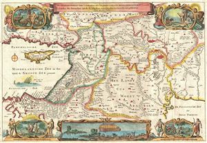
De Gelegentheyt van 't Paradys ende 't Land Canaan mitsgaders de eerste bewoonde landen Der Patriarchen, uyt de H. schrifture en verscheyden Auctoren bij een gestelt door
sold
- Digital Map Information
- Suitable for large format printing
- DPI: 300
- File Size: 8.96 MB
- File Type: ZIP / TIFF
- ICC color profile embedded
- Delivered instantly via download link
This is a splendid early example of Daniel Stoopendaal and Jacob Keur's c. 1730 map of the Holy Land, or as it is titled (in rough translation) 'Paradise, or the Garden of Eden, with the countries adjacent as ... (more details)
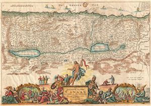
Het Beloofde Landt Canaan door wandelt van onsen Salichmaecker Iesu Christo nessens syne Apostelen.
sold
- Digital Map Information
- Suitable for large format printing
- DPI: 300
- File Size: 9.1 MB
- File Type: ZIP / TIFF
- ICC color profile embedded
- Delivered instantly via download link
This is a splendid early example of Bastiaan Stoopendaal and Jacob Keur's c. 1730 map of Canaan (Israel or Palestine). Oriented to the west, this map covers the Holy Land from the Mediteranean to just beyond ... (more details)
An fascinating fictional plan of Jerusalem.
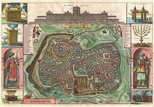
Ierusalem.
sold
- Digital Map Information
- Suitable for large format printing
- DPI: 300
- File Size: 11.21 MB
- File Type: ZIP / TIFF
- ICC color profile embedded
- Delivered instantly via download link
A remarkable imaginary c. 1730 plan of Jerusalem drawn by Daniel Stoopendaal but based upon an early work by Juan Bautista Villalpando. Villalpando's popular fictive view of Jerusalem first appeared in a ... (more details)
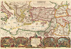
De Beschryvingh van de Reysen Pauli, en van de Andere Apostelen.
sold
- Digital Map Information
- Suitable for large format printing
- Full resolution TIFF file
- ICC color profile embedded
- Delivered instantly via download link
This is a splendid early example of Daniel Stoopendaal and Jacob Keur's c. 1730 map of the travels of the Apostle Paul. Covers the eastern Mediterranean from Sicily to the Holy Land and inland as far as ... (more details)
Early 18th century world map with decorative borders showing an insular California.
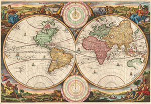
Werelt Caert.
sold
- Digital Map Information
- Suitable for large format printing
- Full resolution TIFF file
- ICC color profile embedded
- Delivered instantly via download link
A fine 1730 world map was drawn by Daniel Stoopendaal for publication in the Keur Bible. Based on Visscher's very similar map of 1663, this map depicts the world on a hemisphere projection surrounded by ... (more details)
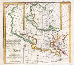
Carte De La Californie et Des Pays Nord-Ouest separes de L'Asie par le Detroit d'Anian, extraite de deux cartes publiees au commencement de 17e Siecle.
sold
- Digital Map Information
- Suitable for large format printing
- DPI: 300
- File Size: 6.62 MB
- File Type: ZIP / TIFF
- ICC color profile embedded
- Delivered instantly via download link
A very interesting 1772 map of the western part of North America by Vaugondy. Includes two contrasting maps, both drawn from larger 17th century maps by Visscher, covering from Cabo san Lucas northward ... (more details)
One of the few views of to show a walled New York.
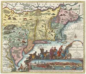
Recens Edita Totius Novi Belgii, in America Septentrionali siti, delineatio cura et sumtibus Tob. Conr. Lotteri, Sac. Caes. Maj. Geographi August. Vind.
sold
- Digital Map Information
- Suitable for large format printing
- Full resolution TIFF file
- ICC color profile embedded
- Delivered instantly via download link
This is Conrad Tobias Lotter's 1777 map of the Northeast and New York, the final map in the Jansson-Visscher series. Despite the map's cartography being over a century old, this map continued to capture the idea of this part of the world for Europeans in general and a German audience in particular. (more details)