
Sweden at the Height of Empire.
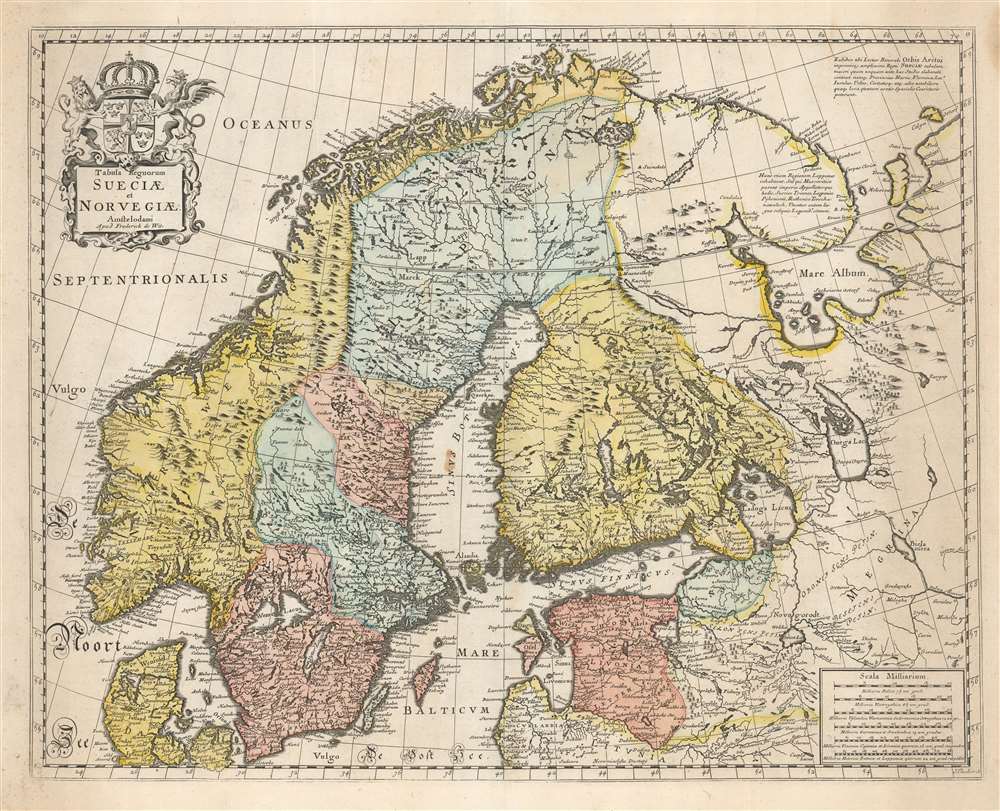
Tabula Regnorum Sueciae et Norvegiae.
$950.00
Acquire
- Digital Map Information
- Suitable for large format printing
- DPI: 600
- File Size: 63.66 MB
- File Type: ZIP / TIFF
- ICC color profile embedded
- Delivered instantly via download link
This is Frederick de Wit's map of Scandinavia. It is based on Anders Bure's 1626 mapping of the region, which swiftly became the dominant mapping of the northern parts of Europe and was not replaced as an authority for more than a century. On the strength of his seminal map and its long tenure as the state-of-the-art map of the northern regions of Europe, Bure is hailed as the Father of Swedish Cartography. The scope of the map includes Denmark, Norway, the greater Swedish Empire, the Baltic coasts of Germany, Poland and Livonia, and the Russian Empire - including 'Lapponia Moscovitica,' the portions of Lapland occupied by Russia. (more details)
Updating Baffin's Mughal Empire.
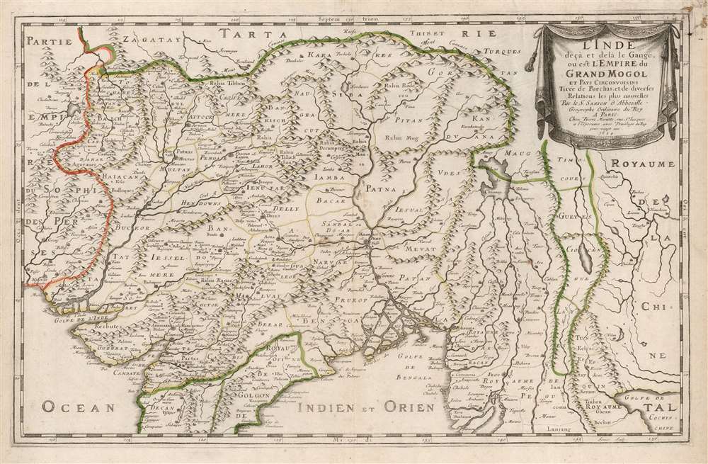
L'Inde deçà et de là Gange, ou est L'Empire do Grand Mogol et Pays Circonvoisins Tirée de Purchas, et de diverses Relations les plus nouvelles.
sold
- Digital Map Information
- Suitable for large format printing
- DPI: 600
- File Size: 44.55 MB
- File Type: ZIP / TIFF
- ICC color profile embedded
- Delivered instantly via download link
This is an attractive example of Nicolas Sanson's 1654 map of the Mughal Empire of Northern India. It is a significant illustration of the early Silk Route trade networks between India and Kabul. The map thus embraces the northern parts of modern India, Pakistan, Afghanistan, Bangladesh, and Burma, as well as parts of Thailand, Laos, and Vietnam. (more details)
The height of the California Gold Rush.
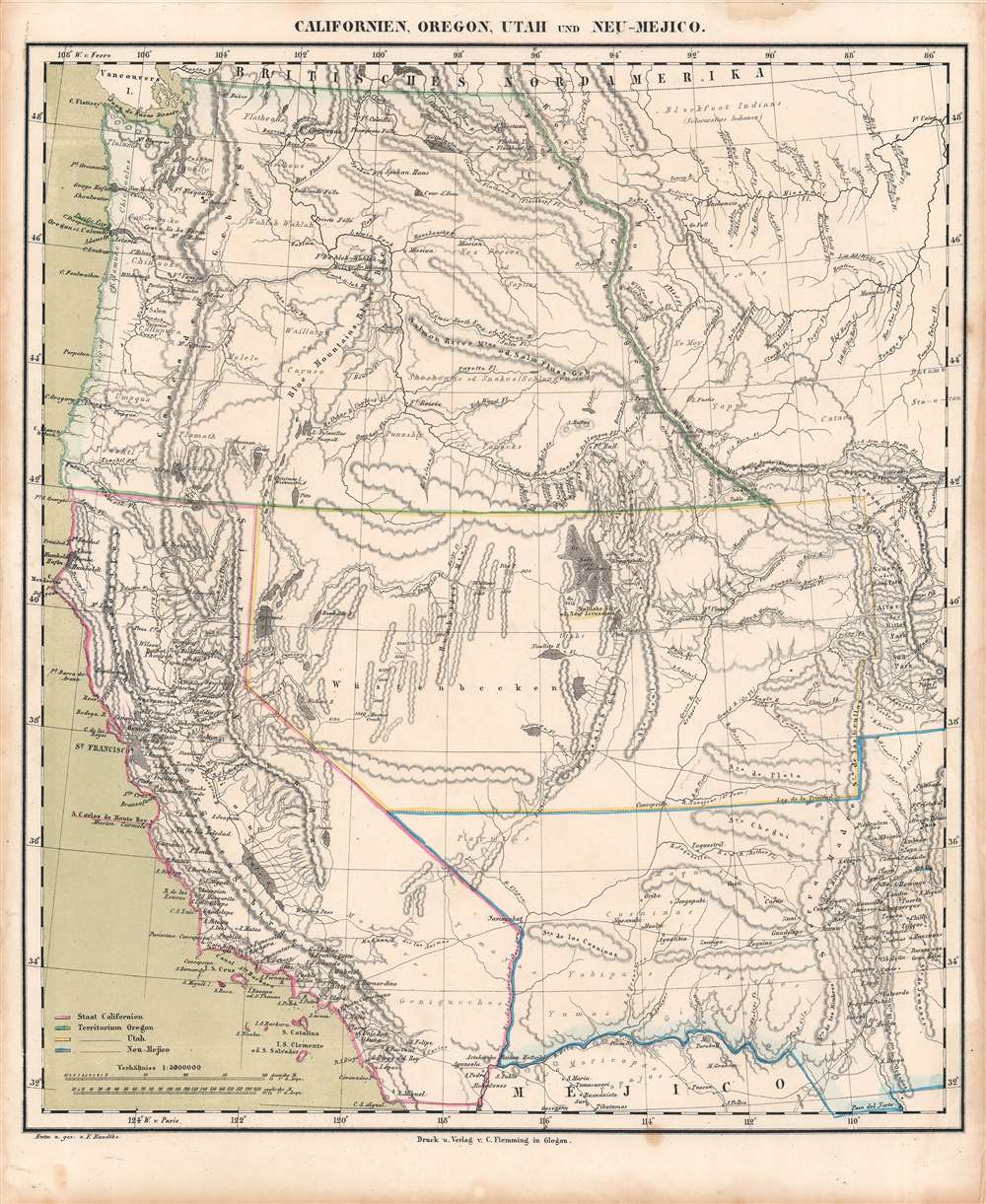
Californien, Oregon, Utah, und Neu-Mejico.
$600.00
Acquire
- Digital Map Information
- Suitable for large format printing
- DPI: 600
- File Size: 28.89 MB
- File Type: ZIP / TIFF
- ICC color profile embedded
- Delivered instantly via download link
This is a c. 1850 Friedrich Handtke and Carl Flemming map of the western United States at the height of the California Gold Rush. This map was issued soon after California became a state. Coverages extends from the Pacific Ocean to the Rocky Mountains and from Canada to Mexico. (more details)
From Normandy to the Siegfried Line.
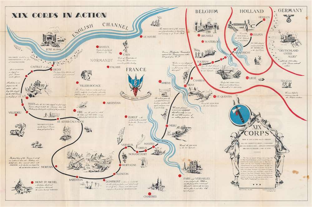
XIX Corps in Action.
sold
- Digital Map Information
- Suitable for large format printing
- Full resolution TIFF file
- ICC color profile embedded
- Delivered instantly via download link
This is a 1944 World War II route map of parts of France, Belgium, Holland, and Germany. It is the first of two maps by Henry J. MacMillan illustrated to follow the 'XIX Corps in Action'. Among similar 'route maps, it holds the distinction of being the only such printed during the war, in November 1944. (more details)
Ski New Hampshire!
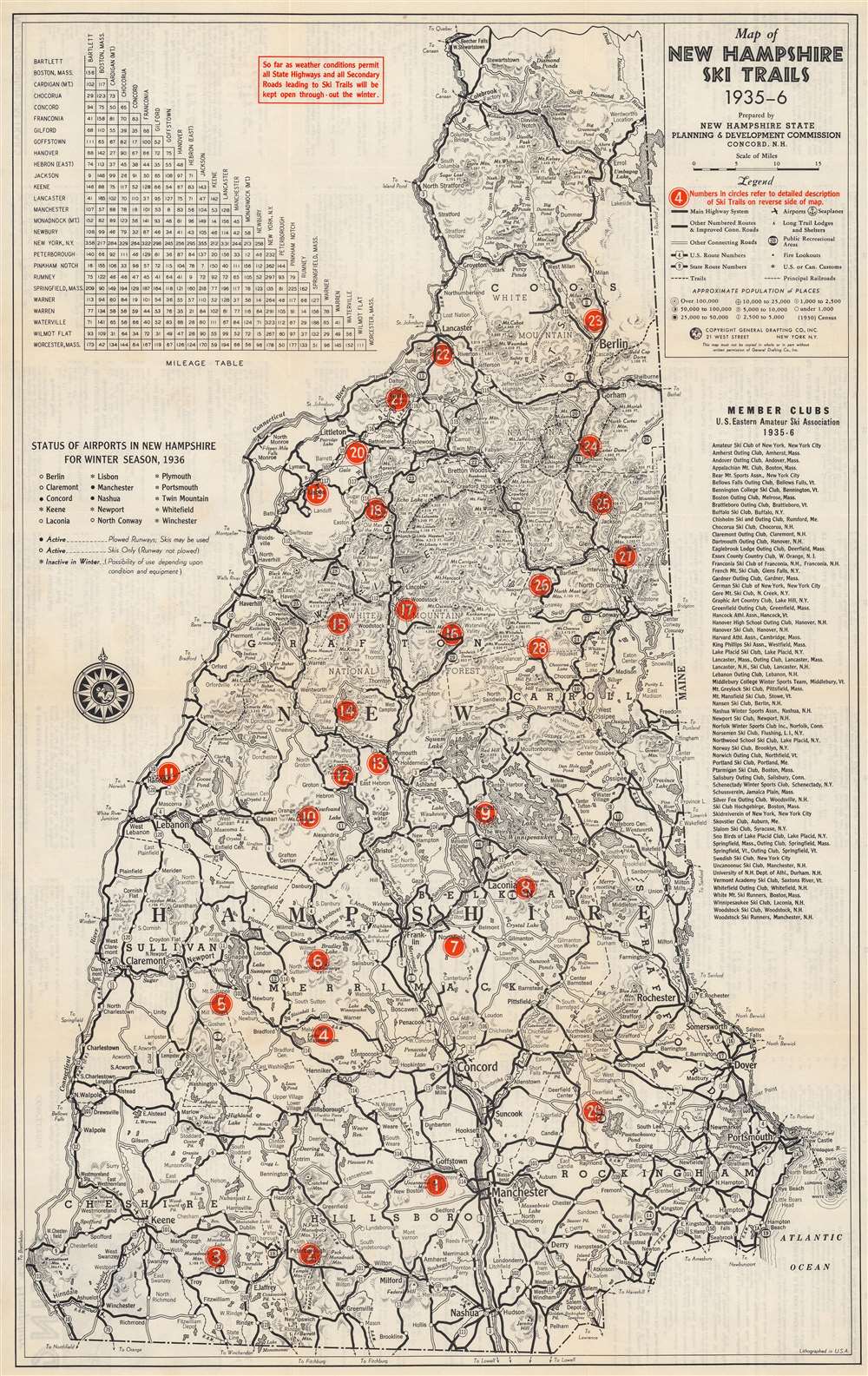
Map of New Hampshire Ski Trails 1935-6.
sold
- Digital Map Information
- Suitable for large format printing
- Full resolution TIFF file
- ICC color profile embedded
- Delivered instantly via download link
This is a 1935 New Hampshire State Planning and Development Commission and General Drafting map of New Hampshire ski trails. Numbered red dots mark twenty-nine ski trails across the state. Each corresponds with an index on the verso. New Hampshire's highway network is illustrated with a milage table in the upper left. New Hampshire's airports are also listed with their 'winter status' noted (open with plowed runways, open without plowed runways so skis are required, and closed during the winter). A list of amateur ski clubs in the eastern United States appears along the right border. (more details)
Training infantry replacements in Florida during World War II.

Map of IRTC Camp Blanding, Florida.
sold
- Digital Map Information
- Suitable for large format printing
- File Size: 16.87 MB
- File Type: ZIP / TIFF
- ICC color profile embedded
- Delivered instantly via download link
This is a WWII era 1945 Don Pfeiffer map of the Infantry Replacement Training Center (IRTC) at Camp Blanding, Florida. The map was issued to help newly arrived soldiers orient themselves as they entered basic training in advance deployment. (more details)
Dawn of the Air Travel.
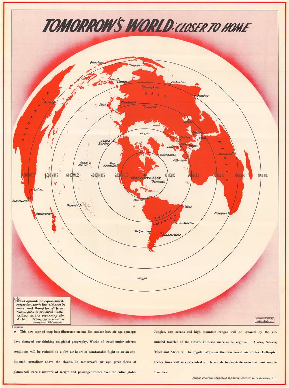
Tomorrow's World: Closer to Home.
sold
- Digital Map Information
- Suitable for large format printing
- File Size: 51.65 MB
- File Type: ZIP / TIFF
- ICC color profile embedded
- Delivered instantly via download link
This is a c. 1944 Marc R. Fore and Newsweek map of the world illustrating the global 'shrinking' effect of air travel. Centered on Washington, D.C., the world is presented on an azimuthal equidistant projection, allowing distances to be illustrated by concentric circles superimposed over the map. Each circle marks 2,000 miles and ten hours of flight time, with the largest marking locations 10,000 miles and fifty flight hours away from Washington. Several global air travel hubs are identified, including London, Paris, Berlin, Sydney, Melbourne, Calcutta, and Cape Town. The caption below the map states, 'weeks of travel under adverse conditions will be reduced to a few air-hours of comfortable flight in an air-conditioned stratoliner above the clouds'. (more details)
Sunny Santa Barbara.
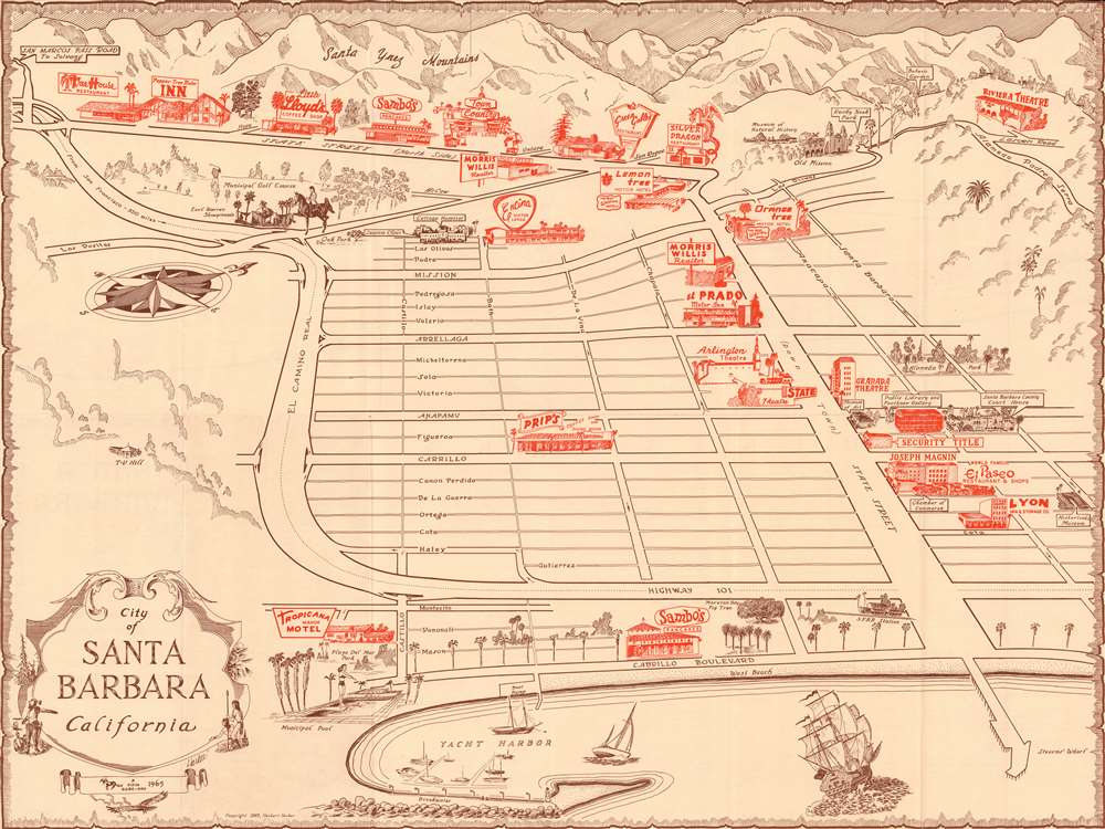
Santa Barbara, California.
sold
This is a rare and charming 1965 Herbert Harker and Pinto Publications bird's-eye view 'guide map' of Santa Barbara, California. It depicts the city at the height of its postwar population boom and infrastructural development. (more details)
First Buddhist map of the world.
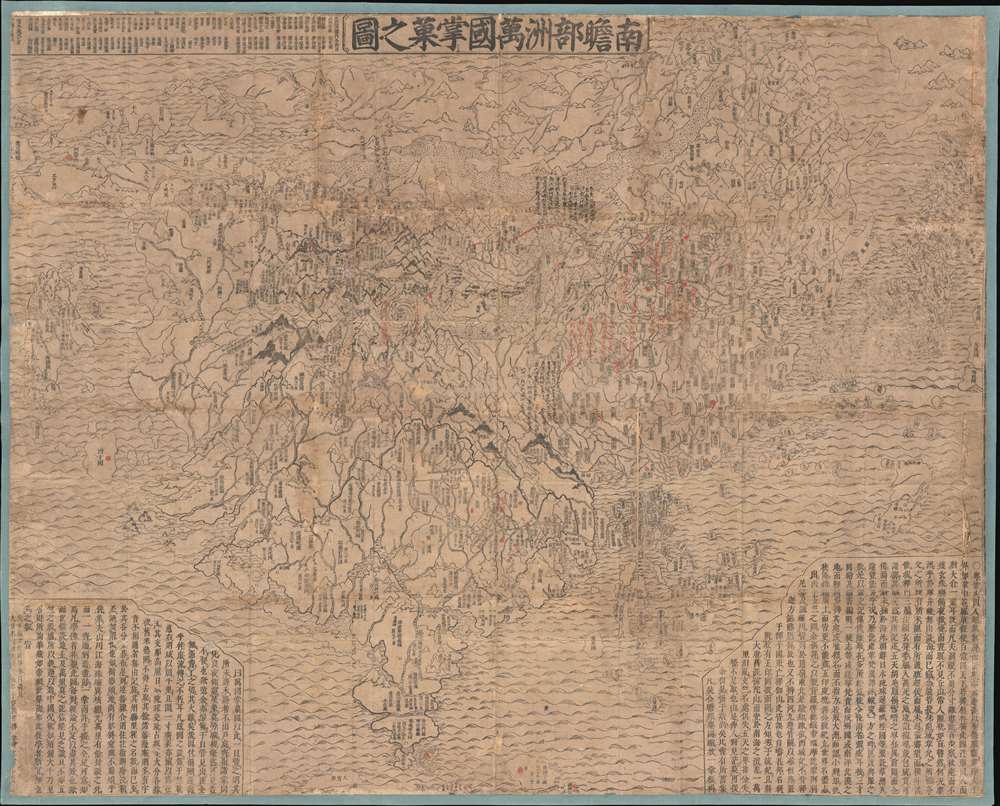
Nansenbushu Bankoku Shoka No Zu (Outline Map of All Countries of the Universe).
sold
- Digital Map Information
- Suitable for large format printing
- DPI: 600
- File Size: 168.79 MB
- File Type: ZIP / TIFF
- ICC color profile embedded
- Delivered instantly via download link
A seminal map of extreme significance. This is the first Japanese printed map to depict the world, including Europe and America, from a Buddhist cosmographical perspective. Printed by woodblock in 1710 (Hoei 7), this map was composed by the Buddhist monk Rokashi Hotan. Inspired by the 1653 publication of Si-yu-ki, a pilgrimage narrative of the Chinese monk Hsuang-Tsang's (602-604) travels to India in search of sacred Sanskrit writings. (more details)
Unique encyclopedic record of Native American toponomy.
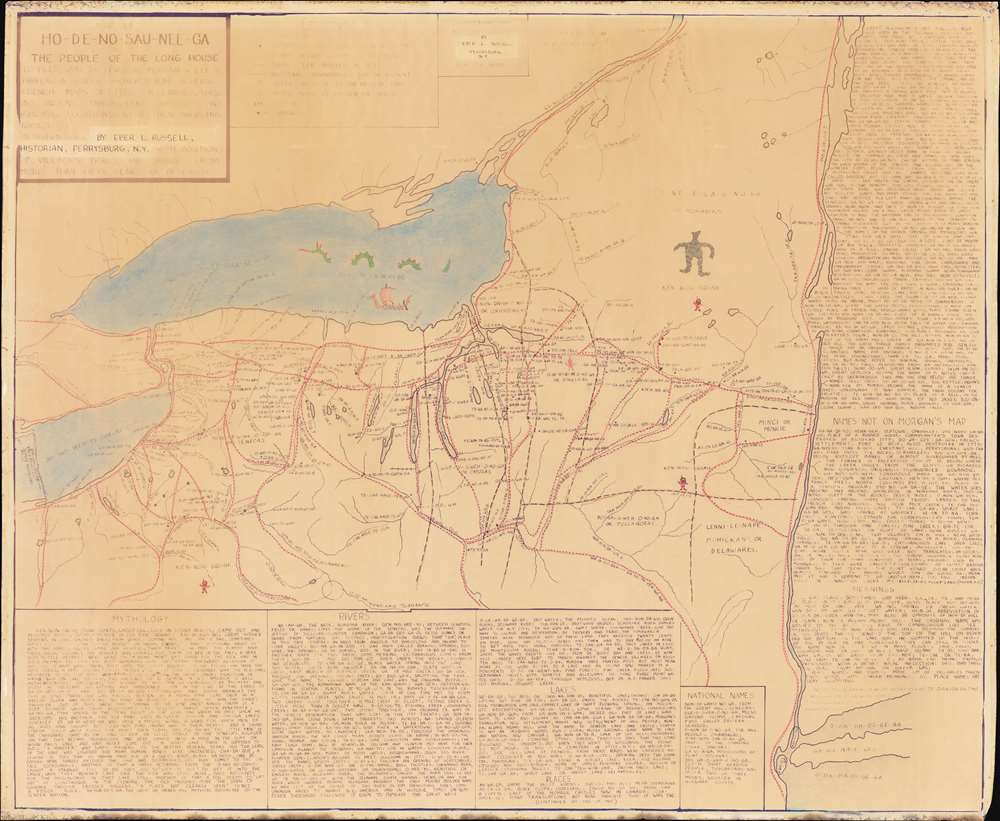
Map of Ho-De-No-Sau-Nee-Ga : or the people of the long house.
sold
An extraordinary 1962 diazotype map by Eber Russell displaying the Native American (Iroquoian) toponymy for settlements, waterways, and other features in upstate New York and portions of Pennsylvania. One of just 4 surviving examples, this map is the product of more than 50 years of research, and an invaluable resource for understanding the pre-colonial Native American presence in New York. The present work was compiled by Eber Russell, who substantially reworked a 19th century map by Lewis Henry Morgan and Adirondack specialist Ely Samuel Parker, two of the most prominent experts on Native American cultures in their time. Compared to its predecessor, Russell's map is a significantly different work on all levels: substantially larger, more focused, more toponymy, and heavily annotated. (more details)
A rare example of an imperial-era Chinese administrative map.

長樂縣全圖 / Complete Map of Changle County.
sold
- Digital Map Information
- Suitable for large format printing
- DPI: 600
- File Size: 134.75 MB
- File Type: ZIP / TIFF
- ICC color profile embedded
- Delivered instantly via download link
A large and finely executed c. 1800 late Qing Chinese manuscript map of Changle County (長樂縣), now Wuhua County, in eastern Guangdong Province. A rare example of a Qing-era administrative map, it displays a great deal of information about the county while also hinting at the limits of Qing authority. (more details)
Rare railroad calendar.

Serving New England.
sold
- Digital Map Information
- Suitable for large format printing
- File Size: 920.66 MB
- File Type: ZIP / TIFF
- ICC color profile embedded
- Delivered instantly via download link
A rare unused 1927 railroad calendar by Stephen J. Voorhies. Coverage embraces parts of New York, Connecticut, and Massachusetts - highlighting the vital New York - Boston corridor. The calendar promotes the services of the New England Steamship Company, the New York New Haven and Hartford Railroad, and the New England Transportation Company - steamships, trains, and buses, respectively. An impressive locomotive takes center stage, but a bus, steamship, trolley, and elegant railway bridges are also represented. (more details)
Earliest accurate European map of Mecca.

[Plan de la ville de La Mecque].
sold
- Digital Map Information
- Suitable for large format printing
- DPI: 600
- File Size: 30.23 MB
- File Type: ZIP / TIFF
- ICC color profile embedded
- Delivered instantly via download link
A groundbreaking 1814 map of Mecca by Ali Bey el Abbassi. This was the first accurate city map of Mecca produced by a non-Muslim European - Ali Bey el Abbassi, a Spanish-born Arabist who spent years traveling throughout Arabia and North Africa. It displays the holy city as it appeared in the early 19th century. (more details)
Before the Back Bay.
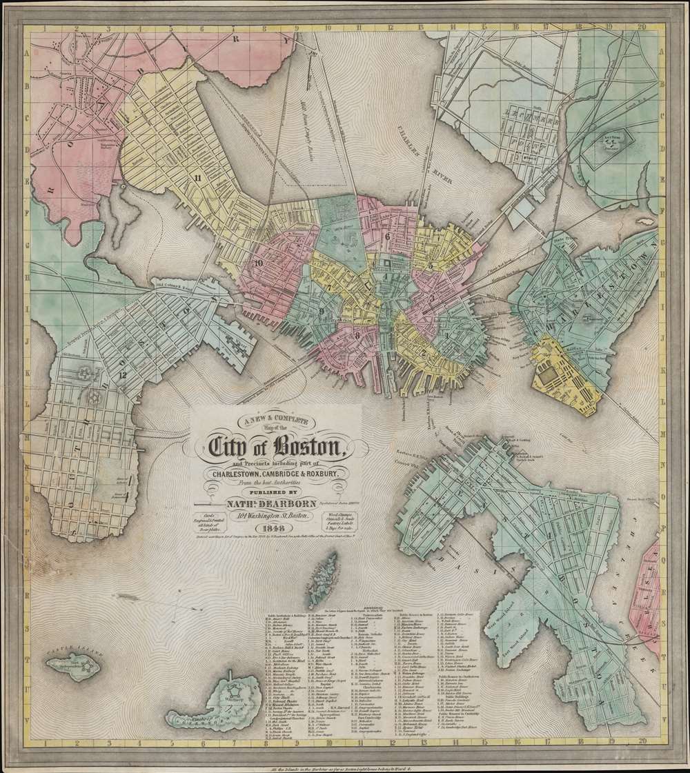
A New and Complete Map of the City of Boston, and precincts including part of Charleston, Cambridge and Roxbury.
sold
- Digital Map Information
- Suitable for large format printing
- DPI: 600
- File Size: 347.74 MB
- File Type: ZIP / TIFF
- ICC color profile embedded
- Delivered instantly via download link
This is a scarce 1848 map of pre-landfill Boston published by Nathaniel Dearborn. Presented with a westward orientation, the map reflects Boston's breakneck growth in the early 19th century. (more details)
Grisly end to the Dakota War.
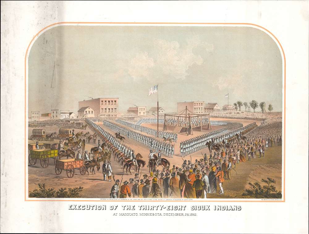
Execution of the thirty-eight Sioux Indians, at Mankato, Minnesota, December, 26, 1862.
sold
- Digital Map Information
- Suitable for large format printing
- File Size: 47.36 MB
- File Type: ZIP / TIFF
- ICC color profile embedded
- Delivered instantly via download link
This 1883 lithograph depicts the mass execution of thirty-eight Dakota in Mankato, Minnesota that took place twenty years earlier during the Dakota War (August 18, 1862 - September 26, 1862). It is a disturbing reminder of atrocities committed during the westward expansion of the United States. The event remains the largest mass execution carried out in U.S. history. (more details)
Issued for the Civil War - one of just two known examples.
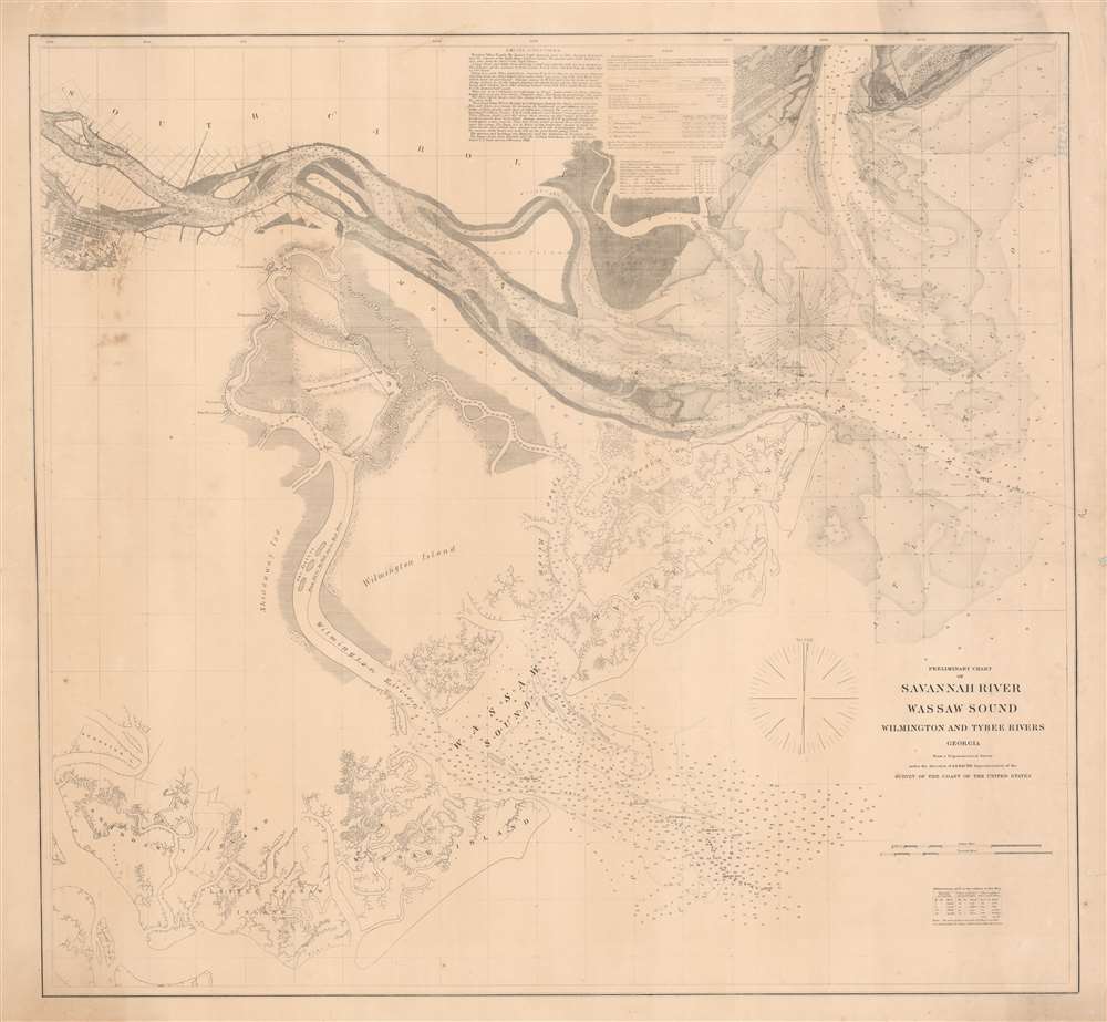
Preliminary Chart of Savannah River Wassaw Sound Wilmington and Tybee Rivers Georgia.
$1,200.00
Acquire
- Digital Map Information
- Suitable for large format printing
- File Size: 47.3 MB
- File Type: ZIP / TIFF
- ICC color profile embedded
- Delivered instantly via download link
An exceptionally rare separate issue c. 1862 Civil War Era U.S. Coast Survey nautical chart or map of the Savannah River and surrounding waters. This chart combines existing surveys of the Savannah River with separate charts prepared of the Wassaw Sound and the Wilmington and Tybee Rivers. Given the presentation on heavier stock and the maps relative rarity, it is likely this was a separate issue prepared for naval action early in the American Civil War (1861 - 1865). (more details)
One of the earliest obtainable views of Honolulu.

Vue de Honolulu. Iles Sandwich.
sold
- Digital Map Information
- Suitable for large format printing
- Full resolution TIFF file
- ICC color profile embedded
- Delivered instantly via download link
One of the earliest obtainable views of Honolulu, Hawaii, this c. 1840 image was drawn by Barthélemy Lauvergne. Lauvergne was one of several artists accompanying the 1836 - 1837 Auguste-Nicolas Vaillant (1793 - 1858) circumnavigation. The scientific expedition arrived in Hawaii on September 28, 1836 and stayed through October 11. It is safe to assume that Lauvergne sketched this view in early October 1836. The view reveals the ragtag European coastal village set beside the tiny harbor of Kou. Note the European style buildings - as opposed to traditional high roofed Hawaiian thatched structures. Two sailing ships are anchored just offshore. Within 20 years, this small settlement would grow to become the economic hub of the entire north Pacific. In 1850, there are records of more than 100 whaling ships crowding the harbor and 3000 drunken sailors wandering the rough streets in search of … the things for which drunken sailors search. (more details)
Privately published chart for Blockade Runners?
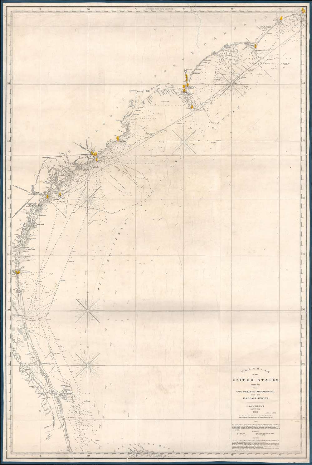
The Coast of the United States Sheet No. 2 from Cape Lookout to Cape Carnaveral from the U.S. Coast Survey.
sold
- Digital Map Information
- Suitable for large format printing
- File Size: 44.94 MB
- File Type: ZIP / TIFF
- ICC color profile embedded
- Delivered instantly via download link
This is a rare 1865 Civil War Era Edmund and George William Blunt 'blockade runner' nautical map of the southeastern coast of the United States extending roughly from Cape Hatteras, North Carolina, to Cape Canaveral (written Carnaveral here), Florida. Benefiting from the work of the U.S. Coast Survey, the chart boasts impressive coastal detail, illustrating innumerable coastal islands, inlets, points, and other important navigational hazards. Depth soundings appear along the coast. Railroads are illustrated operating out of Savannah and Charleston, emphasizing their economic importance to the Confederate States of America. (more details)
Rare early map of Portland main predating the development of the east end Munjoy Hill district.
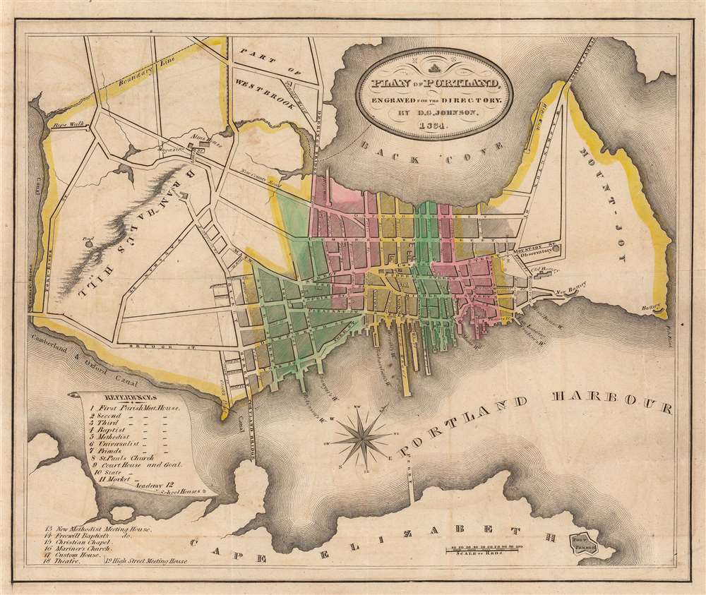
Plan of Portland Engraved for the Directory by D.G. Johnson, 1834.
sold
- Digital Map Information
- Suitable for large format printing
- DPI: 600
- File Size: 15.54 MB
- File Type: ZIP / TIFF
- ICC color profile embedded
- Delivered instantly via download link
A rare map of Portland Maine engraved in 1834 by D. G. Johnson. Oriented to the northwest this map covers peninsular Portland from the Pore River to Portland Harbor, including parts of adjacent Westbrook and Cape Elizabeth. Portland's development at his point was confined to the isthmus between Bracket Street and Washington Avenue. This map thus significantly predates the extensive development of Portland's east end, then known as Mount-Joy, today referred to as Munjoy Hill. Color coding identifies city wards and a reference table in the lower left quadrant notes 12 important civic and religious centers. (more details)
'General Map' of the U.S.-Mexico Boundary Survey.
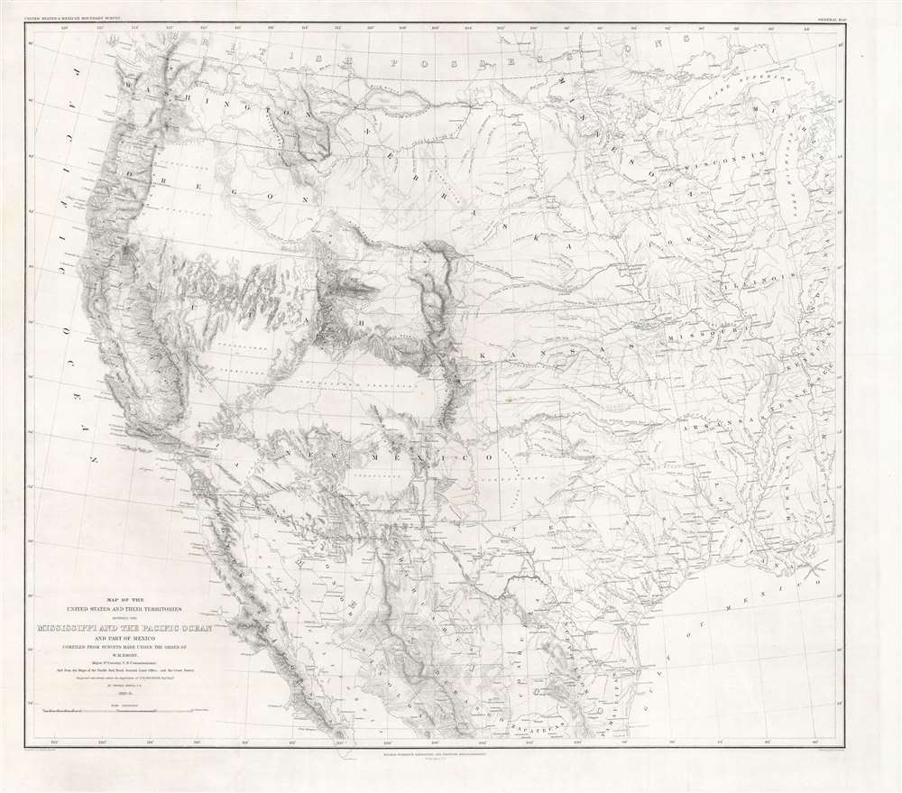
Map of the United States and their territories between the Mississippi and the Pacific Ocean and part of Mexico...
sold
- Digital Map Information
- Suitable for large format printing
- File Size: 57.47 MB
- File Type: ZIP / TIFF
- ICC color profile embedded
- Delivered instantly via download link
This is Emory and Michler's critically important 1857 map of the American West produced following the Treaty of Guadeloupe-Hidalgo and the Gadsden Purchase. The product of years of labor, delays, and frustrations, it appeared in Emory's monumental Report on the United States and Mexican Boundary Survey and was by far the most complete map of the American West at the time. (more details)