
The 'Old Northwest' remembered.
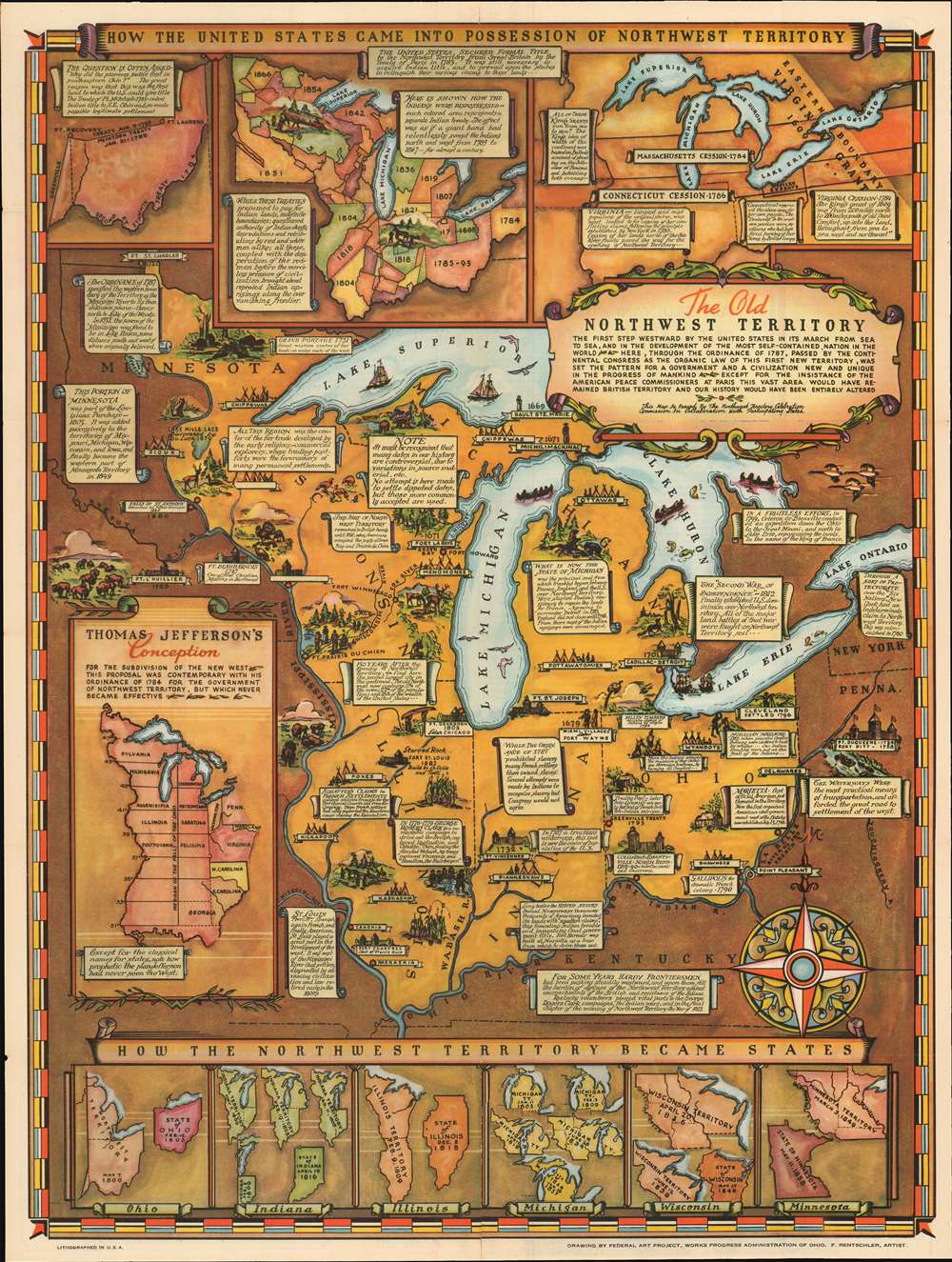
The Old Northwest Territory.
sold
- Digital Map Information
- Suitable for large format printing
- Full resolution TIFF file
- ICC color profile embedded
- Delivered instantly via download link
An uncommon 1937 pictorial map of the old Northwest Territory by Fred Rentschler. The map includes all five of the great lakes and focuses on the modern-day states of Minnesota, Wisconsin, Illinois, Indiana, Michigan, and Ohio. It includes numerous vignette illustrations referencing historic events, American Indian groups, and local folklore. The main map is surrounded by historical maps illustrating various ideas for the Northwest Territory ranging from the 'Thomas Jefferson Conception' to specific illustrations of the individual states in different configurations. The verso of the map features a transcript of the Ordinance of 1787 as well as additional historical text. (more details)
Beautiful nautical chart of Humboldt Bay.

Humboldt Bay California.
sold
- Digital Map Information
- Suitable for large format printing
- Full resolution TIFF file
- ICC color profile embedded
- Delivered instantly via download link
This is an attractive 1851 coastal map or nautical chart of Humboldt Bay, California issued by the U.S. Coast Survey. It covers from Indian Island and Samoa south to Fields Landing. The cities of Eureka, Humboldt, and Bucksport are detailed along with other inland features. An inset in the lower right features a sketch of Humboldt Bay with an elevation profile of Red Bluff Entrance. The chart features numerous depth sounding, sailing directions, and other practical information for the mariner. (more details)
Oldest continuously operating lighthouse on the West Coast.

Sketch J. NO. 4 Indicating proposed sites for a Light-House on Point Pinos Bay, Monterey.
sold
- Digital Map Information
- Suitable for large format printing
- Full resolution TIFF file
- ICC color profile embedded
- Delivered instantly via download link
This is a beautiful 1851 U.S. Coast Survey nautical chart or map of Monterey Bay and Point Pinos, California. Essentially two maps on a single page, the right hand side map was created from surveys made in 1847 and depicts Monterey Bay from Pt. St. Cruz to Point Pinos. Monterey City is identified. The left map focuses on Point Pinos and details proposed light sites and the their potential range of visibility. The Point Pinos Lighthouse was finally built in 1855 and is now the oldest continuously operating lighthouse in the western United States. (more details)
Landmark exploration of a previously unmapped region of Africa.
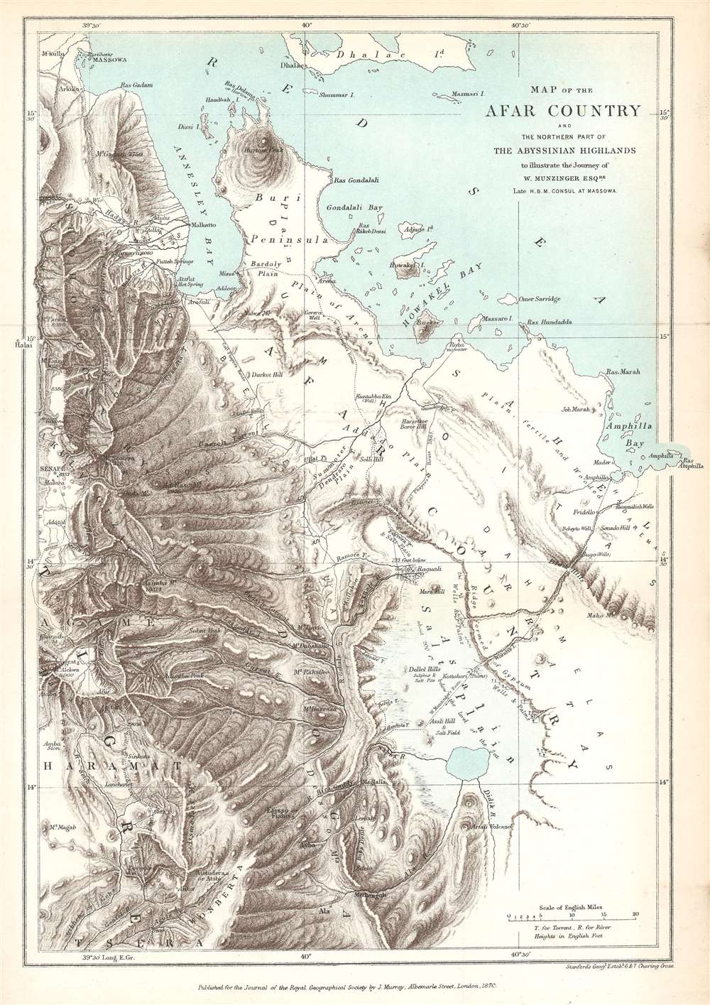
Map of the Afar Country and the Northern Part of the Abyssinian Highlands to illustrate the Journey of W. Munzinger Esqure. Late H.B.M. Consul at Massowa.
$200.00
Acquire
- Digital Map Information
- Suitable for large format printing
- File Size: 5.73 MB
- File Type: ZIP / TIFF
- ICC color profile embedded
- Delivered instantly via download link
This is an 1870 John Murray map of the Afar Country, comprising parts of modern-day Eritrea and Ethiopia. The map was created to accompany a The Journal of the Royal Geographical Society paper by Werner Munzinger. Dashed tracks follow Munzinger's groundbreaking exploration of the little known region. (more details)
Corfu, a popular tourist destination for the ultra-wealthy.
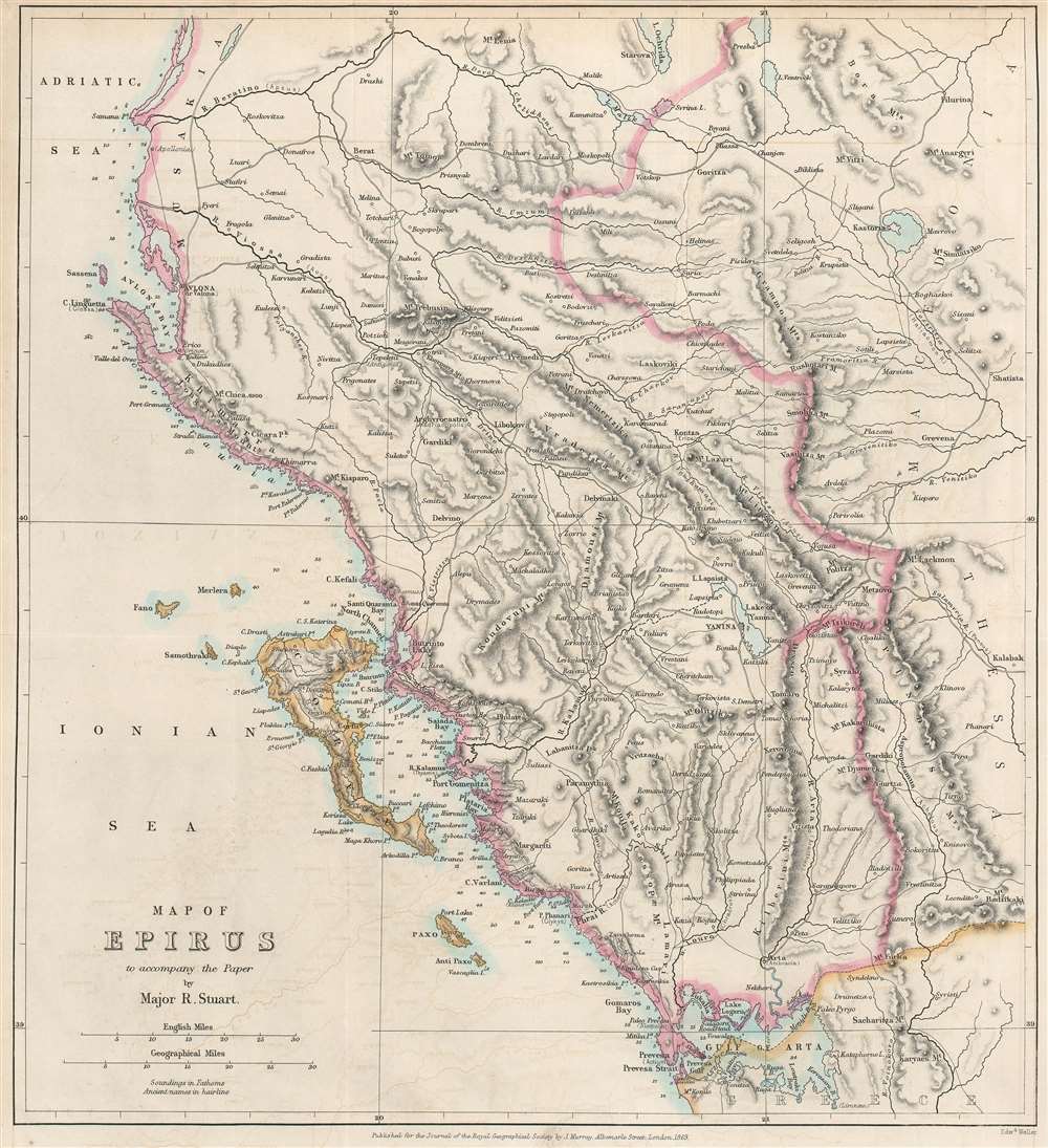
Map of Epirus to accompany the Paper by Major R. Stuart.
sold
- Digital Map Information
- Suitable for large format printing
- File Size: 9.01 MB
- File Type: ZIP / TIFF
- ICC color profile embedded
- Delivered instantly via download link
An important geographical region in antiquity and a popular tourist destination today, this is an 1869 John Murray map of Corfu and Epirus, Greece. Corfu appears in the Ionian Sea just off the coast of Epirus. Cities and towns throughout, including Corfu, the largest city on the island of Corfu, and Ioannina (labeled here as Yanina), the regional capital. (more details)
Pictorial map of Hawaii.
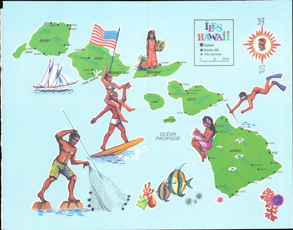
Iles Hawaii.
sold
This is a 1967 Tallandier pictorial map of Hawaii. The map depicts and labels the islands of Hawaii, Maui, Molokai, Oahu, Kauai, Lanai, Kahoolawe, and Nihau. Cities and towns are labeled as well, including Honolulu and Hilo, as well as Pearl Harbor. Hawaii's three largest volcanoes are illustrated. Pictorial vignettes highlight life in the islands, including spearfishing, surfing, and making leis. A young woman holds pineapples on Molokai, a fruit long been associated with Hawaii. (more details)
The opening of the Brooklyn Bridge!

Bird's-Eye View of the Great New York and Brooklyn Bridge, and Grand Display of Fire Works on Opening Night.
sold
- Digital Map Information
- Suitable for large format printing
- File Size: 37.68 MB
- File Type: ZIP / TIFF
- ICC color profile embedded
- Delivered instantly via download link
Perhaps the most dynamic and dramatic Brooklyn Bridge View, this is the 1883 A. Major four-color chromolithograph bird's-eye view of the Brooklyn Bridge during the opening day celebrations. Then known as the 'New York and Brooklyn Bridge' or the 'East River Bridge' (it would not be officially renamed the Brooklyn Bridge until 1915), fireworks erupt from both stone towers and the center of the span. Individuals on rooftops and passengers set off additional celebratory fireworks. Steamers, sailboats, and three-masted schooners fill the East River, creating a visual spectacle emphasizing New York's significance as a port. Pedestrians cross the bridge, some in elegant carriages. The bridge's designer, engineers, draughtsmen, and other important individuals are recognized along the bottom border and a short text summarizes the bridge's specifications and its cost: $15,000,000. (more details)
The largest and best map of Persia.

Map of Persia (in Six Sheets) Compiled in the Simla Drawing Office Survey of India.
sold
- Digital Map Information
- Suitable for large format printing
- File Size: 54.87 MB
- File Type: ZIP / TIFF
- ICC color profile embedded
- Delivered instantly via download link
This massive, six-sheet map of Persia produced in 1897 by the British Survey of India (updated to 1902) was the most detailed map of what is now Iran, Iraq, and parts of Azerbaijan and Turkmenistan that had been executed to date: we are aware of no comparable map prior. Its exhaustive detail would continue to command respect well into the 20th century: the German military faithfully copied this map in 1918, as they did with other British maps of important theaters in the Great War. (more details)
First accurate map of Thailand.

Map of the Kingdoms of Siam and Cochin China.
sold
- Digital Map Information
- Suitable for large format printing
- Full resolution TIFF file
- ICC color profile embedded
- Delivered instantly via download link
This rare large-format 1828 map of Southeast Asia, compiled by John Walker to illustrate John Crawfurd’s mission to Siam (Thailand) is the first accurate survey of the coasts of Siam. Coverage extends from China to Singapore and from the Gulf of Martaban (Burma) to Vietnam and Hainan. Siam at the time was inaccessible to European merchants and even diplomats with its coasts and interior were largely unknown. This map is an amalgam of European sources, but with regard to Siam, derived primarily from secretly acquired early 19th century Siamese surveys previously unknown to Europeans and, for all intent and purposes, still lost. (more details)
War as a game.

[War In China] / Shogaku Rokunensei (小学六年生)
sold
- Digital Map Information
- Suitable for large format printing
- Full resolution TIFF file
- ICC color profile embedded
- Delivered instantly via download link
A striking Japanese propaganda pictorial / manga map and sugoroku game board issued by Shogakukan (小學館) for its Shogaku Rokunensei (小学六年生; [Sixth Grader]) magazine in January of 1945, the final year of World War II. The map covers most of China from the Great Wall to Taiwan and Hainan. Rivers are greatly exaggerated. Despite the desperate situation that Japanese forces were then in, Japanese soldiers, battleships, and warplanes are featured throughout in heroic poses. The verso contains additional content further propagandizing the war effort. (more details)
Home of yellow wine (vin jaune) and comté cheese.
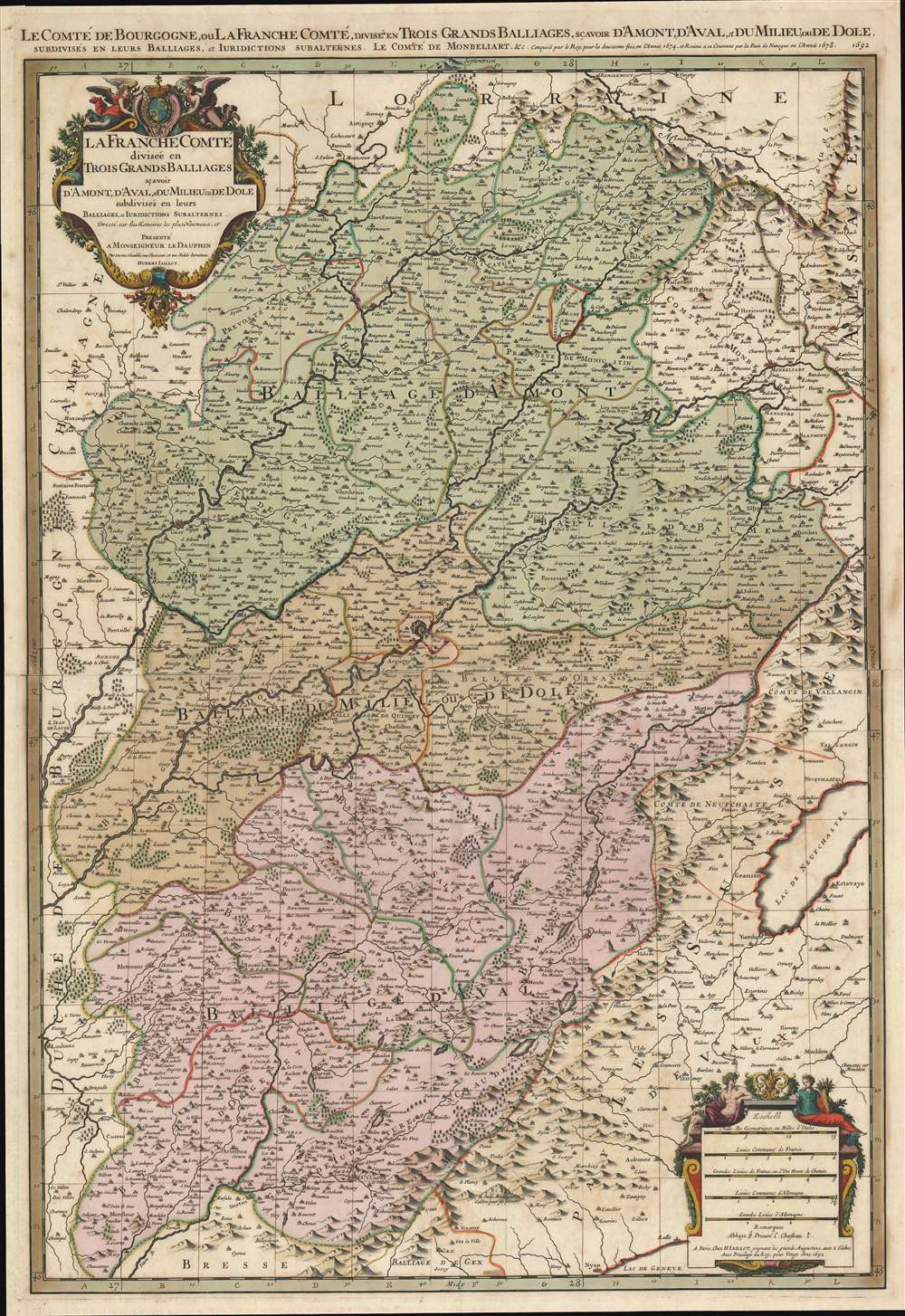
Le Comté de Bourgogne, ou La Franche Comté, Divisée en Trois Grands Balliages, Scavoir d'Amont, d'Aval, et du Milieu, ou de Dole, Subdivisés en Leurs Balliages, et Jurisdictions Subalternes.
sold
- Digital Map Information
- Suitable for large format printing
- Full resolution TIFF file
- ICC color profile embedded
- Delivered instantly via download link
This is a 1692 Alexis-Hubert Jaillot map of Burgundy and Franche-Comté, France. Beautifully engraved and hand colored, myriad cities, towns, and villages are labeled throughout the region, including Besançon, Dole, Vesoul, and Belfort. The Doubs, Saone, and Lougnon Rivers are illustrated and labeled as well. A wonderful title cartouche adorns the upper left corner and a second cartouche on the lower right contains the map's scales. (more details)
Bird's-eye view of the White Mountains advertising railroads.

Bird's-Eye Map of the White Mountains by Boston and Maine.
sold
- Digital Map Information
- Suitable for large format printing
- File Size: 13.25 MB
- File Type: ZIP / TIFF
- ICC color profile embedded
- Delivered instantly via download link
This is an 1887 Boston and Maine Railroad bird's eye view map of the White Mountains promoting their service in the area to tourists. The view depicts the region from St. Johnsbury and East Haverhill to Shelburne, Chatham, and Conway Center and from Lancaster and Jefferson Mills to Plymouth and Squam Lake. Beautifully engraved, every mountain in the region is labeled and its elevation is given. Myriad cities, towns, and villages are identified, along with rivers, ponds, and lakes. Railroad routes in the region, including those of the Boston and Maine Railroad and the Maine Central Railroad, are illustrated by thick black lines. The whole is framed by text advertising the Merrimack Valley Route and the Seashore Route operated by the Boston and Maine Railroad to the White Mountains. In the lower right corner of the advertising surround, a short text promotes 'elegant new Pullman Buffet Cars. At the end of the 19th century, Pullman cars were considered the height of luxury and would have been enticing to potential travelers. (more details)
A beautiful, original color example of this fine map of Eastern France's wine region.
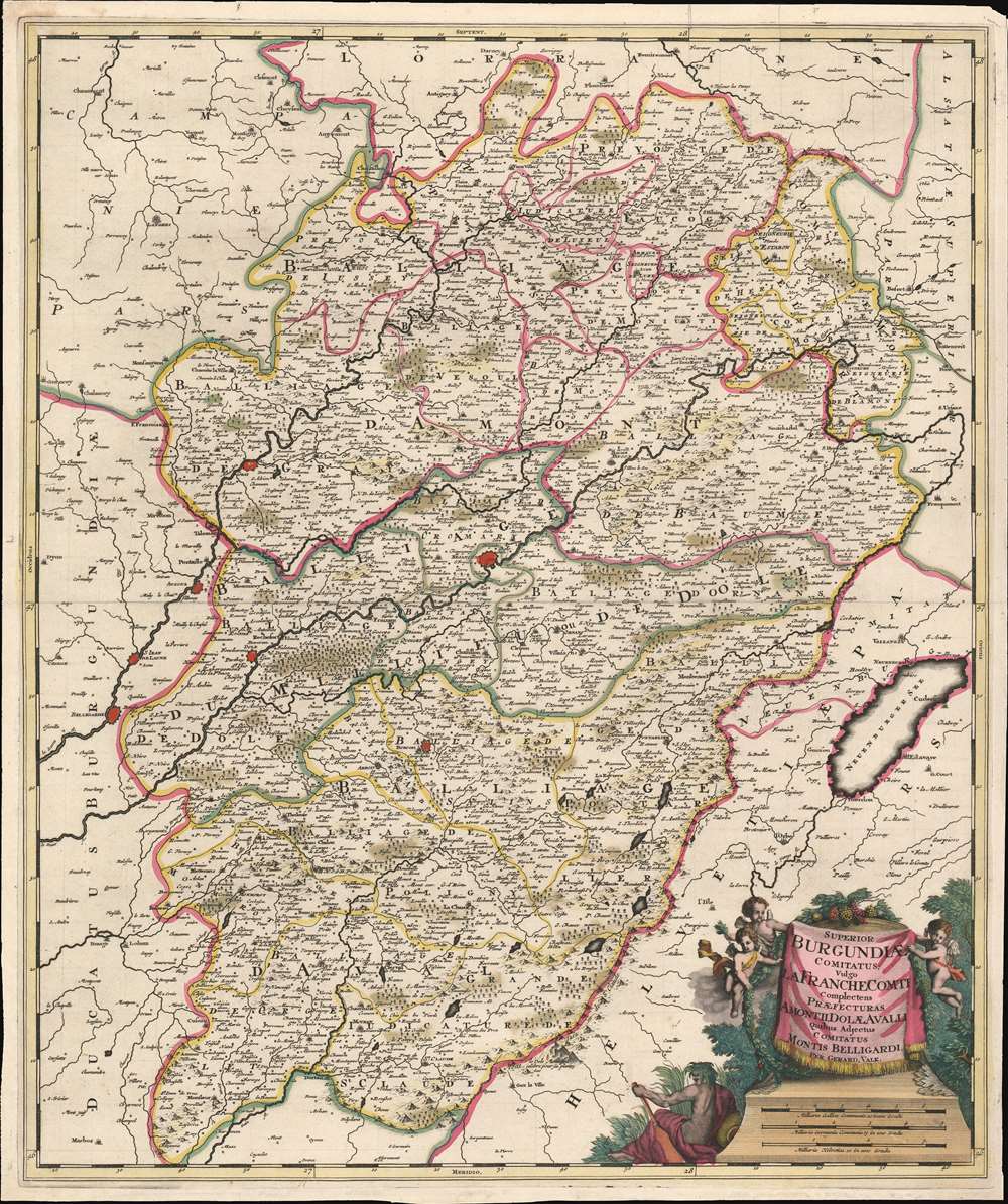
Superior Burgundiae comitatus; vulgo la Franche Comté complectens praefecturas Amontii, Dolae, Avalli quibus adjectus comitatus Montis Belligardi.
$350.00
Acquire
- Digital Map Information
- Suitable for large format printing
- Full resolution TIFF file
- ICC color profile embedded
- Delivered instantly via download link
This is a beautiful example of Gerard Valk's 1702 map of the upper Burgundy region of eastern France. The map is centered on the Saone and the Doubs river valleys, and on the city of Besançon. the region was the County of Burgundy until the region and the neighboring Duchy of Burgundy were abolished during the French Revolution. (more details)
Guide for Maine / New Hampshire outdoorsmen.
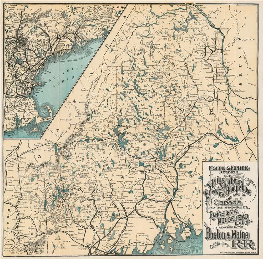
Fishing and Hunting Resorts of Maine, Northern New Hampshire, and Part of Canada and the Provinces, Rangeley and Moosehead Lakes as Reached by the Boston and Maine Railroad and Connections.
sold
- Digital Map Information
- Suitable for large format printing
- File Size: 15.78 MB
- File Type: ZIP / TIFF
- ICC color profile embedded
- Delivered instantly via download link
This is an 1899 Rand Avery Supply Company and Boston and Maine Railroad map of Maine and northern New Hampshire. Depicting the region from the White Mountains northeast to New Brunswick, thick black lines trace the Maine Central Railroad's route. Less imposing black lines illustrate the region's other railroads, including the 'Canadian Pacific Railroad' and the 'Bangor and Aroostook Railroad'. Maine's many lakes, such as Moosehead Lake, Chamberlain Lake, the Eagle Lakes, and Grand Lake, are illustrated and labeled, along with the region's many rivers. Houses, hotels, and other properties catering to outdoor sports enthusiasts are identified, although they are not emphasized. An inset in the upper left promotes the railway network between Boston and Vanceboro, Maine, with spur service to the Mount Desert Island Ferry and numerous lines running through the White Mountains. (more details)
Highlights French champagne, wine, and cheese!
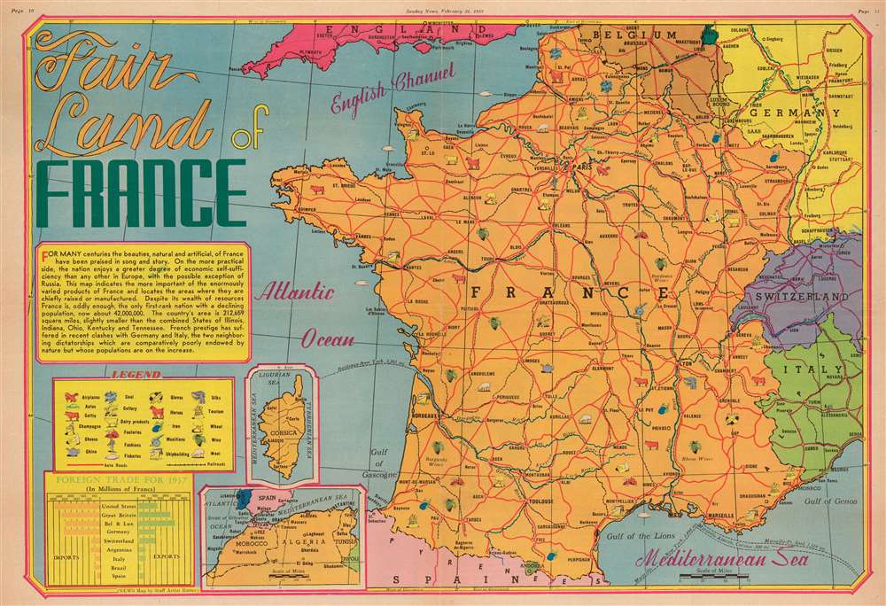
Fair Land of France.
sold
- Digital Map Information
- Suitable for large format printing
- File Size: 26.92 MB
- File Type: ZIP / TIFF
- ICC color profile embedded
- Delivered instantly via download link
This is a 1939 Edwin Sundberg map of France. Sundberg uses icons to mark regions where specific resources, including champagne, cheese, and wine, are cultivated, mined, or raised. France's major highways, and those of surrounding countries, are illustrated in red, and dashed lines mark international steamer routes. A text box along the left border discusses France's economic success, its population, and its geographic size. Insets, situated in the lower left quadrant, focus on Corsica and France's North African colonies, Morocco, Algeria, and Tunisia. A graph in the lower left corner compares France's imports and exports and differentiates them by country of export or import. (more details)
Incorporates beautiful illustrations a plants from all over the world.

World of Flowers.
sold
This is a 1972 John Bartholomew and Barbara Everard pictorial map of the world and its flowers. A topographic world map on Goode's projection occupies the center. While few place names are provided, major bodies of water, landmasses, and islands are named. 161 beautiful illustrations of flora surround the central map. The plants are broken up into eleven geographic groups, which are, proceeding clockwise from the upper left: North America, Arctic, Europe, Mediterranean, Tropical and Central Africa, South Africa, Himalaya and China, Antarctic, Southeast Asia, Australasia, and Central and South America. Each plant is numerically identified and corresponds with indexes situated in the lower left and right corners. (more details)
One of the earliest obtainable maps to focus on all of Manhattan Island.
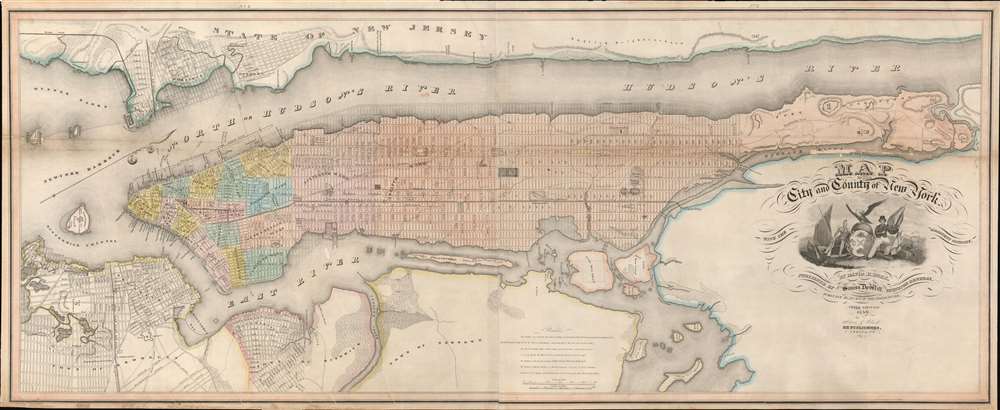
Map of the City and County of New York, with the adjacent country.
sold
- Digital Map Information
- Suitable for large format printing
- Full resolution TIFF file
- ICC color profile embedded
- Delivered instantly via download link
This is an example of David Burr's rare 1839 map of Manhattan, New York City. Burr's map is one of the earliest maps focused specifically on Manhattan to illustrate the entire island. Oriented to the northeast, the map roughly follows the layout and design of the 1811 Commissioner's Plan, wherein the geography of the island is sublimated by the city's iconic street grid. Burr's more commercial map also extends the coverage further east and west, to accommodate, Brooklyn, Bushwick, Williamsburg, Hoboken, and Jersey City. (more details)
The most dramatically engraved and presented map of Africa of the 17th century.
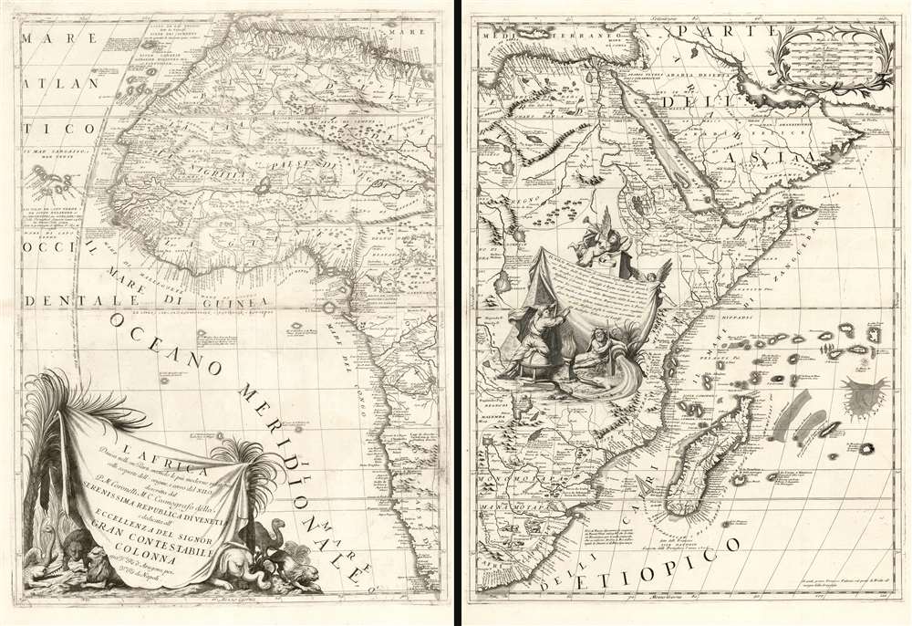
L'Africa Divisa nelle sue Parti secondo le Piùu moderne relationi colle scoperte dell' origine, e coro del NILO, descritta dal P.M. Coronelli M.C. Cosmografo della Serenissima Republica di Veneia è dedicata all' Eccellenza del Signor Gran Contestabile Colonna gia Vce. Rè d' Aragona, poi Vce Rè di Napoli.
sold
- Digital Map Information
- Suitable for large format printing
- Full resolution TIFF file
- ICC color profile embedded
- Delivered instantly via download link
This is Vincenzo Maria Coronelli's magnificent 1691 two-sheet map of Africa: it is among the most distinctive maps ever printed of the continent, and one boldly presenting the groundbreaking revision of the mapping of the River Nile. The size of the map, as well as Coronelli's distinctive and elegant style, establish this map among the most sought-after antique maps of Africa. It is rich in historical detail, noting dates on which different regions were first reached by European explorers. (more details)
The most decorative world map of the 19th century.
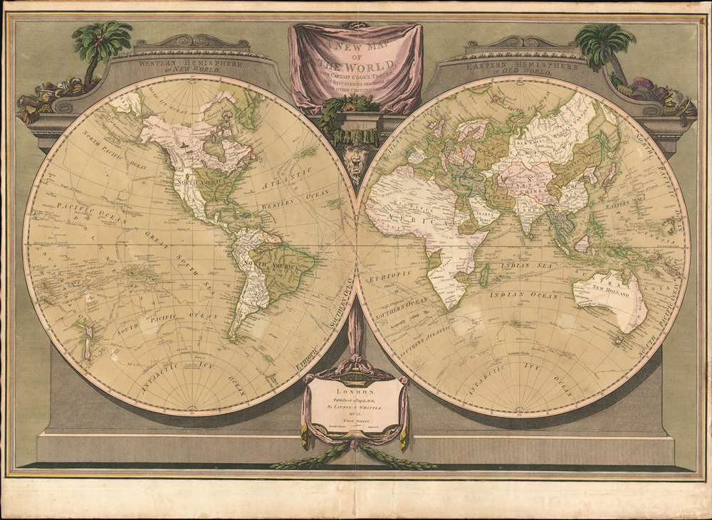
A New Map of the World, with Captain Cook's Tracks, His Discoveries and those of the Other Circumnavigators.
sold
- Digital Map Information
- Suitable for large format printing
- Full resolution TIFF file
- ICC color profile embedded
- Delivered instantly via download link
Possibly the most decorative 19th century double-hemisphere world map, this is Laurie and Whittle's New Map of the World with Captain Cook's Tracks. The map presents the eastern and western hemisphere, set in a striking architectural border with the hemispheres adorned by a pediment identifying the Old and New World. A drape-style title cartouche adorns the top of the map and is surrounded by palms trees, native costumes, and weaponry. On the map itself, the routes of Captain Cook's three voyages, as well as the routes of other circumnavigators are noted. (more details)
Rare Spanish nautical chart of the Balearic Islands.
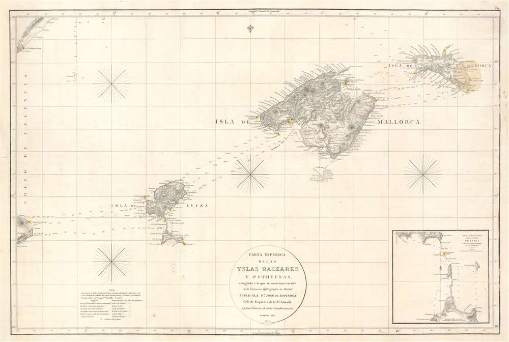
Carta Esferica de las Islas Baleares y Pithyusas, arreglada a la que se construyo en 1807 en la Dirección Hidrografica de Madrid.
sold
- Digital Map Information
- Suitable for large format printing
- Full resolution TIFF file
- ICC color profile embedded
- Delivered instantly via download link
A rare 1812 Dirección de Hidrografía nautical chart or maritime map of the Balearic Islands: Mallorca, Minorca, Ibiza and Formentera. The chart offers extraordinarily detail throughout with topography, town names rivers, roads, and depth soundings. An inset in the lower right details the channels between Ibiza and Formentera (1 : 69400). (more details)