
Bilingual city map of Victoria and Kowloon.

新編香港无龍新界全圖 / New Complete Map of Hong Kong Wulong New Territories.
sold
This is a 1964 Luo Dingzhou (羅定周) bilingual English and Chinese city plan or map of Hong Kong, Kowloon, and the New Territories. The map of Hong Kong, or specifically Victoria, occupies the bottom third of the sheet and depicts from Mount Davis to Pottinger Peak. Most roads are labeled in both languages, along with the piers and docks along the waterfront. Happy Valley Racecourse, Victoria Park, and the Botanic Gardens also merit identification in both English and Chinese. An inset focusing on Victoria's central district appears along the bottom border. Streets, offices, and other buildings are identified here as well. The map of Kowloon occupies the upper right quadrant and presents the region with the same attention to detail. Streets, ferry terminals, docks, and other buildings are labeled here as well. The new runway at Kai Tak Airport spears into Kowloon Bay, and its dimensions (8,350 x 795 feet) are even provided. A map of the entire region, from Hong Kong's border with China to Po Toi Island, appears to the left of the map of Kowloon. Here, major settlements are identified, and red lines trace the region's highways. Nearly all the islands, no matter the size, are labeled in both languages, and ferry routes connect numerous places throughout the region. (more details)
Arthur Donaldson Smith's explorations in East Africa.
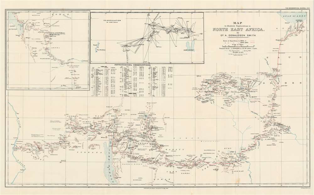
Map to illustrate Explorations in North East Africa.
sold
- Digital Map Information
- Suitable for large format printing
- File Size: 19.99 MB
- File Type: ZIP / TIFF
- ICC color profile embedded
- Delivered instantly via download link
This is a 1900 Arthur Donaldson Smith map of East Africa. The map depicts from the Gulf of Aden south into modern-day Ethiopia and then west across modern-day Kenya and Uganda to the Nile River. Red lines trace Donaldson Smith's two expeditions through the region, with a dotted line following his 1894 - 1895 expedition and a solid line highlighting his route in 1899 - 1900. Locations along both routes are labeled, and Donaldson Smith provides dates when his party arrived at certain places, allowing the viewer to follow both expedition's progress across the continent. An inset map of the 1895 expedition's path south from Lake Rudolf is situated in the upper left corner next to a triangulation survey of most of the territory between Lake Rudolf and the Nile River. A chart of Donaldson Smith's astronomical observations during both expeditions appears below the inset devoted to the triangulation survey. (more details)
Pastedowns allow a glimpse into the evolution of this wonderful piece!
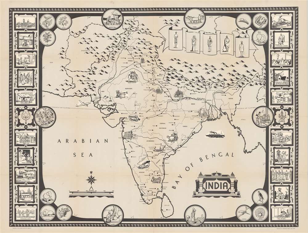
India.
sold
- Digital Map Information
- Suitable for large format printing
- Full resolution TIFF file
- ICC color profile embedded
- Delivered instantly via download link
This is a 1946 Friendship Press pictorial map of India, in a rare incomplete proof state. Predating the Partition of India by one year, the map depicts the region from Iran to Burma and from China and the Soviet Union to Sri Lanka (Ceylon). Profile views of buildings mark certain cities, such as the Taj Mahal, at Agra. Other cities and towns are labeled throughout, including Bombay, Hyderabad, Peshawar, Lahore, Delhi, Calcutta, and Karachi. Provinces throughout India are illustrated and labeled. Railroads connect almost all of India's major cities. India's natural wonders, the Himalayas, and the Indus and Ganges Rivers are also evident. (more details)
Welcome to Tampa - a great place to live!

Newcomers' Guide to Tampa.
sold
This is a 1981 Paul Hagedorn pictorial map of Tampa, Florida. Depicting from Lutz to MacDill Air Force Base and from Citrus Park to Temple Terrace, neighborhoods throughout Tampa are labeled by black block letters. Major roads are illustrated and labeled, some of which follow an organized grid. Others, like the Crosstown Expressway and I-4, wind their way through the city. The Tampa International Airport, Tampa Stadium, the University of South Florida (USF), Busch Gardens, and the Museum of Science and Industry all appear. Old Tampa Bay, Hillsborough Bay, and McKay Bay are filled with sailboats, fishing boats, and other watercraft. An inset situated in the lower right corner focuses on downtown Tampa and highlights City Hall, the Courthouse, library, and the Curtis-Hixson Hall Tampa Museum. (more details)
Highlights Iraq's historical heritage.
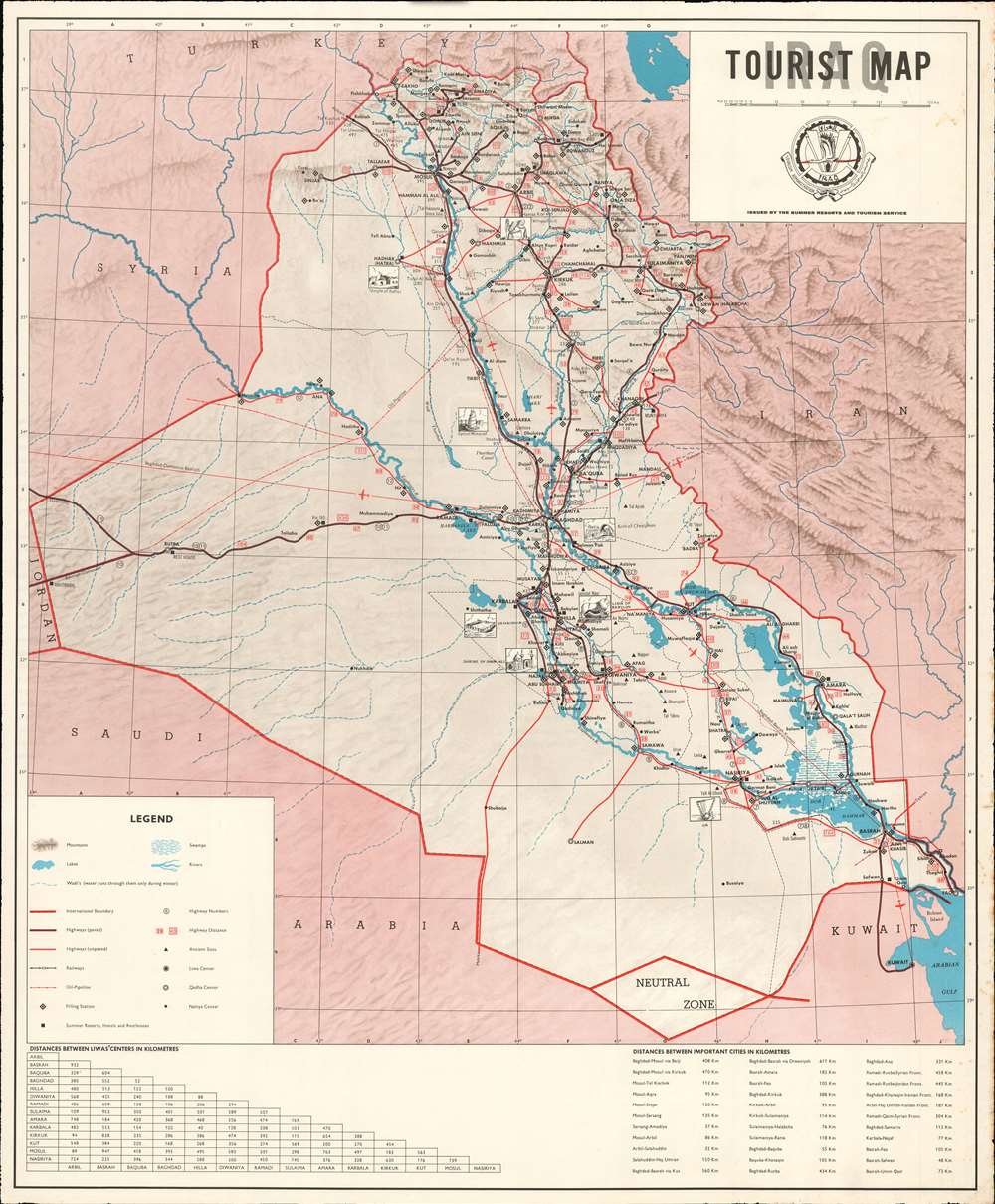
Iraq Tourist Map.
sold
This is a c.1970 Summer Resorts and Tourism Service tourist map of Iraq. Artistic views highlight eight ancient sites across Iraq. Among these are the ancient city of Ur, the Shrine of Imam Ali in Najaf, the Malwiya Mosque (also known as the Great Mosque of Samarra - labeled here as 'Spiral Minaret'), the Temple of Hatra (feared destroyed by ISIL in 2016, but the damage was less extensive than initially feared), the Lamassu or Winged Bull of Nineveh (literally defaced by ISIL in 2015), the Arch of Ctesiphon in Taq Kasra, and the Lion of Babylon near Babylon. Cities and towns are labeled throughout, with different symbols relating to each one's relative size. Paved and unpaved highways, railways, and oil pipelines are traced. Black diamonds mark filling stations, a necessity of modern travel. (more details)
One of the few early official Spanish Maps of the New World.
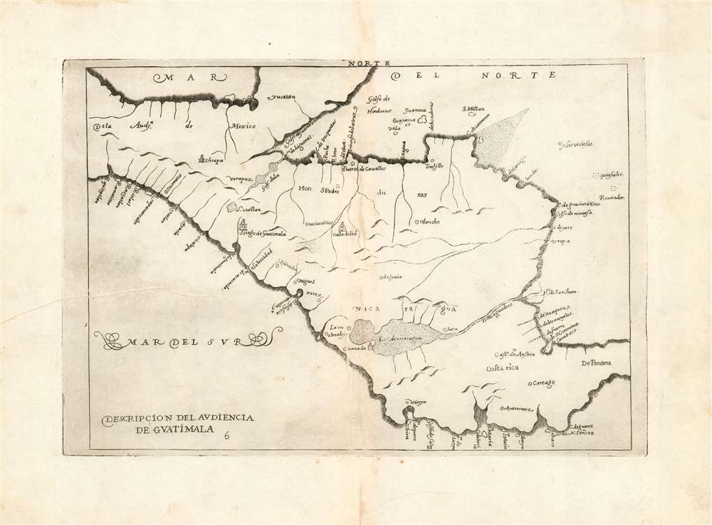
Descripcion del Audiencia de Guatimala.
sold
- Digital Map Information
- Suitable for large format printing
- DPI: 600
- File Size: 5.2 MB
- File Type: ZIP / TIFF
- ICC color profile embedded
- Delivered instantly via download link
This is a handsome example of Antonio de Herrera y Tordesillas' 1726 map of the Audience of Guatemala, which includes modern-day Nicaragua, Costa Rica, Panama, and part of Mexico. It is one of the very few early maps of parts of the New World produced based on official Spanish sources. Spain for the most part maintained a strict policy of secrecy regarding its discoveries in the Americas. It was first included in Herrera's 1601 Descripcion de las Indias Occidentales, the geographical supplement to Herrera y Tordesillas' history of the Spanish exploration of the Americas. (This example is from the second Spanish edition of the work, of 1726. Despite Herrera y Tordesillas not having ever been to the Americas, this work is important in containing geographical information collected by the Spanish in the administration of their colonies, including manuscript charts of Juan López de Velasco. This particular work is one of those derived from Velasco's charts. Interior details are sparse, perhaps due to Spanish concerns of secrecy. Even so, the map shows a number of the chief colonial cities of the region: Santiago de Guatemala, Valladolid, Puerto de Cavallos, and Granada for example. (more details)
The explorations of the HMS Alceste in East Asia.
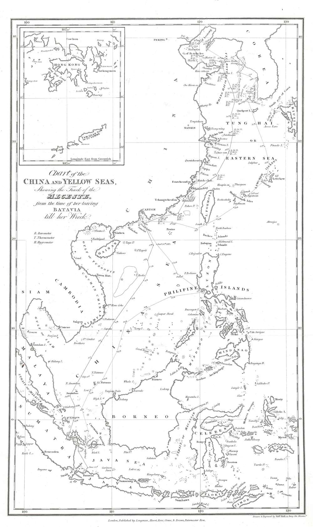
Chart of the China and Yellow Seas, Showing the Track of the Alceste, from the time of her leaving Batavia till her wreck.
$400.00
Acquire
- Digital Map Information
- Suitable for large format printing
- Full resolution TIFF file
- ICC color profile embedded
- Delivered instantly via download link
This is an 1818 Sidney Hall map of East Asia tracing the route of the Alceste during its time in the region serving the Amherst Embassy. The map depicts the region from China to Kyushu (Kiusiu), one of the Japanese home islands, and from Liaodong Bay to Indonesia. Every coastline is illustrated in incredible detail, which appears in stark contrast to the completely blank inland areas. Major cities, such as Beijing (Pekin), Nanjing (Nankin), Guangzhou (Canton), and Saigon (Ho Chi Minh City), are identified. Many islands in the Philippines are labeled, including Luzon, Mindoro, Leyte, Samar, Mindanao, and Cebu (Zebu). Taiwan (Formosa), Malaya, Sumatra, Java, Borneo, Celebes, and Timor are also identified. An inset situated in the upper left corner focuses on Hong Kong and Kowloon. (more details)
The oldest connection between Europe and Asia: the Aleppo - Basra Caravan Route.
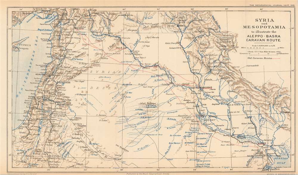
Syria and Mesopotamia to illustrate the Aleppo-Basra Caravan Route.
sold
- Digital Map Information
- Suitable for large format printing
- File Size: 7.57 MB
- File Type: ZIP / TIFF
- ICC color profile embedded
- Delivered instantly via download link
This is a 1918 Royal Geographical Society map of Syria and Mesopotamia, highlighting the ancient caravan route between Aleppo and Basra. Depicting from Cyprus to the Persian Gulf, red dotted lines trace the old caravan routes between Aleppo, Syria, and Baghdad and Basra, Iraq. Aleppo, Baghdad, and Basra are underlined in red to emphasize their importance. Numerous other cities, including Jerusalem, Beirut, Mosul, Gaza, and Damascus, are identified, and the region's rivers, including the Tigris and Euphrates, are illustrated in blue. The Hamrin Mountains, a mountain range in northeastern Iraq, act as the map's eastern boundary. (more details)
Highlights the natural wonders of the State of Maine - including Acadia National Park on Mount Desert Island.
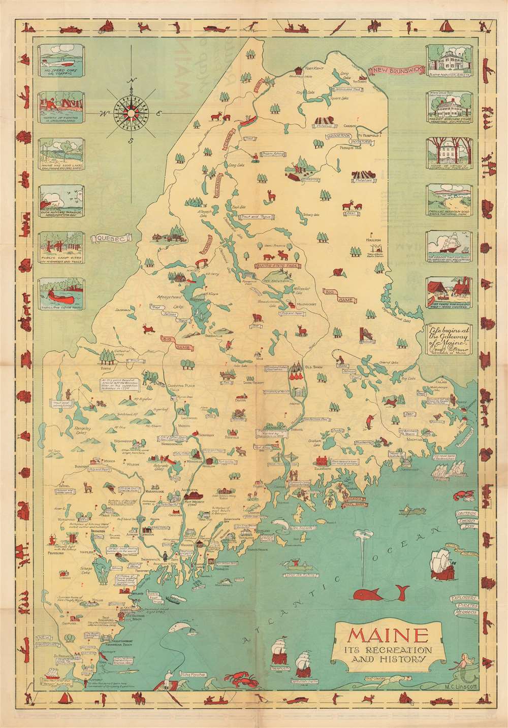
Maine Its Recreation and History.
sold
- Digital Map Information
- Suitable for large format printing
- File Size: 25.34 MB
- File Type: ZIP / TIFF
- ICC color profile embedded
- Delivered instantly via download link
This is a 1935 Mellon C. Linscott pictorial map of Maine. Charmingly illustrated and attractively colored, Linscott's map traces Maine's history, promotes its industries, and highlights the many recreational opportunities afforded to locals and visitors alike. Maine's frontier past is placed at the forefront, with numerous forts illustrated throughout the state, including Fort William Henry, Fort Halifax, and Fort Western. Both Champlain and Captain John Smith's voyages are references, and sites visited by Champlain are noted. Birthplaces of luminaries that hail from Maine are also marked, including Henry Wadsworth Longfellow and Harriet Beecher Stowe. Colleges and universities are illustrated throughout the state, as are other famous buildings. (more details)
A charming pictorial map of part of El Salvador between La Libertad and San Salvador.
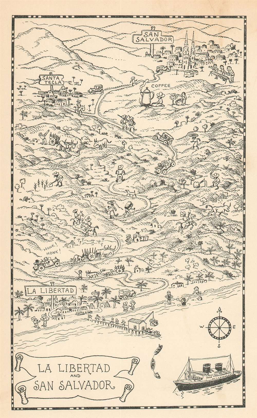
La Libertad and San Salvador.
sold
- Digital Map Information
- Suitable for large format printing
- File Size: 2.87 MB
- File Type: ZIP / TIFF
- ICC color profile embedded
- Delivered instantly via download link
Created for passengers on Grace Line cruises, this is a 1934 Jo Mora pictorial map of El Salvador. La Libertad, El Salvador, served as one of the ports of call on some Grace Line cruises, and passengers were invited to disembark and travel the twenty-six miles to San Salvador, El Salvador's capital. Mora lends his style to this excursion and draws passengers parading down a dock toward cars waiting to ferry them to the city. Locals are also illustrated tending their fields and riding on horseback. One individual is shown stoking a fire under a gigantic coffee pot! (more details)
The Theatre of the Anglo-Afghan Wars.
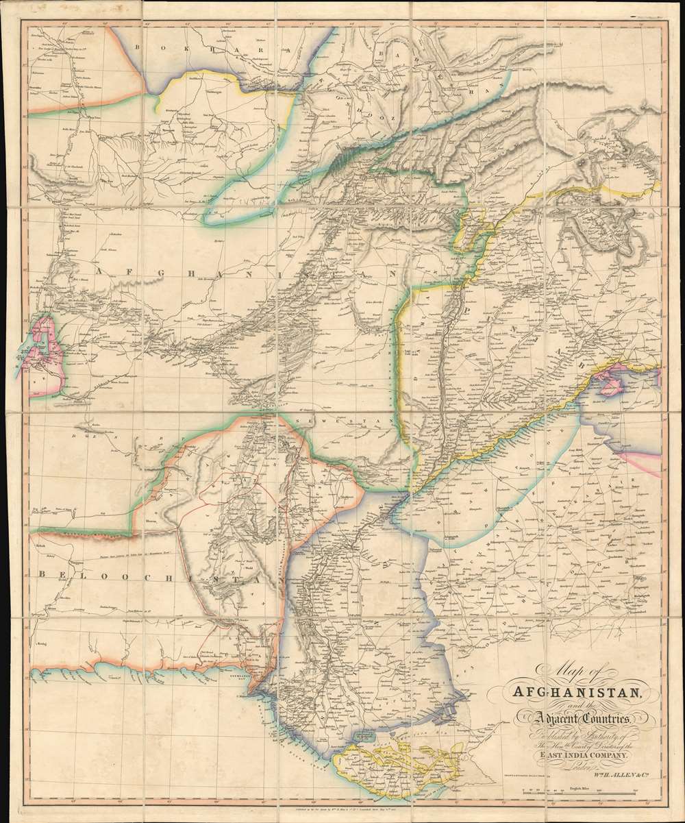
Map of Afghanistan and the Adjacent Countries Published by the Authority of the Hon.ble Court of Directors of the East India Company.
sold
- Digital Map Information
- Suitable for large format printing
- Full resolution TIFF file
- ICC color profile embedded
- Delivered instantly via download link
This is an 1842 Allen map of Afghanistan and its surrounds, showing the theatre of the First Anglo-Afghan War: the first major conflict of ‘The Great Game’ for British control of India. It was printed just four months after the disastrous Retreat from Kabul. Not only are the passes between Kabul and Peshawar shown in detail but the infamous 'Khyber Pass' is labeled clearly. (surpassing other contemporaneous maps of the area ) that it seems clear that the map reflects the best British understanding of Afghanistan’s geography at the time of the conflict. (more details)
A portrait of Grant as the victorious general during the American Civil War.

General Grant.
sold
- Digital Map Information
- Suitable for large format printing
- File Size: 37.06 MB
- File Type: ZIP / TIFF
- ICC color profile embedded
- Delivered instantly via download link
This is a finely engraved 1885 Currier and Ives lithograph portrait of General Ulysses S. Grant (April 27, 1822 - July 23, 1885). Likely published shortly after his death, this portrait depicts Grant as he appeared around 1864, during the American Civil War (1861 - 1865). Both dignified and somber, Grant is presented in his double-breasted Union uniform bearing three-star rank insignia on each shoulder. Grant was the second three-star general in the United States Army (George Washington was the first), granted the rank in 1864 when he took command of the Army of the Potomac. In 1866, Grant become the first four-star general when he was appointed General of the Army. Ulysses S. Grant was a complicated man with a complicated legacy. This portrait captures a moment in time and commemorates a man that fought for the soul of his country. (more details)
Striking chromolithograph of Yellowstone!
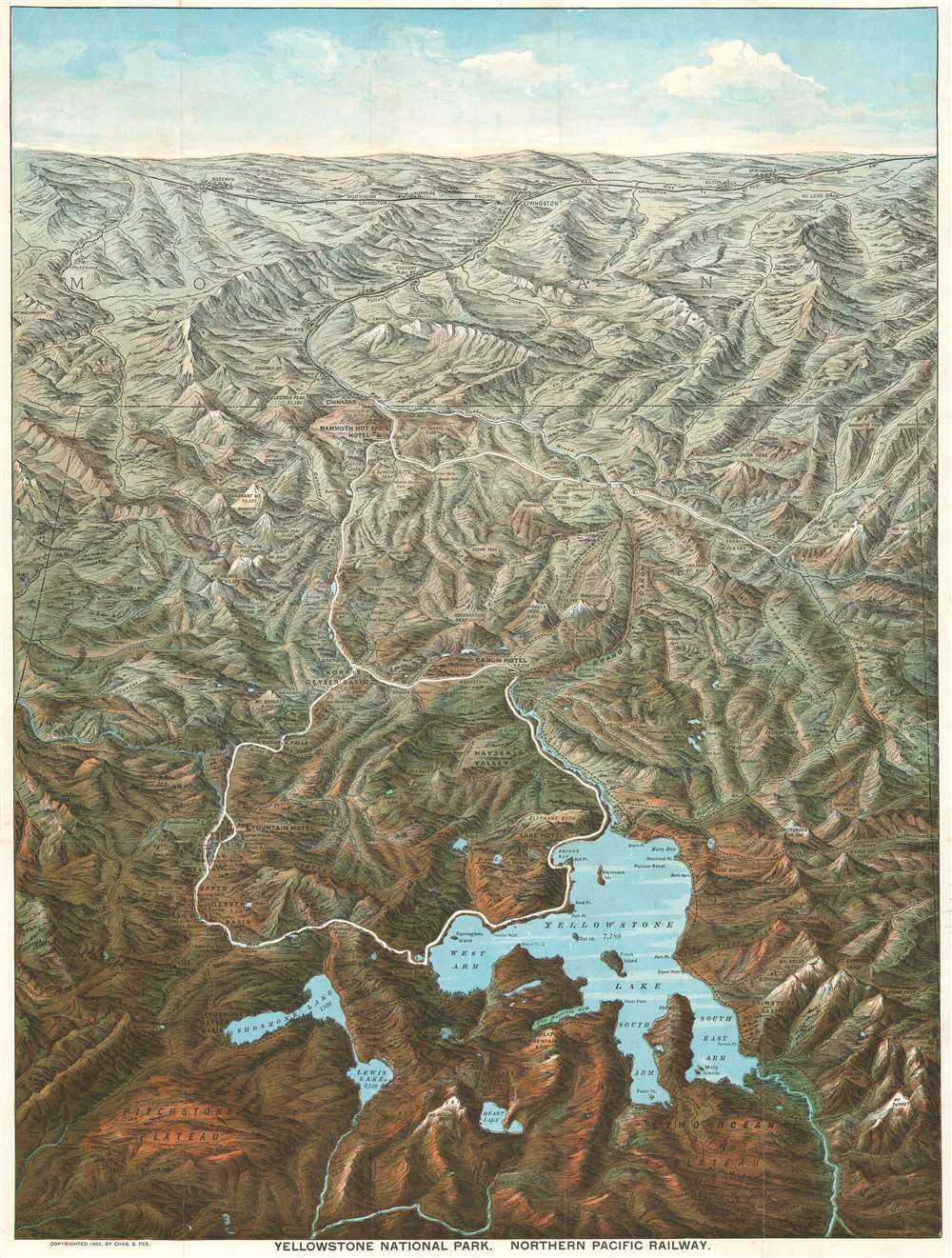
Yellowstone National Park. Northern Pacific Railway.
sold
- Digital Map Information
- Suitable for large format printing
- Full resolution TIFF file
- ICC color profile embedded
- Delivered instantly via download link
This is an 1895 Charles S. Fee chromolithograph bird's-eye view map of Yellowstone National Park, Wyoming. With Yellowstone Lake in the foreground, the view extends northward as far as Bozeman and Livingston, Montana. Fee includes impressive detail throughout, identifying mountains, plateaus, lakes, geyser basins, and hot springs. Yellowstone landmarks, such as Elephant Back, the Grand Canyon, and Old Faithful (in the Upper Geyser Basin), are labeled. The Lake Hotel, Fountain Hotel, Canon Hotel, and Mammoth Hot Springs Hotel all appear. The Yellowstone River snakes its way through the park and roads (colored white, so they stand out) wind their way from north to south. The Northern Pacific Railway runs across the top of the view and south from Livingston to Cinnabar, just outside Yellowstone. (more details)
Produced for the Army Command and General Staff School during World War II.
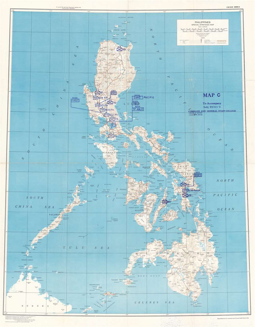
Philippines Special Strategic Map. Map C to Accompany Subj 5532 / 3 Command and General Staff College.
sold
- Digital Map Information
- Suitable for large format printing
- File Size: 97.29 MB
- File Type: ZIP / TIFF
- ICC color profile embedded
- Delivered instantly via download link
This is a 1944 Command and General Staff School map of the Philippines. Created during World War II by the Army Map Service, this map was repurposed by the Command and General Staff School likely for use in a class at the Command and General Staff College. Standard military map symbols identify units on Luzon, Leyte, and Cebu. While many of these units, such as the 70th Infantry Division, the 83rd Infantry Division, the 89th Infantry Division, and the 504th Fighter Squadron, saw combat in World War II, all were deployed in the European theater in 1944 and 1945. Task Force Able did serve in the Pacific and was the first unit to enter Tokyo Bay. However, it was not organized until August 1945. Other units, such as the 27th Corps, never existed. This leads us to speculate that this map was used as part of a hypothetical training exercise at the Command and General Staff College. Unfortunately, we have been unable to locate any information concerning the specific course or exercise. (more details)
A richly detailed debut work by one of the most prolific German mapmakers of the early 18th Century.
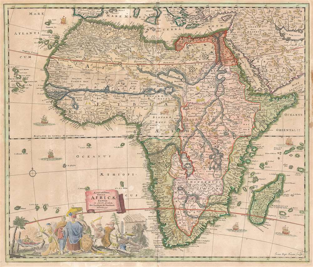
Accuratissima Totius Africae Tabula in Lucem producta per Iacobum de Sandrart Norimbergae.
sold
- Digital Map Information
- Suitable for large format printing
- Full resolution TIFF file
- ICC color profile embedded
- Delivered instantly via download link
This is Jacob Sandrart's scarce, separately published 1697 map of Africa. While cartographically derived from the influential 1670 Totius Africae Accuratissima Tabula by Frederic de Wit, this map is notable for being the first or second signed engraving by Johann Baptist Homann, who would become one of the most important German map publishers of the 18th century. (The other contender is Sandrart's map of the Americas, similarly derived from the work of De Wit.) These maps' production in 1697 just preceded the opening of Homann's own shop, in 1702. (more details)
A rare plan of Boston bordered by advertisements - including one for a piano shop.
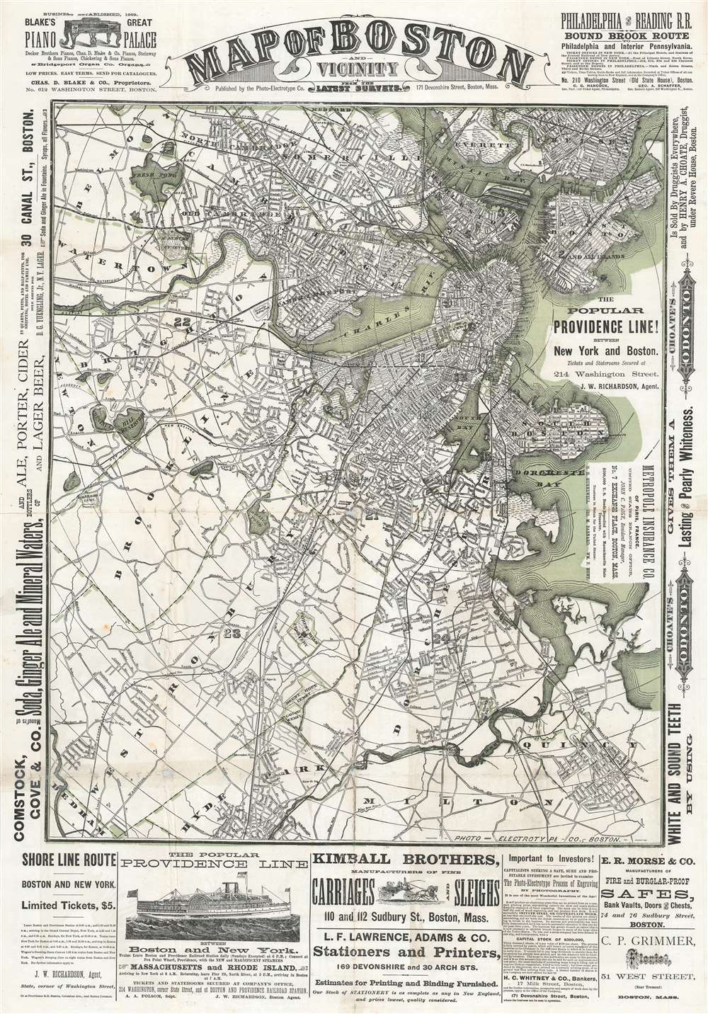
Map of Boston and Vicinity from the Latest Surveys.
sold
- Digital Map Information
- Suitable for large format printing
- Full resolution TIFF file
- ICC color profile embedded
- Delivered instantly via download link
This is a c. 1880 Photo-Electrotype Company city plan or map of Boston and vicinity. The map depicts the region from Newton to East Boston and from Medford and Chelsea to Milton, Hyde Park, and Dedham. Innumerable streets are illustrated and add to the incredible amount of detail presented. Railroad tracks, bridges, parks, and wharves represent Boston's economic importance. The 'urban sprawl' spreading out from the historic center of town underscores the city's growth and prosperity. Advertisements for pianos, alcohol and ginger ale, ferries between New York and Boston, carriages, and printers occupy the borders. A smaller map of central Boston and a bird's-eye view of Boston Harbor are printed on the verso, along with more advertisements. (more details)
Proof state of a rare pictorial wall map of India.

Picture Map of India.
sold
- Digital Map Information
- Suitable for large format printing
- Full resolution TIFF file
- ICC color profile embedded
- Delivered instantly via download link
This is a 1946 Friendship Press pictorial map of India, in a rare incomplete proof state. Predating the Partition of India by one year, the map depicts the region from Iran to Burma and from China and the Soviet Union to Sri Lanka (Ceylon). Profile views of buildings mark certain cities, such as the Taj Mahal, at Agra. Other cities and towns are labeled throughout, including Bombay, Hyderabad, Peshawar, Lahore, Delhi, Calcutta, and Karachi. Provinces throughout India are illustrated and labeled. Railroads connect almost all of India's major cities. India's natural wonders, the Himalayas, and the Indus and Ganges Rivers are also evident. (more details)
Created by a veteran of the Sicily Campaign.
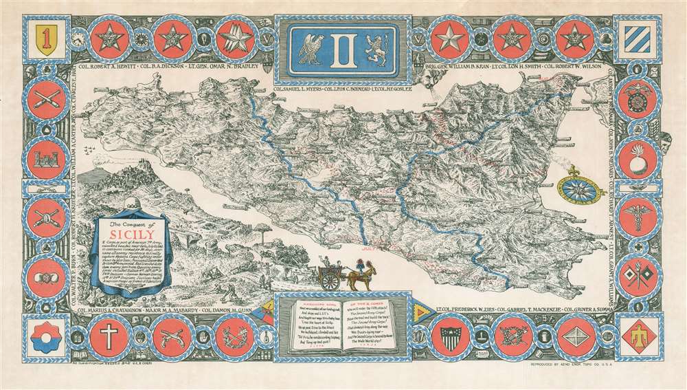
The Conquest of Sicily.
sold
- Digital Map Information
- Suitable for large format printing
- File Size: 16.73 MB
- File Type: ZIP / TIFF
- ICC color profile embedded
- Delivered instantly via download link
This is a 1943 Walter P. Burn pictorial map of Sicily celebrating the Allied conquest of the island and created for the soldiers of II Corps. Depicting Sicily in its entirety, numerous cities and towns are identified throughout the island, including Gela (where the 1st Infantry Division landed), Marsala, Palermo, and Messina. The blue lines demarcate the fighting sector assigned to II Corps. Lines of red dots follow the retreat of Axis defensive lines and underscore Allied progress across the island as of July 10 (the day of the landings), July 13, August 1-6, and August 13. The insignia in the corners represent the U.S. 9th Infantry Division, the U.S. Seventh Army, the U.S. 1st Infantry Division, the U.S. 3rd Infantry Division, and the U.S. 45th Infantry Division. The insignia of II Corps occupies the top center. The smaller insignia along the sides, top, and bottom represent more specific units, such as the Signal Corps, Engineers, Medical Corps, and Artillery. The three stars just to the left of the II Corps insignia signify Lieutenant Omar Bradley, the commander II Corps during Operation Husky, and the one star on the right references Brigadier General William B. Kean, Bradley's chief of staff. Names of officers surround the entire map and create an inner border, and a cartouche in the lower-left corner provides a summary and explanation of the piece. (more details)
Likely published in the months leading up to the Allied invasion of Sicily.

Road Map 1 : 500000 Sicily.
sold
- Digital Map Information
- Suitable for large format printing
- File Size: 28.4 MB
- File Type: ZIP / TIFF
- ICC color profile embedded
- Delivered instantly via download link
This is a 1943 Allied Force Headquarters road map of Sicily. Likely published in the months leading up to Operation Husky, the Allied invasion of Sicily, text situated on the upper border states 'For Use of War Air and Navy Depts Only. Not for Distribution'. Red lines mark significant highways throughout the island, allowing Allied vehicles a clear understanding of the best roads to use while fighting in Sicily. Thick black lines and parallel thin black lines trace smaller roads. Cities, towns, and villages are labeled, such as Ragusa, Syracuse (Siracusa), Catania, Messina, and Palermo. Other symbols identify seaplane bases, large and small airfields, and emergency landing locations. Mount Etna, Sicily's famous active volcano, is prominently illustrated on the upper right between Messina and Catania. Insets situated in the lower-left corner and along the right side contain city plans of many major cities, including Agrigento, Palermo, Catania, Messina, and Syracuse. Red lines mark the important highways through each of these cities. (more details)
Traces William Pitt Amherst's trek across China after he was refused entry into Beijing.

Map of that part of China through which the Embassy passed on its Route from Pekin to Canton.
sold
- Digital Map Information
- Suitable for large format printing
- Full resolution TIFF file
- ICC color profile embedded
- Delivered instantly via download link
This is an 1818 Sidney Hall map of eastern China. Depicting from just north of Beijing to just south of Guangzhou, a thin dotted and dashed line follows the route of the Amherst Embassy to the Chinese Emperor from Beijing (Pekin) to Guangzhou (Canton). Dates appear along the route, allowing the viewer some understanding of the group's progress south. Cities and towns along the route are identified, along with numerous others throughout the rest of the map. The Yangtze River is prominently illustrated, along with smaller rivers and several mountain ranges. The map was reduced from a larger map produced by the Jesuits and included greater detail than the Jesuit map in the region surrounding the Embassy's route. (more details)