
A comical pictorial map of Yellowstone National Park and Jackson Hole.
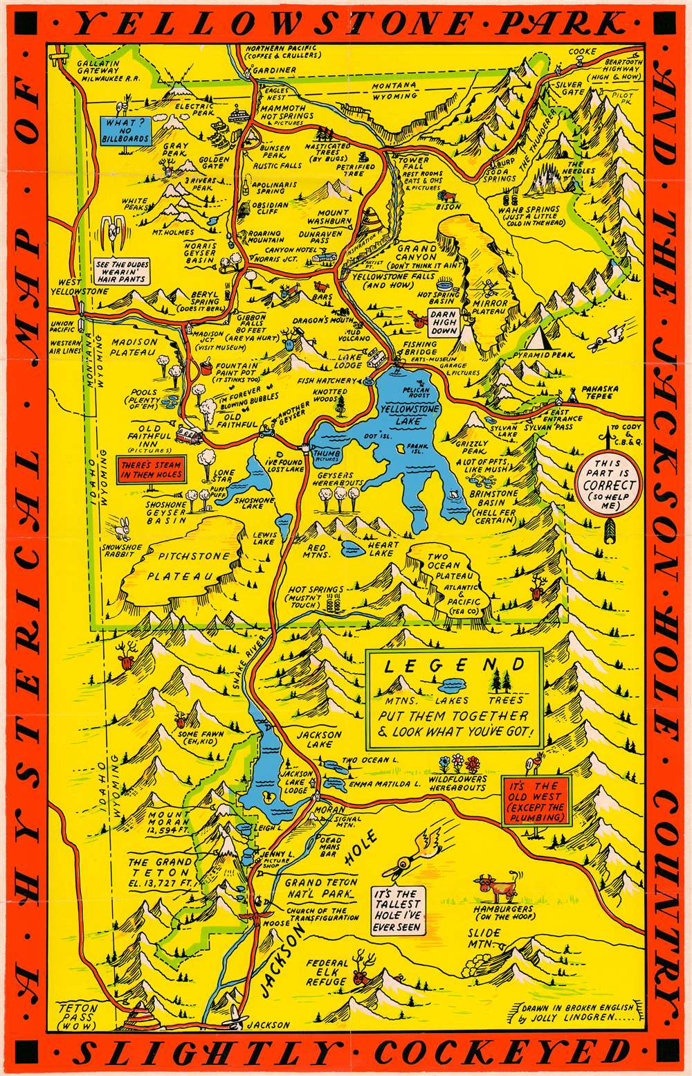
A Hysterical Map of Yellowstone Park and the Jackson Hole Country. Slightly Cockeyed.
sold
- Digital Map Information
- Suitable for large format printing
- File Size: 13.25 MB
- File Type: ZIP / TIFF
- ICC color profile embedded
- Delivered instantly via download link
This is a hilarious c. 1936 Jolly Lindgren pictorial map of Yellowstone National Park and Jackson Hole, Wyoming. The map depicts the region from Idaho to the Absaroka Range and from Montana to Jackson. Major roadways are marked in red with important locations, topography, and more illustrated pictorially. Humorous asides and illustrations are present throughout. Some of the amusing annotations include:
It has been argued that the bright colors and humorous nature of the map are intended to inspire good spirits against the backdrop of national social and economic depression - but such might be said of the entire genre of cartoon pictorial maps which were experiencing a golden age at this time. (more details)
- Old Faithful singing 'I'm Forever Blowing Bubbles'
- Fountain Paint Pot (It Stinks Too)
- Yellowstone Falls (And How)
- Wahb Springs (Just a Little Cold in the Head)
- Hamburgers (on the Hoof)
- Hot Springs (Mustn't Touch)
It has been argued that the bright colors and humorous nature of the map are intended to inspire good spirits against the backdrop of national social and economic depression - but such might be said of the entire genre of cartoon pictorial maps which were experiencing a golden age at this time. (more details)
A first edition chromolithograph bird's-eye-view of New England electric and steam railroads at the turn of the century.

Trolley Wayfinder Birds Eye View of Trolley Routes in New England.
sold
- Digital Map Information
- Suitable for large format printing
- File Size: 22.77 MB
- File Type: ZIP / TIFF
- ICC color profile embedded
- Delivered instantly via download link
A radiantly rich chromolithograph first edition bird's-eye view style pocket map of New England issued in 1904 by John Jenness Lane and George Walker for the New England Street Railway Club. The view was produced upon Lane's election as secretary of the Club to promote the extensive but ephemeral New England streetcar network. Centered on Boston, New England's streetcar system is revealed extending north as far as Lewistown, Brunswick and Yarmouth, Maine; south to Narragansett Bay, Newport and New Bedford, Massachusetts; and west as far as Worcester. Both electric railroads and steam railroads are noted here, with red lines indicating an electric railroad and a black line marking the route of a steam railroad. Various parks, lighthouses, historic sites, and geographical features are also labeled. Popular routes are highlighted by inset maps and include: Springfield-Turners Falls, Worcester-Springfield, Springfield-New York City, Pittsfield and Vicinity, Rochester-Nashua, Portsmouth-Lewiston, and a triangle route from Worchester to Providence to New London and back. An inset of the vicinity of Boston is situated in the upper left. (more details)
One of the Only Acquirable Turkish Maps of Singapore and Borneo
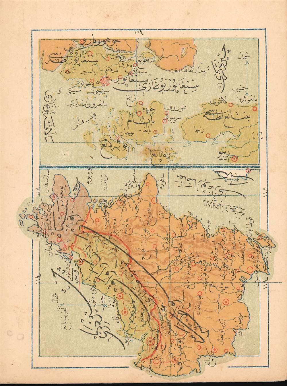
(Turkish Map of Singapore and Borneo)
sold
- Digital Map Information
- Suitable for large format printing
- File Size: 1.15 MB
- File Type: ZIP / TIFF
- ICC color profile embedded
- Delivered instantly via download link
This is a 1909 Turkish map of the Singapore Strait and island of Singapore, combined with a map of Borneo, produced by the Turkish educator and publisher Mehmet Eşref. Most likely the only specific Ottoman map of these areas available to the collector. All titles and descriptive text are in Ottoman Turkish. On the Singapore Straits portion of the map, the city of Singapore itself is marked in red hachure. The map of Borneo is oriented to the west, and its colonial division between the English and the Dutch -which would materially affect the political boundaries of post-colonial Borneo- is indicated with color. Chromolithograph. (more details)
One of the Only Acquirable Turkish Maps of showing Transatlantic Telegraphs
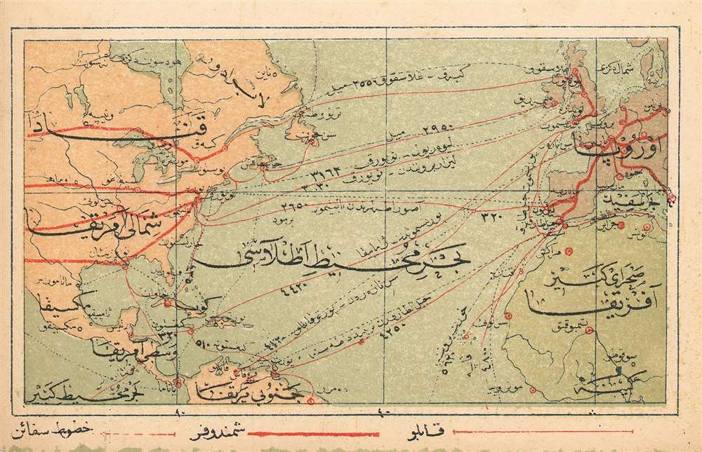
(Turkish Map of North America and Europe showing Transatlantic and Transcontinental Telegraph Cables
sold
- Digital Map Information
- Suitable for large format printing
- File Size: 1.09 MB
- File Type: ZIP / TIFF
- ICC color profile embedded
- Delivered instantly via download link
This is a 1909 Turkish map of North America and Europe, marking the positions of major telegraph cables, both transatlantic and transcontinental. It was produced by the educator and publisher Mehmet Eşref, and may well be the only such printed map available to the collector. All titles and descriptive text is in Ottoman Turkish. National borders are not shown, but major features such as the Great Lakes and the Mississippi do appear. The telegraph routes are marked in red. Chromolithograph. (more details)
Attracive Miniature Turkish Hemisphere Maps

[Turkish Maps of the Eastern and Western Hemispheres]
sold
- Digital Map Information
- Suitable for large format printing
- File Size: 2.15 MB
- File Type: ZIP / TIFF
- ICC color profile embedded
- Delivered instantly via download link
This is a pair of 1909 Turkish Eastern and Western Hemisphere maps, produced by the educator and publisher Mehmet Eşref. Together they comprise one of the few Turkish maps of the world available to the collector. All titles and descriptive text are in Ottoman Turkish. National borders are not shown, but large geographical features - the Great Lakes, the Mississippi River, the Amazon and the Nile do appear. Antarctica is shown in a tentative fashion. Chromolithograph. (more details)
The Earliest Acquirable Map of the State of Louisiana

Louisiana.
sold
- Digital Map Information
- Suitable for large format printing
- DPI: 600
- File Size: 13.31 MB
- File Type: ZIP / TIFF
- ICC color profile embedded
- Delivered instantly via download link
This is 1814 Carey map of Louisiana is the first map of the state (apart from Carey’s own separately-issued, smaller, 1813 map.) It covers the entire state, highlighting the border in outline color. The map’ s best detail adheres to the course and ... (more details)
A Rare, Attractive Miniature Turkish Plan of Istanbul
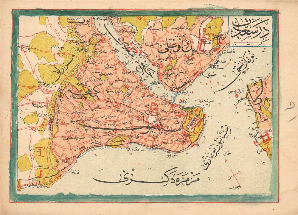
(Turkish Plan of Istanbul and its Surrounds)
sold
- Digital Map Information
- Suitable for large format printing
- File Size: 1.33 MB
- File Type: ZIP / TIFF
- ICC color profile embedded
- Delivered instantly via download link
This is a 1909 Turkish plan of Istanbul, produced by the Turkish educator and publisher Mehmet Eşref. All titles and descriptive text are in Ottoman Turkish. Areas within the city and its suburbs are made distinct with color. Depth soundings are noted in the waterways, and the famous 'Maiden's Tower,' or Kiz Kulesi, is marked just off the shore from Üsküdar. Chromolithograph. (more details)
Murray provides scientific proof of the long believed in southern continent - Antarctica!
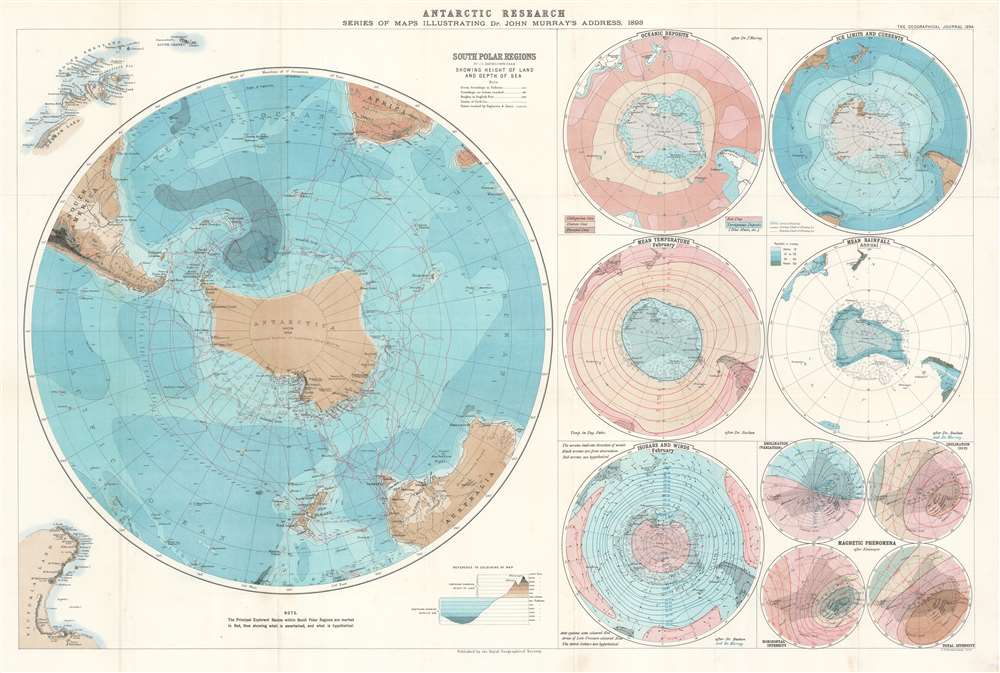
Antarctic Research. Series of Maps Illustrating Dr. John Murray's Address, 1893.
sold
- Digital Map Information
- Suitable for large format printing
- File Size: 30.55 MB
- File Type: ZIP / TIFF
- ICC color profile embedded
- Delivered instantly via download link
This is an 1894 John George Bartholomew map of Antarctica created to accompany Dr. John Murray's address to the Royal Geographical Society (RGS) in 1893. Consisting of one large map of the south polar regions and several smaller ones on one sheet, each map center's on Murray's proposed outline of Antarctica as he believed it existed following his experience as part of the Challenger Expedition. Over the course of his presentation to the RGS, Murray stated that, because of the presence of certain rocks dredged from the ocean floor in the south polar region, he was capable of scientifically confirming the long-hypothesized existence of an Antarctic continent. He even went so far as to state that he believed the continent to be larger than Australia! Each of the maps present on this sheet bears an illustration of Murray's proposed outline of Antarctica. A large portion of the data presented in these maps came directly from the archives of the Challenger Expedition, making a large portion of it new information to the public. (more details)
Engaging Harrison orthographic projection FORTUNE Magazine map printed during World War II.
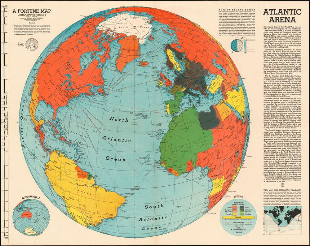
Atlantic Arena. A Fortune Map. Orthographic Series I.
sold
- Digital Map Information
- Suitable for large format printing
- File Size: 38.43 MB
- File Type: ZIP / TIFF
- ICC color profile embedded
- Delivered instantly via download link
This is a June 1942 Richard Edes Harrison orthographic map of the Atlantic theatre of World War II, intended to reinforce American support for actively prosecuting the war in Europe. Centered on the North Atlantic, the map shows all of North America and the Atlantic coastlines of South America, Africa, and Europe. The map's intent is to emphasize the growing importance of the Atlantic theatre to an American public whose attention had been held by the Pacific theatre of the war. A key entitled 'The Line-Up on May 10, 1942' indicates how color is used on the map to identify the affiliation the nations shown. Red for the Allies and black for the Axis, gradations of those colors to indicate occupied countries, gold for pro-Ally nations and green for pro-Axis. Yellow indicates neutral nations. While the sporting reference of 'The Line-Up' might be glib, the strong implication is not only that sides exist in the conflict, but that they are unavoidable: 'true neutral' nations are vastly outnumbered by active players in what can easily be seen is a World War. The depicted sea routes, with the distances between key cities serve to emphasize the immediacy of the European conflict for Americans. Despite the apparently great Atlantic distances, routes between New York and Europe are dwarfed by the vast expanses of ocean lying between the North American west coast and Japan. The immediacy of the European theatre is being emphasized here. These were important points to drive home: while America's war throughout 1942 had been primarily fought in the Pacific, change was in the air. In the Atlantic, the German U-Boat war was going through a disturbing period of success. Britain was fighting Germany and Italy in North Africa. But at the same time, the first American forces were finding their way east: Air Corps bases had by May been established in the UK, and the first U.S. ground forces (including the 1st Armored Division) had been committed to Ireland. While the United States had been galvanized for war against Japan following Pearl Harbor, public support for a European war was less sanguine. (more details)
Highlights the Statue of Liberty, the Empire State Building, and Rockefeller Center.

Looking Up Manhattan Island.
sold
- Digital Map Information
- Suitable for large format printing
- File Size: 13.2 MB
- File Type: ZIP / TIFF
- ICC color profile embedded
- Delivered instantly via download link
This is a 1936 H.M. Gousha Company pictorial map of New York City. The map depicts the island of Manhattan from the Hudson River to Queens and from the Poe Cottage in the Bronx to Liberty Island and the Statue of Liberty. Profile illustrations of famous sites dot Manhattan from one end to the other, with the Empire State Building, the Chrysler Building, the Metropolitan Museum of Art, the American Museum of Natural History, and Trinity Church among the highlights. Columbia University, the Met Cloisters, Hamilton Grange, Washington Square and the Arch, and Rockefeller Center are also illustrated. Yankee Stadium, the New York Botanical Garden, and the Bronx Zoo are shown in the Bronx. The newly-opened Triborough Bridge, Queensborough Bridge, Williamsburg Bridge, Manhattan Bridge, and Brooklyn Bridge are all illustrated, as is the Holland Tunnel, although it is marked only by dashed lines. (more details)
Showcasing New York State's Wealth of Lands Preserved for the Public
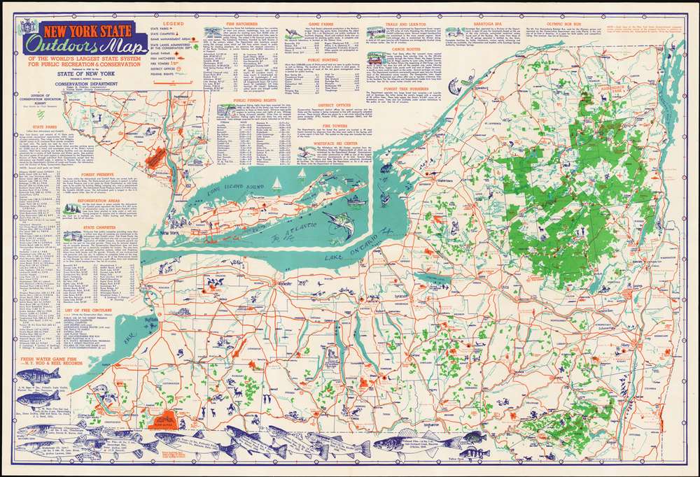
New York State Outdoors Map of the World's Largest State System for Public Recreation & Conservation.
sold
- Digital Map Information
- Suitable for large format printing
- File Size: 32.59 MB
- File Type: ZIP / TIFF
- ICC color profile embedded
- Delivered instantly via download link
This is a 1948 Map of New York State by illustrator (and New York State Superintendant of Conservation Education) Clayton Seagears, issued by the Conservation Department to promote the public use of New York's 'vast network of State parks,' especially for camping, swimming and fishing. The map is filled with drawings of animals, wildlife scenes, and people enjoying themselves hiking, hunting, canoeing, and even getting a massage in Saratoga Spa. Most of these scenes are drawn in a folksy, cartoonish style - but the map is also decorated with quite realistic drawings of the State's principal fresh water game fish, accompanied by the record catches of those fish, complete with location and date of the catch, weight of the fish, and the names of the lucky fishermen. (Arthur Lawton, for your 1944 catch of a 58 pound St. Lawrence Muskalonge, you are here immortalized.) (more details)
A fantastic pictorial map of South America highlighting the continent's flora, fauna, and man-made marvels.
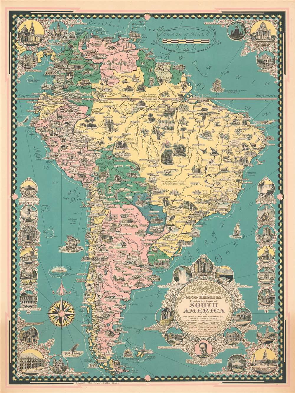
The Good Neighbor Pictorial Map of South America.
sold
- Digital Map Information
- Suitable for large format printing
- File Size: 35.15 MB
- File Type: ZIP / TIFF
- ICC color profile embedded
- Delivered instantly via download link
This is a 1942 Ernest Dudley Chase pictorial map of South America. The map depicts the continent from the Pacific Ocean to the Atlantic Ocean and from Costa Rica to Cape Horn. Incredibly detailed and beautifully illustrated, Chase highlights the wide array of flora and fauna that call South America home alongside its most spectacular natural and man-made sites. Illustrations of South American animals, including the condor, anteater, sloth, macaw, toucan, iguana, and chinchilla, fill the continent. The continent's other natural riches, such as Brazil's diamonds and emeralds, the rubber found in the Amazon, oil, cacao, and tea are also promoted. Cities and towns are labeled throughout, including Sao Paulo, Caracas, Bogota, Quito, La Paz, Lima, Montevideo, Buenos Aires, and Santiago. Each of these cities, along with many others, are also identified by illustrations of famous buildings, or, in the case of Rio de Janeiro, Copacabana Beach. Circular vignettes appear along all four borders and highlight famous buildings from across the continent, the majority of which are churches. Others illustrate world famous sites, such as Machu Picchu, Iguazu Falls, and the Christ the Redeemer statue in Rio de Janeiro. A portrait of Simón Bolívar is included below the title cartouche with a caption celebrating the liberation movement that he instigated from Colombia to Chile. (more details)
A beautiful 19th century view of the Jardin du Luxembourg and the Palais du Luxembourg - with families sailing ships on the basin just as they do today!

Palais de la Chambre des Pairs. Vue Prise du Jardin.
sold
- Digital Map Information
- Suitable for large format printing
- DPI: 600
- File Size: 12.24 MB
- File Type: ZIP / TIFF
- ICC color profile embedded
- Delivered instantly via download link
This is an 1845 Jules Arnout view of the Palais du Luxembourg and the Jardin du Luxembourg in Paris, France. The view overlooks the park from the southeast, with the basin in the foreground and the Palais du Luxembourg, the seat of the French Senate, dominating the view and acting as the main focal point. Small trees and shrubs line the paths, and young boys and their families play with boats on the basin, just as children do to this day. The bell towers of the Saint-Sulpice Church can be seen in the background. (more details)
Identifies schools, municipal buildings, and other sites around Key West and provides a short history of the island.
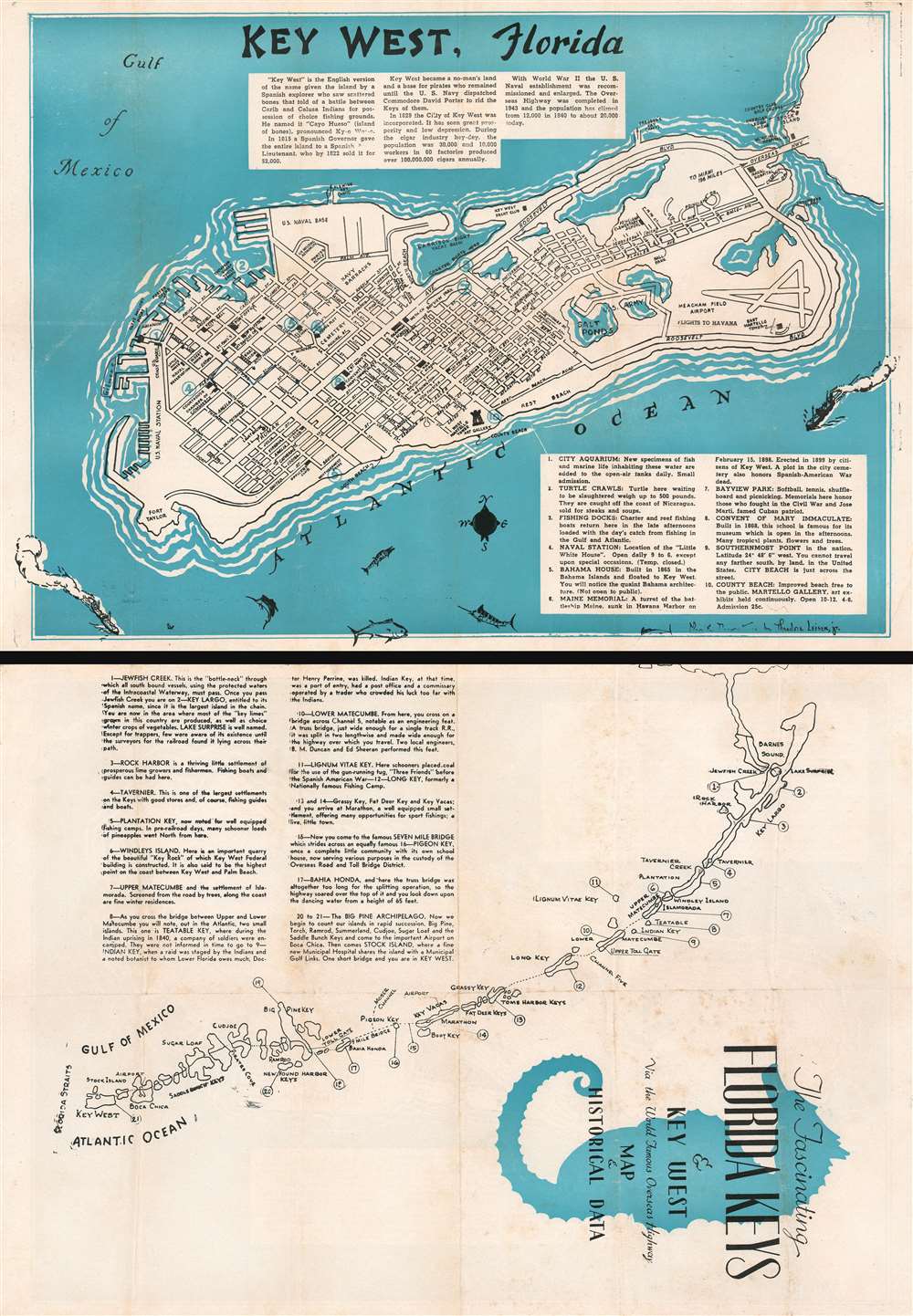
The Fascinating Florida Keys and Key West Via the World Famous Overseas Highway Map and Historical Data.
sold
- Digital Map Information
- Suitable for large format printing
- File Size: 22.66 MB
- File Type: ZIP / TIFF
- ICC color profile embedded
- Delivered instantly via download link
This is a c. 1957 Theodore Leiser, Jr. city map or plan of Key West, Florida. The map depicts the entirety of Key West from Fort Taylor to Stock Island and from the Gulf of Mexico to the Atlantic Ocean. Streets throughout the city are illustrated and labeled, with schools, city happ, the post office, and the West Martello Tower Art Gallery illustrated as well. The U.S. naval base and the navy barracks are identified, as is Meacham Field Airport. The Overseas Highway is labeled along with the naval hospital and the Key West Yacht Club. A short narrative history of Key West is included above the island, while an index of ten locations is situated in the lower right corner and provides short descriptions of these ten sites. A map of the Florida Keys is illustrated on the verso. Each key is labeled and an index in the upper left quadrant provides a sentence or two of information about each one. (more details)
The most important map of the Northeast Passage and pre-Behring map of the NE Asian Arctic.
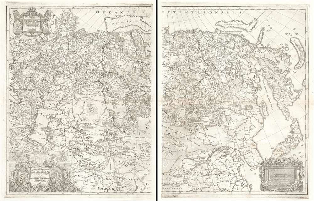
Nova Descriptio Geographica Tattariae Magnae Tam Orientalis Quam Occidentalis In Particularibus Et Generalibus Territoriis Una Cum Delineatione Totius Imperii Russici Imprimis Siberiae Accurate Ostensa.
sold
- Digital Map Information
- Suitable for large format printing
- DPI: 600
- File Size: 71.2 MB
- File Type: ZIP / TIFF
- ICC color profile embedded
- Delivered instantly via download link
A cartographic masterpiece defined by imprisonment, war, and obsession. This is the first edition of Philipp Johann von Strahlenberg's 1730 map of Russia and Siberia. Strahlenberg's expansive map is considered one of the largest, most groundbreaking, and unique maps of Russia to appear in the first half of the 18th century. It is of particular importance to the mapping of Siberia and the Russian Arctic, to establishing expectations for the viability of a Northeast Passage, and to the pre-Bering mapping of the Bering Strait. (more details)
Earliest printed specific map of Kurdistan.
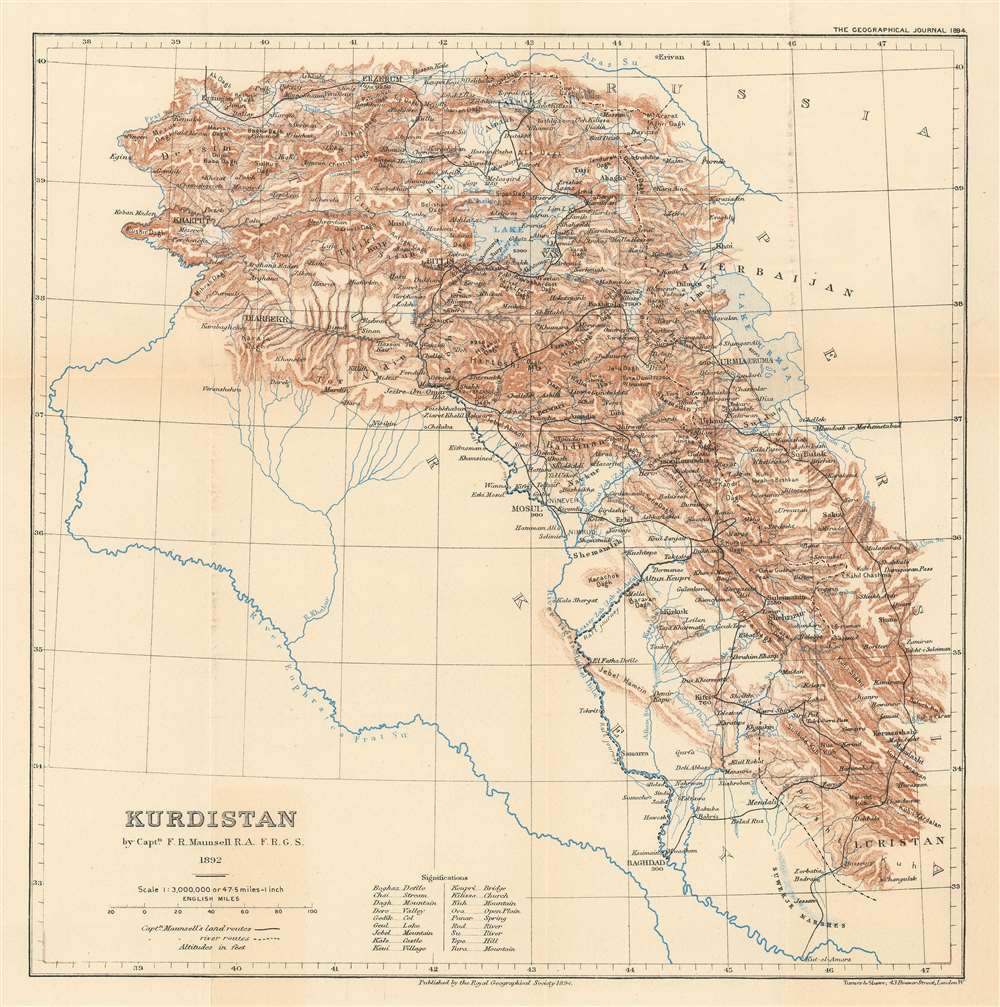
Kurdistan.
sold
- Digital Map Information
- Suitable for large format printing
- File Size: 8.17 MB
- File Type: ZIP / TIFF
- ICC color profile embedded
- Delivered instantly via download link
The earliest printed map specifically of Kurdistan - and a politically charged discovery resonant with modern times. Published in 1894, this map is based upon the firsthand explorations of Captain F. R. Munsell, who visited the region as British spy in the summer of 1892. The map covers what today is a hotly contested and unstable multi-national border region consisting of a mountainous region embracing parts of eastern turkey, Armenia, northern Iraq, northeastern Syria, and northwestern Iran. (more details)
Presenting the Predicted Effects of a Solar Eclipse and Revealing the Explorations of the North
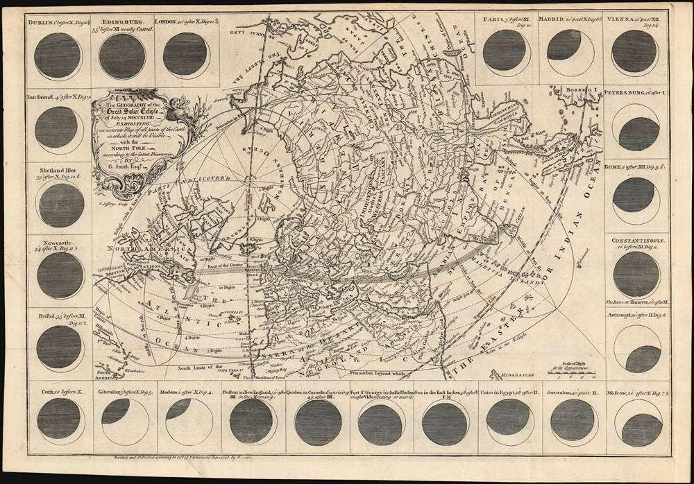
The geography of the great solar eclipse of July 14 MDCCXLVIII. : exhibiting an accurate map of all parts of the Earth in which it will be visible with the North Pole according to the latest discoveries.
sold
- Digital Map Information
- Suitable for large format printing
- DPI: 600
- File Size: 18.25 MB
- File Type: ZIP / TIFF
- ICC color profile embedded
- Delivered instantly via download link
This elegant, 1748 north polar projection map, was drawn by the English astronomer and writer George Smith and engraved by the great English mapmaker Thomas Jefferys. It was produced for inclusion in Smith's pamphlet describing, and predicting the path of, the July 14, 1748 solar eclipse. Twenty-four diagrams show the expected appearance of the eclipsed sun as viewed from different cities, and the map's notation shows both the areas from which partial or full eclipses might be seen. The map’s polar projection is presented obliquely in order to show all the parts of the known world from which the eclipse would be visible. As a result, Smith and Jefferys provide a snapshot of the general state-of-the-art of geographical knowledge of the northernmost parts of the globe to be reached by Europeans, during a period in which the English were active in their attempts to navigate those waters. (more details)
Rare 1940s large format map of Guatemala.
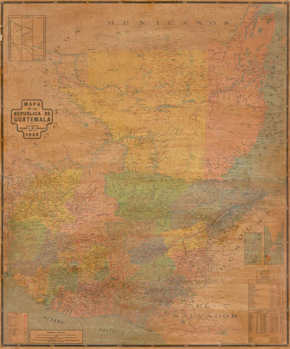
Mapa de la Republica de Guatemala.
sold
- Digital Map Information
- Suitable for large format printing
- File Size: 54.99 MB
- File Type: ZIP / TIFF
- ICC color profile embedded
- Delivered instantly via download link
This is a rare large format map of Guatemala and Belize issued by Federico Polá De Torroella in 1948. The map covers all of Guatemala from the Gulf of Honduras to the Pacific and from Mexico to El Salvador. An inset in the upper left illustrates comparative heights of volcanoes, mountains, and depths of lakes. Twin insets in the lower left highlight Turneffe Atoll and Ambergris Caye, today popular with Scuba Divers as a jumping point for the legendary Great Blue Hole! In thi scorner there is also a key with geographical data and demographic references. (more details)
A Futruristic Vision of Ecologically Friendly Living in a Cold World

Ice City Jan. 10-25 Fargo, N.D. Joint Workshop
sold
- Digital Map Information
- Suitable for large format printing
- File Size: 45.99 MB
- File Type: ZIP / TIFF
- ICC color profile embedded
- Delivered instantly via download link
A unique survival: a fantastic 1972 broadside poster promoting and memorializing the construction and habitation of an ice village, an architectural research project intended to explore the use of ecologically low-impact building systems, primarily ice. The event was a joint workshop held by the architecture departments of North Dakota State University, Carnegie-Mellon University, and the University of Texas at Austin. It appears to have been the brainchild of then - CMU assistant professor of architecture Volker Hartkopf, who accompanied his students to the event. Of it, he said:
We want to stimulate the scientific community to launch extensive research toward development of flexible new building systems... we hope to provide the first full scale realization of responsive environments in architecture... Utilizing (ice) at the workshop we expect to develop and demonstrate processes, forms and techniques which could be used with yet-to-be-developed building materials with similar potential.Between one hundred and two hundred students from the three sponsoring institutions and an international array of others were to spend two weeks in January of 1973 building - and then living in - a village made of ice. Living units, sleeping quarters, entertainment, and study spaces were all to be constructed according to the architectural concepts of UT professor Wolf H. Hilbertz, using water ice chosen for it inexpensiveness, availability, ease of disposal, and minimal environmental impact. (January temperatures in Fargo ranged from 15 to 30 degrees below zero in the 1970s.) (more details)
Charismatic and highly decorative map of Hispaniola or Santo Domingo.
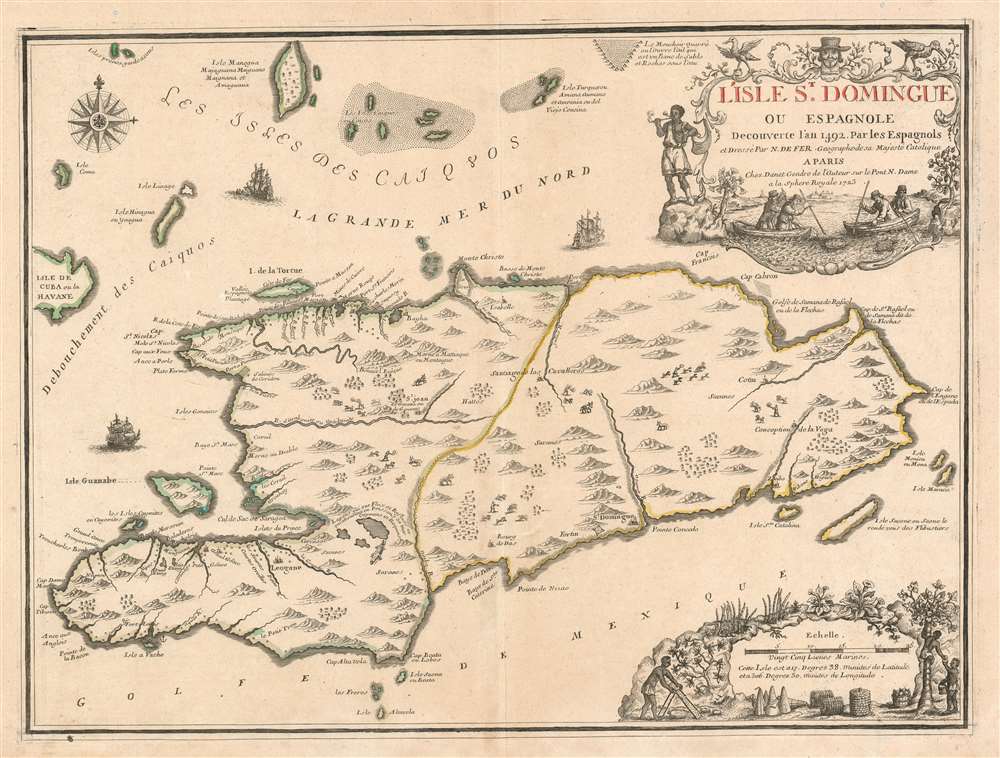
L'Isle St. Domingue ou Espagnole Decouverte l'an 1492 par les Espagnols.
sold
- Digital Map Information
- Suitable for large format printing
- DPI: 600
- File Size: 23.99 MB
- File Type: ZIP / TIFF
- ICC color profile embedded
- Delivered instantly via download link
A stunning large format example of Nicolas De Fer and Guillaume Danet's map of the island of Santo Domingo or Hispaniola. The map coves the island in full as well as parts of adjacent Cuba and Turks and Caicos. The island is shown with colored boundaries derived from the 1697 Treaty of Ryswick dividing the island into the western French portion (modern Haiti) and the larger eastern lands of Spain (Dominican Republic). Topography is drawn in profile according to De Fer's idiosyncratic style. (more details)