
Americas (sold)
One of the most decorative maps of the 18th century - here in a pristine uncolored examples.
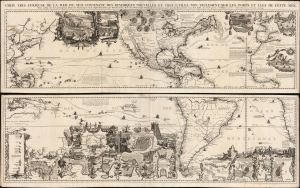
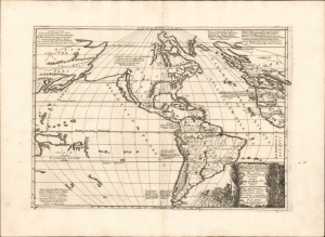
Carte très curieuse de la Mer du Sud, contenant des Remarques Nouvelles et très utiles non seulement sur des Ports et Îles de cette Mer, mais aussy sur les principaux Pays de l'Amerique tant Septentrionale que Méridionale en a été faite.
sold
- Digital Map Information
- Suitable for large format printing
- DPI: 600
- File Size: 2448.4 MB
- File Type: ZIP / TIFF
- ICC color profile embedded
- Delivered instantly via download link
One of the most spectacularly decorative maps of the 18th century, this is Henri Chatelain's magnificent 1719 map of the Americas and the Pacific. The map emerged on the cusp of a new age of global exploration wherein world-spanning trade routes offered Europeans unprecedented exposure to new cultures, peoples, and trade opportunities. It is no mistake that his map of America - as seen here, presents the continent as the center of a staggering array of trade networks reaching from Europe to America itself, the South Pacific, and Africa. (more details)
Dramatic Sea of the West.
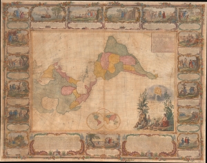
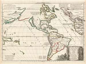
L'Amerique Divisee En Tous Ses Pays Et Etats dressée sur de nouveaux Memoires et sur les derniers Observations.
sold
- Digital Map Information
- Suitable for large format printing
- File Size: 185.45 MB
- File Type: ZIP / TIFF
- ICC color profile embedded
- Delivered instantly via download link
This is a dramatic 1754 east-oriented wall map of the Americas by Jean Janvier and Sebastian G. Longchamps - better known as Voltaire's valet. The dramatic map includes one of cartography's boldest iterations of the Sea of the West. This map appeared at the outset of the French and Indian War (1754 - 1763) and correspondingly details France's bold claims to much of North America. (more details)
First edition.
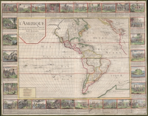
L'Amerique divisée en ses principales parties où sont distingués les uns des autres les estats : selon quils appartiennent presentement aux differents souverains de l'Europe : dressée sur les relations les plus recentes et rectifiées sur les dernieres observations.
sold
- Digital Map Information
- Suitable for large format printing
- Full resolution TIFF file
- ICC color profile embedded
- Delivered instantly via download link
A stunning 1752 wall map of the Americas by Nicolas Baillieul 'le jeune.' Aside from its aesthetic qualities, including elaborate border vignettes, it is also notable for reflecting developing notions of American geography, including tentative mapping of the northwest coast. (more details)
Earliest published sea chart focusing on the California coast!
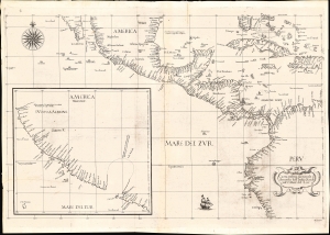
Carta prima generale d'America dell'India Occidentale e Mare del Zur.
sold
- Digital Map Information
- Suitable for large format printing
- File Size: 22.42 MB
- File Type: ZIP / TIFF
- ICC color profile embedded
- Delivered instantly via download link
This is the 1646 first state of Robert Dudley's chart of the middle part of the Americas, illustrating the proximity of the Caribbean Sea and the Pacific Ocean and emphasizing the narrow parts of Central America dividing the two bodies of water. The chart features the western part of the Caribbean, but it is particularly noted for being the first printed sea chart to focus on the Pacific coast, including California. It is, along with Dudley's more narrowly focused charts, the first printed chart of the West Indies and South Florida to employ the Mercator Projection. An inset chart in the lower left focuses specifically on the coast of California, from Baja to Cap Mendocino. (more details)
First specific map to reveal America as separate continent. First map to identify the Pacific Ocean.
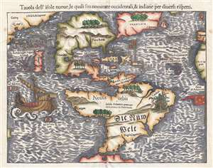
Tavola dell'isole nuove, le quali son nominate occidentali, et indiane per diversi rispetti.
sold
- Digital Map Information
- Suitable for large format printing
- DPI: 300
- File Size: 4.95 MB
- File Type: ZIP / TIFF
- ICC color profile embedded
- Delivered instantly via download link
This is a scarce 1558 Italian edition of Sebastian Münster's map of America, the first printed map of the Western Hemisphere. The map first appeared in Münster’s 1540 edition of Ptolemy's Geographia, one of the earliest versions of the classical work to systematically include maps showing contemporary geographical knowledge. Beginning in 1544 it would be included in Münster’s magnum opus, Cosmographia Universalis, which for over forty years would be the primary source of information for anyone who wished to know about the rest of the world: consequently this map would have had a disproportionate impact, providing the first glimpse of the New World to literate laypeople in Europe nearly half a century. (more details)
First Atlas Map of the Western Hemisphere.
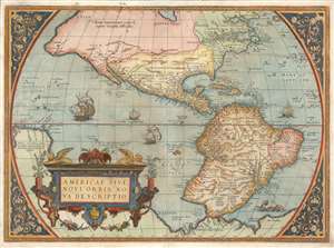
Americae Sive Novi Orbis Nova Descriptio.
sold
- Digital Map Information
- Suitable for large format printing
- Full resolution TIFF file
- ICC color profile embedded
- Delivered instantly via download link
This is Abraham Ortelius' map of the Western Hemisphere, considered to be the 'first map of the Americas to appear in a modern atlas' (Schwartz). Ortelius' success and the spread of his atlas made this fine map the standard - and best - representation of the Americas during the initial period its colonization. (more details)
The first Atlas Map of the Western Hemisphere.
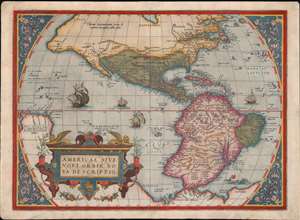
Americae Sive Novi Orbis Nova Descriptio.
sold
- Digital Map Information
- Suitable for large format printing
- Full resolution TIFF file
- ICC color profile embedded
- Delivered instantly via download link
This is Abraham Ortelius' map of the Western Hemisphere, 'first map of the Americas to appear in a modern atlas' (Schwartz). Ortelius' success and the spread of his atlas made this fine map the standard - and best - representation of the Americas during the initial period of the colonization of North America by Europeans. (more details)
Dominant 16th century Map of the Western Hemisphere in Original Color.
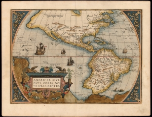
Americae Sive Novi Orbis Nova Descriptio.
sold
- Digital Map Information
- Suitable for large format printing
- Full resolution TIFF file
- ICC color profile embedded
- Delivered instantly via download link
This a striking original-color example of Abraham Ortelius' map of the Western Hemisphere, 'first map of the Americas to appear in a modern atlas' (Schwartz). Ortelius' success and the spread of his atlas made this map the standard - and best - representation of the Americas during the initial period of the European colonization. (more details)
First printed map to illustrate the Chesapeake Bay.
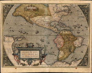
Americae Sive Novi Orbis Nova Descriptio.
sold
- Digital Map Information
- Suitable for large format printing
- Full resolution TIFF file
- ICC color profile embedded
- Delivered instantly via download link
This is Abraham Ortelius' map of the Americas in an attractive, early example of the 1587 third plate, printed in 1589. It represents the state-of-the-art mapping of the Western Hemisphere during the initial period of European Colonization. It is significant as the first printed map to illustrate the Chesapeake Bay, predating John White's 1590 map of Virginia. (more details)
First Printed Map to show the Chesapeake Bay.
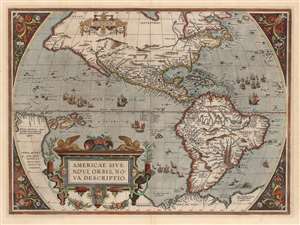
Americae Sive Novi Orbis Nova Descriptio.
sold
- Digital Map Information
- Suitable for large format printing
- DPI: 600
- File Size: 50.62 MB
- File Type: ZIP / TIFF
- ICC color profile embedded
- Delivered instantly via download link
This is Abraham Ortelius' map of the Western Hemisphere, in an attractive example of the 1587 third state. It represents the state-of-the-art mapping of the Americas during the initial period of European Colonization and the first printed map to illustrate the Chesapeake Bay. (more details)
Extremely rare, separately issued.
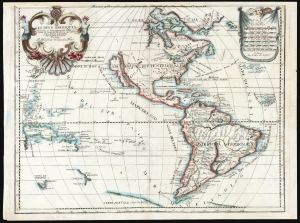
Les Deus Ameriques Divisées en leurs principales Parties, et tirees de toutes les Relations qui ont Par Louis de Lepine Presentee A Monsieur de Chevalier Mari.
sold
- Digital Map Information
- Suitable for large format printing
- File Size: 50.18 MB
- File Type: ZIP / TIFF
- ICC color profile embedded
- Delivered instantly via download link
This is an extremely rare, separately published c. 1695 map of the Western Hemisphere by Louis de Lépine, featuring California as an island. The map also presents the limits of the Pacific Ocean, showing parts of Tasmania, the west coast of New Zealand, part of Japan, and the coastline of the conjectural Terra de Iesso. (more details)
First edition to name the United States.
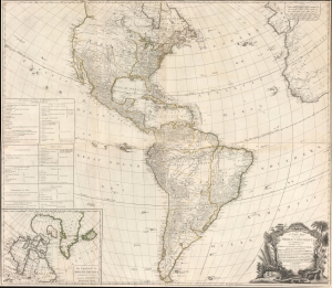
A New Map of the Whole Continent of America, divided into North and South and West Indies, wherein are exactly Described the United States of North America as well as the Several European Possessions according to the Preliminaries of the Peace singed at Versailles Jan. 20 1783.
sold
- Digital Map Information
- Suitable for large format printing
- DPI: 600
- File Size: 97.78 MB
- File Type: ZIP / TIFF
- ICC color profile embedded
- Delivered instantly via download link
A scarce 1783 Sayer and Bennett wall map of America issued shortly after the American Revolutionary War (1775 - 1783). This map followed closely on the Treaty of Versailles, which ended the Revolutionary War and established British recognition of the independent United States. This is the first issue of this map to name the United States - here, including all territory north of Florida, South of the Great Lakes (except Michigan), and east of the Mississippi. (more details)
Lost Continent of Atlantis: Found?
Atlantis Insula a Nicolao Sanson antiquitati restituta nunc demum majori forma delineata et in decem regna iuxta decem Neptuni filios distributa Praeterea insualae. nostraeqr contenentis regiones quibus imperavere Atlantici reges aut quas armis tentavere ex conatibus geographicus.
sold
- Digital Map Information
- Suitable for large format printing
- Full resolution TIFF file
- ICC color profile embedded
- Delivered instantly via download link
This is a beautiful example of Nicolas and Guillaume Sanson's map of America as the lost continent of Atlantis. The present examples is a scarce 1694 Italian edition, finely engraved and printed with strong inks on beautiful Italian paper - à la Coronelli. It is visually and physically superior to Sanson's own earlier editions. (more details)
Lost Continent of Atlantis: Found?
Nicolao Sanson antiquitati restituta ; nunc demum majori forma delineata, et in decem regna, iuxta decem Neptuni filios distributa : Praeterea insualae, nostraeqr. contenentis regiones quibus imperavere Atlantici reges ; aut quas armis tentavere ex conatibus geographicus.
sold
- Digital Map Information
- Suitable for large format printing
- DPI: 600
- File Size: 55.65 MB
- File Type: ZIP / TIFF
- ICC color profile embedded
- Delivered instantly via download link
This is a beautiful, first state example of Nicolas and Guillaume Sanson's map of America, proposing that the continent and the legendary lost continent of Atlantis were one and the same. (more details)
Nazi Propaganda against American Economic Imperialism.
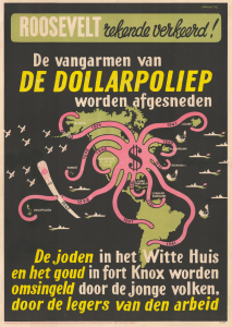
De Dollarpoliep. / [The Dollar Octopus.]
sold
- Digital Map Information
- Suitable for large format printing
- File Size: 27.23 MB
- File Type: ZIP / TIFF
- ICC color profile embedded
- Delivered instantly via download link
This is a powerful 1942 Lou Manche German World War II anti-American antisemitic propaganda poster and map of the Americas, over which is superimposed an avaricious octopus with economic tentacles reaching out to control the world. It was produced by the Nazi Department of People's Education and Propaganda (Departement van Volksvoorlichting en Kunsten) and accuses Jewish influence and American capitalism - centered around Roosevelt, Fort Knox, and the White House - of being a global menace, and attempts to portray the Axis powers as labor-supporting liberators. (more details)
One of the only maps to name the proto-Texan freebooter 'Republic of Fredonia'. And it's in Greek.
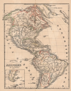
Χαρτησ τησ Αμερικησ / [Map of America].
sold
- Digital Map Information
- Suitable for large format printing
- File Size: 29.47 MB
- File Type: ZIP / TIFF
- ICC color profile embedded
- Delivered instantly via download link
This is a rare hand-colored 1866 Greek-language map of the Americas, produced by Herakles Lazaridou. Although entirely in Greek, this map is fascinating as one of the few maps to name the 'Republic of Fredonia' (1826 - 1827), a short-lived freebooter state in Texas. (more details)
In the wake of the Revolutionary War.
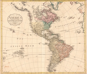
America nach der zweyten Ausgabe von Arrowsmiths Weltcharte und dessen Globular Projection nach den Berichten der Jesuiten und anderer Reisebe Schreiber, und nach Raymals, Gatterers, Angaben entworten von C. Mannert.
sold
- Digital Map Information
- Suitable for large format printing
- Full resolution TIFF file
- ICC color profile embedded
- Delivered instantly via download link
A scarce 1796 map of North and South America by Conrad Mannert. The map depicts the Americas shortly following the close of the American Revolutionary War (1775 - 1783). (more details)
Pacific Northwest w/ manuscript trade routes between San Francisco and Astoria.
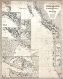
West Coast of North America from San Francisco to Queen Charlotte Ids.
sold
- Digital Map Information
- Suitable for large format printing
- File Size: 57.87 MB
- File Type: ZIP / TIFF
- ICC color profile embedded
- Delivered instantly via download link
A finely executed 1883 James Imray working nautical map of the American Pacific Northwest from San Francisco to the Queen Charlotte Islands. The map includes San Francisco Bay, Vancouver Island, the Strait of Juan de Fuca, the Columbia River and Astoria, and the coasts of Washington, Oregon, northern California, and British Columbia. Pencil manuscript annotations illustrate the route of a merchant ship, probably a fur trader, between the Columbia River frontier trading settlement of Astoria and San Francisco. (more details)
Innovative composite of quantitative and qualitative wind data.
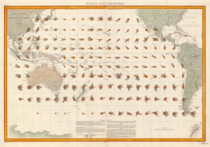
Océan Pacific - Cartes de la Direction et de l'Intensité Probables des Vents. Juillet Août Septembre.
sold
- Digital Map Information
- Suitable for large format printing
- File Size: 49.88 MB
- File Type: ZIP / TIFF
- ICC color profile embedded
- Delivered instantly via download link
This is an 1880 Léon Brault significant map of Pacific Ocean winds. The map is innovative in its expression of both quantitative and qualitative data in relation to wind direction, intensity, and frequency - presaging the work of Matthew Fontaine Maury (1806 - 1873) in the mid-19th century. (more details)
Late Appearance of California as an Island.
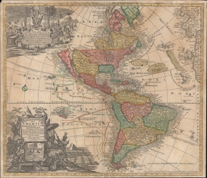
Novus Orbis Sive America Meridionalis et Septentrionalis...
sold
- Digital Map Information
- Suitable for large format printing
- File Size: 27.44 MB
- File Type: ZIP / TIFF
- ICC color profile embedded
- Delivered instantly via download link
This is Johann Michael Probst's rare 1784 issue of Mattheus Seutter's map of the Americas. Among other features, it includes a very late representation of California as an island, a cartographic myth that had largely been dispelled decades earlier. (more details)
The discoveries of Le Maire and Schouten.
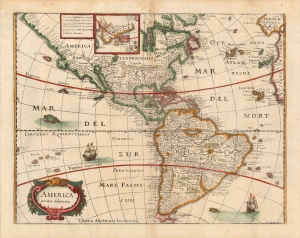
America noviter delineata.
sold
- Digital Map Information
- Suitable for large format printing
- Full resolution TIFF file
- ICC color profile embedded
- Delivered instantly via download link
This is a scarce 1638 Matthias Merian map of the Americas. Merian had already, in 1631 produced a larger-format map of America, based on Jansson’s 1623 America noviter delineata. Merian's source for the present map was not, as Burden suggests, Jodocus Hondius Jr.'s 1618 map of the same title, but Blaeu's Americae Nova Tabula whose detail here is presented with a high degree of faithfulness (although dispensing with Blaeu's decorative borders). It is an interesting choice, but appears to be consistent with Merian's decision to copy Blaeu's world map in this volume. (more details)
Discoveries of Le Maire and Schouten.
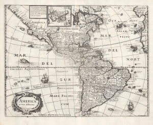
America noviter delineata.
sold
- Digital Map Information
- Suitable for large format printing
- DPI: 600
- File Size: 11.26 MB
- File Type: ZIP / TIFF
- ICC color profile embedded
- Delivered instantly via download link
This is a scarce 1638 Matthais Merian map of the Americas. The map offers a wealth of interesting cartographic tropes and ideas of the early 17th century: El Dorado, Norumbega, new islands in the Pacific, and more. (more details)
Vitriolic Presentation of Greece Occupied by the Ottoman Empire.
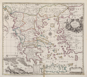
A Map of Greece with part of Anatolia most humbly Inscrib'd to Alexander Uruqhart of Newhall Esq. 1720 Revis'd by J. Senex.
sold
- Digital Map Information
- Suitable for large format printing
- File Size: 2455.27 MB
- File Type: ZIP / TIFF
- ICC color profile embedded
- Delivered instantly via download link
This elegant English map of Greece, produced by John Senex in 1721, presented a British audience with a view of Greece specifically as a possession of the Ottoman Empire. Its beautifully engraved cartouche and its bird's-eye view of Constantinople emphasized the idea that the land presented in the map was one forcibly occupied by the Muslim world in the person of the Ottoman Turks. (more details)
Mussolini Celebrating Pearl Harbor.
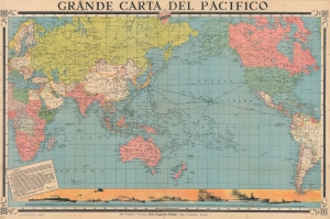
Grande Carta del Pacifico.
sold
- Digital Map Information
- Suitable for large format printing
- File Size: 232.91 MB
- File Type: ZIP / TIFF
- ICC color profile embedded
- Delivered instantly via download link
Celebrating the Japanese attack on Pearl Harbor and centered over the vast expanse of the Pacific, this is a 1942 Visceglia World War II Fascist Italian map of the Pacific. Originating only days after the Japanese attack, the map is an exhortation from Mussolini to celebrate the achievements of their 'friends in the east'. (more details)
Dashed Hopes of a Northwest Passage.
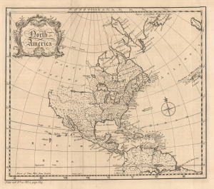
North America.
sold
- Digital Map Information
- Suitable for large format printing
- File Size: 6.9 MB
- File Type: ZIP / TIFF
- ICC color profile embedded
- Delivered instantly via download link
This is a c. 1759 map of North America engraved by John Gibson for Thomas Salmon's The Universal Traveller: Or, a Compleat Description of the Nations of the World. It is notable for reflecting the still-speculative nature of the continent's geography, including suggestions of a possible Northwest Passage. (more details)
Height of the 'Clipper Ship' Era.
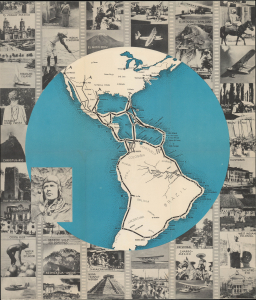
Flying the Lindbergh Trail. An Aerial Travelogue of the Southern Americas.
sold
- Digital Map Information
- Suitable for large format printing
- Full resolution TIFF file
- ICC color profile embedded
- Delivered instantly via download link
This is a scarce c. 1937 promotional folding map prepared by Kenneth W. Thompson for Pan American Airways. The map and photographs, and text on the verso, advertise commercial flights aboard Pan Am's distinctive flying boat 'Clippers,' offering routes along the 'Lindbergh Trail,' named for flights taken early in the career of renowned aviator Charles Lindbergh. (more details)
WWII Radio Show: 'Adventures of the Sea Hound'.
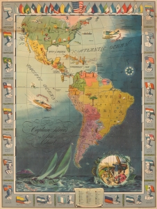
Captain Silver's Sea Chart.
sold
- Digital Map Information
- Suitable for large format printing
- File Size: 37.95 MB
- File Type: ZIP / TIFF
- ICC color profile embedded
- Delivered instantly via download link
An impressive 1942 NEFF pictorial map of the Americas issued for the popular World War II radio show Adventures of the Sea Hound. Each episode of the Sea Hound followed Silver and his companions to a different country, mostly in Latin America. This map allowed young listeners to follow the adventures and learn key geographical and historical facts. (more details)