
ATLASES (sold)
Unique manuscript record of the War of the Quadruple Alliance. Author's own copy.
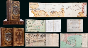
Guerra De Cerdeña Ysicilia, En Los Años De 1717, 18, 19, Y 1720. Con Reflexiones Militares Del Marquèsde La Mina Conde De Pezuela.
sold
This is an extraordinary 2-volume 1755-57 manuscript account of the War of the Quadruple Alliance, fought over Sicily, drafted by a participant, the II Marques de la Mina, Jaime Miguel de Guzmán Davalos y Spinola. It is Mina's personal copy, emblazoned with his arms, rich with masterfully executed foldout manuscript maps and tables, and features exceptional provenance. At the time of writing, this work was suppressed in Spain, as the loss of the Spanish fleet at the Battle of Cape Passaro was a royal embarrassment, leading to it remaining unpublished for more than 140 years. The War of the Quadruple Alliance here represented, while not well known, had global ramifications, as it significantly diminished the Spanish navy, giving the British largely unopposed free reign on the colonial stage, particularly in the Americas. (more details)
Stunning Atlas, Old Color, Distinguished Provenance.

Fasciculus geographicus complectens praecipuarum totius orbis regionum tabulas circiter centum, unà cum earundem enarrationibus.
sold
This is Matthias Quad's geographical atlas in its expanded 1608 edition, with 87 maps in superb original color and a distinguished provenance connecting it to the Lord Wardington Collection. Quad's atlas provided, in a small folio, a compilation of the most state-of-the-art maps of his era - some engraved by Quad himself, the bulk having been engraved by publisher Johan Bussemacher. The richly-colored atlas is beautifully bound in contemporary vellum and is the finest example of this work known. (more details)
The first English Trade Atlas.
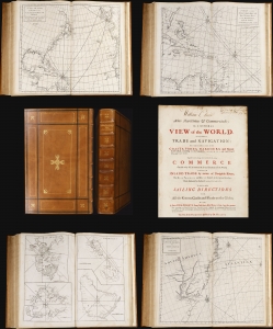
Atlas Maritimus et Commercialis or, A General View of the World, so far as relates to trade and navigation.
sold
This 1728 nautical atlas is the first openly published commercial geography produced for a general audience. 'No previous work in English had offered a survey of the world's trading sites on this scale' (Rogers, 2023). It was an ambitious project brought to completion by a consortium of mapmakers, printers, and writers. While it is conventionally credited to Nathaniel Cutler and the illustrious Edmond Halley, these supplied only portions of the monumental work. The maps can be assigned to John Senex, drawing extensively on a new projection provided by Henry Wilson; much of the descriptive content of the first part of the work has been attributed to the prolific Daniel Defoe, while the second portion - A General Coasting Pilot; Containing Directions for Sailing - is attributed to Cutler. (more details)
A Monument of Renaissance Astronomy
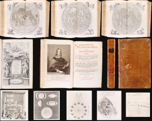
Selenographia: sive lunae descriptio; atque Accurata, Tam Macularum eius, addita est, lentes expoliendi nova ratio (with) Observatio eclipseos solaris Gedani, anno aerae Christianae 1652, die 8. Aprilis (and) Eclipsis Solis observata Gedani Anno á nato Christo 1649, die 4, Novembris, st. Greg. Johanne Hevelio.
sold
A masterpiece of 17th-century scientific engraving and publishing: This is the first edition of Johannes Hevelius' magnificent 1647 Selenographia. This is the first lunar atlas and one of the finest scientific books of the 17th century, in a beautiful example bound with two rare, printed letters regarding Hevelius' observations of the eclipses of November 4, 1649, and April 8, 1652. (more details)
Most Desirable Edition of Bünting's Biblical Geography.
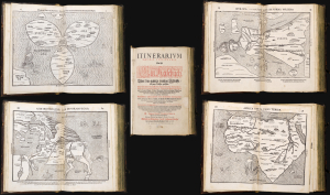
Itinerarium Sacrae Scripturae Das ist/ Ein Reisebuch, Uber die gantze heilige Schrifft in zwey Bücher getheilet. Das Erste Theil begreifft alle Reisen der lieben Patriachen/ Richter/ Könige/ Propheten ... Das Ander/ gehet auff das Newe Testament ... Zuuor gemehret mit einem büchlein DE MONETIS ET MENSVRIS... Insonderheit aber mit einer feinen nützlichen erklerung des Buchs Josua/ Durch M. Henricum Bünting/ Pfarherr der Kirchen zu Grunaw im Lande zu Brunshweig. Mit einer Vorrede des Herrn D. Martini Chemnitij.
sold
- Digital Map Information
- Suitable for large format printing
- Full resolution TIFF file
- ICC color profile embedded
- Delivered instantly via download link
This is a superb example of Heinrich Bünting's 1587 Itinerarium Sacrae Scripturae, the first complete work of biblical geography. This 1587 edition is the first to contain its full complement of figured maps of the continents. Africa, Europa Regina, and Asia-as-a-Pegasus first appear in this edition. Along with the famous cloverleaf world map, Die ganze Welt in einem Kleberblat, it is largely these figural maps for which this work is today most admired. Thus, this is the most desirable form in which this influential and long-lived book appears. (more details)
Remarkable example, exhibiting Catholic censorship.
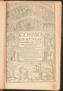
A superb, fascinating example of Sebastian Münster's masterpiece: his Cosmographia, in its much-expanded, first, Latin edition of 1550. Münster's work had between 1544 and 1548 been only published in German. With this edition, opening the work to an international audience, Münster added a wealth of larger and more elaborate images that would seal its popularity. This compendium would for more than half a century provide the European literate layperson their best source of information about the world, via its lively descriptions, engaging woodcut illustrations, and its array of maps. It was also one of the most copiously illustrated, early books, containing nearly 1000 woodcuts as well as the first separate maps of America and Asia, and the first detailed contemporaneous maps of Europe and Africa. Its regional maps present their respective areas in what were often the earliest modern depictions available to the reader.
That the book retained an audience long after its publication is attested to by the present example: almost two hundred and fifty years after its publication, it fell under the scrutiny of a Catholic censor, expurgating passages deemed harmful to the Church, the Papacy, and the modesty of the presumably Catholic reader. (more details)
That the book retained an audience long after its publication is attested to by the present example: almost two hundred and fifty years after its publication, it fell under the scrutiny of a Catholic censor, expurgating passages deemed harmful to the Church, the Papacy, and the modesty of the presumably Catholic reader. (more details)
Superb example of the most finely-engraved Ptolemy, with beautiful original color.
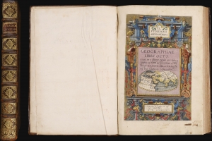
Cl Ptolemaei Alexandrini Geographiae libri octo: recognitiiam diligenter emendati cum tabulis geographicis ad mentem auctoris restitutis ac emendatis, per Gerardum Mercatorem.
sold
This is a superb example of Gerard Mercator's Cl Ptolemaei Alexandrini Geographiae Libri Octo: the 1584 first edition of the full proto-atlas, featuring Willibald Pirckheimer's translation of Claudius Ptolemy's text edited by Arnold Mylius, accompanied by 28 maps in rich, original color. Moreover, the present volume is bound with Mercator's contemporary atlas of France and the Low Countries, Galliae Tabule Geographicae. These volumes were probably joined in the 18th century when this volume was bound. The book thus presents Mercator's earliest published books in a superb, unique example. It is one of the few of Mercator's books to be published in his lifetime. (more details)
Window to the European World.
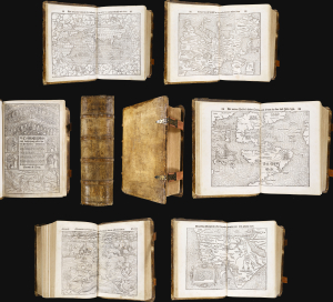
Cosmographey oder beschreibung aller länder, herrschafften, fürnemsten stetten, geschichten, gebreüche[n], hantierungen etc.
sold
A strong example of Sebastian Münster's masterpiece: his Cosmographia Universalis, in a 1564 German edition. This was the original language of Münster's work: from 1544 to 1548, it was published only in his vernacular. This compendium, for more than half a century, has provided the European literate layperson with the best source of information about the world, via its lively descriptions, engaging woodcuts, and maps. These present their respective areas in what were often the earliest modern depictions available to the reader. (more details)
The Finest Engraved Plan of Paris in its Sole Original Edition.
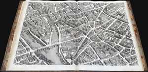
Plan de Paris Commence l’Annee 1734.... Leve et Desine par Louis Bretez Grave par Claude Lucas / Et Ecrit par Aubin.
sold
This is Louis Bretez and Michel-Etienne Turgot's monumental 1739 map of Paris, in a beautiful, bound example. Turgot's map of Paris - possibly the most ambitious urban mapping ever undertaken - shows the whole of 18th century Paris, offering an unparalleled view of the city prior to the 19th century redesign by Baron Georges Eugène Haussmann: every structure within the city at the time is here depicted. Turgot, who held the mayor-like office of Prevôt des Marchands de Paris , commissioned Louis Bretez and Claude Lucas to produce this map. Oriented to the east on an axonometric projection, this map is best understood as an aerial view in which every building, window, tree, shadow, and park are shown from an equidistant aerial perspective. In order to produce the thousands of sketches and surveys required to complete this map, Bretez was issued a permit to enter every building in Paris. It took the team nearly five years of exhaustive sketching and surveying to assemble this masterpiece. (more details)
Latin Edition of an Influential Geography
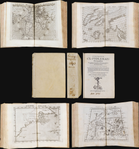
This is a superb example of Girolamo Ruscelli's Geographia Cl. Ptolemaei Alexandrini, the 1562 edition of his expanded Ptolemy, featuring the new Latin re-translation of the work by Giuseppe Moleto, amending Willibald Pirckheimer's translation of Ptolemy's text. Ruscelli's Geographia was a tour de force and, in this Latin edition, it reached its broadest audience, marking this as the most important edition of Ruscelli's Ptolemy. With its complement of maps beautifully engraved by Giulio Sanuto (particularly the Zeno map of the North Atlantic), the work had a long-standing influence on European geographical thought. The maps here are all in their first state and are thus most desirable. (more details)
Rare first edition of 'one of the most valuable works on China, describing districts never before traversed by Europeans.' (Sabin)
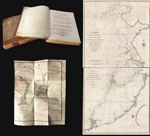
Voyage de l'ambassade de la Compagnie des Indes Orientales Hollandaises, vers l'empereur de la Chine, dans les années 1794 et 1795..
sold
This is a rare 1797/98 Andreas Everardus van Braam Houckgeest two-volume narrative of a VOC embassy to the court of the Qianlong Emperor, in China, and its accompanying maps. During this voyage, Houckgeest became the first American to meet a Chinese Emperor and ... (more details)
Definitive field Atlas of the Revolutionary War.
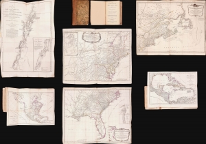
The American Military Pocket Atlas; being An approved Collection of Correct Maps, both General and Particular, of The British Colonies; Especially those which now are, or probably may be The Theatre of War.
sold
This is Sayer and Bennet's 1776 'Holster Atlas', one of the most sought-after cartographic works of the American Revolution. It was published at the beginning of the Revolution and presented as a collection of maps approved by British military authorities for use in the field. (more details)
Remarkable log book of the China Station flagship during and after the Boxer Rebellion.
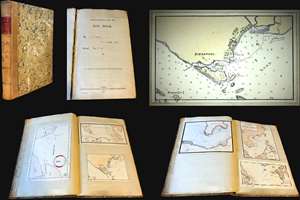
Logbook for use of Junior Officers Afloat. C. V. L. N. / Log Book. Mr. C. V. L. Norcock / H.M.S. Hannibal Glory.
sold
An exceptional and important 1900 – 1902 British naval logbook penned by Charles Vernon Lowcay Norcock (1884 - 1963), an officer in the Royal Navy, recording his experience as a Midshipman on the HMS Glory, flagship of the China Station, in the years of and immediately following the Boxer Rebellion (1899 - 1901). The full logbook covers three ships, recording the voyages of the HMS Hannibal from May to November of 1900; Norcock's subsequent service on the HMS Glory, flagship of the China Station from October of 1900 to January of 1902; and his return voyage to England on the HMS Aurora, from January to February of 1902 - thus covering Norcock's full tour of duty. The content of this volume is exceptionally rich, surpassing most other logbooks, with numerous original manuscript maps of important East Asian ports including Hong Kong, Shanghai, Singapore, Kowloon, Nagasaki, Suez, Valetta, Wusong (Shanghai), Nagasaki, and more. (more details)
Nazi General's presentation atlas of Operation Barbarossa - before it all went to hell.
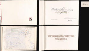
Der Feldzug gegen die Sowiet-Union / Kriegsjahr 1941 / Bearbeitet in der Führungsabteilung des Oberkommandos der Heeresgruppe Nord.
sold
A proof-state white-kid-bound 1941 World War II German general's presentation atlas, here in its only known example, chronicling the first 6 months of Operation Barbarossa. It was lavishly published on Christmas Eve 1941 by the General Staff of Army Group North as a gift to members of Army Group North's General Staff participating in the invasion. This atlas appeared at a high point in the Nazi campaign to conquer the Soviet Union, and the bravado that accompanied their early successes is evident. The present example, 'proof no. 2', is the only known surviving copy. (more details)
Kircher's exploration of the unseen world below.
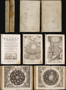
This is the 1678 edition of polymath Athanasius Kircher's celebrated description of the subterranean world, the first serious theoretical exploration of the physical structure of the Earth. Kircher's own experiences of the 1637 eruption of Mount Vesuvius and the catastrophic Calabrian earthquakes of 1638 led him to develop theories regarding the unseen underpinnings of the world. (more details)
Rare 2nd edition (1st Beijing edition) of the official China Postal Atlas.
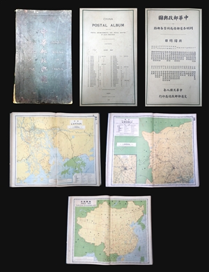
Postal Atlas of China. / China postal album, showing the postal establishments and postal routes in each province.
sold
A scarce example of the 1919 second edition of the official Chinese Postal Atlas. Compiled by Charles Jacot-Guillarmod, this atlas contains 47 maps, including an index, covering all of Chinese in considerable detail. Most of the maps are presented on a ... (more details)
Geographical Reader for Dixie Children.
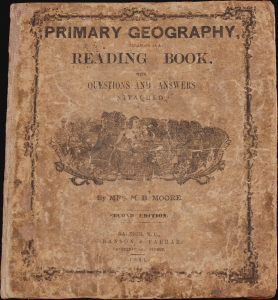
Primary Geography Arranged as a Reading Book, with Questions and Answers Attached.
sold
- Digital Map Information
- Suitable for large format printing
- Full resolution TIFF file
- ICC color profile embedded
- Delivered instantly via download link
This is a rare 1864 geographical atlas by Marinda Branson Moore prepared for Confederate children. Published during the American Civil War (1861 - 1865), the work only maps the Confederate States and contains historically relevant, if racially offensive, text critical of the Union. The work, as expressed by historians O. L. Davis, Jr. and Serena Rankin Parks, addresses the concerns of Southern schoolteachers who saw existing published textbooks as 'blighted with by Yankee biases and inaccuracies.' (more details)
Early days of American Revolutionary War.
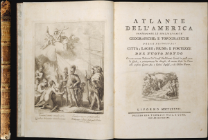
Atlante Dell'America Contenente le Migliori Carte Geografiche, e Topografiche delle Principale Citta, Laghi, Fiumi, e Fortezze del Nuovo Mondo.
sold
This is an important Tommaso Masi 1777 atlas of the Americas, issued in Livorno, Italy, to capitalize on the general interest in the Americas, particularly North America, sparked by the American Revolutionary War (1775-1783). (more details)
Rare Chinese Government collection of 45 highly detailed topographical maps of Beijing or Peking, China.

This is an extraordinarily rare set of 45 post-Liberation topographical maps Beijing or Peking, China. They were issued in 1954 by the People's Republic of China and are de-accessioned library pieces. Each map focuses on a different portion of the city ... (more details)
Foundations of Terra Australis Incognita.
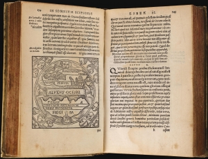
Macrobij Ambrosij Aurelij Theodosij, uiri consularis, and illustris : In Somnium Scipionis, lib. II. Saturnaliorum, lib. VII.
sold
This is a beautiful example of the 1548 Lyon edition of Macrobius' Saturnalia and his commentary on Cicero's Dream of Scipio, or Commentarii in Somnium Scipionis. The latter is one of the most cited works in the scholarship of the Middle Ages. In addition to its foundational role in transmitting Neoplatonism to the medieval world, this book was by the medieval world as the essential primer on cosmography. Macrobius' commentaries built on Cicero's cosmographical ideas and formalized them. Macrobius' analysis of Cicero placed his cosmography in the context of Claudius Ptolemy's astrological work. Through Macrobius' lens, the universe as understood by the ancient world, was embraced by philosophers, authors, and artists. His ideas extensively influenced the early geographers of the 16th century and were the source of early speculation on the existence of the undiscovered 'Terre Australis' (Southern Continent), an idea later adopted by Mercator and Ortelius. (more details)
Rare, incredibly detailed, trilingual 1936 edition of the China Postal Atlas.
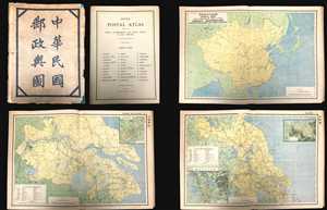
China Postal Atlas Showing the Postal Establishments and Postal Routes in Each Province.
sold
A scarce example of the 1936 edition of the official Chinese Postal Atlas. Compiled by Charles Jacot-Guillarmod, this atlas contains 31 maps, including an index, covering all of China in considerable detail. Most of the maps are presented on a standard ... (more details)
The most detailed early atlas of Miami.
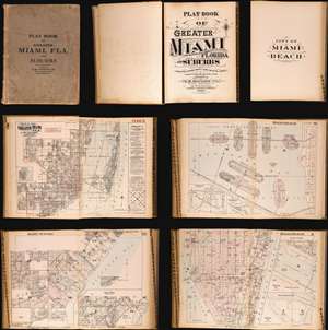
Plat Book of Greater Miami Florida and Suburbs from Official Records, Private Plans and Actual Surveys.
sold
This is the rare and significant 1925 first edition of the G. M. Hopkins atlas of Miami and Miami Beach. The atlas contains the most detailed early maps of Miami Beach. While, in most cases, insurance atlases like this volume are not significant, the opposite is the case of the G. M. Hopkins' Miami Atlas. Short of rare official maps and unobtainable manuscripts, it represents the earliest obtainable maps of Miami Beach, and to a lesser extent, Miami. As a point of reference, although there are earlier development maps, the first official map of Miami Beach was not drawn until 1920 and not committed to print until 1925 - the same year this atlas went to press. (more details)
A plat book of Miami on the eve of American involvement in World War II.
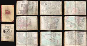
This is an extraordinary and rare 1936 - 1940 G.M. Hopkins Company cadastral plat atlas of Miami and Miami Beach, Florida - as such chronicling the development of Miami's iconic art deco architecture. The atlas consists of 53 maps, 40 of Greater Miami and 15 of Miami Beach. Coverage is detailed and extensive, including downtown Miami, Coral Gables, Little Havana, Edgewater, the Art Deco District, Ocean Drive, the Lincoln Road Mall, Star Island, Venetian Island, Hibiscus Island, Palm Island, Belle Isle, Indian Creek, etc. The detail throughout is outstanding, naming theaters, office buildings, hotels, public utilities, private properties, golf courses, racetracks, and much much more. This atlas was designed for use by the insurance industry to help assess property risk and value. Moreover, the maps were intended to be updated and revised as properties changed with labeled cutout pastedowns. Most, if not all, of the maps in this atlas exhibit such changes, bringing the plat book current to roughly 1973. (more details)
First maps to name Arizona?
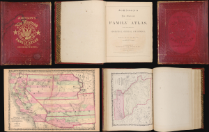
This is the 1860 Richmond-imprint first edition of Johnson's New Illustrated (Steel Plate) Family Atlas. While Johnson's atlases are not, in general, rare, the 1860 Richmond first edition is a genuine rarity. It is one of the only atlases published in the soon-to-be Confederacy prior to the American Civil War (1861 - 1865). It also includes the first two maps to name Arizona, predating the existence of the Arizona Territory by 5 years. In 20 years in the rare map trade, this is the first time we have seen a Richmond-imprint first edition of this atlas. (more details)
A plat book of Miami Beach illustrating the many changes in the city over a twenty-year period.
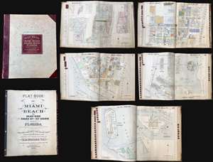
Plat-Book of Miami Beach to Golden Beach also Virginia Key and Key Biscayne Florida.
sold
This is a rare and extraordinary 1952 G. M. Hopkins Company cadastral plat atlas of Miami Beach, Florida. Containing 29 maps, illustrating every part of the city, including the Art Deco District, Ocean Drive, the Lincoln Road Mall, Star Island, Venetian Island, Hibiscus Island, Palm Island, Belle Isle, Indian Creek, etc. The detail throughout is outstanding, naming theaters, office buildings, hotels, public utilities, private properties, golf courses, racetracks, and much much more. This atlas was designed for use by the insurance industry to help assess property risk and value. Moreover, the maps were intended to be updated and revised as properties changed with labeled cutout pastedowns. Most, if not all, of the maps in this atlas exhibit such changes, bringing the plat book current to roughly 1973. (more details)
Using aerial photography to make maps during WWII.
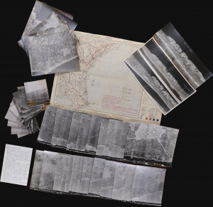
This is a 1943 World War II archive of 39 aerial photographs and a map of Sicily used in planning Operation Ladbroke, the first Allied invasion based on the mass use of gliders. This archive provides insight into how Allied war planners developed operations and integrated new technologies. Aerial photographic interpretation was a cutting-edge field for military planners. This archive represents the advancement of military planning and innovation of cartography through advanced aircraft and photographic technology. (more details)
Quezon's infrastructure vision.
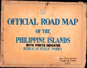
The only known example of a c. 1936 road atlas of the Philippines, produced by the islands' Bureau of Public Works, Manila. It includes 15 maps, plus a title page and an index, covering the entire archipelago in impressive detail. (more details)
Rare and important Ino Tadataka Atlas of the Tokugawa Era.
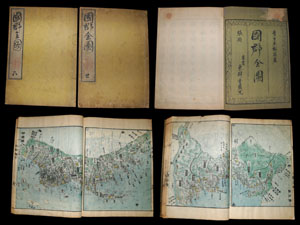
Entitled Kokugun Zenzu and printed c. 1839 (Tenpo 10), this is an early Japanese atlas of exceptional rarity, beauty and importance. Compiled by Motonobu Aoo and Toshiro Eirakayu based upon the works of Japan's 18th century master cartographer Ino ... (more details)
Elegant Edition of the First French Atlas of Asia.
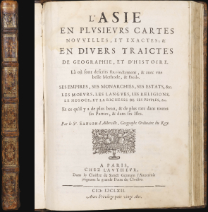
L'Asie en Plusiers Cartes Novelles, et Exactes; et en Divers Traictes de Geographie, et D'Histoire....
sold
This is a handsome example of the first French atlas of Asia, printed in 1662 by Nicolas Sanson, the father of French mapmaking. An encyclopedic atlas, the work contains 17 maps and 100 pages of historical and descriptive text. It was intended to educate the curious reader about the wonders of parts of the world they would likely never see themselves. (more details)
Exceptional School Map Case w/ Maps.
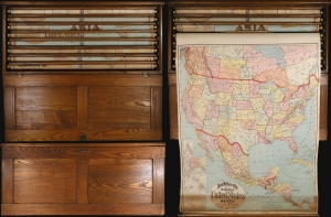
This is an exceptional 1899 Rand McNally oak school room map case complete with its original 8 maps and key. Such cases were commercially manufactured for schools and government organizations from about 1900 to the 1940s. (more details)
Beautifully Executed Manuscript Atlas.
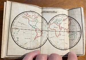
This is a beautifully-executed late 18th manuscript pocket atlas of the world. It is a student work - similar to later, 19th century 'schoolgirl' or 'schoolboy' maps - but has been produced with an unusual level of uniformity and care, and it has been attractively bound. The maps, all done in the same hand, are painstakingly drawn and lettered, and have been carefully and attractively illuminated in original hand color. While we generally associate this form with 19th century British and American students, this example is the work of a late 18th or early 19th century French student - or possibly more than one, as some place name notations appear in a different hand, and possibly at a later date than either of the source maps. (more details)
Unrecorded Marathi Hyderabad Atlas. Hyderabadi Nationalism.
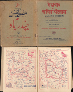
हैदराबाद सचित्र ॲटलस / Pictorial Atlas of Hyderabad.
sold
- Digital Map Information
- Suitable for large format printing
- File Size: 216.74 MB
- File Type: ZIP / TIFF
- ICC color profile embedded
- Delivered instantly via download link
A remarkable find, this is an unrecorded 1937 educational atlas of Hyderabad, India, published in Balbodh, the Marathi script. Simultaneously published in Urdu and Telugu as well, the atlas reflects Hyderabadi pride, including the region's history and vibrant cultural mélange. (more details)