
American Civil War (sold)
A most important Civil War map of Washington D.C.
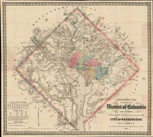
Topographical Map of the Original District of Columbia and Environs: Showing the Fortifications around the City of Washington.
sold
- Digital Map Information
- Suitable for large format printing
- File Size: 51.63 MB
- File Type: ZIP / TIFF
- ICC color profile embedded
- Delivered instantly via download link
Known as 'The Arnold Map', this is the most important Civil War era map of Washington D.C. and vicinity. This map was issued by Edward Greene 'Aloha Vivarttas' Arnold and G. W. Colton in 1862, just after the Second Battle of Bull Run. Centered on the White House, the map illustrates the 'original' ten-mile-square diamond-shaped land allocation set aside for the District of Columbia. As a cartographic piece, Arnold's map exceeded in quality all previous maps of the region, noting roads, canals, turnpikes, railroads, and mills, as well offering a meticulous presentation of topography. Significantly, it illustrates the 51 fortifications, army hospitals, and dozens of small batteries - all critical wartime reconnaissance. (more details)
Cavalry field map for the Atlanta Campaign of the American Civil War.
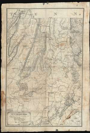
Map of Northern Georgia.
sold
- Digital Map Information
- Suitable for large format printing
- File Size: 32.27 MB
- File Type: ZIP / TIFF
- ICC color profile embedded
- Delivered instantly via download link
'Printed in the Field, Chattanooga, Tenn.', this map of northwestern Georgia is a remarkable artifact of the American Civil War (1861 - 1864) issued by William E. Merrill and William C. Margendant days before the launching of the Atlanta Campaign (May 7, 1863 - Sep 2, 1864). Printed on muslin specifically for Union Calvary officers, this map covers the northeastern part of Georgia, from Chattanooga and the Tennessee border south as far as Dallas and east to include Kennesaw. There can be little doubt that this map saw action in the field, with period manuscript annotations marking routes after May 17th, when Sherman split Union forces south of Adairsville into three separate armies headed by Maj. Generals John Schofield, George H. Thomas, and James B. McPherson. (more details)
Remarkable book with a railroad magnate's appended manuscript maps and annotations relating to the Battle of Gettysburg. Also, an unrecorded early printed map of the Battle of Gettysburg.
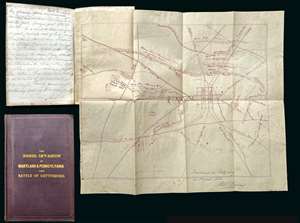
A remarkable discovery, this is a fine example of Michael Jacob's scarce 1864 book on the Confederate invasion of Pennsylvania and the Battle of Gettysburg. While the book itself is uncommon and interesting, the most exciting aspects of the piece are manuscript notes, tipped-in maps, and annotations, by railroad magnate Robert S. Hollins, describing the Battle of Gettysburg and its aftermath. Along with the usual map that accompanies this book, the present example contains additional two tipped-in maps. One a unique manuscript dated to August of 1863, making it one of the earliest known maps of the battle, drawn just days after the conflict. The other is a small but previously unknown printed map of the town and battlefield published by Andrew J. Cross, a clergyman of Baltimore. The extensive manuscript notes, by Baltimore railroad man Robert S. Hollins, describe horse thievery by New Jersey soldiers from Pennsylvania farmers shortly after the battle as well as the acquisition of the maps. (more details)
The Civil War - big and bold.
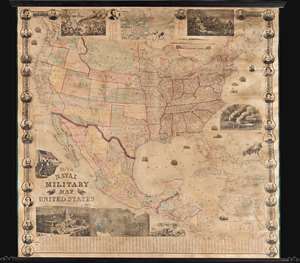
This is a rare 1863 wall map of the United States at the height of the American Civil War (1861 - 1865). The map was issued by John Calvin Smith and Robert Persall Smith during the Civil War to capitalize on general interest in the war among the northern elite. At roughly 70 inches square, this enormous and lavishly produced map covers all of the United States and Mexico. The early state and territory configuration includes the ephemeral Confederate State of Arizona. It is surrounded by images of Union officers and politicians - including Lincoln, Fremont, Wilkes, and Scott. Curiously, these do not include General Grant, as the map's publication in early January of 1863 predates his assumption of overall command on January 29, 1863. The map features multiple vignette scenes including the victory of the Monitor over the Merrimac, the allegorical 'Rescue of the Union', an illustration of 'Camp Life', the Capitol building in Washington, and an overview of the 'Birth of the Union' at Bunker Hill. Of note, the Pacific Telegraph Route is noted running parallel to the Pony Express Route, which is also illustrated. (more details)
Turning Point of the Civil War.
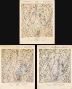
Map of the Battle Field of Gettysburg. July 1st, 2nd, 3rd 1863. First Day's Battle / Second Day's Battle / Third Day's Battle.
sold
- Digital Map Information
- Suitable for large format printing
- Full resolution TIFF file
- ICC color profile embedded
- Delivered instantly via download link
This is John Badger Bachelder's foundational 1876 set of three large-format maps of the Battle of Gettysburg, the definitive turning point of the American Civil War (1861 - 1865). Bachelder had dedicated much of the 13 years since the battle had taken place to researching it, making him the foremost authority on it, resulting in these maps being the definitive contemporaneous account. (more details)
The only Civil War Era wall map of the United States issued by the U.S. Government.
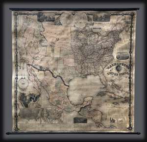
This is the 1861 second edition of Matthew Fontaine Maury’s important wall map of the United States, published by simultaneously by Joseph Taintor of Philadelphia and Holmes Harrison of London. This map covers the entirety of the United States as well as ... (more details)
The only Civil War Era wall map of the United States issued by the U.S. Government.
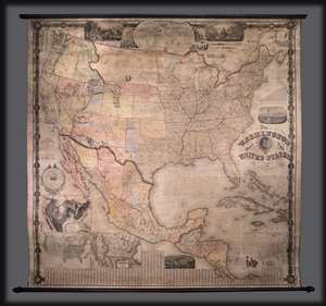
This is the 1861 second edition of Matthew Fontaine Maury’s important wall map of the United States, published by simultaneously by Taintor & Company in Philadelphia and Holmes Harrison & Company of London. This map covers the entirety of the ... (more details)
The only Civil War Era wall map of the United States issued by the U.S. Government.
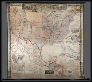
This is the 1861 second edition of Matthew Fontaine Maury's important wall map of the United States, published by simultaneously by Taintor & Company in Philadelphia and Holmes Harrison & Company of London. This map covers the entirety of the ... (more details)
The most iconic view of the Battle of Gettysburg.
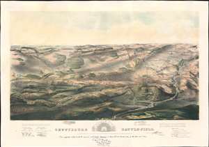
Gettysburg Battle-Field.
sold
- Digital Map Information
- Suitable for large format printing
- File Size: 43.53 MB
- File Type: ZIP / TIFF
- ICC color profile embedded
- Delivered instantly via download link
A remarkable and scarce 1863 proof state of the most iconic view of the American Civil War Battle of Gettysburg printed. This bird's eye view of the Battle of Gettysburg was issued by John Bachelder just months after the actual event. Within days of the battle, Bachelder arrived in Gettysburg where he spent the subsequent 84 days completing a meticulous study of both the battle and the battlefield. Bachelder walked the field daily, interviewed thousands of recovering soldiers on both sides, both commanders and enlisted men, and reconstructed all three days of the battle. (more details)
A scarce proof state of the most iconic view of the Battle of Gettysburg ever published.
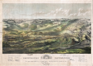
Gettysburg Battle-Field.
sold
- Digital Map Information
- Suitable for large format printing
- File Size: 37.34 MB
- File Type: ZIP / TIFF
- ICC color profile embedded
- Delivered instantly via download link
A remarkable and scarce 1863 proof state of the most iconic view of the American Civil War Battle of Gettysburg printed. This bird's eye view of the Battle of Gettysburg was issued by John Bachelder just months after the actual event. Within days of ... (more details)
The most iconic view of the Battle of Gettysburg.
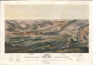
Gettysburg Battle-Field.
sold
- Digital Map Information
- Suitable for large format printing
- File Size: 48.93 MB
- File Type: ZIP / TIFF
- ICC color profile embedded
- Delivered instantly via download link
A remarkable and scarce 1863 proof state of the most iconic view of the American Civil War Battle of Gettysburg printed. This bird's-eye view of the Battle of Gettysburg was issued by John Bachelder just months after the actual event. Within days of the battle, Bachelder arrived in Gettysburg where he spent the subsequent 84 days completing a meticulous study of both the battle and the battlefield. Bachelder walked the field daily, interviewed thousands of recovering soldiers on both sides, both commanders and enlisted men, and reconstructed all three days of the battle. (more details)
Rare Civil War map with remarkable abolitionist provenance.
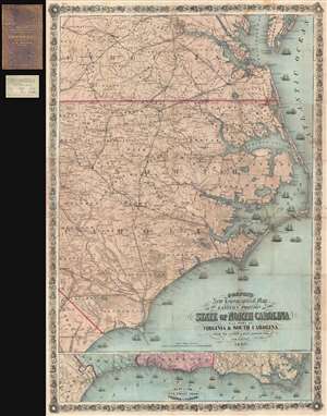
Colton's New Topographical Map of the Eastern Portion of the State of North Carolina with Part of Virginia and South Carolina from the latest and best authorities.
sold
- Digital Map Information
- Suitable for large format printing
- File Size: 29.25 MB
- File Type: ZIP / TIFF
- ICC color profile embedded
- Delivered instantly via download link
This is an impressive large scale 1863 J. H. Colton map of the eastern part of North Carolina during the American Civil War. It is from the library of Union Brigadier General Edward Augustus Wild, the abolitionist leader of the United Stated Colored ... (more details)
Blockade Runners on the Carolina Coast.
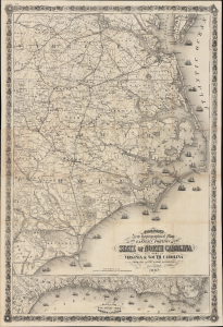
Colton's New Topographical Map of the Eastern Portion of the State of North Carolina with Part of Virginia and South Carolina from the latest and best authorities.
sold
- Digital Map Information
- Suitable for large format printing
- File Size: 81.37 MB
- File Type: ZIP / TIFF
- ICC color profile embedded
- Delivered instantly via download link
This is J. H. Colton's rare, large-format 1863 map of the eastern part of North Carolina during the American Civil War. Among other features, it highlights the Union blockade of the coastlines of these Confederate states, a somewhat porous but still important factor in constraining the Southern economy throughout the war. (more details)
Charting the contours of the early Civil War.
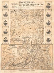
Prang's War Map Missouri, Virginia and North Carolina Coast Line.
sold
- Digital Map Information
- Suitable for large format printing
- File Size: 71.19 MB
- File Type: ZIP / TIFF
- ICC color profile embedded
- Delivered instantly via download link
A rare 1861 Louis Prang map of three theaters of the American Civil War (1861 - 1865), providing an as-it-happened snapshot of the war in its early months, when both Union and Confederate forces rushed to raise armies, produce war materiel, and grasp disputed territory. (more details)
Photograph of the Battlefield of Gettysburg.
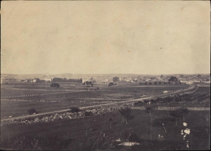
This is an 1863 albumen print of a Timothy O'Sullivan photograph of the Battlefield of Gettysburg. Brady's photo-documentation of the Civil War is significant and played a role much like television journalism did during the Vietnam War - it brought the horrors and violence of the war to the home front, informing public opinion. (more details)
Civil War manuscript map / letter naming 'Rebbaldom'.
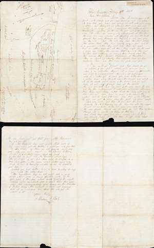
[Plan of Fort Powhatan.]
sold
- Digital Map Information
- Suitable for large format printing
- Full resolution TIFF file
- ICC color profile embedded
- Delivered instantly via download link
This is an 1865 American Civil War manuscript letter and map of Fort Powhatan, Virginia, written by Abraham Slack, a member of the 38th Regiment, New Jersey Infantry. Consisting of three handwritten pages and a map on a single folded sheet. Slack wrote the letter to his son, John William Slack (1850 - c. 1910). In the letter, Slack describes Fort Powhatan in detail, expresses sympathy for desperate condition of the Confederate forces (and families) across the river, details recent military actions, and advises his son on matters of household management. (more details)
Issued during the American Civil War for Spanish Blockade Runners!
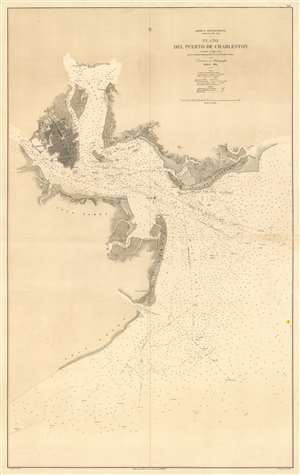
América Septentrional Carolina del Sur. Plano del Puerto de Charleston.
sold
- Digital Map Information
- Suitable for large format printing
- File Size: 38.38 MB
- File Type: ZIP / TIFF
- ICC color profile embedded
- Delivered instantly via download link
An utterly stunning 1864 Civil War Era Spanish Direccion de Hidrografia nautical chart or maritime map of Charleston Harbor, South Carolina. Probably issued for use by Spanish blockade runners during the American Civil War. The map covers the South Carolina coast from Sullivan Island to Folly Island, with a focus on Charleston Harbor. Charleston itself is beautiful engraved and situated between the Ashley and Cooper Rivers. The street grid is detailed, including piers, parks, individual buildings, and more. Similar attention has been given to the Charleston Harbor town of Mount Pleasant and Moultrieville, both of which have since been folded into greater Charleston. (more details)
The only 'realistic' view of the most notorious Anderson confederate Civil War Prison.
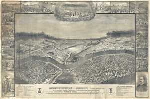
Andersonville Prison. Camp Sumter, GA. As It Appeared August 1st, 1864 When It Contained 35,000 Prisoners of War.
sold
- Digital Map Information
- Suitable for large format printing
- File Size: 378.82 MB
- File Type: ZIP / TIFF
- ICC color profile embedded
- Delivered instantly via download link
This is an 1885 large-format Thomas O'Dea view of the infamous Confederate Civil War Prisoner of War Camp at Andersonville, Georgia. After the Civil War, Andersonville became synonymous with the horrors the country inflicted on itself, encapsulating ... (more details)
Rare view of the of Seat of the Civil War around Washington D.C. and the Chesapeake Bay.
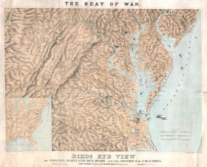
Seat of War. Bird's Eye View of Virginia, Maryland, Delaware and the District of Columbia.
sold
- Digital Map Information
- Suitable for large format printing
- File Size: 29.24 MB
- File Type: ZIP / TIFF
- ICC color profile embedded
- Delivered instantly via download link
A striking 1861 three-color Schedler/Schaus chromolithograph view/map of the Chesapeake Bay region, including Maryland, Virginia, Delaware, and Washington D.C., shortly after the outbreak of the American Civil War (1861 - 1865). Centered on the Chesapeake Bay, the view covers roughly from Gettysburg to Albemarle Sound and from the Ohio River to the Atlantic seaboard. Steam/Sail ships cluster around the mouth of the Chesapeake and Delaware Bays, presumably an attempt to illustrate the ad hoc Union naval blockade of Confederacy. (more details)
The 55th New York Infantry Regiment defending Washington, D.C.
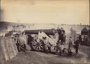
This is an 1861 Matthew Brady Civil War albumen photograph of the 55th New York Infantry manning the artillery at Fort Gaines in Washington, D.C. Based on the 55th New York Infantry Regiment's service record, this photo must have been taken in September or October 1861 when the regiment was on duty at Fort Gaines. Brady's photo-documentation of the Civil War is significant and played a role much like television journalism did during the Vietnam War - it brought the horrors and violence of the war to the home front, informing public opinion. (more details)
A Civil War blockade-runners map of the Savannah River.
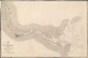
Savannah River Georgia From the United States Coast Survey 1855.
sold
- Digital Map Information
- Suitable for large format printing
- File Size: 46.2 MB
- File Type: ZIP / TIFF
- ICC color profile embedded
- Delivered instantly via download link
This is an extremely scarce 1861 British Admiralty Chart of the Savannah River and city of Savannah, Georgia, issued at the outset of the American Civil War (1961 - 1865). Although formally neutral in the conflict, British private interests financed blockade runners that sent munitions and luxuries to Confederate ports in return for cotton and tobacco. This map of the Savannah River was doubtless produced for this purpose.
The map is derived from U.S. Coast Survey work in the Savannah region completed in 1855, and although the Admiralty chart is superior in construction and presentation, is substantively similar. Coverage extends from the mouth of the Savanna River, Hilton Head, and Tybee Island, westward towards savanna, as far north as Argyle Island. The triangulation for this map was completed by E.O. Cord, C. O. Boutelle, C. P. Bolles and D. T. Van Buren. The topography is the work of H. I. Whiting. The Hydrography was accomplished by a party under the command of J. N. Maffitt. (more details)
The map is derived from U.S. Coast Survey work in the Savannah region completed in 1855, and although the Admiralty chart is superior in construction and presentation, is substantively similar. Coverage extends from the mouth of the Savanna River, Hilton Head, and Tybee Island, westward towards savanna, as far north as Argyle Island. The triangulation for this map was completed by E.O. Cord, C. O. Boutelle, C. P. Bolles and D. T. Van Buren. The topography is the work of H. I. Whiting. The Hydrography was accomplished by a party under the command of J. N. Maffitt. (more details)
First large-scale commercial map of the Confederacy.
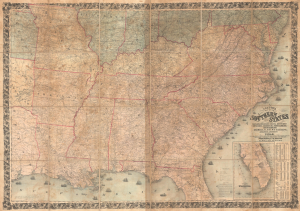
Colton's Map of the Southern States, including Maryland, Delaware, Virginia, Kentucky, Tennessee, Missouri, North Carolina, South Carolina, Georgia, Alabama, Mississippi, Arkansas, Louisiana, and Texas. Showing Also Part of Adjoining States and Territories Locating the Forts and Military Stations of the U. States and Showing all the Rail Roads, R.R. Stations, and other Internal Improvements.
sold
- Digital Map Information
- Suitable for large format printing
- File Size: 198.45 MB
- File Type: ZIP / TIFF
- ICC color profile embedded
- Delivered instantly via download link
This is an 1861 J. H. Colton map of the Confederacy published in the first year of the American Civil War (1861 - 1865). This is the first large-scale commercial map of the Confederacy, published early in 1861, in the immediate wake of the Secession. (more details)
Mostly likely the finest commercially published Civil War Era map of the Mississippi River.
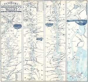
Panorama Of The Mississippi Valley And Its Fortifications.
sold
- Digital Map Information
- Suitable for large format printing
- File Size: 6.28 MB
- File Type: ZIP / TIFF
- ICC color profile embedded
- Delivered instantly via download link
An exceptionally scarce 1863 Charles Magnus Civil War era broadside map of the Mississippi River valley from St. Louis to the Delta of the Mississippi. This map, or as it is called 'panorama', is presented in strip format divided into four distinct ... (more details)
Mostly likely the finest commercially published Civil War Era map of the Mississippi River.
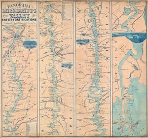
Panorama Of The Mississippi Valley And Its Fortifications.
sold
- Digital Map Information
- Suitable for large format printing
- File Size: 16.95 MB
- File Type: ZIP / TIFF
- ICC color profile embedded
- Delivered instantly via download link
An exceptionally scarce 1863 Charles Magnus Civil War era broadside map of the Mississippi River valley from St. Louis to the Delta of the Mississippi. This map, or as it is called 'panorama,' is presented in strip format divided into four distinct ... (more details)
Mostly likely the finest commercially published Civil War Era map of the Mississippi River.
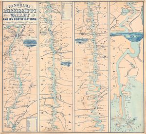
Panorama Of The Mississippi Valley And Its Fortifications.
sold
- Digital Map Information
- Suitable for large format printing
- File Size: 19.45 MB
- File Type: ZIP / TIFF
- ICC color profile embedded
- Delivered instantly via download link
An exceptionally scarce 1863 Charles Magnus Civil War era broadside map of the Mississippi River valley from St. Louis to the Delta of the Mississippi. This map, or as it is called 'panorama,' is presented in strip format divided into four distinct ... (more details)
General Grant with his beloved warhorse, Cincinnati.
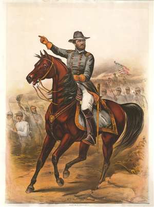
[General Grant and Cincinnati.]
sold
- Digital Map Information
- Suitable for large format printing
- File Size: 29.73 MB
- File Type: ZIP / TIFF
- ICC color profile embedded
- Delivered instantly via download link
A striking 1885 four-color chromolithograph portrait of General Ulysses S. Grant and his fully dressed chestnut warhorse Cincinnati. Grant his here presented in as a Brigadier General, with three stars on his epaulets, suggesting this portrait must represent Grant sometime between 1864 and 1865. Union troops with an American flag battle standard march in the background. This image was issued in 1885 just a few days after Grant's death - presumably to capitalize on general enthusiasm eulogizing the war hero. (more details)
The largest Union prisoner of war camp during the Civil War.
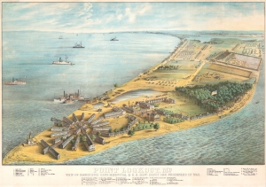
Point Lookout, Md. View of Hammond General Hospital and U.S. Genl. Depot for Prisoners of War.
sold
- Digital Map Information
- Suitable for large format printing
- File Size: 150.63 MB
- File Type: ZIP / TIFF
- ICC color profile embedded
- Delivered instantly via download link
This is an 1864 George Everett chromolithograph bird's-eye view of Point Lookout, Maryland, at the height of the American Civil War (1861 - 1865). Point Lookout was home to the Hammond General Hospital (illustrated here in the foreground) and a notorious Prisoner of War camp. (more details)
Manuscript map drawn by a Confederate soldier of a battle during the first year of the American Civil War.
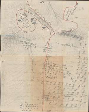
A Hand sketch of Camp Allegheny from memory.
sold
- Digital Map Information
- Suitable for large format printing
- Full resolution TIFF file
- ICC color profile embedded
- Delivered instantly via download link
This is a one-of-a-kind Confederate-drawn manuscript map of the Battle of Camp Allegheny, Pocahontas County, West Virginia, fought on December 13, 1861, early in the American Civil War (1861 - 1865). The map's creator, likely the Confederate officer Thomas Ranson, labels the encampment of the 44th Regiment, the 31st (Virginia) Regiment, and cabins occupied by the 12th Georgia Regiment, and Col. Baldwin's Regiment (the 52nd Virginia Regiment - the likely map creator's unit). Artillery batteries commanded by Anderson and Miller are illustrated on top of the knob in the upper right. A church where Confederate ordnance and commissary supplies were stored is illustrated in a copse of trees near the bottom. The initial Union attack came from these trees and the map's creator marks 'dead Yankeys' throughout the woods. The Staunton Pike, which the Confederates were protecting, runs vertically through the map from east to west (with west at top). (more details)
A portrait of Grant as the victorious general during the American Civil War.
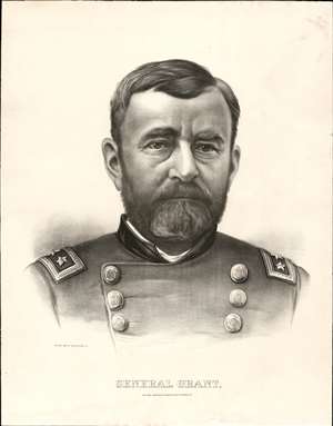
General Grant.
sold
- Digital Map Information
- Suitable for large format printing
- File Size: 37.06 MB
- File Type: ZIP / TIFF
- ICC color profile embedded
- Delivered instantly via download link
This is a finely engraved 1885 Currier and Ives lithograph portrait of General Ulysses S. Grant (April 27, 1822 - July 23, 1885). Likely published shortly after his death, this portrait depicts Grant as he appeared around 1864, during the American Civil War (1861 - 1865). Both dignified and somber, Grant is presented in his double-breasted Union uniform bearing three-star rank insignia on each shoulder. Grant was the second three-star general in the United States Army (George Washington was the first), granted the rank in 1864 when he took command of the Army of the Potomac. In 1866, Grant become the first four-star general when he was appointed General of the Army. Ulysses S. Grant was a complicated man with a complicated legacy. This portrait captures a moment in time and commemorates a man that fought for the soul of his country. (more details)
The 'high water mark' of the Confederacy and turning point of the Battle of Gettysburg.
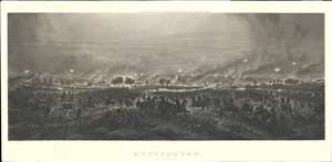
Gettysburg. Repulse of Longstreet's Assault.
sold
- Digital Map Information
- Suitable for large format printing
- File Size: 55.2 MB
- File Type: ZIP / TIFF
- ICC color profile embedded
- Delivered instantly via download link
A fine example of John Badger Bachelder and James Walker's 1876 steel-engraved view of the American Civil War Battle of Gettysburg, here in the rare 1905 edition issued by Bachelder's widow, Lizzie B. Bachelder. The view is derived from James Walker's incredible 20-foot-wide painting of Pickett's Charge, identified here as Longstreet's Assault, considered the 'high water mark' of the Confederacy and the turning point not only of the battle, but of the American Civil War (1861 - 1865). (more details)
Rare Civil War Powder Horn with a map of the Confederacy by Georgia volunteer Jim Reed.
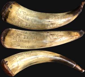
This is a rare c. 1864 map scrimshaw powder horn etched by a Confederate soldier during the American Civil War (1861 – 1865). The powder horn bears a fascinating map covering the coast between Charleston, South Carolina and Savannah, Georgia. ... (more details)
The American Civil War as theater!
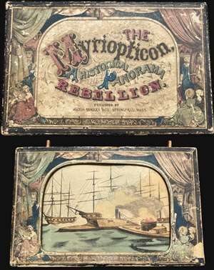
This is Milton Bradley's 1866 Myriopticon, a rolling pictorial panorama summarizing the history of the American Civil War (1861 - 1865). Released not long after the end of the war, the Myriopticon ranks as one of Milton Bradley's first products. Mounted on two rollers, twenty-two events from the war, including the Confederates firing on Fort Sumter, Grant's victory at Fort Donaldson, the first battle between the ironclads, and the horrors of the Battle of Antietam, pass before the viewer's eyes. All these are framed by bunting and curtains painted on the box to create the illusion of a theatre. (more details)