
American Civil War
Unprecedented collection of 55 Mathew Brady photos capturing the Eastern Theater of the Civil War.
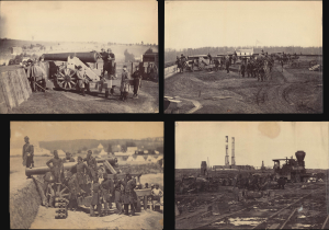
[Mathew Brady American Civil War Photo Archive (1861 - 1865)].
$90,000.00
Acquire
- Digital Map Information
- Suitable for large format printing
- Full resolution TIFF file
- ICC color profile embedded
- Delivered instantly via download link
An extraordinary opportunity, this is a collection of 55 original Mathew Brady / Brady and Company albumen photographs covering the span of the American Civil War (1861 - 1865). The documentation of the Civil War by Brady and his colleagues marks the first instance in which the brutal realities of war were communicated to the general public via a medium as immediate and visceral as photography - an achievement that has led Brady to be called the 'First Photojournalist'. While individual Brady photos occasionally appear at auction and on the market, a collection of this magnitude is unprecedented. (more details)
'The Father of Waters again goes unvexed to the sea.'
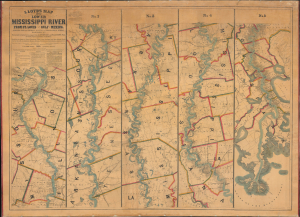
Lloyd’s Map of the Lower Mississippi River From St. Louis to the Gulf of Mexico. Compiled from Government Surveys in the Topographical Bureau...
$17,000.00
Acquire
- Digital Map Information
- Suitable for large format printing
- File Size: 104.66 MB
- File Type: ZIP / TIFF
- ICC color profile embedded
- Delivered instantly via download link
This is James T. Lloyd's engrossing 1863 large-format map of the Mississippi River, produced during the U.S. Civil War (1861 - 1865). It provides a comprehensive overview of the economically vital and strategically critical waterway, then a hotly contested theater of war vital to both the Union and the Confederacy. (more details)
First Clash of Ironclads - by America's first female professional artist.
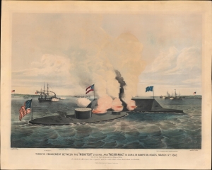
Terrific Engagement Between the 'Monitor' 2 guns, and 'Merrimac' 10 guns, in Hampton Roads, March 9th 1862. The First Fight between Iron Ships of War. In which the Merrimac was ripped, and the whole Rebel Fleet driven back to Norfolk.
$8,500.00
Acquire
- Digital Map Information
- Suitable for large format printing
- Full resolution TIFF file
- ICC color profile embedded
- Delivered instantly via download link
A striking 1862 Currier and Ives original lithograph view of the historic American Civil War battle of the Monitor and Merrimac. Considered the first clash of Ironclads, this was one of the most important naval engagements in the American Civil War (1861 - 1865), transforming future naval warfare. This is one of the first images of the historic battle that would have been available to the general public. Moreover, it is the work of Frances 'Fanny' Palmer, the first American woman to work as a professional artist. (more details)
Manuscript record of the voyage that nearly transformed the American Civil War into a global conflict.
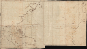
[Voyage of the HMS Rinaldo, 1861-1863]
$5,000.00
Acquire
- Digital Map Information
- Suitable for large format printing
- Full resolution TIFF file
- ICC color profile embedded
- Delivered instantly via download link
A unique c. 1863 manuscript map documenting one of the most consequential British naval voyages of the early American Civil War (1861 - 1865): the 1861-63 Atlantic cruise of HMS Rinaldo. Operating along the North American and West Indian Station, the British warship visited Union and Confederate ports, protected British commercial and diplomatic interests, and carried the released Confederate commissioners James Murray Mason and John Slidell- central figures in the Trent Affair - from Provincetown, Massachusetts, to St. Thomas in the Danish West Indies. This manuscript unites two important episodes in Anglo-American Civil War diplomacy: the resolution of the Trent Affair and the confrontation between General Butler and British acting consul George Coppell. (more details)
One of the few atlas printed in the Confederacy during the Civil War.
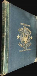
Johnson's New Illustrated (Steel Plate) Family Atlas.
$3,500.00
Acquire
- Digital Map Information
- Suitable for large format printing
- File Size: 33.49 MB
- File Type: ZIP / TIFF
- ICC color profile embedded
- Delivered instantly via download link
A rare Richmond-issue Civil War edition of Johnson's New Illustrated (Steel Plate) Family Atlas published in Richmond in 1861. It is one of the only atlases published in the Confederacy during the American Civil War (1861 - 1865). (more details)
Outbreak of the Civil War.
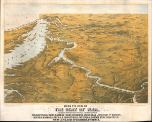
Birds Eye View of The Seat of War. Arranged after the latest Surveys, showing views of Washington, Baltimore, Harpers Ferry, Richmond, Manassas Junction, Ft. Monroe, Norfolk Harbor and c. Their Connections, and The General Surface of the Country in Maryland, Dist. of Columbia, and Virginia.
$3,400.00
Acquire
- Digital Map Information
- Suitable for large format printing
- File Size: 25.3 MB
- File Type: ZIP / TIFF
- ICC color profile embedded
- Delivered instantly via download link
This is a rare 1861 bird's-eye view of the vicinity of Washington, D.C., including Richmond, the mouth of the Chesapeake Bay, and the Potomac River in the early days of the American Civil War (1861 - 1865). The work was compiled by Boston's most talented lithographer, Louis Prang. It is novel in that it is anticipatory, a tool for Prang's audience to understand a conflict that was universally expected, but which had not yet developed. (more details)
Capitalizing on British interest in the American Civil War.
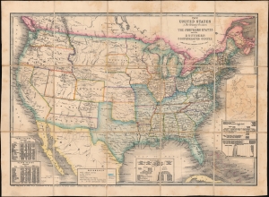
The United States and Relative Position of the Northern States and the Southern Confederated States.
$3,200.00
Acquire
- Digital Map Information
- Suitable for large format printing
- Full resolution TIFF file
- ICC color profile embedded
- Delivered instantly via download link
This is an 1861 James Wyld map of the United States depicting the Union and Confederacy at the outset of the American Civil War (1861 - 1865). It was published in Great Britain to capitalize on British interest in the conflict, which threatened their booming textile industry and thus national economic stability. The 'Southern Confederated States' are shaded blue. Keeping current to the fast-paced events, Wyld remarkably includes the ephemeral Confederate state of Arizona. (more details)
Ephemeral Territories in the American West.
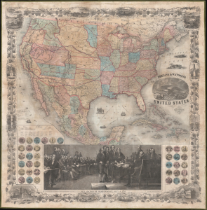
Phelps and Watson's New Map of the United States.
$3,000.00
Acquire
- Digital Map Information
- Suitable for large format printing
- Full resolution TIFF file
- ICC color profile embedded
- Delivered instantly via download link
This is a rare 1860 wall map of the United States published by Phelps and Watson. It presents the territorial configuration of U.S. states and territories on the eve of the U.S. Civil War (1861 - 1865), which would drastically reshape the map. (more details)
The largest Union prisoner-of-war camp during the Civil War.
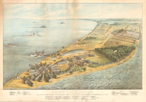
Point Lookout, Md. View of Hammond General Hospital and U.S. Genl. Depot for Prisoners of War.
$2,000.00
Acquire
- Digital Map Information
- Suitable for large format printing
- Full resolution TIFF file
- ICC color profile embedded
- Delivered instantly via download link
This is an 1864 George Everett chromolithograph bird's-eye view of Point Lookout, Maryland, at the height of the American Civil War (1861 - 1865). Point Lookout was home to the Hammond General Hospital (illustrated here in the foreground) and a notorious prisoner-of-war camp. It is one of the few large-format views issued during the war, likely in response to public interest. (more details)
Railroads in the Eastern Theater of the American Civil War.
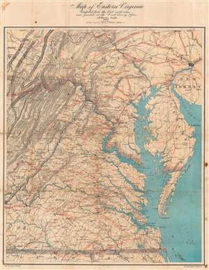
Map of Eastern Virginia.
$2,000.00
Acquire
- Digital Map Information
- Suitable for large format printing
- Full resolution TIFF file
- ICC color profile embedded
- Delivered instantly via download link
This is an 1862 Walter L. Nicholson map of eastern Virginia and Maryland, published during the second year of the American Civil War (1861 - 1865). The map embraces the Eastern Theater of war, from Pennsylvania south to the North Carolina - Virginia border. Washington, D.C. stands out on the Potomac River, while red concentric circles in ten mile increments focus upon Richmond. No battlefields are explicitly marked, but landmarks for which battles were named both before and after this map was published, including Fredericksburg, Chancellorsville, Spotsylvania Court House, and Gettysburg, appear. Red overprinting illustrates the railroad network, which proved critical to both the Union and Confederate war effort. Both sides used the railroads to move men and supplies to and from battlefields. Railroads and railroad hubs thus became strategic targets for raids and advancing armies. (more details)
Seat of the Civil War around Washington D.C. and the Chesapeake Bay.
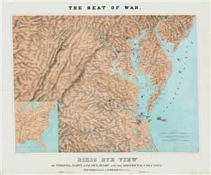
The Sea of War. Birds Eye View of Virginia, Maryland, Delaware and the District of Columbia.
$2,000.00
Acquire
- Digital Map Information
- Suitable for large format printing
- File Size: 56.72 MB
- File Type: ZIP / TIFF
- ICC color profile embedded
- Delivered instantly via download link
A striking 1861 three-color Schedler/Schaus chromolithograph view/map of the Chesapeake Bay region, including Maryland, Virginia, Delaware, and Washington D.C., shortly after the outbreak of the American Civil War (1861 - 1865). (more details)
Honoring military service in the late 19th century.
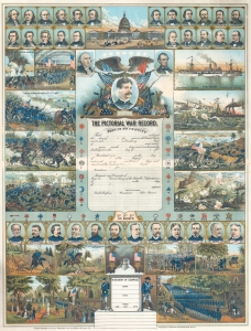
The Pictorial War Record.
$1,900.00
Acquire
- Digital Map Information
- Suitable for large format printing
- File Size: 51.43 MB
- File Type: ZIP / TIFF
- ICC color profile embedded
- Delivered instantly via download link
This is a rare 1898 James M. Vickroy chromolithograph broadside commemorating the Spanish-American War (1898) and the American Civil War (1861 - 1865) - the two most significant American wars of the second part of hte 19th century. The view is part of a genre of decorative broadsides sold commercially to those wishing to commemorate the military service of a family member. This example was never used. (more details)
Execution of a Desperado observed by U.S. Colored Regiments.

Military Execution Of James Griffin, alias John Thomas Barnett, a Private of the 11th Pa. Calvary, for Desertion and Highway Robbery, At Portsmouth, Va., Sept. 17th, 1863.
$1,800.00
Acquire
- Digital Map Information
- Suitable for large format printing
- File Size: 15.84 MB
- File Type: ZIP / TIFF
- ICC color profile embedded
- Delivered instantly via download link
This rare and rather grisly image is a c. 1863 U.S. Civil War Era hand-tinted Endicott lithograph illustrating the execution of John Thomas Barnett, a Union deserter and highwayman. Also, at left, the image includes a rare illustration of the 1st and 2nd Regiment Colored Troops among the observers. Such images, while scarce, were intended to underscore the severity of military justice. (more details)
Battle of the Ironclads.

The First Naval Conflict between Iron Clad Vessels. In Hampton Roads, March 9th 1862.
$1,500.00
Acquire
- Digital Map Information
- Suitable for large format printing
- Full resolution TIFF file
- ICC color profile embedded
- Delivered instantly via download link
This is Charles Parsons' 1862 view of the American Civil War (1861 - 1865) naval battle between the USS Monitor and the CSS Virginia, a captured Union ship formerly called Merrimac. Although the battle was inconclusive, this first confrontation between ironclads ushered in a new era of naval warfare. (more details)
Civil War Veterans - a home.
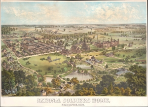
National Soldiers Home, Near Dayton, Ohio.
$1,500.00
Acquire
- Digital Map Information
- Suitable for large format printing
- File Size: 24.92 MB
- File Type: ZIP / TIFF
- ICC color profile embedded
- Delivered instantly via download link
A rare 1878 Adolph Krebs chromolithograph view of the National Soldier's Home (National Asylum for Disabled Volunteer Soldiers) near Dayton, Ohio. The view looks west and slightly north on the campus from a high point to the west of the home, a region today called Highview Hills. (more details)
Civil War Sketch of Cape May.
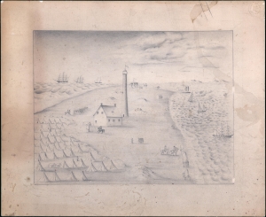
[Cape May Lighthouse].
$1,500.00
Acquire
- Digital Map Information
- Suitable for large format printing
- File Size: 8.51 MB
- File Type: ZIP / TIFF
- ICC color profile embedded
- Delivered instantly via download link
A curious c. 1862 American Civil War era view of Cape May, New Jersey. The view focuses on what we believe to be the Cape May lighthouse during the American Civil War (1861 - 1865). (more details)
America's first great insurance company.
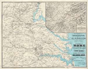
The Approaches from Washington, to Richmond.
$1,250.00
Acquire
- Digital Map Information
- Suitable for large format printing
- File Size: 40.84 MB
- File Type: ZIP / TIFF
- ICC color profile embedded
- Delivered instantly via download link
A scarce 1864 Daniel A. Heald map of the Washington D.C. / Richmond, Virginia area during the American Civil War. The strategically and politically critical corridor between Washington D. C. and Richmond, Virginia was one of the most hotly contested theaters of the American Civil War (1861 - 1865). When this map was issued, in 1864, the war had already turned strongly in favor of the Union. Late 1864 and early 1865 witnessed a succession of battles as Union forces pursued Confederate armies as they retreated toward their capital, Richmond. Battle sites are marked by crossed cavalry swords. The main map relates to the 1862 Peninsular Campaign. While the submap follows military operations in Eastern Tennessee, Northern Alabama, and Georgia - representing the final days of the Confederacy. (more details)
Issued for the Civil War - one of just two known examples.
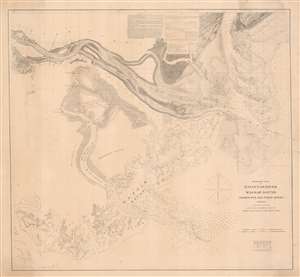
Preliminary Chart of Savannah River Wassaw Sound Wilmington and Tybee Rivers Georgia.
$1,200.00
Acquire
- Digital Map Information
- Suitable for large format printing
- File Size: 47.3 MB
- File Type: ZIP / TIFF
- ICC color profile embedded
- Delivered instantly via download link
An exceptionally rare separate issue c. 1862 Civil War Era U.S. Coast Survey nautical chart or map of the Savannah River and surrounding waters. This chart combines existing surveys of the Savannah River with separate charts prepared of the Wassaw Sound and the Wilmington and Tybee Rivers. Given the presentation on heavier stock and the maps relative rarity, it is likely this was a separate issue prepared for naval action early in the American Civil War (1861 - 1865). (more details)
Eastern Theater of the American Civil War.
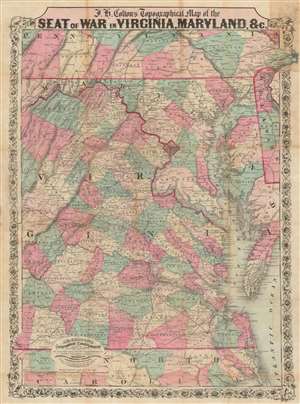
J.H. Colton's Topographical Map of the Seat of War in Virginia, Maryland, etc.
$1,200.00
Acquire
- Digital Map Information
- Suitable for large format printing
- Full resolution TIFF file
- ICC color profile embedded
- Delivered instantly via download link
This is a rare 1862 J. H. Colton map of Virginia, Maryland, and the Chesapeake Bay during the American Civil War (1861 - 1865). This map was issued for readers to follow Civil War events as they unfolded. In 1862, most of the Civil War had yet to come, but there was no doubt that most of the decisive battles would take place in the Mid-Atlantic theater, where the warring capitals stood just over 100 miles apart. (more details)
Active Civil War encampment.
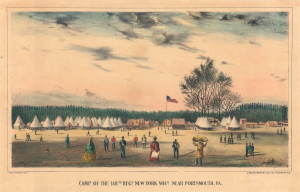
Camp of the 148th Regt. New York Vols. Portsmouth, VA.
$950.00
Acquire
- Digital Map Information
- Suitable for large format printing
- Full resolution TIFF file
- ICC color profile embedded
- Delivered instantly via download link
This is a c. 1863 James S. Laidlaw view of the 148th Regiment, New York Infantry's camp at Portsmouth, Virginia, during the American Civil War (1861 - 1865). Unlike most Civil War images, this view was published contemporaneously with the war. (more details)
Three years before the Civil War.
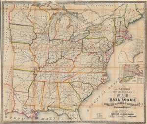
H. V. Poor's new and complete Map of All the Rail Roads in the United States and Canadas in Operation and Progress.
$950.00
Acquire
- Digital Map Information
- Suitable for large format printing
- File Size: 86.11 MB
- File Type: ZIP / TIFF
- ICC color profile embedded
- Delivered instantly via download link
This is a c. 1858 Henry V. Poor railroad wall map of the eastern United States, published just 3 years before the American Civil War (1861 - 1865). Railroads identified by name traverse the country from the Eastern Seaboard the central United States, reaching eastern Nebraska, Kansas, and Texas. (more details)
Snapshot of a rapidly changing country.
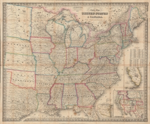
G. Woolworth Colton's New Guide Map of the United States and Canada, with Railroads, Counties etc.
$950.00
Acquire
- Digital Map Information
- Suitable for large format printing
- File Size: 1436.73 MB
- File Type: ZIP / TIFF
- ICC color profile embedded
- Delivered instantly via download link
An impressive 1862 folding map of the United States by George Woolworth Colton, heir of the prominent map publishing firm founded by his father Joseph Hutchins Colton. Remarkably detailed, it highlights railroads, state / territory and county lines, and demographic data at the height of the American Civil War (1861 - 1865). (more details)
Confederate Civil War Map.
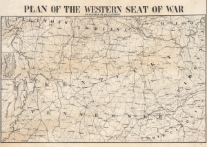
Plan of the Western Seat of War.
$850.00
Acquire
- Digital Map Information
- Suitable for large format printing
- File Size: 18.78 MB
- File Type: ZIP / TIFF
- ICC color profile embedded
- Delivered instantly via download link
This is a c. 1862 Confederate-printed map of the Western Theater of War during the American Civil War (1861 - 1865) created in New Orleans by Henry P. Lathrop. The Western Theater saw some of the war's most brutal fighting, and the Union's first major victories occurred in this theater. Confederate maps of any kind are exceedingly rare as most southern cities lacked supplies or a printing infrastructure capable of supporting map production. (more details)
Pivotal Union victory near the end of the American Civil War.
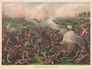
Battle of Five Forks, Va.
$850.00
Acquire
- Digital Map Information
- Suitable for large format printing
- File Size: 38.35 MB
- File Type: ZIP / TIFF
- ICC color profile embedded
- Delivered instantly via download link
This is an 1886 Kurz and Allison view of the pivotal Battle of Five Forks during the American Civil War. Union forces, most mounted on horseback, are illustrated charging Confederate lines from the left. Brutal hand to hand combat dominated the foreground, while an inoperable Confederate cannon lies derelict in lower right. Union cavalry stretches to the horizon, charging through a cloud of gunpowder towards the Confederate lines. Other Confederate troops mount a hasty if orderly retreat. (more details)
Rare Pre-Civil War Map of the United States illustrating California Gold Region.
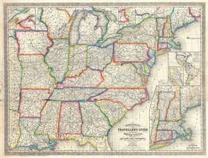
Mitchell's New Traveller's Guide through the United States Showing the Rail Roads, Canals, Stage Roads and c. with Distances from Place to Place.
$800.00
Acquire
- Digital Map Information
- Suitable for large format printing
- File Size: 27.38 MB
- File Type: ZIP / TIFF
- ICC color profile embedded
- Delivered instantly via download link
An uncommon separately issued 1857 pre-Civil War pocket map of the United States issued by Charles Desilver based on earlier maps by Samuel Augustus Mitchell. The map covers the United States from the Atlantic seaboard west to the first tier of states beyond the ... (more details)
Published eight months into the American Civil War!
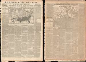
The United States in Black and White. / Major General Butler's Expedition.
$750.00
Acquire
- Digital Map Information
- Suitable for large format printing
- File Size: 74.75 MB
- File Type: ZIP / TIFF
- ICC color profile embedded
- Delivered instantly via download link
Presented here is the full December 17, 1861 edition of The New York Herald published eight months into the American Civil War. This edition features two maps: a front-page map of the United States that highlighting the Confederacy and a map of the Gulf Coast of Mississippi detailing Major General Benjamin Butler's landing on Ship Island. Ship Island, located twelve miles off the coast of Mississippi in the Gulf of Mexico, provided the Union Army with a base of operations in the Gulf. It also allowed the Union some flexibility, in that they could theoretically launch attacks against Texas or New Orleans from Ship Island, which caused the Confederacy significant anxiety. (more details)
Immediately prior to Cold Harbor.
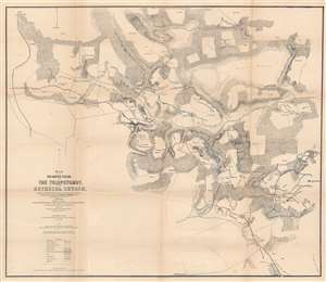
Map of the Battlefields of The Tolopotomoy and Bethesda Church Showing the Field of Operations of the Army of the Potomac Commanded by Maj. Gen. George G. Meade U.S. Army From May 28th to June 2nd 1864.
$750.00
Acquire
- Digital Map Information
- Suitable for large format printing
- File Size: 32.4 MB
- File Type: ZIP / TIFF
- ICC color profile embedded
- Delivered instantly via download link
This is an 1864 Charles W. Howell and James C. Duane map of the battle of Totopotomoy Creek, fought during the American Civil War (1861 - 1865). Depicting the battlefield and the immediate surroundings, red highlights Confederate lines while blue emphasizes Union positions. Red and blue lines illustrate Confederate positions captured by the Union. Army of the Potomac headquarters throughout the battle are labeled and marked with a small American flag. Homesteads in the region, the local store, and churches are identified by name. (more details)
The United States Colored Troops.
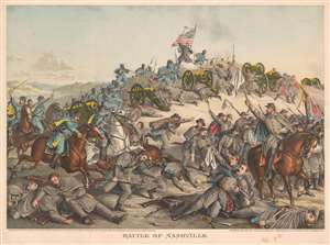
Battle of Nashville.
$750.00
Acquire
- Digital Map Information
- Suitable for large format printing
- File Size: 41.56 MB
- File Type: ZIP / TIFF
- ICC color profile embedded
- Delivered instantly via download link
This is an 1891 Kurz and Allison chromolithograph American Civil War (1861 - 1865) view of the Battle of Nashville, Tennessee. Union troops are illustrated on the left storming Confederate redoubts. United States Colored Troops are prominently featured courageously advancing in the face of point-blank musket fire. The bulk of the illustrated Confederate soldiers appear in the lower right retreating from determined Federal soldiers. (more details)
Rare confederate imprint.
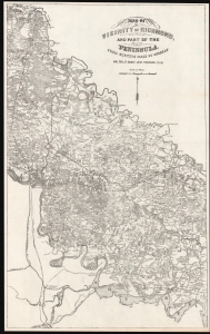
Map of the Vicinity of Richmond, and part of the Peninsula, from Surveys made by the order of Maj. Gen. J. F. Gilmer Chief Engineer, C.S.A.
$700.00
Acquire
- Digital Map Information
- Suitable for large format printing
- File Size: 545.26 MB
- File Type: ZIP / TIFF
- ICC color profile embedded
- Delivered instantly via download link
This is a scarce c. 1866 Civil War map of the vicinity of Richmond, Virginia, issued in Richmond by Confederate Civil Engineer Major General Engineer Jeremy Francis Gilmer. (more details)
The first battle of the Peninsula Campaign.
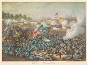
Battle of Williamsburg.
$650.00
Acquire
- Digital Map Information
- Suitable for large format printing
- File Size: 46.11 MB
- File Type: ZIP / TIFF
- ICC color profile embedded
- Delivered instantly via download link
This is an 1893 Kurz and Allison chromolithograph view of the Battle of Williamsburg during the American Civil War (1861 - 1865). Depicting the counterattack led by General Winfield Scott Hancock, Union troops advance on a Confederate position from the left, with the flag of the 5th Wisconsin Infantry Regiment occupying the center of the view next to the American flag. The flag of the 6th Maine Volunteer Infantry Regiment appears in the background near the left border. Confederate and Union troops fight at close range in the lower right foreground, with casualties from both armies sprawled across the field. Some Confederate soldiers are illustrated holding their ground against the charging Federals, but others flee in panic. (more details)
One of Ulysses S. Grant's first victories in the Civil War.
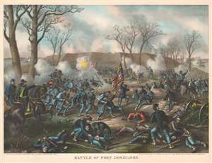
Battle of Fort Donelson.
$600.00
Acquire
- Digital Map Information
- Suitable for large format printing
- File Size: 52.07 MB
- File Type: ZIP / TIFF
- ICC color profile embedded
- Delivered instantly via download link
This is an 1887 Kurz and Allison view of the American Civil War (1861 - 1865) Battle of Fort Donelson, Tennessee. The view illustrates the Union Army of the Tennessee commanded by Brigadier General Ulysses S. Grant (depicted on the left astride a horse) assaulting the Confederate stronghold at Fort Donelson. (more details)
The nail in the coffin of the Confederacy.
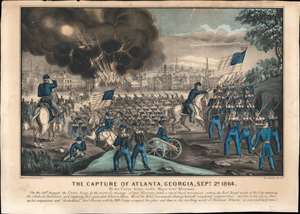
The Capture of Atlanta, Georgia, Sept. 2d, 1864.
$600.00
Acquire
- Digital Map Information
- Suitable for large format printing
- File Size: 26.02 MB
- File Type: ZIP / TIFF
- ICC color profile embedded
- Delivered instantly via download link
This is a nice example of Charles Currier and James Ives' print depicting the 1864 capture of Atlanta by Gen. William Tecumseh Sherman's forces during the U.S. Civil War. The battle was a key victory in Sherman's 1864 Georgia campaign, which culminated in the 'March to the Sea' and the capture of Savannah. Having seized the rebels' rail hub, destroyed their supply lines, and quite literally cut the Confederacy in half, the campaign was decisive in ensuring the Confederacy's ultimate defeat. (more details)