
Germany - Czech Republic (sold)
First Edition, First State of a later censured Map of Hungary.
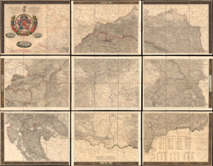
Magyar Ország, Horvát, Tót, Dalmát, és Erdély Országok, a tenger mellék és a végőri videkék kőzonséges pśták és útak főldabrosza... / Vollstaendige General Posten- und Strassen-Karte des Königreichs Ungran, der Königreiche Croatien, Slavonien, Dalmatien, des Grossfürstenth. Siebenbürgen, des Küstenlandes und der Militair-Grenze...
sold
- Digital Map Information
- Suitable for large format printing
- File Size: 591.44 MB
- File Type: ZIP / TIFF
- ICC color profile embedded
- Delivered instantly via download link
This is Blaschnék Sámuel and Schedius Lajos' lavish, very large-format bilingual (Hungarian-German) c. 1836 folding map of the Kingdom of Hungary, here in its first-edition first-state. It depicts the kingdom in the wake of the Napoleonic Wars, when it was in the midst of a reform movement, and represents the most detailed and up-to-date mapping of the kingdom in the first half of the 19th century. (more details)
The earliest acquirable modern printed map of Eastern Europe.
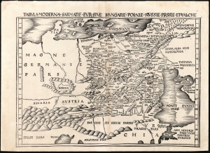
Tabula Moderna Sarmatie Eur. Sive Hungarie Polonie Russie Prussie Et Walachie.
sold
- Digital Map Information
- Suitable for large format printing
- DPI: 600
- File Size: 53.73 MB
- File Type: ZIP / TIFF
- ICC color profile embedded
- Delivered instantly via download link
This is Martin Waldseemüller's 1513 map of Eastern Europe, covering from the Elbe River to the Dnipro River and the Black Sea - roughly Poland, Hungary, Prussia, Lithuania, Russia, Transylvania, and Bulgaria, and some of the earliest obtainable mappings of the Ukraine. (more details)
The largest and best map of Poland following the Third Partition.
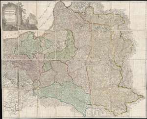
Grenzkarte der Preussischen Russischen und Oestreichischen Monarchien in XVI Blättern.
sold
- Digital Map Information
- Suitable for large format printing
- DPI: 300
- File Size: 61.83 MB
- File Type: ZIP / TIFF
- ICC color profile embedded
- Delivered instantly via download link
An exceedingly rare map of the great significance, this is Daniel Friedrich Sotzmann's 1796 large-format large-scale map of Poland prepared immediately after the 1775 Third Partition of the Polish-Lithuanian Commonwealth. When Sotzmann made this map, he was the ... (more details)
Largest and Best 17th century view of Krakow.
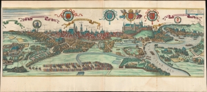
Cracovia Metropolis Regni Poloniae.
sold
- Digital Map Information
- Suitable for large format printing
- File Size: 934.03 MB
- File Type: ZIP / TIFF
- ICC color profile embedded
- Delivered instantly via download link
This is the largest and best 17th-century view of Krakow, Poland. The view was published in c. 1657 by Jan Jansson for his edition of Georg Braun and Franz Hogenberg's Civitatus Orbis Terrarum. (more details)
Beautifully colored map of Poland - with views of Krakow and Breslau!
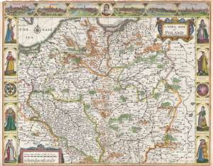
A Newe Mape of Poland.
sold
- Digital Map Information
- Suitable for large format printing
- DPI: 300
- File Size: 11.83 MB
- File Type: ZIP / TIFF
- ICC color profile embedded
- Delivered instantly via download link
This is a 1676 John Speed carte-a-figure map of Poland issued at the end of the Second Polish-Ottoman War. The map depicts from the Baltic Sea and eastern Bohemia to Prussia, Lithuania, and western Russia and from the Baltic to Kraków (Cracow; Cracovia). ... (more details)
Decorative Carte-a-Figure map of Poland!
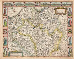
A Newe Mape of Poland.
sold
- Digital Map Information
- Suitable for large format printing
- Full resolution TIFF file
- ICC color profile embedded
- Delivered instantly via download link
This is a 1676 John Speed carte-a-figure map of Poland issued at the end of the Second Polish-Ottoman War. The map depicts from the Baltic Sea and eastern Bohemia to Prussia, Lithuania, and western Russia and from the Baltic to Kraków (Cracow; Cracovia). ... (more details)
Extremely Rare Inspirationist Broadside.
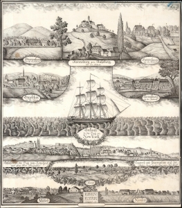
Eben Ezer Sam. 7. 12.
sold
- Digital Map Information
- Suitable for large format printing
- File Size: 13.3 MB
- File Type: ZIP / TIFF
- ICC color profile embedded
- Delivered instantly via download link
This is a one-of-a-kind lithograph broadside by Joseph Prestele (1796 - 1867) encompassing the migration from Hesse, Germany to western New York of the pietist sect known as the Community of True Inspiration. It is a composite image narrating the journey from Germany to America of Prestele and his coreligionists. It illustrates the estates in Hesse, where the sect took root; the ship that brought Prestele and his family to America in 1843; the views of Staten Island visible from the ship; and panoramas of the three villages of Eben-Ezer where Prestele and the Inspirationists settled in the 1840s and 50s. (more details)
Czech nationalism.
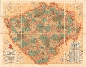
Politicka a Mistopisna Mapa Kralovstvi Ceskeho.
sold
- Digital Map Information
- Suitable for large format printing
- Full resolution TIFF file
- ICC color profile embedded
- Delivered instantly via download link
A rare and beautiful 1872 chromolithograph map of Bohemia (today's Czech Republic) by Czech publisher Josef Erben. This map is significant as, issued during a time of Czech cultural revival and growing nationalism, it represents one of the first maps of Bohemia issued fully in Czech. As such, it is one of the first maps to employ and promote Czech cartographic terminology, which lacking established native cartographic tradition, Erben had to invent from scratch. The terminology presented here had a significant influence on other Czech and subsequent Slavic cartography, who took inspiration from Erben's vocabulary. (more details)
Ground Zero of the Holocaust in Poland.
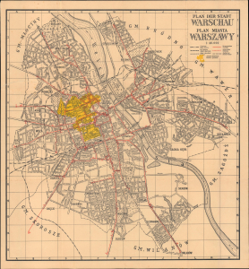
Plan der Stadt Warschau / Plan miasta Warszawy.
sold
- Digital Map Information
- Suitable for large format printing
- Full resolution TIFF file
- ICC color profile embedded
- Delivered instantly via download link
This is a scarce and haunting c. 1941 German-Polish map of Warsaw, prepared during the World War II (1939 - 1945) Nazi occupation. Although ostensibly produced to trace public transit routes, it highlights the city's Jewish Ghetto, the largest such area in Europe and a key site in the perpetration of the Holocaust. (more details)
A complete set of 79th Infantry Division route maps from World War II - maps created by the soldiers for the soldiers.
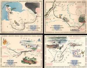
Through France with the 79th Infantry Division 14 June to 29 Aug, 1944. Maj Gen I.T. Wyche, Commanding. / To Belgium and Back wit the 79th Infantry Division 31 Aug to 25 Oct, 1944 Maj. Gen. I. T. Wyche, Commanding. / To the Rhine with the 79th Infantry Division 25 Oct to 14 Feb. 1945 Maj Gen I.T. Wyche, Commanding. / Over the Rhine with the 79th Infantry Division 17 Feb to 9 May 1945 Maj. Gen. I. T. Wyche, Commanding.
sold
- Digital Map Information
- Suitable for large format printing
- File Size: 161.21 MB
- File Type: ZIP / TIFF
- ICC color profile embedded
- Delivered instantly via download link
This is a set of four Steve Kaliher and Harry D. White pictorial World War II route maps of the 79th Infantry's advance from Normandy to Germany. Presented on four separate sheets, a detailed summary of the division's progress across northern Europe from Utah Beach (one of the four Normandy beaches assaulted by Allied troops only eight days on what has become known as D-Day) to Mulheim, Germany. Each map traces a sequence of a few months in the combat history of the 79th with red lines labeled with dates marking the advance week by week and sometimes day to day. Text blocks narrate parts of the advance, providing insight into what the division accomplished during their over 300 days of combat. Cities and towns are identified throughout all four maps, as are rivers. Each map is framed by the names of cities and towns that the division passed through on their advance, fought for, and liberated, adding yet another level of memory to each piece. (more details)
Pro-Polish sentiment following the Second Partition.
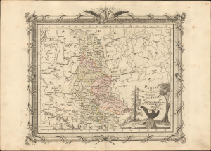
Partie du Royaume de Pologne conquise par les Russes en 1793.
sold
- Digital Map Information
- Suitable for large format printing
- File Size: 9.34 MB
- File Type: ZIP / TIFF
- ICC color profile embedded
- Delivered instantly via download link
This is a scarce c. 1795 map of Eastern Europe, including large portions of today's Belarus and Ukraine, as well as parts of other neighboring countries. It focuses on the lands ceded by the Polish-Lithuanian Commonwealth to the Russian Empire in the 1793 Second Partition of Poland. (more details)
Beginning of Germany's 'stab-in-the-back' myth.
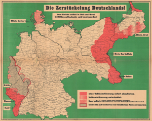
Die Zerstückelung Deutschlands!
sold
- Digital Map Information
- Suitable for large format printing
- File Size: 60.67 MB
- File Type: ZIP / TIFF
- ICC color profile embedded
- Delivered instantly via download link
This is a c. 1919 Gea Verlag propaganda map of Germany highlighting the territory Germany lost after World War I (1914 - 1918), published as details of the Treaty of Versailles became public. Titled 'The Dismemberment of Germany', the map represents Germany's virulent opposition to the Treaty of Versailles. This opposition created fertile ground for the 'stabbed in the back' myth and helped sow the seeds for the militant nationalism that supported Hitler's 1933 rise to power. (more details)
Commemorates the meeting the U.S. Army and the Soviet Red Army on Elbe Day.
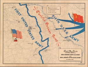
Special Map Showing Contact Between Gen. Hodges' First U.S. Army and Gen. Jadov's Fifth U.S.S.R. Army 25 April 1945.
sold
- Digital Map Information
- Suitable for large format printing
- File Size: 21.83 MB
- File Type: ZIP / TIFF
- ICC color profile embedded
- Delivered instantly via download link
This is a 1945 G-2 Section First U.S. Army map of eastern Germany commemorating the meeting of the U.S. Army and the Soviet Red Army along the Elbe River. With the Elbe illustrated to the right of center, the map depicts the Fifth U.S.S.R. Army sweeping across Germany from the West while the First U.S. Army charges in from the east, with the Twelfth German Army is sandwiched between them. Large Soviet and American flags mark Soviet and American sectors. A banner situated near the top border announces, 'Elements 69th U.S. Division met elements 58th U.S.S.R. Division at Torgau, Germany 25 April 1945 at 1640B. (more details)
Getting reinforcements to the front line during World War II.
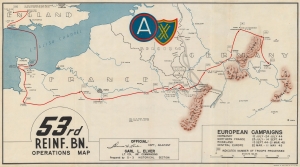
53rd Reinf. Bn. Operations Map.
sold
- Digital Map Information
- Suitable for large format printing
- File Size: 27.43 MB
- File Type: ZIP / TIFF
- ICC color profile embedded
- Delivered instantly via download link
This is an extremely rare c. 1945 World War II 53rd Reinforcement Battalion route map of Europe. This map follows the 53rd Reinforcement Battalion from Chard, England, to Bamberg, Germany, from January 13, 1944, through July 13, 1945. It also informs on the numbers of reinforcements it processed, illustrating the important role this battalion played in winning World War II. (more details)
Resettlement of a Plague Region, Plagued by War and also Plague.
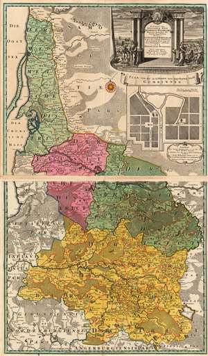
Potentissimo Borussorum Regi Friderico Wilhelmo Majestate Fortitudine Clementia Augustissimo Hancce Lithuaniam Borussicam : in qua loca colonijs Salisburg. ad incolendum Regio nutu concessa chorographice exhibentur D.D.D. Regiae Suae Maiestatis.
sold
- Digital Map Information
- Suitable for large format printing
- Full resolution TIFF file
- ICC color profile embedded
- Delivered instantly via download link
This is a stunning example of the 1735 Homann Heirs map of Lithuania Minor, then the easternmost province of Prussia. The region covered by this grand, two-sheet map is now occupied by Russia's Kaliningrad Oblast (the southern sheet) and the western portion of Lithuania, reaching as far east as modern-day Vištytis and Kudirkos Naumiestis, (Neustadt). The map's detail is rich for the region within the bounds of the Kingdom of Prussia. Across the border into Lithuania, the detail gives way to seemingly endless and trackless forest. (more details)
Created shortly after the 1846 Cracow Uprising.
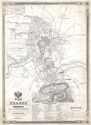
Plan von Krakau mit Podgorze und der nächsten Umgebung.
sold
- Digital Map Information
- Suitable for large format printing
- DPI: 600
- File Size: 30.66 MB
- File Type: ZIP / TIFF
- ICC color profile embedded
- Delivered instantly via download link
This is an 1847 Alexander Kocziczka city map or plan of Kraków, Poland. The map depicts Kraków from Czarna Wieś and Nowa Weiś to Podgorze and from the Upper Silesian - Kraków Railway to the Krakus Mound. Central Kraków is shaded darker than the rest of the map, making the city center the focal point. Twenty-five different locations are alphabetically identified throughout, among them churches, convents, and the theater, all correspond to a key situated along the bottom border. Eighteen locations in surrounding communities are also identified. In the town of Podgorze, across the Vltava River, 11 sites are numerically identified. Both the infantry and cavalry training grounds are noted along the left border, while the roads to Breslau, Warsaw, and Lublin are identified. (more details)
The oldest known map of Berlin.
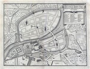
Grundriss der Beyden Churf: Residentz Statte Berlin und Colln an der Spree.
sold
- Digital Map Information
- Suitable for large format printing
- Full resolution TIFF file
- ICC color profile embedded
- Delivered instantly via download link
Drawn in 1652 by Johann Gregor Memhardt, and thus known as the Mamhardt Plan, this is the earliest known map of Berlin. Menhardt prepared this plan while employed by Frederick William, the Great Elector, to restore and rebuild the royal residences in ... (more details)
Rare and Remarkable Soviet 'Victory Map'.
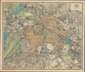
План г. Берлин, 1:25000 / [Plan of Berlin, 1:25000].
sold
- Digital Map Information
- Suitable for large format printing
- File Size: 97.24 MB
- File Type: ZIP / TIFF
- ICC color profile embedded
- Delivered instantly via download link
An artifact of one of the most intense battles of the 20th century, this Russian language 'Victory Map' map of Berlin was produced by the Soviet Union's Leningrad Mapping Unit in 1945 to prepare for the final assault of the war in Europe. (more details)
Rare view depicting the 1655 Siege of Krakow, Poland.

Cracovia Sedes Regia obsessa età Serenissimo Sveo: Gothorum Rege Carolo Gustavo deditione capta d: 8 Octobr. 1655.
sold
- Digital Map Information
- Suitable for large format printing
- DPI: 300
- File Size: 12.97 MB
- File Type: ZIP / TIFF
- ICC color profile embedded
- Delivered instantly via download link
This is a rare 1697 view of Kracow (Cracow), Poland by the German historian Samuel Pufendorf. Depicts the city of Krakow at a pivotal moment in history as it resists the 1655 siege attempts of the Swedish King Carl Gustav X. Krakow appears in the ... (more details)
Striking decorative map of Poland and Lithuania!
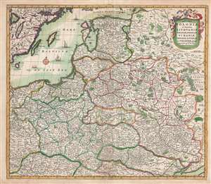
Regni Poloniae et Ducatus Lithuaniae Voliniae, Podoliae, Ucraniae, Prussiae, Lovoniae, et Curlandiae descriptio.
sold
- Digital Map Information
- Suitable for large format printing
- DPI: 300
- File Size: 13.24 MB
- File Type: ZIP / TIFF
- ICC color profile embedded
- Delivered instantly via download link
This is a striking and highly decorative c. 1682 Frederik de Wit map of Poland and Lithuania. The map covers from the Baltic Sea to the Black Sea and from Latvia to Moldova, including much of modern day Poland and Lithuania. The map was issued ... (more details)
First map specifically of the Grand Duchy of Lithuania.
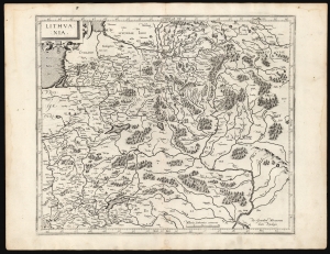
Lithuania.
sold
- Digital Map Information
- Suitable for large format printing
- DPI: 600
- File Size: 46.98 MB
- File Type: ZIP / TIFF
- ICC color profile embedded
- Delivered instantly via download link
This is a superb example of Gerard Mercator's 1595 map of the Grand Duchy of Lithuania, the first issue of the first map dedicated specifically to Lithuania. (more details)
Predicting the Allied advance to plan logistics.
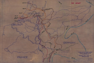
Principal Rail Lines to Berlin - E.T.O.
sold
- Digital Map Information
- Suitable for large format printing
- File Size: 64.69 MB
- File Type: ZIP / TIFF
- ICC color profile embedded
- Delivered instantly via download link
A unique piece, this is a 1944 World War II (1939 - 1945) Second Military Railway Service railroad diazotype map of Europe with extensive predicative manuscript annotation relating to managing logistics behind the battle lines in the face of rapid frontline advancement. The fascinating annotation predicts the Allied advance across Europe in stages from November 1944 through May 1945. The map thus underscores a critical but often overlooked aspect of World War II - logistics. (more details)
Poland's Last Cholera Outbreak.
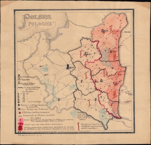
Polska / Pologne.
sold
- Digital Map Information
- Suitable for large format printing
- File Size: 13.14 MB
- File Type: ZIP / TIFF
- ICC color profile embedded
- Delivered instantly via download link
A curious and engaging c. 1923 map of Poland extensive manuscript annotations and highlights illustrating public health measures undertaken to contain a cholera outbreak in the wake of World War I (1914 - 1918), the country's last after battling the disease for decades. (more details)
Restoring civilian governments in occupied and liberated Europe.
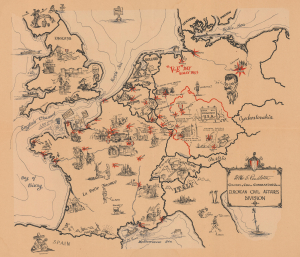
European Civil Affairs Division.
sold
- Digital Map Information
- Suitable for large format printing
- File Size: 22.76 MB
- File Type: ZIP / TIFF
- ICC color profile embedded
- Delivered instantly via download link
This is a 1945 Larry Furman World War II pictorial route map of western and central Europe highlighting the European Civil Affairs Division (ECAD). ECAD was responsible for reestablishing civilian governments in liberated and occupied territories. This map is true WWII scarcity, recorded only at the Library of Congress. (more details)
American soldiers operating railroads in wartime France and Germany.
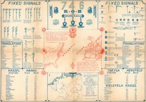
746 R.O.B. / 746 Railway Operating Battalion SNCF Railroad.
sold
- Digital Map Information
- Suitable for large format printing
- Full resolution TIFF file
- ICC color profile embedded
- Delivered instantly via download link
This is a set of 2 infographic maps by Richard E. Phillips detailing the 746th Railway Operating Battalion's involvement in World War II from its activation until the late summer of 1945. These pieces provide visual summaries of the battalion's time in France and Germany, including illustrating signals and providing translations for French and German words the battalion encountered. (more details)
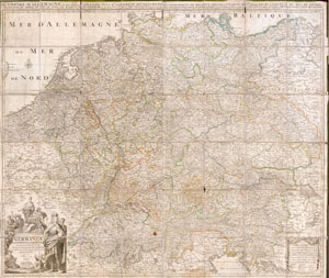
Germaniae L’Empire D’ Allemagne distingue suivant l’etendue tous les etats, principautes et souveradnettes qui passent ou qui ont passé jusque a present sous la nome D’Allemagne sur les Memoires les plus Nouveaux.
sold
- Digital Map Information
- Suitable for large format printing
- File Size: 13.05 MB
- File Type: ZIP / TIFF
- ICC color profile embedded
- Delivered instantly via download link
This is an extraordinary and gigantic c. 1730 map of Germany and the surrounding nations. Map is presented in case or pocket format on 48 linen backed panels. Covers most of what is today central Europe from eastern France and the Netherlands to ... (more details)
British propaganda during the Blitz.
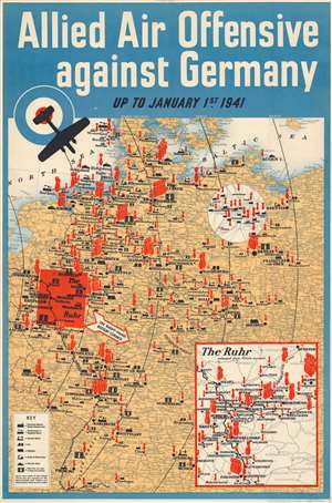
Allied Air Offensive against Germany up to January 1st 1941.
sold
- Digital Map Information
- Suitable for large format printing
- File Size: 35.82 MB
- File Type: ZIP / TIFF
- ICC color profile embedded
- Delivered instantly via download link
This is a 1941 British propaganda broadside of Germany illustrating the Allied air offensive. Designed by His Majesty's Stationery Office, the red bombs highlighted targeted areas - a message to the British people then enduring the Blitz that the RAF could give as well as it got. (more details)
Ephemeral WWII mimeograph Route Map following the 318th Infantry Regiment.
Map Route CT 318.
sold
- Digital Map Information
- Suitable for large format printing
- Full resolution TIFF file
- ICC color profile embedded
- Delivered instantly via download link
This is a 1945 mimeographed World War II unit route map of the 318th Infantry Regiment in Europe. It records the regiment's fight across Europe, noting milestones, and includes an operational report of the last days of combat in the European theatre, May 6-7, 1945, on the verso. As a mimeograph, this route map is unusual for the genre and limited by the medium, making it exceptionally ephemeral. (more details)
Anticipating the Nazi invasion of Poland.
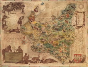
Poloniae regni amplissimi in quo abundantiam silvarum paradisum Venatorum...
sold
- Digital Map Information
- Suitable for large format printing
- Full resolution TIFF file
- ICC color profile embedded
- Delivered instantly via download link
An extremely rare find, this 1938 Eliasz Kanarek and Tadeusz Lipski pictorial nature map of Poland was created for the 1939 New York World's Fair. Meant to be a handout for attendees, Kanarek and Lipski composed this beautiful work to celebrate Poland State Forests and their flora and fauna. The not-so-kind illustrations of Germans and Soviets along the national borders, underscore Poland's precarious situation between aggressive powers. German and Soviet delegations who felt they were insultingly depicted, complained and the map was censured. Nonetheless, within four months of the World's Fair's launch, the mapmaker's fears proved valid and Nazi Germany invaded Poland launching World War II (1939 - 1945). Not all is serious, however. Some fantastical elements are included, among them a pink deer near Bialystok, a mermaid near Warsaw, and Krakow's fierce blue dragon. Both Kanarek and Lipski appear as well, discussing their work by a cartouche situated in the lower left corner. (more details)
Scarce view of Berlin.
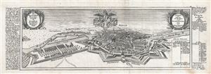
Berlin und Colln an der Spree sampt Fridrichswerder und Dorotheen Statt. / Die Churfürstliche Brandenburgisch nun Koniglich Preussische Residenz Statt.
sold
- Digital Map Information
- Suitable for large format printing
- DPI: 300
- File Size: 6.83 MB
- File Type: ZIP / TIFF
- ICC color profile embedded
- Delivered instantly via download link
A fine 1717 map and birds-eye view of the city of Berlin by Gabriel Bodenehr. This view presented Berlin as the royal Prussian seat. When this map was made, the Kingdom of Prussia was young, having only been established in 1701, and thus ... (more details)
Rare plan of Berlin.
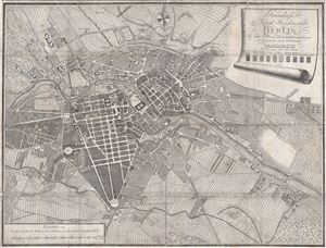
Grundriss der Königl. Residenzstädte Berlin im Jahre 1786 von neuen zusammengetragen und gestochen durch D. F. Sotzmann.
sold
- Digital Map Information
- Suitable for large format printing
- DPI: 300
- File Size: 12.15 MB
- File Type: ZIP / TIFF
- ICC color profile embedded
- Delivered instantly via download link
An extremely scarce 1786 map of Berlin, Germany by F. Nicolai and D. F. Sotzmann. This appears to be a first edition. Centered on the Spree River, this map covers central Berlin and the surrounding farmland as it existed in the late 18th ... (more details)
Algerian Colonial infantry unit during World War II.
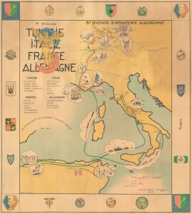
3e Division D'Infanterie Algerienne Tunisie Italie France Allemagne.
sold
- Digital Map Information
- Suitable for large format printing
- File Size: 40.92 MB
- File Type: ZIP / TIFF
- ICC color profile embedded
- Delivered instantly via download link
This is a rare 1945 World War II pictorial route map of the 3rd Algerian Infantry Division in North Africa, Italy, France, and Germany. The map follows the Division from activation until the end of the war and uses vignette illustrations to highlight important moments during the Division's war. This piece holds historical significance as a route map dedicated to a colonial unit. It is a glimpse into the wartime experiences of a group that is often overlooked by popular histories published today. (more details)