
Massachusetts - Connecticut - Rhode Island
Unobtainable first state of one of the most influential maps of New England ever made.
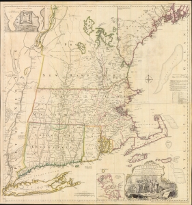
A MAP of the most INHABITED part of NEW ENGLAND, containing the PROVINCES of MASSACHUSETS BAY and NEW HAMPSHIRE, with the COLONIES of KONEKTIKUT AND RHODE ISLAND. Divided into Counties and Townships: The whole composed of Actual Surveys and its situation adjusted by ASTRONOMICAL OBSERVATIONS.
$55,000.00
Acquire
- Digital Map Information
- Suitable for large format printing
- File Size: 35.46 MB
- File Type: ZIP / TIFF
- ICC color profile embedded
- Delivered instantly via download link
This is the rare 1755 first state of Braddock Mead's French and Indian War Era map of New England - one of the most significant and iconic American maps ever produced. It is one of the first large-format regional maps of any part of North America and was the most comprehensively researched and detailed map of contemporary New England. (more details)
Early American Political Satire: In the wake of the Boston Tea Party.
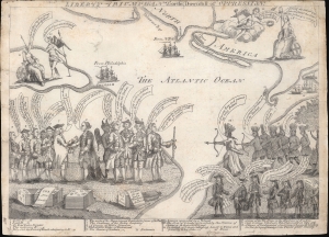
Liberty Triumphant; or The Downfall of Oppression.
$45,000.00
Acquire
- Digital Map Information
- Suitable for large format printing
- DPI: 600
- File Size: 169.18 MB
- File Type: ZIP / TIFF
- ICC color profile embedded
- Delivered instantly via download link
An iconic 1774 American political cartoon by Henry Dawkins lampooning the Tax Act and the Boston Tea Party. This is likely the most important political cartoon issued in the lead-up to the American Revolutionary War (1775 - 1783). It was published after the Tea Party but before the Intolerable Acts. The image is innovative in its use of cartographic imagery, larger-than-life representations of key political figures, and use of allegory. Moreover, it stands out for its remarkable encapsulation of the complex pre-Revolution political environment. (more details)
First printed English Nautical Chart of New York and New England. / First use of the name 'Connecticut' in any form.
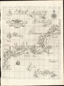
Carta particolare della nuova Belgia è parte della nuova Anglia La longitudiné Cominca da l'Isola di Pico d'Asores. D'America Carta II.
$40,000.00
Acquire
- Digital Map Information
- Suitable for large format printing
- File Size: 14.46 MB
- File Type: ZIP / TIFF
- ICC color profile embedded
- Delivered instantly via download link
This is a superb example of Robert Dudley's 1647 / 1661 nautical map of the coast of New York and New England - according to Burden, the 'first printed sea chart of New England and the New Netherlands.' Moreover, it is the first chart of New England to be produced by an Englishman. The chart's portolan-like lines and exquisite Florentine calligraphy distinguish it as one of the most beautiful works dedicated to the region. It is a rarity on the market, and a prize map for collectors of New York and New England. (more details)
The first map to illustrate and name all five of the Great Lakes.
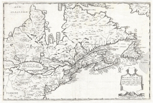
Description de la Nouvelle France, ou, sont remarquées les diverses habitations des françois, despuis la première descouverte jusques à present, receuillie et dressée sur diverses relations modernes.
$23,000.00
Acquire
- Digital Map Information
- Suitable for large format printing
- DPI: 300
- File Size: 8.1 MB
- File Type: ZIP / TIFF
- ICC color profile embedded
- Delivered instantly via download link
A rare separately published map considered the to be the first to illustrate all five of the Great Lakes. Drawn by Jean Boisseau, this map is cartographically derived from Samuel de Champlain's important map of 1632 with some important changes. The map covers from ... (more details)
Earliest detailed mapping of western Martha's Vineyard.
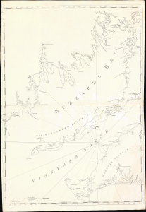
[Buzzard's Bay and Vineyard Sound.]
$17,000.00
Acquire
- Digital Map Information
- Suitable for large format printing
- Full resolution TIFF file
- ICC color profile embedded
- Delivered instantly via download link
This beautifully engraved map is the earliest acquirable issue of J. F. W. Des Barres' 1776 map of Buzzard's Bay and Vineyard Sound, capturing western Martha's Vineyard and the southern harbors of the Massachusetts mainland at the outbreak of the American Revolutionary War (1775 - 1783). It contains the first detailed mapping of the western part of Martha's Vineyard and the most accurate chart of the waters of Buzzard's Bay and Vineyard Sound. It remained authoritative for nearly 50 years. (more details)
The Finest View of Nantucket Town
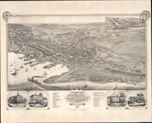
Bird's Eye View of the Town of Nantucket in the State of Massachusetts. Looking Southwest.
$16,000.00
Acquire
- Digital Map Information
- Suitable for large format printing
- File Size: 109.45 MB
- File Type: ZIP / TIFF
- ICC color profile embedded
- Delivered instantly via download link
An impressive 1881 bird's-eye view map of the town of Nantucket, Massachusetts, by Joseph Stoner. This is considered the largest and best bird's-eye view of Nantucket. It emerged as the city was transitioning from a maritime whaling hub to a resort economy. (more details)
Most important map in 18th century American history.
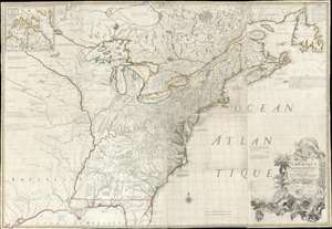
Amerique Septentrionale avec Les Routes, Distances et miles, Villages et Etablissements François et Anglois Par le Docteur Mitchel.
$12,000.00
Acquire
- Digital Map Information
- Suitable for large format printing
- Full resolution TIFF file
- ICC color profile embedded
- Delivered instantly via download link
This is the important 1777 Georges Le Rouge French edition of the seminal John Mitchell map of the eastern part of North America. The Mitchell map is considered the single most important map in 18th-century American history. It was used as a primary reference for nearly every treaty and boundary dispute in colonial North America from the French and Indian War (1754 - 1763) through the late 19th century. The map is all the more astounding because this is Mitchell's one and only map - a truly remarkable feat of virtuosity. (more details)
First large-scale map to show American postal routes.
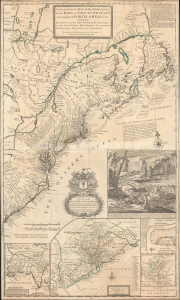
A New and Exact Map of the Dominions of the King of Great Britain on ye Continent of North America. Containing Newfoundland, New Scotland, New England, New York, New jersey, Pensilvania, Maryland, Virginia and Carolina.
$11,000.00
Acquire
- Digital Map Information
- Suitable for large format printing
- File Size: 44.83 MB
- File Type: ZIP / TIFF
- ICC color profile embedded
- Delivered instantly via download link
This is Herman Moll's 1715 'Beaver Map' of the British Colonies in America, here in its 1733 state (see below). In addition to its iconic and namesake image of Niagara Falls and the rich American peltries, this map is also significant as one of the most accurate maps of the period and the first large-scale map to show American postal routes. (more details)
First Official Map of Massachusetts.
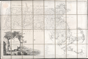
Map of Massachusetts Proper Compiled form Actual Surveys made by Order of the General Court, and under the inspection of Agents of their appointment, by Osgood Carleton.
$7,800.00
Acquire
- Digital Map Information
- Suitable for large format printing
- Full resolution TIFF file
- ICC color profile embedded
- Delivered instantly via download link
Known as 'The Agent's Map', this is a fine example of the first official map of Massachusetts, published in 1801 by Osgood Carleton. The map emerged out of a long and complex struggle to produce a large-scale, accurate, and comprehensive state map - something increasingly important in the heady early days of independence following the American Revolutionary War (1775 - 1783). (more details)
Capital of New England - one of the earliest views of Boston based on actual observation.

A View of the City of Boston the Capital of New England, in North America. / Vue de la Ville de Boston Capitale de la Nouvelle Angleterre, dans l'Amérique Septentrionale.
$6,500.00
Acquire
- Digital Map Information
- Suitable for large format printing
- File Size: 29.58 MB
- File Type: ZIP / TIFF
- ICC color profile embedded
- Delivered instantly via download link
This is the rare Thomas Pownall view of Boston, published in 1768. It is one of the earliest obtainable views of Boston, offering a glimpse of the city shortly after the French and Indian War (1754-1763). (more details)
'Towards thee I roll, thou all-destroying but unconquering whale...' -Melville
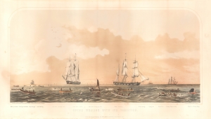
Sperm Whaling with Its Varieties.
$5,000.00
Acquire
- Digital Map Information
- Suitable for large format printing
- File Size: 21.24 MB
- File Type: ZIP / TIFF
- ICC color profile embedded
- Delivered instantly via download link
This is Benjamin Russell's stunning 1870 chromolithograph view of the American sperm whaling industry, printed by John Henry Bufford. (more details)
The first edition of one of the most distinctive maps of the Dutch Golden Age.
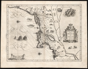
Nova Belgica Et Anglia Nova.
$5,000.00
Acquire
- Digital Map Information
- Suitable for large format printing
- Full resolution TIFF file
- ICC color profile embedded
- Delivered instantly via download link
This is the rare 1634 first atlas edition of Willem Blaeu's foundational map of the American Northeast, presenting the regions settled by the Dutch (New Netherlands) and the English (New England). Uniquely oriented to the west, Blaeu's map covers the American coast from Virginia, past New York and Long Island to Cape Cod, New England, and Quebec. The map is the first of the region to depict the fur-bearing and food animals of the region accurately, and it does so in profusion. Between this imagery and the fleet of trade ships heading towards the coast, the decorative elements vividly emphasize the region's resource wealth. (more details)
Vineyard Haven at the height of its Whaling Boom.
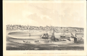
View of the Village of Holmes' Hole, Marthas Vineyard, Mass. 1856.
$4,500.00
Acquire
- Digital Map Information
- Suitable for large format printing
- File Size: 78.72 MB
- File Type: ZIP / TIFF
- ICC color profile embedded
- Delivered instantly via download link
This is a striking 1856 bird's-eye view of Vineyard Haven, Martha's Vineyard, by William H. Sturtevant and J. H. Bufford. It depicts Vineyard Haven when it was emerging as a center of whaling and a stop on the Underground Railroad. (more details)
Oldest Town in New England.
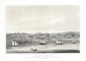
A View of Plymouth, from the beach east of the Harbor - the oldest town in New England and landing place of the Pilgrim Fathers. Dec. 22d. 1620.
$4,500.00
Acquire
- Digital Map Information
- Suitable for large format printing
- File Size: 18.05 MB
- File Type: ZIP / TIFF
- ICC color profile embedded
- Delivered instantly via download link
This is a rare lithograph view of Plymouth, Massachusetts, drawn by Timothy Barry and printed in Boston by J. H. Bufford between 1851 and 1855. Although outstripped in growth by nearby Boston, Plymouth is one of the oldest cities in the United States and was the first permanent settlement of Europeans in New England. (more details)
Used by Henry David Thoreau when writing 'Cape Cod.'
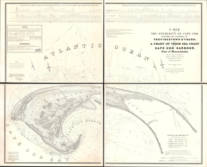
A Map of the Extremity of Cape Cod Including the Townships of Provincetown and Truro: A Chart of Their Sea Coast and of Cape Cod Harbour, State of Massachusetts.
$4,000.00
Acquire
- Digital Map Information
- Suitable for large format printing
- Full resolution TIFF file
- ICC color profile embedded
- Delivered instantly via download link
An exceptional discovery, this is James Duncan Graham's wall map of Provincetown at the tip of Cape Cod. At the time of issue, and for a long time afterward, this was the definitive map of the Provincetown area and the surrounding waters, said to have been used by, among many others, Henry David Thoreau when writing Cape Cod. The map was produced to
aid in the projection of the works for the military defenses of the important harbor formed by the peculiar spiral termination of [Cape Cod], and also to aid our ships of war and other vessels in entering it with safety after making this prominent headland. (Congressional Report, 25th Congress, Second Session, p. 3).(more details)
Pre-landfill Boston from Telegraph Hill.
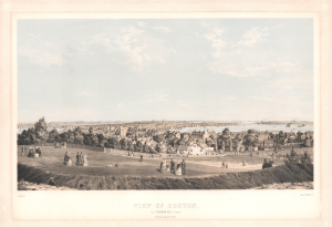
View of Boston from Telegraph Hill, S. Boston.
$4,000.00
Acquire
- Digital Map Information
- Suitable for large format printing
- Full resolution TIFF file
- ICC color profile embedded
- Delivered instantly via download link
This is Bernard Spindler 1854 bird's-eye view of Boston, Massachusetts. This is among the earliest and rarest published views of Boston. (more details)
A Superb View of Southie.
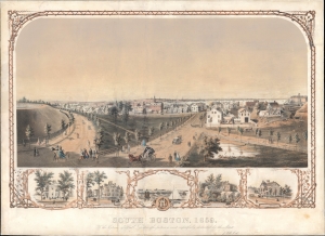
South Boston, 1859. To the Citizens of South Boston - this picture is most respectfully dedicated by the Artist.
$4,000.00
Acquire
- Digital Map Information
- Suitable for large format printing
- File Size: 33.43 MB
- File Type: ZIP / TIFF
- ICC color profile embedded
- Delivered instantly via download link
A rare view of South Boston in 1859, drawn by Joseph Foxcroft Cole. It depicts the neighborhood of Dorchester Heights at a time when South Boston was growing rapidly, both demographically and territorially. (more details)
One of the few views of to show a walled New York.
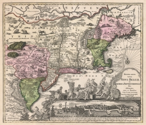
Recens Edita Totius Novi Belgii, in America Septentrionali siti, delineatio cura et sumtibus Tob. Conr. Lotteri, Sac. Caes. Maj. Geographi August. Vind.
$3,500.00
Acquire
- Digital Map Information
- Suitable for large format printing
- DPI: 600
- File Size: 74.88 MB
- File Type: ZIP / TIFF
- ICC color profile embedded
- Delivered instantly via download link
This is Conrad Tobias Lotter's 1757 map of New York, New England, and the mid-Atlantic colonies. It represents the final map in the Jansson-Visscher series. Despite the map's cartography being over a century old, this map continued to capture the idea of this part of the world for Europeans in general and a German audience in particular. (more details)
Colonial history and rugged New England beauty.
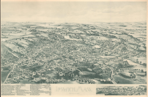
Ipswich, Mass. Incorporated 1634.
$3,500.00
Acquire
- Digital Map Information
- Suitable for large format printing
- File Size: 17.84 MB
- File Type: ZIP / TIFF
- ICC color profile embedded
- Delivered instantly via download link
A striking 1893 bird's-eye view map of Ipswich, Massachusetts. The view captures Ipswich during its transition from a maritime center to an industrial hub focused on shoemaking and textiles. Other parts of Ipswich, such as Crane Beach and Castle Hill, illustrated here on the horizon, were beginning to emerge as elite enclaves for summer visitors. Ipswich remains a well-preserved historical town to this day, with many of the buildings illustrated here still standing. (more details)
Planning the Back Bay.
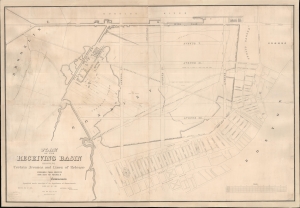
Plan of the Receiving Basin Showing Certain Avenues and lines of Release.
$3,500.00
Acquire
- Digital Map Information
- Suitable for large format printing
- DPI: 600
- File Size: 154 MB
- File Type: ZIP / TIFF
- ICC color profile embedded
- Delivered instantly via download link
One of the earliest published maps of the Back Bay, Boston, surveyed in 1852 in anticipation of the Back Bay Landfill. The map represents one of the earliest representations of the Back Bay, then a tidal swamp, overlaid with streets and avenues, thus part of Boston's grid. It shows the beginnings of the Back Bay Landfill efforts, as well as the beneficiaries of the project who would build enormous fortunes on the development. (more details)
Large, Beautifully Executed Schoolgirl Map.
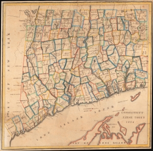
Connecticut Exene Tobey 1854.
$3,500.00
Acquire
- Digital Map Information
- Suitable for large format printing
- File Size: 26.2 MB
- File Type: ZIP / TIFF
- ICC color profile embedded
- Delivered instantly via download link
This is an attractive 1854 schoolgirl manuscript map of Connecticut drawn by 13-year-old Exene E. Tobey of New Canaan. (more details)
Inset of Boston - first map of an English colonial city on a non-English map.
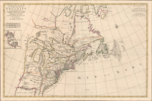
Carte Nouvelle De L'Amerique Angloise Contenant La Virginie, Maryland, Caroline, Pensylvania, Nouvelle Iorck, N. Iarsey, N.France, Et Les Terres Nouvellement Decouverte...
$3,200.00
Acquire
- Digital Map Information
- Suitable for large format printing
- Full resolution TIFF file
- ICC color profile embedded
- Delivered instantly via download link
An impressive large-scale Pierre Mortier 1700 map of the British Colonies in North America. The map features an important inset of Boston - the first map of a British colonial city on a non-British map (Burden). It was issued to capitalize on popular interest in King William's War (1689 - 1697). (more details)
African American shipwrights in Boston.
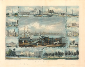
Boston and its environs. / und seine Umgebungen / et ses environs.
$3,000.00
Acquire
- Digital Map Information
- Suitable for large format printing
- Full resolution TIFF file
- ICC color profile embedded
- Delivered instantly via download link
A striking 1859 view of Boston, with surrounding vignettes, engraved by Johann Poppel, printed by Charles D. Andrews, and published by Frederick Goth. It reflects the changing face of the city, as older buildings were being demolished or replaced to make way for more modern structures, including rail stations and museums. Notably, the main image prominently depicts a team of African American workers building a ship in the foreground. (more details)
Largest photographic view of the Great Fire of Boston.
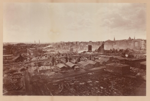
[Great Fire of Boston Burnt District.]
$3,000.00
Acquire
- Digital Map Information
- Suitable for large format printing
- Full resolution TIFF file
- ICC color profile embedded
- Delivered instantly via download link
This is a mammoth plate 1872 D. W. Butterfield albumen photograph illustrating the devastation of the Great Boston Fire. It represents the largest known photograph of the Great Fire - an artifact of the photographer's unique custom-built large-format camera. (more details)
Scarce 19th century image of the great Cape Ann Fishing Port.
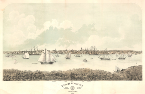
View of Gloucester. From Rocky Neck. 1876.
$3,000.00
Acquire
- Digital Map Information
- Suitable for large format printing
- File Size: 28.16 MB
- File Type: ZIP / TIFF
- ICC color profile embedded
- Delivered instantly via download link
A fine 1876 George Douglas / F. Kimball Rogers low-perspective view of Gloucester, Massachusetts. (more details)
Only recorded bird's-eye view of Ridgefield.
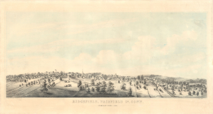
Ridgefield, Fairfield Co, Conn. From East Ridge. _ 1953.
$3,000.00
Acquire
- Digital Map Information
- Suitable for large format printing
- File Size: 18.39 MB
- File Type: ZIP / TIFF
- ICC color profile embedded
- Delivered instantly via download link
An unrecorded 1853 C. Kelsey and G. Hawyard 2-color chromolithograph bird's-eye view of Ridgefield, Fairfield County, Connecticut. Today, Ridgefield is considered one of Connecticut's most beautiful and historic towns, known for its well-preserved colonial downtown. (more details)
'Of all the wild romantic places I have visited, nothing exceeds Pigeon Cove...' - Francis A. Durivage
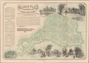
Ocean View Extreme Point Cape Ann, Pigeon Cove, Mass. A little over an hour's ride from Boston by Eastern Rail-Road.
$2,900.00
Acquire
- Digital Map Information
- Suitable for large format printing
- File Size: 133.07 MB
- File Type: ZIP / TIFF
- ICC color profile embedded
- Delivered instantly via download link
An exceptional c. 1870 J. H. Bufford map of Pigeon Cove and Ocean View, now part of Rockport, Cape Ann, Massachusetts. The view promotes ambitious plans for a luxurious resort community on the northeastern point of Cape Ann - Ocean View. The plan mostly materialized, transforming the Pigeon Cove - Andrews Point area into a thriving resort community by the end of the century. (more details)
Hartford County, by a Native Son.
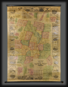
This is a rare 1855 wall map of Hartford County, Connecticut, by Edgar M. Woodford, a native of the county, based in West Avon. It features numerous insets and vignettes, making this an incredible piece of Hartford County history. (more details)
New England's 'Toy Town'.
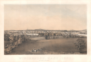
Winchendon, Mass, 1860, from Residence of Henry Wyman.
$2,500.00
Acquire
- Digital Map Information
- Suitable for large format printing
- Full resolution TIFF file
- ICC color profile embedded
- Delivered instantly via download link
This is a rare c. 1860 bird's-eye view of Winchendon, Massachusetts, drawn by Roswell Morse Shurtleff. It displays the town on the eve of the U.S. Civil War, when early signs of industrialization were changing the face of the town. (more details)
Boston Harbor with a tantalizing glimpse of Old Ironsides.
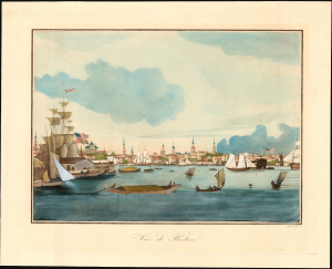
Vue de Boston.
$2,500.00
Acquire
- Digital Map Information
- Suitable for large format printing
- File Size: 10.03 MB
- File Type: ZIP / TIFF
- ICC color profile embedded
- Delivered instantly via download link
A striking and rare c. 1840 Garneray aquatint view of Boston Harbor teeming with ships. The bright, sunlit scene is rendered with delicate engraving and luminous gouache hand color. (more details)
Early view of America's whaling capital.
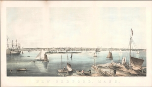
New Bedford, Mass.
$2,500.00
Acquire
- Digital Map Information
- Suitable for large format printing
- File Size: 23.58 MB
- File Type: ZIP / TIFF
- ICC color profile embedded
- Delivered instantly via download link
This is a c. 1858 Joseph Foxcroft Cole view of New Bedford, Massachusetts, the whaling capital of the United States in the leadup to the American Civil War (1861 - 1865). (more details)
Lane's largest lithographic view of Gloucester Harbor.
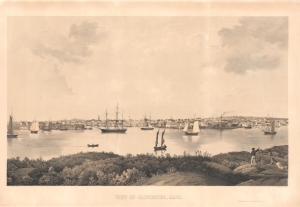
View of Gloucester, Mass.
$2,500.00
Acquire
- Digital Map Information
- Suitable for large format printing
- Full resolution TIFF file
- ICC color profile embedded
- Delivered instantly via download link
A charming 1859 lithographic view of Gloucester, Massachusetts, by the legendary Cape Ann marine painter Fitz Henry Lane. This is the third and largest of Lane's lithographic views of Gloucester. The view looks northeast towards Gloucester from Rocky Neck, an outcropping near Smith's Cove. While dimensionally the largest of Lane's Gloucester views, this also has the narrowest coverage, roughly 74°, allowing him to focus on the bustling Harbor Cove and adjacent Duncan's Point, where his studio was located. (more details)