
Views (sold)
The largest and most decorative map of Shanghai!
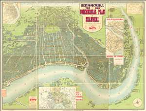
The New Commercial Plan of Shanghai (with which is incorporated the Wharf and Godown Plan). Surveyed, constructed and designed by the Far Eastern Geographical Establishment 6 Kiukiang Road Shanghai.
sold
- Digital Map Information
- Suitable for large format printing
- File Size: 300.62 MB
- File Type: ZIP / TIFF
- ICC color profile embedded
- Delivered instantly via download link
The greatest and most impressive map of Shanghai we have yet seen. Issued in 1915, this is the Far Eastern Geographical Establishment / Edwin John Dingle / H. J. Fruin pictorial view and map of Shanghai. The map is a staggering 83 x 63 inches. The view looks on Shanghai from the east, at a high point across the Huangpu River in what is today the hip Pudong district. In includes the Bund, the Shanghai International Settlement, and the British and French Concessions, as well as the old Chinese City at left. It was issued shortly after the shortly after the 1911 Xinhai Revolution. One can follow Wusong Creek westward into the Horizon, which is illustrated with clouds. Inset maps detail Shanghai and Environs, Road Plan of Shanghai, The Nantao District, and The Rubicon District. (more details)
A stunning late 19th century Vietnamese manuscript map.
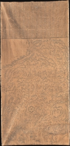
清化省圖本 / [Map of Thanh Hóa Province].
sold
- Digital Map Information
- Suitable for large format printing
- Full resolution TIFF file
- ICC color profile embedded
- Delivered instantly via download link
An incredible, one-of-a-kind large-format 1878 manuscript map depicting Thanh Hóa Province (清化省) in north-central Vietnam by Trần Lưu Huệ, an official at the court of the Nguyễn Dynasty. It is one of only a few examples of traditional Chinese-influenced Vietnamese cartography in private hands and outside of Vietnam. The area here covered was significant for the Nguyễn emperors, who had risen to prominence from Thanh Hóa in the early Lê Dynasty (r. 1428 - 1789). This, nonetheless, captures the Nguyễn Empire in decline as French Indochina began its push into the region. (more details)
Earliest view of Tsingtao or Qingdao - drawn shortly after the German takeover.
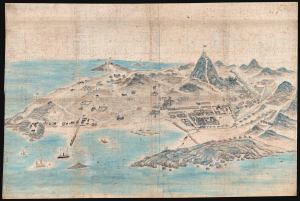
[Tsingtao]
sold
- Digital Map Information
- Suitable for large format printing
- File Size: 78.87 MB
- File Type: ZIP / TIFF
- ICC color profile embedded
- Delivered instantly via download link
This is an outstanding c. 1899 Chinese manuscript view of the city of Qingdao (Tsingtao), China, as it appeared early in the German colonial period. It is hand-painted by an unknown Chinese artist on silk and represents the earliest known image of Qingdao. (more details)
Laredo's urbanization.
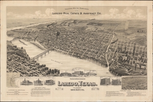
Perspective Map of the City of Laredo, Texas. The Gateway to and from Mexico.
sold
- Digital Map Information
- Suitable for large format printing
- File Size: 1068.57 MB
- File Type: ZIP / TIFF
- ICC color profile embedded
- Delivered instantly via download link
A very rare broadside bird's-eye view map of Laredo, Texas. The map was issued on Laredo's quadranscentennial, and so reflects a 25-year period of breakneck growth and prosperity, from which Laredo emerged as the most prosperous and connected border city in south Texas. (more details)
Silver boomtown by the first African American Lithographer.
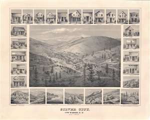
Silver City, Owyhee, I.T.
sold
- Digital Map Information
- Suitable for large format printing
- File Size: 52.62 MB
- File Type: ZIP / TIFF
- ICC color profile embedded
- Delivered instantly via download link
A remarkable 1866 bird's-eye view of Silver City, Idaho Territory, issued by Grafton Tyler Brown, America's first African American lithographer, and presenting the mining boomtown at its height of prosperity. Silver City experienced one of America's richest mineral strikes, producing gold and silver for more than 40 years. This view is one of only two known examples, significant not only for its historic illustration of a pop-up boomtown in full bloom, but also for being one of the few surviving views engraved and printed by Grafton T. Brown. Unlike many views, it has the unique distinction of being drawn from daguerreotype photographs taken by Philip Frederick Castleman, who visited with a supply caravan in 1866. (more details)
First printing of one of the most significant and desirable views of San Francisco.
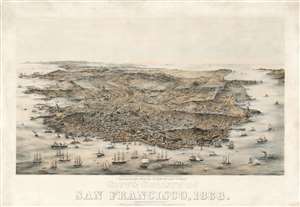
Bird's Eye View of the City and County of San Francisco, 1868.
sold
- Digital Map Information
- Suitable for large format printing
- Full resolution TIFF file
- ICC color profile embedded
- Delivered instantly via download link
An extraordinary Charles Braddock Gifford and William Vallance Gray 3-color chromolithograph bird's-eye view of San Francisco, California, in 1868 - one of the most desirable and influential views of San Francisco ever produced. The view looks southwest on San Francisco Peninsula from an imaginary highpoint to the northeast. The city and bustling harbor are prominent in the foreground while the peninsula's hills and lakes are in the background. The Golden Gate appears at the upper right, and Telegraph Hill at bottom center. (more details)
Center of Qing Power on Taiwan.
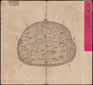
台灣府城全圖 / [Complete Map of the Walled City of Taiwan-fu].
sold
- Digital Map Information
- Suitable for large format printing
- Full resolution TIFF file
- ICC color profile embedded
- Delivered instantly via download link
A remarkable find, this unrecorded c. 1830 manuscript map presents a detailed catalog of Tainan, Taiwan, when the city served as the Qing administrative capital of the island, known as Taiwan-fu. (more details)
One of the most significant and desirable views of San Francisco ever published.
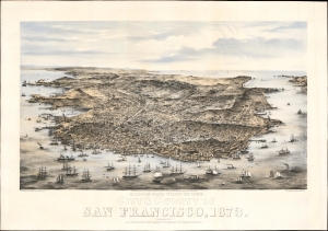
Bird's Eye View of the City and County of San Francisco, 1873.
sold
- Digital Map Information
- Suitable for large format printing
- Full resolution TIFF file
- ICC color profile embedded
- Delivered instantly via download link
This is Charles Braddock Gifford and William Vallance Gray's extraordinary 1873 three-color chromolithograph bird's-eye view of San Francisco, California - one of the most desirable and influential views of San Francisco ever produced. It captures the city in its second distinct phase, having left behind the Gold Rush era and embraced the role of financier of the Pacific Coast, particularly western Nevada's Comstock Lode. (more details)
A superb example of a great rarity of San Francisco.
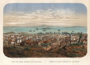
Vue de San Francisco en 1860. / View of San Francisco in 1860.
sold
- Digital Map Information
- Suitable for large format printing
- File Size: 36.57 MB
- File Type: ZIP / TIFF
- ICC color profile embedded
- Delivered instantly via download link
This is an extremely rare c. 1860 Louis Le Breton chromolithograph view map of San Francisco. It was printed in Paris by François-Désiré Gosselin in conjunction with San Francisco publisher Henry Payot. This early iteration of the view is significant for its early - and unique - depiction of Chinese immigration to California, focusing on San Francisco's Chinatown. (more details)
Urbanization of the Garden District!
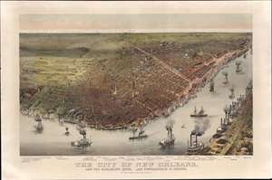
The City of New Orleans, and the Mississippi River, Lake Pontchartrain in Distance.
sold
- Digital Map Information
- Suitable for large format printing
- Full resolution TIFF file
- ICC color profile embedded
- Delivered instantly via download link
This is a rare 1885 Currier and Ives chromolithograph bird's-eye view of New Orleans. Unlike earlier views of New Orleans, this unusual view focuses attention southwest of the French Quarter towards the Garden District and extends west far enough to include Audubon Park. This is significant, as the view was issued to celebrate the 1884 - 1885 Industrial and Cotton Centennial Exposition, the campus of which appears at the far left. In the foreground the Mississippi waterfront bustles with classic paddlewheel riverboat traffic, while in the distance, Lake Pontchartrain lines the horizon. In general, the vertical perspective has been somewhat exaggerated to highlight the tallest and most impressive buildings. (more details)
Unusual fisheye view of New York with early Baseball imagery in the Elysian Fields.
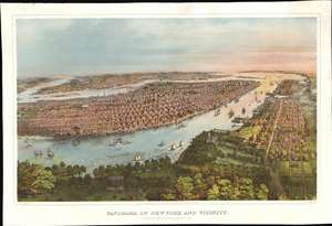
Panorama of New York and Vicinity.
sold
- Digital Map Information
- Suitable for large format printing
- File Size: 74.95 MB
- File Type: ZIP / TIFF
- ICC color profile embedded
- Delivered instantly via download link
A rich and striking large-format 1866 John Bachmann panoramic three-color chromolithograph view of New York City as seen from a point high over the Elysian Fields (baseball) of Hoboken. The view is expansive and utilizes an unusual fish-eye perspective. It looks on Manhattan from the west, with the area of focus roughly corresponding to 32nd Street. Coverage extends north to Central Park, south to Sandy Hook, and east to include parts of Brooklyn and Queens. Manhattan's major parks are recognizable, including Madison Square, Gramercy, Washington Square, City Hall, and the still under construction Central Park. Vast swathes of lotted but undeveloped land are evident along Park Avenue north of Bryant Park. Along the Hudson, there are also a number of large gentlemanly estates - survivors of a bygone era that would soon disappear entirely. The Hudson River is busy with an assortment of sail and steamships. On the right side of the map, Hoboken and beyond, Jersey City, are evident. In the foreground there is a prominent display of the Elysian Fields, where two different baseball games are in progress. (more details)
The absolute best view of Boston.
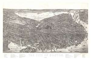
The City of Boston. 1879.
sold
- Digital Map Information
- Suitable for large format printing
- File Size: 40.5 MB
- File Type: ZIP / TIFF
- ICC color profile embedded
- Delivered instantly via download link
A magnificent 1879 bird's-eye view and map of Boston by James Compton Hazen and Oakley Hoopes Bailey, it is considered the largest and most detailed view of Boston Proper. The view presents Boston from an imaginary elevated position to the southeast of the city, looking northwest towards the Charles River with Cambridge appearing in the upper left and East Boston in the upper right. Hazen's slight and novel exaggeration of the vertical axis enhances the view with an intense three-dimensionality. This effect further highlighted by Hazen's use of a modified axonometric perspective - a technique that assumes a uniform fixed height and angle relative to all buildings, here modified only slightly to create a subtle perspective within the main Boston peninsula. The traditional view modality reasserts itself beyond the city proper where the background and outlying areas recede into the horizon. (more details)
Covered wagons in the Rockies - on the overland trail.

Our-Camp 62d Pine-Grove-Creek Rocky Mountains.
sold
- Digital Map Information
- Suitable for large format printing
- File Size: 86.98 MB
- File Type: ZIP / TIFF
- ICC color profile embedded
- Delivered instantly via download link
An exceptional discovery, this is a Daniel A. Jenks' original 1859 pen-and-ink drawing depicting a camp in the Platte Valley, in the Rocky Mountains of modern-day Wyoming, composed on his overland journey to California. It is part of a series of drawings Jenks composed trail-side covering his Transmississippi travels from 1849 to 1865. This is the only known example of one of Jenks' individual drawings appearing on the market. (more details)
A study in contrast.
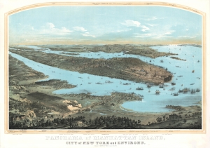
Panorama of Manhattan Island, City of New York and Environs.
sold
- Digital Map Information
- Suitable for large format printing
- DPI: 600
- File Size: 157.36 MB
- File Type: ZIP / TIFF
- ICC color profile embedded
- Delivered instantly via download link
John Bornet presents a sweeping panoramic bird's-eye view of New York City on the cusp of its monumental expansion northwards in the second half of the 19th century. The view looks east on Manhattan, Queens, and Brooklyn from a high point to the west of Hoboken, New Jersey. Bornet purports to have drawn the view 'from nature', likely from Bergen Hill, New Jersey, a popular high point used by other viewmakers of the period. (more details)
Iconic view of New York with Spectacular Chromolithograph Color.
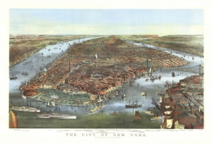
The City of New York.
sold
- Digital Map Information
- Suitable for large format printing
- File Size: 48.95 MB
- File Type: ZIP / TIFF
- ICC color profile embedded
- Delivered instantly via download link
This is a beautiful example of the iconic 1870 Currier and Ives chromolithograph view of New York City, specifically Manhattan. It is the first edition of this famous view to include the Brooklyn Bridge, in the year construction on the wonder began, but 13 years before it opened! This example also has the richest original chromolithograph color we have seen in any example. (more details)
The most extraordinary view of Saigon or Ho Chi Minh City during the French period.
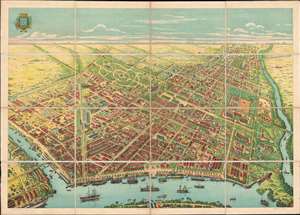
[Saigon]
sold
- Digital Map Information
- Suitable for large format printing
- File Size: 117.95 MB
- File Type: ZIP / TIFF
- ICC color profile embedded
- Delivered instantly via download link
The only known example of what can only be the largest and most spectacular panoramic bird's-eye view of Saigon (Ho Chi Minh City, Vietnam) ever produced. Drafted by Gaston Pusch and published in Saigon by Claude et Cie., this c. 1898 view was printed using a sophisticated multi-color chromolithograph process - a testament to the intellectual and industrial prosperity of Saigon at the height of French imperial rule. The perspective Bird's-eye view looks on Saigon from a high point to the east of the city just across the bustling Saigon River. The view celebrates the massive and all-encompassing rebuilding of Saigon on a grand scale in the late 19th century, reveling lively city full of imposing colonial buildings, sprawling formal gardens, and grand tree-lined boulevards. (more details)
Iconic view of New York with spectacular chromolithograph color.
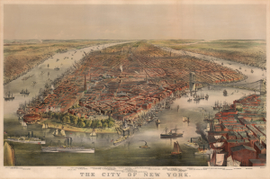
The City of New York.
sold
- Digital Map Information
- Suitable for large format printing
- File Size: 57.82 MB
- File Type: ZIP / TIFF
- ICC color profile embedded
- Delivered instantly via download link
This is a beautiful example of the iconic 1870 Currier and Ives chromolithograph view of New York City, specifically Manhattan. It is the first edition of this famous view to include the Brooklyn Bridge, in the year construction on the wonder began, but 13 years before it opened! (more details)
Iconic early map of New England and New York with 'Visscher View' of New Amsterdam.
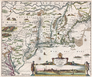
Novi Belgii Novaeque Angliae Nec Non Pennsylvaniae et Partis Virginiae Tabula multis in locis emendata.
sold
- Digital Map Information
- Suitable for large format printing
- DPI: 300
- File Size: 15.13 MB
- File Type: ZIP / TIFF
- ICC color profile embedded
- Delivered instantly via download link
A map of extreme importance, this is a fine example of Nicholaas Visscher's 1684 Novi Belgii or map of New York, New England, Pennsylvania, and Virginia. This is the first map in the Jansson-Visscher Series here presented in its 4th state (Burden, 315). Like most ... (more details)
Iconic early map of New England and New York with 'Visscher View' of New Amsterdam.
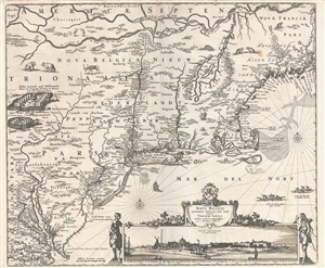
Novi Belgii Novaeque Angliae Nec Non Pennsylvaniae et Partis Virginiae Tabula multis in locis emendata.
sold
- Digital Map Information
- Suitable for large format printing
- DPI: 300
- File Size: 14.86 MB
- File Type: ZIP / TIFF
- ICC color profile embedded
- Delivered instantly via download link
A map of extreme importance, this is a fine example of Nicholaas Visscher's 1684 Novi Belgii or map of New York, New England, Pennsylvania, and Virginia. This is the first map in the Jansson-Visscher Series here presented in its 4th state (Burden, 315). Like most ... (more details)
Possibly the only surviving example of this remarkable 19th century Manhattan Birds-Eye View.
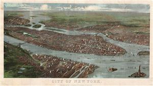
City of New York.
sold
- Digital Map Information
- Suitable for large format printing
- File Size: 4.87 MB
- File Type: ZIP / TIFF
- ICC color profile embedded
- Delivered instantly via download link
A rare possibly unique find, this is G. W. and C. B. Colton's magnificent 1897 panoramic birds-eye view of New York City. Presented in chromolithograph color this map reveals Manhattan, Brooklyn, and Queens as seen from high above Jersey City and Hoboken, which ... (more details)
Strikingly engraved view of Jerusalem at the time of Solomon's Temple.
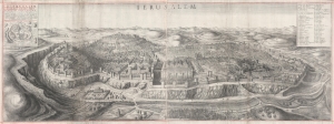
Ierusalem. Hierusalem Veteris Imago Vera.
sold
- Digital Map Information
- Suitable for large format printing
- DPI: 600
- File Size: 124.93 MB
- File Type: ZIP / TIFF
- ICC color profile embedded
- Delivered instantly via download link
A spectacularly engraved large-scale 1660 Wenceslaus Hollar bird's-eye of Jerusalem during the period of the Solomon's Temple. The view is based upon the 1604 writings and drawings of Juan Bautista Villalpando (Villalpandus; 1552 - 1608), a Spanish Jesuit of Sephardic ancestry. The work, although mostly imaginary, proved highly influential. (more details)
Important early view of Salt Lake City, Utah.
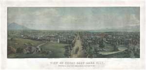
View of Great Salt Lake City.
sold
- Digital Map Information
- Suitable for large format printing
- File Size: 54.36 MB
- File Type: ZIP / TIFF
- ICC color profile embedded
- Delivered instantly via download link
This is a very rare 1867 Christian Inger view of Salt Lake City, Utah. The view illustrates Salt Lake City looking down Main Street as it appeared roughly 20 years following the arrival of the Mormons. The development, in such a short period of time, is ... (more details)
...with every building recognizable!
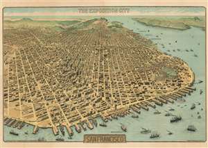
The Exposition City San Francisco.
sold
- Digital Map Information
- Suitable for large format printing
- File Size: 122.73 MB
- File Type: ZIP / TIFF
- ICC color profile embedded
- Delivered instantly via download link
An extraordinary bird's-eye view perspective view and map of San Francisco, risen from the ashes of the 1906 earthquake and fire, ready to retake the world stage by hosting of the Panama-Pacific International Exposition. The view looks westward on San Francisco from a fictional highpoint above today's San Francisco-Oakland Bay Bridge with California Street running dead center. The Embarcadero and docks appear in the foreground, while Golden Gate Park and the Pacific are recognizable in the distance. The Panama-Pacific Exposition, displayed here prospectively, appears at right, near the Golden Gate. Across the bay, in the distance, Mount Tamalpais, with a winding road ascending, is recognizable. The view presents a city fully recovered from a disaster that, just six years prior, destroyed eighty percent of the city. Cartographically the map is noteworthy as it illustrates and names nearly every single building - an astounding achievement and an invaluable record of San Francisco c. 1912. (more details)
One of the most influential views of New York City ever published.
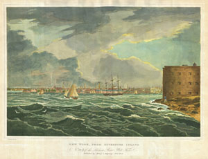
New York, From Governors Island. No.2 20 of theHudson River Port Folio. Published by Henry I. Megarey New York.
sold
- Digital Map Information
- Suitable for large format printing
- DPI: 300
- File Size: 17.84 MB
- File Type: ZIP / TIFF
- ICC color profile embedded
- Delivered instantly via download link
A rare find, this is plate no. 20 from William G. Wall, and Henry L. Megarey's important 1825 Hudson River Port Folio. The Hudson River Port Folio is considered to be the first and finest set of views of the Hudson River ever published. The Port Folio ... (more details)
A moment of explosive growth.
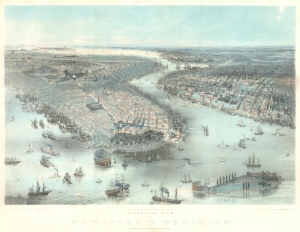
Birds Eye View of New-York and Brooklyn.
sold
- Digital Map Information
- Suitable for large format printing
- File Size: 46.8 MB
- File Type: ZIP / TIFF
- ICC color profile embedded
- Delivered instantly via download link
This is an 1850 John Bachmann rare bird's-eye view of New York City and Brooklyn. The work captures New York at a moment of explosive growth due to rapid industrialization and waves of new immigration - specifically, highly educated middle-class merchants and tradesmen from Germany and Central Europe (like Bachmann himself) fleeing in the wake of the failed Peoples Revolutions of 1848. (more details)
German Immigration to Texas - slavery content.
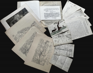
This is a unique manuscript and typescript archive covering the experiences of the German Wuppermann family's immigration to Texas from roughly 1857 to 1865. It is told from the perspective of Klara Anna Laura Tafel (née Wuppermann; 1851 - 1946), a young girl at the time of the recorded events. Work includes references to the harshness of frontier life, slavery (the Wuppermanns owned two slaves), the American Civil War, and anti-German prejudice at the hands of the Know-Nothings. (more details)
Japanese war propaganda.
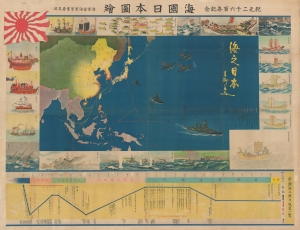
海國日本圖繪 紀元二千六百年紀念 / [Depiction of Maritime Japan, to Commemorate the 2600th Anniversary of the Imperial Family].
sold
- Digital Map Information
- Suitable for large format printing
- File Size: 477.31 MB
- File Type: ZIP / TIFF
- ICC color profile embedded
- Delivered instantly via download link
A rare, huge, and brilliantly-colored propaganda work issued by the Imperial Japanese Navy (IJN) on the eve of the Pearl Harbor attack, this 1940 map celebrates the history of Japan's maritime ventures and the strength of the IJN. It also celebrates the 2600th anniversary of the Japanese imperial family that year, which was accompanied by an outpouring of hypernationalist propaganda. (more details)
Bar Harbor's Gilded Age.
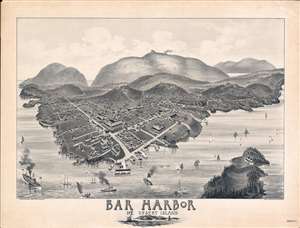
Bar Harbor Mt. Desert Island.
sold
- Digital Map Information
- Suitable for large format printing
- File Size: 60.03 MB
- File Type: ZIP / TIFF
- ICC color profile embedded
- Delivered instantly via download link
A rare and highly unusual 1886 Charles E. Jorgensen bird's-eye view of Bar Harbor, Mount Desert Island, Maine - illustrating the town at the height of Mount Desert Island's gilded age. This view was published to publicize the rebuilding of the Green Mountain Hotel (following a fire) and the inauguration of the Green Mountain Railroad - here visible at the summit of Cadillac Mountain. (more details)
The rare propaganda-ish 'Farm Animal' variant on the Visscher-Jansson Series map of New York, Virginia, and New England.
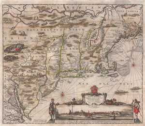
Novi Belgii Novaeque Angliae Nec Non Pennsylvaniae et Partis Virginiae Tabula multis in locis emendata.
sold
- Digital Map Information
- Suitable for large format printing
- Full resolution TIFF file
- ICC color profile embedded
- Delivered instantly via download link
An attractive old color example of Justus Danckerts' 1684 Novi Belgii or map of New York, New England, Pennsylvania, and Virginia. Some call this the 'farm animal map' for its novel incorporation of farm animals, ranging from horses and cows to chicken ... (more details)
First Detailed, Dedicated Plan of London.
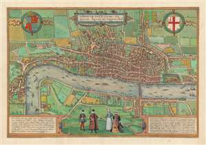
Londinum Feracissimi Angliae Regni Metropolis.
sold
- Digital Map Information
- Suitable for large format printing
- DPI: 600
- File Size: 46.69 MB
- File Type: ZIP / TIFF
- ICC color profile embedded
- Delivered instantly via download link
This is Georg Braun and Franz Hogenberg's plan of London, the first surviving, single-sheet, printed map of London. The significance of this seems not to have been lost on the authors, who made it the first plan in their Civitatis Orbis Terrarum, the first published collection of city plans and views. It is one of the few acquirable depictions of the city made before the Great Fire of 1666 (Howgego notes that it was the Great Fire itself, and the problems attendant to land ownership and rebuilding that led to proper surveys of the city in the first place.) (more details)
First view of Austin - or any other Texan city.

Texas in 1840, or the Emigrant's Guide to the New Republic. / City of Austin as the New Capital of Texas in January 1, 1840.
sold
- Digital Map Information
- Suitable for large format printing
- File Size: 3 MB
- File Type: ZIP / TIFF
- ICC color profile embedded
- Delivered instantly via download link
This is the rare 1840 first edition of A. B. Lawrence's Texas in 1840 with a dramatic hand-colored frontispiece being the earliest first-hand bird's-eye view of Austin, Texas - indeed the first such view of a Texan city and one of the earliest of any western town. (more details)
Gold, geology, and the Great Sioux War.
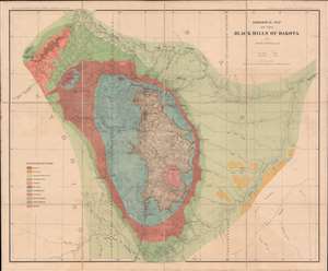
This is an 1879 Henry Newton geological atlas of the Black Hills, Dakota Territory (now South Dakota) published during the height of the Black Hills Gold Rush. Consisting of two maps and one view, the atlas provides some of the earliest detailed surveys of the region and particularly its geology, a matter of critical importance to miners. The present example, unlike any other we've seen, is handsomely dissected, laid on linen, and accompanies a custom original slipcase. (more details)