

Earliest Acquirable Printed Map of Arabia.
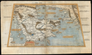
Sexta Asiae Tabula.
sold
- Digital Map Information
- Suitable for large format printing
- Full resolution TIFF file
- ICC color profile embedded
- Delivered instantly via download link
A foundational work of Renaissance cartography: this is the first acquirable printed map of the Arabian Peninsula. Appearing in the Rome edition of Ptolemy, in its 1478 printing, it is preceded only by the unacquirable 1477 Bologna Ptolemy. Ptolemy's 2nd-century innovation of representing the three-dimensional world on a grided mathematical projection provided the basis of all modern cartography. Of all the early printed versions of Ptolemy's maps, those produced for the Rome edition are considered the finest until Mercator's 1578 edition. The present example is embellished with attractive old hand color. (more details)
With the only pre-1500 map reflecting the Age of Discovery.
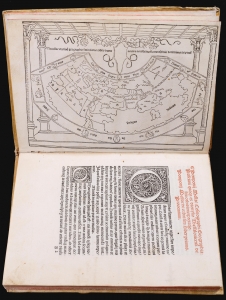
This is a rare, important 1482 incunable edition of Pomponius Mela's Cosmographi Geographica or De situ orbis, the only full Latin text on geography to have survived the classical era. This 1482 edition is doubly important as the first geographical text to include a map, as opposed to an atlas. Moreover, it is the only map of the pre-1500 era to show evidence of the Portuguese voyages of discovery. (more details)
The Most Beautiful 15th Century Map of the World.
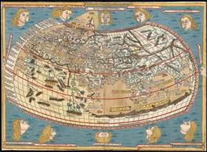
[Untitled map of the World].
sold
- Digital Map Information
- Suitable for large format printing
- DPI: 600
- File Size: 18.86 MB
- File Type: ZIP / TIFF
- ICC color profile embedded
- Delivered instantly via download link
This is a beautiful example, in rich original color, of the world map of the 1486 Ulm Ptolemy: regarded as the most beautiful, printed world map of the 15th century. The present example is one of the finest to appear on the market in recent years. It appeared in the first edition of Ptolemy printed north of the Alps, and as such it provided the foundation for the revolution in geographical knowledge that occurred in the opening years of the 16th century. The 'world' as depicted here is mainly the Oikumene, the inhabited world as it was known to 2nd century Romans. It covers the 'Old World' from the islands of the Atlantic Ocean (both real and legendary) to Indochina, and from the Arctic to the Tropic of Capricorn. But this was also the first printed world map to depart from a purely Ptolemaic model, offering more contemporaneous knowledge: the early depiction of Scandinavia and Iceland. (more details)
The European World As Columbus Sailed.
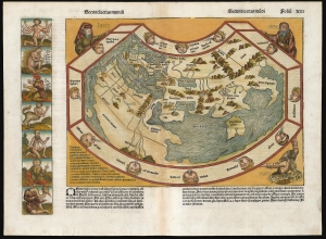
[Untitled map of the world] 'Secunda etas mūdi'.
sold
- Digital Map Information
- Suitable for large format printing
- Full resolution TIFF file
- ICC color profile embedded
- Delivered instantly via download link
One of the most distinctive early maps, this is the incunable map of the world accompanying Hartman Schedel's 1493 Liber Cronicarum or the 'Nuremberg Chronicle'. It is one of the few 15th-century printed maps available to the collector, but even among the earliest printed world maps, it is unique in its presentation and content. Published while Columbus sailed, this map captures the European world at the dawn of the Age of Discovery, just 40 years after the printing press. (more details)
Earliest Acquirable Printed Representation of Lyon.
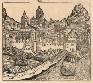
Lion.
sold
- Digital Map Information
- Suitable for large format printing
- Full resolution TIFF file
- ICC color profile embedded
- Delivered instantly via download link
This is the earliest acquirable printed depiction of Lyon, France. It appeared in Hartmann Schedel's 1493 Liber Chronicarum, also known as the Nuremberg Chronicle. (more details)
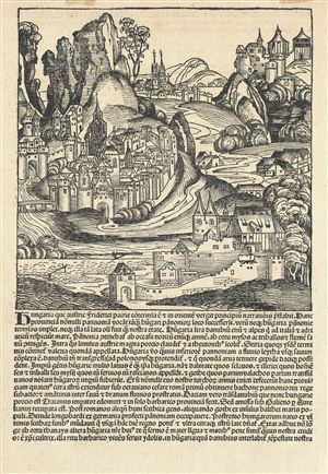
Hungaria que Asutrie Friderici …
sold
- Digital Map Information
- Suitable for large format printing
- DPI: 300
- File Size: 7.48 MB
- File Type: ZIP / TIFF
- ICC color profile embedded
- Delivered instantly via download link
A scarce page from Hartmann Schedel's 1493 Liber Chronicarum illustrating several imaginary Hungarian towns in a idealized countryside. The Liber Chronicarum or, as it is more commonly known, the Nuremberg Chronicle is alavishly illustrated world history ... (more details)
Eastern reaches of the Silk Road.
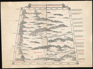
Octava Asia Tabula.
$2,000.00
Acquire
- Digital Map Information
- Suitable for large format printing
- File Size: 18.22 MB
- File Type: ZIP / TIFF
- ICC color profile embedded
- Delivered instantly via download link
This is a rare example of Bernard Sylvanus' 1511 Ptolemaic map of the eastern reaches of the Silk Road. Printed in a single edition, it is one of the most visually distinctive early woodcut maps to detail parts of modern-day Kazakhstan, Kyrgyzstan, and Tajikistan, the northeastern part of Mongolia, and the Xinjiang province of China. For Ancient Romans, this was the most remote part of the known world: Serica, named after the precious silk understood to originate there. (more details)
First map of the region printed in color.
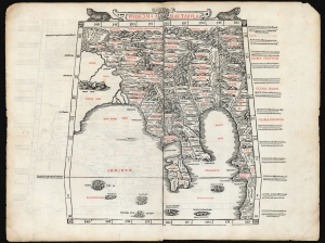
Undecima Asiae Tabula
sold
- Digital Map Information
- Suitable for large format printing
- File Size: 19.28 MB
- File Type: ZIP / TIFF
- ICC color profile embedded
- Delivered instantly via download link
This is a rare example of Bernard Sylvanus' 1511 Ptolemaic map of Southeast Asia and the Malay Peninsula. Printed in a single edition, it is one of the most visually distinctive early woodcut maps of the Far East, an area known to ancient geographers as 'India Extra Gangem' or 'India Beyond the Ganges'. By Ptolemy's reckoning, this map depicted the easternmost extreme of the Indian Ocean. This part of the world would soon be revealed to contain the East Indies and the Spice Islands. (more details)
The earliest acquirable modern printed map of Eastern Europe.
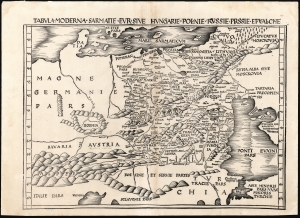
Tabula Moderna Sarmatie Eur. Sive Hungarie Polonie Russie Prussie Et Walachie.
sold
- Digital Map Information
- Suitable for large format printing
- DPI: 600
- File Size: 53.73 MB
- File Type: ZIP / TIFF
- ICC color profile embedded
- Delivered instantly via download link
This is Martin Waldseemüller's 1513 map of Eastern Europe, covering from the Elbe River to the Dnipro River and the Black Sea - roughly Poland, Hungary, Prussia, Lithuania, Russia, Transylvania, and Bulgaria, and some of the earliest obtainable mappings of the Ukraine. (more details)
One of the Earliest Printed Maps of India.
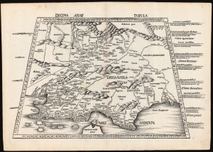
Decima Asie Tabula.
$8,500.00
Acquire
- Digital Map Information
- Suitable for large format printing
- File Size: 22.27 MB
- File Type: ZIP / TIFF
- ICC color profile embedded
- Delivered instantly via download link
This is Martin Waldseemüller's 1513 edition of the Ptolemaic map of India, one of the earliest acquirable maps of the area and an essential step in the subcontinent's cartographic evolution. Waldseemüller and Ringmann issued it for their 1513 Geographie Opus Novissima, the most comprehensively edited and amended edition of Claudius Ptolemy's 2nd-century geography. Moreover, this map was the largest format edition of Ptolemy's map to have been produced to date. (more details)
One of the Earliest Printed Maps of Arabia.
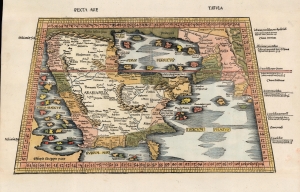
Sexta Asie Tabula.
sold
- Digital Map Information
- Suitable for large format printing
- Full resolution TIFF file
- ICC color profile embedded
- Delivered instantly via download link
This is the Waldseemüller / Ringmann 1513 map of Arabia, considered one of the earliest acquirable maps of the Arabian Peninsula and essential to any serious Arabia collection. It was issued for Waldseemüller and Ringmann's 1513 Geographie Opus Novissima, then the most thoroughly edited and amended edition of Ptolemy. Moreover, this map was the most detailed map of the Arabian Peninsula to have been produced to date, illustrating and naming many of the islands of the Red Sea and the Persian Gulf, and including comprehensive interior detail. Despite presenting ancient geography, the detail of Ptolemaic maps of the region had yet to be improved upon significantly, and so this map remained one of the most detailed maps of the Arabian Peninsula available, illustrating and naming many of the islands of the Red Sea and the Persian Gulf, and including comprehensive interior detail. (more details)
Anatolia as known to Ancient Rome.
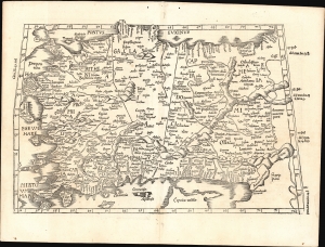
[Tabula I. Asiae].
$1,000.00
Acquire
- Digital Map Information
- Suitable for large format printing
- Full resolution TIFF file
- ICC color profile embedded
- Delivered instantly via download link
This is Laurent Fries' 1525 edition of Martin Waldseemüller's Ptolemaic map of Anatolia, one of the earliest generally acquirable maps of what would become modern-day Turkey. (more details)
One of the Earliest Modern Maps Ceylon / Sri Lanka.
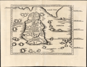
[Tabula XII. Asiae.]
$750.00
Acquire
- Digital Map Information
- Suitable for large format printing
- Full resolution TIFF file
- ICC color profile embedded
- Delivered instantly via download link
This is Laurent Fries' 1525 edition of Martin Waldseemüller's Ptolemaic map of Sri Lanka. This island - here named Taprobana - represented, for Ptolemy, the limit of European geographic knowledge in the east. The smallest area to have appeared in Ptolemaic canon, later geographers wrestled with the identity of the island depicted. Many correctly identified the island as Sri Lanka, though Munster, Mercator, and others speculated that the better candidate was Sumatra. (more details)
Earliest Acquirable use of 'America' on a map.
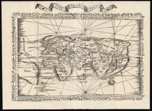
Orbis Typus Universalis Iuxta Hydrographorum Traditionem Exactissime Depicta. 1522 L. F.
sold
- Digital Map Information
- Suitable for large format printing
- File Size: 19.83 MB
- File Type: ZIP / TIFF
- ICC color profile embedded
- Delivered instantly via download link
This is a superb example of Lorenz Fries's 1522 map of the world in its 1535 edition: a key discovery-era document, being the second earliest, acquirable, printed map to name 'America' (appearing here in South America). (more details)
Earliest Acquirable map to name 'America'
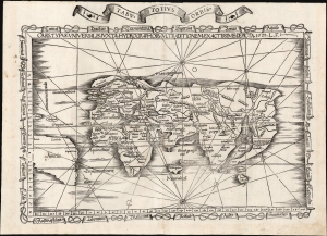
Orbis Typus Universalis Iuxta Hydrographorum Traditionem Exactissime Depicta. 1522 L. F.
sold
- Digital Map Information
- Suitable for large format printing
- File Size: 17.38 MB
- File Type: ZIP / TIFF
- ICC color profile embedded
- Delivered instantly via download link
This is Lorenz Fries' 1522 map of the world in its 1535 edition: a key discovery-era document, being the second earliest acquirable printed map to name 'America' (appearing here in South America). (more details)
Reconciling New Discovery with Ptolemy.
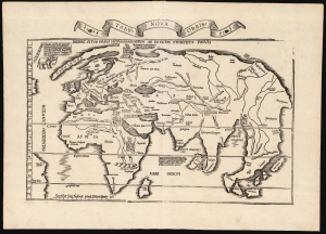
Tabu. Nova Orbis.
sold
- Digital Map Information
- Suitable for large format printing
- Full resolution TIFF file
- ICC color profile embedded
- Delivered instantly via download link
A superb example of Lorenz Fries's 1522 map of the world. This is one of the great Discovery-Era world maps, capturing the impact of contemporary exploration on the late-Roman cartographic models of Ptolemy. (more details)
The Silk Road between the Caspian Sea and the Hindu Kush.
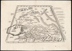
[Tabula Septima Asiae].
sold
- Digital Map Information
- Suitable for large format printing
- Full resolution TIFF file
- ICC color profile embedded
- Delivered instantly via download link
This is Laurent (Lorenz) Fries' 1522 map of central Asia and the Silk Road, among the earliest acquirable maps of Central Asia east of the Caspian Sea. Although presenting 2nd-century Ptolemaic geography, this map remained relevant as the best map of the region available. Additionally, Fries' iteration of this Ptolemaic map is distinct from any other in its incorporation of contemporary information about the denizens of the region - in this case, drawn from the texts on Waldseemüller's 1516 Carta Marina. (more details)
Foundation of the mapping of Arabia.
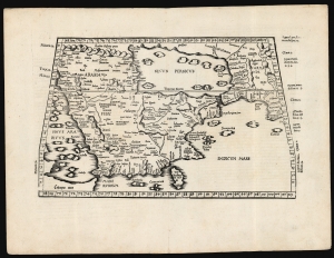
[Tabula Sexta Asiae].
$2,750.00
Acquire
- Digital Map Information
- Suitable for large format printing
- Full resolution TIFF file
- ICC color profile embedded
- Delivered instantly via download link
This is Laurent (Lorenz) Fries' 1522 map of Arabia, among the earliest acquirable maps of the Arabian Peninsula. Although presenting 2nd-century Ptolemaic geography, this map remained accurate and relevant and one of the best maps of the peninsula available. (more details)
Discovery Era World Map.
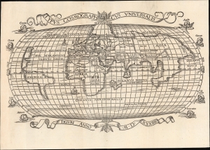
Typus Cosmographicus Universalis.
sold
- Digital Map Information
- Suitable for large format printing
- Full resolution TIFF file
- ICC color profile embedded
- Delivered instantly via download link
This is Joachim Vadian's rare 1534 woodcut map of the world, combining a largely Ptolemaic formulation of Europe and Asia with what was a modern depiction of Africa and the New World. It is one of the earliest maps to name America. While largely derived from the map Sebastian Münster prepared for Simon Grynaeus in 1532, it is in many ways a better representation of Münster's source, the 1507 map of Martin Waldseemüller. (more details)
First generally acquirable Map of Scandinavia, Iceland and Greenland.
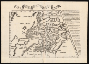
Norbegia et Gottia.
sold
- Digital Map Information
- Suitable for large format printing
- Full resolution TIFF file
- ICC color profile embedded
- Delivered instantly via download link
This is Lorenz Fries' 1522 map, in a 1535 edition, of one of the earliest maps to focus on the northern parts of Europe, including Iceland and Greenland. It is one of the earliest acquirable maps to include the geography of Claudius Clavus (1388 - 14??). (more details)
Ancient Persia.
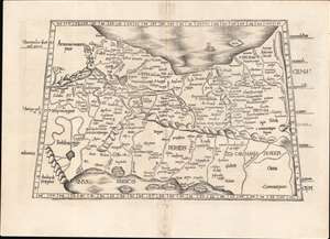
[Tabula V. Asiae].
sold
- Digital Map Information
- Suitable for large format printing
- Full resolution TIFF file
- ICC color profile embedded
- Delivered instantly via download link
This is Laurent Fries' Ptolemaic map of Persia, one of the earliest generally acquirable maps of what would become Iran and Iraq. The map spans from Mesopotamia - the Tigris and Euphrates Rivers valleys - to a mountain range roughly corresponding with the Masjed Mountains of easternmost Persia, embracing modern-day Iran, Iraq, the Caspian Sea, and the Persian Gulf. (more details)
Western China, Mongolia and Central Asia North of the Himalayas
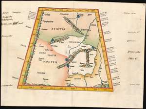
(Tabula VIII Asiae)
sold
- Digital Map Information
- Suitable for large format printing
- DPI: 600
- File Size: 17.68 MB
- File Type: ZIP / TIFF
- ICC color profile embedded
- Delivered instantly via download link
This map depicts the area now known as China and Mongolia. Specifically, it shows the lands known to Strabo and Ptolemy as Scythia Extra Imaum and Serica. Scythia Extra Imaum refers to the territory of the nomadic Scythians to the east of the Tian Shan mountain range, while Serica was a mysterious land thought to be the source of silk: indeed, the place name literally means “the land where silk comes from.” The map includes specific descriptors for some of the people to be found in the region: in the northwestern extreme of the map, Hippophagi (horse-eaters) and Anthropophagi (cannibals) can be found. Since this map covers one of the norther nmost regions addressed in Ptolemy's work, it includes notation in its margins indicating the increase in the length of the days as one travels north, a phenomenon not easily observed during Ptolemy's time but one with which northern European travelers of the 16th century would have been growing familiar. (more details)
First acquirable map of China and Japan.
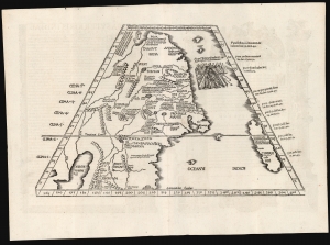
[Ta. Superioris. Indiae Et Tartariae Maioris.]
sold
- Digital Map Information
- Suitable for large format printing
- Full resolution TIFF file
- ICC color profile embedded
- Delivered instantly via download link
A seminal work, this 1522 Lorenz Fries map is the first European map to focus on China and Japan and the first specific map to utilize Marco Polo's geographical reports of East Asia. It was also one of the first maps included in a printed edition of Ptolemy's Geographia to reflect a contemporaneous understanding of the subject region. It is also the only acquirable printed map of the region derived from Martin Waldseemüller's 1507 world map, representing one of the first efforts to reconcile ancient geography with new information from exploration and geographical theory. (more details)
The first printed map of the Pacific Northwest.
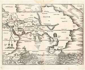
[Africa/ Asia Maior/ Terra incognita]
sold
- Digital Map Information
- Suitable for large format printing
- Full resolution TIFF file
- ICC color profile embedded
- Delivered instantly via download link
This is a rare 1538 map of Asia, executed by Sebastian Münster for inclusion in his edition of Solinus' Polyhistor. It predates by two years the map of Asia in Münster's 1540Geographia. Although it is not entirely a modern work, it is the earliest printed map focusing on the continent of Asia. It also contains the first printed representation of the Pacific Northwest, more than thirty years prior to the Ortelius map generally granted that laurel. (more details)
First printed map of the Western Hemisphere.
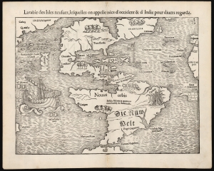
La table des Isles neufues, lesquelles on appelle isles d'occident et d Indie pour divers regardz.
sold
- Digital Map Information
- Suitable for large format printing
- Full resolution TIFF file
- ICC color profile embedded
- Delivered instantly via download link
This is an excellent 1552 French-text edition of Sebastian Münster's 1540 map of America, the first printed map of the Western Hemisphere. From 1544, this map was included in Münster's Cosmographia. The 1552 editions are the last published in Münster's lifetime - after which production quality significantly declined. Cosmographia long outlasted Münster, remaining the best source for over 40 years for anyone who wished to know about the world. Consequently, this map had a disproportionate impact, providing the first glimpse of the New World to Europeans for nearly half a century. (more details)
Earliest obtainable modern map of Poland and Hungary.
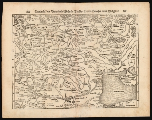
Landftafel des Ungerlands / Polands / Reüssen / Littaw / Walachei unnd Bulgarei.
sold
- Digital Map Information
- Suitable for large format printing
- Full resolution TIFF file
- ICC color profile embedded
- Delivered instantly via download link
This is the 1564 German edition of Sebastian Münster's map of Poland and Hungary, the first acquirable map to focus on the region using contemporary place names and geographical knowledge. (more details)
Habitable world as known to the ancients.
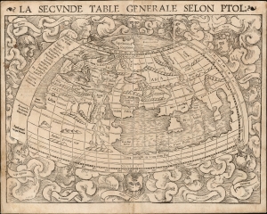
La Seconde Table Generale Selon Ptol.
sold
- Digital Map Information
- Suitable for large format printing
- Full resolution TIFF file
- ICC color profile embedded
- Delivered instantly via download link
An attractive example of Sebastian Münster's 1540 map of the world, according to Claudius Ptolemy, in a 1568 French text edition. The map details the Oikumene, the inhabited world as it was known to the Roman Empire of the second century, well before the Age of Discovery. It covers only the 'Old World' from the Atlantic (Pillars of Hercules) to Indochina, and from the Arctic to the Tropic of Capricorn. The map is surrounded by aeoli and clouds. (more details)
First Edition, First State.
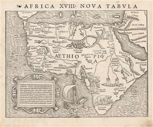
Africa XVIII. Nova Tabula.
sold
- Digital Map Information
- Suitable for large format printing
- Full resolution TIFF file
- ICC color profile embedded
- Delivered instantly via download link
This is the rare 1540 first edition of Sebastian Münster's map of Africa, the earliest detailed map of the continent available to the collector, here in its earliest state. As is to be expected for an early printing strike, the image is bold, sharp and clear. This attractive and evocative map was broadly influential: for more than thirty years during the age of discovery, this map would be the predominant representation of Africa available to the European reader. (more details)
First Edition, First State.
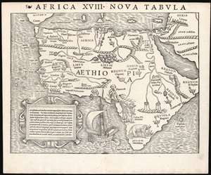
Africa XVIII. Nova Tabula.
sold
- Digital Map Information
- Suitable for large format printing
- Full resolution TIFF file
- ICC color profile embedded
- Delivered instantly via download link
This is the rare 1540 first edition of Sebastian Münster's map of Africa, the earliest detailed map of the continent available to the collector, here in its earliest state. As is to be expected for an early printing strike, the image is bold, sharp and clear. This attractive and evocative map was broadly influential: for more than thirty years during the age of discovery, this map would be the predominant representation of Africa available to the European reader. (more details)
The earliest modern map to clearly depict Poland and Hungary.
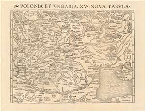
Polonia et Ungaria, XV. Nova Tabula.
sold
- Digital Map Information
- Suitable for large format printing
- DPI: 600
- File Size: 37.24 MB
- File Type: ZIP / TIFF
- ICC color profile embedded
- Delivered instantly via download link
This is the scarce 1540 first state of Sebastian Münster's map of Poland and Hungary, the first map to focus on the region using contemporary place names and geographical knowledge. The only earlier printed maps to focus at all on the region were iterations of Ptolemy's maps of Sarmatia in Europe; the nearest contender for an earlier modern map of the region is Waldseemüller's 1513 Tabula moderna Sarmatie which was of broader scope (reaching as far west as Germany and the Bavarian Alps) and whose geography for the region is far more primitive. Münster's map is the first of this region to present the reader with a largely recognizable depiction of Poland and Hungary. (more details)
Earliest modern map to clearly depict Poland and Hungary.
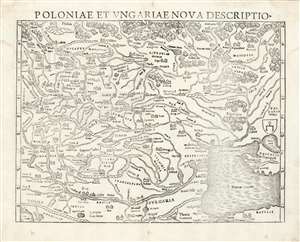
Polonia et Ungariae Nova Descriptio.
sold
- Digital Map Information
- Suitable for large format printing
- Full resolution TIFF file
- ICC color profile embedded
- Delivered instantly via download link
This is the 1559 Latin edition of Sebastian Münster's map of Poland and Hungary, the first acquirable map to focus on the region using contemporary place names and geographical knowledge. The only earlier printed maps to focus at all on the region were iterations of Ptolemy's maps of Sarmatia in Europe; the nearest surviving contender for an earlier modern map of the region is Waldseemüller's 1513 Tabula moderna Sarmatie which was of broader scope (reaching as far west as Germany and the Bavarian Alps) and whose geography for the region is far more primitive. Bernard Wapowski's c. 1526 map of Sarmatia informed Münster's ma, but only fragments of it have survived. Münster's map is thus the first of this region available to the collector with a largely recognizable depiction of Poland and Hungary. (more details)
One of the Finest and Most Detailed Woodcut World Maps.
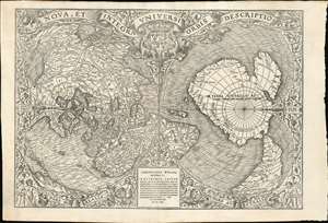
Nova, et Integra Universi Orbis Descriptio.
sold
- Digital Map Information
- Suitable for large format printing
- Full resolution TIFF file
- ICC color profile embedded
- Delivered instantly via download link
This the rare and influential 1531 Oronce Fine map of the world, portrayed using a double cordiform polar projection. This intricate woodcut map was both influential and - especially compared to other printed maps of its era - remarkably reflective of state-of-the-art cartographic detail. Rodney Shirley proclaimed it 'a rendering considerably in advance of any others printed earlier.' Many areas of significant interest are addressed in detail for the first time. The peninsular shape of Florida is clearly presented for the first time, and both Pineda and Cortez' mapping of the Gulf of Mexico are recorded here. This is the first printed map to refer to Magellan's voyage, naming a 'Mare Magellanicum' west of South America. The map breaks from Martin Waldseemüller's convention of presenting North America as separate from Asia: Fine's map incontrovertibly presents Labrador, Florida and the Gulf Coast as part of the Asian mainland; South America itself is depicted as taking the place of the Ptolemaic Great Promontory, or 'Dragon's Tail' that appeared on earlier maps like the 1507 Waldseemüller and the 1490 Martellus. Although including (but not naming) Magellan's strait, the map fails to account for the size of the ocean that circumnavigator revealed (despite naming that ocean - Mare Magellanicum.) (more details)
Quintessential Discovery Era World.
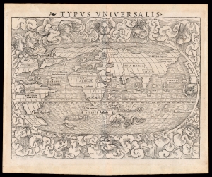
Typus Universalis.
sold
- Digital Map Information
- Suitable for large format printing
- Full resolution TIFF file
- ICC color profile embedded
- Delivered instantly via download link
This is a superb example of the scarce first block of Sebastian Münster's 1540 map of the world, one of the most distinctive maps of the Age of Discovery. It is a remarkable work of synthesis, providing the best summation of the rapidly expanding known world. Although this first block only appeared in the few editions of Münster's Geographia and Cosmographia that were printed prior to 1550, its content was largely preserved in the second block which replaced it. Thus, it was able to provide a broad audience their first image of the post-Magellanic world, unchallenged until the 1570 publication of Ortelius' Theatrum Orbis Terrarum. The present example is the 1545 third state of the map. (more details)
Early ptolemaic map of Central Asia!
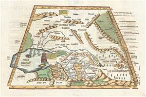
[Title on Verso] Tabula Septima Asiae Complectitur Margianam, Bactrianam, Sogdianam, Sacas, & Scythiam, Intra Imaum Montem.
sold
- Digital Map Information
- Suitable for large format printing
- DPI: 300
- File Size: 5.73 MB
- File Type: ZIP / TIFF
- ICC color profile embedded
- Delivered instantly via download link
A fine example of the 1541 Vienne-in-the-Dauphane edition of Lorenz Fries' Ptolemaic map of central Asia. The map's coverage extends from the western Caspian Sea and the Central Asian Steppe, Afghanistan, including all or parts of modern day Kazakhstan, Turkmenistan, Iran, Afghanistan, Uzbekistan, and Iran. The Himalayas are evident at the base of the map and have a rope-like aspect. The map exhibits the typical trapezoidal projection common to early Ptolemaic maps. (more details)
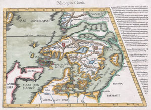
Norbegia & Gottia.
sold
- Digital Map Information
- Suitable for large format printing
- DPI: 300
- File Size: 5.91 MB
- File Type: ZIP / TIFF
- ICC color profile embedded
- Delivered instantly via download link
A masterpiece. This is an important early map of Scandinavia by cartographer Martin Waldseemuller. It is heavily based on the similar map by Claudius Clavus, which appeared in the 1425 Ulm edition of Ptolemy's Geographia. The most notable difference between ... (more details)
First printed map of the Western Hemisphere in one of its earliest printings.
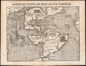
Novae Insulae XVII Nova Tabula.
sold
- Digital Map Information
- Suitable for large format printing
- Full resolution TIFF file
- ICC color profile embedded
- Delivered instantly via download link
This is a superb example of Sebastian Münster's map of America, the first printed map of the Western Hemisphere. This map appeared in the second, 1542 printing of Münster's edition of Ptolemy's Geographia, preceded only by the 1540. As is to be expected for an early printing strike, the image is bold, sharp, and clear. This attractive and evocative map was broadly influential. Münster's Geographia was one of the earliest versions of Ptolemy's work to systematically include maps showing contemporary geographical knowledge, but the map's 1544 inclusion in Münster's magnum opus, Cosmographia Universalis would insure that for more than thirty years during the age of discovery, this map would provide the first glimpse of the New World to the literate European. (more details)
2nd Century Persian Empire.
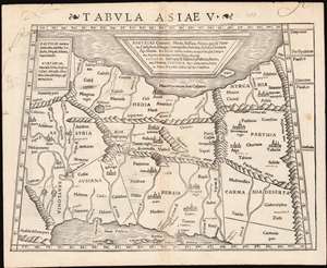
Tabula Asiae V.
sold
- Digital Map Information
- Suitable for large format printing
- Full resolution TIFF file
- ICC color profile embedded
- Delivered instantly via download link
This is a 1542 example of Sebastian Münster's Ptolemaic map of Persia, the fifth of Ptolemy's Asia maps. The map covers modern-day Iraq and Iran, extending from the Fertile Crescent to the desert south of the Caspian Sea. In the 1st and 2nd centuries CE, these territories were occupied by the Persian Empire, and its vassal kingdoms Carmania, Hyrcania, Parthia, Media, Assyria, Susiana (Elam), and Babylonia. The western limit of the map is marked by the Tigris and Euphrates Rivers; and the eastern by the Masdoranus Mountains (roughly corresponding to the Eastern Iranian Range). The map is bordered on the south by the Persian Gulf, and on the north by the southern shores of the Caspian Sea (then conceived as a wide and oval). (more details)
Earliest map of Czech, earliest map with a key!
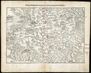
Behmer kunigreich mit bergen und waelden gerings umb beschlossen.
sold
- Digital Map Information
- Suitable for large format printing
- Full resolution TIFF file
- ICC color profile embedded
- Delivered instantly via download link
This is Munster's 1545 map of Bohemia, the earliest acquirable printed map of what is now the Czech Republic. This map appeared in the 1572 Latin edition Munster’s Cosmographia Universalis, a work notable for presenting to a broad lay audience many of the first printed maps based on contemporaneous surveys and toponymy, rather than data from classical sources. Munster’s source for this map was Nicolaus Claudianus’ 1518 map of Bohemia, which now exists in only one known surviving example. Munster's map is the only version of Claudianus' map available to the collector. (more details)
Earliest map of Czech, earliest map with a key!
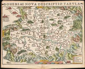
Bohemiae Nova Descriptio Tabula.
sold
- Digital Map Information
- Suitable for large format printing
- Full resolution TIFF file
- ICC color profile embedded
- Delivered instantly via download link
This is Munster's 1545 map of Bohemia, the earliest acquirable printed map of what is now the Czech Republic. This map appeared in the 1572 Latin edition Munster’s Cosmographia Universalis, a work notable for presenting to a broad lay audience many of the first printed maps based on contemporaneous surveys and toponymy, rather than data from classical sources. Munster’s source for this map was Nicolaus Claudianus’ 1518 map of Bohemia, which now exists in only one known surviving example. Munster's map is the only version of Claudianus' map available to the collector. (more details)
Earliest map of Czechia, earliest map with a key!
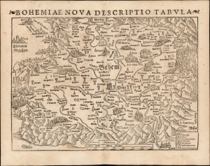
Bohemiae Nova Descriptio Tabula.
sold
- Digital Map Information
- Suitable for large format printing
- Full resolution TIFF file
- ICC color profile embedded
- Delivered instantly via download link
This is Sebastian Münster's 1545 map of Bohemia, the earliest acquirable printed map of what is now the Czech Republic. This example appeared in the 1572 Latin edition of Münster's Cosmographia Universalis, a work notable for presenting to a broad lay audience many of the first printed maps based on contemporaneous surveys and toponymy, rather than data from classical sources. Munster's source for this map was Nicolaus Claudianus' 1518 map of Bohemia, which now exists in only one known surviving example. Munster's map is the only version of Claudianus' map available to the collector. (more details)
The Earliest Acquirable Map of Bohemia, and the First Acquirable Map to Use a Key
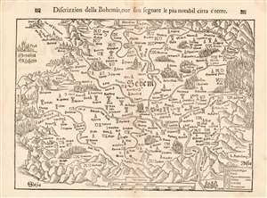
Discrizzion della Bohemia, oue son segnate le piu notabil citta é terre.
sold
- Digital Map Information
- Suitable for large format printing
- DPI: 600
- File Size: 10.23 MB
- File Type: ZIP / TIFF
- ICC color profile embedded
- Delivered instantly via download link
This is Munster's 1545 map of Bohemia, the earliest acquirable printed map of what is now the Czech Republic. The map appeared in an Italian edition of Munster’s Cosmographia Universalis, a work notable for presenting to a broad lay audience many of the first printed maps to rely on recent surveys and toponymy, rather than data from classical sources. Munster’s source for this map was Nicolaus Claudianus’ 1518 map of Bohemia, which now exists in only one known copy. Munster's map is the only version of Claudianus' map available to the collector. (more details)
Earliest map of Europe based on contemporaneous knowledge.
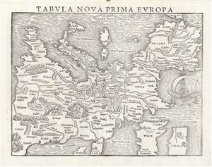
Tabula Nova Prima Europa.
sold
- Digital Map Information
- Suitable for large format printing
- Full resolution TIFF file
- ICC color profile embedded
- Delivered instantly via download link
This is a rare 1545 example of Sebastian Münster's southern-oriented map of Europe: an early imprint of the first acquirable map of Europe based on contemporary geographical information, and the only generally acquirable derivative of Martin Waldseemüller's unobtainable 1511 map of Europe. Münster's Geographia and Cosmographia provided for many years the literate European's only glimpses of the world, and these two works contained a number of maps with previously unseen contemporaneous knowledge of the areas they depicted. For Münster's readership, this map was almost certainly the first depiction of their home continent not based upon the 2nd century work of Claudius Ptolemy. (more details)
Earliest map of Greece based on contemporaneous knowledge, in a very early issue.
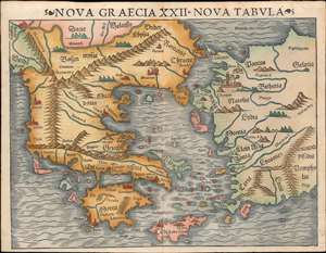
Nova Graecia XXII Nova Tabula.
sold
- Digital Map Information
- Suitable for large format printing
- File Size: 9.2 MB
- File Type: ZIP / TIFF
- ICC color profile embedded
- Delivered instantly via download link
This is a scarce 1545 example of Sebastian Münster's modern map of Greece: the second imprint of the first detailed map specifically of Greece and the Greek Islands based on contemporary geographical information. Münster's Geographia and Cosmographia provided for many years the literate European's only glimpses of the world, and these two works contained several maps with previously unseen contemporaneous knowledge of the areas they depicted. For Münster's readership, this map was the first depiction of Greece not based upon the 2nd century work of Claudius Ptolemy. This map appeared in Geographia as a somewhat late addition: the 1540 and 1542 editions of the work did not include this map. It would appear again in the 1552 Ptolemy (with the added coordinate bars characteristic of that edition.) It first appeared in the 1544 debut edition of Münster's Cosmographia and would appear in all editions of that work until 1578. In that 1544 German edition, the title of the map explicitly states Münster's intent: 'Neüw Griechen land mit andern anstoffenden in lendern/ wie es zu unsern zeiten beschreiben ist' - 'New Greece... as it is described in our era.' (more details)
First printed map to show New York Harbor
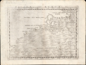
Tierra Nueva.
sold
- Digital Map Information
- Suitable for large format printing
- Full resolution TIFF file
- ICC color profile embedded
- Delivered instantly via download link
This is Giacomo Gastaldi's 1548 map of the eastern coast of North America. It is considered the first printed map specifically of the American eastern coastline and the first obtainable map to illustrate Narragansett Bay, Block Island, New York Harbor, Long Island, the Outer Banks, and Bermuda. (more details)
The First Separate, Modern Map of India
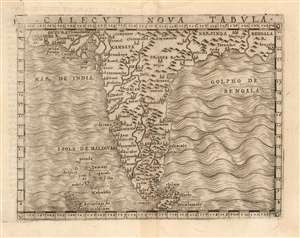
Calecut Nova Tabula.
sold
- Digital Map Information
- Suitable for large format printing
- DPI: 600
- File Size: 2.92 MB
- File Type: ZIP / TIFF
- ICC color profile embedded
- Delivered instantly via download link
This is Giacomo Gastaldi's 1548 map of the Indian Peninsula. It is the earliest printed, modern map of India - all earlier maps of the region being iterations of Claudius Ptolemy's geographical information of the 2nd century. Though a Venetian, Gastaldi's information shows knowledge of the depth of Portuguese penetration of the subcontinent. Guzarat, Goa, Calecut, Delhi and many other place names appear on the map. Sri Lanka (Ceilam) is shown in its correct location and is not conflated with Sumatra, as many of the Ptolemaic maps appeared to do. The archaic term 'Taprobana' does not appear. The Maldives are shown with some exaggeration. (more details)
Foundations of Terra Australis Incognita.
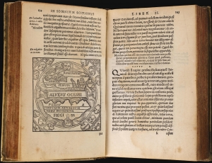
Macrobij Ambrosij Aurelij Theodosij, uiri consularis, and illustris : In Somnium Scipionis, lib. II. Saturnaliorum, lib. VII.
sold
This is a beautiful example of the 1548 Lyon edition of Macrobius' Saturnalia and his commentary on Cicero's Dream of Scipio, or Commentarii in Somnium Scipionis. The latter is one of the most cited works in the scholarship of the Middle Ages. In addition to its foundational role in transmitting Neoplatonism to the medieval world, this book was by the medieval world as the essential primer on cosmography. Macrobius' commentaries built on Cicero's cosmographical ideas and formalized them. Macrobius' analysis of Cicero placed his cosmography in the context of Claudius Ptolemy's astrological work. Through Macrobius' lens, the universe as understood by the ancient world, was embraced by philosophers, authors, and artists. His ideas extensively influenced the early geographers of the 16th century and were the source of early speculation on the existence of the undiscovered 'Terre Australis' (Southern Continent), an idea later adopted by Mercator and Ortelius. (more details)
Italian Edition of the Earliest Acquirable Plan of Paris.
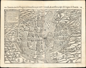
Lutetia Parisiorum urbs, toto orbe celeberrima notissimaque, caput regni Franciæ.
sold
- Digital Map Information
- Suitable for large format printing
- Full resolution TIFF file
- ICC color profile embedded
- Delivered instantly via download link
This attractive 1550 woodcut map of Paris is the earliest acquirable plan of the city, here from the 1558 Italian edition of Sebastian Münster's Cosmographia. (more details)
Sebastian Münster's Home City.
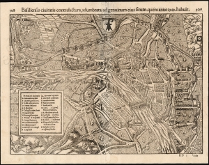
Basiliensis civitatis contrafactura, adumbrata ad genuinum eius situm, quem anno 1549, habuit.
sold
- Digital Map Information
- Suitable for large format printing
- Full resolution TIFF file
- ICC color profile embedded
- Delivered instantly via download link
Sebastian Münster's lively and remarkably accurate woodcut bird's-eye view of Basel, Switzerland's old town as it stood in 1549, is the earliest acquirable map of that city. It is preceded only by the view appearing in the 1493 Nuremberg Chronicle. Münster's work is particularly significant, as it is a representation of the mapmaker's home city. (more details)
First Printed Modern Map of Asia.
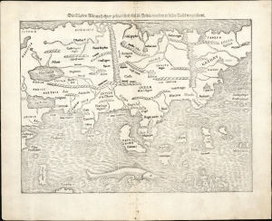
Die Laender Asie nach ihrer gelegenheit biss in India werden in diser Tafel verzeichnet.
$2,000.00
Acquire
- Digital Map Information
- Suitable for large format printing
- Full resolution TIFF file
- ICC color profile embedded
- Delivered instantly via download link
This is a 1574 strike of Sebastian Münster's 1540 map of Asia, the first printed map of that continent based on contemporary data and the earliest obtainable map of the continent overall. The map depicts the Asian continent from the Caspian Sea and the Persian Gulf to the Pacific Ocean and from the Arctic Ocean to the Indian Ocean. Although the interior detail is based heavily on Ptolemy, Münster also blends in information gleaned from recent discoveries by Portuguese traders and adventurers, including Vasco da Gama (c. 1460 - 1624). Both the Portuguese outposts of Goa and Calicut, on the Indian subcontinent, are labeled, and the depiction of India is improved, moving closer to a truly accurate depiction, although still undersized. The inclusion of Sri Lanka (Zaylon) as an island is also an improvement; Münster applies Ptolemy's historical name for Sri Lanka - Taprobana - to Sumatra, which is placed correctly to the west of the Malay peninsula. (more details)
First edition of the earliest printed map of Amsterdam available to the collector.
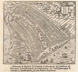
[Untitled Bird's Eye View of Amsterdam].
sold
- Digital Map Information
- Suitable for large format printing
- Full resolution TIFF file
- ICC color profile embedded
- Delivered instantly via download link
This is Sebastian Münster's 1550 view / map of Amsterdam, the earliest acquirable printed map of that city. It was preceded only by the 1544 wall map of Cornelis Anthonisz, Münster's source for this view. Anthonisz's wall map - which survives in fewer than ten examples - represented the best (and only) firsthand depiction of Amsterdam of its time. Its depiction in 1550 by Münster and in 1572 by Braun and Hogenberg established as the dominant 16th century image f what would become the chief economic engine of the seventeenth century. (more details)