
Matthews-Northrup Works (sold)
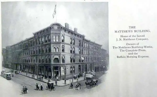
Matthews-Northrup Works (fl. c. 1895 - 1930) were a Buffalo, New York based, in their own words, "writing, designing, engraving, printing, [and] binding" firm. The firm was founded by James Newson Matthews (November 21, 1828 - December 20, 1888) as the J. N. Matthews Company. William Phelps Northrup (April 2, 1850 - February 2, 1929) later joined the company as an apprentice and then partner, at which point the firm was reincorporated as the Matthews-Northrup Works. The Matthews-Northrup Works rose to prominence as publishers and printers of railroad maps, with dozens to their credit. When James died, his shares were inhered by George Edward Matthews (1855 - 1910), who ran the business until his death in 1910. Also in 1910, they famously redesigned the cover of National Geographic Magazine. Despite some six previous cover changes in just 21 years, the Matthews-Northrup layout proved so popular that it was used for nearly 50 years. The firm can also take credit for the Winchell typeface, designed in 1903 under E. E. Winchell's tenure as art director. Curiously, the partners of Matthews-Northrup maintained an unusual affectation in which only the officers of the company could wear beards or mustaches. In this same spirit, the firm also had its own private social club, the Fellowcraft Club, where the all-male employees could relax, play pool, drink and dine. Matthews-Northrup maintained offices on Washington Street, Buffalo, where they were based, as well as Madison Square, New York City, Garden Tower, Boston, and the Citizens Building in Cleveland.
Virginia's most important 19th century railway.
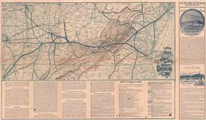
Map Showing the Route to the Mountain and Sea Side Resorts Chesapeake and Ohio Route.
sold
- Digital Map Information
- Suitable for large format printing
- Full resolution TIFF file
- ICC color profile embedded
- Delivered instantly via download link
This is a c. 1885 Matthews Northrup railroad map of Virginia and Kentucky highlighting the Chesapeake and Ohio Route, also known as the Chesapeake and Ohio Railway. Connecting Memphis, Tennessee and Newport News and Old Point Comfort, Virginia, a thick black line highlights the route of the Chesapeake and Ohio Railway. Stops along the route, including Richmond, Charlottesville, and Louisville, are identified. The routes of connecting railroads, including the Philadelphia, Wilmington, and Baltimore Railroad, the Pennsylvania Railroad, and the Baltimore and Ohio Railroad, are traced by thinner black lines. Very thin black lines detail the rest of the region's railway network. Cities, towns, and villages are labeled throughout, along with mountain ranges and rivers. Information about the railroad and potential destinations is included along the bottom border and on the verso. Advertisements for the Hygeia Hotel in Old Point Comfort and the Hotel Warwick in Newport News occupy the space to the right of the right border. (more details)
Large in-station map of the Union Pacific Routes - 1 of just 2 known examples.
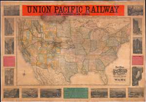
New Map of the Union Pacific Railway, the Short, Quick and Safe Line to all Points West.
sold
- Digital Map Information
- Suitable for large format printing
- File Size: 188.26 MB
- File Type: ZIP / TIFF
- ICC color profile embedded
- Delivered instantly via download link
This rarity is a large format 1887 wall map of the United States issued by Rand McNally and Company on behalf of the Union Pacific Railroad. This scarce railroad map was issued exclusive for company use at larger stations, and was not publicly distributed, hence its extreme rarity. There are no other examples of the current map known, but the Library of Congress does own an earlier 1883 edition. The map embraces the whole of the United Sates, illustrating the routes of the Union Pacific Railroad and its many subsidiaries, as well as, in some cases, important connecting routes operated by competing railroads. The map is surrounded by 14 vignette views engraved by the Matthews Northrup Company illustrating the spectacular sights and geographical oddities to be observed along the Union Pacific routes. Further textual advertisements promote the Union Pacific as the shortest, quickest, and safest route westward. (more details)
First map of the 'Plant System' in Florida.
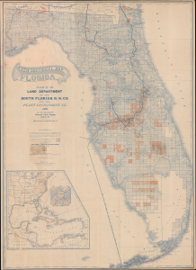
A New Sectional Map of Florida.
sold
- Digital Map Information
- Suitable for large format printing
- Full resolution TIFF file
- ICC color profile embedded
- Delivered instantly via download link
This is a rare 1888 large-format map of Florida prepared by the Land Department of the South Florida Railroad and the Plant Investment Company, and printed by Matthews, Northrup, and Co. It depicts 'Plant System' of railroad and land magnate Henry B. Plant (1819 - 1899) as it was reaching its apex, expanding into South Florida and linking it with wider regional rail and steamship connections. (more details)
Promotes steamship routes to the West Indies, Central, and South America leaving from Tampa, Florida.
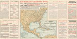
The Plant System Via Port Tampa to Cuba, West Indies, Mexico, South and Central America.
sold
- Digital Map Information
- Suitable for large format printing
- File Size: 29.16 MB
- File Type: ZIP / TIFF
- ICC color profile embedded
- Delivered instantly via download link
This is an 1889 Matthews, Northrup, and Company map of North America promoting Tampa, Florida as national transport hub for both land and sea routes. Known as the Plant System, the map depicts a vast transportation network centered on Tampa, but extending from Nevada and Idaho to the Windward Islands and from Quebec to northern South America. Thick black lines mark Plant System rail lines along the East Coast from New York to Tampa, with thick dashed lines illustrating Plant Steamship lines from Tampa to Mobile, Alabama and from Tampa to Havana, Cuba via Key West. Thinner black lines highlight affiliated rail lines in the central U.S., while even thinner lines illustrate the rest of the rail network spreading out like a spider's web across the country. Other steamship routes throughout the Caribbean are also included, rendering apparent that travel is possible between all the islands in the West Indies, Mexico, and Central and South America. Advertisements promoting worldwide travel flank the map on both sides, touting the fact that travelers can purchase tickets to any of the locations illustrated on the map plus several different cities in Europe, including London and Paris, from Plant System agents. (more details)
The Jacksonville, Tampa, and Key West System!
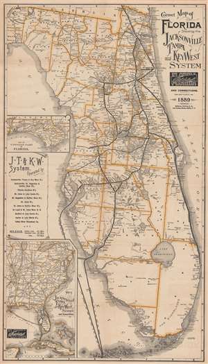
Correct Map of Florida Showing the Jacksonville Tampa and Key West System and Connections.
sold
- Digital Map Information
- Suitable for large format printing
- File Size: 30.23 MB
- File Type: ZIP / TIFF
- ICC color profile embedded
- Delivered instantly via download link
This is an 1889 Matthews Northrup railroad map of Florida. Thick black lines highlight the main railroads throughout Florida, including the Jacksonville, Tampa, and Key West System; the Savannah, Florida, and Western Railway; the Jacksonville, St. Augustine, and Halifax River Railway; the Florida Southern Railway; and the St. Johns and Halifax River Railway. Major stops along all these railways are identified. Dashed lines illustrate associated steamship lines associated, such as the Indian River Steamboat Company operated by the Jacksonville, Tampa, and Key West System. Thinner lines trace unaffiliated railways, such as the Orange Belt Railway and the Florida Central and Peninsular Railroad. Two insets appear along the left depicting the Florida panhandle and the railroad network in the eastern United States, respectively. (more details)
Illustrates the vast amounts of land available for purchase from the Northern Pacific Railroad.
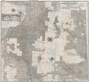
Map Showing Land Grant of the Northern Pacific Railroad Co. in Western Washington and Northern Oregon.
sold
- Digital Map Information
- Suitable for large format printing
- File Size: 37.83 MB
- File Type: ZIP / TIFF
- ICC color profile embedded
- Delivered instantly via download link
This is an 1890 Matthews. Northrop, and Company Northern Pacific Railroad map of western Washington state and northern Oregon. The map depicts the region from the Pacific Ocean to the Columbia River and from the Strait of Juan de Fuca to the Portland. Nearly all of ... (more details)
Impressive Reach of the Plant System in Florida.
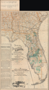
Township Map of Peninsular Florida. / Florida Map Illustrating its Geographical Position and showing Routes of the 'Plant System' of Railway and Steamship Lines / Map Showing the Lands of the Associated Railway Land Department of Florida.
sold
- Digital Map Information
- Suitable for large format printing
- Full resolution TIFF file
- ICC color profile embedded
- Delivered instantly via download link
This is an 1892 promotional map of Florida, prepared by David H. Elliott of the Associated Railway Land Department of Florida, and printed by Matthews, Northrup, and Company. While promoting Florida generally, it specifically highlights the railways, steamship lines, and lands of the Plant System (railroads), a major player in Florida's land and investment boom at the time. (more details)
Promotes the Florida Central and Peninsular Railroad.
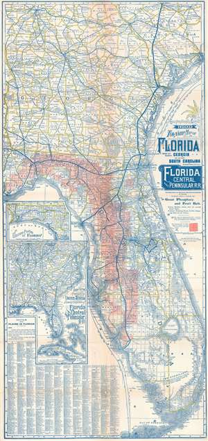
Geographically Correct Indexed Township Map of Florida Middle and Southern Georgia and Southern South Carolina showing complete system of Florida Central and Peninsular Railroad.
sold
- Digital Map Information
- Suitable for large format printing
- Full resolution TIFF file
- ICC color profile embedded
- Delivered instantly via download link
A rare 1894 map of Florida and Georgia illustrating the Florida Central and Peninsular Railroad at its peak. The map was issued not only to highlight the FCP achievements in reaching Tampa and St. Petersburg, but also to promote the extensive discoveries of phosphates. These discoveries extend from the Apalachicola River east through the panhandle and then south to Charlotte Harbor. Two insets are situated along the left border. The top inset depicts the western portion of the Florida Panhandle and the bottom inset illustrates the railroad network in the southeastern United States. An index of locations throughout Florida occupies the lower left corner. (more details)
Florida's Phosphate Industry.
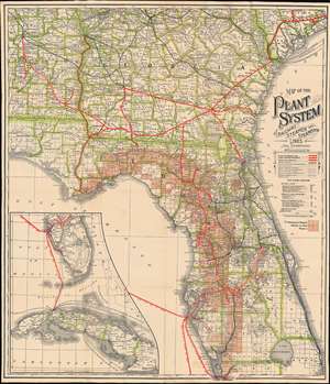
Map of the Plant System of Railway, Steamer and Steamship Lines and Connections.
sold
- Digital Map Information
- Suitable for large format printing
- File Size: 27.1 MB
- File Type: ZIP / TIFF
- ICC color profile embedded
- Delivered instantly via download link
A striking 1893 map of Florida, Georgia, and Alabama, illustrating the extent of the Plant system, a Tampa-based network of railroads and steamers traveling throughout the southeastern United States. The map also highlights Florida's rich phosphate mining region - a major source of revenue for the Plant system which was ideally suited to transport the valuable mineral. (more details)
The first state of the pre-East Coast Railroad map of Florida.
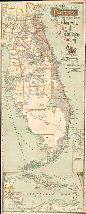
Map of the Peninsula of Florida and Adjacent Islands Published by the Jacksonville, St. Augustine and Indian River Railway.
sold
- Digital Map Information
- Suitable for large format printing
- Full resolution TIFF file
- ICC color profile embedded
- Delivered instantly via download link
A special rarity for the Florida collector, this is the first-state first-edition of the highly decorative 1894 map of peninsular Florida issued by the Mathews-Northrup Company for the Henry Morrison Flagler’s (1830 - 1913) Jacksonville, St. Augustine, and Indian River Railway, precursor to the Florida East Coast Railway. This is the first state of this famous map, pre-dating all other known examples and contemporaneous with, but in superior condition to, the Library of Congress example. The map covers from the Georgia Border to Key West and Cuba, and from Cedar Key to the Bahamas. The route of the railroad is illustrated in red overprinting extending from Jacksonville to Palm Beach, with major stops at Ormond, and Rockledge. Points further south, as far as Miami, can be reaching via the Lake Worth and Biscayne Bay Stage Line, which began operating around this time. The map also illustrates the 1892 J. E. Ingraham route across the Everglades – an exploratory expedition intended to determine the viability of a cross-Everglades railroad. (more details)
First promotion of Miami Beach as 'resort' property.
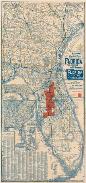
Geographically Correct Indexed Township Map of Florida, Middle and Southern Georgia, and Southern South Carolina, Showing the complete system of Florida Central and Peninsular R.R.. The shortest and Quickest Route to all Points in Florida extending directly through the Great Phosphate and Fruit Belt.
sold
- Digital Map Information
- Suitable for large format printing
- Full resolution TIFF file
- ICC color profile embedded
- Delivered instantly via download link
A rare 1894 map of Florida and Georgia illustrating the Florida Central and Peninsular Railroad at its peak, with provenance to Florida real-estate pioneer Elnathan T. Field. The map was issued not only to highlight the FCP achievements in reaching Tampa and St. Petersburg, but also to promote and sell the extensive properties straddling the railroad grant. These are shaded bright orange and are unmistakable. Intriguingly, the map also exhibits magenta overprinting promoting beachfront property from Jupiter to Miami Beach - in particular Hypoluxo Beach, near Lake Worth, which is further promoted on the verso. This is the earliest known printed map of Hypoluxo Beach, issued just after the barrier island was lotted out for sale and the earliest known promotion of Miami Beach as 'resort property'. (more details)
Florida's Chain of Opulent Hotel Resorts.
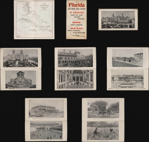
The Florida East Coast Hotel System St. Augustine Ponce de Leon, Alcazar, Cordova Ormond Hotel Ormond Palm Beach Royal Poinciana, Palm Beach Inn.
sold
This map and brochure is a 28-page pamphlet promoting tourism and hotels along Florida's Atlantic coastline, produced c. 1895 by the Florida East Coast Railway under superintendent of the hotel system, C. B. Knott. (more details)
Iconic railroad map illustrating the development of Florida resort tourism.
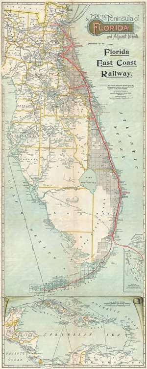
Map of the Peninsula of Florida and Adjacent Islands.
sold
- Digital Map Information
- Suitable for large format printing
- File Size: 14.28 MB
- File Type: ZIP / TIFF
- ICC color profile embedded
- Delivered instantly via download link
A highly decorative 1896 map of Peninsular Florida issued by the Mathews-Northrup Company for the Henry Morrison Flagler’s (1830 – 1913) Florida East Coast Railway. The map covers from the Georgia Border to Key West and Cuba, and from Cedar Key to the Bahamas. The route of the railroad is illustrated in red overprinting extending from Jacksonville to Miami, with major stops at Ormond, Rockledge, and Palm Beach. The map also identifies the drainage canals from Lake Okeechobee that were then being constructed by J. O. Wright to grade the Everglades. It also illustrates the 1892 J. E. Ingraham route across the Everglades – an exploratory expedition intended to determine the viability of a cross-Everglades railroad. (more details)
Large in-station map of the Union Pacific Routes - 1 of just 3 known examples.
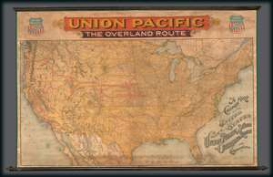
A Correct Map of the United States Showing the Union Pacific System The overland Route and Connections.
sold
- Digital Map Information
- Suitable for large format printing
- Full resolution TIFF file
- ICC color profile embedded
- Delivered instantly via download link
This rarity is a large format 1896 wall map of the United States issued by Rand McNally and Company on behalf of the Union Pacific Railroad. This scarce railroad map was issued exclusively for company use at larger stations, and was not publicly distributed, hence its extreme rarity. The map embraces the whole of the United Sates, illustrating the routes of the Union Pacific Railroad and its many subsidiaries, as well as, in some cases, important connecting routes operated by competing railroads. The map's focuses are the Union Pacific Routes westward from hubs in Kansas City, Leavenworth, St. Joseph, Council Bluffs, and Sioux City. (more details)
Height of the Railway Age in the Southeast.
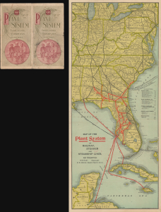
Map of the Plant System of Railway, Steamer and Steamship Lines. and Connections.
sold
- Digital Map Information
- Suitable for large format printing
- File Size: 15.43 MB
- File Type: ZIP / TIFF
- ICC color profile embedded
- Delivered instantly via download link
This is a scarce c. 1898 folding map of Florida and environs prepared by the firm Matthews Northrup for the Plant System of railroads and steamships. It presents the Plant System near its greatest extent, not long before it was acquired by the Atlantic Coast Line Railroad in 1902. (more details)
Railroads in Florida and the U.S. East Coast.
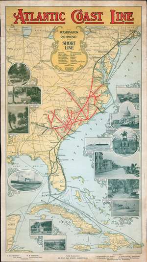
Atlantic Coast Line via Washington and Richmond The Short Line.
sold
- Digital Map Information
- Suitable for large format printing
- File Size: 45.92 MB
- File Type: ZIP / TIFF
- ICC color profile embedded
- Delivered instantly via download link
An outstanding c. 1898 Matthews-Northrup railroad broadside map of the eastern United States. Depicting the region from Boston to Jamaica and from St. Louis and New Orleans to the Atlantic Ocean, major railway lines throughout the country are illustrated and labeled, along with steamship lines between Florida and Cuba, Puerto Rico, and Jamaica. Thick red lines highlight the route of the Atlantic Coast Line, with white dots marking every station stop. Much less detailed thick black lines illustrate important connecting railroads, including the Plant System from Charleston to Tampa and the Florida East Coast Railway from St. Augustine to Miami. The rest of the extensive rail network in the eastern U.S. is traced by thin black lines bearing the names of their respective railroads. Photographs adorn the left and right borders and promote Florida's mild climate and the history of the American South to a Northern audience. (more details)
Promotes wellness tourism in the Hudson Valley.
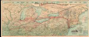
The Health and Pleasure Resorts of New York and New England, the Best Way to Reach Them via 'America's Greatest Railroad'. The New York Central and Hudson River R.R.
sold
- Digital Map Information
- Suitable for large format printing
- File Size: 45.01 MB
- File Type: ZIP / TIFF
- ICC color profile embedded
- Delivered instantly via download link
This is an 1898 Matthews Northrup railroad map of the northern United States. Depicting from Des Moines, Iowa to New Brunswick and from Lake Superior and Duluth, Minnesota to Charleston, West Virginia, thick red lines trace the routes of the New York Central and Hudson River Railroad and its principal connections, all of which are identified. Labeled circles mark stations along these routes. Thin black lines, which are also labeled, illustrate routes of railroads not affiliated with the New York Central. (more details)
The Plant System at its height.
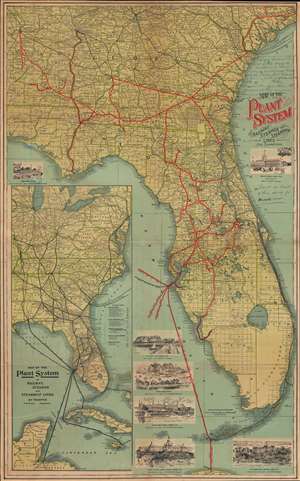
Map of the Plant System of Railway, Steamer and Steamship Lines and Connections.
sold
- Digital Map Information
- Suitable for large format printing
- File Size: 56.05 MB
- File Type: ZIP / TIFF
- ICC color profile embedded
- Delivered instantly via download link
A striking c. 1900 map of Florida and Georgia illustrating and promoting the Plant Railroad network. The map represents the Plant System at the height of its development, with coverage extending throughout Florida, Georgia, and Alabama. (more details)
The Florida East Coast Railway before the Key West Extension.
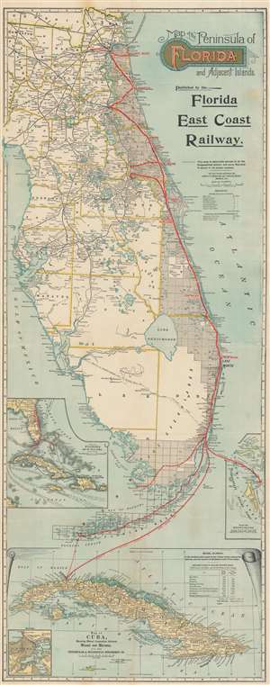
Map of the Peninsula of Florida and Adjacent Islands.
sold
- Digital Map Information
- Suitable for large format printing
- File Size: 47.81 MB
- File Type: ZIP / TIFF
- ICC color profile embedded
- Delivered instantly via download link
A highly decorative 1903 map of Peninsular Florida issued by the Mathews-Northrup Company for Henry Morrison Flagler’s (1830 – 1913) Florida East Coast Railway. The map covers from the Georgia border to Key West and Cuba, and from Cedar Key to the Bahamas. The route of the railroad is illustrated in red overprinting extending from Jacksonville to just south of Miami, with major stops noted. The map also identifies drainage canals from Lake Okeechobee constructed by J. O. Wright to drain the Everglades. The routes of the Peninsular and Occidental Steamship Company from Miami to Key West, Havana, and Nassau are illustrated by thick dashed lines. Inset maps focus on the Bahamas, the West Indies, and Cuba. (more details)
Only known example of this map overprinted to illustrate the Cook-Peary North Pole discovery debate of 1909.
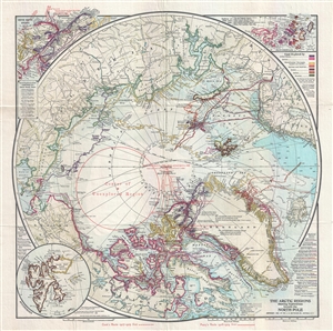
The Arctic Regions Showing Exploration towards the North Pole.
sold
- Digital Map Information
- Suitable for large format printing
- File Size: 11.25 MB
- File Type: ZIP / TIFF
- ICC color profile embedded
- Delivered instantly via download link
An extremely rare 1909 separately issued map of the Arctic showing exploratory routes towards the North Pole as of 1909. The map covers the Arctic regions as far south as Iceland and the Bearing Straits. The map is based upon a 1907 map issued by J. N. Matthews ... (more details)
Only known example of this map overprinted to illustrate the Cook-Peary North Pole discovery debate of 1909.
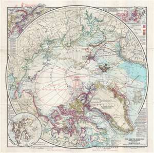
The Arctic Regions Showing Exploration towards the North Pole.
sold
- Digital Map Information
- Suitable for large format printing
- Full resolution TIFF file
- ICC color profile embedded
- Delivered instantly via download link
An extremely rare 1909 separately issued map of the Arctic showing exploratory routes towards the North Pole as of 1909. The map covers the Arctic regions as far south as Iceland and the Bearing Straits. The map is based upon a 1907 map issued by J. N. Matthews ... (more details)
The rise of American resort travel.
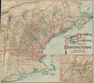
Summer Resorts of the Coast, Lake and Mountain Regions along the Boston and Maine Railroad and Connections.
sold
- Digital Map Information
- Suitable for large format printing
- File Size: 136.38 MB
- File Type: ZIP / TIFF
- ICC color profile embedded
- Delivered instantly via download link
This is a decorative c. 1910 Matthews-Northrup map of New England. The map reflects the influence of railroads on the rise of summer resort travel in the early 20th century. (more details)
Incredibly attractive map of New England tracing the Boston and Maine Railroad rail network.
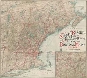
Summer Resorts of the Coast, Lake and Mountain Regions along the Boston and Maine Railroad and Connections.
sold
- Digital Map Information
- Suitable for large format printing
- File Size: 31.08 MB
- File Type: ZIP / TIFF
- ICC color profile embedded
- Delivered instantly via download link
This is a wonderfully decorative 1911 Matthews-Northrup map of New England. The map depicts the region from New York City northwards along the Atlantic coast as far as New Brunswick and the Gulf of Saint Lawrence and from the Hudson River Valley to the Atlantic ... (more details)
The Catskill Forest Preserve.
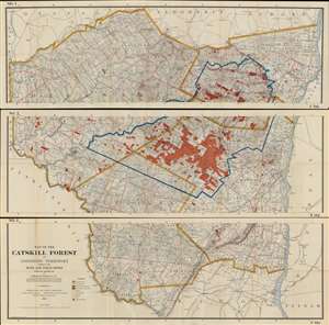
Map of the Catskill Forest and Adjoining Territory Compiled from Maps and Field notes Partially Revised 1911.
sold
- Digital Map Information
- Suitable for large format printing
- Full resolution TIFF file
- ICC color profile embedded
- Delivered instantly via download link
This is the Edward B. Codwise revised 1911 edition of the William Fox map of the Catskill Forest Preserve. It was produced by the New York State Fisheries, Game, and Forest Commission under the supervision of the civil engineer Edward B. Codwise. This mammoth map, printed to three sheets (joinable), is centered on Delaware, Greene, Sullivan and Ulster Counties in New York State, on the west bank of the Hudson River. It shows the boundaries of counties, towns, and individual tracts of land within those counties, with areas of forest reserve highlighted in red. Water routes, roads and railroads are also detailed; streets are named. Mountains are shown pictorially in hachure. (more details)
Iconic railroad map illustrating the development of Florida resort tourism.
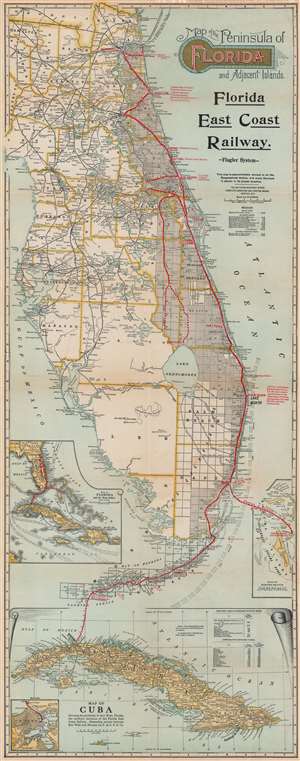
Map of the Peninsula of Florida and Adjacent Islands.
sold
- Digital Map Information
- Suitable for large format printing
- File Size: 49.08 MB
- File Type: ZIP / TIFF
- ICC color profile embedded
- Delivered instantly via download link
A highly decorative 1912 map of Peninsular Florida issued by the Mathews-Northrup Company for the Henry Morrison Flagler’s (1830 – 1913) Florida East Coast Railway. The map covers from the Georgia Border to Key West and Cuba, and from Cedar Key to the Bahamas. The route of the railroad is illustrated in red overprinting extending from Jacksonville to Key West, with major stops, and the grand hotels available there, including the Royal Palm, the Breakers, the Ponce de Leon, and the Ormond, noted. The map also identifies drainage canals from Lake Okeechobee constructed by J. O. Wright to grade the Everglades. It also illustrates the 1892 J. E. Ingraham route across the Everglades – an exploratory expedition intended to determine the viability of a cross-Everglades railroad. (more details)
A vibrantly colored map of the Capital of the United States.
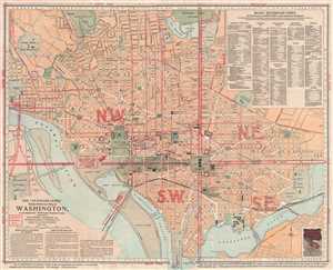
The 'Standard Guide' Ready Reference Map of Washington, to accompany the 'Washington Standard Guide'.
sold
- Digital Map Information
- Suitable for large format printing
- File Size: 10.53 MB
- File Type: ZIP / TIFF
- ICC color profile embedded
- Delivered instantly via download link
This is an appealing 1912 map or plan of Washington D.C. by the Foster and Reynolds Company of Washington. It covers Washington D.C. from the Arlington National Cemetery eastward as far as 28th Street and the Congressional Cemetery and from the Soldiers' Home ... (more details)
Wonderfully decorative vacationer's map of New England.
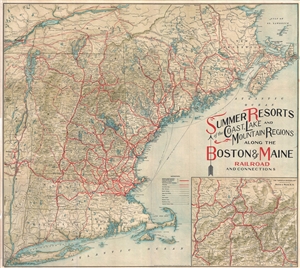
Summer Resorts of the Coast, Lake and Mountain Regions along the Boston & Maine Railroad and Connections.
sold
- Digital Map Information
- Suitable for large format printing
- Full resolution TIFF file
- ICC color profile embedded
- Delivered instantly via download link
A wonderfully decorative 1912 map of New England issued by the Matthews-Northrup company. The map covers from New York City northwards along the Atlantic coast as far as New Brunswick and the Gulf of Saint Lawrence; and from the Hudson River Valley to the ... (more details)
The FEC reaches Key West!
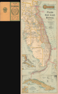
Map of the Peninsula of Florida and Adjacent Islands.
sold
- Digital Map Information
- Suitable for large format printing
- Full resolution TIFF file
- ICC color profile embedded
- Delivered instantly via download link
A highly decorative 1914 map of Peninsular Florida issued by the Mathews-Northrup Company for Henry Morrison Flagler's (1830 - 1913) Florida East Coast Railway. This map, in its various editions, dominated Florida cartography for more than 30 years. The present example is one of just 2 editions to illustrate the Key West Extension. (more details)
The FEC reaches Key West!
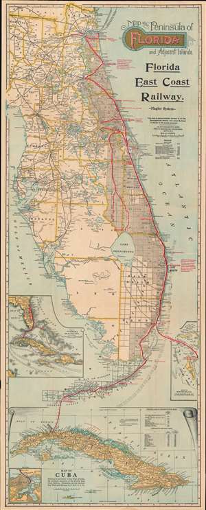
Map of the Peninsula of Florida and Adjacent Islands.
sold
- Digital Map Information
- Suitable for large format printing
- File Size: 47.19 MB
- File Type: ZIP / TIFF
- ICC color profile embedded
- Delivered instantly via download link
A highly decorative 1914 map of Peninsular Florida issued by the Mathews-Northrup Company for the Henry Morrison Flagler’s (1830 – 1913) Florida East Coast Railway. The map covers from the Georgia Border to Key West and Cuba, and from Cedar Key to the Bahamas. The route of the railroad is illustrated in red overprinting extending from Jacksonville to Key West, with major stops, and the grand hotels available there, including the Royal Palm, the Breakers, the Ponce de Leon, and the Ormond, noted. The map also identifies drainage canals from Lake Okeechobee constructed by J. O. Wright to grade the Everglades. (more details)
The FEC reaches Key West!
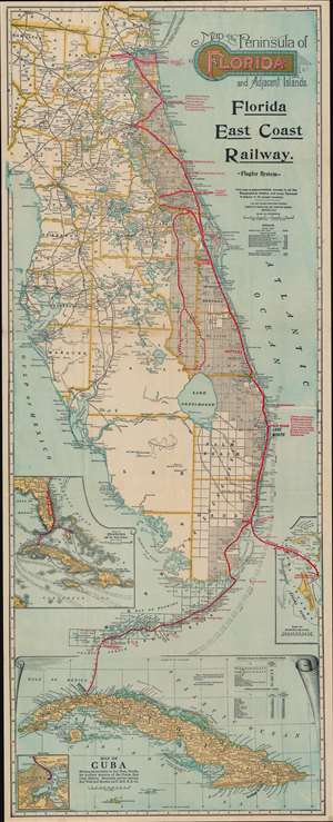
Map of the Peninsula of Florida and Adjacent Islands.
sold
- Digital Map Information
- Suitable for large format printing
- File Size: 46.97 MB
- File Type: ZIP / TIFF
- ICC color profile embedded
- Delivered instantly via download link
A highly decorative 1914 map of Peninsular Florida issued by the Mathews-Northrup Company for the Henry Morrison Flagler’s (1830 – 1913) Florida East Coast Railway. The map covers from the Georgia Border to Key West and Cuba, and from Cedar Key to the Bahamas. The route of the railroad is illustrated in red overprinting extending from Jacksonville to Key West, with major stops, and the grand hotels available there, including the Royal Palm, the Breakers, the Ponce de Leon, and the Ormond, noted. The map also identifies drainage canals from Lake Okeechobee constructed by J. O. Wright to grade the Everglades. (more details)
The FEC reaches Key West!
Map of the Peninsula of Florida and Adjacent Islands.
sold
- Digital Map Information
- Suitable for large format printing
- Full resolution TIFF file
- ICC color profile embedded
- Delivered instantly via download link
A highly decorative 1914 map of Peninsular Florida issued by the Mathews-Northrup Company for the Henry Morrison Flagler's (1830 - 1913) Florida East Coast Railway. The map is one of just 2 editions to illustrate the Key West Extension. (more details)
The Southern Pacific Railroad's to the Panama-Pacific Exposition!
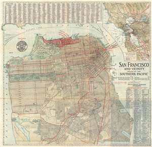
San Francisco and Vicinity Issued by the Southern Pacific.
sold
- Digital Map Information
- Suitable for large format printing
- File Size: 24 MB
- File Type: ZIP / TIFF
- ICC color profile embedded
- Delivered instantly via download link
An attractive first edition 1914 city map or plan of San Francisco, California, issued in by the Southern Pacific Railroad. The map covers the northern part of San Francisco Peninsula from Bellevue Street and Lake Merced to San Francisco Bay. The routes of the Southern Pacific Railroad are highlighted in red, emphasizing their utility in accessing the Panama-Pacific International Exposition. This, however, may not have been the case, as there is another depot near the exposition grounds for ferries, operated by a competitor, that offers direct access to the fair. It is also important to note that the Exposition did not begin until February 1915, and this map was printed in 1914. Thus, it was created while the Panama-Pacific International Exposition was still in the planning phases. Geographically, the map offers impressive detail, all streets and numerous parks and public buildings are identified, even the individual links in the San Francisco Gold and Country Club are noted. Golden Gate Park and the Presidio Military Reservation are particularly well rendered. At the top of the map, the lands reserved for the Panama-Pacific International Exposition are marked and highlighted in red. (more details)
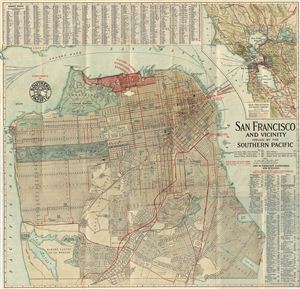
San Francisco and Vicinity Issued by the Southern Pacific.
sold
- Digital Map Information
- Suitable for large format printing
- File Size: 6.97 MB
- File Type: ZIP / TIFF
- ICC color profile embedded
- Delivered instantly via download link
An attractive pocket map or city plan of San Francisco, California, issued in 1914 by the Southern Pacific Railroad. The map covers the northern part of San Francisco Peninsula from Bellevue Street and Lake Merced northwards. Offering impressive detail, ... (more details)
Iconic railroad map illustrating the development of Florida resort tourism.
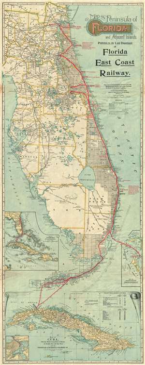
Map of the Peninsula of Florida and Adjacent Islands.
sold
- Digital Map Information
- Suitable for large format printing
- File Size: 21.17 MB
- File Type: ZIP / TIFF
- ICC color profile embedded
- Delivered instantly via download link
A highly decorative c. 1915 map of Peninsular Florida issued by the Mathews-Northrup Company for the Henry Morrison Flagler’s (1830 - 1913) Florida East Coast Railway. The map covers from the Georgia border to Key West and Cuba, and from Cedar Key to the Bahamas. The route of the railroad is illustrated in red overprinting extending from Jacksonville to Key West, with major stops, and the grand hotels available there, including the Royal Palm, the Breakers, the Ponce de Leon, and the Ormond, noted. The map also identifies drainage canals from Lake Okeechobee constructed by J. O. Wright to grade the Everglades. It also illustrates the 1892 J. E. Ingraham route across the Everglades - an exploratory expedition intended to determine the viability of a cross-Everglades railroad. (more details)
Development of Florida resort tourism.
Map of the Peninsula of Florida and Adjacent Islands.
sold
- Digital Map Information
- Suitable for large format printing
- File Size: 84.93 MB
- File Type: ZIP / TIFF
- ICC color profile embedded
- Delivered instantly via download link
A highly decorative c. 1915 map of Peninsular Florida issued by the Mathews-Northrup Company for the Henry Morrison Flagler’s (1830 - 1913) Florida East Coast Railway. It maps Flagler's resort empire and in doing so illustrating the underpinnings of modern East Florida. (more details)
Wonderfully decorative vacationer's map of New England.
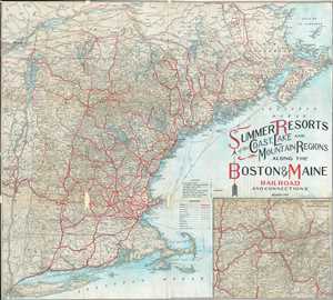
Summer Resorts of the Coast, Lake and Mountain Regions along the Boston & Maine Railroad and Connections.
sold
- Digital Map Information
- Suitable for large format printing
- File Size: 21.17 MB
- File Type: ZIP / TIFF
- ICC color profile embedded
- Delivered instantly via download link
A wonderfully decorative 1915 map of New England issued by the Matthews-Northrup Company. The map covers from New York City northwards along the Atlantic coast as far as New Brunswick and the Gulf of Saint Lawrence; and from the Hudson River Valley to ... (more details)
Letter from a ticket agent to a potential customer on verso.
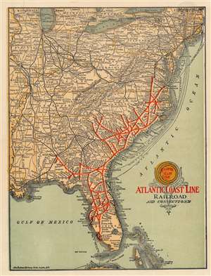
Atlantic Coast Line Railroad and Connections.
sold
- Digital Map Information
- Suitable for large format printing
- Full resolution TIFF file
- ICC color profile embedded
- Delivered instantly via download link
An outstanding c. 1916 Matthews-Northrup railroad map of the eastern United States highlighting the route of the Atlantic Coast Line. The map is essentially letterhead and features a letter on the verso from a ticket agent to a client. (more details)
Spectacular 'Englishified' large format map of Florida.
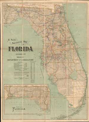
A New Sectional Map of Florida.
sold
- Digital Map Information
- Suitable for large format printing
- Full resolution TIFF file
- ICC color profile embedded
- Delivered instantly via download link
A spectacular 1917 large format map of Florida issued by the Matthews-Northrup Company for the Florida Department of Agriculture. The map covers all of peninsular Florida, including the Florida Keys. An inset in the lower left details the Florida Panhandle. The map is broken into rectilinear platting (land grids) - betraying the source material as the state and federal land surveys. Despite being issued by the Department of Agriculture, this is very much a transportation map, with detailed breakdowns of Florida railroads as of 1916, including the Florida East Coast Railway, which extends all the way to Key West. It also notes inlands waterway routes, noting canals and improvements. (more details)
The World War I Western Front in June 1918.
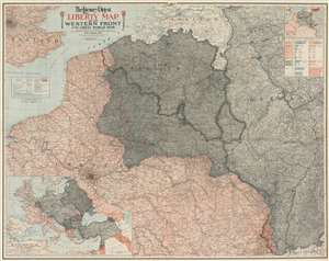
The Literary Digest Liberty Map of the Western Front of the Great World War Showing the Battle Line of Liberty as it Stood June 5, 1918.
sold
- Digital Map Information
- Suitable for large format printing
- Full resolution TIFF file
- ICC color profile embedded
- Delivered instantly via download link
This is a 1918 Matthews-Northrup wall map of northern France, Belgium, Germany, and the surrounding region highlighting the World War I Western Front as of June 5, 1918. A tricolor blue, white, and red line (reminiscent of the French flag) traces the front from the North Sea to Switzerland through parts of western Belgium and northern France. Entente Powers (Britain and France) are shaded pink, while hues of gray fill in members of the 'Teutonic Allies' (Germany) or territory occupied by them (Belgium, Luxembourg, and northeastern France). A blue dashed line marks Germany's farthest advance, while a red dashed line illustrates the advancement of French forces. An accompanying index identifies over 11,000 place names. An inset in the upper right highlights coal and iron regions in occupied territory and Germany and a table just below it quantifies the production. An inset in the lower left corner depicts everywhere fighting was happening around the world. Red lines reinforce these disparate regions: northern France, Russia, Romania, northeastern Italy, Greece, Palestine, and modern-day Iraq. (more details)
Extensive railway map of the United States and its territories (including the Philippines!), Canada, and Mexico.
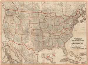
General Railway Map Engraved Expressly for The Official Guide of the Railways and Steam Navigation Lines, of the United States, Porto Rico, Canada, Mexico, and Cuba. Comprising Maps of the United States, Cuba, Porto Rico, the Philippines, etc.
sold
- Digital Map Information
- Suitable for large format printing
- File Size: 64.36 MB
- File Type: ZIP / TIFF
- ICC color profile embedded
- Delivered instantly via download link
This is a 1918 National Railway Publication Company railway map of the United States, Canada, Mexico, Cuba, and the Philippines. The map depicts North America from southern Canada to Mexico City and from the Pacific to the Atlantic. As a highly ... (more details)
Washington, D.C. at the height of the Roaring 20s.
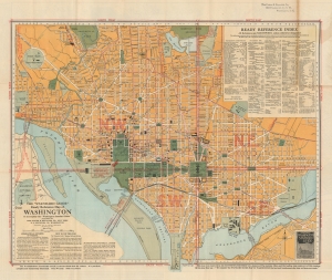
The 'Standard Guide' Ready Reference Map of Washington.
sold
- Digital Map Information
- Suitable for large format printing
- Full resolution TIFF file
- ICC color profile embedded
- Delivered instantly via download link
This is a 1924 plan or map of Washington, D.C., by the Foster and Reynolds Company of New York. This map appeared as the District of Columbia was emerging from the shadow of World War I and stepping into the modern era. This map reflects the city's rapid expansion in this period, fueled by the postwar economic boom and the growing federal government. (more details)
A poineering railroad.
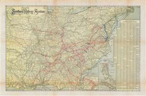
Map of the Southern Railway System Geographically Correct.
sold
- Digital Map Information
- Suitable for large format printing
- File Size: 52.92 MB
- File Type: ZIP / TIFF
- ICC color profile embedded
- Delivered instantly via download link
A scarce 1926 Matthews Northrup map of the southeastern and southcentral United States detailing the routes of the Southern Railway System. The map covers from the Sabine River and Oklahoma borderlands eastward to the Atlantic Seaboard and from the Great Lakes to the Gulf of Mexico. Coverage is extended to include Florida via an inset. Rail lines either owned outright, in part, or leased by the Southern Railway are highlighted and color-coded. The map also notes steamship routes that provide vital maritime connections to various domestic and foreign ports. (more details)