
Philip, George (sold)
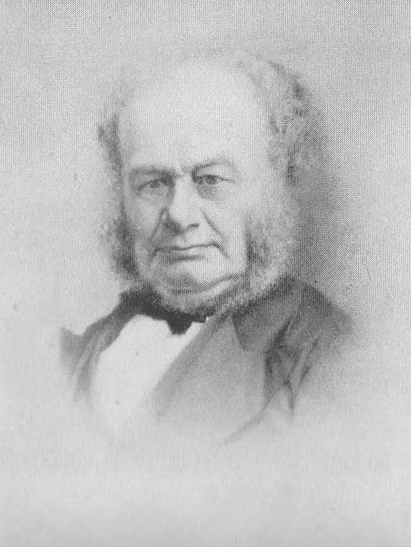
George Philip (1800 - 1882) was a map publisher and cartographer active in the mid to late-19th century. Philip was born into a Calvinst family in Huntly, Aberdeenshire, Scotland. Around 1819 he apprenticed himself to William Grapel, a Liverpool printer and bookseller. Fifteen years later, in 1834, Philip founded his own Liverpool book and map firm. Philip's earliest cartographic ventures were mostly educational material issued in tandem with John Bartholomew Sr., August Petermann, and William Hughes. In 1848, Philip admitted his son, George Philip Jr. (1823 - 1902) into the firm, renaming it George Philip and Son Ltd. George Philip Jr. ran the firm until his death in 1902, by which time it had developed into a major publishing concern. His successors established the London Geographical Institute, a factory where they embraced modern printing techniques to produce thousands of economical and high quality maps. In April 1988, George Philip & Son was acquired by Octopus Publishing, a branch of Reed International. Nonetheless, today the firm trades and publishes to this day as George Philip and Son.
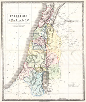
Palestine or the Holy Land According to its Ancient Divisions & Tribes.
sold
- Digital Map Information
- Suitable for large format printing
- Full resolution TIFF file
- ICC color profile embedded
- Delivered instantly via download link
This beautiful hand colored map is a steel plate engraving of Israel / Palestine or the Holy Land. Depicts the region as it would have been during the period of the Twelve Tribes of Israel. There are numerous notations referencing well, caravan routes and ... (more details)
Gold Field map of Australia drawn for the 1851 Victoria Gold Rush. Earliest known edition.
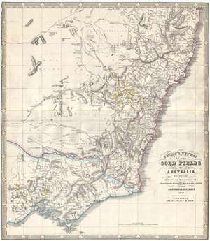
Philip's New Map of the Gold Fields of Australia comprising all the recent discoveries of Mr. Hargraves, Mr. Hunter, Revd. W. Clark and others in the auriferous districts.
sold
- Digital Map Information
- Suitable for large format printing
- DPI: 300
- File Size: 12.77 MB
- File Type: ZIP / TIFF
- ICC color profile embedded
- Delivered instantly via download link
A remarkable 1852 George Philip map of the Gold Discoveries in New South Sales, Victoria, Australia. The map, in original color, covers the southeast part of the Australian Continent from Clarence to Port Phillip and Wilson Promontory. Gold regions are ... (more details)
Extremely rare map of Australia during the 1851 Gold Rush.
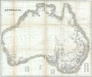
Australia.
sold
- Digital Map Information
- Suitable for large format printing
- DPI: 300
- File Size: 9.3 MB
- File Type: ZIP / TIFF
- ICC color profile embedded
- Delivered instantly via download link
A remarkable 1853 John Capper Map of Australia issued to promote the 1851 Victoria Gold Rush. Capper's map covers the entire continent and offers a wealth of interesting annotations. On the western side of the continent, for example there is annotation ... (more details)
Gold Field map of Australia drawn for the 1851 Victoria Gold Rush.
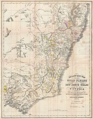
Philip's New Map of the Gold Fields of Australia comprising all the recent discoveries of Rev. W.B. Clarke, Mr. Hargraves, Mr. Hunter and others in the auriferous districts.
sold
- Digital Map Information
- Suitable for large format printing
- DPI: 300
- File Size: 9.34 MB
- File Type: ZIP / TIFF
- ICC color profile embedded
- Delivered instantly via download link
A remarkable 1853 map of the Gold Discoveries in New South Sales, Victoria, Australia. The map, in original color, covers the southeast part of the Australian Continent from Clarence to Pot Phillip and Wilson Promontory. The map was published early ... (more details)
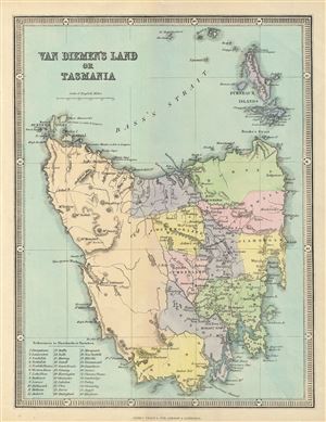
Van Diemen's Land or Tasmania.
sold
- Digital Map Information
- Suitable for large format printing
- File Size: 3.98 MB
- File Type: ZIP / TIFF
- ICC color profile embedded
- Delivered instantly via download link
This is a beautiful 1857 map of Van Diemen's Land or Tasmania issued by George Philip and Sons. The map covers the entire island of Tasmania in considerable detail noting lakes, mountains, rivers, towns, parishes and other topographical features. Van ... (more details)
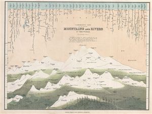
Comparative View of the Principal Mountains and Rivers in the World.
sold
- Digital Map Information
- Suitable for large format printing
- File Size: 3.55 MB
- File Type: ZIP / TIFF
- ICC color profile embedded
- Delivered instantly via download link
This is a fine example of George Philip's 1862 comparative view of the world's principal mountains and rivers. Details the world's great mountains divided according to mountain ranges, Himalayas, Alps, Andes, and so on, while principal rivers are ... (more details)
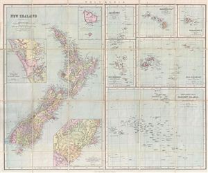
Philips Authentic Map of New Zealand Mounted on Cloth.
sold
- Digital Map Information
- Suitable for large format printing
- File Size: 3.46 MB
- File Type: ZIP / TIFF
- ICC color profile embedded
- Delivered instantly via download link
This is a beautiful example of George Philip's 1888 pocket map of New Zealand and the islands of Polynesia. This is essentially seven maps compiled onto a single sheet. The left map, covering half of the sheet, focuses on New Zealand with three ... (more details)
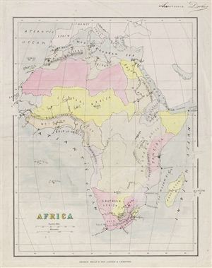
Africa.
sold
- Digital Map Information
- Suitable for large format printing
- File Size: 3.31 MB
- File Type: ZIP / TIFF
- ICC color profile embedded
- Delivered instantly via download link
This is a whimsical example of an 1890 Philip's schoolboy / schoolgirl map of Africa. Covers the continent from the Mediterranean Sea to the Cape of Good Hope and includes parts of Spain, France and Italy. The publishing group of George Philip ... (more details)
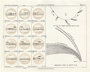
Jupiter & Comets.
sold
- Digital Map Information
- Suitable for large format printing
- File Size: 1.22 MB
- File Type: ZIP / TIFF
- ICC color profile embedded
- Delivered instantly via download link
This is a fine example of Philip's 1892 map or chart of Jupiter and comets. Divided into two sections, the right section of the map features two diagrams depicting 'The tail of the comet directed from the Sun' and Bredichin's theory of comets' ... (more details)
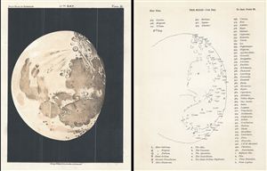
11th Day.
sold
- Digital Map Information
- Suitable for large format printing
- File Size: 2.25 MB
- File Type: ZIP / TIFF
- ICC color profile embedded
- Delivered instantly via download link
This is a fascinating example of Philip's 1892 map or Chart of the Moon on its 11th day. This chart was created to study the various lunar formations during its various stages – from new to full. This particular chart represents the Moon on ... (more details)
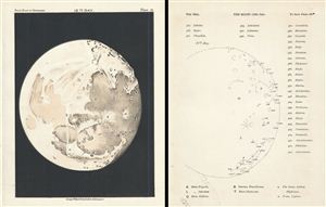
12th Day.
sold
- Digital Map Information
- Suitable for large format printing
- File Size: 2.48 MB
- File Type: ZIP / TIFF
- ICC color profile embedded
- Delivered instantly via download link
This is a fascinating example of Philip's 1892 map or Chart of the Moon on its 12th day. This chart was created to study the various lunar formations during its various stages – from new to full. This particular chart represents the Moon on ... (more details)
Depicts the newly surveyed border between British and Portuguese Central East Africa.
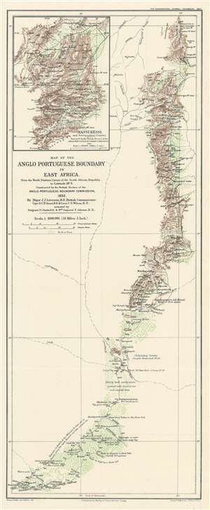
Map of the Anglo Portuguese Boundary in East Africa.
sold
- Digital Map Information
- Suitable for large format printing
- File Size: 7.43 MB
- File Type: ZIP / TIFF
- ICC color profile embedded
- Delivered instantly via download link
This is an 1893 George Philip map of the border between British and Portuguese Central East Africa decided upon in the Anglo-Portuguese Treaty of 1891. Depicting the border as it was surveyed by the Anglo-Portuguese Delimination Commission in 1892, innumerable rivers, mountain peaks, and roads are identified. Green is used to highlight areas of trees and brush, while brown marks the spine of mountains that forms part of the newly designated border. Notes provide commentary on the terrain, water supply, vegetation, and animal life. (more details)
Comprised of six charts on one sheet illustrating rain and snow fall, temperature, river basins, and vegetation in the Arctic Basin.
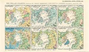
Six Polar Charts illustrating Mr. Henry Seebohm's Presidential Address, Nottingham, September, 1893.
sold
- Digital Map Information
- Suitable for large format printing
- File Size: 8.66 MB
- File Type: ZIP / TIFF
- ICC color profile embedded
- Delivered instantly via download link
This is an 1893 Ernst Georg Ravenstein map of the Arctic consisting of six small maps printed on one sheet created to help illustrate Mr. Henry Seebohm’s address to the Royal Geographical Society. Each map illustrates a different aspect of the Arctic Basin, with a map focusing on river basins, temperature (coldest month), rain and snow, heights and depths, temperature (coldest month), and vegetation. An incredible amount of detail is present on each map. For example, four different colors are used to illustrate variations in precipitation and temperature in three of the maps, while five colors are employed to highlight different vegetation zones. The map detailing heights and depths, which would more traditionally be referred to as a topographic map, very much resembles other maps within that genre. (more details)
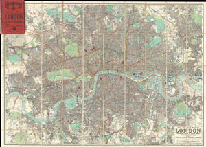
Philips' New Map of London Extending Four & a Half Miles Round Charing Cross.
sold
- Digital Map Information
- Suitable for large format printing
- File Size: 55.18 MB
- File Type: ZIP / TIFF
- ICC color profile embedded
- Delivered instantly via download link
A stunning example of George Philip's c. 1985 folding pocket map of London, England. Covers the urban center of London from Barnes in the west to Victoria Dock in the east, as well as north as far as Finsbury Park and south as far as Brockwell ... (more details)
Novel mechanized educational globe.
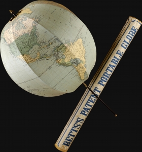
A fine c. 1910 example of John Betts' patented collapsible globe. It is John Betts' most enduring legacy as an educational publisher.The globe, measuring some 15 inches in diameter, is of composed of printed cloth stretched over an umbrella-like metal frame. It can be opened and closed much like an umbrella, offering an easy-to-use and portable globe. (more details)
First War of the 20th Century.
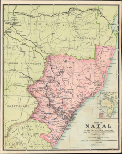
Map of Natal shewing railway lines, stations and connections, counties, productions, settlements, etc.
sold
- Digital Map Information
- Suitable for large format printing
- File Size: 23.27 MB
- File Type: ZIP / TIFF
- ICC color profile embedded
- Delivered instantly via download link
This is a 1902 George Philip and Son map of the Colony of Natal, in Southern Africa, produced near the end of the Second Boer War (1899 - 1902). As Natal was the main theater in the first phase of the conflict, it would have been of considerable interest to a riveted British public. (more details)
British Empire trade infographic.
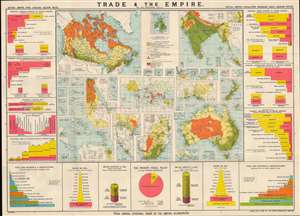
Trade and the Empire: graphically represented by 56 coloured maps and diagrams.
sold
- Digital Map Information
- Suitable for large format printing
- Full resolution TIFF file
- ICC color profile embedded
- Delivered instantly via download link
This is a rare c. 1903 George Philip infographic map illustrating trade within the British Empire, with an emphasis on India, Canada, Australia, and South Africa. It is simultaneously a very informative historical source, a piece of imperial propaganda, and a set of maps of the key holdings in the British Empire. (more details)
WWI Infographic.
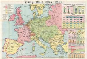
Daily Mail War Map.
sold
- Digital Map Information
- Suitable for large format printing
- Full resolution TIFF file
- ICC color profile embedded
- Delivered instantly via download link
This is a 1914 George Philip map of Europe at the beginning of World War I. Philip uses colors to illustrate the alliances between the Triple Entente (Great Britain, France, and Russia) and the Triple Alliance (Germany, Austria-Hungary, and Italy). Neutral and independent countries are shaded other colors, although their neutrality did not save them from the onslaught of war in Belgium's case. Major cities are identified across the continent, along with fortresses, airship depots, wireless stations, and railways. Infographics along the right border provide an incredible visual summary of each country's military strength. The infographics create compelling comparisons between the belligerents. The comparison between standing armies, for example, lays bare the shocking difference between the Russian and French armies and the British army. At the same time, the British navy vastly outclasses all others in every category. Aircraft appear as well, an intriguing prospect in 1914 since airships and airplanes had never before been used in combat. (more details)
Uses infographics to compare the armies and navies of European countries at the outbreak of World War I.
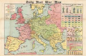
Daily Mail War Map.
sold
- Digital Map Information
- Suitable for large format printing
- File Size: 43.73 MB
- File Type: ZIP / TIFF
- ICC color profile embedded
- Delivered instantly via download link
This is a 1914 George Philip map of Europe at the beginning of World War I. Philip uses colors to illustrate the alliances between the Triple Entente (Great Britain, France, and Russia) and the Triple Alliance (Germany, Austria-Hungary, and Italy). Neutral and independent countries are shaded other colors, although their neutrality did not save them from the onslaught of war in Belgium's case. Major cities are identified across the continent, along with fortresses, airship depots, wireless stations, and railways. Infographics along the right border provide an incredible visual summary of each country's military strength. The infographics create compelling comparisons between the belligerents. The comparison between standing armies, for example, lays bare the shocking difference between the Russian and French armies and the British army. At the same time, the British navy vastly outclasses any of the others in almost every category. Aircraft appear as well, an intriguing prospect in 1914 since airships and airplanes had never before been used in combat. (more details)
WWI Infographic.
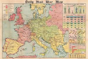
Daily Mail War Map.
sold
- Digital Map Information
- Suitable for large format printing
- Full resolution TIFF file
- ICC color profile embedded
- Delivered instantly via download link
This is a 1914 George Philip map of Europe at the beginning of World War I. Philip uses colors to illustrate the alliances between the Triple Entente (Great Britain, France, and Russia) and the Triple Alliance (Germany, Austria-Hungary, and Italy). Neutral and independent countries are shaded other colors, although their neutrality did not save them from the onslaught of war in Belgium's case. Major cities are identified across the continent, along with fortresses, airship depots, wireless stations, and railways. Infographics along the right border provide an incredible visual summary of each country's military strength. The infographics create compelling comparisons between the belligerents. The comparison between standing armies, for example, lays bare the shocking difference between the Russian and French armies and the British army. At the same time, the British navy vastly outclasses all others in every category. Aircraft appear as well, an intriguing prospect in 1914 since airships and airplanes had never before been used in combat. (more details)
Spectacular flag chart reflecting the apex of the British Empire.
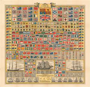
Philips' Flags of All Nations.
sold
- Digital Map Information
- Suitable for large format printing
- Full resolution TIFF file
- ICC color profile embedded
- Delivered instantly via download link
A stunning c. 1922 George Philip and 'Brown Son and Ferguson' chromolithograph vexillology chart illustrating the 'flags of all nations'. This chart was issued at the height of the British Empire in the interwar period between World War I and World War II. Underscoring the maritime might of the British Empire, the chart his heavy Anglo-focused, with dozens of flags associated with the British Empire, its vast private and naval fleets, and its colonial dependencies. The chart also offers flags for dozens of other countries. Some of the more interesting are Afghanistan, the U.S. 'Revenue Cutter Service', and Tibet. In the years after this map was made, the Empire began a long decline. Evident here are independent flags for Ireland and Egypt, reflecting the Irish War for Independence (1921) and Declaration of Egyptian Independence (1922), both emblematic of growing anti-colonial movements. Along the bottom of the chart there is additional information useful to the armchair mariner regarding the identification of different types of ships, and the complex naming of ship rigging. (more details)
Cartographic pedagogy.
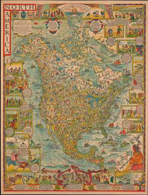
North America.
sold
- Digital Map Information
- Suitable for large format printing
- File Size: 81.88 MB
- File Type: ZIP / TIFF
- ICC color profile embedded
- Delivered instantly via download link
A dense large scale 1930 pictorial map of North America drawn by Margaret Whiting Spilhaus and published by George Philip and Son. Drawn for education, the map presents a panoramic view of American history from discovery to 1930. Spilhaus was a passionate about geographical education, believing strongly that we should 'learn from mistakes of the past'. (more details)
Includes images of famous monuments and tourist attractions.
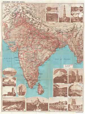
Tourist Map of India
sold
- Digital Map Information
- Suitable for large format printing
- File Size: 50.34 MB
- File Type: ZIP / TIFF
- ICC color profile embedded
- Delivered instantly via download link
This is a lovely c.1930 map of India by George Philip and Sons Ltd. The map extends from Kashmir south to include Ceylon or Sri Lanka and includes modern day India, Pakistan, Nepal, Bhutan, and Burma or Myanmar. Cities, towns, and villages are labeled throughout, with large block lettering marking the region's most important cities. Bold red lines highlight the region's railway network and even differentiates between broad gauge and narrow gauge tracks. (more details)
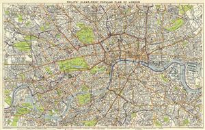
Philips' Clear Print Popular Plan on London.
sold
- Digital Map Information
- Suitable for large format printing
- Full resolution TIFF file
- ICC color profile embedded
- Delivered instantly via download link
This is a beautiful c.1930 map or plan of London, England by George Philip and Sons. It covers from Acton Park east to West India Docks and from Hackney Downs south as far as Clapham Common. The map is exceptionally detailed, noting individual ... (more details)
Worldwide air routes during the Great Depression.
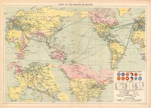
Chart of the World's Air Routes.
sold
- Digital Map Information
- Suitable for large format printing
- File Size: 28.34 MB
- File Type: ZIP / TIFF
- ICC color profile embedded
- Delivered instantly via download link
This is a c. 1935 George Philip and Son map of the world's air routes before World War II. Philips, a British publishing house, uses color to emphasize British routes and other assets worldwide. British air routes, both in operation and projected, are traced with red lines. Blue lines mark operational and projected air routes operated worldwide by any other nations. Even the colors used to fill in the countries of the world emphasize British power. Pink highlights states within the British Empire, while the rest of the world's landmasses are shaded yellow. Dark green shipping lanes crisscross and curve their way through the world's oceans. The width of each shipping lane correlates to its significance, with the most used lanes connecting the North America with Britain, and Britain with India. Two inset maps along the bottom border detail European air routes and routes in Canada and the United States. A text inset, situated in the lower right, includes drawings of some international military aviation insignia, along with information concerning the identification of civilian aircraft, and a key explaining the various notations and colors used. It also demonstrates that two different scales are used at the Equator and the 45th Parallels. (more details)
Dates from the beginning of the Second Italo-Ethiopian War.
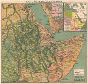
Picture Map of Abyssinia.
sold
- Digital Map Information
- Suitable for large format printing
- File Size: 17.63 MB
- File Type: ZIP / TIFF
- ICC color profile embedded
- Delivered instantly via download link
This is a 1935 George Philip and Son pictorial map of East Africa at the outset of the Second Italo-Ethiopian War. The map depicts the region from the White Nile in Anglo-Egyptian Sudan to Cape Guardafui and from Port Sudan on the Red Sea to Uganda, Kenya, and southern Somalia, including Mogadishu. Beautifully illustrated, the region's mountainous terrain is highlighted, labeling several mountain summits, and their elevations provided. Myriad cities, towns, and other settlements throughout the region are identified, including Addis Ababa. Railroads are noted and easily identified. An inset map in the upper right corner situates the region with regard to Italy and her other African colonies. A second, smaller, inset map provides the Daily Mail's audience with some understanding of how great the distances are in East Africa by providing a map of England on the same scale. (more details)
Charter for a better world...
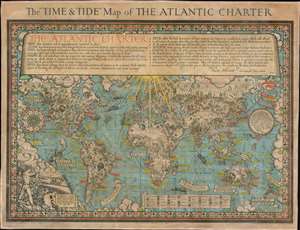
The 'Time and Tide' Map of The Atlantic Charter.
sold
- Digital Map Information
- Suitable for large format printing
- File Size: 70.3 MB
- File Type: ZIP / TIFF
- ICC color profile embedded
- Delivered instantly via download link
This is a 1942 MacDonald Gill pictorial map of the world celebrating the announcement of the Atlantic Charter, a statement of joint American and British goals for the world after World War II. The map depicts the world using Gall's stereographic projection and places Europe and Africa at center with the Americas to the left and Asia to the right. Pictorial symbols highlight resources, giving the map an air of strategic importance, since natural resources were key to the global conflict then raging. Circular vignettes provide insight into the daily lives of people from walks of life, including a Canadian lumberjack, an American farmer, an Arabian trader, and an Australian rancher. Countries are labeled, as are cities and towns, some with banners, others with text. (more details)
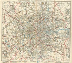
The Royal Automobile Club Official Map of Recommended Routes Into, Out of, Round and Across London.
sold
- Digital Map Information
- Suitable for large format printing
- File Size: 34.88 MB
- File Type: ZIP / TIFF
- ICC color profile embedded
- Delivered instantly via download link
This is a stunning example of George Philip's 1947 folding pocket map of London and vicinity, England. It covers London and its neighborhoods in extensive detail. The map notes towns, counties, streets, parks, important buildings, railways, ... (more details)
Winston Churchill's travels during World War II.
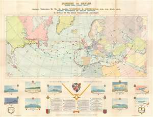
Dunkirk to Berlin June 1940 - July, 1945. Journeys Undertaken By The Rt. Honble. Winston S. Churchill, O.M., C.H., F.R.S., M.P., Prime Minister of Great Britain In Defense of the British Commonwealth and Empire.
sold
This is a 1956 Frank A. de Vine Hunt and George Philip map of Winston Churchill's travels as Prime Minister between June 1940 and July 1945. Colorful, numerically identified lines trace nineteen trips by air, sea, road, and rail to the United States, North Africa, continental Europe, the Middle East, and Russia. Each color represents a different year: yellow for August 1941 through August 1942, green for August 1942 through August 1943, red for August 1943 through August 1944, and blue for August 1944 through August 1945. Among the more recognizable excursions are those to sign the Atlantic Charter, three trips Washington, D.C. for 'Washington Conferences', trips to the Cairo Conference, Teheran Conference, and the Yalta Conference, and visits to the Normandy beachhead, the invasion beaches in southern France. Information concerning each trip appears in a legend situated at bottom center, and destinations, stops, and dates for each are all provided. Illustrations of warships and airplanes used to transport Prime Minister Churchill encircle the legend and depict the Atlantic Charter meeting, the H.M.T. Queen Mary used on part of three voyages, an R.A.F. (Royal Air Force) York aircraft used on part of four voyages, and a 'Skymaster' used on five trips between 1944 and 1945, among others. (more details)
Winston Churchill's travels during World War II.
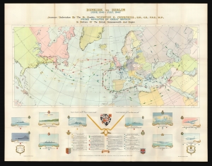
Dunkirk to Berlin June 1940 - July, 1945. Journeys Undertaken By The Rt. Honble. Winston S. Churchill, O.M., C.H., F.R.S., M.P., Prime Minister of Great Britain In Defense of the British Commonwealth and Empire.
sold
This is a 1956 Frank A. de Vine Hunt and George Philip map of Winston Churchill's travels as Prime Minister between June 1940 and July 1945. (more details)