
Early Appendix Issue.
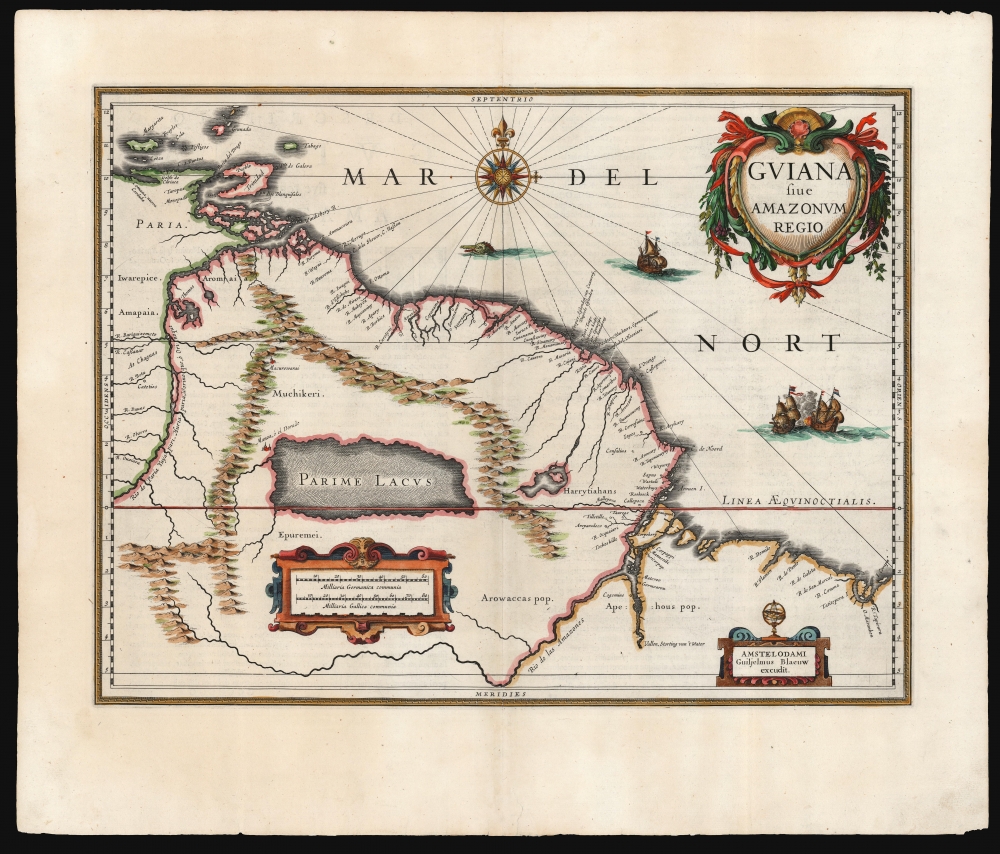
Guiana sive Amazonum Regio.
sold
- Digital Map Information
- Suitable for large format printing
- Full resolution TIFF file
- ICC color profile embedded
- Delivered instantly via download link
This is an early, 1631 example of Willem Blaeu's map of Guiana, displaying the northeastern parts of South America, Lake Parima (Parime Lacus), and the route to El Dorado. Blaeu acquired the plate from his competitor Jodocus Hondius, but the map's geographical information is the work of neither of them. It was initially drawn by Dutch cartographer Hessel Gerritz, who produced the map on the strength of his 1628/29 voyage to Brazil and the Caribbean. This would be among the maps Gerritz contributed to Joannes de Laet’s Beschrijvinghe van West-Indiën first published in 1625. The map covers from Isla Margarita and the Orinoco Delta eastward as far as Tampico and southwards as far as the Amazon River. (more details)
Celebrating the Holy League's 1699 victory over the Ottoman Empire.
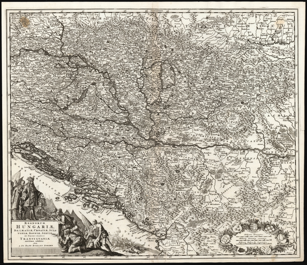
Regnorum Hungariae, Dalmatiae, Croatiae, Sclavoniae, Bosniae, Serviae et Principatus Transylvaniae novissima exhibiteo facta A Io. Bapt. Homann Norimb.
sold
- Digital Map Information
- Suitable for large format printing
- Full resolution TIFF file
- ICC color profile embedded
- Delivered instantly via download link
This is a first plate, first state example of Johann Baptist Homann's 1701 map of the Kingdoms of Hungary and the Balkans, produced in celebration of the 1699 victory of the Holy League following the Great Turkish War (1683 - 1699), concluded by the Ottoman Empire's surrender at the Treaty of Karlowitz. Consequently, this represented the new frontier with the Ottoman Empire following the treaty, spanning from the border of Poland in the north to Albania in the south. (more details)
After the Second Seminole War - U.S. Power in the region consolidated.
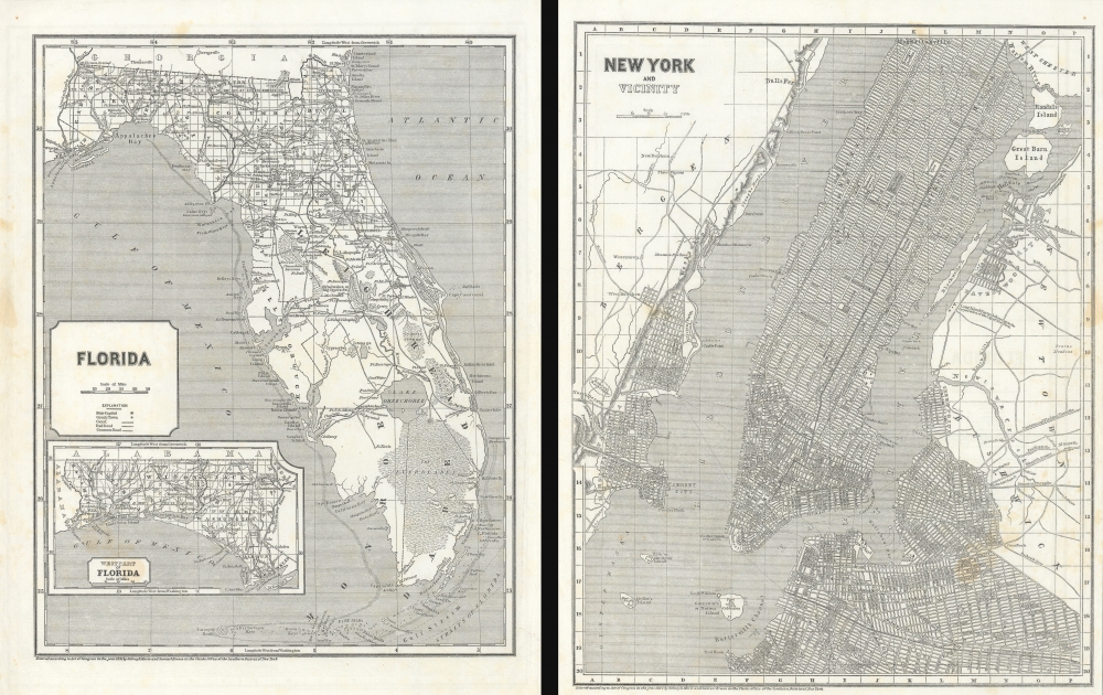
Florida. / New York and Vicinity.
sold
- Digital Map Information
- Suitable for large format printing
- DPI: 600
- File Size: 54.74 MB
- File Type: ZIP / TIFF
- ICC color profile embedded
- Delivered instantly via download link
Maps of the Florida and New York City in 1845, issued for Sidney E. Morse's Cerographic Atlas. The maps are printed back-to-back. The more significant of the two maps, depicting Florida, captures the state as it emerged from the Second Seminole War and the United States solidified its control over the territory. (more details)
A pilgrimage center in Madhya Pradesh.
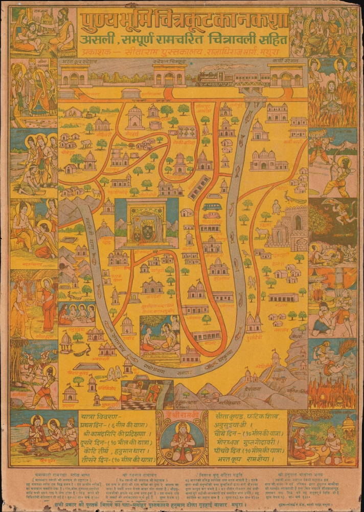
पुण्यभूमि चित्रकूट का नकशा असली, सम्पूर्ण रामचरित चित्रावली सहित. / Map of the Holy Land of Chitrakoot Along with the real complete pictorial story of Rama's Life.
sold
This is a c. 1970 Hindu pictorial map of Chitrakoot, a pilgrimage center in north central India. Chitrakoot is connected with the epic Ramayana and is an important location in the life of Rama, the seventh avatar of Vishnu. It is also admired for its picturesque landscapes, dramatic waterfalls, and serene natural beauty. (more details)
The Battle for Proportional Representation in Florida.

Miami Anti-Reapportionment Bloc.
sold
A manuscript c. 1955 political cartoon by George White produced for the Tampa Bay Tribune. It deals with the reapportionment fight, a hot button issue in state politics throughout 1955 and 1956 related to proportional representation in legislative districts. (more details)
Workshop of the world.
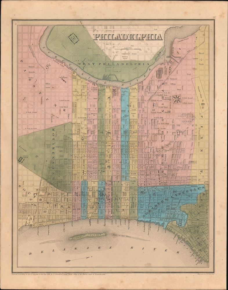
Philadelphia.
sold
- Digital Map Information
- Suitable for large format printing
- DPI: 600
- File Size: 248.98 MB
- File Type: ZIP / TIFF
- ICC color profile embedded
- Delivered instantly via download link
This is an 1838 Thomas G. Bradford map of Philadelphia, Pennsylvania. (more details)
Iconic design.

New York Subway Guide.
sold
A masterpiece of 20th century graphic design, this is the 1972 Massimo Vignelli map of the New York Subway system. (more details)
Out of the Sulu Sea.
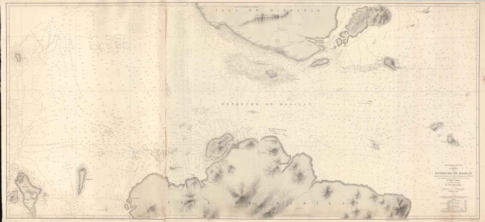
Archipiélago Filipino. Carta del Estrecho de Basilan.
sold
- Digital Map Information
- Suitable for large format printing
- File Size: 174.45 MB
- File Type: ZIP / TIFF
- ICC color profile embedded
- Delivered instantly via download link
A rare 1886 nautical map of the Basilan Strait, Sulu Sea, Mindanano, Philippines. The strait was (and remains) a critical passage through the Sulu Archipelago and major access point to the Moro Gulf, southern Mindanano, and the trans-Pacific passage. (more details)
'A towering landmark along the path of Western cartographic development' - Wheat
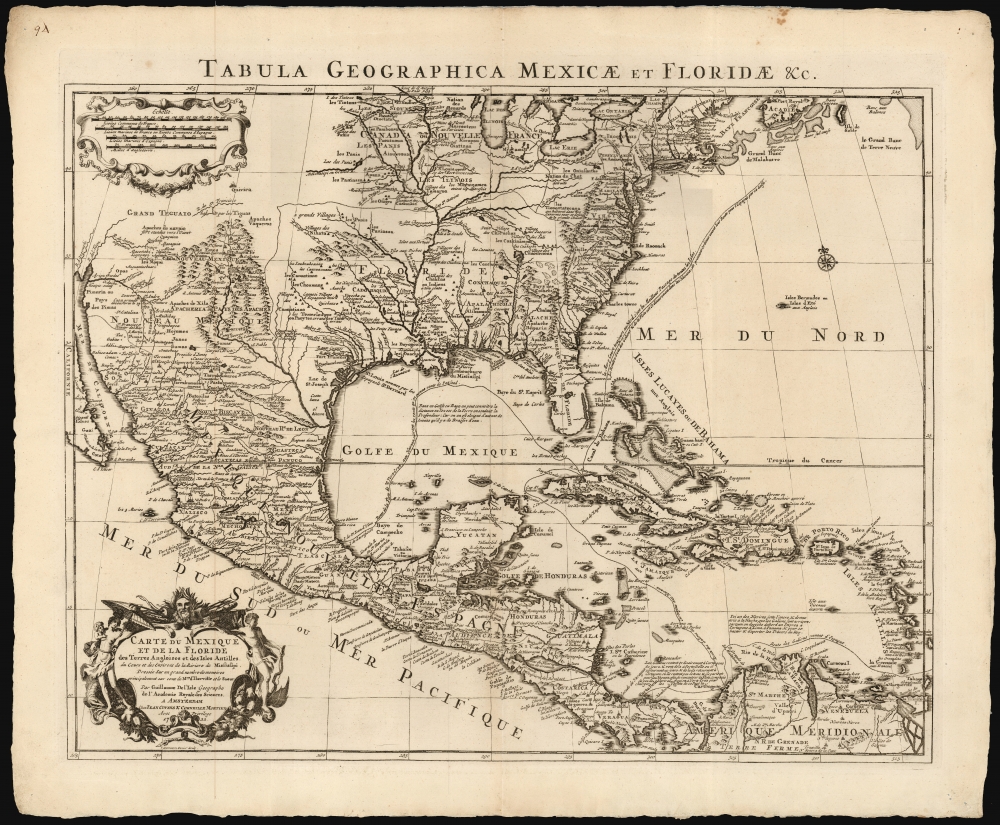
Carte du Mexique et de la Floride des Terres Angloises et des Isles Antilles... / Tabula Geographica Mexicae et Floridae etc.
sold
- Digital Map Information
- Suitable for large format printing
- DPI: 600
- File Size: 60.78 MB
- File Type: ZIP / TIFF
- ICC color profile embedded
- Delivered instantly via download link
This is the 1722 Covens and Mortier issue of Guillaume de L'Isle's groundbreaking map of North America, focusing on Mexico, the Mississippi watershed, and the West Indies. De L'Isle first published this map in 1703, at which point it was the most sophisticated map of the region obtainable: the first map to accurately denote the course of the Mississippi River, the first to accurately place the Great Lakes, and the first appearance on a map of updates from La Salle, Bienville, and D'Iberville. (more details)
California emergence as a major economy in the late 19th century.
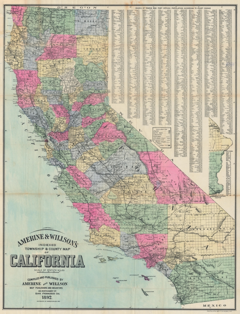
Amerine and Willson's Indexed Township and County Map of California.
sold
- Digital Map Information
- Suitable for large format printing
- Full resolution TIFF file
- ICC color profile embedded
- Delivered instantly via download link
This is the 1892 Amerine and Willson map of California. It illustrates the state during a heady period of expansion, largely driven by rapid railroad development in the second half of the 19th century that opened the way for agricultural development of the interior as well as real estate booms in Los Angeles and San Diego. (more details)
Exceptional map from the First and Finest Austrian Atlas.
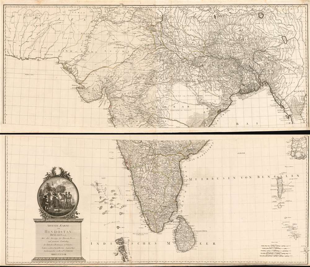
Neueste Karte von Hindostan Bengalen etc. etc. Mit der Anzeige der Strassen, Paesse, und genauester Eintheitung der britischen Besilzungen in Ostindien Verfasst von Herrn Jakob Rennell Ingenieur Major Neu herausgegeben von Herrn F.A. Schraembl. MDCCLXXXVIII.
sold
- Digital Map Information
- Suitable for large format printing
- DPI: 600
- File Size: 148.91 MB
- File Type: ZIP / TIFF
- ICC color profile embedded
- Delivered instantly via download link
This is Franz Anton Schrämbl's 1788 map of India. This scarce, magnificently-engraved map is a faithful rendition of James Rennell's masterful 1782 Map of Hindoostan, the finest 18th century map of the subcontinent, capturing the best surveys of India available during the period in which the British East India Company held sway. Rennell's work, based on the first scientific surveys of India, presented the region in a matchless degree of detail. By adopting this map as his source, Schrämbl was choosing the absolute state-of-the-art of India mapping. One of the first Austrian world atlases, Schrämbl's Allgemeiner Grosser Atlas presented the works of the best cartographers of the day: D'Anville, Kitchin, the Berlin Academy of Sciences and the St. Petersburg Academy of Sciences all shared the pages of this monumental work with Rennell. (more details)
The Transformation of Dartmouth's Campus.

[Untitled / Dartmouth College Green].
sold
- Digital Map Information
- Suitable for large format printing
- File Size: 5.13 MB
- File Type: ZIP / TIFF
- ICC color profile embedded
- Delivered instantly via download link
A scarce c. 1913 yard-long panoramic photograph of Dartmouth College. It displays the campus at the tail end of a dramatic transformation, as fires and increased enrollment saw the construction or reconstruction of multiple structures. (more details)
An American Engineer Battalion in WWII.
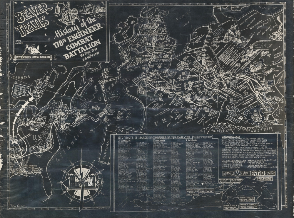
Beaver Trails. History of the 178th Engineer Combat Battalion 23 July 1943 to 23 Sept. 1945.
sold
- Digital Map Information
- Suitable for large format printing
- File Size: 23.01 MB
- File Type: ZIP / TIFF
- ICC color profile embedded
- Delivered instantly via download link
This is a 1945 178th Engineer Combat Battalion World War II blackprint pictorial route map of Europe created by LeRoy Gensler. The map highlights the battalion's actions in combat, including during the Battle of the Bulge and building a bridge across the Rhine River. (more details)
Multiple China Trade voyages recorded.
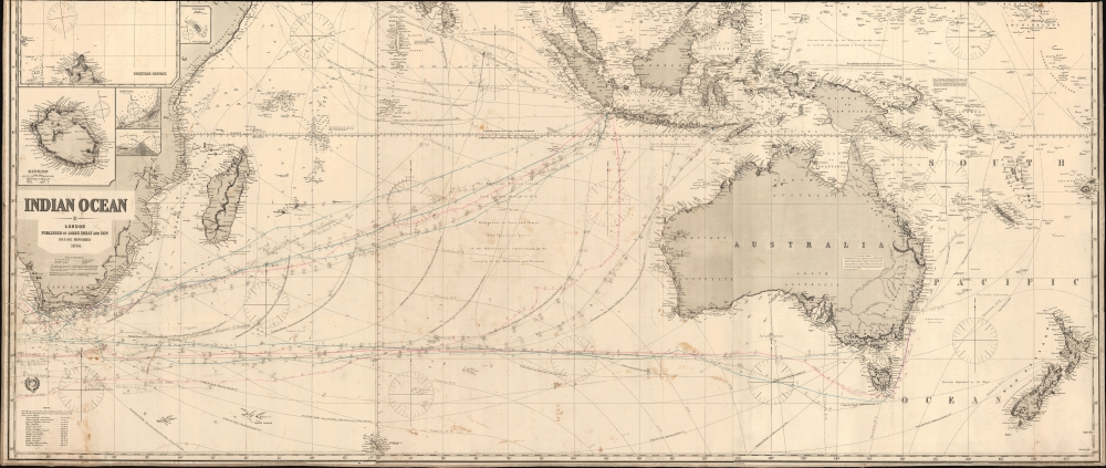
Indian Ocean.
sold
- Digital Map Information
- Suitable for large format printing
- File Size: 108.17 MB
- File Type: ZIP / TIFF
- ICC color profile embedded
- Delivered instantly via download link
This is an 1884 James Imray blueback nautical map illustrating the Indian Ocean, as well as Cape Horn, the East Indies, Australia, and New Zealand. This was the essential chart of navigation to China and the East Indies in the late 19th century. The piece is most fascinating for its detailed manuscript records of multiple voyages, from New York, Cardiff, and Liverpool to Hong Kong, Manila, Sydney, and Bombay. (more details)
Earliest map to name Bunker Hill - reporting the moment troops were preparing for battle.
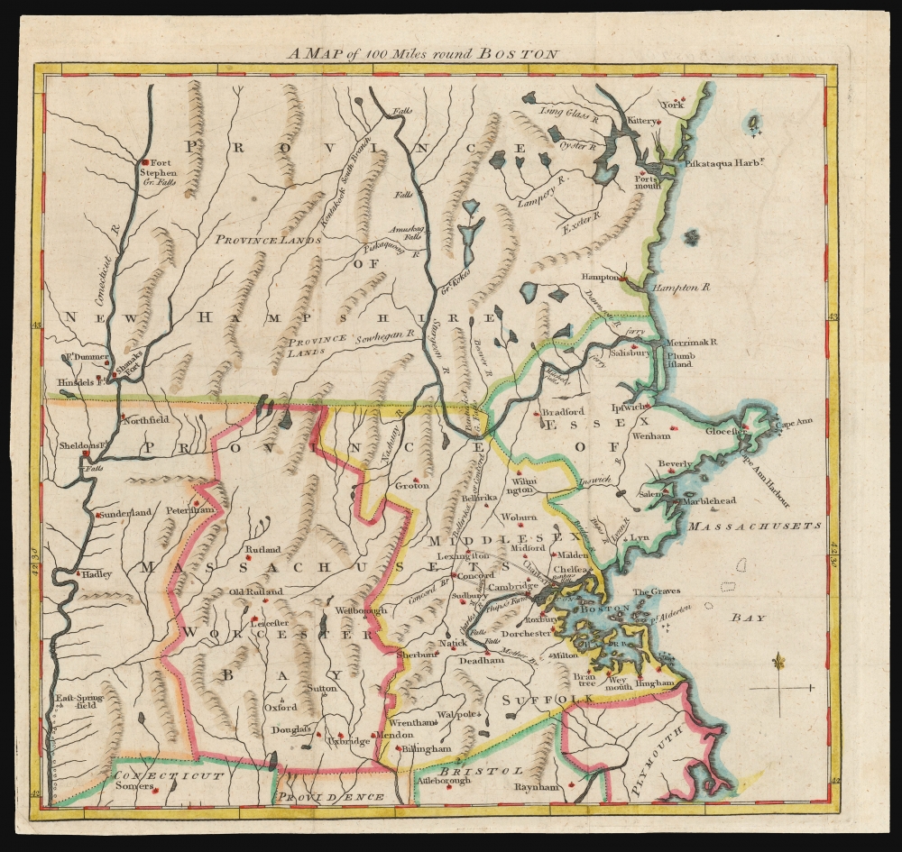
A Map of 100 Miles round Boston.
sold
- Digital Map Information
- Suitable for large format printing
- DPI: 600
- File Size: 10.68 MB
- File Type: ZIP / TIFF
- ICC color profile embedded
- Delivered instantly via download link
This 1775 map of the region surrounding Boston, issued in the early days of the American Revolutionary War, is the earliest printed map to name Bunkers Hill, and was printed before the results of the battle were known. This map appeared astonishingly early, in the June 1775 issue of The Gentleman's Magazine. The issue's contents page includes the following note with respect to this map:
with an accurate Map of the Country One Hundred Miles round Boston, in order to shew the Situation and March of the Troops, as well Provincials as Regulars, which are now within Sight of each other, and are hourly expected to engage.(emphasis ours)So although the map appeared in print just following the battle, it was printed before the outcome, or even the first shot, of the battle was actually reported in England. (more details)
Charting the waters of Mid-Coast Maine.
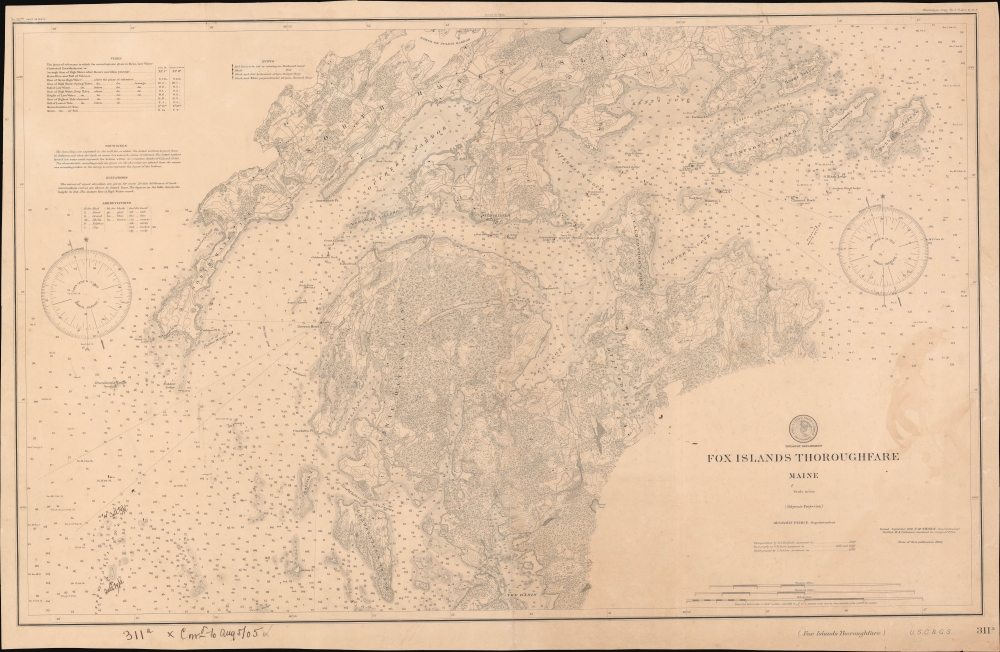
Fox Islands Thoroughfare Maine.
sold
- Digital Map Information
- Suitable for large format printing
- File Size: 864.22 MB
- File Type: ZIP / TIFF
- ICC color profile embedded
- Delivered instantly via download link
An 1886 nautical chart or map of the Fox Islands Thoroughfare between Vinalhaven and North Haven, Knox County, Maine, produced by the U.S. Coast Survey. In addition to providing a helpful guide for navigators, it demonstrates the increasing standardization and complexity of nautical charts in the second half of the 19th century. (more details)
Yosemite's tallest waterfall.

Yo-Semite Falls. California.
sold
- Digital Map Information
- Suitable for large format printing
- File Size: 23.8 MB
- File Type: ZIP / TIFF
- ICC color profile embedded
- Delivered instantly via download link
This is the desirable c. 1873 Currier and Ives lithograph view of Yosemite Falls, California. Although undated, it is one of 6 Yosemite images issued by the firm between 1860 and 1875. (more details)
Railroads and Ranches along the Rio Grande.
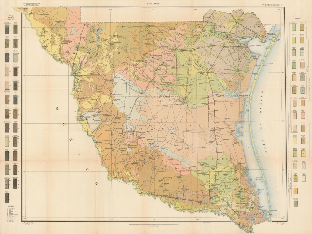
Soil Map. Reconnaissance. Survey South Texas Sheet.
sold
- Digital Map Information
- Suitable for large format printing
- File Size: 112.14 MB
- File Type: ZIP / TIFF
- ICC color profile embedded
- Delivered instantly via download link
A colorful large-format 1909 map of southern Texas, surveyed by George N. Coffey, a pioneer in American soil science, and published by the Bureau of Soils. It presents the region in an era of consolidation, both of ranches and railways. (more details)
Scarce Miniature Map of Germany.

[Untitled map of Germany].
sold
- Digital Map Information
- Suitable for large format printing
- DPI: 600
- File Size: 5.48 MB
- File Type: ZIP / TIFF
- ICC color profile embedded
- Delivered instantly via download link
This attractive woodcut map of Germany and its neighboring regions was executed by Giuseppe Moretti for inclusion in the 1688 edition of Giuseppe Rosaccio's Teatro del Mondo. It covers the bulk of the Holy Roman Empire. The production of a woodcut map in this period is itself unusual, especially coming from Italy. Venetian and Roman mapmakers had been working on copperplate well before that technology had passed to Antwerp and Amsterdam. (more details)
Charming Chart of Cape Ann.

Rockport Harbor Massachusetts.
sold
- Digital Map Information
- Suitable for large format printing
- File Size: 15.62 MB
- File Type: ZIP / TIFF
- ICC color profile embedded
- Delivered instantly via download link
An example of the U.S. Coast Survey's 1886 nautical chart or maritime map of Cape Ann or Rockport Harbor, in the North Shore region of Massachusetts. (more details)