
Early, gorgeous chart of the East Indies.
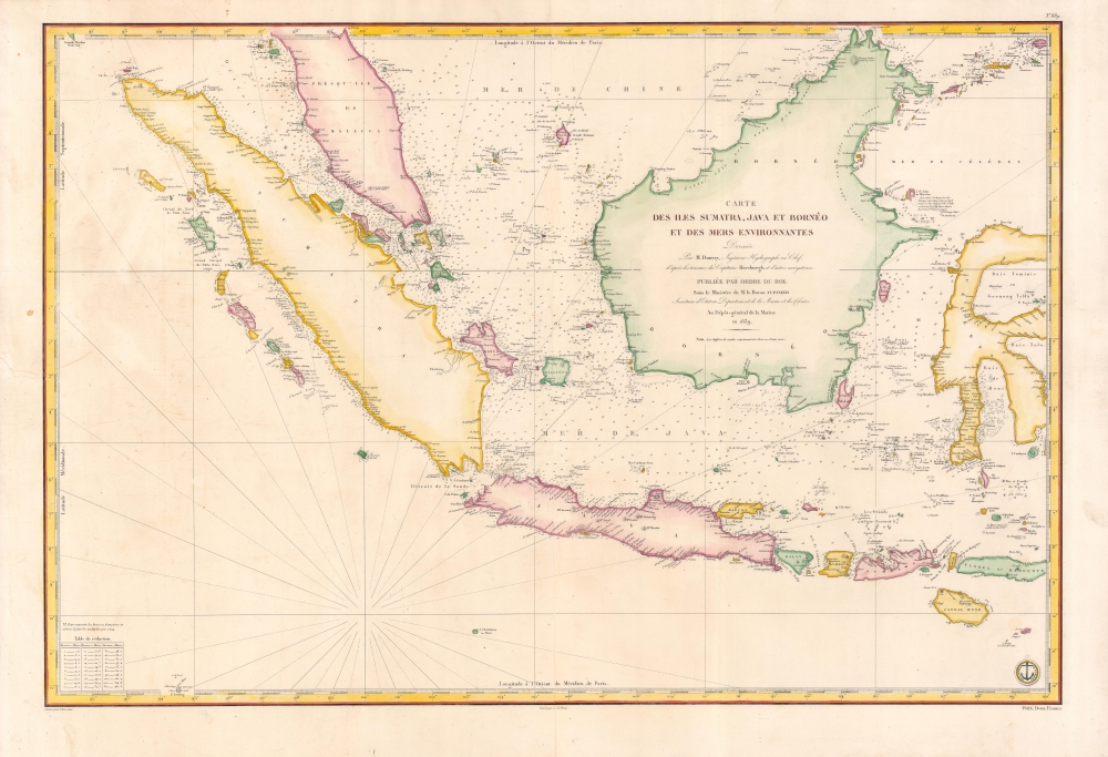
Carte des Iles Sumatra, Java et Borneo et des mers Environnantes...
$1,000.00
Acquire
- Digital Map Information
- Suitable for large format printing
- Full resolution TIFF file
- ICC color profile embedded
- Delivered instantly via download link
A beautiful and rare 1839 French Depot-General de la Marine nautical chart or maritime map of the East Indies or Insular Southeast Asia - including Singapore. The size and level of detail is impressive, reflecting the importance of the chart as representing the pinnacle of hydrographical knowledge at the time. (more details)
Detailed history of the French and Indian War and American Revolution.
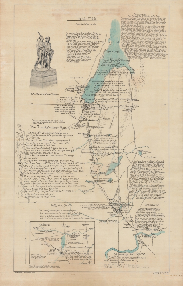
Battle grounds on the old trail from Lake George to Fort Edward, 1646-1788.
sold
- Digital Map Information
- Suitable for large format printing
- File Size: 32.24 MB
- File Type: ZIP / TIFF
- ICC color profile embedded
- Delivered instantly via download link
A rare historical map of Upstate New York focusing on the Adirondacka and Lake George region, created by Harriet A. Bentley, and published in 1917 by Rand McNally. Clearly a labor of love, it is adorned with copious notes providing a military history of the region, focusing on the French and Indian War (1754 - 1763) and the American Revolutionary War (1775 - 1783). (more details)
Important French colony.
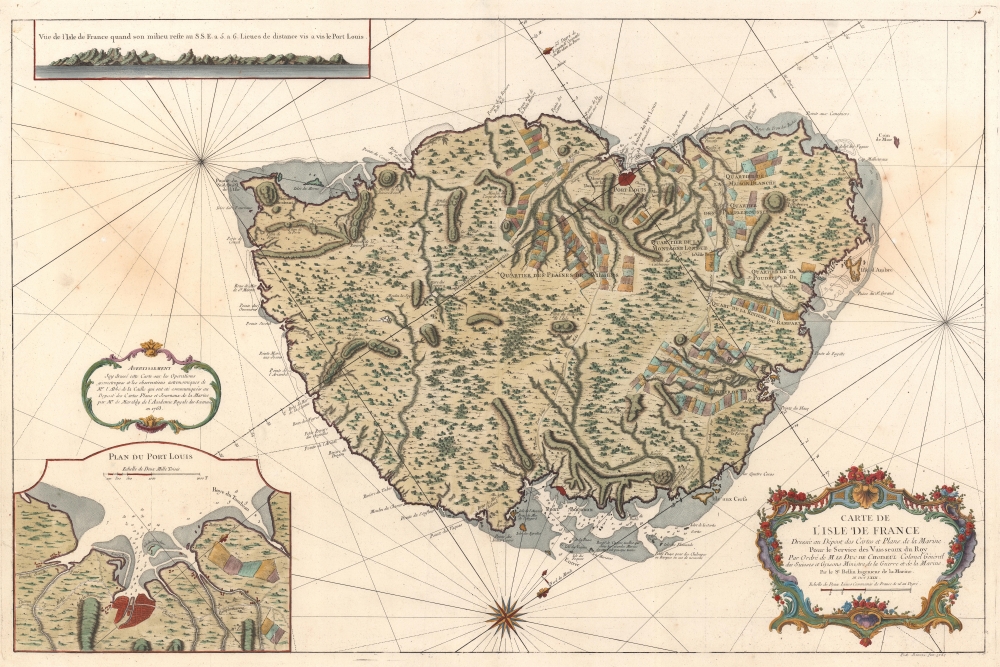
Carte de l'Isle de France Dressée au Dépost des Cartes et Plans de la Marine Pour le Service des Vaisseaux du Roy Par Ordre de M. le Duc de Choiseul Colonel Général des Suisses et Grisons Ministre de la Guerre et de la Marine.
sold
- Digital Map Information
- Suitable for large format printing
- DPI: 600
- File Size: 73.01 MB
- File Type: ZIP / TIFF
- ICC color profile embedded
- Delivered instantly via download link
This is a 1763 Jacques-Nicolas Bellin map of Mauritius. It was issued near the peak of French colonial power, before the French Revolution and the Napoleonic Wars. Mauritius is here represented as the darling of French colonial power in the Indian Ocean. Not only was Isle de France a critical stopping point on the East India Trade (and not just for the French), under management of the French East India Company, it was also a highly productive agrarian colony. (more details)
Southern Spain during the War of Spanish Succession.
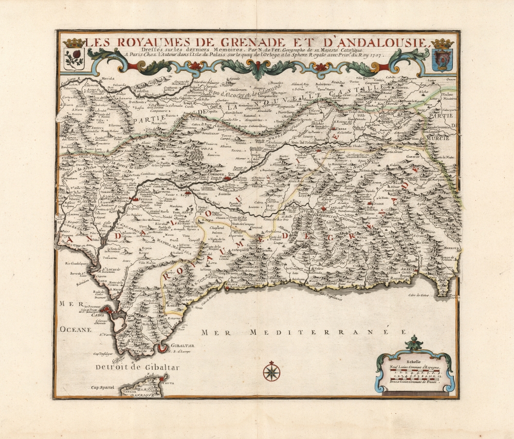
Les Royaumes de Grenade et d'Andalousie.
sold
- Digital Map Information
- Suitable for large format printing
- DPI: 600
- File Size: 56.57 MB
- File Type: ZIP / TIFF
- ICC color profile embedded
- Delivered instantly via download link
This is a large, elegant map of Grenada and Andalusia in southern Spain produced in 1707 by Nicolas De Fer, in a lovely original color example. The map was produced during the War of Spanish Succession (1701 - 1714), of which the region here depicted was one of the many theatres. Cadiz and Málaga, in particular, saw major fleet actions in 1702 and 1704, respectively.It encompasses from the Strait of Gibraltar in the south to Guadiana River in the north. Cities are marked, pictorially indicating differences in size and importance. Among its chief cities are Cadiz, Seville, Écija, Córdoba, Jaén, Grenada, and the ports of Málaga, Almeria, and Gibraltar. The title at top is set off with an elegant strapwork border and is flanked with the arms of the Kingdoms of Granada and Andalusia. (more details)
Warships in the Atlantic.

Conflit Hispano Americain Carte du Théâtre de la Guerre Dressée Spécialement pour les lecteurs de La Dépêche.
sold
- Digital Map Information
- Suitable for large format printing
- File Size: 121.42 MB
- File Type: ZIP / TIFF
- ICC color profile embedded
- Delivered instantly via download link
This is an 1898 Charaire map of the Atlantic Ocean between the United States and Spain published during the Spanish-American War. The view underscores French and general European curiosity (and concern) over the conflict. Spain's humiliating defeat in a matter of months marked an end to hundreds of years of Spanish empire and transformed the United States from an isolationist into an imperial power. (more details)
North Pole in Texas?

Official Texas Brags Map of North America.
sold
This is a 1967 John Randolph and Mark Storm pictorial map of Texas dominating North America - accompanied by is original mailer. An outsized Texas engulfs North America from the Pacific north of Baja to the Gulf Coast and from the Yucatan to north of the U.S.-Canada border. (more details)
Colorful and unique map of Ceylon.
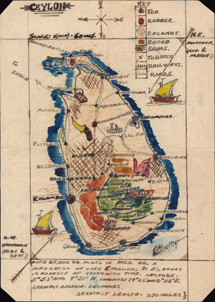
Ceylon.
sold
- Digital Map Information
- Suitable for large format printing
- File Size: 3.77 MB
- File Type: ZIP / TIFF
- ICC color profile embedded
- Delivered instantly via download link
A charming c. 1900 small-format map of Ceylon (Sri Lanka), produced by an unknown cartographer. Despite its size, the map provides detail on the island's climate, topography, economy, infrastructure, demographics, and more. (more details)
Thomson's best Great Lakes map.
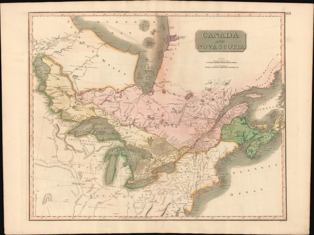
Canada and Nova Scotia.
sold
- Digital Map Information
- Suitable for large format printing
- DPI: 600
- File Size: 711.54 MB
- File Type: ZIP / TIFF
- ICC color profile embedded
- Delivered instantly via download link
This is John Thomson's 1814 map of Canada and the Great Lakes. Although intended to focus on Ontario and Quebec, this is also Thomson's best and largest scale map of all five Great Lakes. (more details)
London legends and folklore.

Children's Map of London.
sold
A colorful c. 1955 pictorial map of London by Leslie G. Bullock. The map covers central London from Hyde Park to Aldgate and from Green Park to Waterloo Station. The map was issued to raise funds for the Hospital for Sick Children, Great Ormond Street London. It identifies most major roads with important buildings rendered pictorially. The whole is filled with charming quotations from various authors ranging from Rudyard Kipling, Alfred Noyes, Benjamin Franklin, and others. Surrounded by decorative work intended to represent London life and folklore. (more details)
First printed map of the Western Hemisphere in one of its earliest printings.

Novae Insulae XVII Nova Tabula.
sold
- Digital Map Information
- Suitable for large format printing
- Full resolution TIFF file
- ICC color profile embedded
- Delivered instantly via download link
This is a superb example of Sebastian Münster's map of America, the first printed map of the Western Hemisphere. This map appeared in the second, 1542 printing of Münster's edition of Ptolemy's Geographia, preceded only by the 1540. As is to be expected for an early printing strike, the image is bold, sharp, and clear. This attractive and evocative map was broadly influential. Münster's Geographia was one of the earliest versions of Ptolemy's work to systematically include maps showing contemporary geographical knowledge, but the map's 1544 inclusion in Münster's magnum opus, Cosmographia Universalis would insure that for more than thirty years during the age of discovery, this map would provide the first glimpse of the New World to the literate European. (more details)
Vestiges of Assyria.

Vestiges of Assyria, sheet 1st, an ichnographic sketch of the remains of ancient Nineveh with the enceinte of the modern Mosul, the [Arabic inscription] of Arab M.S.S. and the ΜΕΣПΙΛΑ of the Anabasis constructed from the trigonometrical survey in the spring of 1852 at the command of the government of India.
sold
- Digital Map Information
- Suitable for large format printing
- File Size: 1761.26 MB
- File Type: ZIP / TIFF
- ICC color profile embedded
- Delivered instantly via download link
A striking 1855 ichnographic map of Mosul, Iraq, and the neighboring excavations at the ancient Assyrian capital of Nineveh. This map is significant, not only as one of the first modern surveys of Mosul, but also for its premier cartographic representation of the seminal archeological excavations at Nineveh performed by Austen Henry Layard. These excavations produced several paradigm-breaking discoveries, including the Epic of Gilgamesh and pre-Biblical 'Great Flood' narratives. (more details)
First Dutch Atlas Map of North America.
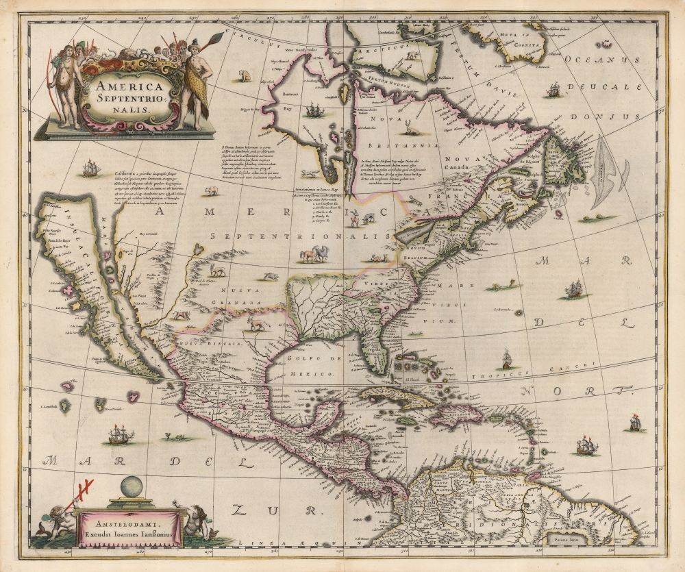
America Septentrionalis.
sold
- Digital Map Information
- Suitable for large format printing
- Full resolution TIFF file
- ICC color profile embedded
- Delivered instantly via download link
This is a beautiful old-color example of Jan Jansson's 1636 map of North America. It is the first folio map to focus on North America specifically after De Jode's 1593 map, and as such features several cartographic primacies. It is the first general Dutch map of North America to depict a Great Lake connected to the St. Lawrence, and the first obtainable Dutch atlas map of North America to embrace the theory of Insular California. Map historian Carl Wheat considered the many accurate depictions of America's fauna on the map to 'represent its most authentic information, so far as what is now western United States is concerned'. (more details)
Debut of the Eiffel Tower.

Exposition Universelle de Paris 1889.
sold
- Digital Map Information
- Suitable for large format printing
- File Size: 111.66 MB
- File Type: ZIP / TIFF
- ICC color profile embedded
- Delivered instantly via download link
This is an 1889 Gibert-Clarey (GTC) chromolithograph broadside issued to promote the Paris Exposition Universelle. Although numerous stunning broadsides were issued for the Exposition, this one stands out for its beautiful and technical mastery. (more details)
Insular Korea.
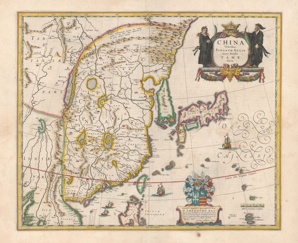
China Veteribus Sinarum Regio nunc Incolis Tame dict.
sold
- Digital Map Information
- Suitable for large format printing
- DPI: 600
- File Size: 50.83 MB
- File Type: ZIP / TIFF
- ICC color profile embedded
- Delivered instantly via download link
This is a beautiful example of Willem Blaeu's 1634 map of China, Korea, and Japan. It constitutes the best European knowledge of East Asia prior to the reports of Martino Martini, which in the 1650s caused the complete revision of Blaeu's maps. Major advancements include the mapping of Korea, novel detail in Taiwan / Formosa, and a reconsideration of the authoritative Ortelius/Barbuda map. (more details)
Uncle Sam stakes a claim to Cuba and the Pacific.
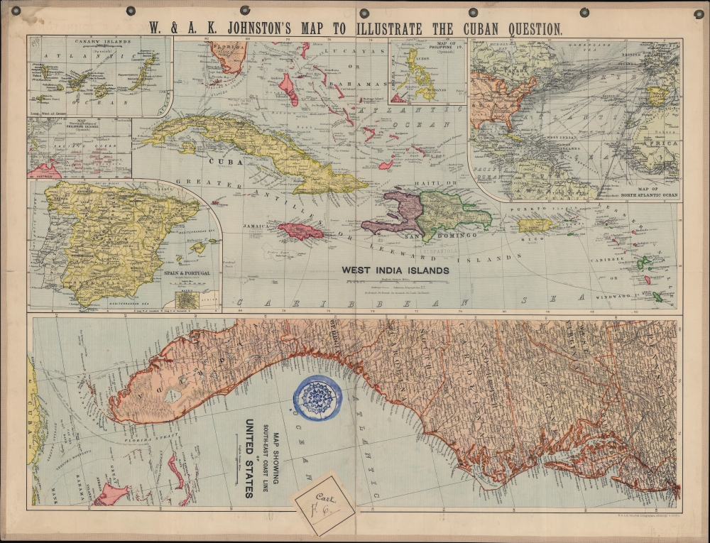
W. and A.K. Johnston's Map to illustrate the Cuban question.
sold
- Digital Map Information
- Suitable for large format printing
- File Size: 26.2 MB
- File Type: ZIP / TIFF
- ICC color profile embedded
- Delivered instantly via download link
A series of maps related to the Spanish-American War, this sheet was published by W. and A.K. Johnston in 1898 to illustrate the theater of conflict and related territories. It was produced in the wake of the USS Maine explosion and rising tensions between the U.S. and Spain. (more details)
Lovely Lake Geneva.
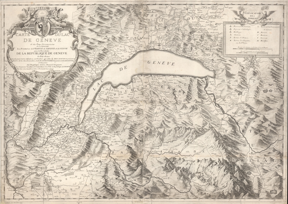
Carte du Lac de Genève et des pays circonvoisins...
sold
- Digital Map Information
- Suitable for large format printing
- DPI: 600
- File Size: 917.64 MB
- File Type: ZIP / TIFF
- ICC color profile embedded
- Delivered instantly via download link
A large-format 1730 Antoine Chopy map of Lake Geneva and environs, covering the northwestern end of the European Alpine region that today straddles the border between France and Switzerland. It was published in Histoire de Genève, rectifiée et augmentée par d'amples notes, an authoritative and comprehensive history of the city. (more details)
The heavens, in vivid color.
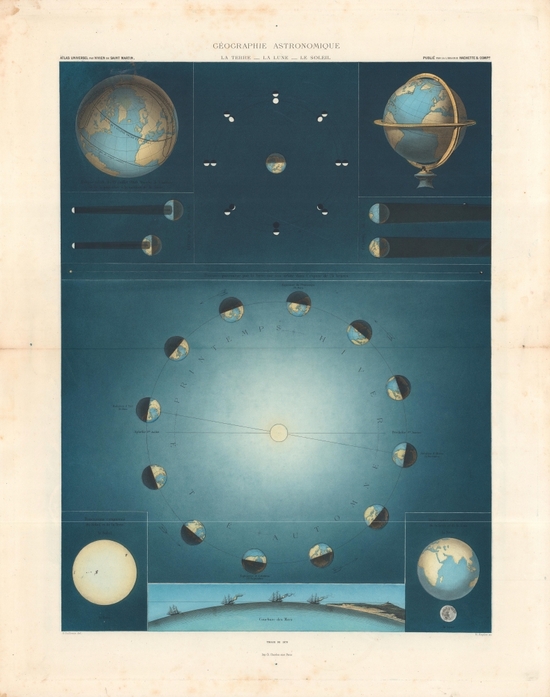
Géographie Astronomique, La Terre - La Lune - Le Soleil.
sold
- Digital Map Information
- Suitable for large format printing
- File Size: 28.12 MB
- File Type: ZIP / TIFF
- ICC color profile embedded
- Delivered instantly via download link
A gorgeous representation of the Earth, Moon, and Sun explaining the phases of the moon, the seasons, and more. This sheet appeared in Louis Vivien de Saint-Martin's 1878 Atlas Universel de Géographie… (more details)
The final frontier!
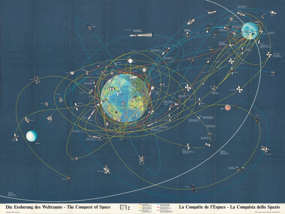
Die Eroberung des Weltraums - The Conquest of Space - La Conquête de l'Espace - La Conquista dello Spazio.
sold
This is a 1969 Hallwag pictorial map of space exploration, created shortly after American astronauts Neil Armstrong and Buzz Aldrin landed on the Moon. The map depicts the trajectories of both manned and unmanned spacecraft in orbit around the Earth, the Moon, and flying by Mars. These trajectories are printed in different colors so that each spacecraft can be properly attributed to the nation responsible for its launch. (more details)
British expansion in India.
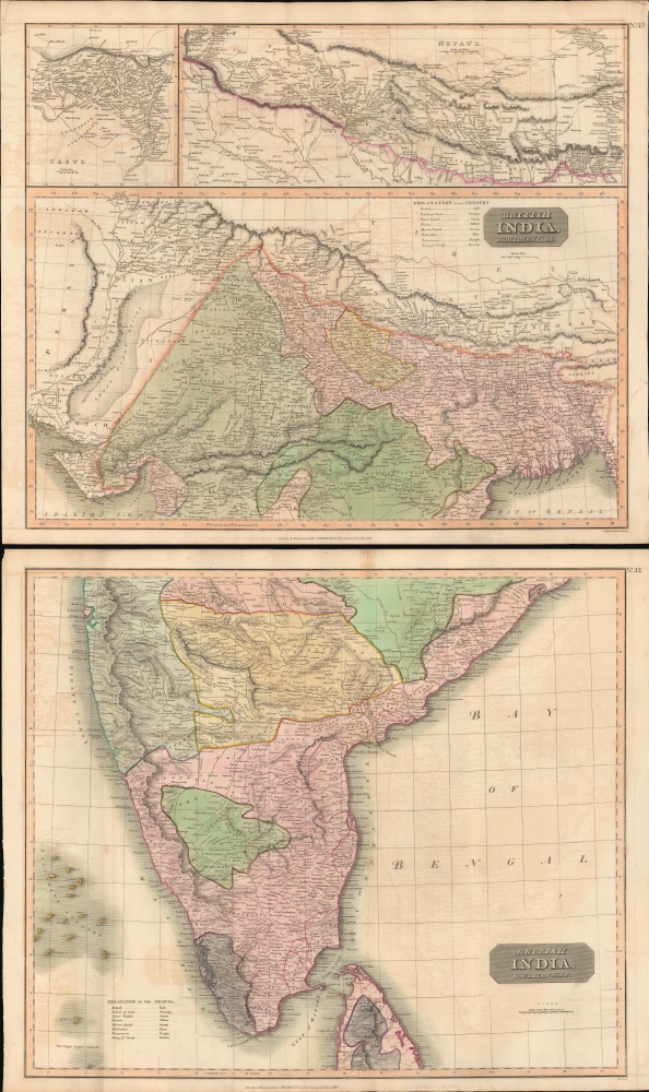
British India, Northern Part. British India, Southern Part.
$400.00
Acquire
- Digital Map Information
- Suitable for large format printing
- Full resolution TIFF file
- ICC color profile embedded
- Delivered instantly via download link
This is a stunning set of two 1817 maps of India and Nepal by Edinburgh cartographer John Thomson. As a whole, the maps illustrate India when the British East India Company had expanded their control - here in pink - from coast to coast. Color coding, with a key on the lower sheet, defines spheres of influence, including both British allies and enemies. (more details)
Tracing the latest circumnavigators.
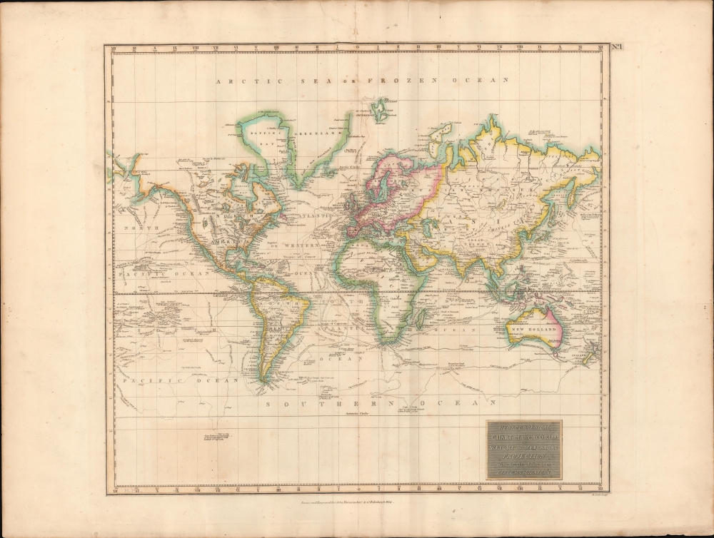
Hydrographical Chart of the World on Wright or Mercator's Projection With Tracts of the Last Circumnavigators.
sold
- Digital Map Information
- Suitable for large format printing
- DPI: 600
- File Size: 702.61 MB
- File Type: ZIP / TIFF
- ICC color profile embedded
- Delivered instantly via download link
An example of John Thomson's 1814 map of the world on Mercator's projection. Published in the 1814 edition of Thomson's General Atlas, this map was drawn to illustrate the great voyages of discovery of the late 18th century, most specifically Cook, Perouse, and Vancouver. (more details)