
Summation of the First European Surveys of Northern Arabia Embracing the History of the Arab Revolt.
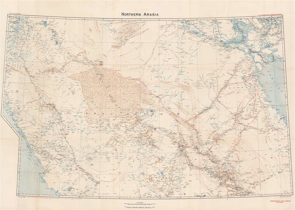
Northern Arabia/ Shakespear's Last Journey. Carruthers. GSGS 2931.
sold
- Digital Map Information
- Suitable for large format printing
- File Size: 51.07 MB
- File Type: ZIP / TIFF
- ICC color profile embedded
- Delivered instantly via download link
This 1922 Royal Geographic Society map of northern Arabia, Jordan, Kuwait and Southern Iraq, capturing the first European surveys of this region, frames the dramatic first British government efforts to map this previously uncharted region and build new alliances before and during World War I (1914 - 1918). The map - very probably the work of Douglas Carruthers but attributed only to the General Staff Geographical Section of the British War Office - has been further overprinted to highlight the heroic accomplishments of Captain William Shakespear, the first European to map the north-central part of the Arabian Peninsula and an advisor to Ibn Saud (1876 - 1953), future King of Saudi Arabia. (more details)
South and Mid-Coast Maine.

Coast Chart No. 107 Seguin Island to Kennebunkport Maine.
sold
- Digital Map Information
- Suitable for large format printing
- File Size: 34.65 MB
- File Type: ZIP / TIFF
- ICC color profile embedded
- Delivered instantly via download link
This is an 1878 U.S. Coast and Geodetic Survey nautical chart or maritime map of Casco Bay and the southern coast of Maine - the heartland of maritime Maine. Centered roughly on Cape Elizabeth, coverage extends roughly from Seguin Island south past Portland, to Kennebunkport. The coastline and the many coastal islands are illustrated in detail. Most of the coastal islands are identified by name. Ledges, rivers, necks, points, bays, and other nautical features and hazards are illustrated as well. Countless depth soundings appear throughout. Portland, Kennebunkport, and Biddeford are labeled with their street layout evident. The Atlantic and St. Lawrence Railroad hugs the coastline between Portland and Yarmouth Falls Village. (more details)
Opening the way for Sherman's March.

Battle of Chattanooga.
sold
- Digital Map Information
- Suitable for large format printing
- File Size: 41.63 MB
- File Type: ZIP / TIFF
- ICC color profile embedded
- Delivered instantly via download link
This is an 1888 Kurz and Allison view of the American Civil War Battle of Chattanooga. Union forces appear on the right and are illustrated advancing on Confederate positions. Smoke and flames erupt from the barrels of both armies' rifles. Although unlabeled, given the terrain, this view likely depicts either General Sherman's or General Thomas's assault of Missionary Ridge. (more details)
Zionism for Israeli children.
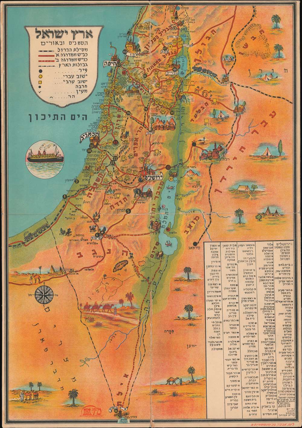
Eretz Israel Hasanim and Orim / אריך ישראל הסנים ובאורים
sold
- Digital Map Information
- Suitable for large format printing
- File Size: 29.82 MB
- File Type: ZIP / TIFF
- ICC color profile embedded
- Delivered instantly via download link
A striking c. 1950 Hebrew Zionist chromolithograph pictorial map and game board by Binyamin Bar-Levi, Tel-Aviv. This map / game was issued shortly after Israel's founding. Important cities and historical sites are identified pictorially. The map illustrates railroad lines connecting Israel to the surrounding countries - many of which are now defunct. Some 125 locations are numbered with a corresponding index in the lower right. Interestingly, yellow circles represent Israeli settlements, while yellow squares represent Arab settlements. (more details)
The 'Keys' to great fishing adventures!

Russ Smiley's Fishing Map of South Florida.
sold
This is a 1971 Russ Smiley pictorial fishing map of South Florida. Depicting from Fort Lauderdale to Key West, Smiley pays particular attention to coastal regions and the Florida Keys. Keys are labeled throughout with pink overprinting marking lighthouses, beacons, and buoys. Pink overprinting also identifies prime fishing areas and seasons for snook, bonefish, and tarpon. Special zones north of Key West are labeled as 'Prohibited' and 'Danger'. Black dashed lines highlight the John Pennekamp Coral Reef State Park. An 'inset' of Key West appears at the top center just below the title. This includes a detailed depiction of the waters around the island, but very little discernible detail is included on the island itself. (more details)
Colonial inter-relations in East Africa.
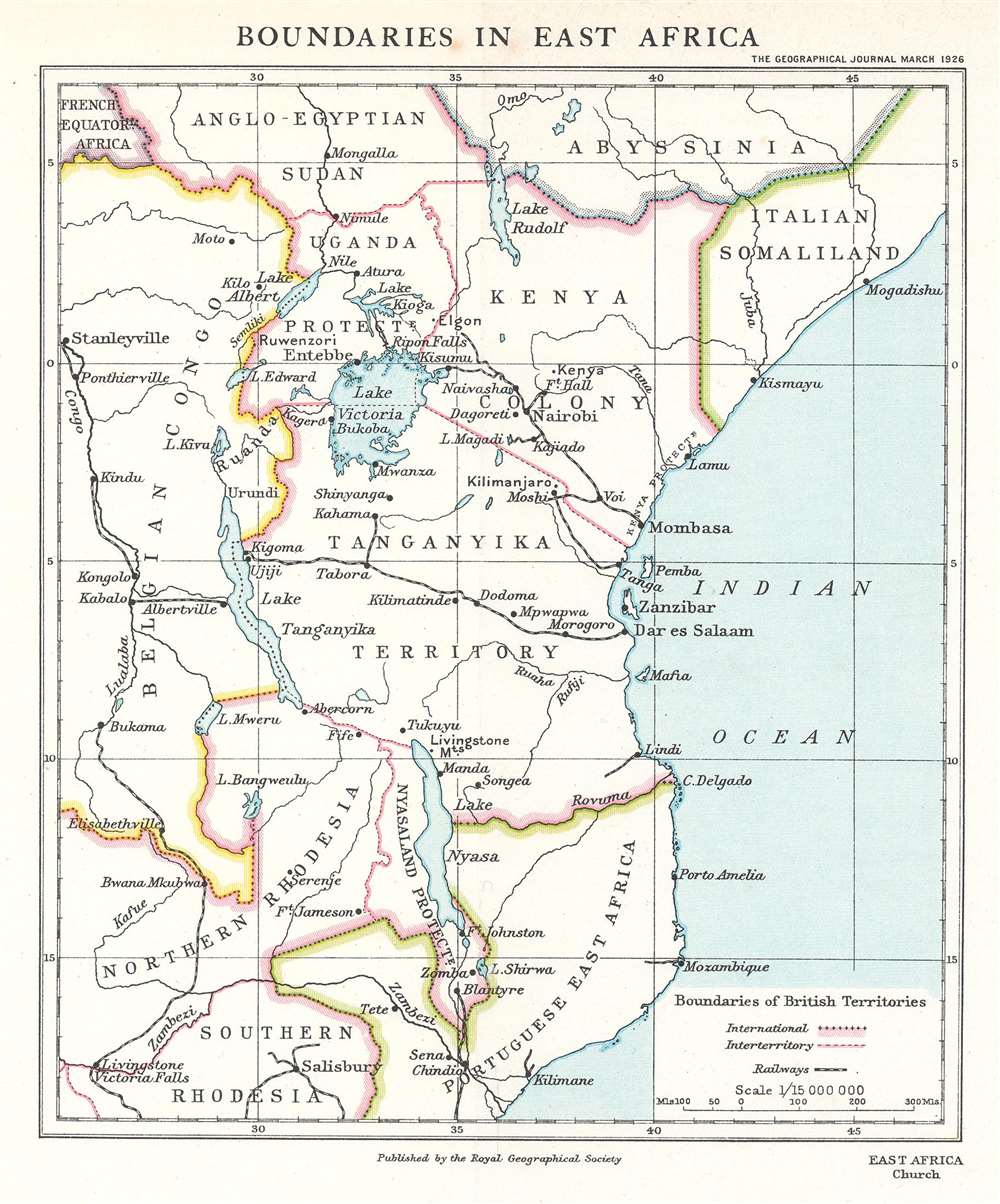
Boundaries in East Africa.
sold
- Digital Map Information
- Suitable for large format printing
- File Size: 2.86 MB
- File Type: ZIP / TIFF
- ICC color profile embedded
- Delivered instantly via download link
This is a 1926 Royal Geographical Society map of East Africa, accompanying an article detailing the itinerary and findings of the East African Commission. The map depicts from Abyssinia and Anglo-Egyptian Sudan south to Southern Rhodesia, thus embracing the modern-day nations of Kenya, Tanzania, Mozambique, Zambia, and parts of the Congo, Ethiopia, Uganda, and Somalia. Several railways, including the Central Tanganyika Railway, are illustrated. Major cities and other settlements are identified, such as Livingstone, Zomba, Dar es Salaam, Tabora, Entebbe, and Nairobi. (more details)
A large city plan of St. Louis.
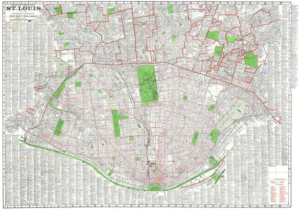
Map of Greater St. Louis.
sold
- Digital Map Information
- Suitable for large format printing
- Full resolution TIFF file
- ICC color profile embedded
- Delivered instantly via download link
This is c. 1953 Henry Emmett Gross city plan or map of St. Louis, Missouri. The thick red lines mark the city limits of St. Louis and by the same logic the boundaries of various suburbs. The thin red lines within St. Louis and, in one case, outside St. Louis, mark streetcar and bus lines. Streets throughout the city are illustrated and labeled. The city's many parks are shaded green, along with Jefferson Memorial National Park along the Mississippi River, now called Gateway Arch National Park. A complete alphabetical street index practically borders the map on three sides. (more details)
Vacation all year! SoCal Life!

Official All-Year Club Sight-Seeing Map Southern California.
sold
- Digital Map Information
- Suitable for large format printing
- Full resolution TIFF file
- ICC color profile embedded
- Delivered instantly via download link
This is a 1953 All-Year Club of Southern California pictorial tourist map of southern California. Coverage extends from Topaz Lake south to the U.S. - Mexico border and from the Pacific Ocean to the California - Nevada border. Pictorial vignettes add charm to this colorful map: Tourists are illustrated sunbathing, fishing, surfing, hiking, and rock climbing, while a rancher, a covered wagon, and a miner reference the region's history. Grapes, oranges, giant sequoias, and cacti highlight the breadth of California's flora. Block texts introduce the region's eight counties, recount history, and highlight places of interest. A yellow box in the upper right includes the All-year Club's pitch that weather in southern California is ideal year-round. (more details)
Drive Highway 1 in Florida and enjoy the sunshine!

Florida's Holiday Highways.
sold
This is a charming c. 1954 American Automobile Association (AAA) pictorial tourist map of Florida. Depicting from Brunswick, Georgia, south along the Atlantic Coast to Miami and continuing to Key West, the map highlights the storied U.S. Highway 1 and several connecting highways along the coast. Pictorial vignettes highlight popular activities, like swimming, deep sea fishing, and golfing. Tourist attractions (many now defunct) like Marineland, the Norton Art Gallery, and Monkey Village are also highlighted. The recently established Everglades National Park extends the map's coverage and is emphasized in verdant green. An index of distances from Jacksonville occupies the left third of the map. (more details)
Streetcar lines of Minneapolis.
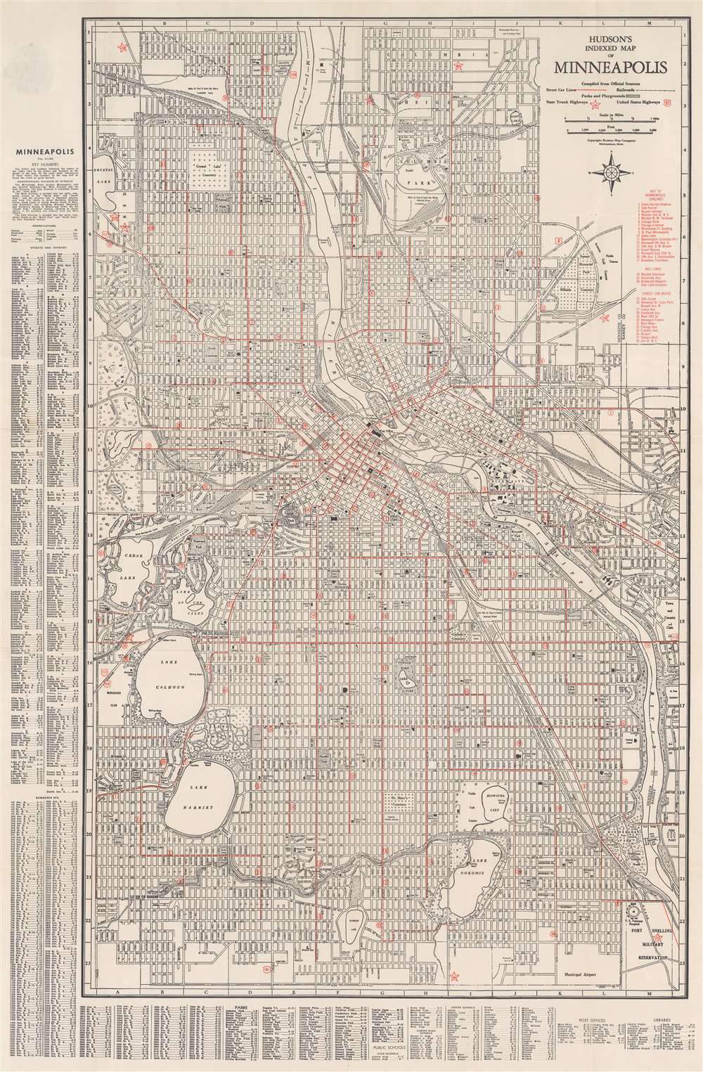
Hudson's Indexed Map of Minneapolis.
sold
- Digital Map Information
- Suitable for large format printing
- Full resolution TIFF file
- ICC color profile embedded
- Delivered instantly via download link
This is a c. 1948 Hudson Map Company city plan or map of Minneapolis, Minnesota. The Mississippi River cuts through the center of town before turning to the right and flowing off the map just above the Fort Snelling Military Reservation and its U.S. Veterans Hospital. Several railway pass through the city, including the Great Northern Railway, the Chicago, Milwaukee, St. Paul, and Pacific, and the Northern Pacific. Overprinted red stars mark Minnesota state highways and red shields mark U.S. highways. Red overprinting also highlights Minneapolis streetcar and bus lines. An index along the left lists streets alphabetically and numerically. Below the map, similar indexes identify city parks, public schools, post offices, and libraries. (more details)
One of the earliest named highways in the United States.

Your Free Strip Map Dixie highway. North or South...Your Favorite Route to Florida or the Great Smokies.
sold
This is a 1955 U.S. 27 Dixie Highway Association map of the Dixie Highway, a network of four highways stretching from Bay City, Michigan to Miami, Florida. A thick red line identifies the Dixie Highway. Cities and towns are identified and mileage provided. U.S. highway shields numerically identify connecting roadways. Vignettes highlight sites of particular interest, such as horse farms near Lexington, Kentucky, Silver Springs, and the Bok Tower. Great Smoky Mountains National Park is illustrated and labeled. (more details)
First edition of Nell's important large format map of Colorado.
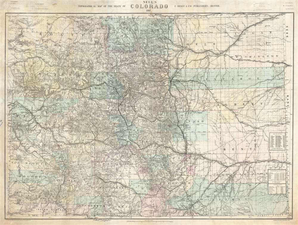
Nell's Topographical Map of the State of Colorado.
sold
- Digital Map Information
- Suitable for large format printing
- File Size: 87.77 MB
- File Type: ZIP / TIFF
- ICC color profile embedded
- Delivered instantly via download link
This is the very rare 1887 first edition of Louis Nell's separate-issue map of Colorado. It is hands down the largest and most detailed map of Colorado to appear after the 1876 statehood. The map painstakingly illustrates topography, names rivers and streams, shows railroads, identifies footpaths, and more. The map is further broken down into counties and Land Office districts. Native American reservations, military reservations, and mining territories are also named. Mountain peaks, many of which have today become popular ski resorts, are named throughout. (more details)
Promotes the Florida Central and Peninsular Railroad.
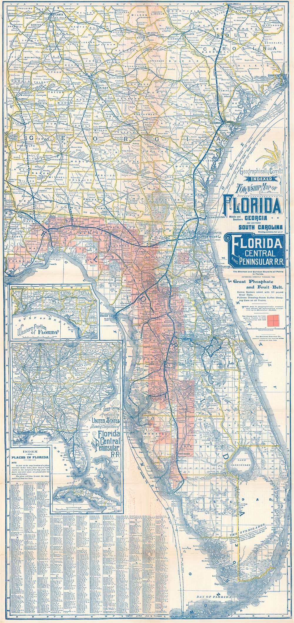
Geographically Correct Indexed Township Map of Florida Middle and Southern Georgia and Southern South Carolina showing complete system of Florida Central and Peninsular Railroad.
sold
- Digital Map Information
- Suitable for large format printing
- Full resolution TIFF file
- ICC color profile embedded
- Delivered instantly via download link
A rare 1894 map of Florida and Georgia illustrating the Florida Central and Peninsular Railroad at its peak. The map was issued not only to highlight the FCP achievements in reaching Tampa and St. Petersburg, but also to promote the extensive discoveries of phosphates. These discoveries extend from the Apalachicola River east through the panhandle and then south to Charlotte Harbor. Two insets are situated along the left border. The top inset depicts the western portion of the Florida Panhandle and the bottom inset illustrates the railroad network in the southeastern United States. An index of locations throughout Florida occupies the lower left corner. (more details)
Who owns New York City? City or State?
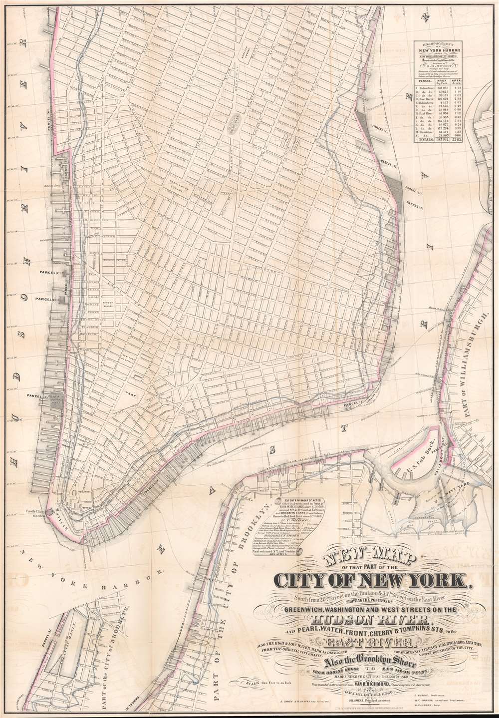
New Map of that Part of the City of New York south from 20th Street on the Hudson and 35th Street on the East River.
sold
- Digital Map Information
- Suitable for large format printing
- File Size: 45.27 MB
- File Type: ZIP / TIFF
- ICC color profile embedded
- Delivered instantly via download link
This is a rare map drawn to settle a land rights dispute between New York City and New York State. The map extends from roughly 32nd street to the Battery and includes the shorelines of Brooklyn and Queens. It illustrates the city's street grid, showing all piers and docks, ferry lines, and the pier line. Most importantly, it illustrates the cities original boundary line, noting both the high and low water marks (this was one of the maps consulted by Egbert Viele to produce the famous 1865 Waterways Map). More importantly, it illustrates the shore boundaries of Manhattan and Brooklyn according to the various surveys and charters completed between 1735 and 1808. (more details)
Japanese anti-Soviet anti-Communist Propaganda Pictorial!

最近の東 亞形勢圖解 / Illustrated Explanation of Recent East Asia Situations. / Saikin no Tōa keisei zukai.
sold
- Digital Map Information
- Suitable for large format printing
- File Size: 173.24 MB
- File Type: ZIP / TIFF
- ICC color profile embedded
- Delivered instantly via download link
A remarkable 1937 Osaka Mainichi Shimbun large-format Japanese anti-Soviet propaganda pictorial map of East Asia. Centered on China, this stunning map depicts from Central Asia and India to Japan, and from Siberia to Vietnam. The map employs text, color coding, and cartoon imagery to illustrate the confusing political, military, and economic environment in East Asia at this time, expressing the dangers of Soviet expansionism, and suggesting a Japanese military buildup to counter it. (more details)
Striking depiction of Mount Desert Island.
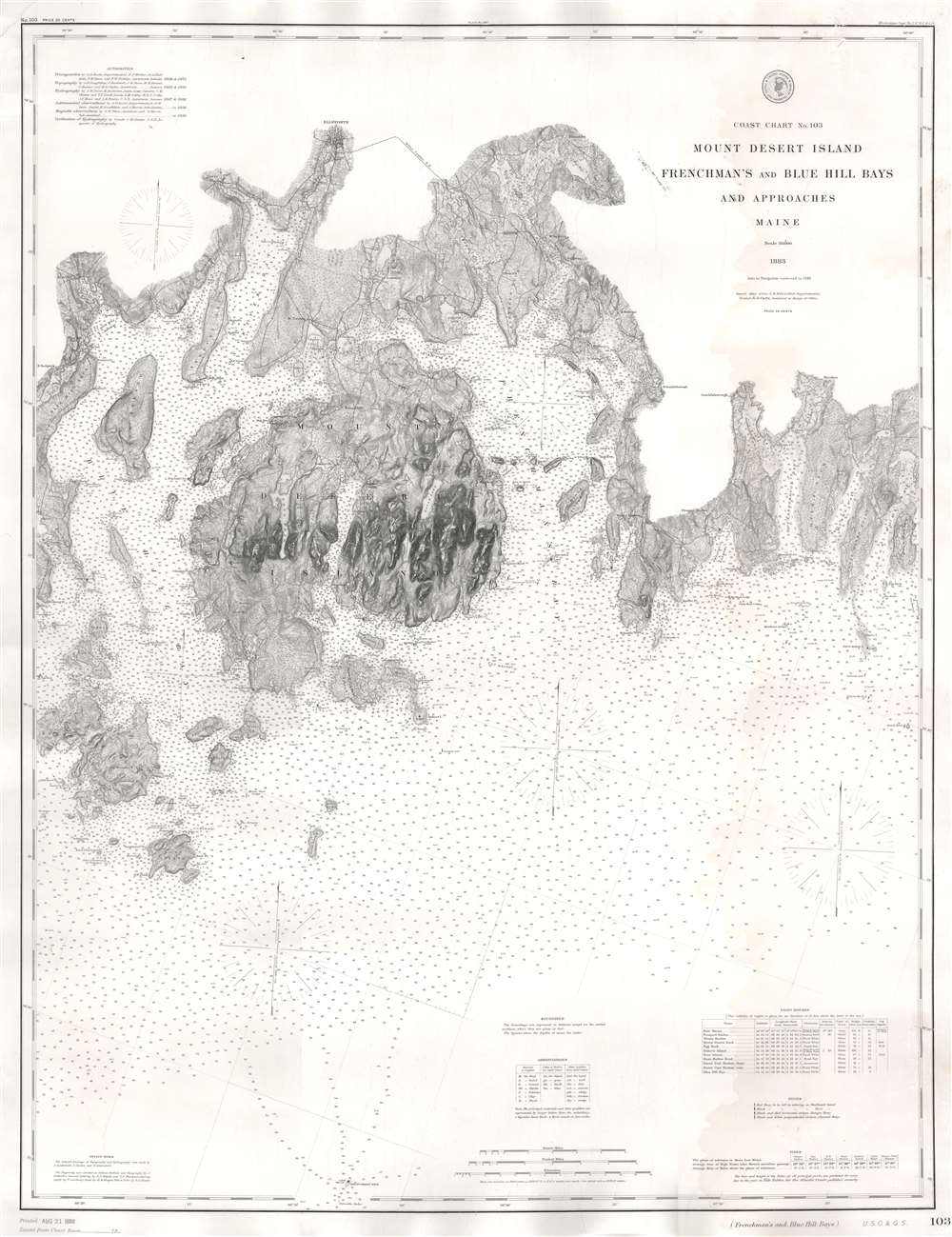
Coast Chart No. 103 Mount Desert Island Frenchman's and Blue Hill Bays and Approaches Maine.
sold
- Digital Map Information
- Suitable for large format printing
- File Size: 60.18 MB
- File Type: ZIP / TIFF
- ICC color profile embedded
- Delivered instantly via download link
This is an 1888 U.S. Coast and Geodetic Survey nautical chart or maritime map of Mount Desert Island, Frenchman's Bay, and vicinity, Maine. With Mount Desert Island situated slightly to the left of center, the map depicts from New Sedgwick and Blue Hill Neck to Pigeon Hill and Pigeon Hill Bay. Mount Desert Island's celebrated topography is illustrated in detail. Roads traverse the island and individual residences are marked but not labeled. Mountain peaks, harbors, points, coves, ponds, and lakes are all identified as well. Other islands throughout are also illustrated, along with harbors, necks, coves, and bays. As this is a nautical chart, countless depth soundings are indicated. (more details)
Explorer's Routes and National Roads.
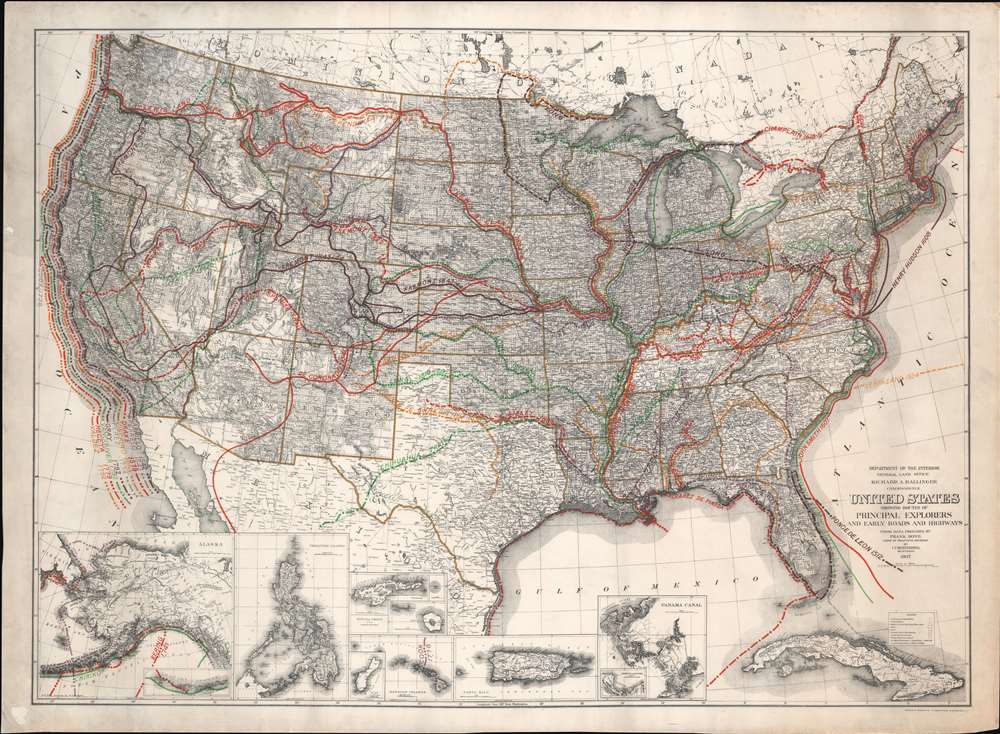
United States Showing Routes of Principal Explorers and Early Roads and Highways.
sold
- Digital Map Information
- Suitable for large format printing
- File Size: 62.87 MB
- File Type: ZIP / TIFF
- ICC color profile embedded
- Delivered instantly via download link
A most fascinating production, this is a fine example of the 1907 first edition of the Berthrong / Bond map of the United States showing exploratory routes and improved roads. The base map is a reduction of the General Land Office map of the United States issued annually from 1899 to illustrate the extending and progress of the Public Surveys. That map has here been overlayed with color-coded routes illustrating the most prominent explorations from the 1500s through the mid-19th century. In addition, it shows important roads then in being built or improved, including the National highway, Braddock Road, the Great Trail. The map was intended to demonstrate the current state of geographical knowledge and underscore the fact that - by 1907, little was left unexplored. (more details)
Evolution of the National Mall.
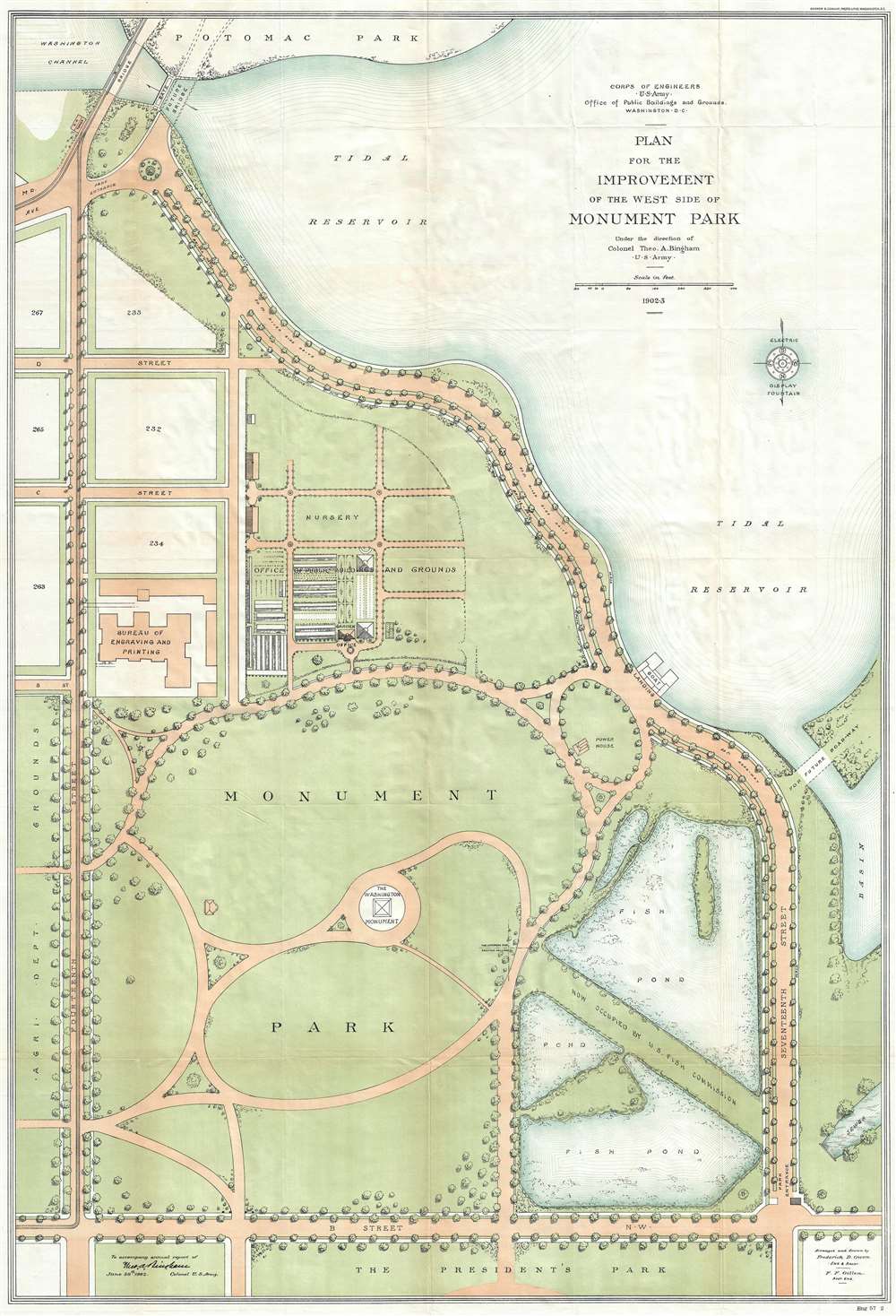
Plan for the Improvement of the West Side of Monument Park.
sold
- Digital Map Information
- Suitable for large format printing
- File Size: 17.94 MB
- File Type: ZIP / TIFF
- ICC color profile embedded
- Delivered instantly via download link
This is a 1902-04 U.S. Army Corps of Engineers map of Monument Park, the National Mall, Washington D.C. This map was issued to address draining issues of drainage - note the large fishponds in the lower right. Centered on the Washington Monument and oriented to the south, with north at the bottom, the map depicts from the President's Park at the bottom to the tidal reservoir, the Maryland Avenue Bridge and Potomac Park at the top, and from Fourteenth Street to Seventeenth Street and the tidal basin on the right. Above Memorial Park and the Washington Monument, B, C, and D Streets are depicted as well as several city blocks. The Bureau of Engraving and Printing is identified, as well as the Nursery of the Office of Public Buildings and Grounds. To the right of Monument Park, two fishponds are illustrated, which, per the map, were part of the U.S. Fish Commission. To the left of Monument Park, across Fourteenth Street, lies the grounds of the Agriculture Department. (more details)
The mythical lands of Jean de Gama.
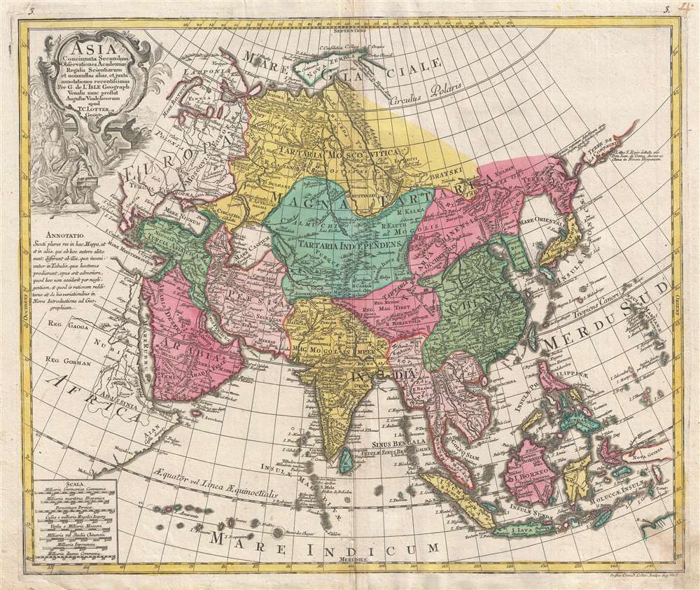
Asia Concinnata Secundum Observationes Academiae Regalis Scientiarum et nonnullas alias, et iuxta annotationes recentissimas.
$850.00
Acquire
- Digital Map Information
- Suitable for large format printing
- DPI: 300
- File Size: 13.36 MB
- File Type: ZIP / TIFF
- ICC color profile embedded
- Delivered instantly via download link
A rare and attractive old color 1770 map of Asia by Tobias Conrad Lotter. Centered on Independent Tartary, this map covers the entire continent from Africa and the Mediterranean east to the Bering Sea and south as far as Java and New Guinea. The map renders the entire region in detail offering both topographical and political information with forests and mountains beautifully rendered in profile. (more details)
Follow the 5th Armored Division across Europe during World War II.

The Trek of the 5th Armored.
sold
- Digital Map Information
- Suitable for large format printing
- Full resolution TIFF file
- ICC color profile embedded
- Delivered instantly via download link
Drafted by Robert G. Buchan, this is an all-business history of the 5th Armored Division’s drive across Europe. Red lines mark the division’s progress, sometimes day-to-day, naming towns and cities visited. Information about the division’s movements, such as their claim to have been the first American division in Germany, as well as the first division to breach the Siegfried Line, are in red. Dates when the division was pulled off the line and when they crossed the Rhine River are also given. Exhibiting an impressive dedication to detail, the route is sometimes divided between the ‘CCA’ (Combat Command A), ‘CCB’ (Combat Command B) and ‘CCR’ (Combat Command Reserve or Headquarters). Comparable in size to brigades or regiments, combat commands were newly established within the 4th, 5th, and 6th Armored Divisions in 1943. The 2nd and 3rd Armored Divisions maintained their original organization until the end of the war. (more details)