
The Mortal Dangers of Arboriculture.

The Tree of Misery and Death, With Some of its Roots Laid Bare.
sold
- Digital Map Information
- Suitable for large format printing
- File Size: 26 MB
- File Type: ZIP / TIFF
- ICC color profile embedded
- Delivered instantly via download link
This is an extremely rare, chromolithograph temperance broadside printed c. 1860. We generally associate the temperance movement and its attendant propaganda with the United States, but it was in fact a global movement. In the United Kingdom, where this broadside was printed, the temperance movement was particularly strong in the industrial midlands. where alcoholism was rife among young workers. (more details)
Stalin's beard as the iron curtain.

[Europe].
sold
- Digital Map Information
- Suitable for large format printing
- File Size: 18.19 MB
- File Type: ZIP / TIFF
- ICC color profile embedded
- Delivered instantly via download link
This is a 1952 David Low serio-comic map of Europe. Low masterfully updates a genre that dates back to the beginning of the twentieth century for a 1950s audience. As is the case with most maps in this genre, Russia, or in this case the Soviet Union, dominates the map. Here, the U.S.S.R. is personified by none other than Joseph Stalin. Stalin's famous moustache here takes the form of an 'iron curtain,' a phrase coined by Winston Churchill during a speech at Westminster College in Fulton, Missouri, on March 5, 1946. As is the case with serio-comic maps, the nations of Europe have been transfigured, in this case, into people. Most of eastern Europe has been enveloped by Stalin and his iron curtain, and only their boots are visible. Germany is slowly being pulled into under the curtain and is being sawed in half by itself and by a Soviet arm. Finland is busy trying to pull itself out from under the curtain while the rest of Scandinavia whispers between themselves. Yugoslavia, personified by Marshal Josip Tito, makes rude gestures at the Stalin, just as Tito did. Greece and Turkey are hiding behind the Bosporus, armed and ready for a Soviet invasion. France stands armed and ready, with Belgium and the Netherlands standing shoulder to shoulder with them, although eclipsed by their power. Switzerland appears as a dove sitting outside a birdhouse, while Italy is held back by the Pope. Britain appears as a haggard factory worker, once again tightening their belt in austerity, while Northern Ireland and the Republic of Ireland are, literally, fighting like cats. Spain is a weary old woman, and Franco is fishing for dollars in the Atlantic. Portugal appears as the only country not suffering in one way or another, with several people wearing crowns peering out the windows of an apartment house. (more details)
Rare 1821 edition.
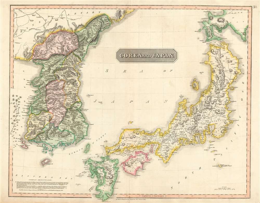
Corea and Japan.
sold
- Digital Map Information
- Suitable for large format printing
- Full resolution TIFF file
- ICC color profile embedded
- Delivered instantly via download link
This is John Thomson's revised 1821 map of Korea and Japan. Both Korea and Japan are divided according to their constituent provinces with Hokkaido, identified as Jesso (Yesso), partially off the map. The island of Hachijo (incorrectly identified here as Fatsisio), just south of Edo Bay, is identified as a 'Place of Exile for the Grandees of Japan.' Although the Izu Islands were in fact used as convict settlements in the 18th century, Hachijo Island was not particular in that respect, nor was the social status of its criminals. A wall of wooden spikes dividing Chinese Tartary (today's Manchuria) from Korea is also noted. The sea between Japan and Korea, whose name, either the 'Sea of Korea' or the 'Sea of Japan,' is currently a matter of historical and political dispute between the two countries, is here identified in favor of Japan. (more details)
Illustrates the Old City and the Temple Mount in detail.

ירושלם העתיקה והחדשה / Jerusalem Old and New.
sold
- Digital Map Information
- Suitable for large format printing
- Full resolution TIFF file
- ICC color profile embedded
- Delivered instantly via download link
This is a 1942 Steimatzky pictorial map of Jerusalem in Hebrew. The map depicts the city from Karem es Sila to El Tur and the Mount of Olives and from the Hadassa Medical Center, the Hebrew University and Mt. Scopus to Meqor Hayim. Illustrating numerous buildings in profile, the Old City and the Temple Mount act as the focal point. Surrounded by walls, several buildings within the Old City, such as the Holy Sepulcre, St. Anne's, the Supreme Muslim Council, and several gates are labeled. On the Temple Mount, the Dome of the Rock and the El Aksa Mosque are illustrated. Some of the locations illustrated outside the Old City include the Citadel, the Church of Dormition, the Tomb of the Virgin, the Tombs of the Kings, and several monasteries and convents. Neighborhoods throughout the city are labeled, along with streets and the railway which enters the city near the bottom of the map. (more details)
A brilliant, data rich depiction of early mid-century New York City.

The City of New York.
sold
- Digital Map Information
- Suitable for large format printing
- File Size: 47.57 MB
- File Type: ZIP / TIFF
- ICC color profile embedded
- Delivered instantly via download link
This 1939 Richard Edes Harrison map of New York City - published in conjunction with the New York World’s Fair - represents a triumph of the visual display of quantitative information. Its aesthetic impact is all the more impressive in its clear expression of municipal and demographic data, making this a map of the people of New York City, as much as of the physical city itself. All five boroughs are represented in the primary map. On it, Harrison’s masterful use of vivid color to distinguish between residential, commercial, industrial, and federal use of land is clear yet supple, able to make distinction (for example) of low-income housing projects using the same palette. Parks and cemeteries both appear as green spaces, with white spots - evoking headstones - indicating the difference between the two. The two major airports (Floyd Bennett Field and North Beach Airport) are given their own color as well. The city’s industrial areas, shown in black, dominate the East River and Hudson coastlines, a reminder of the centrality of trade to the city’s development and history. (more details)
A rare real estate advertisement from 1930s Santa Barbara.
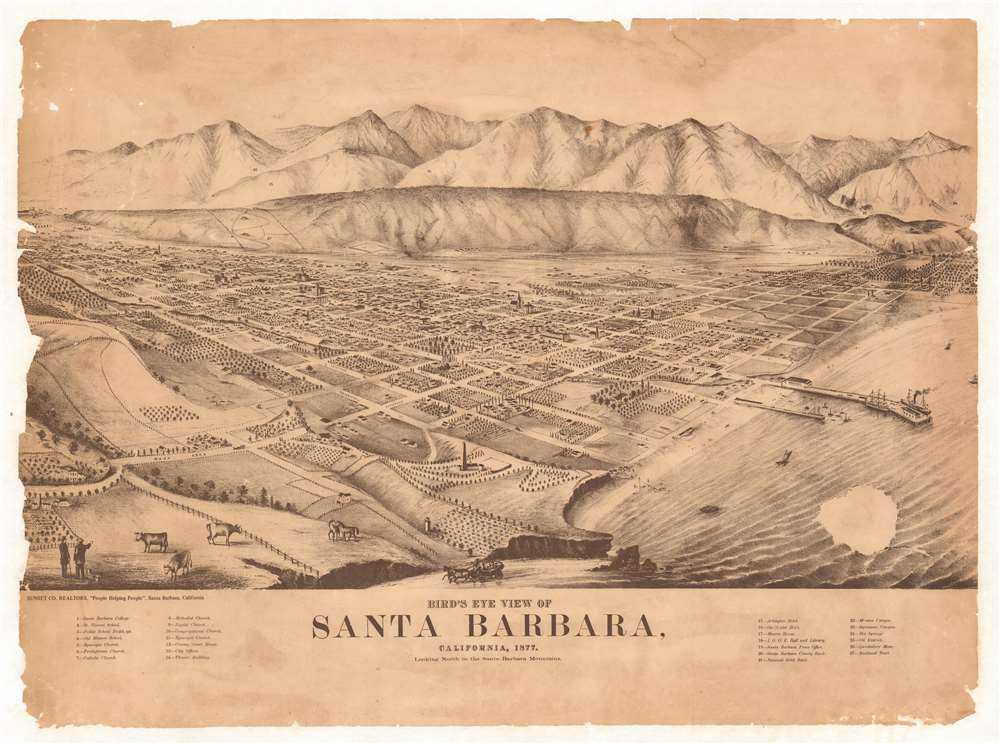
Bird's Eye View of Santa Barbara, California.
sold
- Digital Map Information
- Suitable for large format printing
- File Size: 36.42 MB
- File Type: ZIP / TIFF
- ICC color profile embedded
- Delivered instantly via download link
This is a c. 1930 Sunset County Realtors photolithographic bird's-eye view advertising broadside map of Santa Barbara, California. Looking north toward the Santa Barbara Mountains, streets appear as wide thoroughfares populated by horseback riders and people. Twenty-seven locations around town are numerically identified and correspond to an index along the bottom border. These include Santa Barbara College, over half a dozen churches, the National Gold Bank, the Quicksilver Mine, and the Independent Order of Oddfellows (I.O.O.F.) Hall and Library. Two large ships, one a three-mast sailing ship and the other a 'modern' steamship, are illustrated docked to a large pier, while several smaller craft, mostly sailboats, crowd the water near the smaller pier. (more details)
French wine - enough said.
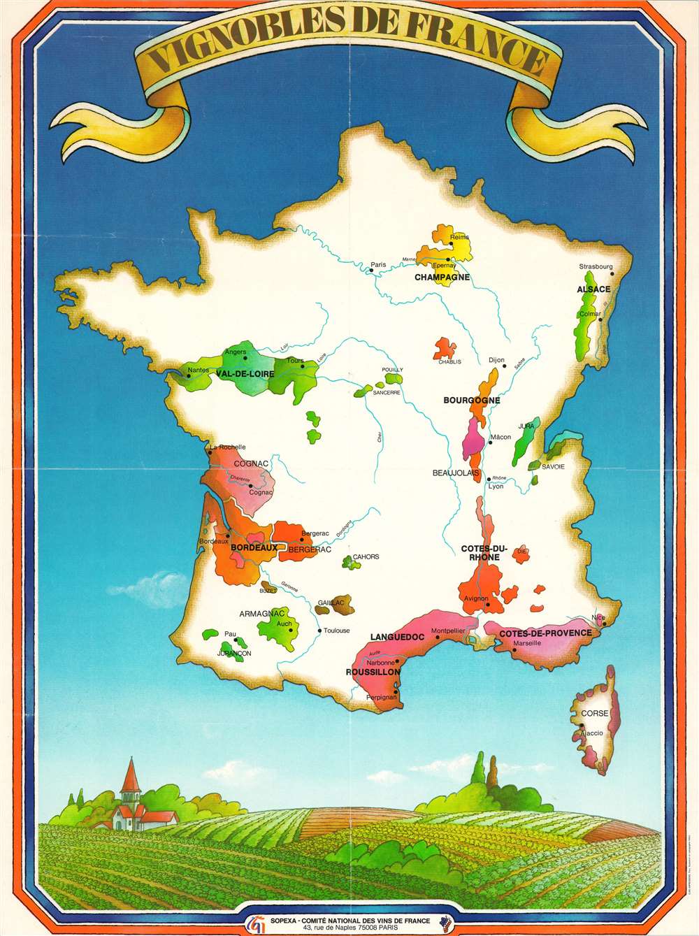
Vignobles de France.
sold
This is a c. 1970 SOPEXA and Comité national des vins de France map of France and its wine regions. Over a dozen prominent French wine regions are highlighted using different colors, including Champagne, Bordeaux, Côtes-du-Rhone, Val-de-Loire, Côtes-de-Provence, Bourgogne, and Beaujolais. Smaller regions, including Chablis, Jura, and Savoie are labeled as well. Aditionally, the areas where Cognac and Armagnac are distilled appear as well. France's rivers are illustrated and its major cities, such as Paris, Lyon, Bordeaux, Nice, Marseille, and Avignon. A charming illustration of a French vineyard decorates the bottom border. (more details)
Chinese Mao Zedong propaganda celebrating the French student strike and general strike of May 68.

法国人民革命斗争示意图 / Sketch of the Revolutionary Struggle of the French People. 法国地图 / Map of France.
sold
This is a May 1968 Communist Chinese propaganda broadside map of France, celebrating the 'May 68' French student and general strikes. Published by the Xinhua Bookstore, maps of France are printed on both sides. A map with icons celebrating the students and workers striking throughout France appears on one side. The worker and the student are illustrated arm in arm; icons of trains, ships, and airplanes allude to the complete standstill imposed upon France's transportation network by the strikes. A proclamation attributed to Mao Zedong and accompanied by his portrait is emblazoned across the top and declares the 'awakening' of the proletariat and workers worldwide alongside the imminent demise of U.S. imperialism and other 'pests.' The broadside then goes on to detail how the French 'have set off a huge storm of revolutionary struggle' and that 'more than 10 million workers have launched a strike that shocked the capitalist world.' An inset on the left situates France in Europe, providing its Chinese audience with some idea of where this struggle is taking place. The map of France on the verso details the French railway system, and another quotation from Mao predicts the imminent collapse of colonialism, imperialism, and all exploitation systems. (more details)
An iconic radio show illustrated!

Welcome to Simmons Corners Tucker County Where Radio's Little Orphan Annie Has Had So Many Thrilling Adventures.
sold
- Digital Map Information
- Suitable for large format printing
- Full resolution TIFF file
- ICC color profile embedded
- Delivered instantly via download link
An uncommon 1936 map of the idyllic fictional town of Simmons Corners, Tucker County, made popular by the Little Orphan Annie radio show. The radio show, based upon a newspaper comic strip by the same name by Harold Gray, was set in the fictional rural American community of Simmons Corners. Praised as being the oldest American children's radio program, the show was released in 1931 and ran until 1942. While Gray's original comic was often charged with political content, the radio show, which was sponsored by Ovaltine, was largely an advertisement for that product, the promotion of which consumed nearly half of each 15-minute episode. Nonetheless, the show became enormously popular with children across the country. Ovaltine further capitalized on the show by introducing a series of 'premiums' obtainable only by mail with a set number of 'proofs of purchase.' Among the premiums were coffee mugs, secret decoder rings, and this 1936 map of Annie's stomping ground, Simmons Corners. The map is accompanied by its original shipping envelope addressed to one Mary Aldlaned of Spring Grove, Pennsylvania. (more details)
Created by noted Arctic explorer Knud Rasmussen.

Routes of Dr. Rasmussen's Fifth Thule Expedition 1921 - 1924.
sold
- Digital Map Information
- Suitable for large format printing
- File Size: 4.51 MB
- File Type: ZIP / TIFF
- ICC color profile embedded
- Delivered instantly via download link
This is a 1926 Knud Rasmussen map of the Arctic and the Fifth Thule Expedition. Depicting the region from Siberia to Iceland and from the North Pole to Churchill, Canada, on Hudson Bay, eight routes record separate parts of the expedition. A key in the lower left presents the various patterns employed to differentiate between these lines and specify which explorer's exploits are traced. Individual islands throughout the Arctic Ocean are labeled, along with bays, peninsula, inlets, and other coastal features. Rivers and lakes in Canada are also illustrated. (more details)
A beautiful map that belies Grenada's violent 18th century.
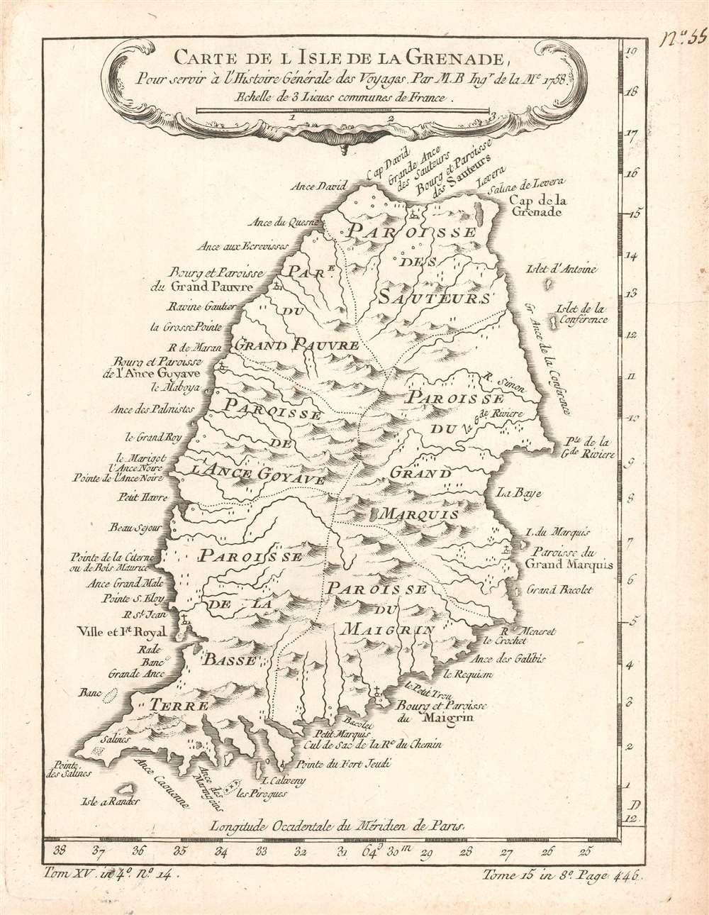
Carte de l'Isle de la Grenade. Pour servir à l'Histoire Générale des Voyages.
sold
- Digital Map Information
- Suitable for large format printing
- Full resolution TIFF file
- ICC color profile embedded
- Delivered instantly via download link
This is a 1780 Jacques-Nicolas Bellin map of Grenada. Depicting the entire island, coastal points, islands, and harbors are labeled. The island is divided into parishes and its many rivers and mountains are illustrated. Fort Royal, the French colonial capital, is labeled. (more details)
The only known unmounted North American globe gores from an extremely rare 17th century globe.
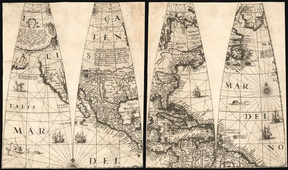
[Four Untitled Globe Gores on Two Sheets]
sold
- Digital Map Information
- Suitable for large format printing
- Full resolution TIFF file
- ICC color profile embedded
- Delivered instantly via download link
A once-in-a-lifetime addition to a collection: the sole known example of this quartet of globe gores, printed in 1623 by Jodocus Hondius II and Jan Jansson for the construction of their 17-inch globe. These four globe gores cover all of North America. The only known copies of these loose gores, they represent a remarkable survival and present unique geographical data. This is the earliest acquirable depiction of North America to show a specific Great Lake based on actual report, and features a unique depiction of the Saint Lawrence River. It contains a remarkable delineation of the American Southwest, with a correct depiction of its rivers not typical for Dutch maps of the period. Such features can be ascribed to the globe being a new work by Jodocus Hondius II and his brother-in-law Jansson, rather than derivative of the elder Hondius, or indeed any other acquirable work of his or their own. (more details)
Extraordinary Spanish military map of the Philippines.

Carta Itineraria de la Isla de Luzon por el Teniente Coronel de E. M. del Ejercity de Filipinas.
sold
- Digital Map Information
- Suitable for large format printing
- Full resolution TIFF file
- ICC color profile embedded
- Delivered instantly via download link
A very rare and important large-scale 6-color chromolithograph 1882 map of Luzon and Manila, the Philippines, by the Spanish military engineer Anselmo Olleros y Mansilla. The map details all of Luzon as well as the surrounding waters. It is color coded by political-military districts (as defined by the Spanish administration) and shows proposed railroads, telegraph stations, existing roads broken down by grade, and more. Topography is illustrated throughout using delicate shading with mountain peaks labeled in red. (more details)
Tappan Adney's manuscript proof of his 1898 overland map to the Klondike. A one-of-a-kind addition to any Yukon Gold Rush Collection.
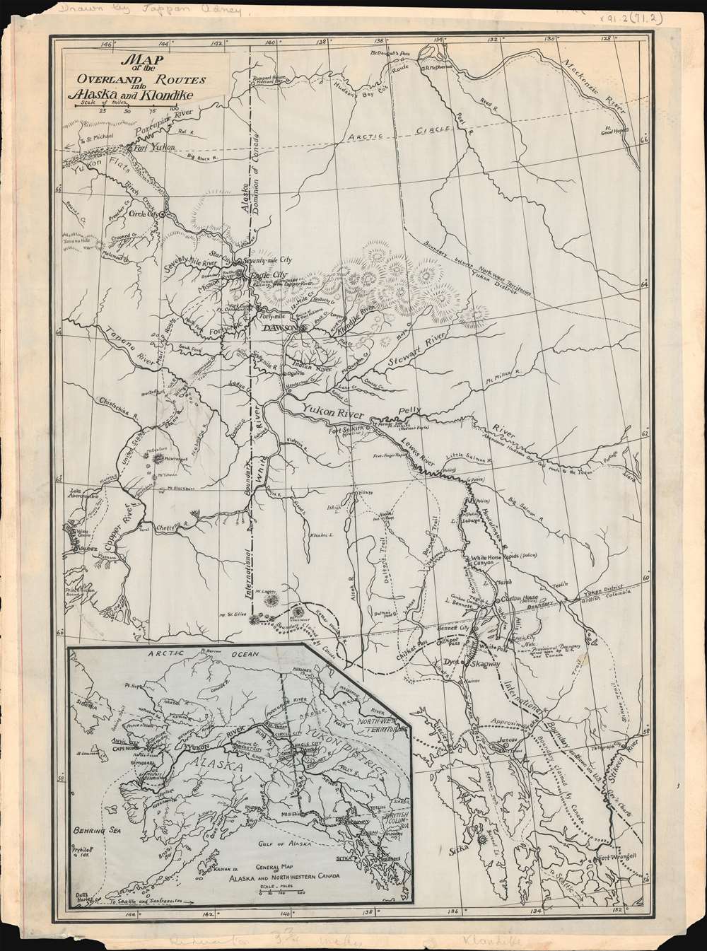
Map of the Overland Routes into Alaska and Klondike.
sold
- Digital Map Information
- Suitable for large format printing
- File Size: 5.37 MB
- File Type: ZIP / TIFF
- ICC color profile embedded
- Delivered instantly via download link
A remarkable discovery and highly important Klondike Gold Rush (1896 - 1899) map, this is a one-of-a-kind 1897-1898 original manuscript (hand drawn) proof of journalist Edwin Tappan Adney's map illustrating the overland route to the Yukon and Klondike River. The map covers from Sitka north to Fort Yukon, the Porcupine River, and the Mackenzie River - all just north of the Arctic Circle. In the process it covers various routes to the Klondike Goldfields, as well as river courses and topography, identifying trading posts, territorial claims, proposed railway routes, indigenous villages and forts. (more details)
Russian and Japanese conflict over railway rights in Manchuria.
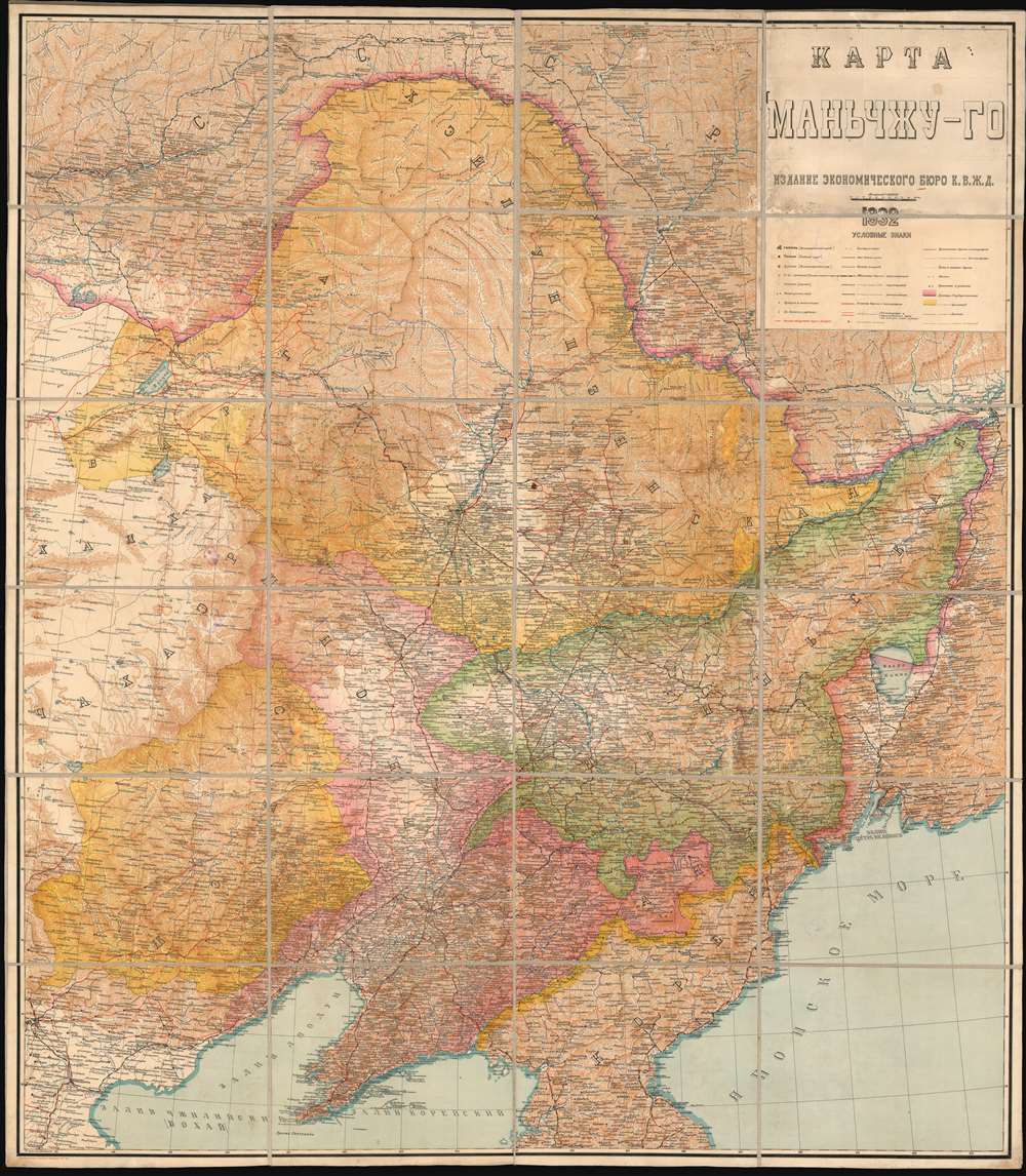
КАРТА МАНЬЧЖУ-ГО. / Manchu-Go Map.
sold
- Digital Map Information
- Suitable for large format printing
- Full resolution TIFF file
- ICC color profile embedded
- Delivered instantly via download link
This is a 1932 wall map of Manchuria or Manchukuo published by the Economic Bureau of the Chinese Eastern Railway (abbreviated K.V.Zh.D. in Russian). Entirely in Russian, the map depicts Manchukuo, the name giving to the Japanese puppet state established after the 1932 Japanese invasion of Manchuria. This railroad map was published by the Soviet division of the Chinese Eastern Railway, a vital transport artery critical to Soviet ambitions in East Asia. These railways, the Trans-Siberian Railway and the Chinese Eastern Railway (also known as the Trans-Manchurian Railway), played a pivotal role in the geopolitical upheavals in East Asia during the early 20th century. The publication of this piece by the Soviets, the year Manchukuo was established, underscores the significance control of the railroads had on Soviet psyche and perhaps their premonitions of what was to come. (more details)
An ephemeral period in the American West following the Kansas-Nebraska Act.
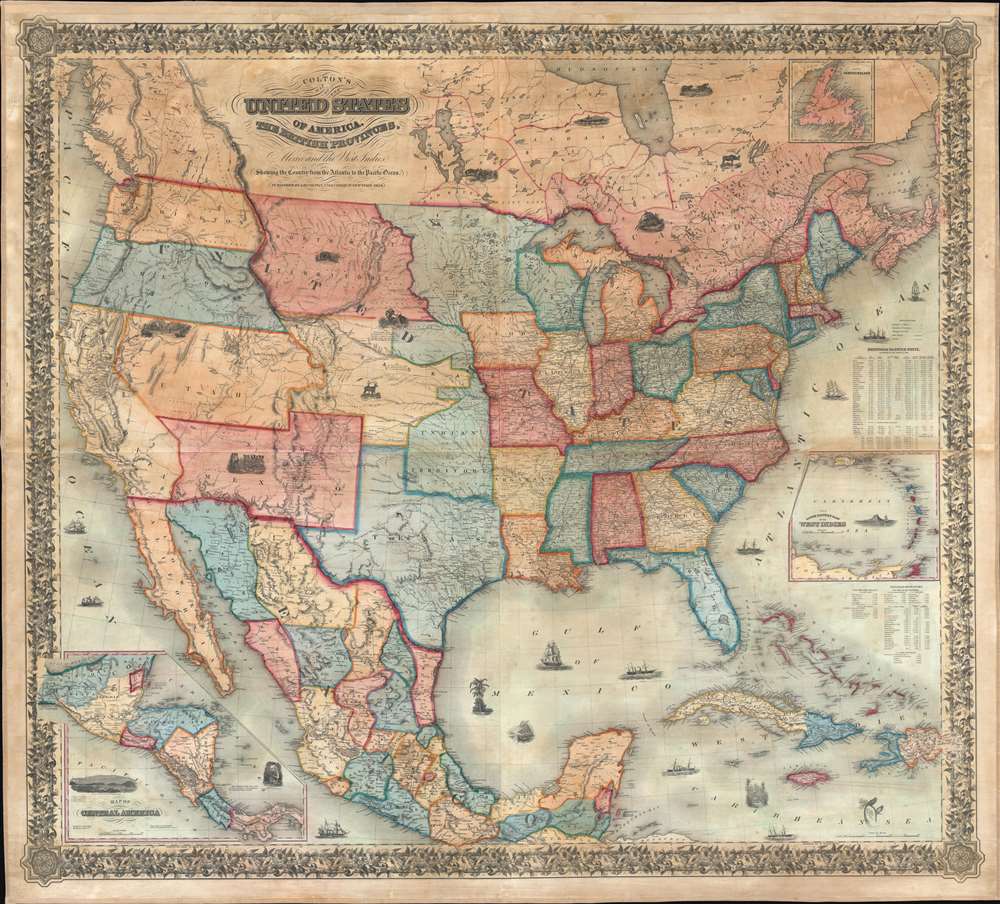
Colton's map of the United States of America, the British provinces, Mexico and the West Indies. Showing the country from the Atlantic to the Pacific Ocean.
sold
- Digital Map Information
- Suitable for large format printing
- DPI: 600
- File Size: 205.98 MB
- File Type: ZIP / TIFF
- ICC color profile embedded
- Delivered instantly via download link
This is a large 1854 J. H. Colton wall map of the United States with significant Trans-Mississippi and Great Plains content. This is the largest and most significant of the three separate issue maps of the United States Colton issued in the 1850s. It covers the entire United States as well as most of Mexico, parts of southern Canada, and the Greater Antilles. Central America and the lower Antilles appear in insets. There are numerous ethnographical, geographical, and historical vignettes throughout including a wagon train, American Indians hunting, ships, palm trees, volcanoes, and more. (more details)
1st geological map of the United States.
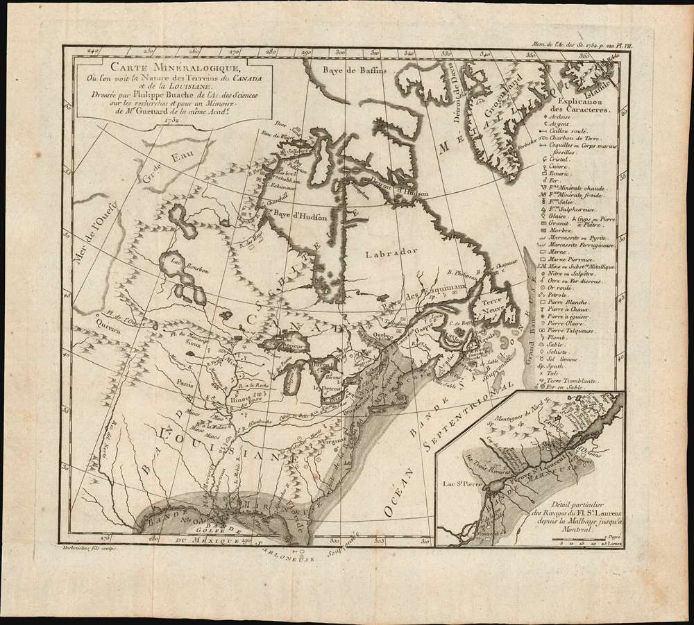
Carte minéralogique, où l'on voit la Nature des Terreins du Canada et de la Louisiane.
sold
- Digital Map Information
- Suitable for large format printing
- Full resolution TIFF file
- ICC color profile embedded
- Delivered instantly via download link
An object of considerable rarity and significance, this is the first geological map of the United States, drawn by Philippe Buache and published in 1752 by Jean-Étienne Guettard. The map covers the eastern part of the modern-day United States and Canada from the Rio del Norte (Rio Grande) and the apocryphal 'Mer de L'Ouest' (Sea of the West) to the Atlantic seaboard, Greenland, and the Grand Banks. The map was part of Guettard's curious presentation issued at the Paris Académie Royale des Sciences comparing the geography of North America to the geography of Switzerland. The report also contained, therefore, the first geological map of Switzerland. (more details)
Wonderful board game of Jules Verne's 'Around the World in Eighty Days.'

Le Tour du Monde en Quatre-Vingts Jours. J. Verne.
sold
- Digital Map Information
- Suitable for large format printing
- File Size: 19.36 MB
- File Type: ZIP / TIFF
- ICC color profile embedded
- Delivered instantly via download link
This is an 1875 Pierre-Jules Hetzel board game map of Jules Verne's novel Around the World in Eighty Days, or as it is known in French Le Tour du monde en quatre-vingts jours. A map of his adventures adorns the center of the board and traces his journey from London around the world back to London. Two concentric circles, divided into eighty even wedges, surround the central map and create the field of play. Eighty different illustrations adorn each wedge and highlight a separate event, place, or character within the book. In the book, an English gentleman named Phileas Fogg reads in a London newspaper that it is now possible to travel around the world in eighty days. Immediately, he makes a bet that he could travel around the world in eighty days with other members of his social club. The proposed itinerary included stops in Bombay, Hong Kong, San Francisco, and New York, and all these cities appear along the board. Other cities, not promoted by the newspaper but places where Fogg encounters difficulties, including Turin, Singapore, Alexandria, and Omaha, are illustrated as well. Some of his modes of transportation, including trains and sailing ships, add to the board's attraction, along with his more exotic transportation choices, such as elephants and camels, add fantastic textual references. Two portraits of Phileas Fogg, one of his valet Passepartout, and one of Fix, the police officer tracking Fogg across the world, contribute detail, along with views of other events within the book. (more details)
A beautiful maritime chart of southern England.
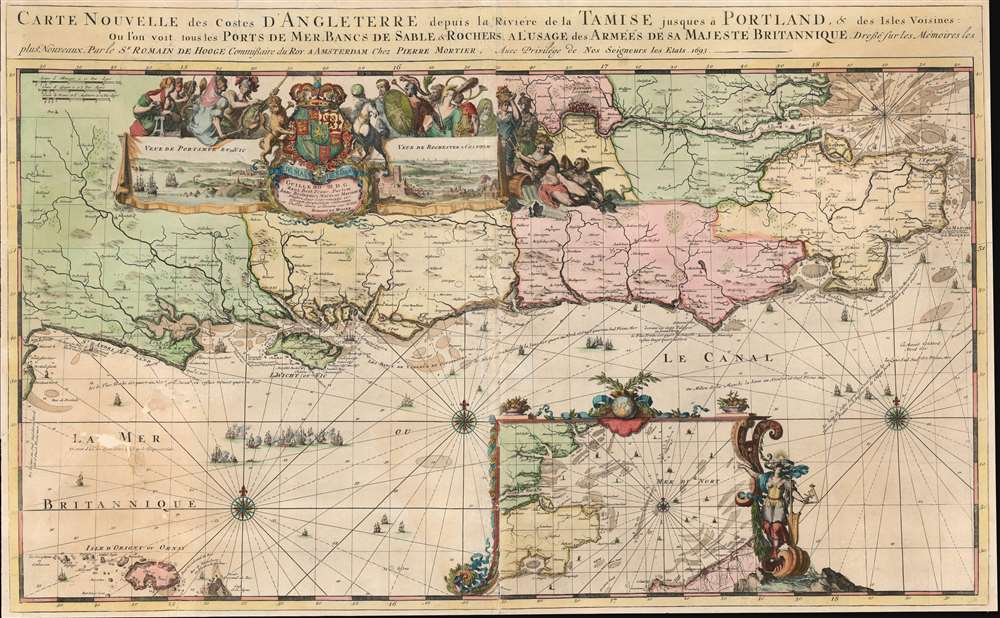
Carte Nouvelle des Costes d'Angleterre depuis la Riviere de la Tamise jusques à Portland, et des Isles Voisines: Ou l'on voit tous les Ports de Mer, Bancs de Sable et Rochers. A l'Usage des Armées de sa Majesté Britannique.
sold
- Digital Map Information
- Suitable for large format printing
- Full resolution TIFF file
- ICC color profile embedded
- Delivered instantly via download link
This is a 1693 Romeyn de Hooghe map of the southern coast of England including the Thames estuary and London. The map depicts from the Isle of Portland east to the Thames estuary and from London to Aldernay, including the Isle of Wight. Cities and towns are labeled throughout. An inset along the bottom border focuses on southeastern England and the North Sea along with northeastern France around Calais and Dunkirk. A decorative cartouche appears in the upper left quadrant and includes views of Portsmouth and Rochester. Wonderfully decorated with compass roses and rhumb lines, this chart is part of a group of nine charts created by de Hooghe and published by Mortier, all of which are regarded as the most decorative sea charts of the 17th century. (more details)
Innovative, if incorrect, theories about the world's mountain ranges.
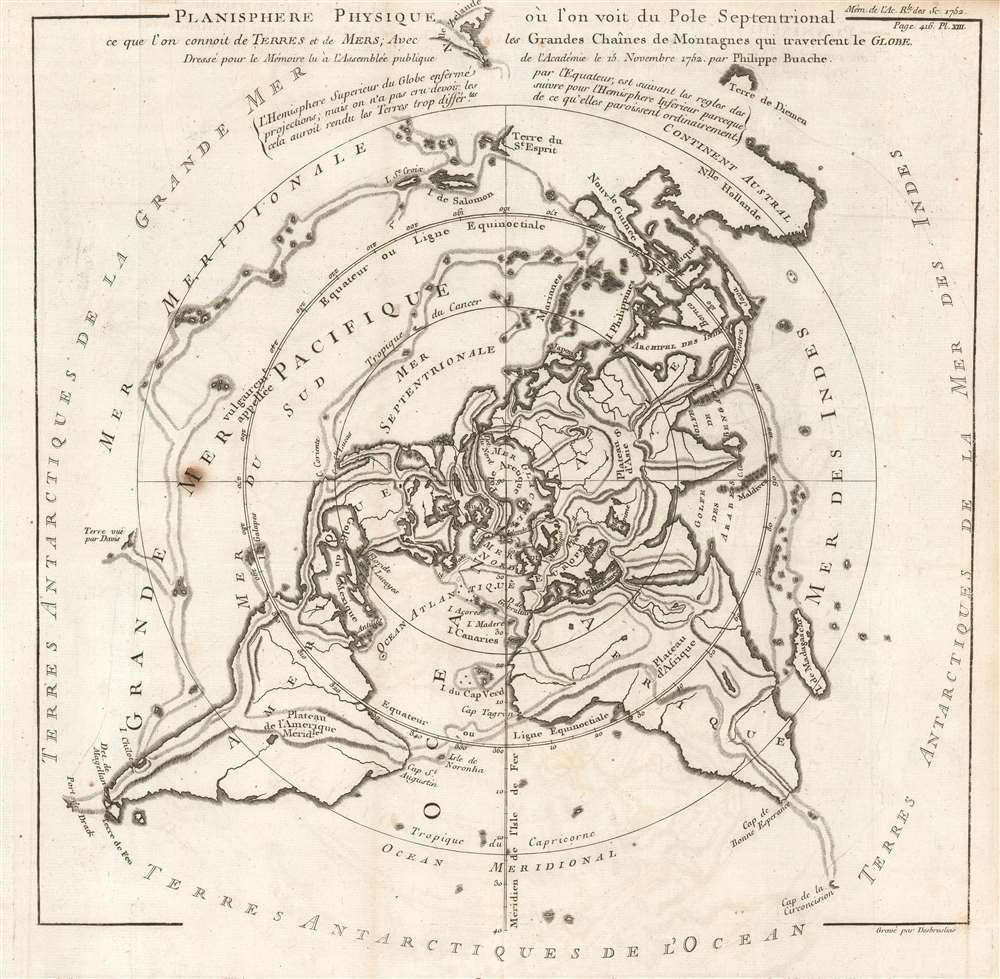
Planisphere Physique où l'on voit du Pole Septentrional ce que l'on connoit de Terres et de Mers; Avec les Grandes Chaînes de Montagnes qui traversent le Globe.
sold
- Digital Map Information
- Suitable for large format printing
- Full resolution TIFF file
- ICC color profile embedded
- Delivered instantly via download link
This is a beautiful 1752 Philippe Buache map of the world represented on an unusual polar projection rendered from the North Pole. The map covers from the North Pole Arctic region south beyond Tasmania (Van Diemen's Land) to include parts of New Zealand and even Cap de la Circoncision (Bouvet Island). (more details)