
The first printed example of a Babinet / Mollweide Projection?
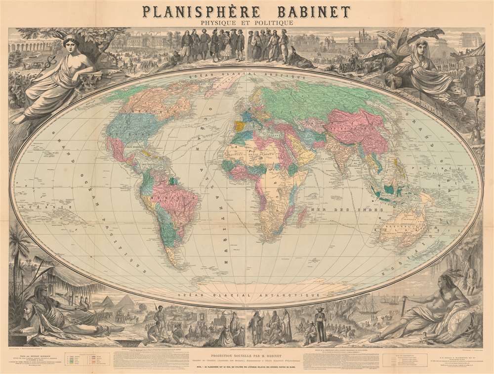
Planisphère Babinet Physique et Politique.
sold
- Digital Map Information
- Suitable for large format printing
- File Size: 192.9 MB
- File Type: ZIP / TIFF
- ICC color profile embedded
- Delivered instantly via download link
A stunning c. 1860 wall-sized map of the world on a Mollweide or Babinet Projection surrounded by elaborate allegorical imagery. Our research suggests this is one of the earliest, if not the earliest, published example of a Mollweide Projection. The map is centered on Europe and is, indeed, Eurocentric, with color coding intended to represent colonial claims around the world. Tracks at sea illustrate popular maritime routes across the Atlantic and to various points, around Africa, and to Australia, China, and the East Indies. Text at bottom center by Victor Adolphe Malte-Brun (1816 - 1889) and Hermann Berghaus (1828 - 1890), the preeminent geographers of the day, praise the usefulness and practicality of the Mollweide / Babinet projection. (more details)
Extremely rare Spanish nautical chart of Florida and the Gulf of Mexico with mansucript annotations. Associated with the Trienio Liberal and Spanish democracy.
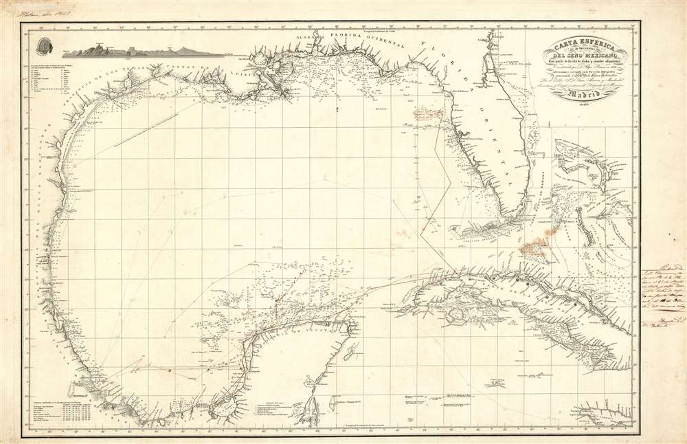
Carta Esferica de la costas del seno Mexicano Con parte de la isla de Cuba y canales adjacentes.
sold
- Digital Map Information
- Suitable for large format printing
- DPI: 600
- File Size: 56.35 MB
- File Type: ZIP / TIFF
- ICC color profile embedded
- Delivered instantly via download link
This is a finely engraved and rare 1836 Spanish Depósito Hidrográfico nautical chart or maritime map by Felipe Bauzá detailing the western Caribbean, the Gulf of Mexico, Florida, the Bahamas, and Cuba. The chart contains interesting manuscript annotations regarding Spanish naval traffic in the region and a defaced London imprint, indicative of political turmoil in Spain and the author's exile. (more details)
A promotional pictorial map highlighting the Spanish Main and the history of the Americas.
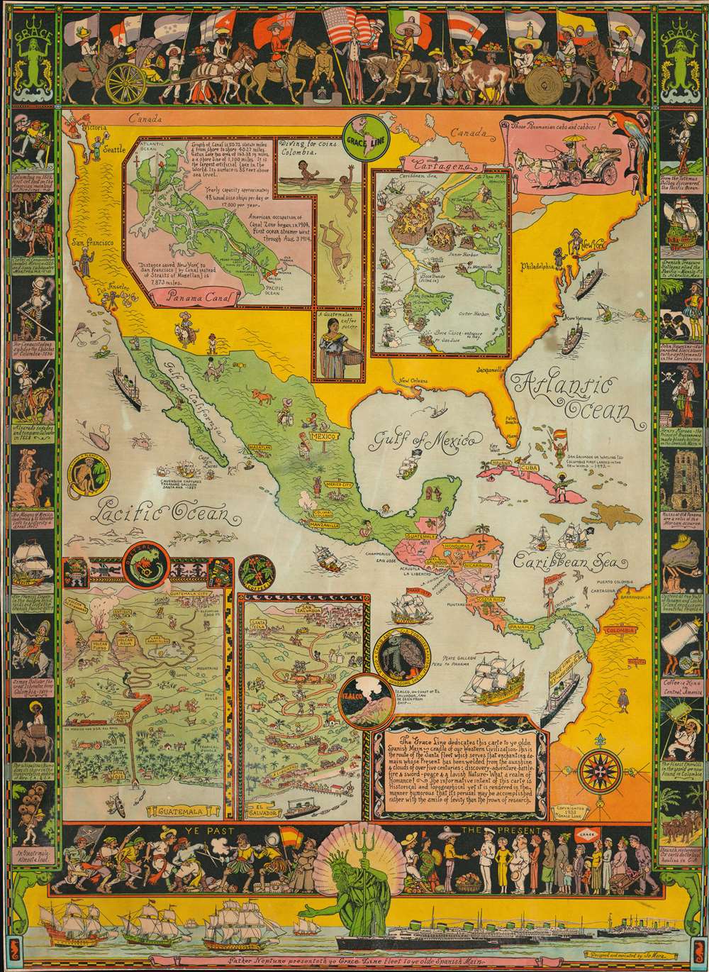
Father Neptune presenteth ye Grace Line fleet to ye olde Spanish Main.
sold
This is a rare 1933 Jo Mora pictorial map of Central America commissioned by the Grace Line to celebrate and advertise its newly-launched passenger service from New York City to Seattle via the Panama Canal. Focused on Central America, the map depicts North, Central, and South America and focuses on ports of call of the Grace Line. The whole map is dedicated to the memory of the Spanish Main, which is referred to as the 'cradle of our Western Civilization'. Mora also includes a disclaimer of sorts just below this dedication, stating 'The informative intent of this carte is Historical and Topographical yet it is rendered in the manner humorous that its perusal may be accomplished rather with the smile of levity than the frown of research'. (more details)
Beautiful chromolithograph map of the New York - Lake George - Lake Champlain - Montreal route.

Showing the Route of the Champlain Transportation Co's Steamers. The Gateway of the Country.
sold
- Digital Map Information
- Suitable for large format printing
- File Size: 52 MB
- File Type: ZIP / TIFF
- ICC color profile embedded
- Delivered instantly via download link
A stunning 1898 chromolithograph map illustrating the routes of the Champlain Transportation Company. The map covers the briskly travelled Hudson Valley / Lake Champlain corridor between New York City and Montreal, extending eastward to the Atlantic to include Portland, Portsmouth, and Boston. While the focus of the map are the ferry routes through Lake George and Lake Champlain, the map also illustrates railroad lines operating by the Champlain Transportation Company to various points in the Adirondacks, Green Mountains and White Mountains. Competing but connecting railroad lines appear in black. The mountainous regions are highlighted to suggestive that these destinations are cool summer resorts. (more details)
Map of Texas at the moment of Annexation.
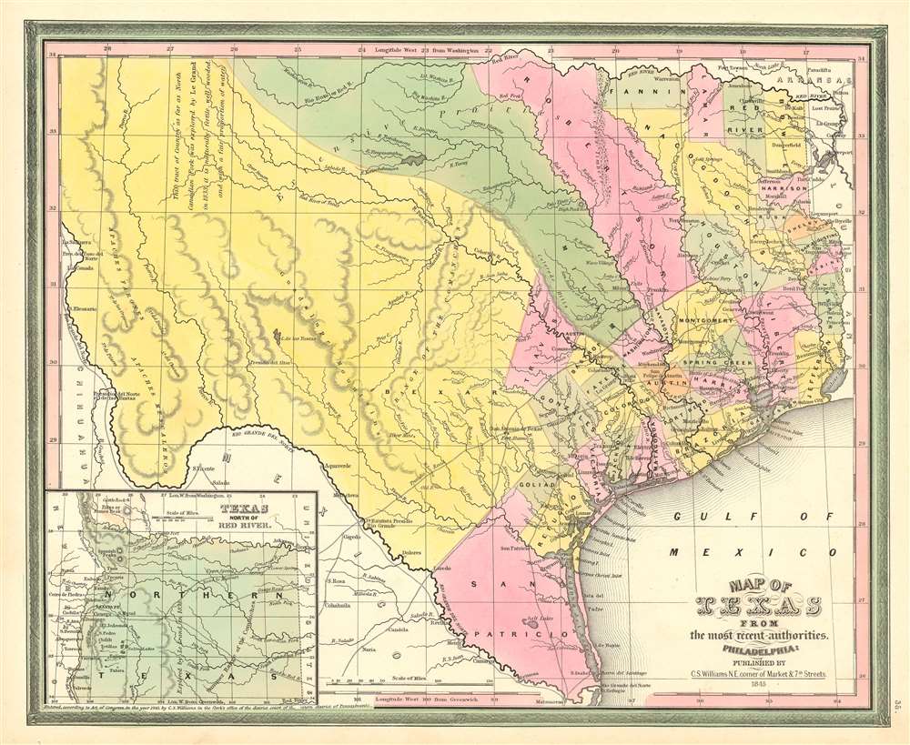
Map of Texas from the most recent authorities.
sold
- Digital Map Information
- Suitable for large format printing
- DPI: 600
- File Size: 14.99 MB
- File Type: ZIP / TIFF
- ICC color profile embedded
- Delivered instantly via download link
A rare 1845 / 1846 first edition example of the C. S. Williams / J. H. Young / S. A. Mitchell map of Texas published in the final days of the Republic of Texas just at Texas was preparing to join the United States. Coverage includes Texas at its fullest extent, reaching from the Santa Fe and the Rio Grande del Norte to the Sabin River and extending as far north as the Arkansas River (plus a stovepipe encompassing the Green Mountains not fully illustrated). Northwestern Texas is incorporated via an inset in the lower left. (more details)
A separate issue nautical chart centered on Hilton Head Island.

Coast Chart No. 155 Coast of South Carolina and Georgia From Hunting Island to Ossabaw Island Including Port Royal Sound and Savannah River.
sold
- Digital Map Information
- Suitable for large format printing
- File Size: 98.25 MB
- File Type: ZIP / TIFF
- ICC color profile embedded
- Delivered instantly via download link
This is a scarce separate issue 1890 nautical chart or maritime map of the U.S. coast between Savannah, Georgia and Port Royal Sound, South Carolina. Oriented with northwest at the top and centered on Hilton Head Island, the chart covers from the Vernon River to St. Helena Island, including the Port Royal Sound, Hilton Head Island, Tybee Island, the Savanna River, and Savanah itself. Exemplifying the height of U.S.C.S. mapmaking, this chart offers outstanding detail throughout, including Savannah's unique street grid and numerous islands of varying size. The rivers, sounds, and Atlantic Ocean are full of countless depth sounding and shading is employed in indicate shallow areas and shoals. Beaufort, South Carolina is illustrated and labeled, as are several railroads, including the Port Royal Railroad, the Central Railroad of Georgia, and the Savannah, Florida, and Western Railroad. Other communities, such as Bluffton, are also identified. Information concerning tides, lighthouses and beacons, soundings, buosy, and abbreviations used is situated along the left border. (more details)
Includes Sapelo Island, Turtle Island, Ossabaw Island, Blackbeard Island, and St. Catherine's Island
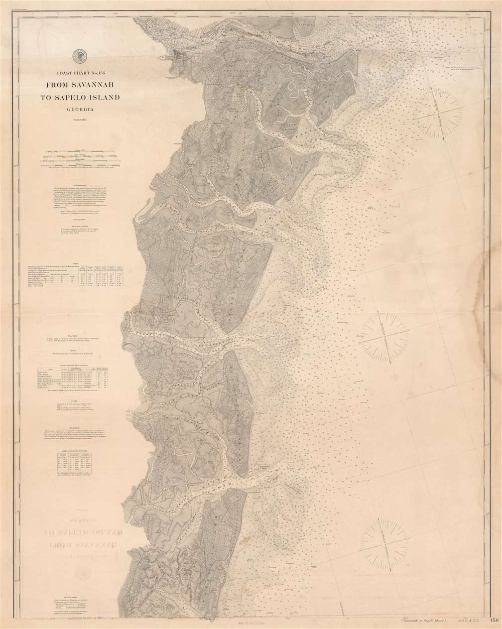
Coast Chart No. 156 From Savannah to Sapelo Island Georgia.
sold
- Digital Map Information
- Suitable for large format printing
- File Size: 96.35 MB
- File Type: ZIP / TIFF
- ICC color profile embedded
- Delivered instantly via download link
This is an 1889 U.S. Coast Survey nautical chart or maritime map of the coast of Georgia. Providing a detailed depiction of the maze of rivers, creeks, and islands that create this portion of the American coast, the map illustrates from Hutchinson's Island in the Savannah River to the Atlantic Ocean and from Turtle Island to Sapelo Island. Islands of varying size are identified all along the coast, including Tybee Island, Skiddaway Island, Wassaw Island, Ossabaw Island, St. Catherine's Island, and Sapelo Island. Myriad depth soundings are provided in the Atlantic and along most of the region's rivers and creeks. Savannah is situated illustrated near the top border with the Central Railroad of Georgia, the Savannah and Tybee Railroad, and the Savannah, Florida, and Western Railroad all illustrated in the immediate vicinity. Information concerning tides, lighthouses, beacons, buoys, and soundings is all included along the left border. This chart could potentially be joined with another chart available through Geographicus: SapeloIslandAmeliaIsland-uscgs-1877. (more details)
A charming pictorial map of Florence featuring profile illustrations of the city's iconic buildings.
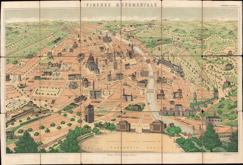
Firenze Monumentale.
sold
- Digital Map Information
- Suitable for large format printing
- File Size: 39.16 MB
- File Type: ZIP / TIFF
- ICC color profile embedded
- Delivered instantly via download link
This is a c. 1900 Emilio Tarchi pictorial tourist map of Florence, Italy highlighting the historic city's most iconic buildings. Beautifully rendered, the map depicts the city from the Piazza Cavour to the Porta Romana and from the Viale Michelangiolo to the Piazzale Vittorio Emanuele II. The Cathedral of Santa Maria del Fiore, the Basilica of Santa Croce, and the Palazzo Vecchio are only a few of Florence's celebrated architecture illustrated here. Numerous other buildings are illustrated in a cadastral manner, including the Uffizi Gallery next to the Palazzo Vecchio and the Ponte Vecchio. Others, like the Museum of Natural History, are simply labeled. Roads and plazas throughout the city are identified, including those in the parks surrounding the city. (more details)
Highlight Key West - known for its fantastic snorkeling and scuba diving.

Coast Chart No. 170 Florida Reefs Key West to Rebecca Shoal.
sold
- Digital Map Information
- Suitable for large format printing
- File Size: 66.13 MB
- File Type: ZIP / TIFF
- ICC color profile embedded
- Delivered instantly via download link
This 1889 U.S. Coast and Geodetic Survey nautical chart or maritime map of the Florida Keys depicts this iconic island chain from Key West to Rebecca Shoal. Famous as a tourist destination, Key West is known for its coral reefs and the scuba diving and snorkeling activities associated with the reefs. All the channels heading into Key West are identified, as are the navigation buoys, which are colored and labeled by number. A shipwreck just off Key West is also noted. Numerous other keys, such as Woman Key, Snipe Key, Mule Key, Man Key, and Boca Grande Key, are illustrated west of Key West and labeled. Marquesas Keys is also illustrated and labeled. Myriad depth soundings are indicated throughout, providing important information to the mariner. Information concerning soundings, abbreviations, and buoys is situated in the lower left corner, while notes about the weather signal, the lighthouses, and the tides are included in the lower right corner. (more details)
Depicts Amelia Island and the St. John's River in detail.
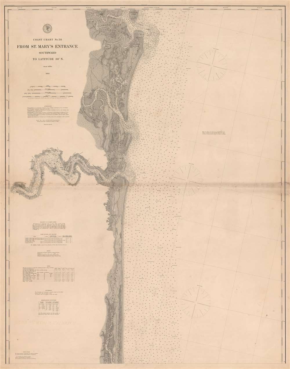
Coast Chart No. 58 From St. Mary's Entrance Southward to Latitude 30 Degrees N.
sold
- Digital Map Information
- Suitable for large format printing
- File Size: 70 MB
- File Type: ZIP / TIFF
- ICC color profile embedded
- Delivered instantly via download link
An incredibly detailed piece, this is an 1882 U.S. Coast and Geodetic Survey nautical chart or maritime map of Amelia Island and St. John's River, Florida. The map depicts the region from Jacksonville to the Atlantic Ocean and from St. Mary's River to 30 degrees north latitude. Myriad depth soundings are indicated throughout, including upstream along most of the region's rivers and creeks. The cities of St. Mary's, Florida, and Jacksonville, Florida are both labeled. Numerous coastal islands are identified, including Amelia Island, Tiger Island, Cumberland Island, and Talbot Island. Islands, points, and creeks are all labeled along the course of the St. John's River from Jacksonville to the river's mouth. Information concerning beacons in the St. John's River, other coastal lighthouses, beacons, and buoys, tides, soundings, and abbreviations used on the chart is all situated along the left border. (more details)
Illustrates modern-day Dry Tortugas National Park.
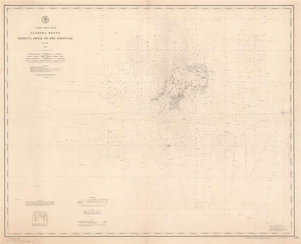
Coast Chart No. 171 Florida Reefs Rebecca Shoal to Dry Tortugas.
sold
- Digital Map Information
- Suitable for large format printing
- File Size: 52.81 MB
- File Type: ZIP / TIFF
- ICC color profile embedded
- Delivered instantly via download link
This is an 1889 U.S. Coast and Geodetic Survey nautical chart of the Dry Tortugas Islands, a group of islands near the end of the Florida Keys. The chart focuses on the Dry Tortugas and depicts the region from west of the island group to Rebecca Shoal. Today, the Dry Tortugas and the surrounding area form the Dry Tortugas National Park. Myriad depth soundings populate the chart, with the greatest concentration about the islands. Each of the keys are labeled, including Loggerhead Key, Long Key, and Bush Key. Fort Jefferson is labeled, as are the light within Fort Jefferson and the light on Loggerhead Key. The channels through the islands are also identified. Information concerning lighthouses, buoys, soundings, and abbreviations used on the chart is situated in the lower left corner. (more details)
Depicts the short-lived 'neutral zone' between the Sioux and the Sauks and Foxes, negotiated by William Clark, half of the duo of Lewis and Clark.
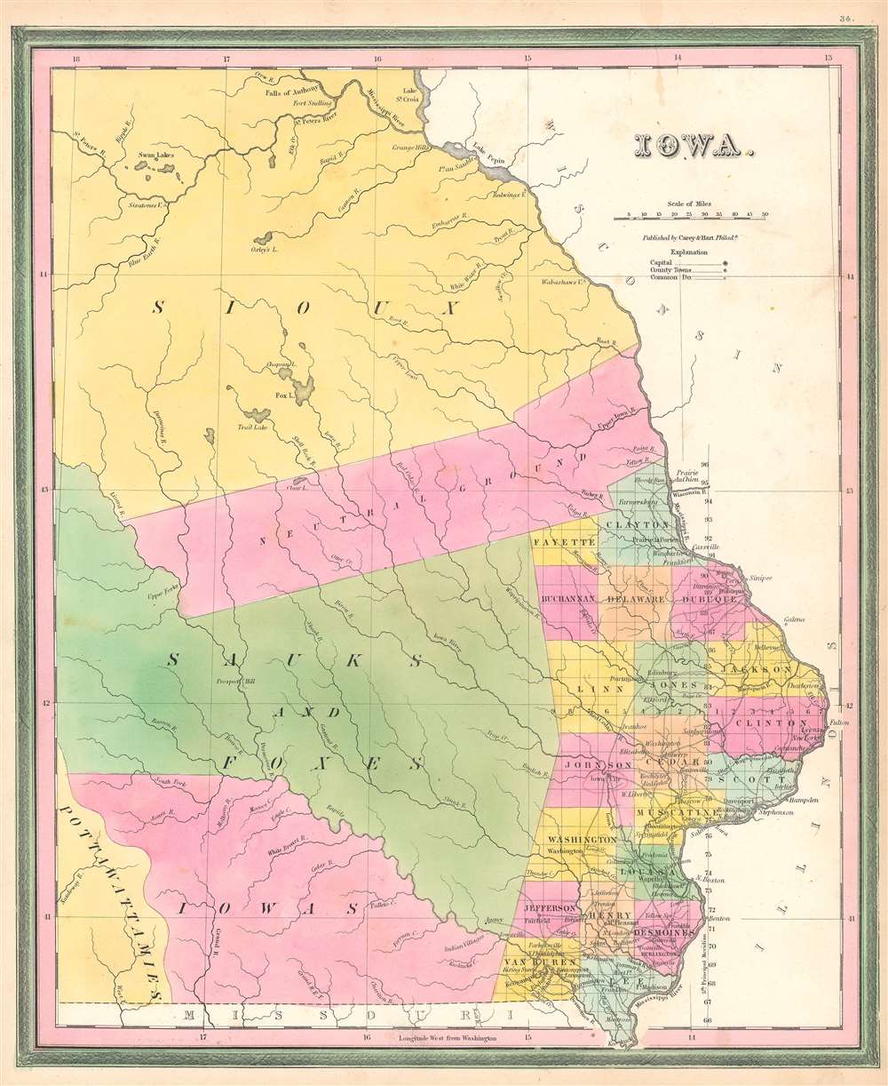
Iowa.
sold
- Digital Map Information
- Suitable for large format printing
- DPI: 600
- File Size: 10.54 MB
- File Type: ZIP / TIFF
- ICC color profile embedded
- Delivered instantly via download link
This is a first edition 1846 Samuel Augustus Mitchell map of Iowa. The map depicts the region from central Iowa to Wisconsin and Illinois and from Lake St. Croix to Missouri. Only the extreme southeastern portion of the territory has been surveyed, with the familiar grid of the Public Land Survey System providing some organization. A handful of counties are illustrated, labeled, and shaded different colors to allow for easy differentiation. Iowa City and Dubuque are labeled, as are several other cities and towns. The rest of Iowa is divided between the Sioux, Sauks and Foxes, Iowas, and Pottawattamies. The only other land here is a 40-mile wide neutral zone of land that was purchased from the Sauk and the Sioux in an effort to establish territorial rights between the tribes. This treaty, agreed to in 1825, was facilitated by William Clark, of Lewis and Clark fame, and the surveying was completed by U.S. Deputy Surveyor Captain Nathan Boone, son of Daniel Boone. (more details)
Includes Carver's Claim - a debunked 18th century land claim that never truly existed.
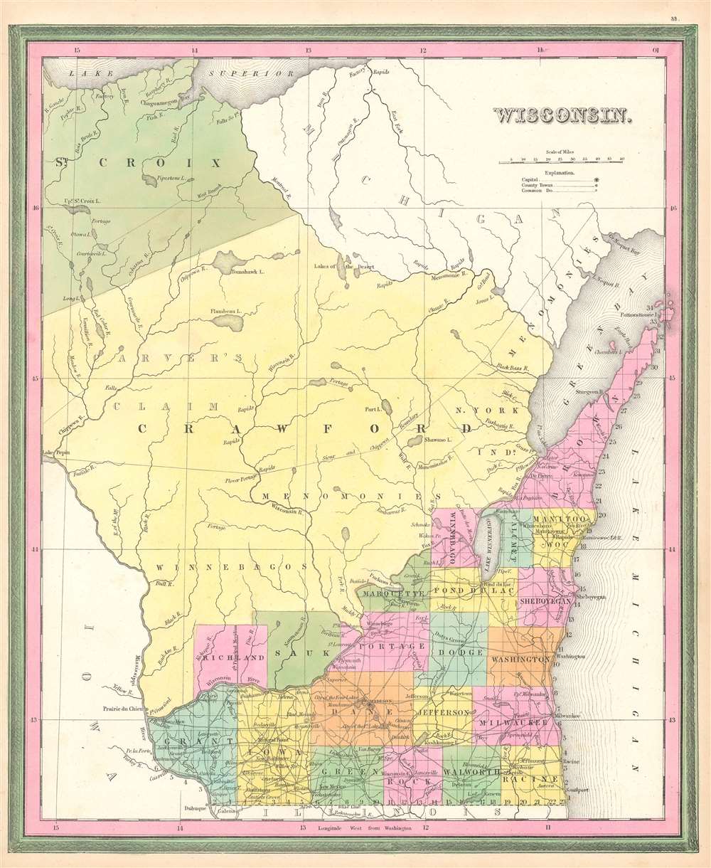
Wisconsin.
sold
- Digital Map Information
- Suitable for large format printing
- DPI: 600
- File Size: 11.9 MB
- File Type: ZIP / TIFF
- ICC color profile embedded
- Delivered instantly via download link
This is a first edition 1846 Samuel Augustus Mitchell map of Florida. The map depicts the region from Lake Pepin to Lake Michigan and from Lake Superior to Illinois and Iowa. At this point in American history, Wisconsin was still a territory and would not be granted statehood until May 29, 1848, over two years after this map was published. Here, only the southeastern portion of Wisconsin is illustrated as having been divided into counties and surveyed. The familiar grid of the Public Land Survey System divides this portion of the territory, while the rest of the territory remains unsurveyed. Counties are labeled and shaded different colors to allow for easy differentiation. Cities and towns are identified, including Madison, Milwaukee, and Sheboygan. Crawford and St. Croix Counties occupy the vast majority of the territory. Crawford County was one of Wisconsin's original counties and originally covered the western half of present-day Wisconsin. It was transferred from Michigan to the newly formed Wisconsin Territory as the former prepared for statehood and was slowly divided until it reached its current size. (more details)
One of the earliest Federal surveys of the Utah Territory.
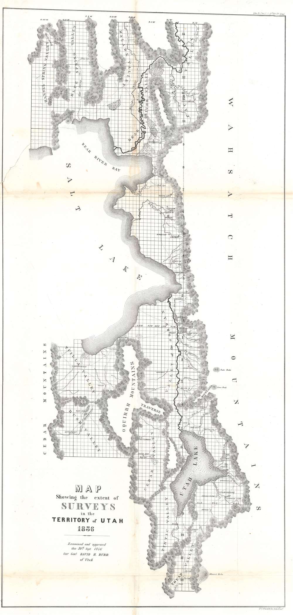
Map Showing the extent of Surveys in the Territory of Utah.
sold
- Digital Map Information
- Suitable for large format printing
- File Size: 21.79 MB
- File Type: ZIP / TIFF
- ICC color profile embedded
- Delivered instantly via download link
An important early map of Utah, this 1856 David Burr map highlights the eastern part of the Great Salt Lake and the vicinity. The map depicts the region from Hansel Spring Valley and the Cedar Mountains to the Wahsatch Mountains and from Malade Valley to Youab Valley. Mountain ranges, lakes, and smaller chains of hulls separate valleys throughout the region. These mountain ranges form the natural parries to the surveys accomplished by David Burr, then the Surveyor General of Utah, and his predecessors. These natural obstacles are the only areas not shown as having been surveyed, noted by the grid of the Public Land Survey System then in use in the United States. Cities, towns, and villages are identified as well, including Salt Lake City, Ogden, and Provo. (more details)
Highlights the island's wonderful tourist activities including its many golf courses.

Bermuda Islands.
sold
- Digital Map Information
- Suitable for large format printing
- File Size: 18.95 MB
- File Type: ZIP / TIFF
- ICC color profile embedded
- Delivered instantly via download link
This is a c. 1927 Clarence Hornung pictorial tourist map of the Bermuda Islands. The map depicts the region from Southampton County to Saint David's Island and from Ireland Island to the Atlantic Ocean. As this is a tourist map, the pictorial vignettes tend to mark the numerous hotels and other attractions important to fair-weather tourists, such as golf courses and beaches. The racetrack and causeway are also illustrated, as are St. Catherine Point and Murray's Anchorage on St. George Island. The military barracks in Devonshire, most likely not on the average tourist's itinerary, is also noted. Each of the nine counties are illustrated and labeled. Towns are also noted. Inset maps along the top border detail the towns of Hamilton and St. George. (more details)
Extraordinary early map of the Upper West Side of Manhattan.
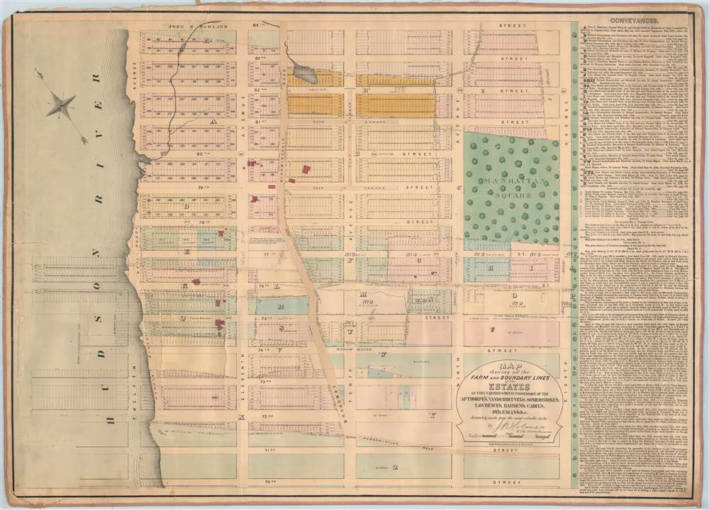
Map showing all the Farm and Boundary Lines of the Estates as they existed when in possession of the Apthorpe's, Vanderheuvel's, Sommeridike's, Lawrence's, Harsen's, Cadel's, Dykeman's and c.
sold
- Digital Map Information
- Suitable for large format printing
- File Size: 62.81 MB
- File Type: ZIP / TIFF
- ICC color profile embedded
- Delivered instantly via download link
One of only 3 known examples of John Bute Holmes's c. 1874 cadastral map of the Upper West Side of Manhattan. The map covers from 70th street to 84th street and from the Hudson River to Central Park, including Manhattan Square, where the American Museum of Natural History would be constructed in 1874. This area comprises the earliest developed part of the Upper West Side and, with the construction of Central Park, flourished as one of Manhattan's most desirable neighborhoods. (more details)
Paris after the Haussmann Renovations at the height of the Second Empire.

Paris Vue Générale Prise au Dessus de L'Entrée du Jardin ds Tuileries Le Nouveau Louvre, La Rue de Rivoli et Les boulevards.
sold
- Digital Map Information
- Suitable for large format printing
- File Size: 120.04 MB
- File Type: ZIP / TIFF
- ICC color profile embedded
- Delivered instantly via download link
An utterly captivating 1867 large-format lithograph view of Paris by Michel-Charles Fichot and Rose-Joseph Lemercier. The view looks southwest on Paris from hypothetical position above the Bassin Octagonal in the Jardin des Tuileries. The Louvre appears front and center, with the Rue de Rivoli on its left and the Seine on tis right. Notre Dame and the Ile de Cité, the Hôtel de Ville, Tour St. Jacques, and other monuments are apparent. (more details)
Full color foe of Dover, New Hampshire!

Bird's Eye View of Dover Strafford Co. New Hampshire looking southwest 1877.
sold
- Digital Map Information
- Suitable for large format printing
- File Size: 75.71 MB
- File Type: ZIP / TIFF
- ICC color profile embedded
- Delivered instantly via download link
A stunning 1877 Albert Ruger three-color chromolithograph view of Dover, New Hampshire, set against a backdrop the rolling hills of southern New Hampshire. The view looks southwest on Dover from a hypothetical high point well above Garrison Hill. With a sufficiently altitudinous perspective to present a map-like layout of Dover, the view centers on the Cocheco River and extends broadly in all directions, revealing a bustling mill town at its height. The Boston and Maine Railroad enters town from the lower left corner. The T-shaped Washington Street Mills, at a sharp bend in the Cocheco River, still stands and now hosts a variety of businesses, restaurants, galleries, and even a church. (more details)
Features manuscript notations detailing ammunition dumping and military exercises.

West Indies. Puerto Rico.
sold
- Digital Map Information
- Suitable for large format printing
- File Size: 46 MB
- File Type: ZIP / TIFF
- ICC color profile embedded
- Delivered instantly via download link
This is a 1950 British Admiralty nautical chart or maritime map of Puerto Rico featuring manuscript notations detailing military exercises and underwater ammunition dumps. The chart depicts the region from Mona Island to St. Thomas and St. Croix and from 19 degrees north latitude to almost 17 degrees north latitude. (more details)
A pictorial map of Iran published either by or for the U.S. military.
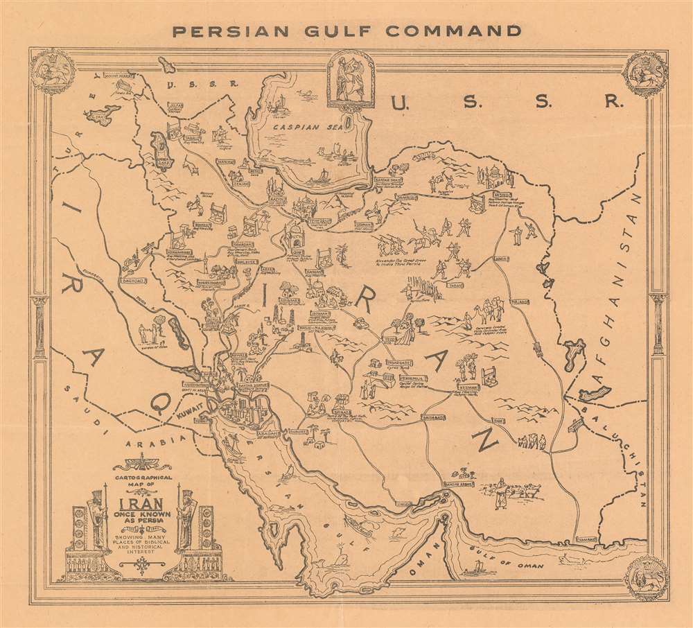
Cartographical Map of Iran Once Known as Persia 1322 - 1944 Showing Many Places of Biblical and Historical Interest.
sold
- Digital Map Information
- Suitable for large format printing
- File Size: 17.67 MB
- File Type: ZIP / TIFF
- ICC color profile embedded
- Delivered instantly via download link
This is a 1944 Persian Gulf Command pictorial map of Iran. The map depicts the region from Turkey, Iraq, and Saudi Arabia to Afghanistan and from the Soviet Union to the Perisan Gulf and the Gulf of Oman. Cities throughout Iraq are labeled and illustrated with pictorial vignettes. Most of these municipalities are also accompanied by a small caption giving some information about them. Teheran (Tehran), for example, is labeled simply as the capital of Iran, but Persepolis is noted as the capital of Iran during the reign of Darius, Shush is labeled as the site of Daniel's tomb, and Isfahan is noted for its mosque as well as its pottery, silk mills, and silversmiths. Other cities are also noted for their resources, such as Resht, which is known for its lace, and Shiraz, which is known for opium and vineyards. Cars, trucks, and people riding horses are illustrated using the roads connecting the towns, while trains are drawn on the rail lines, with one appearing on the route between Basra and Tehran. A vignette to the right of Tehran notes that Alexander the Great marched to India through Persia, and another notes that caravans traditionally transported oriental rugs and copper ware from the East. People are illustrated harvesting caviar on the Caspian Sea, while both small sailboats and large steamships ply the waters of the Persian Gulf. A title cartouche that invokes ancient Persian art is situated in the lower left corner. (more details)