
Commemoration of the 'Great White Fleet,' a major episode in the emergence of the United States as a global naval power.

Souvenir of our Famous Cruise Around the World.
sold
- Digital Map Information
- Suitable for large format printing
- File Size: 14.83 MB
- File Type: ZIP / TIFF
- ICC color profile embedded
- Delivered instantly via download link
This is a rare commemorative c. 1909 handkerchief celebrating the 1907 - 1909 World Cruise of the 'Great White Fleet.' Inaugurated under president Theodore Roosevelt, the 'Great White Fleet' was an American naval review in the form of a world cruise. It ... (more details)
One-of-a-kind puzzle map set in original metal box! Puzzles include Railroad Map of the United States, County of Westchester, Europe, and County Map of New England.
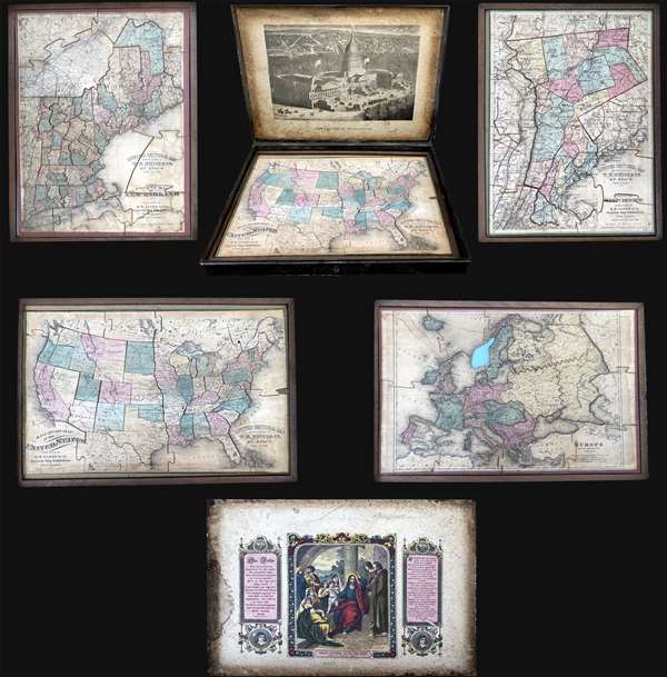
Improved Sectional Map: Railroad Map of the United States. / County of Westchester. / Europe. / County Map of New England.
sold
This is an 1877 set of four double-sided puzzle maps of the United States, Westchester, New England, and Europe contained in their original metal box. The verso of each puzzle also features an image, with a view of the United States Capitol Building on ... (more details)
Exceptional map of Colombia illustrating Coffee plantations.
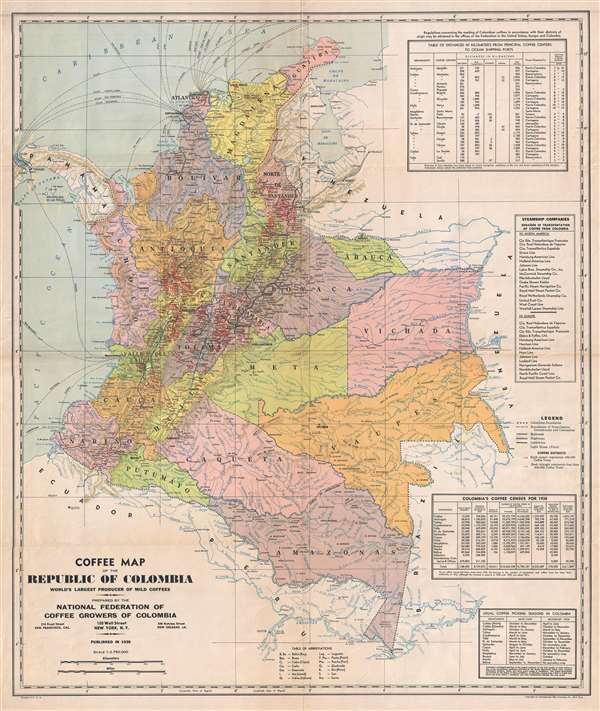
Coffee Map of the Republic of Colombia World's Largest Producer of Mild Coffees.
sold
- Digital Map Information
- Suitable for large format printing
- File Size: 16.63 MB
- File Type: ZIP / TIFF
- ICC color profile embedded
- Delivered instantly via download link
This is an uncommon 1939 map of Colombia issued the National Federation of Coffee Growers of Colombia (Federación Nacional de Cafeteros de Colombia). The map was prepared and printed by the International Map Company of New York. It illustrates modern ... (more details)
Illustrates Narragansett Bay, Buzzard's Bay, and Martha's Vineyard.
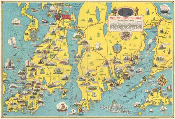
Mount Hope Bridge, Bristol, Rhode Island.
sold
- Digital Map Information
- Suitable for large format printing
- File Size: 12.59 MB
- File Type: ZIP / TIFF
- ICC color profile embedded
- Delivered instantly via download link
This is a 1939 John Haley and H. W. Hetherington pictorial map of coastal Rhode Island and Massachusetts. The map depicts the region from Jamestown, Rhode Island to western Cape Cod, including Falmouth and Woods Hole, Massachusetts and from Bristol, ... (more details)
Depicts the rail network of the Atchison, Topeka and Santa Fe railway - the second transcontinental rail route.
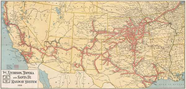
The Atchison, Topeka, and Santa Fe Railway System.
sold
- Digital Map Information
- Suitable for large format printing
- File Size: 14.94 MB
- File Type: ZIP / TIFF
- ICC color profile embedded
- Delivered instantly via download link
This is a 1926 Montross and Clarke map of the Atchison, Topeka and Santa Fe (ATSF) railway network in the Western United States. The map depicts the region from the Pacific Ocean to Chicago and from Oregon, Idaho, Wyoming, Nebraska, Iowa, and ... (more details)
A visual summary of European combat during World War I.

The World War 1914 - 1918.
sold
- Digital Map Information
- Suitable for large format printing
- File Size: 51.15 MB
- File Type: ZIP / TIFF
- ICC color profile embedded
- Delivered instantly via download link
This is a 1928 Samuel Calvin Dickerhoff, Jr. and J. B. Ferris infographic chart detailing the events of World War I. Incredibly detailed and meticulously researched, a newspaper advertisement for the chart stated that it took five years to ... (more details)
Detailed and attractive map of Madrid, Spain.
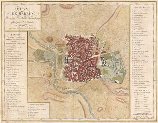
Plan de Madrid.
sold
- Digital Map Information
- Suitable for large format printing
- DPI: 300
- File Size: 6.74 MB
- File Type: ZIP / TIFF
- ICC color profile embedded
- Delivered instantly via download link
This is a 1782 Edme Mentelle map or plan of Madrid, Spain. This map depicts the city of Madrid from the Manzanares River in the west to the Campo Grande in the east and from the Puerta de Embaxadores in the south to the Puerta des los ... (more details)
Details the extensive road network in the region, connecting Baghdad to Kabul.
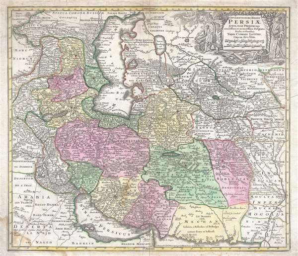
Opulentissimi Regni Persiæ juxta suas Provincias recentissima et accuratissima Designatio. Studio et Sumtibus.
sold
- Digital Map Information
- Suitable for large format printing
- DPI: 300
- File Size: 18.36 MB
- File Type: ZIP / TIFF
- ICC color profile embedded
- Delivered instantly via download link
This is a scarce c. 1750 Tobias Conrad Lotter map of Persia, the Caspian Sea, and the Caucasus. The map depicts the region from the Black Sea to Kashmir and the Indus River and from the Sea of Azov and the Caspian Sea to the Persian ... (more details)
Beautiful example of Johnson's iconic map of Florida.

Johnson's Florida.
sold
- Digital Map Information
- Suitable for large format printing
- File Size: 5.49 MB
- File Type: ZIP / TIFF
- ICC color profile embedded
- Delivered instantly via download link
A beautiful example of Alvin Jewett Johnson and Benjamin P. Ward's 1862 map of Florida. This rare map offers a fascinating snapshot of this secessionist state early in the American Civil War. The map illustrates Florida in full, ... (more details)
A beautiful map of the Caribbean illustrating all the islands.
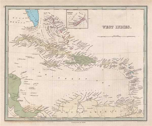
West Indies.
sold
- Digital Map Information
- Suitable for large format printing
- DPI: 300
- File Size: 3.64 MB
- File Type: ZIP / TIFF
- ICC color profile embedded
- Delivered instantly via download link
This is an 1846 Thomas G. Bradford map of the West Indies. The map depicts the region from the Gulf of Mexico and Honduras to Barbados and the Atlantic Ocean and from Florida and the Bahamas to Colombia and Venezuela. Highly ... (more details)
A map of Sri Lanka during the time of Portuguese rule.
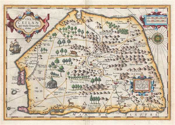
Ins. Ceilan quae incolis Tenarisin dicitur.
sold
- Digital Map Information
- Suitable for large format printing
- DPI: 300
- File Size: 7.92 MB
- File Type: ZIP / TIFF
- ICC color profile embedded
- Delivered instantly via download link
This is a 1609 Gerard Mercator and Jodocus Hondius map of Sri Lanka. The map, which is oriented from the east, depicts the entire island. Cartographically it remains vaguely defined in an unusual five-sided form – ... (more details)
A detailed map that was prepared for the United States Pacific Railway Commission.

Map Showing the Pacific Railways and Their Branches. Prepared for the United States Pacific Railway Commission.
sold
- Digital Map Information
- Suitable for large format printing
- File Size: 25.52 MB
- File Type: ZIP / TIFF
- ICC color profile embedded
- Delivered instantly via download link
This is an 1887 George Washington and Charles B. Colton railroad map of the western United States. The map depicts the western United States from the Pacific Ocean to Lake Superior, Lake Michigan, Illinois, Kentucky, ... (more details)
Illustrates the first thorough survey by a Western explorer of part of Tibet and Xinjian, China.
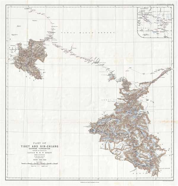
Part of Tibet and Sin-Chiang (Chinese Turkestan) Showing the Surveys of Captain H. H. P. Deasy.
sold
- Digital Map Information
- Suitable for large format printing
- File Size: 7.74 MB
- File Type: ZIP / TIFF
- ICC color profile embedded
- Delivered instantly via download link
This is a 1900 Henry Hugh Peter Deasy map of Tibet and Xinjian (Sin-Chiang), China illustrating Deasy's exploration in the region. The map depicts the region from the Taghdumbash Pamir to the Tolan Khoja River and ... (more details)
A scarce nautical chart of Vineyard Haven, Martha's Vineyard.

Harbor of Refuge No. The Harbor of Holmes' Hole.
sold
- Digital Map Information
- Suitable for large format printing
- DPI: 300
- File Size: 4.01 MB
- File Type: ZIP / TIFF
- ICC color profile embedded
- Delivered instantly via download link
This is a rare example of the 1847 U.S. Coast Survey nautical chart or map of Holmes' Hole (Vineyard Haven), Martha's Vineyard, Massachusetts. Focusing on the town of Holmes' Hole, today's Vineyard Haven, this ... (more details)
Depicts several rail lines in Georgia that were operating in the 1840s.

Georgia.
sold
- Digital Map Information
- Suitable for large format printing
- DPI: 300
- File Size: 5.96 MB
- File Type: ZIP / TIFF
- ICC color profile embedded
- Delivered instantly via download link
This is an 1846 Thomas G. Bradford map of Georgia. The map depicts the region from Alabama to South Carolina and from North Carolina to Florida and the Atlantic Ocean. Highly detailed, each county is labeled and ... (more details)
Illustrates the Wabash and Erie Canal - the longest fabricated structure in the United States.
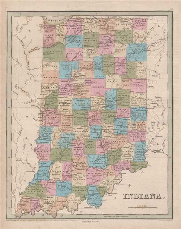
Indiana.
sold
- Digital Map Information
- Suitable for large format printing
- DPI: 300
- File Size: 4.85 MB
- File Type: ZIP / TIFF
- ICC color profile embedded
- Delivered instantly via download link
This is an 1846 Thomas G. Bradford map of Indiana. The map depicts the region from Illinois to Ohio and from Michigan and Lake Michigan to Kentucky. Highly detailed, each county is labeled and shaded a different ... (more details)
An interesting 1876 reprint of a 1782 map of Manhattan.
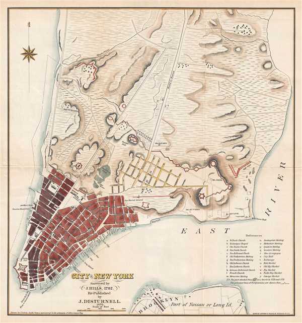
City of New York. Surveyed by J. Hills, 1782. Re-Published by J. Disturnell. 1876.
sold
- Digital Map Information
- Suitable for large format printing
- File Size: 3.26 MB
- File Type: ZIP / TIFF
- ICC color profile embedded
- Delivered instantly via download link
This is an 1876 John Disturnell republication of a 1782 J. Hills city map or plan of New York City. The map depicts the lower half of Manhattan and a small part of Long Island, including Brooklyn. Most of ... (more details)
Illustrates early British expeditions into Tibet - which foreigners were then forbidden to enter.
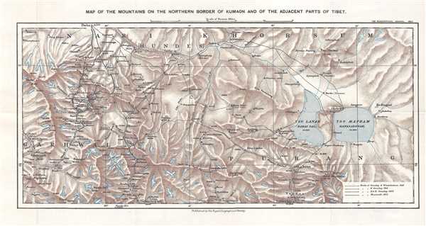
Map of the Mountains on the Northern Border of Kumaon and of the Adjacent Part of Tibet.
sold
- Digital Map Information
- Suitable for large format printing
- File Size: 6.22 MB
- File Type: ZIP / TIFF
- ICC color profile embedded
- Delivered instantly via download link
This is a 1900 Royal Geographical Society map tracing the three surveying expeditions mounted by Sir Henry Strachey, his brother, Sir Richard Strachey, and J. E. Winterbottom, despite the longstanding ... (more details)
Nautical chart of the Mississippi River Delta.
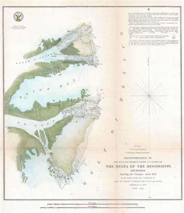
H No. 8 Reconnoissance of the N.E. and S.E. Passes and Passe A l'Outre of The Delta of the Mississippi Louisiana.
sold
- Digital Map Information
- Suitable for large format printing
- DPI: 300
- File Size: 3.32 MB
- File Type: ZIP / TIFF
- ICC color profile embedded
- Delivered instantly via download link
An attractive hand colored 1851 U.S. Coast Survey nautical chart or map of the Mississippi Delta. The map depicts the Louisiana coast from Passe À L'Outre to the Southeast Pass. Numerous depth ... (more details)
Triangulation chart of part of South Carolina's coast near Charleston.

Sketch E No. 3 North and South Edisto River and St. Helena Sound South Carolina.
sold
- Digital Map Information
- Suitable for large format printing
- DPI: 300
- File Size: 2.28 MB
- File Type: ZIP / TIFF
- ICC color profile embedded
- Delivered instantly via download link
This is an attractive 1851 U.S. Coast Survey triangulation chart of the coast of South Carolina between St. Helena's Sound and the North Edisto River. The map depicts from St. Helena Sound to ... (more details)