
NEW ACQUISITIONS
Mazatlán!
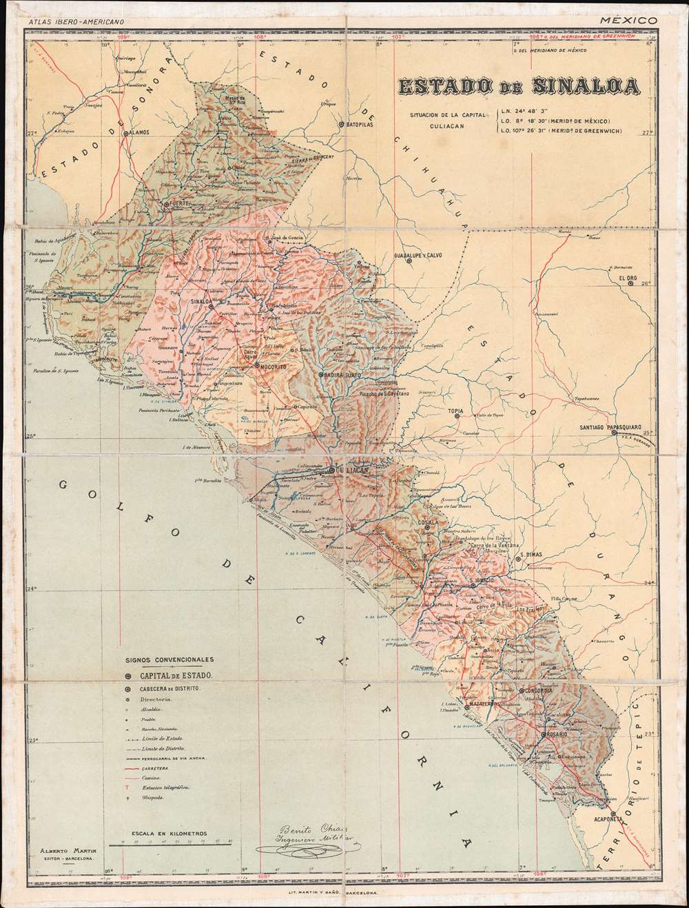
Estado de Sinaloa.
$400.00
Acquire
- Digital Map Information
- Suitable for large format printing
- Full resolution TIFF file
- ICC color profile embedded
- Delivered instantly via download link
This is a c. 1900 Benito Chías y Carbó map of Sinaloa, Mexico. A state in northwestern Mexico, Sinaloa is home to the cities of Mazatlán and Culiacán Rosales, the state capital. Both of these cities are identified here, along with towns and villages throughout the state. Bright red lines trace the state's highways and roads, while the one railroad connecting Culiacán and Altata on the Gulf of California is highlighted by a black and white dashed line. Red 'T's mark telegraph stations and small black crosses identify bishoprics. (more details)
Promotes tourism by rail in British Columbia - including a visit to Jasper National Park, then the largest national park in the Americas.
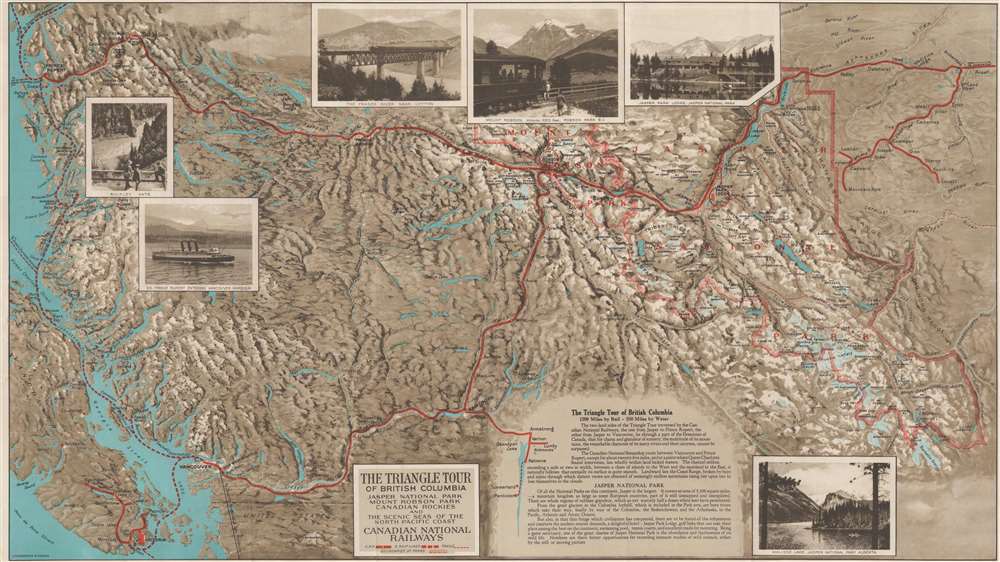
The Triangle Tour of British Columbia. / Alaska and the Yukon.
$350.00
Acquire
- Digital Map Information
- Suitable for large format printing
- Full resolution TIFF file
- ICC color profile embedded
- Delivered instantly via download link
This is a c. 1927 Canadian National Railway map of the Triangle Tour of British Columbia. The map depicts two train and one steamship route, allowing the tourist to experience the 'charm and grandeur' of the wilderness of British Columbia by traveling by rail from Vancouver to Jasper and from Jasper to Prince Rupert and then via steamship from Prince Rupert along the Canadian coastline south to Vancouver. (more details)
Highlights the 'Terrestrial Hemisphere' on a newly-conceived projection.
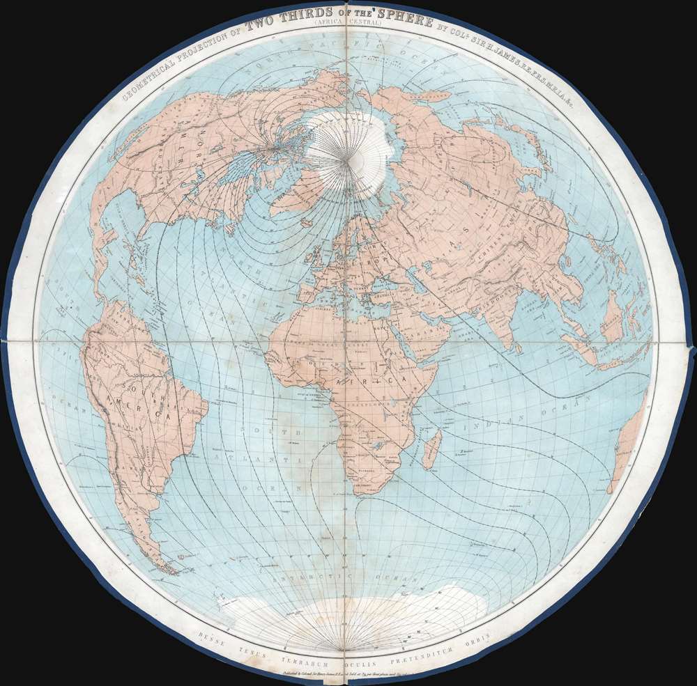
Geometrical Projection of Two Thirds of the Sphere. (Africa Central).
$750.00
Acquire
- Digital Map Information
- Suitable for large format printing
- File Size: 27.56 MB
- File Type: ZIP / TIFF
- ICC color profile embedded
- Delivered instantly via download link
This is an 1860 Henry James geometrical projection circular map of two-thirds of the world, focusing on the 'terrestrial hemisphere'. Centered on northern Africa, the world appears as if on the inside of a sphere. Dashed lines represent lines of longitude. Some countries, although not all, are labeled. A handful of cities are identified as well, including the major meridian cities: London, Paris, Rome, New York, and Washington, D.C. (more details)
Men of Harlech on to glory...
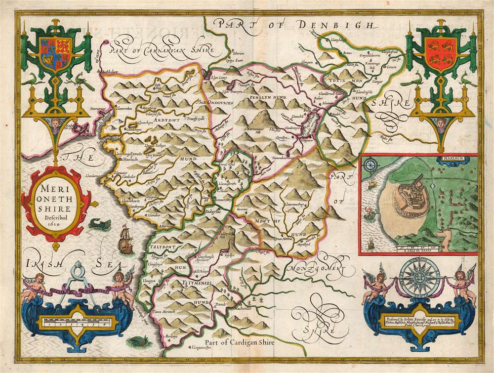
Merionethshire Described 1610.
$750.00
Acquire
- Digital Map Information
- Suitable for large format printing
- Full resolution TIFF file
- ICC color profile embedded
- Delivered instantly via download link
This is John Speed's map of the county of Merionethshire, Wales. It was included in Speed's The Theatre of the Empire of Great Britaine. Despite its depicting one of the most sparsely-populated counties of the United Kingdom, the map is richly detailed, showing towns, castles, forests, and lakes. The countryside's mountainous terrain is illustrated pictorially. An inset plan in the center right shows the town of Harlech, whose castle dominates the image much as it does the legend of the town, its famous siege being immortalized in song. Just offshore, the sea facing the castle sports a mermaid. (more details)
Marking the Momentous Battle of Bosworth.
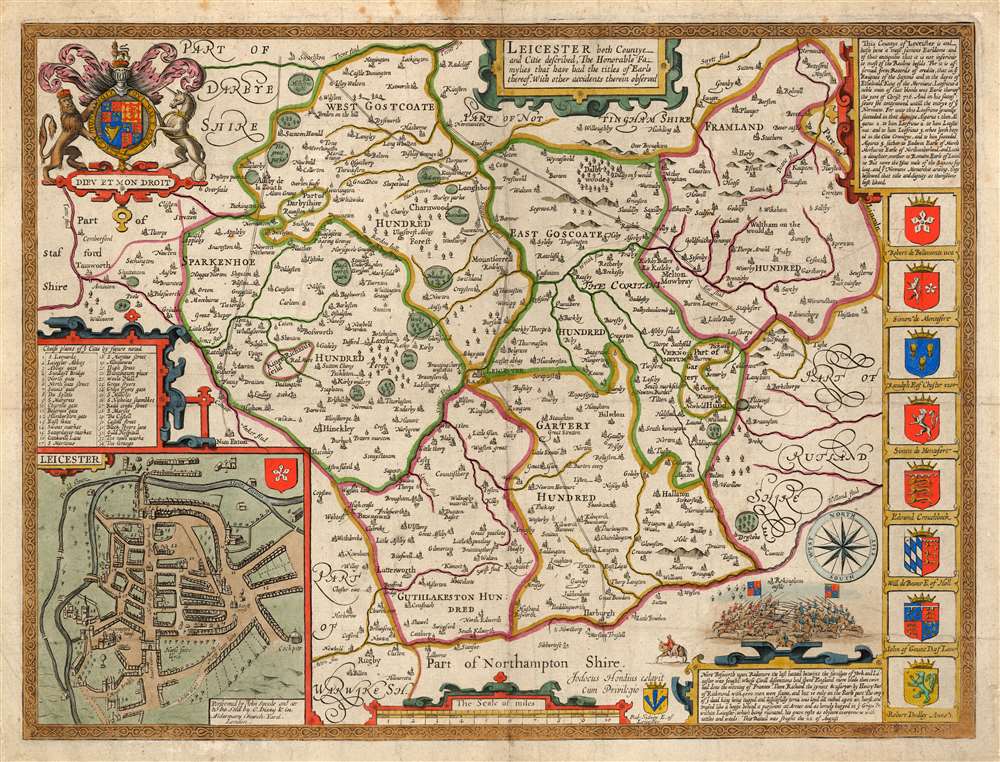
Leicester, both Countye and Citie described, the Honorabe Famylies that have had titles of Earls thereof. With other accidents therein observed.
$750.00
Acquire
- Digital Map Information
- Suitable for large format printing
- Full resolution TIFF file
- ICC color profile embedded
- Delivered instantly via download link
This is John Speed's 1770 map of the East Midlands county of Leicestershire, England. It was first included in Speed's county atlas and remained in publication long after Speed's death, and in this case this specific map was printed in Cluer Dicey's scarce, final edition of 1770. The map is richly detailed, showing towns, abbeys, castles, forests, and parklands. An inset plan in the lower left details the walled town of Leicester with a key naming thirty-four streets, gates and buildings. Along the right side of the map are displayed the armorial crests of eight of the historical Earls of Leicester. At the bottom are the arms of Robert Sidney, the second Earl of Leicester (probably added by Bassett and Chiswell in 1676). At the upper left are the Royal Arms, with the motto 'Dieu et Mon Droit.' (more details)
Lighthouses...and more lighthouses!
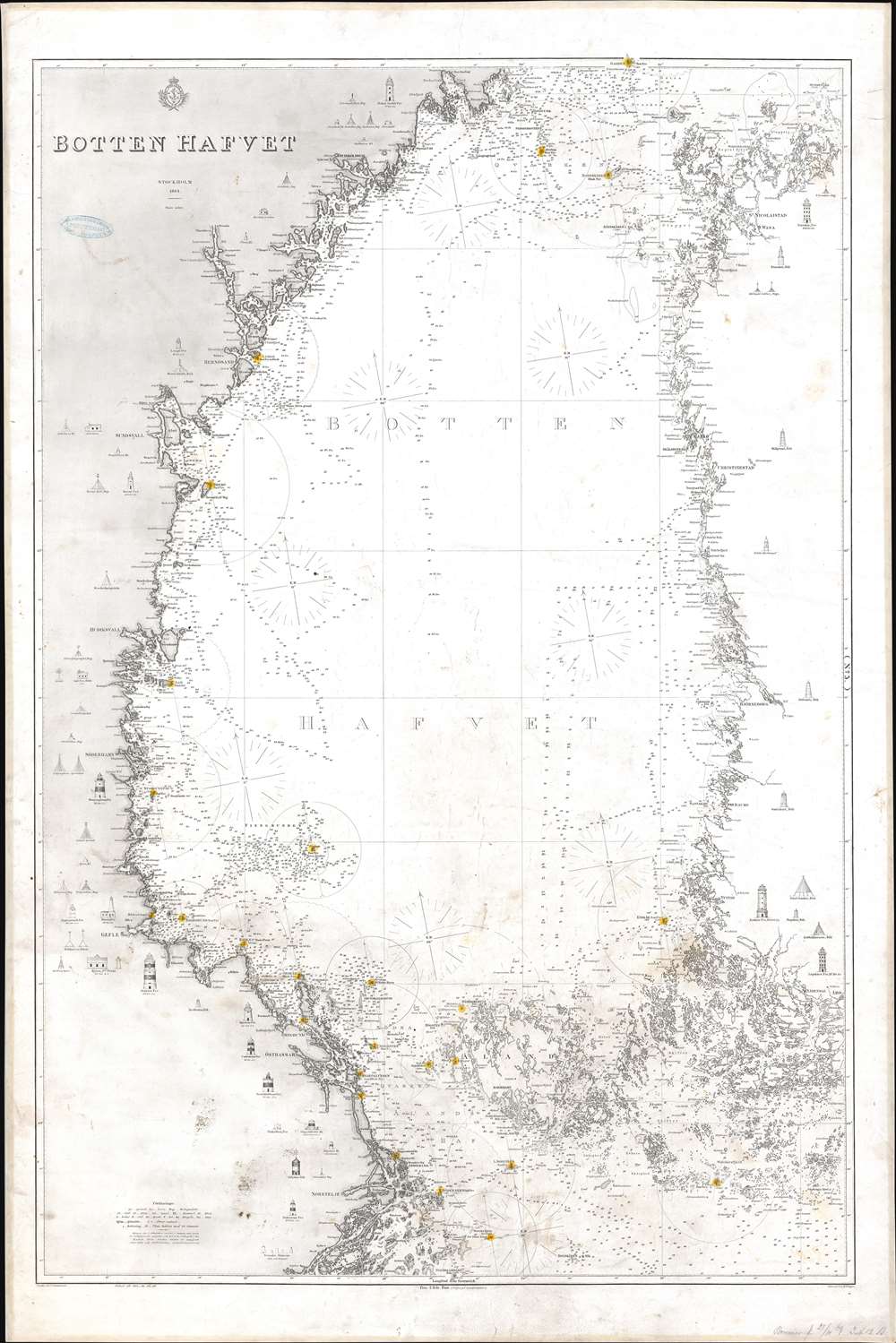
Botten Hafvet.
$700.00
Acquire
- Digital Map Information
- Suitable for large format printing
- File Size: 47.13 MB
- File Type: ZIP / TIFF
- ICC color profile embedded
- Delivered instantly via download link
This is an 1868 Royal Swedish Nautical Chart Archive nautical chart or maritime map of the Bothnian Sea, or Bottenhavet in Swedish. The Bothnian Sea is a body of water situated between Sweden and Finland, part of the larger Gulf of Bothnia. Depicting from Gadden south to Lulla, both coastlines are illustrated in detail. Coastal islands are illustrated and labeled. Countless depth soundings, coastal lights, and other navigation aids are highlighted. Many of these lighthouses are illustrated in profile along the Swedish and Finnish coastlines - useful for helping the mariner to recognize them and thus know his location. (more details)
'You'd Like Living in Kansas'.
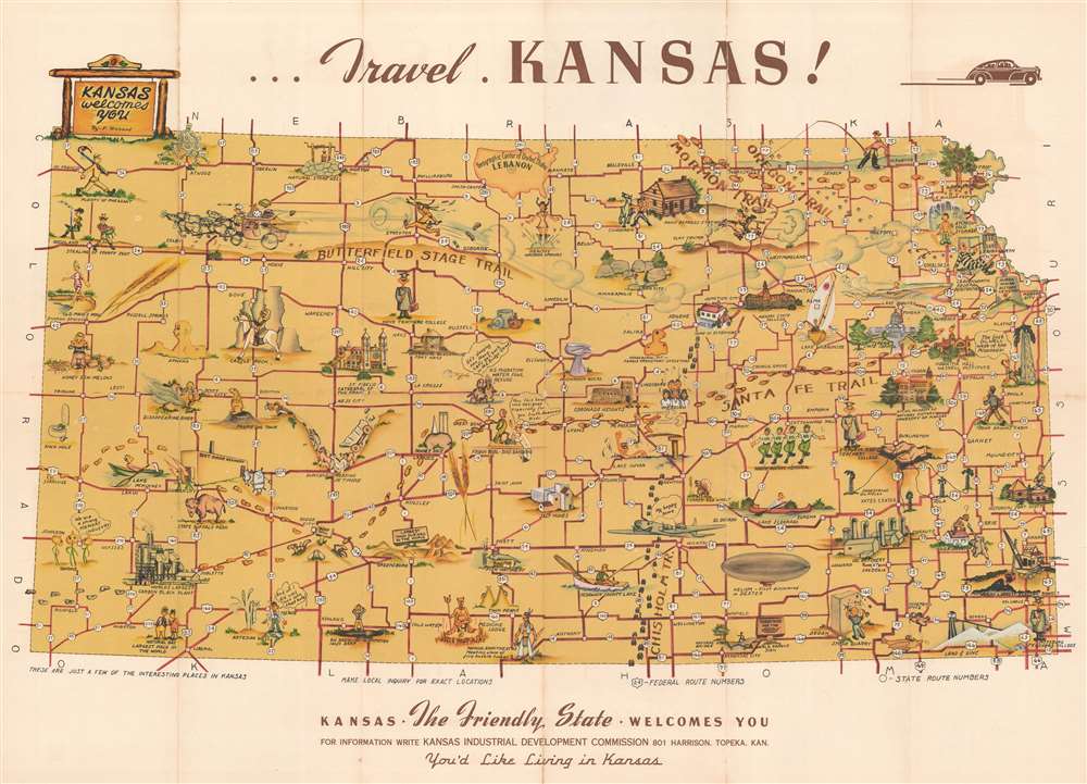
Kansas the Friendly State Welcomes You.
$350.00
Acquire
- Digital Map Information
- Suitable for large format printing
- Full resolution TIFF file
- ICC color profile embedded
- Delivered instantly via download link
This is a c. 1948 F. Richard pictorial tourist map of Kansas. Pictorial vignettes highlight sites across the state along with historic events and monuments. Footprints trace the Mormon Trail and the Santa Fe Trail, while horse hoofprints mark the Oregon Trail and steer hoofprints mark the Chisholm Trail. A stagecoach flies down the Butterfield Stage Trail chased by an angry Native American. President Eisenhower's home is illustrated and labeled, as are historic churches, universities, and several factories. Boeing's factory in Wichita is highlighted with a cartoon version of a B-29. Illustrations of graduates in their regalia mark the state's three teachers' colleges. Other comical vignettes mark the U.S. Migration Waterfowl Refuge, Leavenworth Federal Penitentiary, and the Knute Rockne Memorial. (more details)
United States during the 1939 World's Fair.
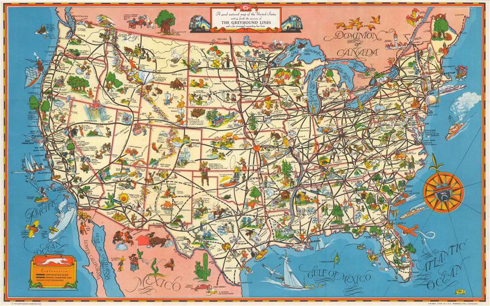
A Good - Natured Map of the United States Setting Forth the Services of The Greyhound Lines and a Few Principal Connecting Bus Lines.
$200.00
Acquire
- Digital Map Information
- Suitable for large format printing
- Full resolution TIFF file
- ICC color profile embedded
- Delivered instantly via download link
This is a charming 1939 pictorial map of the United States, produced as a pamphlet by the Greyhound Bus Company to promote their line as a comfortable and affordable means of travel - with a special focus on the upcoming New York World's Fair. (more details)
British diplomat's travels through Shaanxi.

China. Map showing Routes in the province of Shensi by Eric Teichman, B.A.
$175.00
Acquire
- Digital Map Information
- Suitable for large format printing
- File Size: 8.78 MB
- File Type: ZIP / TIFF
- ICC color profile embedded
- Delivered instantly via download link
This is a 1918 Eric Teichman map of Shaanxi (Shensi) Province, China, created to accompany of an article written by Teichman for The Geographical Journal. A dashed line traces Teichman's route through the region, some of which follows the Huang Ho (Yellow) River. Towns and villages along the route are labeled, along with major towns around the region not encountered by Teichman. The area's many rivers are illustrated and labeled. Per the note in the lower right corner
This map is based on an original M.S. compiled by Mr. Teichman from his recent prismatic compass traverses, Chinese maps and local information, and adjusted at the places indicated by letters to the surveys and astronomically determined positions of Clementi (C), Tufel (T) and Filchner (F). Heights along the routes are from Mr. Teichman's readings of two aneroids, and should be considered as approximate only. Those obtained from other travelers are shown by letters attached as above. Heights marked (G) are from the Karte von Ost-China 1/M.(more details)
Civil War era map of Philly!
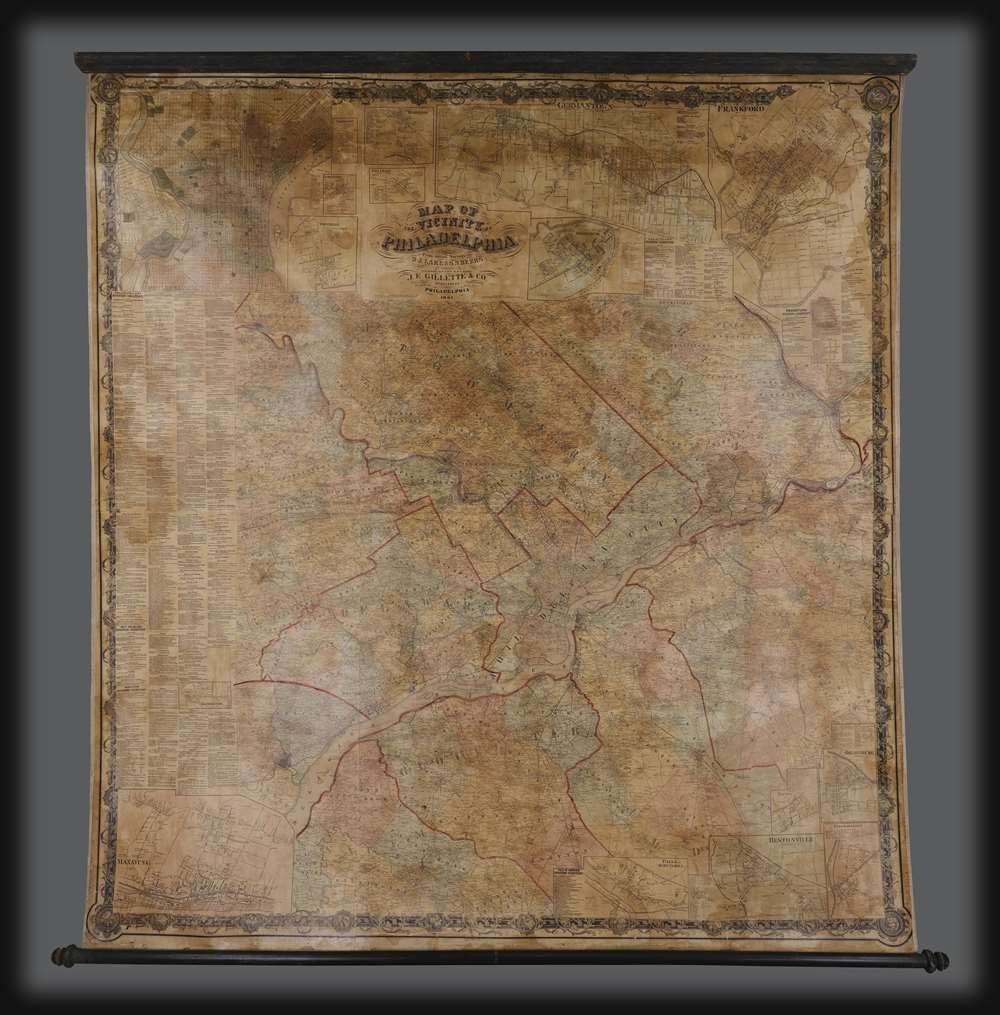
Map of the Vicinity of Philadelphia.
$2,500.00
Acquire
- Digital Map Information
- Suitable for large format printing
- Full resolution TIFF file
- ICC color profile embedded
- Delivered instantly via download link
An impressive 1861 Civil War Era wall map of Philadelphia, Pennsylvania, and vicinity by Silas N. Beers and J. E. Gillette. Centered on Philadelphia, coverage extends roughly 25 miles around in all directions. There is a large inset of Philadelphia in the upper right as well as a city directory along the left side. In addition, there are numerous smaller inset plans detailing surrounding towns and communities. (more details)
'Captain Hook discovered these islands' - no kidding.
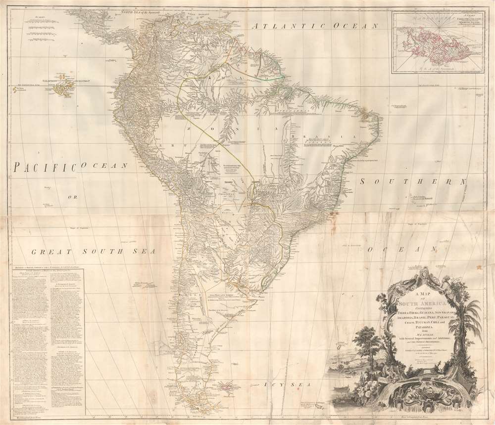
A Map of South America containing Tierra-Firma, Guayana, New Granada, Amazonia, Brasil, Peru, Paraguay, Chaco, Tucuman, Chili and Patagonia from M. D'Anville with Several Improvements and Additions, and The Newest Discoveries.
$1,000.00
Acquire
- Digital Map Information
- Suitable for large format printing
- DPI: 300
- File Size: 56.86 MB
- File Type: ZIP / TIFF
- ICC color profile embedded
- Delivered instantly via download link
This is probably the most important large format wall map of South America produced in the 18th century. Largely based upon the earlier D'Anville map, this map has been enlarged and expanded by the English publishing house of Laurie and Whittle. Depicts the continent in full with an inset of the Falkland Islands. This map is unique in that it is a serious attempt to compile all of the accurate scientific knowledge of the South American continent available at the time, this offering a smorgasbord of factual, speculative, and historical detail. (more details)
Edwin Tunis' first and finest pictorial map!
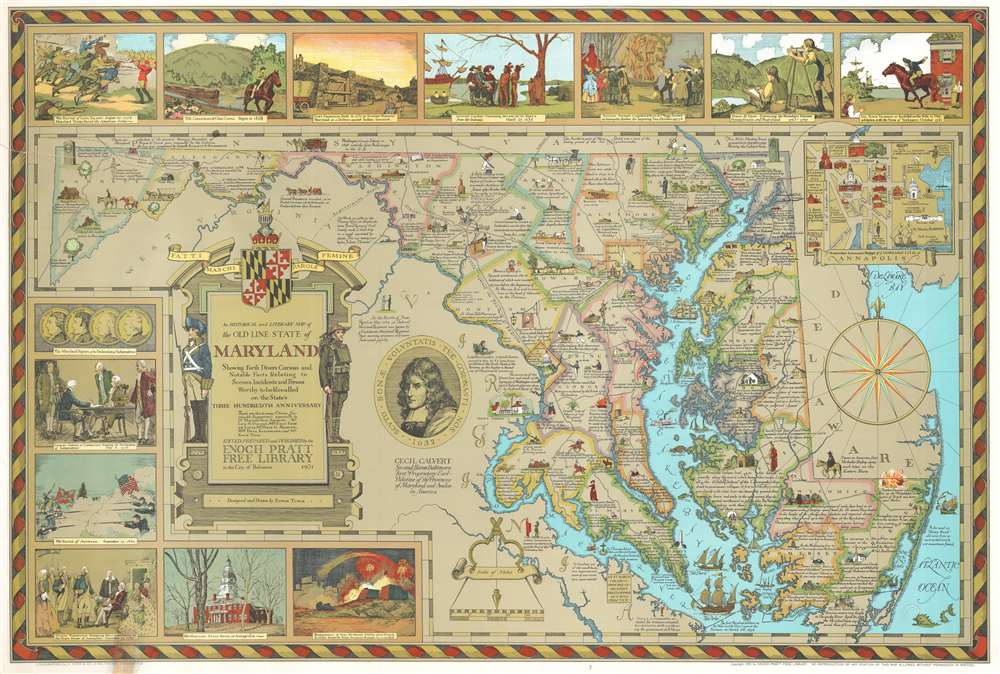
An Historical and Literary map of the Old Line State of Maryland Showing forth divers curious and notable facts relating to scenes, incidents and persons worthy to be recalled on the state's three hundredth anniversary.
$850.00
Acquire
- Digital Map Information
- Suitable for large format printing
- File Size: 58.9 MB
- File Type: ZIP / TIFF
- ICC color profile embedded
- Delivered instantly via download link
Issued during the Golden Age of American Pictorial Maps (c. 1920 - 1960), this wonderful 1931 first edition historical and pictorial map of Maryland was the first map issued by Edwin Burdette Tunis. The map covers all Maryland, including the Chesapeake Bay in full, as well as adjacent parts of Delaware and Virginia. Published in conjunction with the Enoch Pratt Free Library, this type of pictorial map is a natural extension of Tunis' meticulous attention to historical detail. Copious annotations throughout describe historical personages, locations, battles, and buildings, as well as expounding upon the general historical progression of the region. Vignettes above and to the left of the map proper illustrate the Battle of Long Island, the opening of the Chesapeake and Ohio Canal, the construction of Fort Frederick, the purchase of St. Mary's by Leonard Calvert from indigenous American Indian tribes, and more. An inset in the upper left details Annapolis and the U.S. Naval Academy. (more details)
The mythical lands of Jean de Gama.
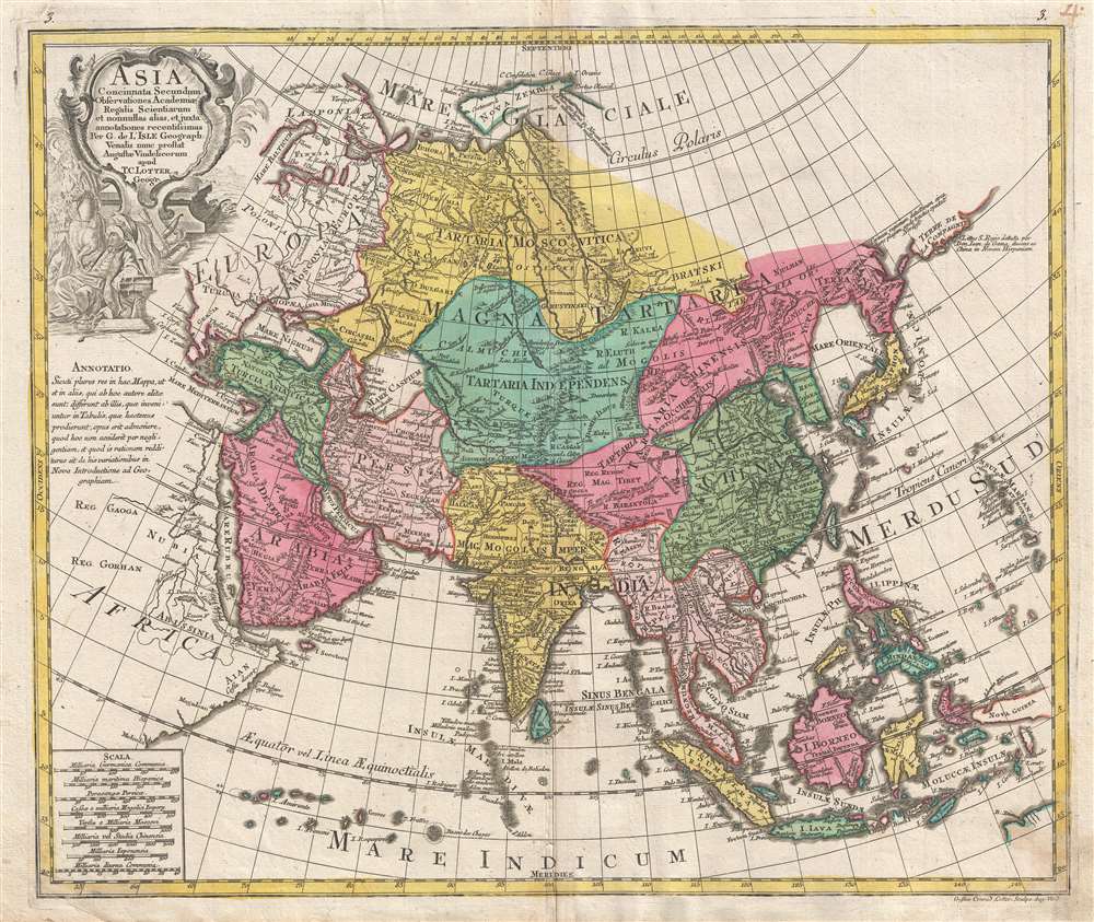
Asia Concinnata Secundum Observationes Academiae Regalis Scientiarum et nonnullas alias, et iuxta annotationes recentissimas.
$850.00
Acquire
- Digital Map Information
- Suitable for large format printing
- DPI: 300
- File Size: 13.36 MB
- File Type: ZIP / TIFF
- ICC color profile embedded
- Delivered instantly via download link
A rare and attractive old color 1770 map of Asia by Tobias Conrad Lotter. Centered on Independent Tartary, this map covers the entire continent from Africa and the Mediterranean east to the Bering Sea and south as far as Java and New Guinea. The map renders the entire region in detail offering both topographical and political information with forests and mountains beautifully rendered in profile. (more details)
Scare Rea edition.
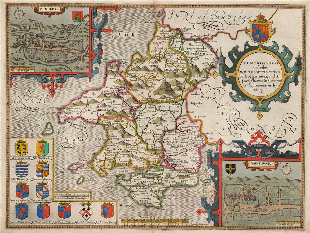
Penbrokshyre described and the situations both of Penbroke and St. Davids shewed in due form as they were taken by John Speed.
$750.00
Acquire
- Digital Map Information
- Suitable for large format printing
- Full resolution TIFF file
- ICC color profile embedded
- Delivered instantly via download link
This is John Speed's map of the county of Pembrokeshire, Wales. Engraved in 1608, this map was printed by publisher Roger Rea between 1662 and 1665. While Rea and his son produced an edition of Speed's The Theatre of the Empire of Great Britaine, examples of their output were also sold to their competitor John Overton (1640 - 1708) for inclusion in his atlases. These lacked the verso text that generally characterizes Speed maps, and such examples are scarce. Moreover, much of the stock remaining to Roger Rea the Younger after his father's death of the plague was itself destroyed in the 1666 Great Fire of London. Thus, any example of a Speed map with the imprint of 'Roger Rea the Elder and younger' is a rarity. (more details)
The United States Colored Troops.
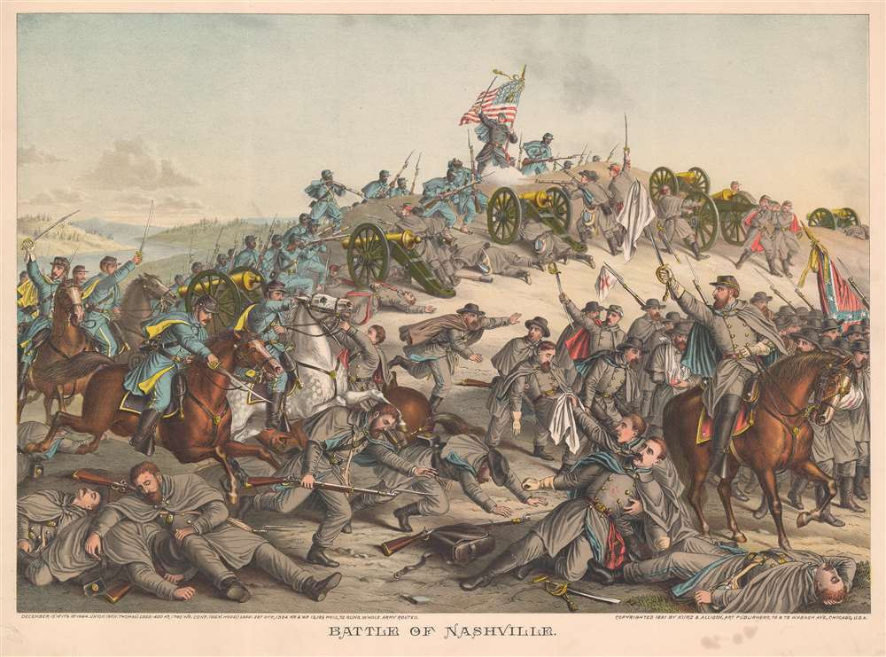
Battle of Nashville.
$750.00
Acquire
- Digital Map Information
- Suitable for large format printing
- File Size: 41.56 MB
- File Type: ZIP / TIFF
- ICC color profile embedded
- Delivered instantly via download link
This is an 1891 Kurz and Allison chromolithograph American Civil War (1861 - 1865) view of the Battle of Nashville, Tennessee. Union troops are illustrated on the left storming Confederate redoubts. United States Colored Troops are prominently featured courageously advancing in the face of point-blank musket fire. The bulk of the illustrated Confederate soldiers appear in the lower right retreating from determined Federal soldiers. (more details)
Key Border County Between England and Wales.
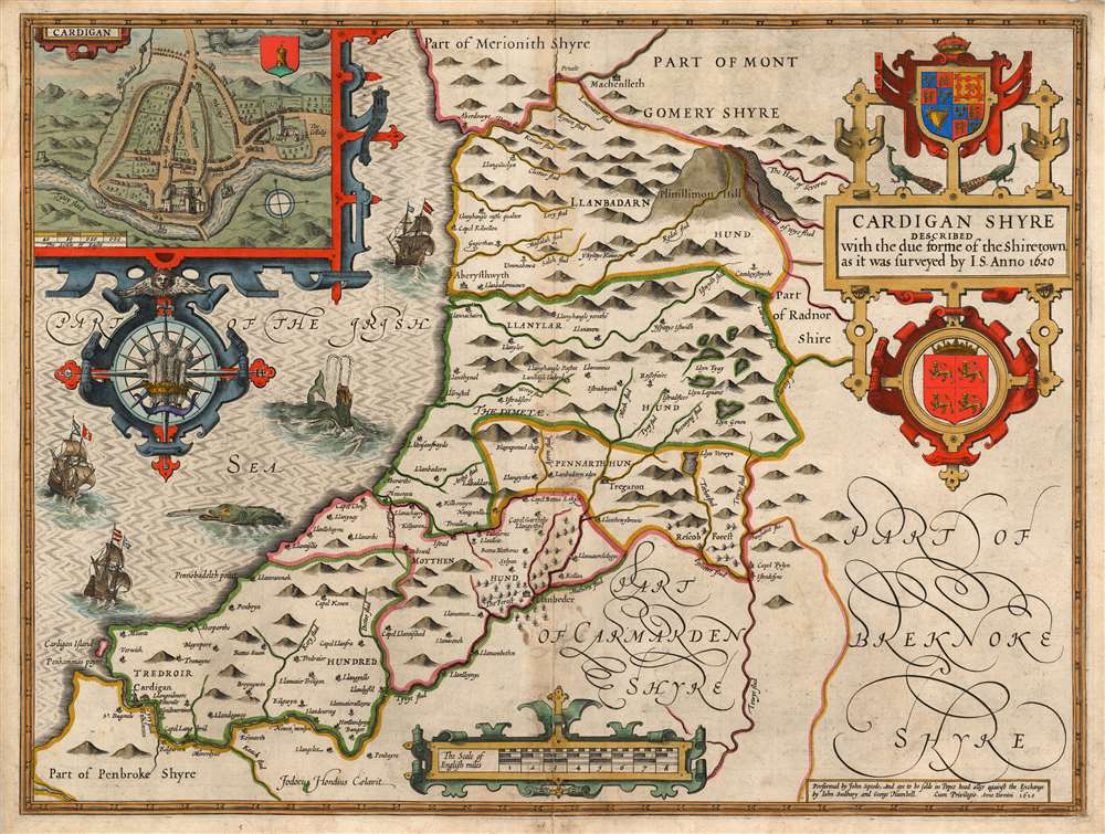
Cardigan Shyre Described with the due forme of the Shiretown as it was surveyed by I.S. Anno 1610.
$750.00
Acquire
- Digital Map Information
- Suitable for large format printing
- Full resolution TIFF file
- ICC color profile embedded
- Delivered instantly via download link
This is John Speed's map of the county of Cardiganshire, Wales. Engraved in 1608, this map was included in a 1627 edition of Speed's The Theatre of the Empire of Great Britaine. While many of Speed's maps were derived from the work of Christopher Saxton, this one was founded on Speed's own surveys. The map is beautifully engraved - this, the work of Jodocus Hondius - and identifies the county's towns, major villages, and its five hundreds of Genau'r-Glyn (Llanbadarn on the map), Ilar (Llanylar), Moyddyn, Penarth and Troedyraur. Rivers are marked and named. The region's mountainous terrain is indicated pictorially, with special emphasis placed on 'Plinillimon Hill' - that is to say, Plynlimon or Pen Pumlumon Fawr, the highest point of the Cambrian Mountains in Wales, and the source of the rivers Severn, Wye and Rheidol. (The headwaters of these rivers are all shown.) (more details)
Key Border County Between England and Wales.
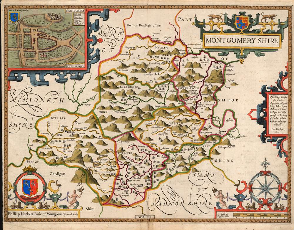
Montgomery shire.
$750.00
Acquire
- Digital Map Information
- Suitable for large format printing
- Full resolution TIFF file
- ICC color profile embedded
- Delivered instantly via download link
This is John Speed's map of the county of Montgomeryshire, Wales. Engraved in 1610, it was included in a 1646 edition of Speed's The Theatre of the Empire of Great Britaine. Speed derived this work from Christopher Saxton's extremely rare 1579 map of the county and added updated detail including the attractive town plan. The map is richly detailed, showing towns, abbeys, castles, forests, and parklands. The countryside's mountainous terrain is shown pictorially. An inset plan in the upper left details the castle and town of Montgomery. In it, a key labels the important streets, locations of the castle itself, and the city's wall (ruined since 1402.) The map includes a beautifully rendered compass rose, and the arms of Phillip Herbert (1584 - 1650). Herbert was the fourth Earl of Pembroke, and a favorite of King James I (1566 - 1625), who made Pembroke the Earl of Montgomery in 1605. (more details)
The trans-Pacific aviation race.
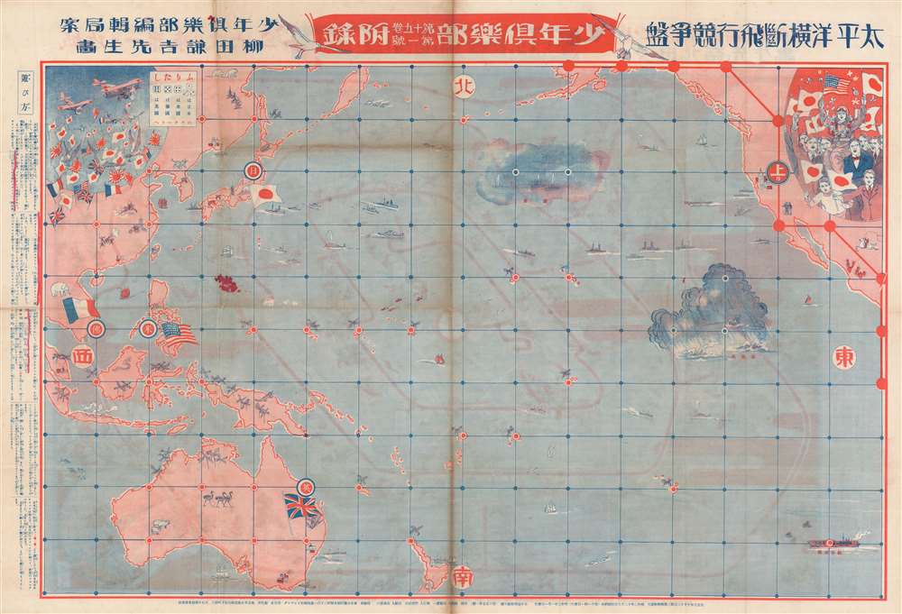
太平洋横断飛行競争盤 / Trans-Pacific Flight Game Board. / 城攻め一番乗り双六 / Castle Attack Sugoroku.
$750.00
Acquire
- Digital Map Information
- Suitable for large format printing
- Full resolution TIFF file
- ICC color profile embedded
- Delivered instantly via download link
This is a rare 1927 (Showa 2) map and Sugoroku board drawn to promote Japanese ambitions to achieve the first solo trans-Pacific flight. The map was published by Dainippon Yutsukai Kodansha (大日本雄辯會講談社) as a New Year supplement to their 'Japanese Youth Club' periodical. The map is printed on both sides. The more interesting side (to us), is the trans-pacific flight Sugoroku. The opposite side features a brightly lithographed castle siege game. (more details)
Celebrating Henry V, 'The Great Triumpher Over France'
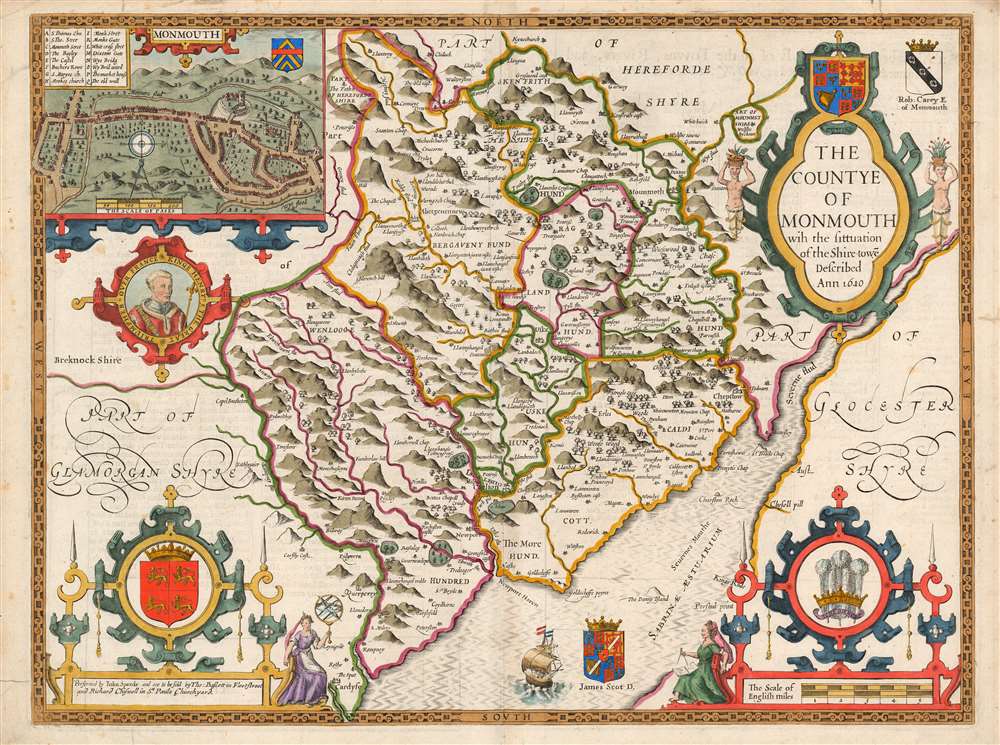
The Countye of Monmouth wih the sittuation of the Shiretowē Described Ann 1610.
$750.00
Acquire
- Digital Map Information
- Suitable for large format printing
- Full resolution TIFF file
- ICC color profile embedded
- Delivered instantly via download link
This is John Speed's map of the county of Monmouthshire, Wales. It was included in Speed's The Theatre of the Empire of Great Britaine. The map is richly detailed, showing towns, abbeys, castles, forests, and parklands. The countryside's rugged terrain is shown pictorially. An inset plan in the upper left details the castle and town of Monmouth. In it, a key labels the important streets, locations of the castle itself, St. Mary's Church, the town market, and the city's old wall and gates. Below the inset is a medallion depicting England's King Henry V (1386 - 1422), who was also known as Henry of Monmouth. King Henry's famed victories in the Hundred Years' War are celebrated in the medallion's text, 'Kinge Henry 5, The Great Triumpher Over France.' Henry's famous victory at Agincourt was nearly two centuries distant at the time this map was engraved: but those remote events had been made current by Shakespeare's 'Henriad' plays, which fixed Henry as the exemplar of the noble English war leader. (more details)
Innovative pictorial map of Cape Cod.
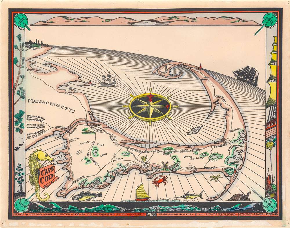
Cape Cod.
$650.00
Acquire
- Digital Map Information
- Suitable for large format printing
- File Size: 12.78 MB
- File Type: ZIP / TIFF
- ICC color profile embedded
- Delivered instantly via download link
A charming 1938 pictorial map of Cape Cod, Massachusetts, but artist Harold Hamilton Webb. Centered on Hamilton's home, Hyannis, the map looks north on Cape Cod, which reaches to the horizon line near Providence. The line of the horizon is exaggerated between Boston and Providence to express the curvature of the Earth - an innovative style cartographer Richard Edes Harrison adopted to great effect for war progress maps in the 1940s. The map shows the roads and lakes of Cape Cod. Fish swim the seas and three sailing vessels ply the waves. The title, in the lower right, is supported by a seahorse. The border is composed of scenes from Cape Code, including the land, sea, foliage, and a sailing ship. (more details)