
Florida's cities and destinations, including Disney World.

Florida.
sold
This is a 2001 Unique Media pictorial bird's-eye view map of Florida. Overlooking Florida from the southeast, exaggerated illustrations of the state's most iconic skylines draw attention. Among these are Miami, Tampa, St. Petersburg, Orlando, Tallahassee, and Jacksonville. Other landmarks, including Walt Disney World (Cinderella's Castle and Spaceship Earth at Epcot), Sea World (a gigantic orca), and Kennedy Space Center (the Space Shuttle), appear in much the same manner. Osceola National Forest, Apalachicola National Forest, and Everglades National Park are illustrated as open wild spaces home to the state's iconic wildlife. (more details)
Arguing the Texas Compromise of 1850. Mormons on Great Salt Lake.
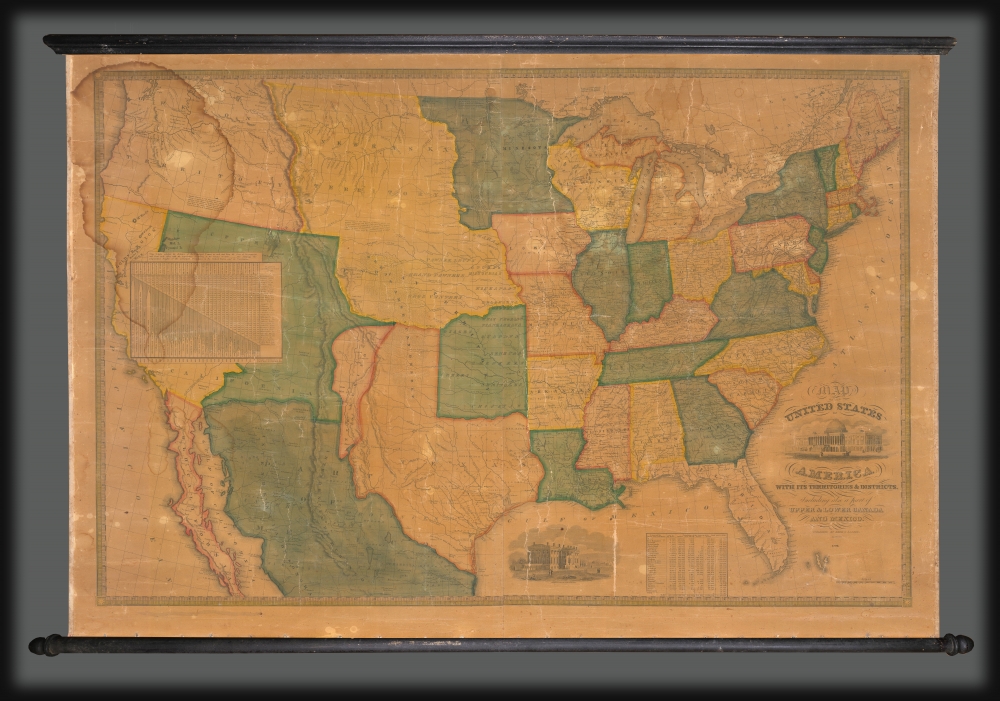
Map of the United States of America with its Territories and Districts. Including also a part of Upper and Lower Canada and Mexico.
sold
- Digital Map Information
- Suitable for large format printing
- DPI: 600
- File Size: 1774.84 MB
- File Type: ZIP / TIFF
- ICC color profile embedded
- Delivered instantly via download link
A most intriguing unrecorded early 1850 variant of the Reed and Barber map of the United States reflecting a nation in flux. The map was issued to satisfy popular curiously regarding the intensely debated newly acquired 'Mexican Cessions', as well as the new national and international borders. It illustrates ambiguity regarding the legislative arguments leading to the Compromise of 1850, which reshaped Texas into its modern configuration, Mormon settlement around Great Salt Lake, the changes brought about by the California Gold Rush, the Oregon Question, the Indian Territories, and more. (more details)
The heyday of rum production in colonial Martinique.
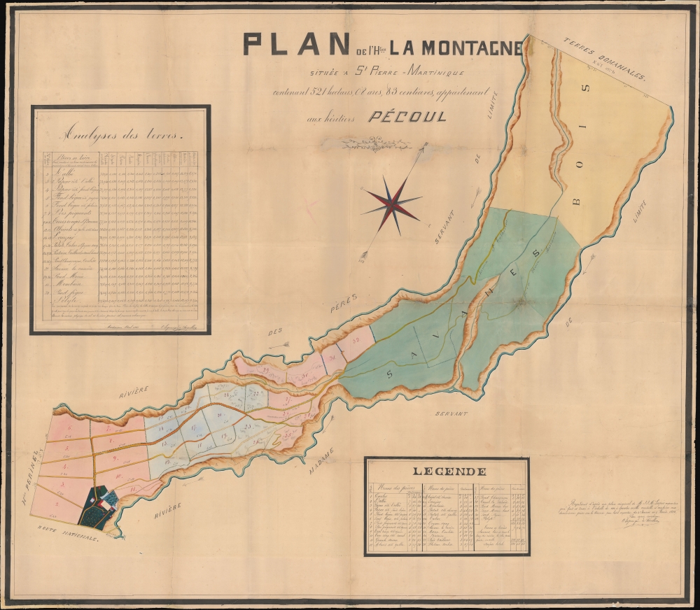
Plan de l'Htion La Montagne situèe a St. Pierre-Martinique contenant 521 hectares, 08 ares, 83 centiares, appartenant aux hèritiers Pécoul.
sold
- Digital Map Information
- Suitable for large format printing
- File Size: 247.21 MB
- File Type: ZIP / TIFF
- ICC color profile embedded
- Delivered instantly via download link
This large-scale 1886 manuscript wall map illustrates the original sugar plantation and rum refiners of the Pécoul family, the 'Habitation la Montagne', Martinique. The map illustrates the hey-day French colonial plantation culture and rum production in Martinique, before the 1902 eruption of Mount Pelée. (more details)
A must-have for the early mapping of the American west.

Le Nouveau Mexique, et la Floride: Tirées de diverses Cartes, et Relations. Par N. Sanson d'Abbeville Geogr ordre du Roy. A Paris. Chez Pierre Mariette, Rue S. Jacque a l'Esperance Avec Privilege du Roy, pour vingt Ans. 1656.
sold
- Digital Map Information
- Suitable for large format printing
- DPI: 600
- File Size: 36.2 MB
- File Type: ZIP / TIFF
- ICC color profile embedded
- Delivered instantly via download link
This is a beautiful example of Nicolas Sanson's 1656 map of New Mexico and Florida: the first atlas map to emphasize this geographical focus. It also presented arguably the most influential depiction of California-as-an-island, providing the dominant model of that cartography for the remainder of the seventeenth century, reaching into the eighteenth. (more details)
From Empire to Republic.
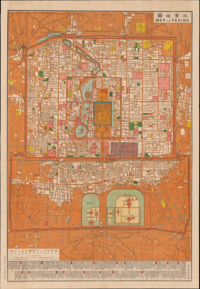
Map of Peking. / 北京地圖
sold
- Digital Map Information
- Suitable for large format printing
- File Size: 102.86 MB
- File Type: ZIP / TIFF
- ICC color profile embedded
- Delivered instantly via download link
This is a rare, important, and beautifully produced multi-color chromolithograph map of Beijing issued by the Chung-Tung Litho Works press in 1914. Issued under the Beiyang Government (1912 - 1928) or First Republic of China, this map is significant in illustrating a transition of power from the old imperial system to a theoretically modern republic. (more details)
The height of Treaty Ports Shanghai.
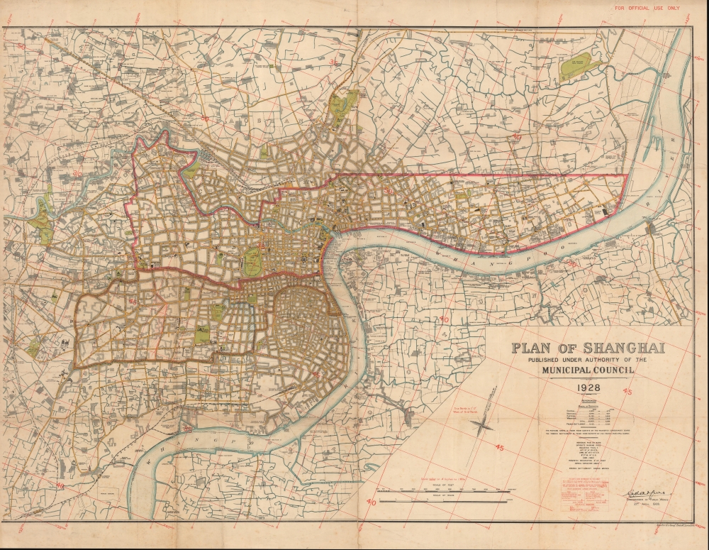
Plan of Shanghai, Published under authority of the Municipal Council 1928.
sold
- Digital Map Information
- Suitable for large format printing
- File Size: 68.79 MB
- File Type: ZIP / TIFF
- ICC color profile embedded
- Delivered instantly via download link
A rare 1928 large-format map of Shanghai produced by Stanford's Geographical Establishment for the Shanghai Municipal Council. It provides an excellent overview of the city, including its Chinese-administered areas, at the height of the treaty port era, when Shanghai emerged as one of the main commercial and financial centers in Asia. (more details)
The European Powder Keg, in Animal Form.

Mappa Humoristico da Europa.
sold
- Digital Map Information
- Suitable for large format printing
- File Size: 15.38 MB
- File Type: ZIP / TIFF
- ICC color profile embedded
- Delivered instantly via download link
This is a rare, attractive 1914 António Soares chromolithograph map of Europe satirizing the early stages of the World War I. Such maps had been popularized going as far back as the mid-19th century, with notable examples produced to comment on conflicts such as the Franco-Austrian War, the Crimean War, the Franco-Prussian War, and the Russo-Japanese war; the Great War did not therefore escape this treatment. Produced for a wide audience, such maps were intended to present the relevant conflicts clearly and entertainingly. The present example uses a zoological theme to outline the early explosion of the cataclysm of WWI. (more details)
The early days of Minnesota Territory.
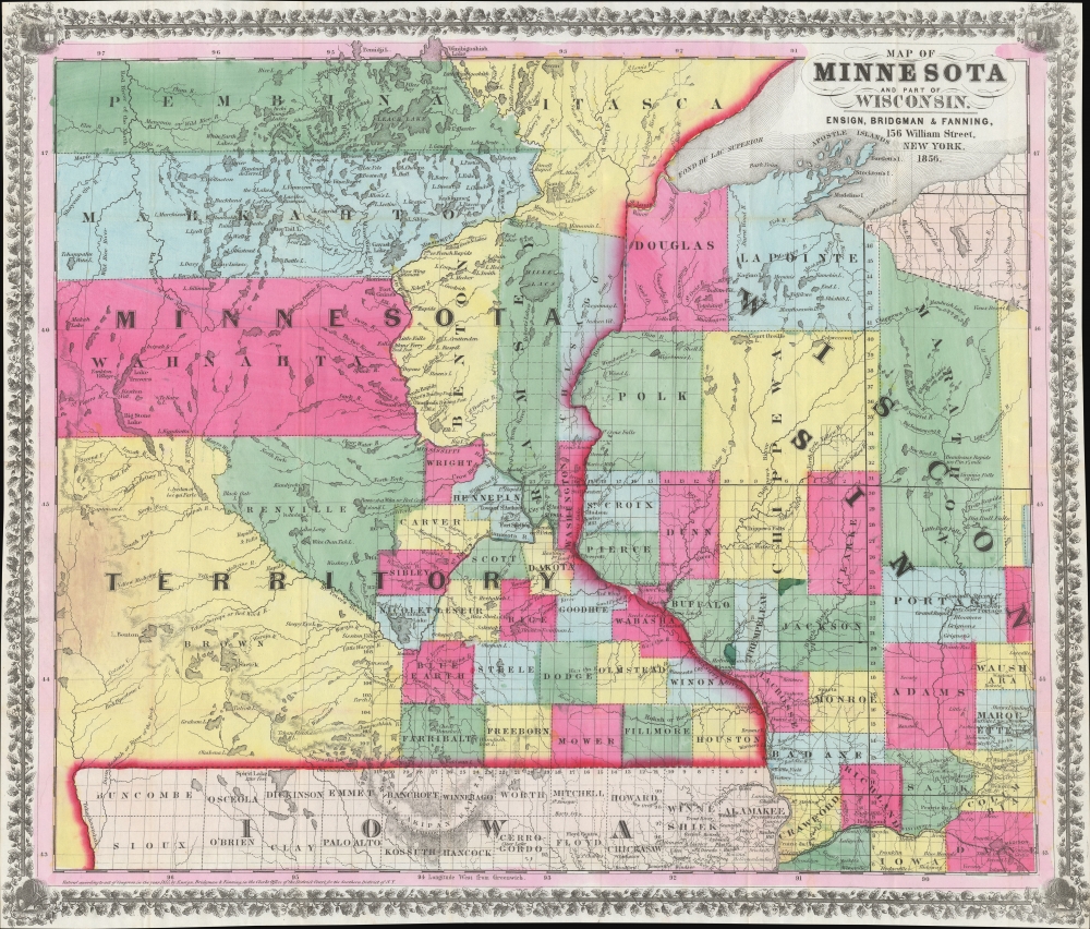
Map of Minnesota and Part of Wisconsin.
sold
- Digital Map Information
- Suitable for large format printing
- Full resolution TIFF file
- ICC color profile embedded
- Delivered instantly via download link
A stunning 1856 Ensign, Bridgman, and Fanning map of Minnesota Territory representing the early settlement of Minnesota. This map illustrates the beginning of the settlement plan for Minnesota proposed by Jonathan Carver in his 1778 Travels. When this map was issued, life in Minnesota was characterized by harsh living conditions and frontier lawlessness dominated by American Indian relations and the fur trade. (more details)
The Spanish Main with the Grace Line!
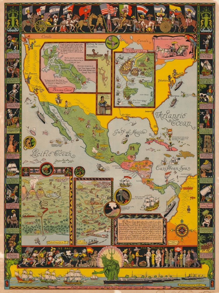
Father Neptune presenteth ye Grace Line fleet to ye olde Spanish Main.
sold
This is a rare 1933 Jo Mora pictorial map of Central America commissioned by the Grace Line to celebrate and advertise its newly-launched passenger service from New York City to Seattle via the Panama Canal. Centered on Central America, the map depicts North, Central, and South America and focuses on ports of call of the Grace Line. The whole is dedicated to the memory of the Spanish Main, which is referred to as the 'cradle of our Western Civilization'. Mora also includes a disclaimer of sorts just below this dedication, stating
The informative intent of this carte is Historical and Topographical yet it is rendered in the manner humorous that its perusal may be accomplished rather with the smile of levity than the frown of research.(more details)
Good times with geography!
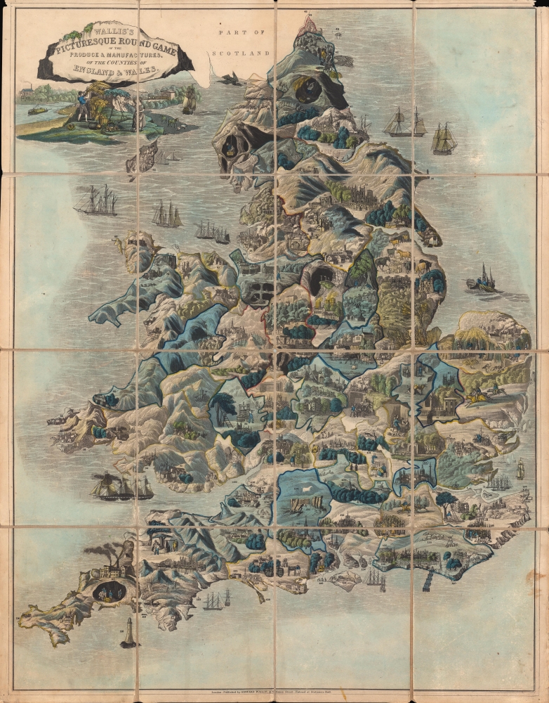
Wallis's Picturesque Round Game of the Produce and Manufactures of the Counties of England and Wales.
sold
- Digital Map Information
- Suitable for large format printing
- Full resolution TIFF file
- ICC color profile embedded
- Delivered instantly via download link
A fine example of this colorful c. 1830 table game map of England and Wales, filled with vignette illustrations. A race game with the added benefit of teaching children geography, this map represents each county in England and Wales. (more details)
One of history's most important diplomatic failures.

A general chart on Mercators projection to shew the track of the Lion and Hindostan from England to the Gulph of Pekin in China and their return to England.
sold
- Digital Map Information
- Suitable for large format printing
- Full resolution TIFF file
- ICC color profile embedded
- Delivered instantly via download link
This large 1796 John Barrow nautical map of the Atlantic and Indian Oceans was produced to accompany George Leonard Staunton's account of the first British diplomatic embassy to China, led by George Macartney on behalf of George III. It was drawn by John Barrow, who had served as the comptroller to Lord Macartney's mission. (more details)
Mapping a geopolitical shift.
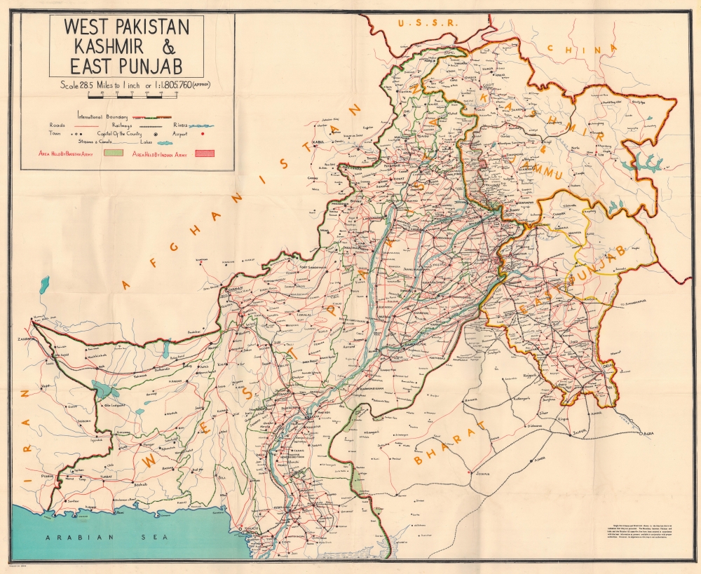
Map of West Pakistan, Kashmir, East Punjab and Rajisthan Showing International Boundaries and Cease-fire Lines of 1947 and 1965. / West Pakistan Kashmir and East Punjab.
sold
This is a 1966 Ferozsons map of West Pakistan issued following the Indo-Pakistani War of 1965. While the conflict is little known outside of the respective aggressor nations, viewed in the context of the Cold War, it led to a major geopolitical transition, as both nations felt betrayed by western powers and instead developed closer ties to the Soviet Union and China. (more details)
First State of one of the Earliest Modern Maps of the Holy Land and Cyprus.

Soria et Terra Santa Nuova Tavola.
sold
- Digital Map Information
- Suitable for large format printing
- Full resolution TIFF file
- ICC color profile embedded
- Delivered instantly via download link
This is a superb, first state example of Girolamo Ruscelli's 1561 map of the Holy Land and Cyprus. It is an enlarged, more finely-engraved iteration of Giocomo Gastaldi's 1548 Soria e Terra Sancta nova tabula. While Tibbetts avers that the Ruscelli contains fewer place names than its Gastaldi source, he is incorrect: Ruscelli's map preserves all the data of the Gastaldi, but between the increased size of the plate and the clear, legible, and well-spaced engraving of the newer map, its data is presented without the crowding evident on the 1548 map. The skill evident in this 1561 work can be credited to the engraver Giulio Sanuto, one of the few Venetian engravers whose career was not isolated either to map engraving or to figurative artistic works, but consisted of both over a career of more than forty years. (more details)
'Discover America' with Coca-Cola!

Play 'Discover America' with Caps from Coke.
sold
This is a 1962 Coca-Cola game map of the United States issued as part of Coca-Cola's campaign 'Discover America'. Coca-Cola produced 102 vignettes of sites across the United States (two for each state) and printed them on the bottom of their bottlecaps. A 'USA' shield on the cap indicated that it was part of the campaign. Once all 102 were collected, they could be redeemed for a whopping one 6-pack of Coca-Cola and another of Sprite. Coca-Cola also produced a 'collection card' upon which caps could be pasted to keep track of the collection. (more details)
Most magnificent pictorial map of China.

A Map of China. / 象形中華民國人物輿地全圖 / Xiàngxíng Zhōnghuá Mínguó Rénwù Yúdì Quántú (Pictorial Full Map of the People and Geography of the Republic of China.)
sold
- Digital Map Information
- Suitable for large format printing
- Full resolution TIFF file
- ICC color profile embedded
- Delivered instantly via download link
The most extraordinary pictorial map we have seen and the best specifically of China, a masterpiece. This enormous and lavish chromolithograph pictorial map of China was compiled in 1931 by John A. Diakoff, drawn by G. Primakoff, and printed by Yao-Hsiun. The map covers China from Kashgar to Taiwan, including neighboring Korea, Japan, Mongolia, and Nepal. All lands within China are rich in color and detail with countless vignettes illustrating a diversity of plant and animal life, human cultures, architectures, and resources. Text and annotations throughout are in both English and Chinese. Regions outside of China, like Japan, Korea, and India, are also heavily illustrated with vignettes, but are not in color. (more details)
Extremely rare and dramatic bird's eye view of Jerusalem with an abundance of scriptural references.

A correct Plan of the City of Jerusalem, with the genealogy of Our Blessed Lord and Saviour Jesus Christ.
sold
- Digital Map Information
- Suitable for large format printing
- DPI: 600
- File Size: 73.65 MB
- File Type: ZIP / TIFF
- ICC color profile embedded
- Delivered instantly via download link
This is a rare 1795 separate-issue pictorial view of Jerusalem, by London copperplate printer John Haines. Haines' maps, all large-scale wall maps intended for education and moral edification, were separately published in small numbers and very few survive. (more details)
Bestiary of fantastical northern monsters.

Mostri marini e terrestri, che si trouano in ogni luogo nelle parti d'aquilone.
sold
- Digital Map Information
- Suitable for large format printing
- Full resolution TIFF file
- ICC color profile embedded
- Delivered instantly via download link
Often euphemistically referred to as Munster's Monsters, this is Sebastian Münster's bestiary of sea serpents and other astonishing monsters, some fictional, some real. The image first appeared in the expanded 1550 editions of Munster's Cosmographia, a work which for more than half a century provided the European literate layperson their best source of information about the world. Most of the beasts here are derived from a 1539 map of Scandinavia by Olaus Magnus. As fanciful as these creatures may appear, many depict factual creatures that Scandinavian sailors and whalemen occasionally encountered. Among the more recognizable beasts are various forms of whales with obvious blowholes, at least two enormous lobsters, a sea serpent (possibly an oarfish), the whale fish (white fish at center, an Orca), and something that might very well be a walrus. Of course, there are fictional sea monsters too, including a pig faced sea beast, apparently seen by sailors in 1537, and the Sea Buffalo, something that looks like a cross between a bull and a fish. (more details)
Lavishly illustrated celestial chart.

Haemisphaeria Sphaerarum Rectae Et Obliquae Utriusque Motus Et Longitudines Tam Coelestes Quam Terrestres Ac Stellarum Affectiones Monstrantia.
sold
- Digital Map Information
- Suitable for large format printing
- DPI: 300
- File Size: 10 MB
- File Type: ZIP / TIFF
- ICC color profile embedded
- Delivered instantly via download link
A fine 1708 Andreas Cellarius celestial chart illustrating the motions of the upright (the Equatorial Coordinate System) and oblique spheres (the Ecliptic Coordinate System), the Celestial and Terrestrial Longitudes, and the influence of the stars. The surround is lavishly decorated with finely engraved and colored images of clouds, putti, and two sub-diagrams. It is of note that this is a beautifully colored example with giltwork incorporated into the color. (more details)
First Blaeu edition of the first map of Madagascar based on firsthand report.
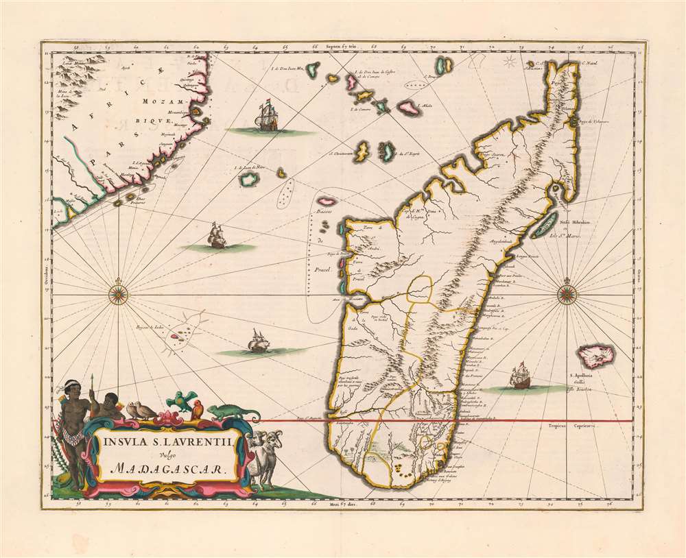
Insula S. Laurentii, vulgo Madagascar.
sold
- Digital Map Information
- Suitable for large format printing
- Full resolution TIFF file
- ICC color profile embedded
- Delivered instantly via download link
This is the first, 1662 edition of Joan Blaeu's map of Madagascar, in a superb original color example heightened with gold. It is among the scarcest of Blaeu's atlas maps,and one of the most beautifully engraved. This example is particularly desirable, featuring sumptuous original color and delicate gold highlighting. (more details)
Superb 18th century flag chart identifying the flags of the Dutch East India Company and Dutch West India Company.

Flaggen aller Seefahrenden Potenzen und Nationen in der gantzen Welt.
sold
- Digital Map Information
- Suitable for large format printing
- DPI: 300
- File Size: 12.76 MB
- File Type: ZIP / TIFF
- ICC color profile embedded
- Delivered instantly via download link
A c. 1765 flag chart issued by Matthias Seutter and Tobias Conrad Lotter. The flag features 139 flags of various nations, factions, and trading companies. Among the more interesting flags are those of the Dutch West India Company (G.W.C. /Geoctroyeerde Westindische Compagnie) and the Dutch East India Company (V.O.C. / Vereenigde Oostindische Compagnie). The premier placement of English flags in the upper left quadrant suggest that this chart may have been copied from an English source. (more details)