
The Northern Limits of Geographical Knowledge in the Age of Discovery
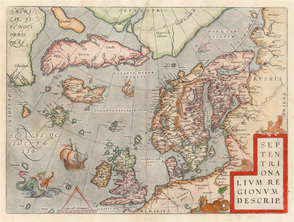
Septentrionalium Regionum Desrip.
sold
- Digital Map Information
- Suitable for large format printing
- DPI: 600
- File Size: 49.65 MB
- File Type: ZIP / TIFF
- ICC color profile embedded
- Delivered instantly via download link
One of Abraham Ortelius' most interesting maps, this is his 1570 map of Scandinavia and the Arctic. During the Age of Discovery, these north parts of the world represented regions as remote and unfamiliar as the coasts of America, Africa, and Asia. The map covers the northern regions from the English Channel to the just south of the North Pole and from America to Russia, including England, Scandinavia, Finland, Denmark, Iceland, and Greenland, as well as parts of America (Estotiland), the apocryphal island of Frisland, and Mercator's speculative Arctic islands. (more details)
The Great Mercator's Map of the East.
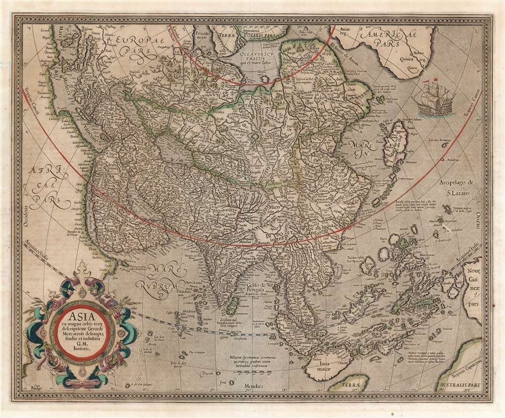
Asia ex magna orbis terre. descriptione Gerardi Mercatoris desumpta studio et industria G. M. Iunioris.
sold
- Digital Map Information
- Suitable for large format printing
- Full resolution TIFF file
- ICC color profile embedded
- Delivered instantly via download link
This is Gerard Mercator's 1595 map of Asia, the second map of the continent to appear in an atlas. It presents Asia as it was understood at the beginning of the Dutch effort to extend power into the Spice Islands, and at the dawn of the effort to discover alternative routes to them that would bypass the Portuguese lock on the Asia trade. The map extends across the Pacific to include New Guinea, the Philippines, and part of North America. While the interior still contains place names and geographical features that would have been familiar to Strabo, Ptolemy and Marco Polo, the coastline of Asia is filled with contemporary detail. The coastline of the subcontinent shows access to the best Dutch cartography of the late 16th century. The map shows part of North America across the mythical 'Strait of Anian.' In addition to the place name Anian, America contains several other place names, notably Coronado's 'Quivira,' the hoped-for location of the legendary seven cities of gold. The southeast portion of the map includes Sumatra, a recognizable Malay Peninsula, and a reasonably well-informed treatment of the Philippines and the Spice Islands. Sri Lanka appears in its proper location and correct naming (Zeilam ins.) rather than the Ptolemaic Taprobana; a note assigns that name as the name for Sumatra known in antiquity. New Guinea appears in part, and in the lower right corner is a glimpse of 'Terrae Australis Pars': not, alas, an early glimpse of the modern continent of Australia, but the northern extent of the then-undiscovered and legendary terra Australis, or Antarctica. In the north, there is yet no note of Barentz's discoveries for the Dutch in and around Nova Zemla, and there is shown a portion of Mercator's Terrae Polaris: two of his four Arctic landmasses appear. Japan is shown in the early, 'kite' shaped form that appeared on Mercator's 1569 world map; Korea does not yet appear. (more details)
The state of Franklinia. The first map of the United States by a Southerner.
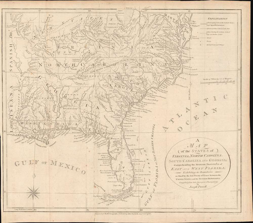
A Map of the States of Virginia, North Carolina, South Carolina and Georgia; Comprehending the Spanish Provinces of East and West Florida: Exhibiting the Boundaries as fixed by the late Treaty of Peace between the United States and the Spanish Dominions.
sold
- Digital Map Information
- Suitable for large format printing
- DPI: 600
- File Size: 242.41 MB
- File Type: ZIP / TIFF
- ICC color profile embedded
- Delivered instantly via download link
This 1792 Joseph Purcell map of the United States recording post-Revolutionary War westward expansion. This is one of the earliest maps to identify the ephemeral pseudo-state of Franklinia, the claims of the Ohio Company of Associates, the lands of the New Jersey and Wabash Companies, the Cumberland Settlement, and the Moravian Settlement. It is moreover, one of the best maps of the American Indian nations in the southeast - benefiting from Purcell's firsthand reconnaissance. Significantly, this is also the first maps of the United States by a southern cartographer. (more details)
Revealing Uzbek geography
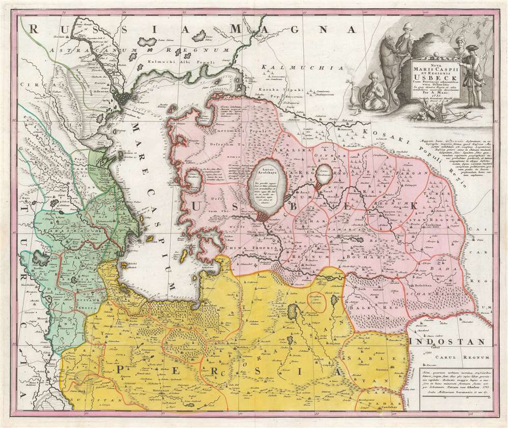
Nova Maris Caspii et Regionis Usbeck cum Provincijs adjacentibus vera Delineatio.
sold
- Digital Map Information
- Suitable for large format printing
- DPI: 600
- File Size: 69.16 MB
- File Type: ZIP / TIFF
- ICC color profile embedded
- Delivered instantly via download link
This is Abraham Maas' map of Uzbekistan and the Caspian Region, edited by Johann Peter von Ghelen and published by Homann Heirs in 1735. It was the first map to show the results of Peter the Great's initiatives to chart this ill-understood frontier of the Russian Empire, and it is the first printed map specifically of the Uzbek region. The map shows the area around the Caspian Sea and northern Iran. A broad area running eastwards from the Caspian is marked 'Uzbek;' this encompasses Turkmenistan, Uzbekistan, Kyrgyzstan, Tajikistan and part of Kazakhstan. (more details)
State-of-the-art 18th Century Cartography.

Africa, Performed by the Sr. D'Anville under the Patronage of the Duke of Orleans.
$1,000.00
Acquire
- Digital Map Information
- Suitable for large format printing
- Full resolution TIFF file
- ICC color profile embedded
- Delivered instantly via download link
This large and evocative four-sheet 1755 wall map of Africa captures a transitional period in European understanding of African geography. It was bound, in its four separate sheets, in the second volume of Malachy Postlethwayte's The Universal Dictionary of Trade and Commerce. The map is the work of Solomon Boulton, who drafted the map as a largely faithful translation of the illustrious French cartographer Jean-Baptiste Bourguignon d’Anville's 1749 map of the continent. D'Anville was an extremely careful mapmaker, meticulous in detail and scrupulous in the data presented in his work, and for the most part Boulton preserves these qualities while translating the original text and adding an attractive rococo cartouche. (more details)
Pyongyang and environs, in the good old days.

[Pyongan].
sold
- Digital Map Information
- Suitable for large format printing
- DPI: 600
- File Size: 27.51 MB
- File Type: ZIP / TIFF
- ICC color profile embedded
- Delivered instantly via download link
This is a unique c. 1850 map of Pyongan Province (平安道) published in Korea during the late Joseon period (1392 - 1897). It provides substantial geographic and administrative information on Pyongan, one of the eight traditional provinces of Joseon, now located in the Democratic People's Republic of Korea (North Korea). (more details)
An early atlas map of Hwanghae Province, ground zero of the Korean War.

[Hwanghae].
sold
- Digital Map Information
- Suitable for large format printing
- DPI: 600
- File Size: 24.99 MB
- File Type: ZIP / TIFF
- ICC color profile embedded
- Delivered instantly via download link
This is a unique c. 1850 map of Hwanghae Province (黃海道) published in Korea during the late Joseon period (1392 - 1897). It provides a wealth of geographic and administrative information on Hwanghae, one of the eight traditional provinces of Joseon, now located in the Democratic People's Republic of Korea (North Korea). (more details)
Pictorial map of Rome.
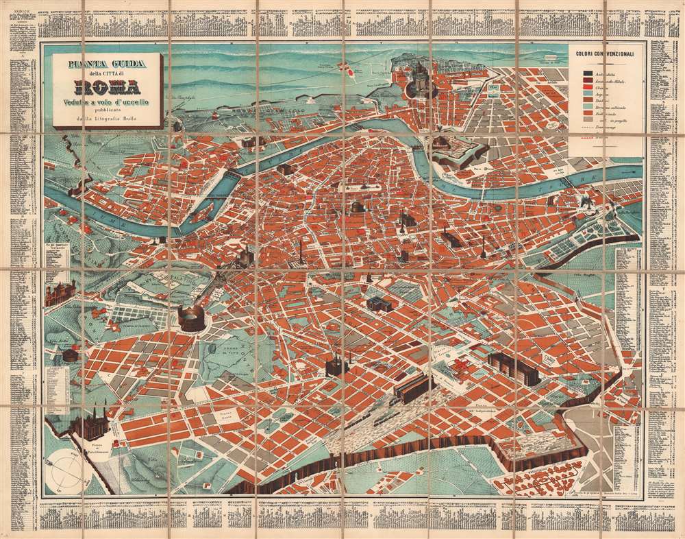
Pianta Guida della Città di Roma: Veduta a volo d'uccello.
sold
- Digital Map Information
- Suitable for large format printing
- File Size: 104.64 MB
- File Type: ZIP / TIFF
- ICC color profile embedded
- Delivered instantly via download link
This is a scarce c. 1900 Romolo Bulla indexed pictorial bird's eye view of Rome, Italy. Oriented towards the west-southwest, it depicts Rome from the Aventine Hill to the Piazza del Popolo and the Villa Borghese, and from the Vatican to the Termini train station. (more details)
A most hotly disputed straits.

China Sea. Formosa I. and Strait. From Various Admiralty Surveys 1843 - 1904. Formosa and the Pescadores Is. from Japanese Government Surveys 1895 - 1909.
sold
- Digital Map Information
- Suitable for large format printing
- File Size: 56.96 MB
- File Type: ZIP / TIFF
- ICC color profile embedded
- Delivered instantly via download link
This 1929 British Admiralty nautical chart or maritime map of Taiwan (Formosa) and the Taiwan Strait (Formosa Strait) details one of the world's most hotly disputed straits. The map embraces the entire island of Taiwan, the Penghu Islands (Pescadores), and part of the Fujian coast of China. Taiwan exhibits a surprising amount of inland detail for a nautical chart, including roads, cities, towns, villages, and detailed topography. In China proper, inland detail does not extend beyond the coastline and is limited to rivers and some high points. Yellow manuscript notations mark coastal lights and beacons. (more details)
A most attractive Dutch Map of the Mogul Empire.
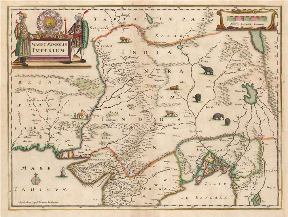
Magni Mogolis Imperium.
sold
- Digital Map Information
- Suitable for large format printing
- DPI: 600
- File Size: 44.94 MB
- File Type: ZIP / TIFF
- ICC color profile embedded
- Delivered instantly via download link
This is an attractive, original color example of Jan Jansson's 1641 map of the Mughal Empire of Northern India. It is the most attractively engraved of the 17th century maps derived from the unacquirable Baffin / Roe map. It features the first accurate mapping of the Indus River, as well as western and central India. At its heart, the map reveals the vital trade routes between the chief cities of Gujarat, Agra, Jaisalmer, and their linkage the Silk Road center of Kabul. (more details)
France recognizes the Republic of Texas.

Carte Des États-Unis du Méxique.
sold
- Digital Map Information
- Suitable for large format printing
- DPI: 600
- File Size: 65.65 MB
- File Type: ZIP / TIFF
- ICC color profile embedded
- Delivered instantly via download link
This is an 1841 Pierre and Alexandre Lapie map of Mexico and the southwestern United States, one of the earliest non-American maps to include the Republic of Texas. The map depicts the region from the Pacific Ocean to the Mississippi River and from the Oregon Territory to the Yucatan Peninsula and the Pacific Ocean. (more details)
Boston and its immediate surroundings.
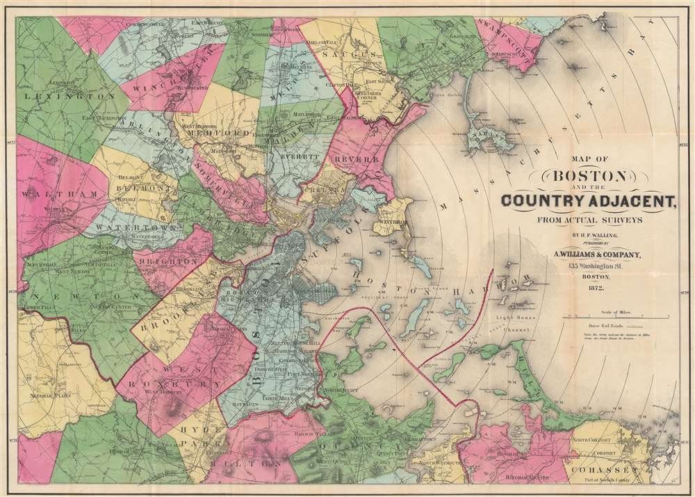
Map of Boston and the County Adjacent, From Actual Surveys.
sold
- Digital Map Information
- Suitable for large format printing
- Full resolution TIFF file
- ICC color profile embedded
- Delivered instantly via download link
This is an 1872 Henry Walling map of Boston, Massachusetts, and the surrounding region. Railroads run in and out of the city, including the Boston and Providence Railroad, the Boston and Worcester Railroad, and the Old Colony and Trail River Railroad. Several horse-drawn streetcar lines are illustrated as well. Boston Common, the hospital, state house, jail, and customs house are labeled within the city. Individual buildings appear, with some identified, such as factories, churches, and train stations. Concentric circles illustrating mile increments emanate from the State House in Boston. (more details)
Cattle country.
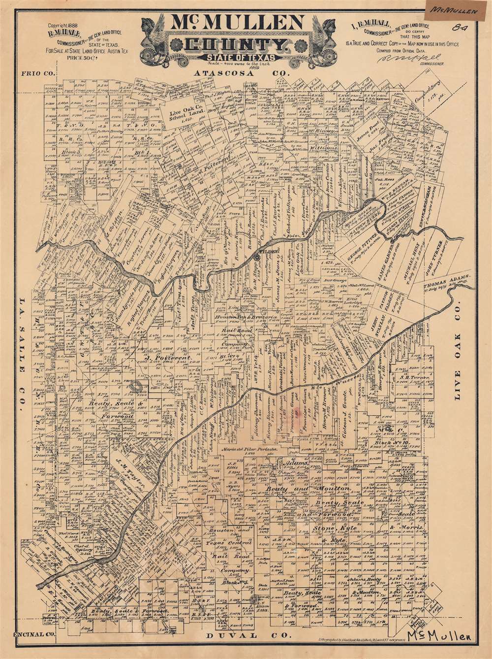
McMullen County. State of Texas.
sold
- Digital Map Information
- Suitable for large format printing
- File Size: 61.43 MB
- File Type: ZIP / TIFF
- ICC color profile embedded
- Delivered instantly via download link
This is a very rare 1889 plat or cadastral map of McMullen County, Texas produced by Augustus Gast for the Texas General Land Office. It shows the demarcation of properties and their owners in the South Texas county, which was and remains primarily ranchland. (more details)
Stunningly engraved.
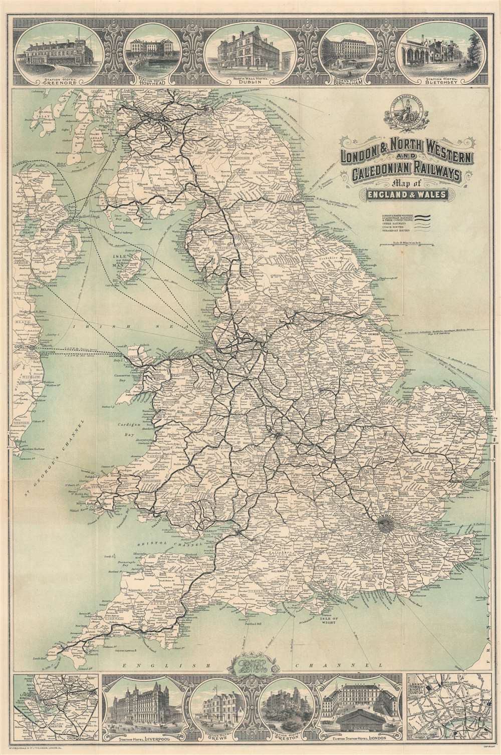
London and North Western and Caledonian Railways Map of England and Wales.
sold
- Digital Map Information
- Suitable for large format printing
- Full resolution TIFF file
- ICC color profile embedded
- Delivered instantly via download link
A beautifully engraved piece, this is a c. 1911 George McCorquodale map of England and Wales created for the London and North Western and Caledonian Railways. Bold lines trace railroads throughout England and Wales, with station stops identified. Vignettes along the top and bottom borders illustrate station hotels, including hotels in Dublin, Birmingham, Bletchley, Liverpool, and London. An inset in the lower left details on the region around Liverpool, Manchester, and Crewe, while a second inset in the lower right depicts London, highlighting its railway stations: Euston, King's Cross, St. Pancras, and Waterloo. (more details)
One of the 18th century's key works on ancient history.
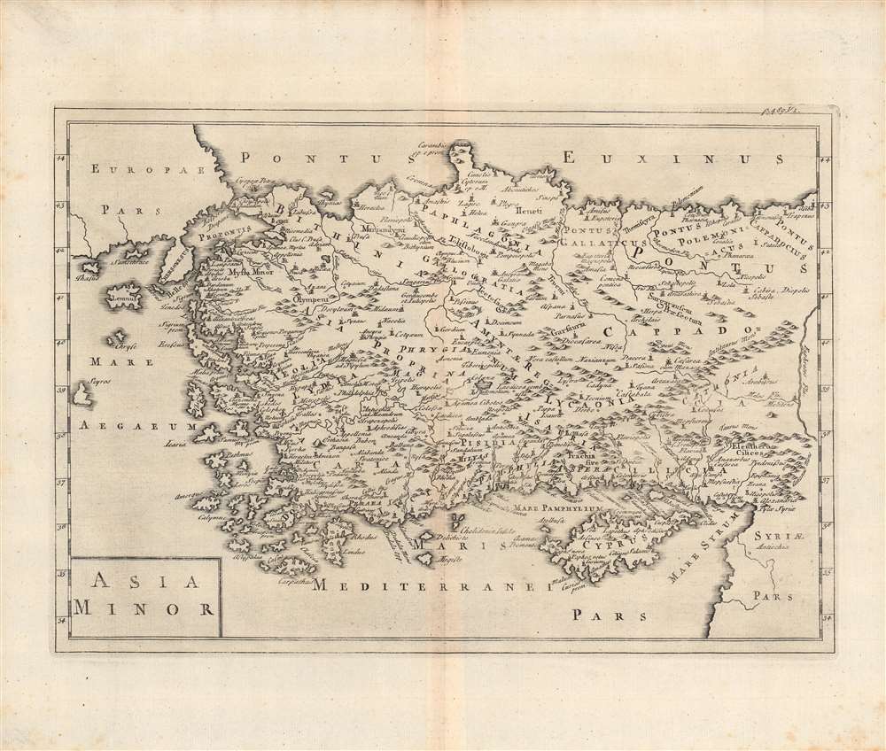
Asia Minor.
sold
- Digital Map Information
- Suitable for large format printing
- DPI: 600
- File Size: 33.01 MB
- File Type: ZIP / TIFF
- ICC color profile embedded
- Delivered instantly via download link
This is a c. 1703 map of Asia Minor by Christoph Cellarius' published in his Notitia Orbis Antiqui, Sive Geographia Plenior.... Cellarius was an expert on ancient languages and history, and this work employs the Latinized names of ancient Anatolian territories and kingdoms. (more details)
The Caribbean on the cusp of emancipation.
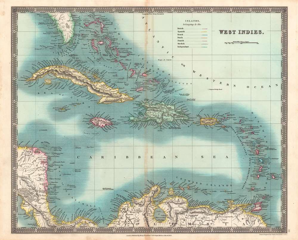
West Indies.
sold
- Digital Map Information
- Suitable for large format printing
- DPI: 600
- File Size: 44.63 MB
- File Type: ZIP / TIFF
- ICC color profile embedded
- Delivered instantly via download link
This is an especially vivid example of John Dower and Henry Teesdale's 1831 map of the West Indies published in their A New General Atlas of the World. This map was published when the region was undergoing rapid transformations resulting from the end of the slave trade and the institution of slavery itself. (more details)
One of the most desirable maps of any part of the world, ever printed.
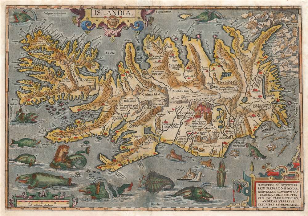
Islandia.
sold
- Digital Map Information
- Suitable for large format printing
- Full resolution TIFF file
- ICC color profile embedded
- Delivered instantly via download link
This is a beautiful example of the Vrients issue of Abraham Ortelius' 1587 map of Iceland. Ortelius' Islandia is arguably the most famous decorative map, being the 'monster map' par excellence, as it presents a menagerie of sea monsters typically found on early maps. The map is geographically important as well. It strongly evokes Iceland's astonishing terrain with its vigorously engraved mountains, and it is remarkably accurate since it is the first map of Iceland based on reports of an Icelander, Gudbrandur Thorlaksson (Guðbrandur Þorláksson; c. 1542 0 1627). (more details)
Singapore's Chinatown.
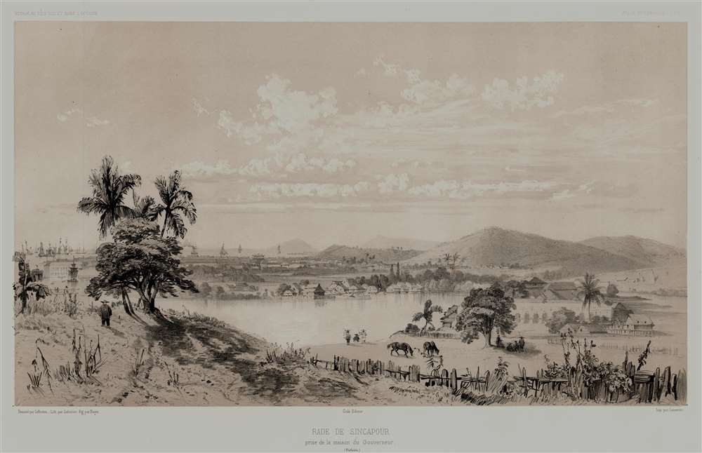
Rade de Sincapour Prise de la maison du Gouverneur. (Malaisie).
sold
- Digital Map Information
- Suitable for large format printing
- Full resolution TIFF file
- ICC color profile embedded
- Delivered instantly via download link
One of the earliest obtainable views of Singapore, this is Eugène Cicéri's 1846 view of Singapore drawn from original sketches and maps compiled during Jules Sébastien César Dumont d'Urville's (1790 - 1842) circumnavigation of the globe. The source sketches were created when d'Urville's ships, Astrolabe and Zélée, were at Singapore between June 27 and July 2, 1839. (more details)
Chained in the claws of the British Empire.

Bajo la zarpa británica, Breve historia del militarismo inglés.
sold
- Digital Map Information
- Suitable for large format printing
- File Size: 211.7 MB
- File Type: ZIP / TIFF
- ICC color profile embedded
- Delivered instantly via download link
A fascinating 1918 German-issued Spanish-language World War I broadsheet propaganda map representing the world wrapped in chains of British militantism and colonialism. Issued by F. Haase, this map was part of the WWI propaganda war waged by both the Allies and Central powers to sway the hearts and minds of neutral nations. (more details)
First published plan of Singapore.
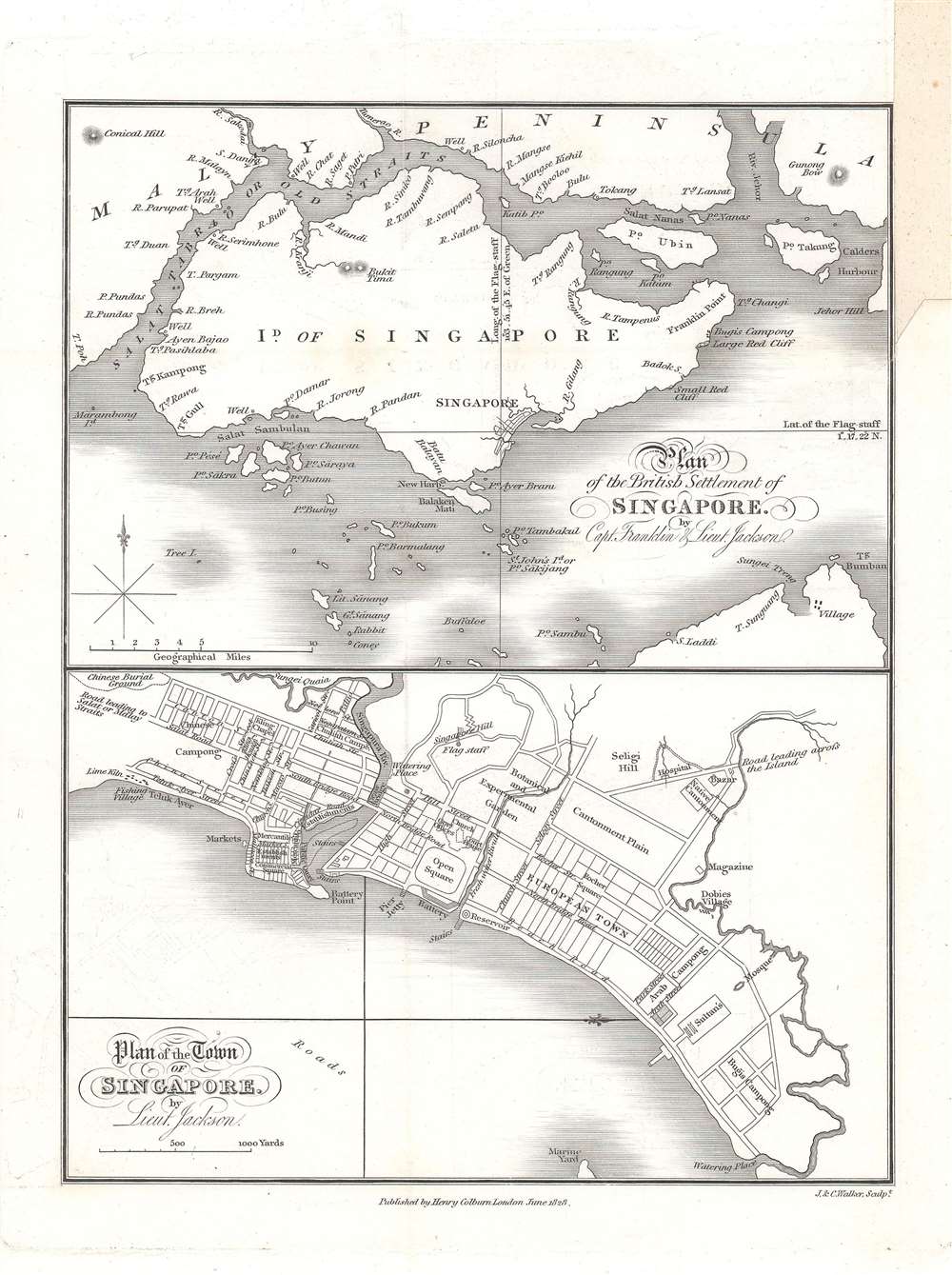
Plan of the Town of Singapore by Lieut. Jackson. / Plan of the British Settlement of Singapore by Capt. Franklin and Lieut. Jackson.
sold
- Digital Map Information
- Suitable for large format printing
- DPI: 600
- File Size: 9.23 MB
- File Type: ZIP / TIFF
- ICC color profile embedded
- Delivered instantly via download link
Known as the Jackson Plan or Raffles Plan, this is the first published map of Singapore. Published in 1828, the map was drawn by Lieutenant Philip Jackson at the request of the founder of modern Singapore, Sir Stamford Raffles (1781 - 1826). It is divided into two sections, a map of the island of Singapore at top, and a close-up plan of the town of Singapore at bottom, oriented towards the west. The city plan presents an idealized version of Singapore following the Raffles vision and, while not fully implemented, was influential in the early development of the colony. (more details)