
Navigating the Puget Sound.

Birdseye View of Puget Sound Country and Vicinity.
sold
- Digital Map Information
- Suitable for large format printing
- File Size: 39.66 MB
- File Type: ZIP / TIFF
- ICC color profile embedded
- Delivered instantly via download link
A striking 1910 chromolithograph view map of Puget Sound, Olympic Peninsula, and Vancouver Island. The view looks west on the Puget Sound from an orbital-level highpoint above Washington State. Coverage extends from the Columbia River to the Northern tip of Vancouver and from Seattle to the distant, red, sunset over the Pacific. The routes of the Puget Sound Navigation company are highlighted. (more details)
Focus on Yale.
New Haven.
sold
- Digital Map Information
- Suitable for large format printing
- File Size: 90.86 MB
- File Type: ZIP / TIFF
- ICC color profile embedded
- Delivered instantly via download link
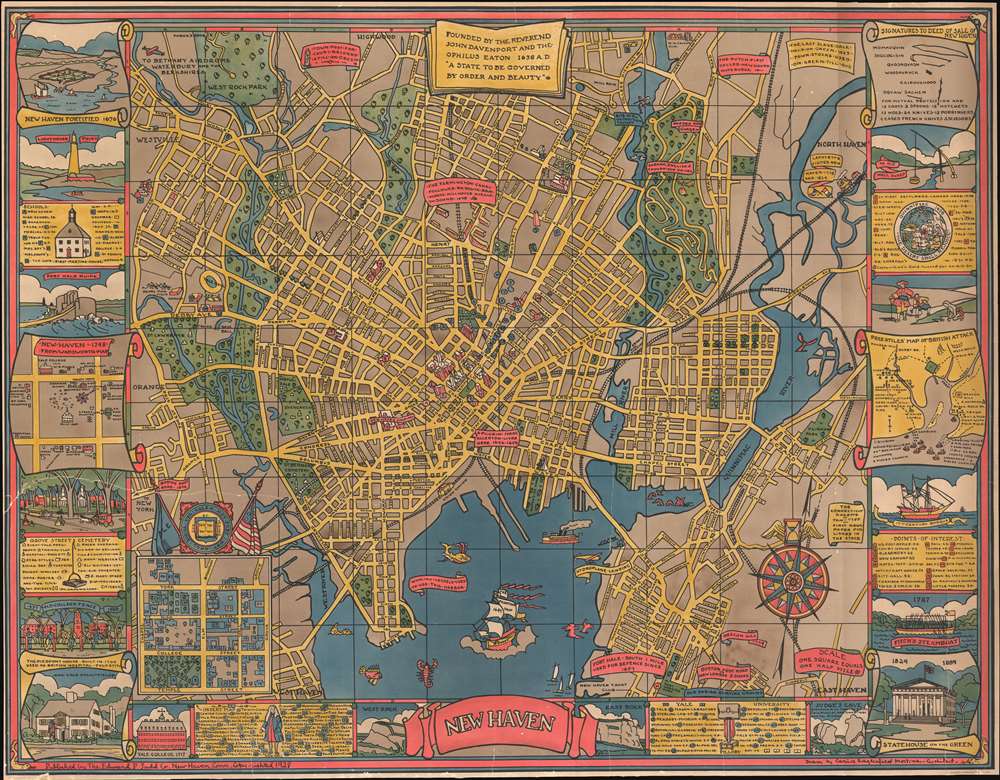
This is a 1928 Carina Eaglesfield Mortimer pictorial city map or plan of New Haven, Connecticut. The map depicts the city from Westville and Orange to the Quinnipiac River, North Haven, and Fairmont Park and from West Rock Park to Fort Wooster Park. (more details)
How was the 'West Won'?

Danny Arnold's Pictorial Map of How the West Was Won...
sold
This is a c. 1963 Fran Dowie pictorial map of the United States highlighting U.S. frontier history, or 'How the West was won'. The map was most likely created to cash in on the success of the Cinerama film by the same name. Captioned illustrations mark important historical events and provide context. Important battles during the Indian Wars, acts of frontier justice against outlaws such as Jesse James and Billy the Kid, and the shootout at the O.K. Corral are a few of the events noted. Pioneer trails, such as the Oregon Trail, the Santa Fe Trail, and the Pony Express Route, are illustrated as well. The Grand Canyon, the Rocky Mountains, and the Sierra Nevada Mountains evoke the majesty of the rugged terrain. The whole is surrounded by a pictorial border incorporating portraits of frontier personalities: Doc Holliday, Crazy Horse, Jim Bowie, Wyatt Earp, Davy Crockett, and Jesse James. (more details)
The first pictorial map made in Israel?

Jerusalem.
sold
This is a stunning 1969 first edition Herman Bollmann bird's eye view pictorial map of Jerusalem. The map depicts the city from the Old City to Hebrew University. Buildings throughout Jerusalem are illustrated in detail, including the Dome of the Rock, the Western Wall, the Al-Aqsa Mosque, the Church of the Redeemer, and the Church of the Holy Sepulcher in the Old City, which is surrounded by its ancient walls. Numerous gates in the walls are identified. Myriad small buildings are illustrated within the Old City, and the Jewish Quarter, Christian Quarter, Muslim Quarter, and Armenian Quarter are each labeled. Buildings and other sites outside the Old City are also illustrated and labeled, including the Church of the Tomb of the Virgin, Gethsemane, David's Tomb, the Church of Dormition, and the Yemin Moshe Synagogue. The Catholic, Protestant, Jewish, and Muslim cemeteries are all identified. Numerous streets are identified. The whole is surrounded by a border bearing the name of Jerusalem translated into sixteen different languages. (more details)
'How this coast smells of riches!' - Jane de Glehn
Relief Map of Cannes and surrounding country. / Carte en Relief de Cannes et Environs.
sold
- Digital Map Information
- Suitable for large format printing
- Full resolution TIFF file
- ICC color profile embedded
- Delivered instantly via download link
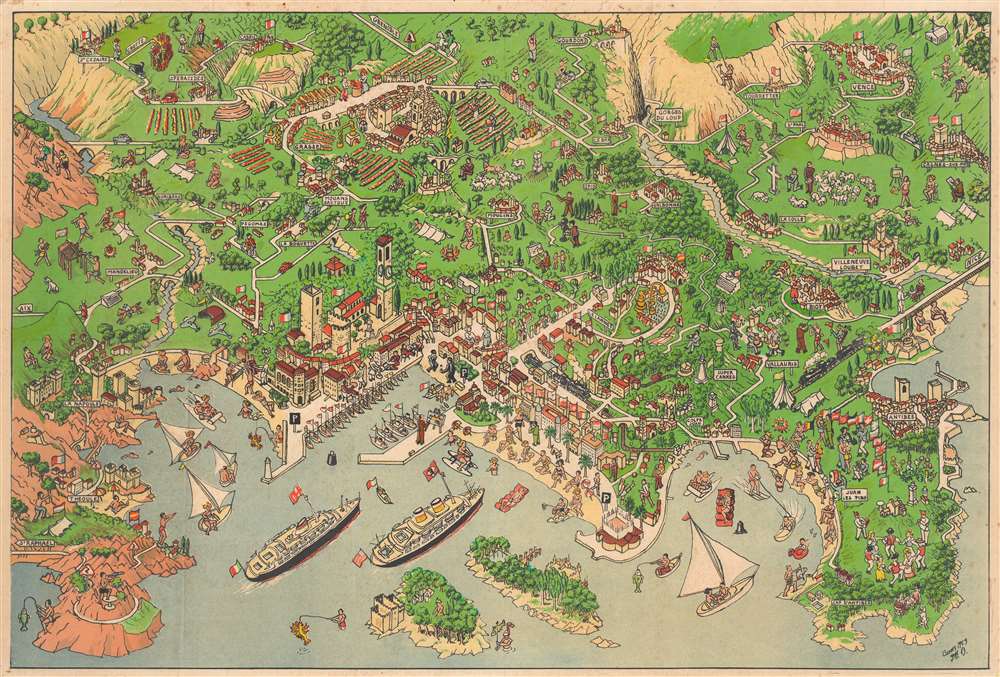
This is a 1953 pictorial map of Cannes, Côte d'Azur, France. World famous as the host of the Cannes Film Festival, Cannes appears just below center with its celebrated beaches and harbor on full display. Vacationers sunbathe on the beaches and sail and paddle-board in the bay. More vacationers waterski and enjoy the fine weather in the Golfe Juan not far from Juan les Pins and Antibes, two other popular French Riviera resort towns. Villages interspaced with lavender fields dot the landscape inland. (more details)
Take a steamship to Florida from New York!

The Clyde Steamship Co. Map of Florida Showing Routes and Railroad Connections.
sold
- Digital Map Information
- Suitable for large format printing
- Full resolution TIFF file
- ICC color profile embedded
- Delivered instantly via download link
This is a 1903 Clyde Steamship Company map of Florida. Overprinted red dashed lines mark the Clyde Steamship Company's routes out of Jacksonville north to Charleston, New York, and Boston, as well as the St. John's River Line from the coast inland south along the river to Sanford. An inset map along the left border traces the company's many routes from their terminal in Florida to destinations along the coast. A second inset map, in the lower left, details the Florida panhandle from the Alabama border to Washington County. (more details)
Charming pictorial map of Miami Beach.
Miami Miami Beach Tourguide Map.
sold
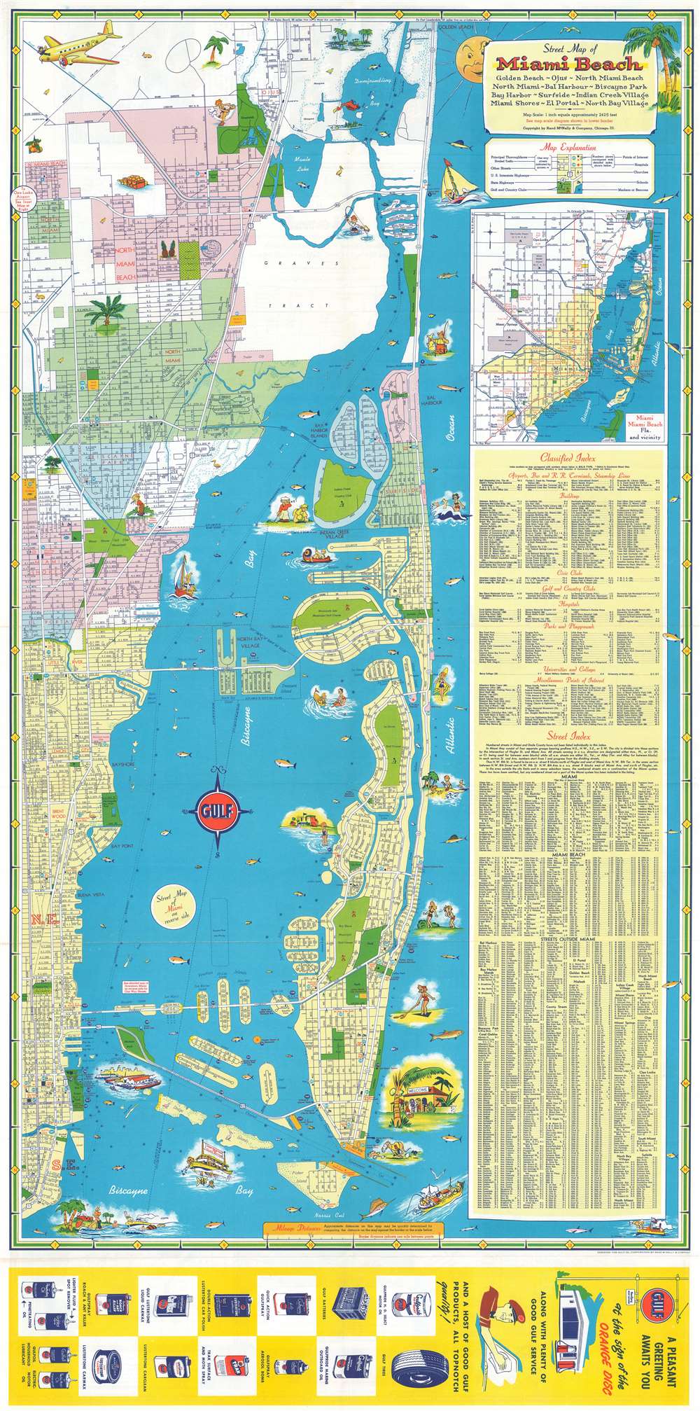
This is a c. 1957 Rand McNally city plan or map of Miami and Miami Beach, Florida. Miami Beach appears on the recto and Miami on the verso. Humorous vignettes populate both maps, including people playing golf, tennis, football, and polo. Others enjoy the fantastic weather, suntanning on the beach or taking a nap under a palm. Vacationers go fishing, sailing, and take in a game at the Orange Bowl. Streets are illustrated and labeled throughout, along with numerous other locations, such as parks, hospitals, churches, schools, libraries, and golf courses. (more details)
The threat China joining the 'Nuclear Club'!
Provinces, Cities of Red China are Mapped.
sold
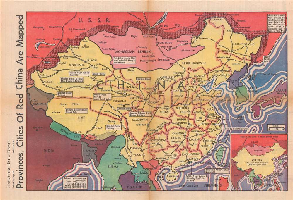
This is a 1967 Longview Daily News map of China emphasizing the rising communist power. The map was published three years after the People's Republic of China (PRC) tested their first nuclear weapons and is intended to emphasize the potential threat these weapons posed to the democratic world. White text boxes emphasize China's uranium mines, missile ranges, and main nuclear test site. American concern surrounding China joining the 'nuclear club' was heightened by the every-increasing American military presence in South Vietnam. Other text-boxes note Tibet's resentful relationship with China, Hong Kong as 'the British Crown Colony' and a 'listening post for the West', and 'Nationalist China's Island Stronghold' (Taiwan). The buffer zone between the Soviet Union and the PRC is marked by black diagonal lines. Both sides claimed these border areas, a dispute that would lead to the undeclared 1969 Sino-Soviet border war. (more details)
Fishing in Tampa.

Rube Allyn's Authentic Fishing Map Lower Tampa Bay.
sold
A most interesting map, this is Rube Allyn's fishing map of southern Tampa Bay. The map depicts from Mullet Key to Gulfport and Boca Ciega Bay. It is detailed with a wealth of information valuable to the fisherman. It points out where certain fish can be found, provides basic depths, and offers interesting colloquial names for offshore locations. This map is part of a series produced by Allyn in the late 1950s and early 1960. The present map is sheet 1A, the other sheets in the set include 1B, 2A, and 3C - all of which are cataloged in the Touchton Collection at the Tampa Bay History Center. (more details)
Iconic map of Paris and its monuments.

Paris Monumental et Métropolitain.
sold
- Digital Map Information
- Suitable for large format printing
- Full resolution TIFF file
- ICC color profile embedded
- Delivered instantly via download link
This extremely appealing c. 1920 pocket map of Paris France by Robelin combines the virtues of a map and a view. Designed with the tourist in mind, this map covers the embastilled center of Paris and its immediate vicinity. It reflects the transformation and modernization of Paris under Napoleon III and Georges-Eugène Haussmann. Paris proper is colored in appealing pastels and exhibits more 'map-like' qualities in the layout of the streets, trains, and bridges. Various monuments, including the Eiffel Tower, the Arc de Triomphe, Sacre-Coeur, the Pantheon, and others are shown in profile. Major streets, subway lines, and subway stations are also noted. Paris is surrounded in green, including the Bois de Boulogne and the Bois de Vincennes. Several of the surrounding villages are labeled as well. (more details)
A Glimpse of Expanding St. Petersburg, Florida.
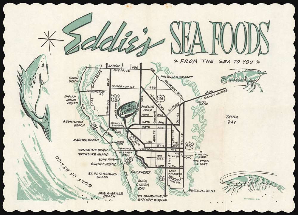
Eddie's Sea Foods *From the Sea to You*
sold
This 1962 placemat map of St. Petersburg, Florida is a promotional work for a seafood restaurant. Decorated with crawfish and other seafood, the centerpiece is a road map of St. Petersburg from its barrier islands on the Gulf Coast to the Tampa Bay shore, extending from Pinellas Point in the south to Bay Drive in the North. The map captures the city just prior to a series of major changes to its infrastructure: Boca Ciega Bay's landfill islands such as Capri, Paradise Island, and Yacht Club Estates did not yet exist, for example. The Pinellas Byway bridge does not appear here: it would not be completed until December, 1962. The Welch Causeway, connecting Madeira Beach with Seminole Boulevard, was built earlier that year, giving us the 1962 dating. (more details)
Defending the borders in the wake of Commodore Perry.
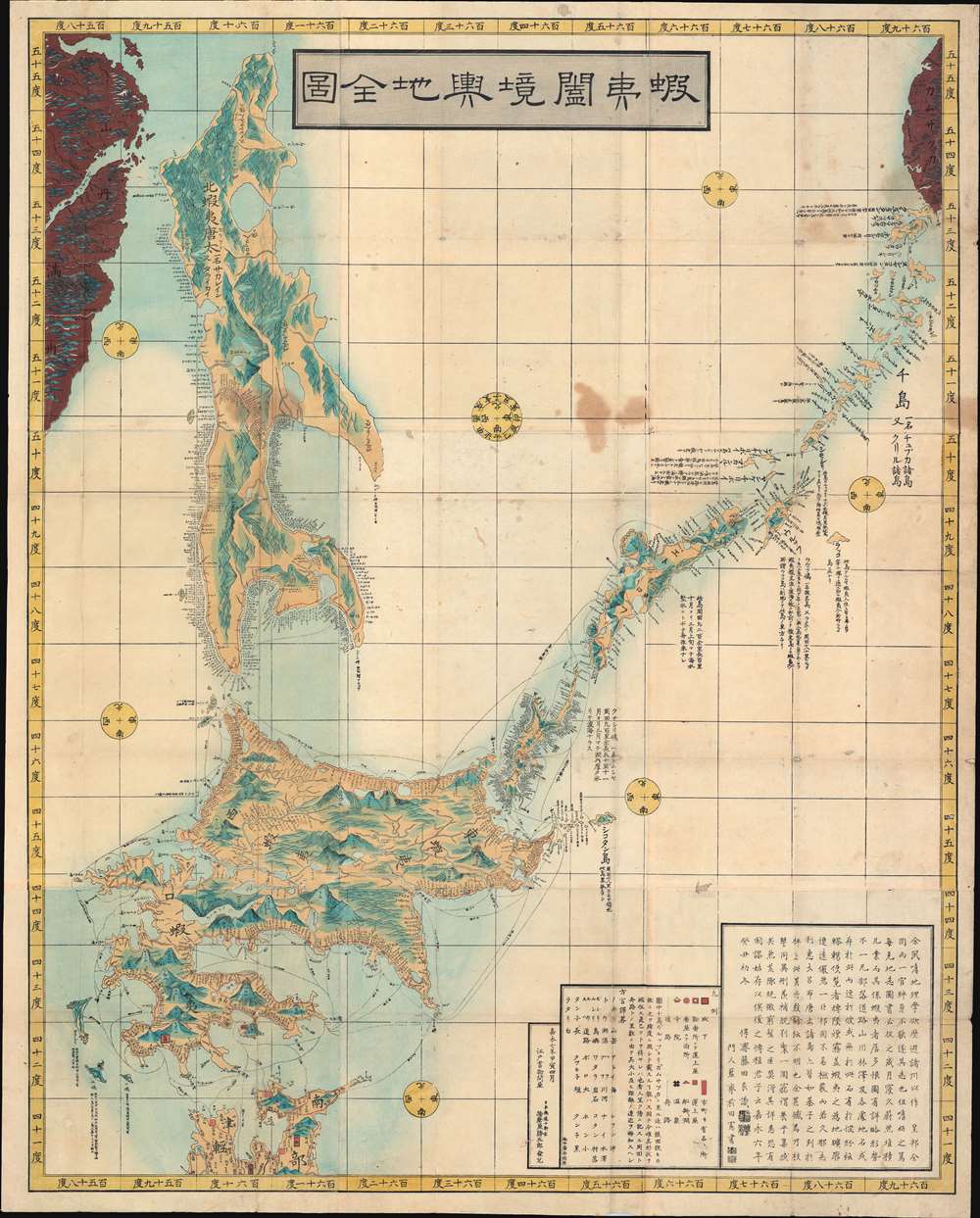
蝦夷闔境輿地全図 / Ezo Kokyou Yochi Zenzu. / Complete Map Ezo Border.
sold
- Digital Map Information
- Suitable for large format printing
- DPI: 600
- File Size: 120.07 MB
- File Type: ZIP / TIFF
- ICC color profile embedded
- Delivered instantly via download link
This is a rare 1854, Kaei 7, Japanese Edo period Fujita Ryou (橋本貞秀) chromoxylographic map illustrating Hokkaido, Sakhalin, and the Japanese Kuril Islands. It was issued following the 1853 arrival of Commodore Matthew Perry anticipating the opening of Hakodate as one of the 5 Japanese treaty ports. The maps coverage extends north from the tip of Honshu to include Sakhalin Island and the Kuril Islands as far as Kamchatka. This is a practical map, intended for actual Japanese voyages, both military and trade, and thus features copious annotations and coastal notes. A preface in Chinese is added to the end of the map, and 16 Ainu words are listed as 'dialect translation abbreviations'. (more details)
The Red River Rebellion...
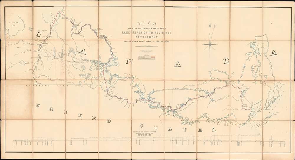
Plan Shewing the Proposed Route from Lake Superior to Red River Settlement.
sold
- Digital Map Information
- Suitable for large format printing
- File Size: 40.99 MB
- File Type: ZIP / TIFF
- ICC color profile embedded
- Delivered instantly via download link
A most interesting and influential 1870 Canadian War Office map issued during the Red River Rebellion (1869 - 1870). The map covers from Lake Winnipeg and the Red River Settlement to the western shores of Lake Superior. It details two alternate river / lake / portage routes from Superior to Fort Garry, modern-day Winnipeg. The first being the traditional route, or 'Pigeon River Route', following the US - Canada border, the second being the longer but wholly Canadian 'Kaministiguia Route'. The map was issued by the War Department for the Wolseley Expedition, a military force sent to suppress the Red River Rebellion and prevent the Settlement's pending annexation by land-hungry Minnesotans. The outcome of the map and the Expedition was the 1870 creation of Manitoba as a province in the Canadian Confederation. The map would later be used for preliminary surveys anticipating the construction of a trans-Canadian railway. (more details)
Rare Rummell!

Amherst College.
sold
- Digital Map Information
- Suitable for large format printing
- File Size: 31.52 MB
- File Type: ZIP / TIFF
- ICC color profile embedded
- Delivered instantly via download link
A most unusual and scarce c. 1915 Richard Rummell bird's-eye view of Amherst College, Massachusetts. Founded in 1821, Amherst College went through a lot of changes since this view was made. The view looks south on the college. The large avenue running through the image is Pleasant Street. The college observatory, the Octagon (1848) is evident near center. To the left of the Octagon is College Row, with the distinctive clock tower of Johnson Chapel (1827), flanked by North and South Colleges. The elaborate granite Walker Hall (1870), once called the 'Temple of Science' appears on the south side of Webster Circle, roughly where Robert Frost Library now stands. (more details)
A comic look at 1980 Hong Kong.

Hong Kong.
sold
A 1980 charming pictorial map of Hong Kong by illustrator and Hong Kong historian Tom Briggs. The map looks east on Hong Kong, with Kowloon on the left and Hong Kong Island on the right. The Star Ferry appears just below and left of center, connecting Central to Kowloon Pier. The map is rife with advertising for Hong Kong Business, but also historical notes, and humorous commentary. For example, a wizard advertised as a 'World Money Analyst' claims he can 'turn it into almost anything.' Fish in the harbor comment on Hong Kong social strata - 'They haven't spoken a word to anyone since they moved up to mid levels.' The pirate 'Eung Po Choi' claims that in 100 years he'll be a 'Hong Kong real estate developer.' Even the basement strip club, 'Bottoms Up' appears - duty free. (more details)
Communist forced labor camps in Bulgaria.

45 ГОДИНИ СТИГАТ. / 45 Years Are Enough!
sold
Created by Dimitar Tomov, this 1989 map of Bulgaria highlights the network of forced labor and concentration camps throughout Bulgaria in the second half of the 20th century. The camp network was perpetrated by the Communist regime which was in power between 1944 and 1989. Forced labor camps are marked by black stars and black flags bearing grisly white skulls. Each camp is identified by name in Bulgarian, including many of the most infamous, such as Belene (Белене), Lovech (Ловеч), and Bobov Dol (Бобов дол). The former headquarters of the Bulgarian Communist Party marks Sovia (Sofia), Bulgaria's capital. The five stars below the building suggest that five separate camps operated within Sofia. (more details)
Ancient and modern directional names explained.

[Untitled diagrams of Compass Roses, Naming the Cardinal Directions.]
sold
- Digital Map Information
- Suitable for large format printing
- Full resolution TIFF file
- ICC color profile embedded
- Delivered instantly via download link
This is an attractively-engraved plate comparing four different conventions in naming the cardinal directions. It was printed in a 1661 Elzevir edition of Philipp Cluver's introduction to geography. Cluver's work appeared in editions by several different houses, and with maps of wildly differing characteristics. Presented here are four separate diagrams, each exemplifying a different, common convention for directional toponomy. (more details)
1st Official Map of Massachusetts.
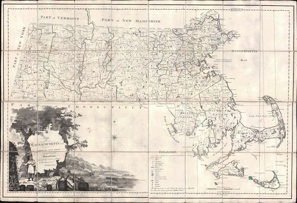
Map of Massachusetts Proper Compiled form Actual Surveys made by Order of the General Court, and under the inspection of Agents of their appointment, by Osgood Carleton.
sold
- Digital Map Information
- Suitable for large format printing
- Full resolution TIFF file
- ICC color profile embedded
- Delivered instantly via download link
Known as 'The Agent's Map', this is a fine example of the first official map of Massachusetts, published in 1801 by Osgood Carleton. The map emerged out of a long and complex struggle to produce a large-scale, accurate, and comprehensive state map - something increasingly important in the heady early days of independence following the American Revolutionary War (1775 - 1783). This expansive map covers all of Massachusetts in considerable detail, giving no attention whatsoever to the neighboring states. While generally ignoring topography, the map offers superb practical detail throughout, noting roads, county borders, schools, meeting houses, courts, milage from Boston, and more. The sole mountain illustrated is the Hoosack Range, near modern-day North Adams. (more details)
The Civil War - big and bold.
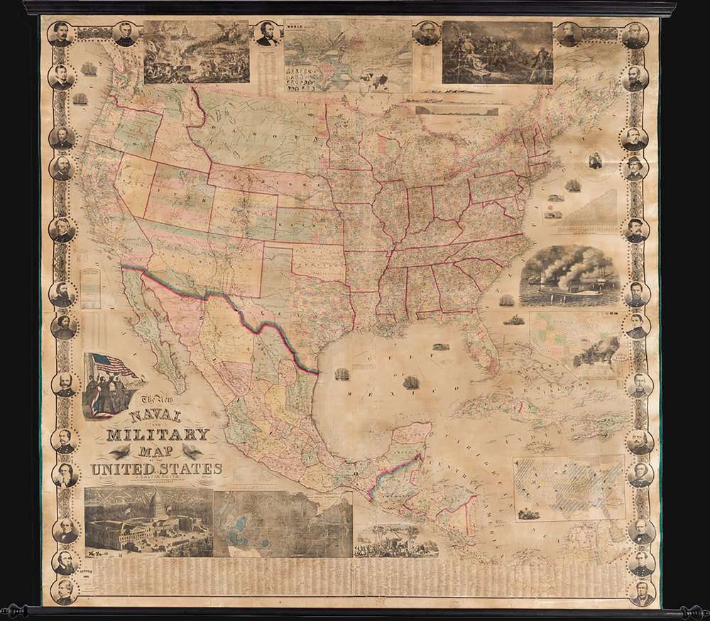
The New Naval and Military Map of the United States.
sold
This is a rare 1863 wall map of the United States at the height of the American Civil War (1861 - 1865). The map was issued by John Calvin Smith and Robert Persall Smith during the Civil War to capitalize on general interest in the war among the northern elite. At roughly 70 inches square, this enormous and lavishly produced map covers all of the United States and Mexico. The early state and territory configuration includes the ephemeral Confederate State of Arizona. It is surrounded by images of Union officers and politicians - including Lincoln, Fremont, Wilkes, and Scott. Curiously, these do not include General Grant, as the map's publication in early January of 1863 predates his assumption of overall command on January 29, 1863. The map features multiple vignette scenes including the victory of the Monitor over the Merrimac, the allegorical 'Rescue of the Union', an illustration of 'Camp Life', the Capitol building in Washington, and an overview of the 'Birth of the Union' at Bunker Hill. Of note, the Pacific Telegraph Route is noted running parallel to the Pony Express Route, which is also illustrated. (more details)
Essential French-and-Indian War Map.
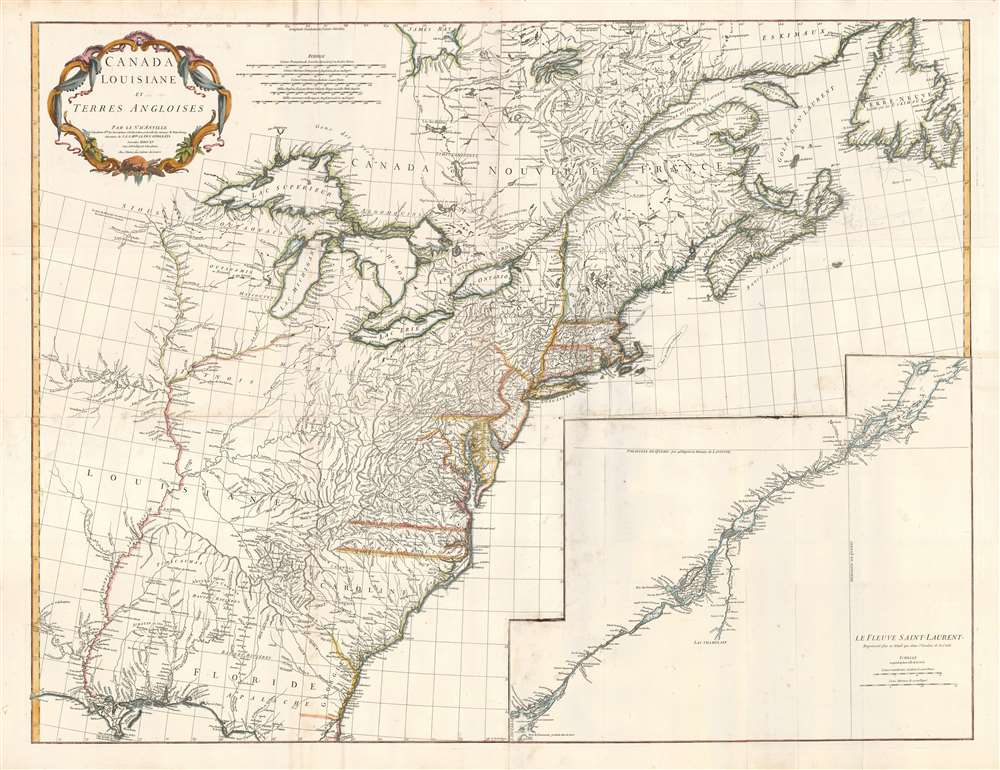
Canada Louisiane et Terres Angloises.
sold
- Digital Map Information
- Suitable for large format printing
- DPI: 300
- File Size: 56.89 MB
- File Type: ZIP / TIFF
- ICC color profile embedded
- Delivered instantly via download link
This is Jean-Baptiste Bourguignon d'Anville's 1755 map of North America from the Mississippi watershed eastwards. It spans from Newfoundland and James' Bay to St. Augustine, Florida. The map reaches westward as far as modern day Texas, and extends eastward to embrace Newfoundland. It details the English colonies along the Atlantic seaboard, as well as French claims in Louisiana (the Mississippi Valley) and modern day Canada. Elevation is rendered in profile with fortifications, towns, and American Indian villages identified. A large inset centered on Montreal details the course of the St. Lawrence River from the Isle Aux Coudres to Lake Ontario. (more details)