
Highlights mass transit in New York City including the Elevated Railroad and the Street Horse Cart Railroads.
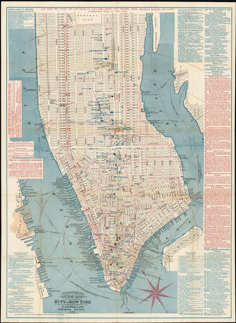
Citizens and Travelers Guide Map in, to and from the City of New York and Adjacent Places.
sold
- Digital Map Information
- Suitable for large format printing
- File Size: 35.85 MB
- File Type: ZIP / TIFF
- ICC color profile embedded
- Delivered instantly via download link
This is the sole 1877 edition of this Edsall and Company map of New York City drawn to promote the Adams Express Company, a 19th-century freight and cargo transport business which remains as one of the oldest companies still listed on the New York Stock Exchange. The map depicts Manhattan from 63rd Street to The Battery and from the Hudson (North) River to Hunter's Point, Green Point, and Brooklyn. The map's role in promoting a shipping company is reflected in the map's meticulous depiction of the city's growing transit system, providing the reader a visceral sense of the burgeoning, busy city as it developed. The Elevated Railroad, which ran every eight minutes from South Ferry along Ninth Avenue to 59th Street is shown, along with sixteen different lines of the Street Horse Car Railroad. As the name suggests, the Street Horse Car Railroad consisted of carts running on rails pulled by horses. Several different companies operated on certain lines, and these cars were a much more pleasant form of transport and sheltered customers from the elements. Each of these lines, the Elevated Railroad and the Street Horse Cart Railroads, are illustrated by red lines snaking their way through the streets. The Hudson River Railroad, which left Pennsylvania Station and ran along Eleventh Avenue, is illustrated by black railroad tracks, as are the New York, New Haven and Hartford Railroad and the New York Central and Hudson Railroad, which left from Grand Central.
Numerous locations throughout Manhattan are labeled, including City Hall, County Court, Trinity Church, and Bellevue Hospital. Other locations are labeled by blue overprinting, including Tiffany and Company's location at Union Square, several different Delmonico's Restaurant locations, and numerous hotels. The Brooklyn Bridge, which was in the process of being built, is illustrated across the East River and labeled simply 'Suspension Bridge'. Information provided along the left and right borders includes the operating schedule and fare rates for the New York Elevated Railroad, departure points for five different railway companies that take travelers out of the city, information concerning ferries across the North and East Rivers and international steamship departure piers. Routes of the Street Horse Car Railroad are also provided, along with information about hotels, both on the American and European plan. (more details)
Numerous locations throughout Manhattan are labeled, including City Hall, County Court, Trinity Church, and Bellevue Hospital. Other locations are labeled by blue overprinting, including Tiffany and Company's location at Union Square, several different Delmonico's Restaurant locations, and numerous hotels. The Brooklyn Bridge, which was in the process of being built, is illustrated across the East River and labeled simply 'Suspension Bridge'. Information provided along the left and right borders includes the operating schedule and fare rates for the New York Elevated Railroad, departure points for five different railway companies that take travelers out of the city, information concerning ferries across the North and East Rivers and international steamship departure piers. Routes of the Street Horse Car Railroad are also provided, along with information about hotels, both on the American and European plan. (more details)
Wonderful pictorial map celebrating the beginning of the 1946 college football season.

Albert Richard Sportswear Grid Revue.
sold
- Digital Map Information
- Suitable for large format printing
- File Size: 26.95 MB
- File Type: ZIP / TIFF
- ICC color profile embedded
- Delivered instantly via download link
This is a scarce 1946 F.E. Cheeseman pictorial map of United States college football teams - possibly the rarest of the series. The map depicts the continental United States from the Pacific Coast to the Atlantic Seaboard and from the Canadian border to the Mexican border and the Gulf of Mexico. Pennants, stuck into the map of the United States as if it were a cork board, mark the location of a plethora of American college football teams, with many of the most successful teams present. Smaller white banners with green text mark the conference winners which include Army, Indiana, Oklahoma, Texas, Denver, Colorado College, U.S.C., Alabama, and Duke. The map is situated 'above' a football field, with a quarterback to the left and three cheerleaders in the bottom right corner. The teams in the National Professional Football League and the All-America Professional Football Conference are recognized below the map. The whole is framed by numerous different graphics and tables providing information about the history of college football and about the previous season. For example, a portrait of the 1945 Heisman Trophy Winner Army fullback Felix (Doc) Blanchard, is included on the left just above nine portraits of 'great all-time coaches'. Portraits of famous all-time players are on the right, below an illustration of the first inter-collegiate game of football played between Princeton and Rutgers in 1869. Sketches of the All-Star game between the Los Angeles Rams and the College All-Stars and of Harvard Stadium, the first football stadium built in America, are situated along the bottom. (more details)
A superbly detailed plan of Barcelona.
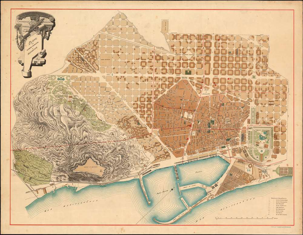
Ordenanzas Municipales Apendice No. 1 (b) Plano del Término Municipal de Barcelona. 1891.
sold
- Digital Map Information
- Suitable for large format printing
- File Size: 30.66 MB
- File Type: ZIP / TIFF
- ICC color profile embedded
- Delivered instantly via download link
This rare 1891 map of Barcelona chronicles the rapid pace of urban renewal in the city that took place in the latter half of the 19th century. The plan focuses on the municipality of Barcelona. It is oriented to the northwest, with the city's port and the Mediterranean Sea along the bottom of the lithograph. To the south of the city, the castle and park of Montjuïc are shown with their topography elegantly depicted in hachure. \To the west and north, Barcelona's characteristic grid of octagonal blocks can be seen filling up. This grid was implemented here and in the surrounding Eixample district after 1860 on the plan of Ildefons Cerdà i Sunyer, which was a process that had accelerated after the Universal Exposition of 1888. The development of the Parc de la Ciutadella and the development of La Barceloneta was also part of the 1888 Exposition, and is new on this plan. Although unpopular at first, Cerdà's plan attained enough support that the reconstruction began in earnest. Eventually, Barcelona became a hub of modernism, giving rise to the work of Art Nouveau architects like Antonio Gaudi. Today, Barcelona is one of the few old European cities that exhibits a comprehensive central plan and, due to Cerdà's vision, is considered one of Europe's most beautiful metropolises. (more details)
Stunning Art Deco Map of Paris in an early state.
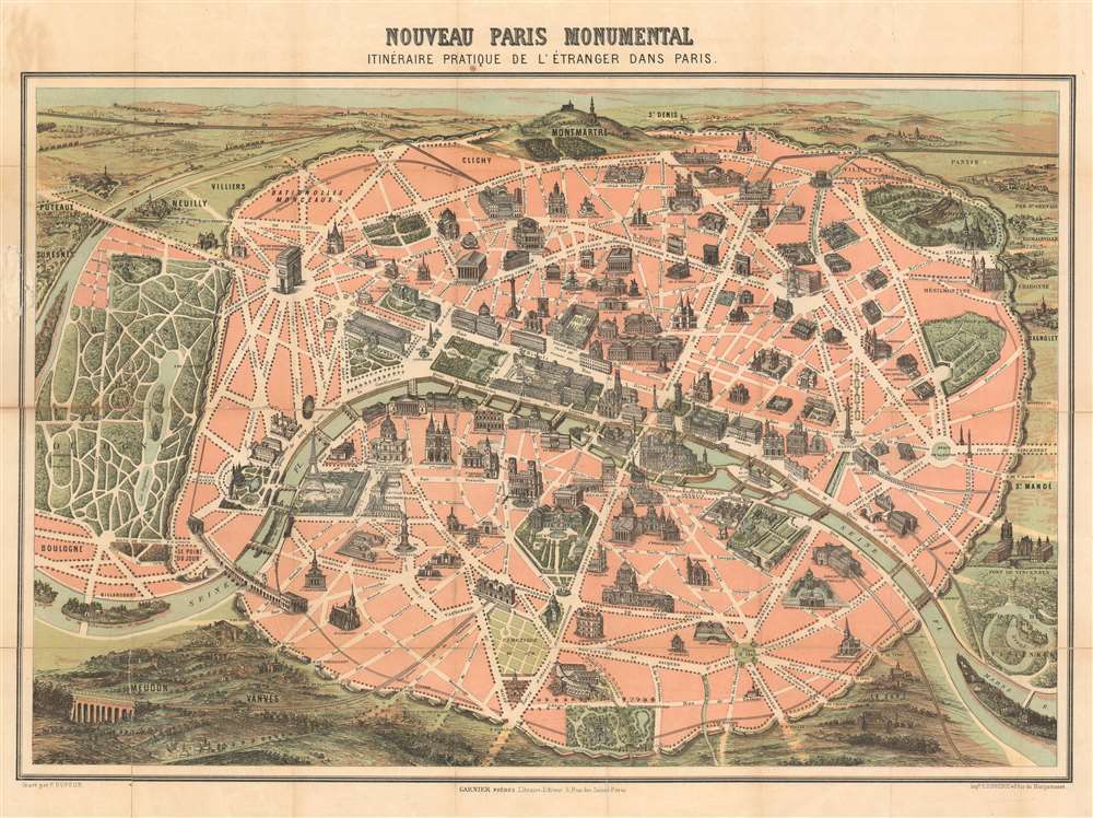
Nouveau Paris Monumental Inineraire Pratique de L'Étranger Dans Paris.
sold
- Digital Map Information
- Suitable for large format printing
- File Size: 35.89 MB
- File Type: ZIP / TIFF
- ICC color profile embedded
- Delivered instantly via download link
An iconic c. 1889 chromolithographic tourist pocket map of Paris, France. Presented as a same field birds-eye view, this map centers on the Seine River, and covers the embastilled heart of modern Paris. Issued as a tourist piece for the 1889 Exposition Universelle, which introduced the Eiffel Tower, buildings and monuments shown in profile, including the Eiffel Tower, the Arc de Triomphe, Sacre-Coeur, the Pantheon, etc. Paris itself is set as if in a verdant garden surrounded by the Bois de Boulogne, the Bois de Vincennes, and various suburban villages. In the north, under a blue sky, rolling hills stretch indefinitely into Normandy towards the English Channel. (more details)
Features a visually arresting border highlighting American air, land, and sea power to be used in the coming war.
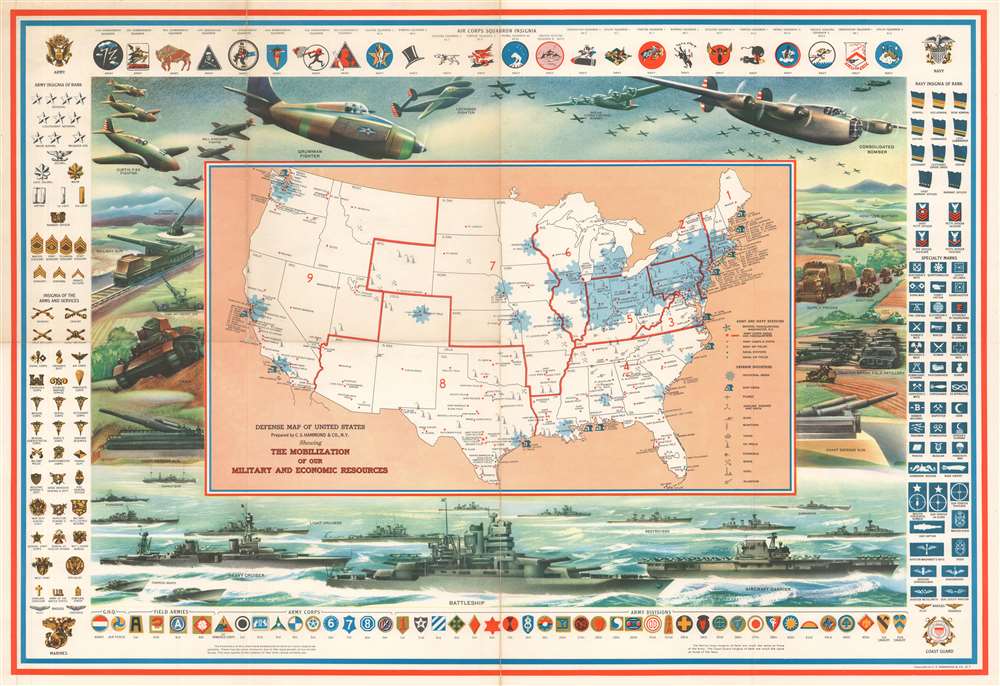
Defense Map of the United States Prepared by C.S. Hammond and Company, N.Y. Showing the Mobilization of our Military and Economic Resources.
sold
- Digital Map Information
- Suitable for large format printing
- File Size: 49.95 MB
- File Type: ZIP / TIFF
- ICC color profile embedded
- Delivered instantly via download link
This is a c. 1941 C. S. Hammond and Company pictorial map of the United States highlighting the military and economic resources available on the brink of World War II. The map depicts the United States from the Pacific coast to the Atlantic Seaboard and from the Canadian border to the Mexican border and Key West. Blu -colored cogs highlight industrial areas around the country in an effort to illustrate the industrial might that would be brought to bear. Other defense industries are marked on the map by icons, including shipyards and factories making planes, airplane engines, munitions, tanks, guns, steel, and aluminum. Army and navy bases are identified as well, as are army and navy airfields.
It is the pictorial border, however, that immediately draws the viewer's attention. The air, land, and sea forces of the United States military are put on full display, creating a forceful image that definitely falls under the umbrella of propaganda and the banner of 'support the military'. Cutting edge aircraft, such as the Boeing B-17 Flying Fortress, Consolidated B-24 Liberator, Lockheed P-38 Lightning, Grumman F4F Wildcat, and Curtiss P-40 Warhawk, are prominently illustrated along the map's top border, with tanks, artillery guns, howitzers, and supply trucks representing ground forces.
Perhaps the most incredible part of this piece (with the benefit of hindsight of course) is the placement of the battleship front and center along the bottom border. The legendary naval engagements fought between the United States and Japan had not yet occurred, and naval strategists believed that the battleship, not the aircraft carrier, would be the key element to success on the world's oceans. An aircraft carrier appears to the right of the battleship, complete with its aircraft on the flight deck. A heavy cruiser steams to the battleship's left, surrounded by torpedo boats, light cruisers, destroyers, and submarines.
Illustrations of American Army and Navy insignia frame the entire piece, with army insignia on the left and navy insignia on the right. Army insignia of rank, from general to private first class, are situated at the top left, while insignia of 'arms and services', such as the infantry, ordnance department, signal corps, and medical corps, are on the bottom left. Naval insignia of rank are just opposite, on the top right, while naval specialty marks, such as sharpshooter, bugler, machinist's mate, and cook, are on the bottom right. A sample of Army and Navy Air Corps insignia are included along the top, while the insignia of army headquarters, field armies, army corps, and army divisions are along the bottom. (more details)
It is the pictorial border, however, that immediately draws the viewer's attention. The air, land, and sea forces of the United States military are put on full display, creating a forceful image that definitely falls under the umbrella of propaganda and the banner of 'support the military'. Cutting edge aircraft, such as the Boeing B-17 Flying Fortress, Consolidated B-24 Liberator, Lockheed P-38 Lightning, Grumman F4F Wildcat, and Curtiss P-40 Warhawk, are prominently illustrated along the map's top border, with tanks, artillery guns, howitzers, and supply trucks representing ground forces.
Perhaps the most incredible part of this piece (with the benefit of hindsight of course) is the placement of the battleship front and center along the bottom border. The legendary naval engagements fought between the United States and Japan had not yet occurred, and naval strategists believed that the battleship, not the aircraft carrier, would be the key element to success on the world's oceans. An aircraft carrier appears to the right of the battleship, complete with its aircraft on the flight deck. A heavy cruiser steams to the battleship's left, surrounded by torpedo boats, light cruisers, destroyers, and submarines.
Illustrations of American Army and Navy insignia frame the entire piece, with army insignia on the left and navy insignia on the right. Army insignia of rank, from general to private first class, are situated at the top left, while insignia of 'arms and services', such as the infantry, ordnance department, signal corps, and medical corps, are on the bottom left. Naval insignia of rank are just opposite, on the top right, while naval specialty marks, such as sharpshooter, bugler, machinist's mate, and cook, are on the bottom right. A sample of Army and Navy Air Corps insignia are included along the top, while the insignia of army headquarters, field armies, army corps, and army divisions are along the bottom. (more details)
A wonderful pictorial map of Maine celebrating the state's history - particularly is shipbuilding heritage.
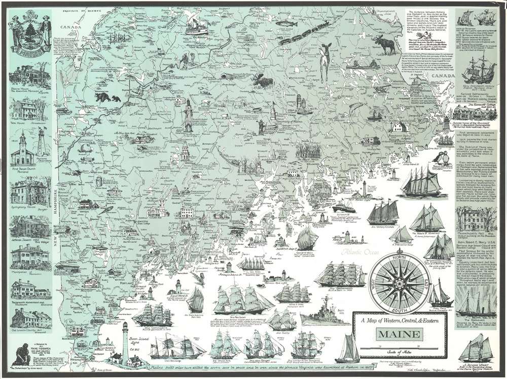
A Map of Western, Central, and Eastern Maine.
sold
- Digital Map Information
- Suitable for large format printing
- File Size: 39.04 MB
- File Type: ZIP / TIFF
- ICC color profile embedded
- Delivered instantly via download link
This is a c. 1952 Ruth Rhoads Lepper Gardner pictorial map of southern Maine. The map depicts the region from the Maine - New Hampshire border and the Chaudière River in Canada to the Atlantic Ocean and from Quebec, Canada and Moosehead Lake, Maine to Isles of Shoals. Highly detailed, cities and towns throughout Maine are identified, including Augusta, Lewiston, Bangor, and Portland. Vignettes illustrated sites throughout the state, highlighting historic events and locations, as well as other points of interest, such as museums, historic houses, and the world's tallest wooden Indian. Numerous ships are drawn in profile, paying homage to Maine's long history as shipbuilders. Ship dating from as early as 1690 are present, with the most recent being a destroyer that was built in Bath in 1952. Per the map, the first six-mast ship ever built was constructed in Camden in 1900. Lighthouses all along the coast are also illustrated and labeled. A history of Maine is provided along the right border, while views of historic houses, a church, and an observatory are included along the left border. (more details)
The Earliest Acquirable Printed Map of the Caroline Islands
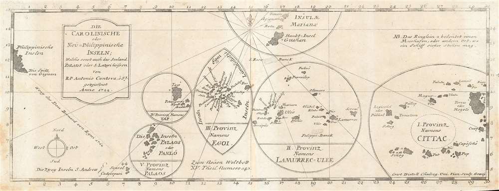
Die Carolinische oder Neu=Philippinische Inseln; Welche sonst auch das Seeland Palaos oder S. Lazari heissen von R. P. Antonio Cantova, e S. J. gezeichnet Anno 1722.
sold
- Digital Map Information
- Suitable for large format printing
- DPI: 600
- File Size: 5.58 MB
- File Type: ZIP / TIFF
- ICC color profile embedded
- Delivered instantly via download link
The earliest printed map of the Caroline Islands, produced by Joseph Stöcklein in 1728 for inclusion in Welt-Bott, his monumental collection of Jesuit missionary letters. The map was based on the reports of the Jesuit Juan Antonio Cantova (1686-1731), the first to establish a Christian mission in the Caroline Islands in 1722. The publication of this map pre-dates Cantova's 1731 establishment of his mission in Ulithi and subsequent death at the hands of the natives of the island Mogmog (among the island group marked III. Proving Names Egoi on the map.) Cantova's information, as reported in his 1722 letter to the confessor to the King of Spain, was derived from interviews with two separate groups of natives who were blown off course and shipwrecked at Guam, where Cantova was based. From these, Cantova learned their language and received the account of the islands which informs this map. The map's division of the archipelago into five distinct groups was derived from these interviews, as were the locations of safe anchorages was shown. The map also shows 1712 track of Bernard de Egui from the Philippines to the islands of S. Andrea, the first European contact with the Caroline Islands. (more details)
Russia and the Ukraine as known in the Classical Era

Tabula Asiae II.
sold
- Digital Map Information
- Suitable for large format printing
- Full resolution TIFF file
- ICC color profile embedded
- Delivered instantly via download link
This 1552 example of the second Asian map from Sebastian Munster's Ptolemy shows the lands in Asia occupied in the 1st and 2nd centuries CE by the Sarmatians, a large Iranian confederation who during the classical era were based in the steppes north of the Black Sea and the Caspian Sea. The region includes today's South-Eastern Ukraine, Southern Russia, and the Caucasus. Visible on the map are the northern parts of the Black Sea and the Caspian Sea, as well as the Maeotian sea - now known as the Sea of Azov. The Volga River dominates the map, albeit with its Ptolomaic toponym 'Rha.' The map includes historical references to the campaigns of Alexander the Great against the Scythians, noting the presence of monuments left by that emperor both in European and Asian Sarmatia. (more details)
The Oldest Continuously Published (Hollywood) Star Map

Souvenir Map and Guide to Starland Estaes and Mansions… A Fascinating Trip Through Movieland With Other Information Fall Issue 1957.
sold
- Digital Map Information
- Suitable for large format printing
- File Size: 25.41 MB
- File Type: ZIP / TIFF
- ICC color profile embedded
- Delivered instantly via download link
This is the Fall 1957 issue of the famous 'Souvenir Map and Guide to Starland Estates and Mansions,' the oldest continuously published map of its kind. The map, regularly updated, was sold as early as 1933 by Wesley G. Lake from a Los Angeles street corner. The business would pass through by his wife Martha; their daughter Vivienne, and their granddaughter Linda. City efforts to curtail sales of such maps (to fight tourist traffic in Beverly Hills and protect camera-shy celebrities) were scotched by the First Amendment in a 1976 Supreme Court contest. (more details)
Chronicling the Expansion of Boston into its Suburbs
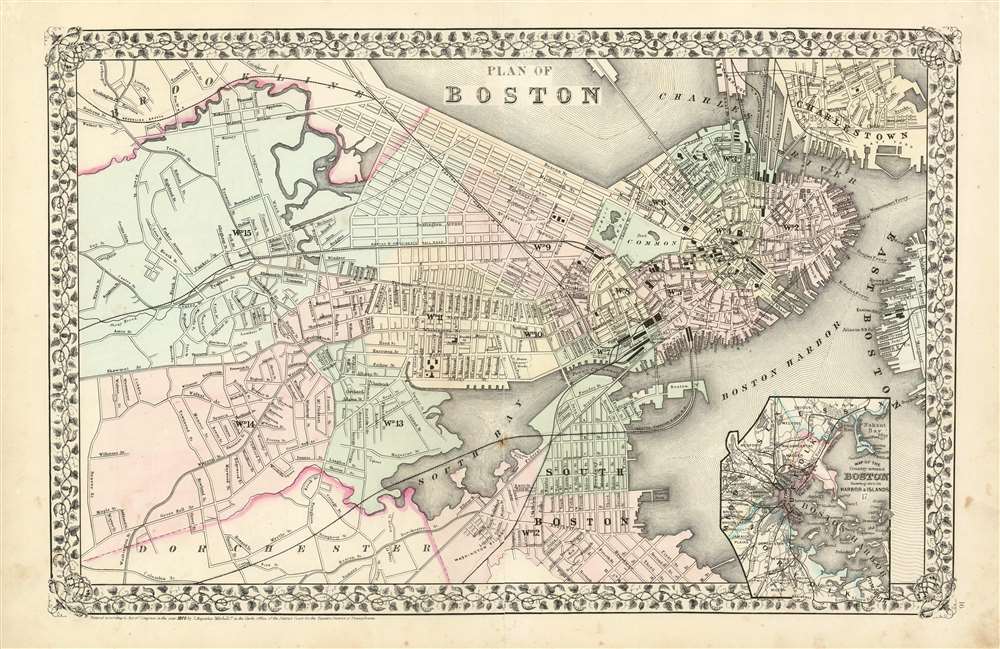
Plan of Boston.
sold
- Digital Map Information
- Suitable for large format printing
- File Size: 22.69 MB
- File Type: ZIP / TIFF
- ICC color profile embedded
- Delivered instantly via download link
A beautiful example of S. A. Mitchell Jr.'s newly-expanded 1870 map of Boston, Massachusetts. While Mitchell's 1860's plans of Boston extend only as far west as Dartmouth Street, this new map covers as far west as Brookline and as far south as Dorchester. The map is sharply detailed, with special focus on railroads and terminal buildings. Some prospective streets - Atlantic Avenue, in particular - are shown, prior to the placement of the landfill on which the street would be built. An inset in the lower right quadrant depicts Boston Harbor and the surrounding counties of Essex, Middlesex and Nortfolk . Features the vine motif border typical of Mitchell maps from the 1866 - 1882 period. (more details)
Everything a Visitor Could Want To Do In Friendly New York City
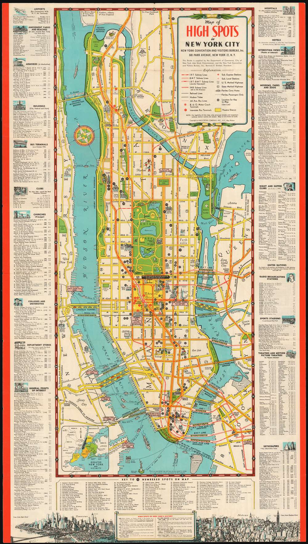
Map of High Spots in New York City.
sold
- Digital Map Information
- Suitable for large format printing
- File Size: 28.17 MB
- File Type: ZIP / TIFF
- ICC color profile embedded
- Delivered instantly via download link
This 1949 Hagstrom Map of New York City, was produced for and published by the New York Convention and Visitors Bureau and the Department of Commerce. It highlights for the visitor to New York a wide array of The City's attractions, ranging from points of interest for the casual sightseer to nightclubs for the more dedicated visitor. (more details)
Pictorial map of the Penobscot Bay region of Maine.
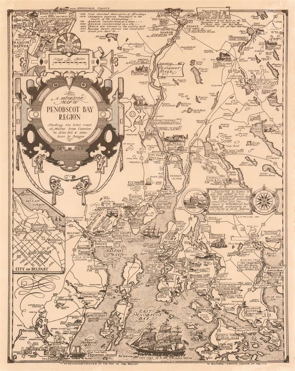
A Decorative Map of Penobscot Bay Region Showing the tidal coast of Maine from Camden to Blue Hill and Isles boro to Bangor.
sold
This is a 1940 Luther Savage Phillips pictorial map of Penobscot Bay, Maine. The map depicts the region from Hobbs Pond and Camp Merestead to Blue Hill Bay and from Bangor to Deer Isle. Sites throughout the region are illustrated in profile with their names inscribed on banners, including the Penobscot Marine Museum, the St. Regis Paper Company, Sunset Ridge Farm, Camp Roosevelt, and the Walter M. Hardy Orchard. Other regional sites are also identified, as are important highways, rivers, and islands. An inset to the right of center illustrates Fort Pownal and is situated next to a textbox that provides a short history of Penobscot Bay which reads, ‘Discovered by Gomes in 1525 and named by him ‘Baya Fermosa’ (beautiful bay), the Penobscot - generally associated with the region of Norumbega - has appeared prominently on old charts of North America.’ A short chronological history of the region is included as well, along the top border, near an inset map of 'Part of Bangor and Brewer', while a second insert, in the lower left quadrant, details the city of Belfast. Three sailing ships are depicted in Penobscot Bay, along with a lone sea monster. (more details)
One of the most richly informative cartographic productions ever created.
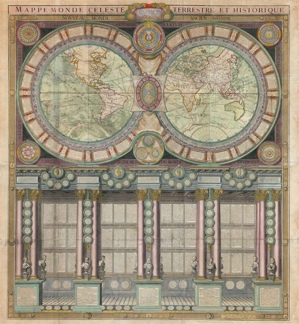
Mappe-Monde Celeste Terrestre et Historique.
sold
- Digital Map Information
- Suitable for large format printing
- DPI: 600
- File Size: 132.49 MB
- File Type: ZIP / TIFF
- ICC color profile embedded
- Delivered instantly via download link
A stunning large format wall map of the world in six panels issued in 1786 by Charles Desnos and Nicolas Jaugeon. Described by map historian Rodney W. Shirley as 'a veritable compendium of a map,' this is one of the most richly informative cartographic productions ever issued. The map consists of a double hemisphere map projection surrounded by no less than 60 Aeoli windheads, astronomical data on constellations, cosmic systems, and other charts - intentionally placing the world in the context of the greater cosmos. Its elegant presentation conveys confidence in the human capacity to describe not only the Earth, but the cosmos itself. The double hemisphere map rests upon Corinthian columns, underscoring the classical foundations of western scientific thought, here augmented by new discovery. The unique, neo-classical motif is carried through to the bottom half of the engraving, where panels of text are set within a portico supported by Corinthian columns. Completing the illusion are a coffered roof and a patterned tile floor. At the base of the columns there busts and accounts of the great explorers, among them Columbus, Magellan, and Vasco de Gama. (more details)
Extremely rare view of New Haven and Yale!

New Haven, From East Rock, 1853.
sold
- Digital Map Information
- Suitable for large format printing
- DPI: 600
- File Size: 27.93 MB
- File Type: ZIP / TIFF
- ICC color profile embedded
- Delivered instantly via download link
This is an extremely rare 1853 lithograph view of New Haven, Connecticut, as seen from East Rock by Titus H. Darrow and the firm of E. C. Kellogg. The view looks south-southwest on New Haven from East Rock, a local high point. The large buildings of Yale University are evident just left of center. The view reviews a bustling port, with numerous ships and a long pier. Several bridges, including an active railroad bridge, exit New Haven to the east. In the foreground, picnickers on East rock observe the town. (more details)
A striking map of the Moon published in November 1963 - the same month as the John F. Kennedy assassination.
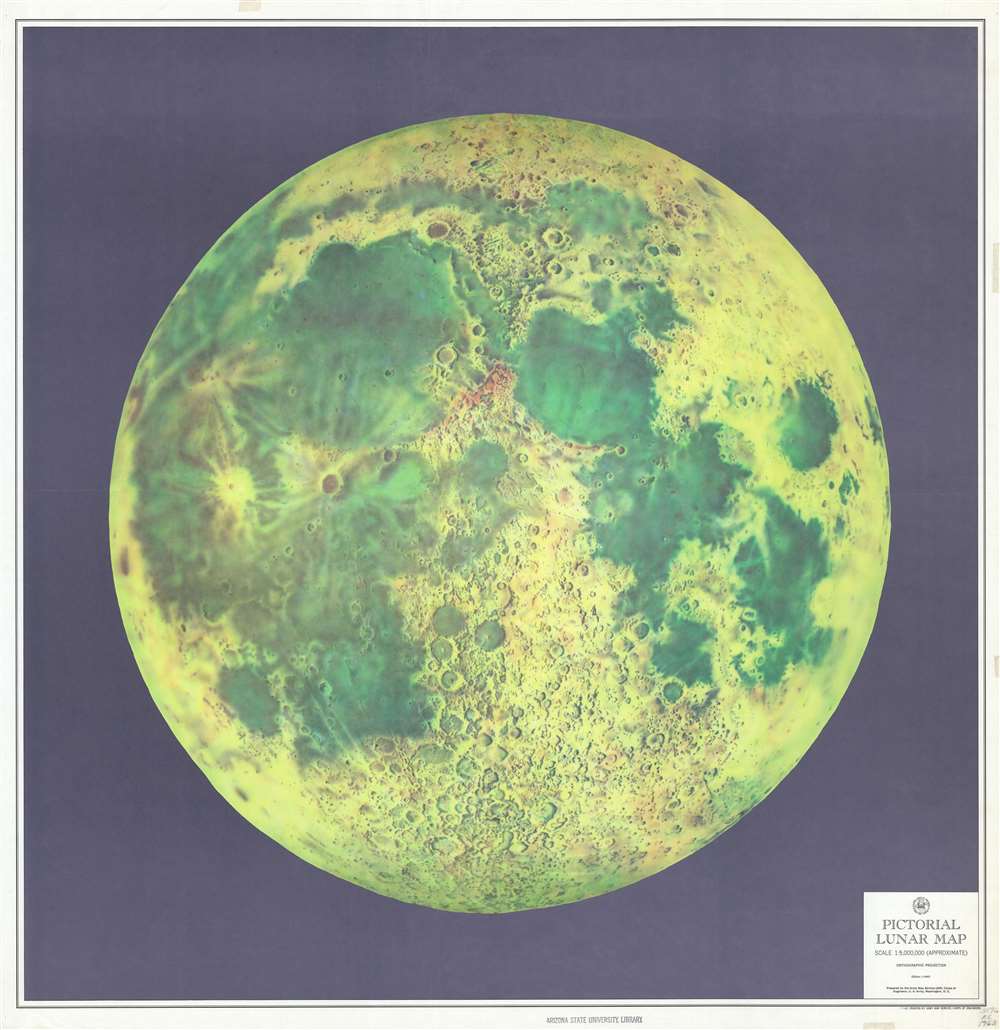
Pictorial Lunar Map.
sold
- Digital Map Information
- Suitable for large format printing
- File Size: 103.34 MB
- File Type: ZIP / TIFF
- ICC color profile embedded
- Delivered instantly via download link
This is a large-format 1963 Army Map Service pictorial map of the Moon. The map depicts the visible face of the Moon in striking detail, with the myriad craters and maria beautifully illustrated. Kepler and Copernicus, two craters in the Oceanus Pocellarum, are strikingly detailed. The lunar maria, or the lunar seas, as early astronomers believed them to be, are colored in such a way to make them appear to be bodies of water, when they are in fact large basaltic plains. (more details)
A wonderful pictorial map of Portland, Maine promoting Portland's first nursery.
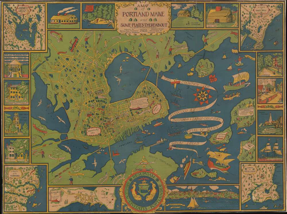
A Map of Portland Maine and Some Places Thereabout.
sold
- Digital Map Information
- Suitable for large format printing
- File Size: 64.98 MB
- File Type: ZIP / TIFF
- ICC color profile embedded
- Delivered instantly via download link
This is a 1928 Katherine Dudley pictorial city map or plan of Portland, Maine. The map depicts the region from the Fore River to Mackworth Point and from the Presumscot River to Fort Scammel and House Island. Wonderfully, almost whimsically, illustrated, buildings throughout town are illustrated in profile and labeled with white banners, including schools, churches, the hospital, the public library, and the Y.M.C.A. Roads throughout town are illustrated as well and the major ones are labeled. Bug Light marks the entrance to Portland Harbor and the bay is filled with ships. Captain John Smith's vessel, which arrived in 1614, is among those present, as is the Canceau, the Spitfire Bomb, and Captain Levett's expedition, which appeared in 1623. The whole is bordered by a series of vignettes and inset maps depicting such things and Portland's first church, first hotel, views State Street and Middle Street, and a view of Portland itself. The maps focus on Falmouth Neck, the Kennebunks, Sebaco Lake, and Prouts Neck (more details)
Fascinating infrastructure map of Sabah. Malaysia, as British North Borneo.
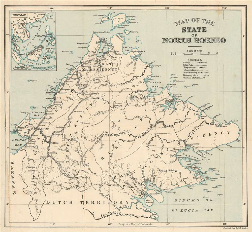
Map of the State of North Borneo.
sold
- Digital Map Information
- Suitable for large format printing
- Full resolution TIFF file
- ICC color profile embedded
- Delivered instantly via download link
A rare c. 1926 Edward Stanford Geographical Establishment map of British Northern Borneo, or the modern Malaysian state of Sabah. Coverage extends from Sarawack to the Sulu Sea, and from Balambagan Island and Banggi Island south to Dutch Borneo or what is today Kalimatan. The map focuses on infrastructure, an important metric for the development of the region, highlighting railways lines, bridle paths, telegraph lines, telephone lines, and wireless stations. It also maps the inland river systems with car, underscoring the fact that, despite entering the age of rail, the primary arteries of trade in North Borneo remained the waterways. A smaller inset general map of the East Indies and Southeast Asia appears in the upper left. (more details)
Traces the route of the Spokane, Portland, and Seattle Railway along the Columbia River.
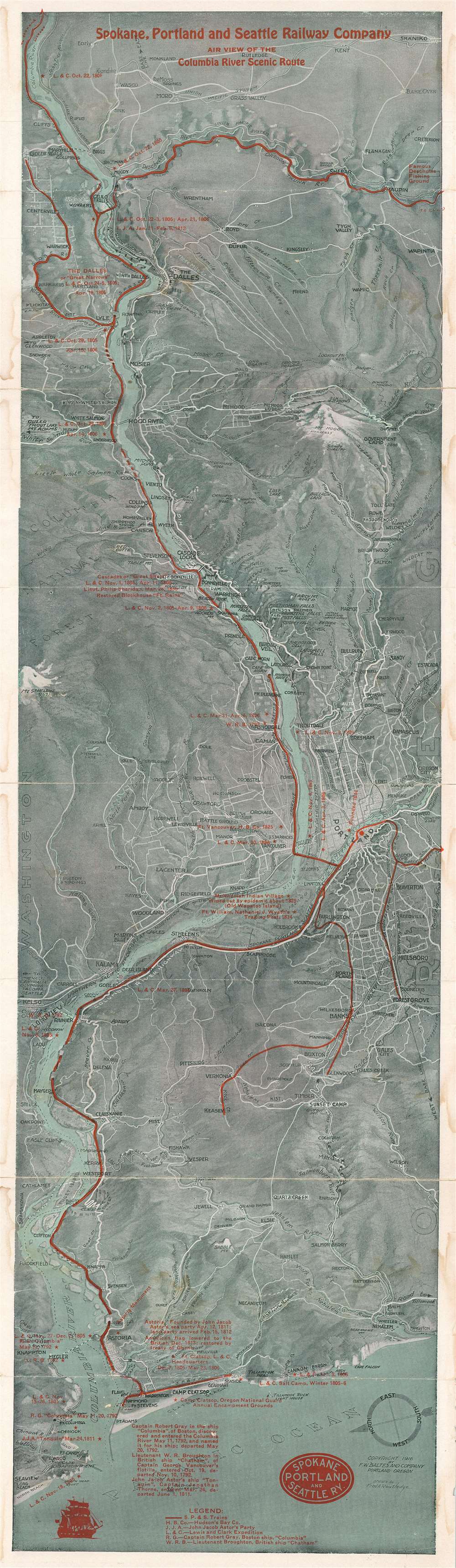
Spokane, Portland, and Seattle Railway Company Air View of the Columbia River Scenic Route.
sold
- Digital Map Information
- Suitable for large format printing
- File Size: 42.57 MB
- File Type: ZIP / TIFF
- ICC color profile embedded
- Delivered instantly via download link
This is a 1916 Fred A. Routledge pictorial bird's eye view of the Columbia River Valley. Overlooking the area from the west, the map depicts the region from Mt. St. Helens and Centerville, Washington to Wapinitia, Oregon and Brighton, Oregon and from Shaniko, Oregon to the Pacific Ocean. Created to promote the Columbia River Scenic Route operated by the Spokane, Portland, and Seattle Railway Company, the railway's routes are highlighted by solid red lines following the course of the Columbia River. Other trunk lines run west from Portland to serve smaller communities, with another heading south from Celilo Falls. Cities and towns across the region are identified, including Portland, The Dalles, and Longview. Important historical events are marked by red overprinting, with particular interest paid to the progress of Lewis and Clark's expedition in the region in 1805 - 1806. Locations of Hudson Bay Company outposts, military forts, and John Jacob Astor's settlement of Astoria are also included. A legend along the bottom border explains the different abbreviations used in these references and a small text gives historical context to Captain Robert Gray of Boston, Lieutenant W.R. Broughton, and John Jacob Astor. (more details)
Includes Republic of Texas Flag!

[Flag Chart]
sold
- Digital Map Information
- Suitable for large format printing
- DPI: 600
- File Size: 61.79 MB
- File Type: ZIP / TIFF
- ICC color profile embedded
- Delivered instantly via download link
A scarce an unusual c. 1836 ensign or flag chart printed on fabric. Flags of interest include the Lone Star Flag of Texas, the ensign of the British East India Company, and the 20-star U.S. Flag of 1818. A large Royal standard of the United Kingdom appears at center. Larger flags in each corner represent, clockwise form upper left, Prussia, Spain, France, and the United States. An annotation near the Japan flag comments that each 'prince' has his own flag. (more details)
Pen and ink pictorial map of Marth's Vineyard!
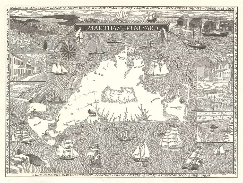
Martha's Vineyard.
sold
A stunning 1976 pictorial map of Martha's Vineyard. Lithographed in a striking black and white pen and ink style, the map covers all of Martha's Vineyard with vignette illustrations of the island's iconic homes, scenery, and ships. A wale appears in the lower left in reference to the island's whaling heritage. Edgartown, Vineyard Haven, Oak Bluffs, Chilmark and West Tisbury are all identified. The border of the map features quotes from Bartholomew Gosnold (1571 - 1607) who discovered Martha's Vineyard in 1602. (more details)