
First sight of the Pacific on the Central Pacific.
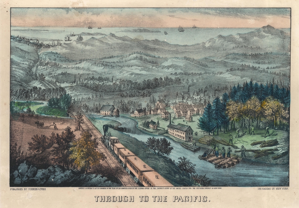
Through to the Pacific.
$1,900.00
Acquire
- Digital Map Information
- Suitable for large format printing
- File Size: 11.1 MB
- File Type: ZIP / TIFF
- ICC color profile embedded
- Delivered instantly via download link
This is an 1870 Currier and Ives lithograph celebrating the arrival of the Central Pacific Railroad on the West Coast - San Francisco is in the background. This is one of Currier and Ives' most iconic small-format views. (more details)
The American Colonies on the Brink of Revolution.
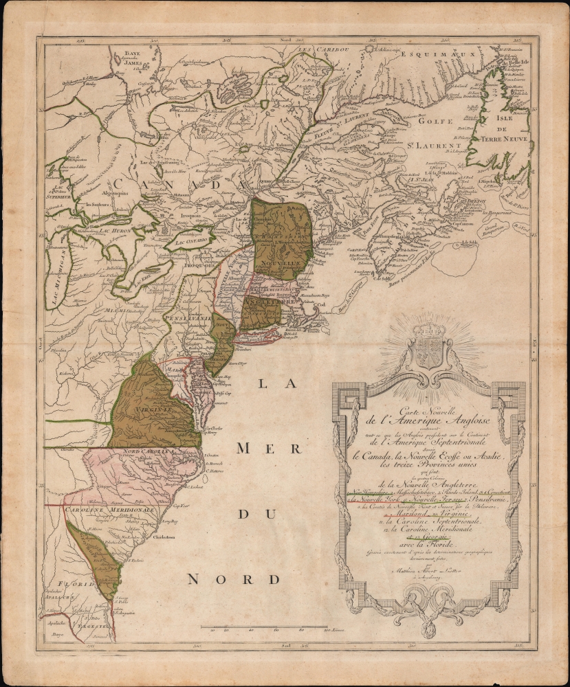
Carte Nouvelle de L'Amerique Angloise contenant tout ce que les Anglois possedent sur le Continent de L'Amerique Septentrionale savoir le Canada, la Nouvelle Ecosse ou Acadie, les treize Provinces unies
sold
- Digital Map Information
- Suitable for large format printing
- Full resolution TIFF file
- ICC color profile embedded
- Delivered instantly via download link
An uncommon French-language 1776 Mathais Albrecht Lotter map of the American colonies on the cusp of the American Revolutionary War. (more details)
Tabulating Immigration in Late 19th Century New York City.
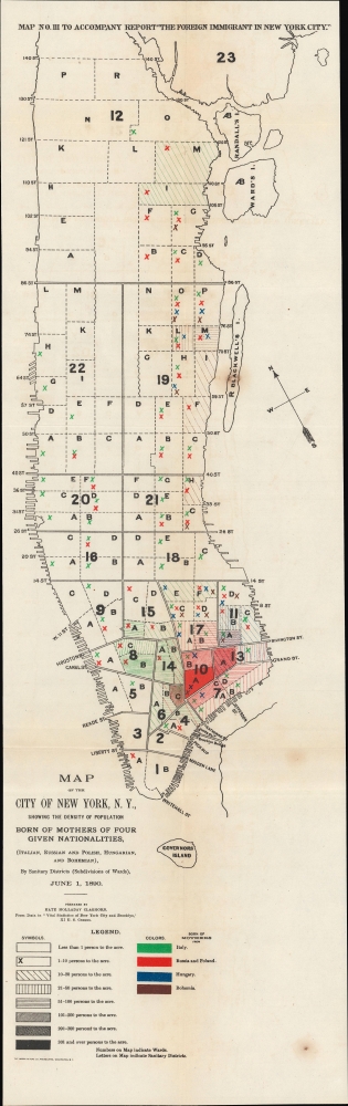
Map of the City of New York, N.Y., showing the Density of Population Born of Mothers of Four Given Nationalities, (Italian, Russian and Polish, Hungarian, and Bohemian)
sold
- Digital Map Information
- Suitable for large format printing
- File Size: 8.27 MB
- File Type: ZIP / TIFF
- ICC color profile embedded
- Delivered instantly via download link
An early work of sociological cartography, this 1890 map of New York City was prepared by Kate Holladay Claghorn and published as a supplement to the 1901 government report 'The Foreign Immigrant in New York City.' It displays the population density of four European ethnic groups in Manhattan, demonstrating their concentration in Lower Manhattan. (more details)
One of the first maps of Prospect Park.

Design for Prospect Park as Proposed to be Laid Out for The City of Brooklyn.
sold
- Digital Map Information
- Suitable for large format printing
- File Size: 13 MB
- File Type: ZIP / TIFF
- ICC color profile embedded
- Delivered instantly via download link
A rare 1868 first edition of Calvert Vaux and Frederick Law Olmsted's map of Prospect Park, Brooklyn. Issued just months after its October 1867 completion, this is one of the first published maps to depict the design of Prospect Park. The map depicts the park as a whole and includes pathways, lakes, buildings, individual trees, rocks, and elevation measurements. The streets and avenues surrounding the park are also noted. (more details)
De l'Isle's State-of-the-art cartography, ludicrously misattributed.
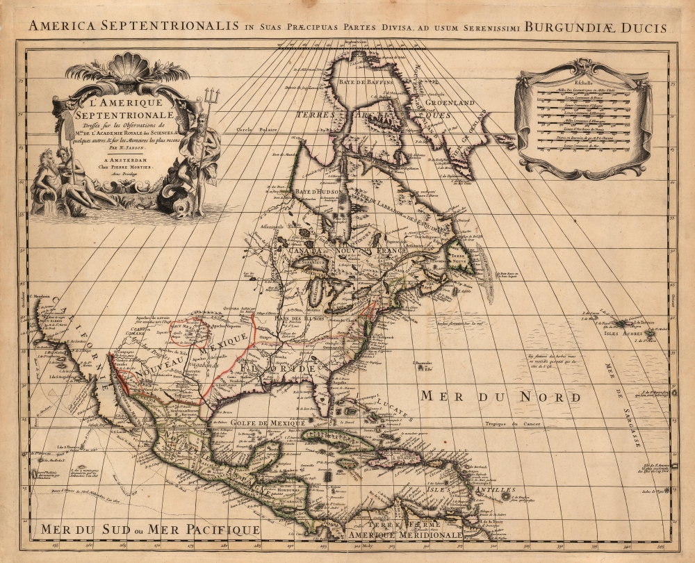
America Septentrionalis in suas Praecipuas Partes Divisa, Ad Usum Serenissimi Burgundiae Ducis/ L'Amerique Septentrionale Dressee sur les Observations de Mrs. de l'Academie Royale des Sciences et quelques autres, et sur les Memoires les plus recens Par N. Sanson.
sold
- Digital Map Information
- Suitable for large format printing
- Full resolution TIFF file
- ICC color profile embedded
- Delivered instantly via download link
This is Peter Mortier's 1708 edition of De L'Isle's foundational 1700 mapping of North America. De l'Isle's map was the first to begin correcting the California-as-an-island myth, however tentatively. The map embraces North America from Baffin's Bay southwards as far as the Spanish Main, westwards to Cape Mendocino, and eastwards to include the Azores and the Sargasso Sea. Cartographically this map is faithful to the De L'Isle, differing mainly in the positioning of the title cartouche and the mileage scales. (more details)
Internationalism in Japan as it regained its independence after WWII.

世界一周 / [Around the World].
sold
- Digital Map Information
- Suitable for large format printing
- Full resolution TIFF file
- ICC color profile embedded
- Delivered instantly via download link
Issued in 1952, the year Japan regained its sovereignty after WWII, this is a rare double-sided world map published for Jidō Nenkan (兒童年鑑, Children's Yearbook). They demonstrate the inculcation of a new spirit of internationalism in Japan, especially among children, after the nationalist militarism and destruction of the war years. (more details)
Early view of Salt Lake City.

Great Salt Lake, Utah.
sold
- Digital Map Information
- Suitable for large format printing
- File Size: 10.5 MB
- File Type: ZIP / TIFF
- ICC color profile embedded
- Delivered instantly via download link
This is an original c. 1870 Currier and Ives lithograph view of Salt Lake City, Utah, roughly 20 years after the city's settlement. (more details)
Acadia National Park by a Northeast Harbor local.

A Map of Mount Desert Island.
sold
This is a scarce 1932 pictorial map of Mount Desert Island and its vicinity, drawn and published by Northeast Harbor artist Luther S. Phillips. The map includes Acadia National Park, the largest and most beloved national park in the eastern United States. (more details)
Texas Centennial.
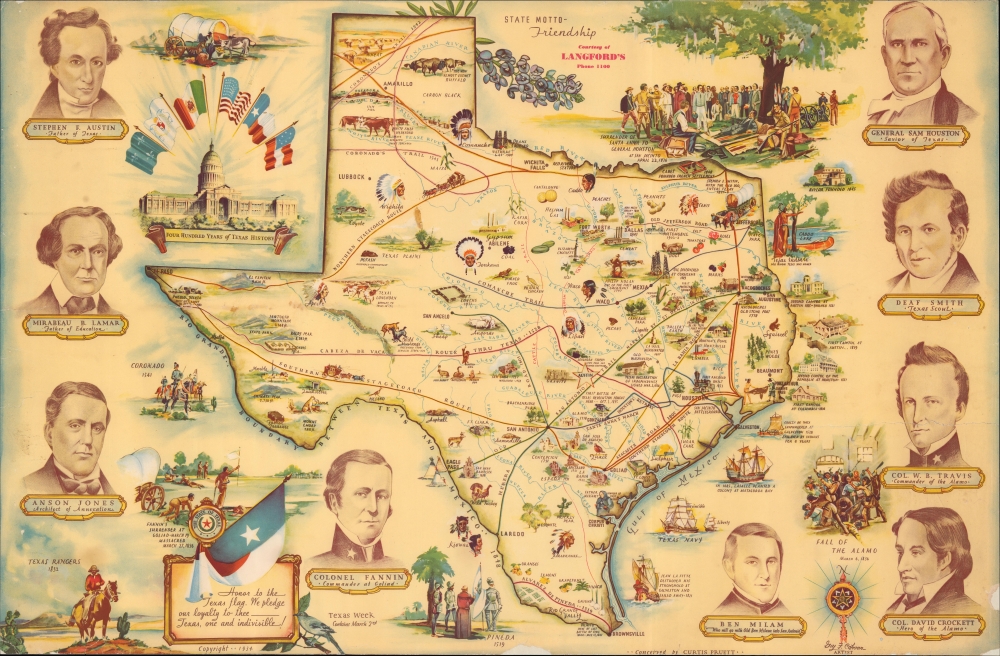
Four Hundred Years of Texas History.
sold
- Digital Map Information
- Suitable for large format printing
- File Size: 48.19 MB
- File Type: ZIP / TIFF
- ICC color profile embedded
- Delivered instantly via download link
A lively, large-format pictorial historical map of Texas, 'conceived' by Curtis Pruett and drawn by Guy F. Cahoon in 1934, in advance of the centennial of the Texas Revolution and the founding of the Republic of Texas. It depicts many of the central players in the revolution and founding fathers of the republic, including Sam Houston, Stephen Austin, James Fannin, and William Travis. (more details)
The Westward Expansion Explained.
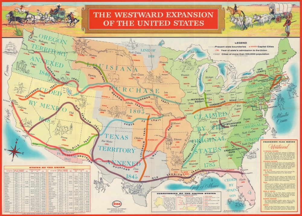
The Westward Expansion of the United States. / Life in Colonial America and the Westward Expansion of the United States.
sold
This is a 1958 General Drafting Company pictorial map of the United States illustrating the Westward Expansion. (more details)
Best neutral-perspective map of the French and Indian War.
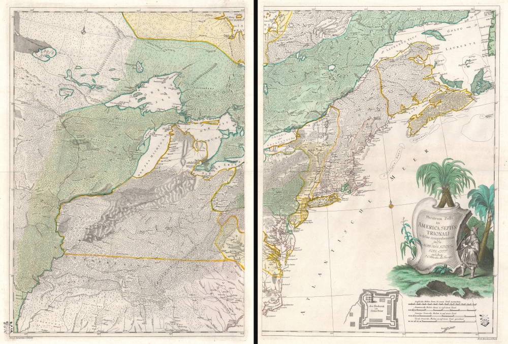
Theatrum belli in America Septentrionali. II. foliis comprehensum jussu Acad. Reg. Scient. et Eleg. Litt. exhibet I. C. Rhode Ac: Geogr. Berger, sculpsit berol.
$14,000.00
Acquire
- Digital Map Information
- Suitable for large format printing
- Full resolution TIFF file
- ICC color profile embedded
- Delivered instantly via download link
An important separately issued c. 1761 Johann Christoph Rhode map of eastern North America published in Berlin is considered the most important neutral perspective map of the French and Indian War (1754 - 1763). Rhode's map is little known and often overlooked by collectors, surprising as it is unquestionably the most exceptional map of the Theater of the French and Indian War published in any country other than the belligerent nations. (more details)
Earliest Acquirable use of 'America' on a map.
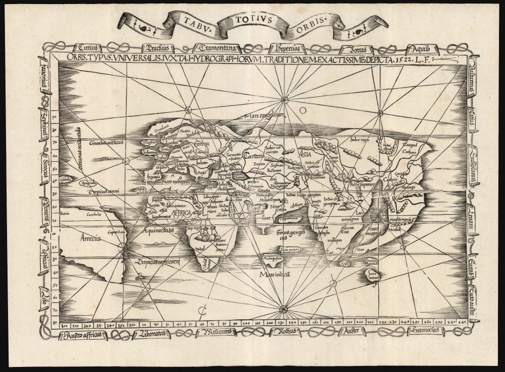
Orbis Typus Universalis Iuxta Hydrographorum Traditionem Exactissime Depicta. 1522 L. F.
sold
- Digital Map Information
- Suitable for large format printing
- File Size: 19.83 MB
- File Type: ZIP / TIFF
- ICC color profile embedded
- Delivered instantly via download link
This is a superb example of Lorenz Fries's 1522 map of the world in its 1535 edition: a key discovery-era document, being the second earliest, acquirable, printed map to name 'America' (appearing here in South America). (more details)
First Map of Maryland - Promoting colonization.
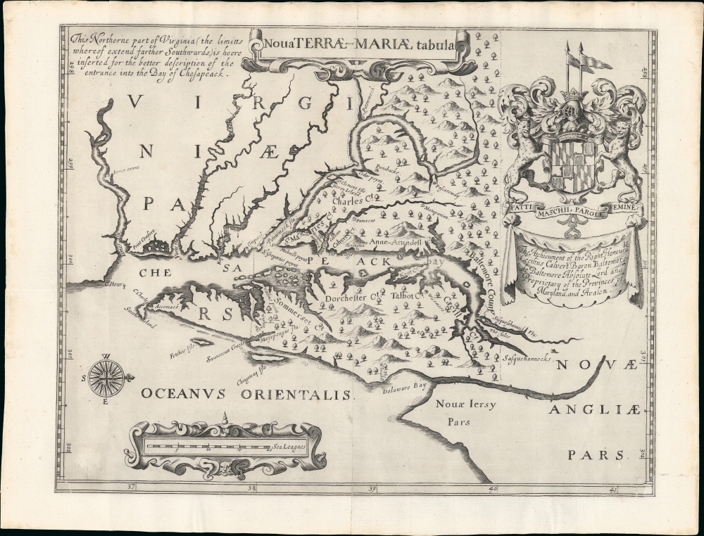
Nova Terrae-Mariae Tabula.
sold
- Digital Map Information
- Suitable for large format printing
- Full resolution TIFF file
- ICC color profile embedded
- Delivered instantly via download link
This is the 1671 John Ogilby second edition of the 1635 Lord Baltimore map of the Chesapeake Bay - considered the first map of Maryland. Although based on the 1635 map, this Ogilby edition is no slavish copy and includes unique and significant cartography not found elsewhere. It was issued to promote British colonization of Maryland and includes a wealth of unique, relevant detail, including new town sites, ten new county designations, and more defined borders. By all reports, it was successful, with nearly 25,000 English settlers moving to Maryland by 1681. (more details)
Unabashed Japanese ambitions in WWI.
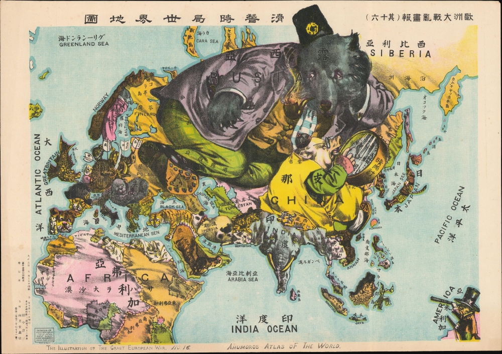
The Illustration of the Graet European War. No. 16. A Humoros Atlas of the World. / 歐洲大戰亂畫報(其十六)滑稽欧亜外交地図.
sold
- Digital Map Information
- Suitable for large format printing
- File Size: 28.45 MB
- File Type: ZIP / TIFF
- ICC color profile embedded
- Delivered instantly via download link
An exceptional September 13, 1914, Japanese serio-comic map of Asia and Europe at the outbreak of World War I. The masterfully drawn chromolithograph map unabashedly illustrates Japanese aspirations to exploit the war in Europe, with underpinning elements of cultural supremacy, imperial ambitions towards China, concern over but contempt for Russia, and grudging respect towards the United States. (more details)
An epic cartographic achievement.
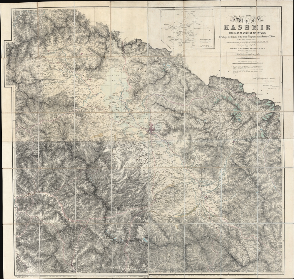
Map of Kashmir with part of Adjacent Mountains surveyed on the basis of the Great Trigonometrical survey of India, under the instructions of Lieutt. Colonel A. S. Waugh, Engineers, F.R.S. F. R.G.S. Survey General of India, by Captain T. G. Montgomerie, Engineers. F.R.G.S. 1st. Assistants under his orders, during 1855, 56 and 57.
sold
- Digital Map Information
- Suitable for large format printing
- File Size: 264.53 MB
- File Type: ZIP / TIFF
- ICC color profile embedded
- Delivered instantly via download link
This is the first edition of Thomas G. Montgomerie's 1859 large-scale map of Kashmir and Jammu - considered the greatest achievement of one of the most epic concerted cartographic efforts in history, the Great Trigonometrical Survey of India. (more details)
Seminal Map of the north Amazon and Orinoco.
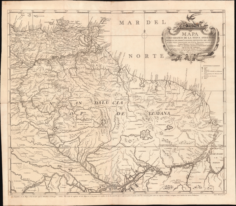
Mapa Coro-Grafico de La Nueva Andalucia, Provincias de Cumaná, y Guyana, Vertientes de Orinoco, su cierto origen, Ccomunicación con el de las Amazonas, situación de la Laguna Parime, y nuevas Poblaciónes.
sold
- Digital Map Information
- Suitable for large format printing
- Full resolution TIFF file
- ICC color profile embedded
- Delivered instantly via download link
An extraordinary 1778 Spanish map of northern Brazil, eastern Venezuela, and Guyana, prepared by Luis de Surville y Villerey. When issued, this was the most comprehensive study of the overlapping and complex Orinoco-Amazon-Rio Negro basin system. (more details)
From the most important celestial atlas of the 18th Century.
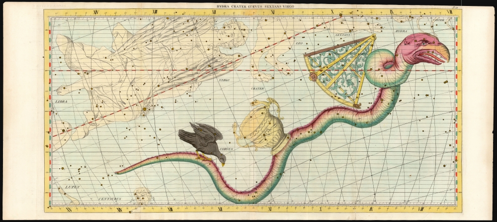
Hydra Crater Corvus Sextans Virgo.
sold
- Digital Map Information
- Suitable for large format printing
- File Size: 48.82 MB
- File Type: ZIP / TIFF
- ICC color profile embedded
- Delivered instantly via download link
This grand and beautiful celestial chart depicts the constellations of Hydra, Crater, Corvus, Sextans, and Virgo. It was issued in the first two editions of John Flamsteed's 1729 Atlas Coelestis. In the present example, the constellation Hydra and the contiguous constellations of Crater, Corvis, and Sextans have been illuminated with attractive hand color. Parts of Cancer, Leo, Lupus, and Centaurus are visible at the edges of the engraving. (more details)
The wheel of the Zodiac in a beautiful example.
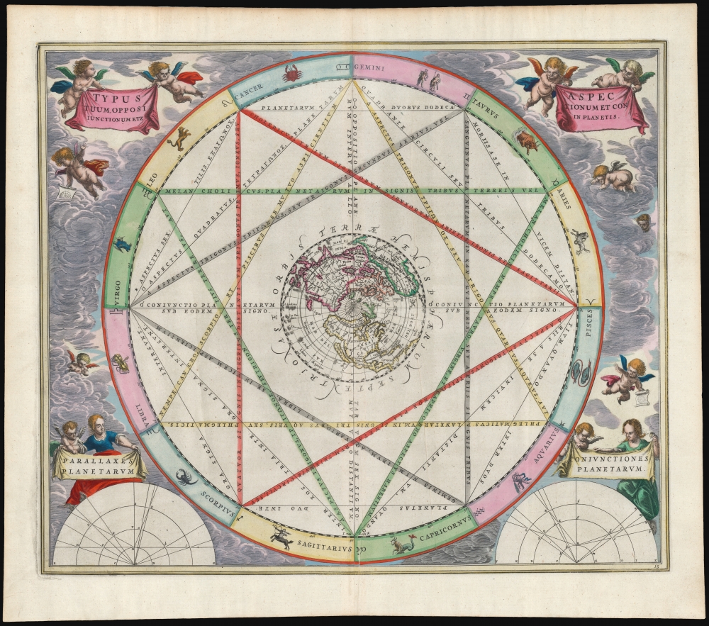
Typus Aspectuum Oppositionum et Conjunctionum Etz In Planetis.
sold
- Digital Map Information
- Suitable for large format printing
- Full resolution TIFF file
- ICC color profile embedded
- Delivered instantly via download link
This beautiful work is Andreas Cellarius' 1660 astrological chart, in its second 1661 edition with beautiful original color. The work illustrates how planetary positions affect the 'humors', and thus human behavior. (more details)
On the Mormon Trail.
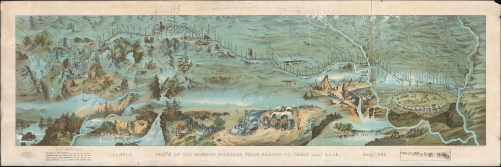
Route of the Mormon Pioneers from Nauvoo to Great Salt Lake.
sold
- Digital Map Information
- Suitable for large format printing
- File Size: 42.35 MB
- File Type: ZIP / TIFF
- ICC color profile embedded
- Delivered instantly via download link
This is a striking 1899 chromolithograph panoramic Millroy and Hayes bird's-eye view and map of the 1,300-mile Mormon Trail. The view covers the region between the Mississippi River and Great Salt Lake and chronicles the westward migration of the Mormon Pioneers from Nauvoo, Illinois, to Great Salt Lake, Utah, 1846-1847. (more details)
Pre-Civil War Westward Expansion.
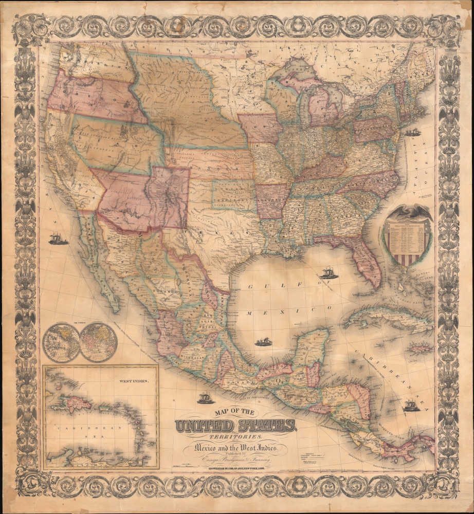
Map of the United States, with its Territories; also Mexico and the West Indies.
sold
- Digital Map Information
- Suitable for large format printing
- File Size: 87.11 MB
- File Type: ZIP / TIFF
- ICC color profile embedded
- Delivered instantly via download link
A scarce American wall map of the United States and Mexico issued by Ensign, Bridgeman and Fanning in 1856. As the title suggests, the map covers all of the United States as well as Mexico, Cuba, and Central America as far as Panama. Inset maps in the lower left illustrate the world and the Lesser Antilles. The focus of the map is westward expansion in the United States. Updates accordingly focused on administrative changes west of the Mississippi. Here, Texas conforms to the Compromise of 1850 borders, and the Gadsden Purchase has added new territory to New Mexico. The borders of Kansas and Nebraska follow the Kansas-Nebraska Act of May 30, 1854, in which Nebraska stretches to the Canadian border. The gold region in the Sacramento Valley is highlighted in California. The map notes emigrant and exploration routes to the west, including Fremont's Route, the Oregon Trail, and the Santa Fe Caravan route. American Indian lands are rigorously identified throughout as if to remind emigrants that the land is not completely free and uninhabited. (more details)