
Alaska and Hawaii (sold)
Thorough, early defense of the Sea of the West and the Northwest Passage.
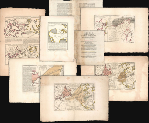
Exposé des Découvertes au Nord de la Grande Mer...
sold
- Digital Map Information
- Suitable for large format printing
- Full resolution TIFF file
- ICC color profile embedded
- Delivered instantly via download link
This is an extremely rare example of Philippe Buache's 1753 Exposé des Découvertes au Nord de la Grande Mer, the essential maps published to support the astonishing geographical theories of Philippe Buache and Joseph Nicolas De l'Isle, presented in August 1752 to the Paris Academie des Sciences. It was then the most complete cartographical defense of Nicolas De l'Isle's 'exposé' of Russian cartographic advances, along with Buache's synthesis of several mappings of the Pacific Northwest, revealing compelling (if ultimately false) evidence of a viable Northwest Passage. These maps were later included in the 1753-1755 Considérations Géographiques, 'the magnum opus of the Delisle-Buache theory of the layout of lands in the North Pacific space,' (Lada-Mocarski, 1969) appearing there in their second states. These six sheets are all first state examples, indicating that the Exposé enjoyed an earlier publication, spurred perhaps by the novelty of Buache and De l'Isle's arguments and the urgency with which the two geographers wished to assuage and rebut critics of their presentation to the Academie. (more details)
By far the rarest of the great early maps of Hawaii.
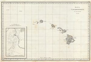
КАРТА САНДВЙЧЕВЫХЪ ОСТРВОВЪ 1826 [Map Sandvychevyh Ostrovov 1828] (Map of the Sandwich Islands 1826)
sold
- Digital Map Information
- Suitable for large format printing
- Full resolution TIFF file
- ICC color profile embedded
- Delivered instantly via download link
Perhaps the rarest of all the great early maps of the Hawaiian Islands, this is the Russian language first edition of Admiral Adam Johann von Krusenstern's important map of the Sandwich Islands or Hawaii. The map covers the Hawaiian archipelago in full with an ... (more details)
Unique survivor from the First Hawaii Territory Survey.
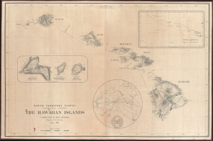
Hawaii Territory Survey. The Hawaiian Islands Compiled from the latest information Map by H. E. Newton June 1919.
sold
- Digital Map Information
- Suitable for large format printing
- File Size: 109.11 MB
- File Type: ZIP / TIFF
- ICC color profile embedded
- Delivered instantly via download link
A singular survivor from the first Hawaiian Territorial Survey, this is Henry E. Newton's 1919 map of the Hawaiian Islands, here in a previously unknown double-sized presentation issue. This is the most important map of Hawaii issued during the territorial period and the foundation for most subsequent maps of the archipelago into the late 20th century. (more details)
Extremely rare, highly influential, and very important foundational map of the North Pacific showing Sea of the West and the apocryphal discoveries of Admiral de Fonte.
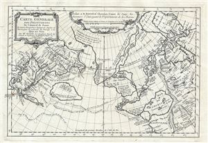
Carte General Des Decouvertes De L'Amiral de Fonte Et autres Navigateurs Espagnols, Anglois, et Russes, pour la recherche du Passage a la Mer du Sud.
sold
- Digital Map Information
- Suitable for large format printing
- DPI: 300
- File Size: 6.51 MB
- File Type: ZIP / TIFF
- ICC color profile embedded
- Delivered instantly via download link
An object of extreme historical importance and rarity, this map was the center of one of the most heated cartographic debates in history. This is an unrecorded state of Joseph-Nicolas de L'Isle's (Delisle) map of the Northern Pacific Ocean and Arctic. De ... (more details)
Tappan Adney's manuscript proof of his 1898 overland map to the Klondike. A one-of-a-kind addition to any Yukon Gold Rush Collection.
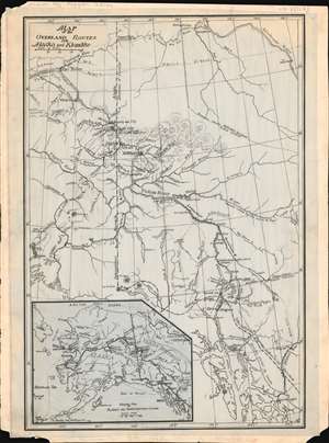
Map of the Overland Routes into Alaska and Klondike.
sold
- Digital Map Information
- Suitable for large format printing
- File Size: 5.37 MB
- File Type: ZIP / TIFF
- ICC color profile embedded
- Delivered instantly via download link
A remarkable discovery and highly important Klondike Gold Rush (1896 - 1899) map, this is a one-of-a-kind 1897-1898 original manuscript (hand drawn) proof of journalist Edwin Tappan Adney's map illustrating the overland route to the Yukon and Klondike River. The map covers from Sitka north to Fort Yukon, the Porcupine River, and the Mackenzie River - all just north of the Arctic Circle. In the process it covers various routes to the Klondike Goldfields, as well as river courses and topography, identifying trading posts, territorial claims, proposed railway routes, indigenous villages and forts. (more details)
The Russian Empire at its height of expansion just before the Napoleonic Invasion.
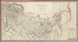
ГЕНЕРАЛЬНАЯ КАРТА РОССIЙСКОЙ ИМПЕРIИ HA ПЯТДЕСЯТЪ ГУБЕРНIЙ РАЗДЂЛЕННОЙ, съ ПОКАЗАНIЕМЪ СОСЕДСТВЕННЫХЪ ВЛАДЂНІЙ и большихъ дорогъ. / A General Map of the Russian Empire Divided into the Fifty Provinces, Showing Neighboring Domains and Highways.
sold
- Digital Map Information
- Suitable for large format printing
- DPI: 600
- File Size: 112.48 MB
- File Type: ZIP / TIFF
- ICC color profile embedded
- Delivered instantly via download link
An exceptionally rare 1809 large-format map of the Russian Empire by Alexsandr Dmitrievich Savinkov. This is the largest and most important map published during Savinkov's tenure at the Saint Petersburg Imperial Map Depot. Presented on a conic equidistant projection, Savinkov's map covers the Russian Empire in all of its expansiveness, from Finland, annexed into Russia in the year this map was made, to Russian Alaska, and from the Arctic to Mongolia. It is dedicated to Savinkov's patron, Tsar Alexander I or Alexander Pavlovich (1777 - 1825), who ruled from 1801 to 1825. The whole exhibits Savinkov's distinctive and exceptional fine engraving style. (more details)
1st to show Vancouver Island and Puget Sound.
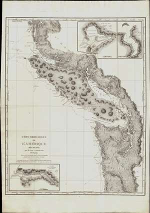
Cote Nord-Ouest de L'Amerique Reconnue par le Cape. Vanouver. 3e. Partie.
sold
- Digital Map Information
- Suitable for large format printing
- Full resolution TIFF file
- ICC color profile embedded
- Delivered instantly via download link
This is the 1799 French edition of George Vancouver's 1799 nautical map of the region around Vancouver Island, the Strait of Juan de Fuca, the mouth of the Columbia River, and Queen Charlotte Sound, extending from Cape Lookout (in modern-day Oregon) to Cape Swaine (Alaska). It is considered to be the great navigator George Vancouver's most important and influential map, among those he produced in his foundational reconnaissance of the northwest coast of America (1791 - 1795). (more details)
Quite simply the largest, most beautiful, and most important early map of Hawaii ever published.
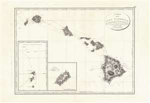
Carte des Iles Sandwich d'apres la reconnoissance qui en a ete faite dans les differentes relaches de la corvette La Decouverte et de sa conserve Le Chatham commandes par le Capt. Vancouver en 1792, 1793 et 1794.
sold
- Digital Map Information
- Suitable for large format printing
- Full resolution TIFF file
- ICC color profile embedded
- Delivered instantly via download link
This is a beautiful example of George Vancouver's seminal 1799 map of the Hawaiian Islands, considered the largest, most important, and most beautiful map of Hawaii to appear in the 18th century. George Vancouver first sighted Hawaii on January 18, 1778, as a midshipman on the HMS Discovery, consort ship to Captain James Cook's HMS Resolution, becoming one of the first Europeans to see the idyllic island group. Despite Cook's having been killed by angry Hawaiian natives, Vancouver formed a good opinion of the both the archipelago and the Hawaiian people. Fourteen years later and captain of his own ship, George Vancouver chose the Hawaiian Islands as a winter base while exploring the Northwest Coast of America in search of the elusive Northwest Passage. During his three seasonal visits to the Hawaiian Islands, Vancouver and his Lieutenant Joseph Baker completed this, the first complete map of the archipelago. His route, which zigzags around and between the islands, is carefully noted and includes visits in 1792, 1793, and 1794. (more details)
Quite simply the largest, most beautiful, and most important early map of Hawaii ever published.
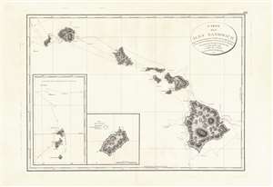
Carte des Iles Sandwich d'apres la reconnoissance qui en a ete faite dans les differentes relaches de la corvette La Decouverte et de sa conserve Le Chatham commandes par le Capt. Vancouver en 1792, 1793 et 1794.
sold
- Digital Map Information
- Suitable for large format printing
- DPI: 600
- File Size: 21.69 MB
- File Type: ZIP / TIFF
- ICC color profile embedded
- Delivered instantly via download link
This is a beautiful example of George Vancouver's seminal 1799 map of the Hawaiian Islands, considered the largest, most important, and most beautiful map of Hawaii to appear in the 18th century. George Vancouver first sighted Hawaii on January 18, 1778, when, as a midshipman on the HMS Discovery, consort ship to Captain James Cooks' HMS Resolution, becoming one of the first Europeans to see the idyllic island group. Despite Cook's having been killed by angry Hawaiian natives, Vancouver formed a good opinion of the both the archipelago and the Hawaiian people. Fourteen years later and captain of his own ship, George Vancouver chose the Hawaiian Islands as a winter base while exploring the Northwest Coast of America in search of the elusive Northwest Passage. During his three seasonal visits to the Hawaiian Islands, Vancouver and his Lieutenant Joseph Baker completed this, the first complete map of the archipelago. His route, which zigzags around and between the islands, is carefully noted and includes visits in 1792, 1793, and 1794. (more details)
A foundational map and the single most influential map of the the Pacific Northwest issued in the middle of the 18th Century.
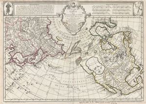
Carte Des Nouvelles Decouvertes au Nord de la Mer de Sud, tant a l'Est de la Syberie et du Kamtchatka, qu'a L'Ouest de la Nouvelle France.
sold
- Digital Map Information
- Suitable for large format printing
- DPI: 300
- File Size: 17.62 MB
- File Type: ZIP / TIFF
- ICC color profile embedded
- Delivered instantly via download link
Rare first edition of Joseph Nicolas De l'Isle's extraordinary 1752 map of North America, Siberia, the Arctic, and the North Pacific. J. N. De L'Isle and Buache drew this map to illustrate their speculations on the feasibly of a Northwest Passage. ... (more details)
First map to show Vancouver Island and Puget Sound.
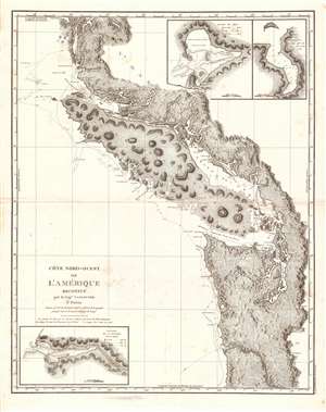
Cote Nord-Ouest de L'Amerique Reconnue par le Cape. Vanouver. 3e. Partie.
sold
- Digital Map Information
- Suitable for large format printing
- Full resolution TIFF file
- ICC color profile embedded
- Delivered instantly via download link
This is the 1799 French edition of George Vancouver's 1799 nautical map of the region around Vancouver Island, the Strait of Juan de Fuca, the mouth of the Columbia River, and Queen Charlotte Sound, extending from Cape Lookout (in modern-day Oregon) to Cape Swaine (Alaska). It is considered to be the great navigator George Vancouver's most important and influential map, among those he produced in his foundational reconnaissance of the northwest coast of America (1791 - 1795). (more details)
Japanese immigration guide to America!
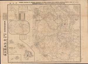
Map Showing Location of Japanese Residents in Hawaii, Canada, South America, Mexico and the Pacific Coast of USA. / 和英両文米国, 布哇, 加奈陀, 墨西哥及南米日本人在住地明細地圖
sold
- Digital Map Information
- Suitable for large format printing
- Full resolution TIFF file
- ICC color profile embedded
- Delivered instantly via download link
This is a fascinating large scale 1917 Yamazaki Hatsutaro map of the western United States and Hawaii designed act as a guide for Japanese immigrants to the America. The map is centered on California - then the hub of Japanese immigration and cultural life in North America - and extends eastward roughly to Nebraska and Texas. A large inset in the lower left details the Hawaiian Islands, also a center of Japanese immigration. Smaller insets detail global shipping routes, South America, and the Pacific northwest including British Columbia and Alaska. Smaller tables offer statistics on Japanese population density broken down by state, with California having the highest concentration of émigrés. The verso features a comprehensive bi-lingual index and promotional material for Japanese-friendly hotels, steamers, newspapers, and other services. (more details)
Awe inspiring nautical chart of th north Pacific Ocean.
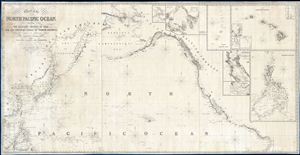
Chart of the North Pacific Ocean, Exhibiting the Eastern Shores of Asia and the Western Coast of North America from the Equator to Behring's Strait with plan, on an enlarge scale, of the Principal Island and Harbours.
sold
- Digital Map Information
- Suitable for large format printing
- DPI: 300
- File Size: 86.53 MB
- File Type: ZIP / TIFF
- ICC color profile embedded
- Delivered instantly via download link
A spectacular and massive 1849 James Imray nautical chart or maritime map of the northern Pacific. Roughly centered on Hawaii, this sprawling chart covers from Hainan and Borneo eastwards to Columbia and Panama, and from the Behring Strait to the Moluccas and the Galapagos Islands (the Equator). The chart is rendered on a Mercator Projection with latitude measured from Greenwich, England. Like most nautical charts, the cartographer offers very little inland detail, but a wealth of maritime data. This includes the identification of various ports and harbors, coastal topography, shoals and other undersea dangers, and countless depth soundings in fathoms. Additionally, the cartographer has noted aspects of various islands that may have been of importance to the mariner, for example Christmas Island has 'Plenty of Turtle, no fresh Water.'
This map is decorated with ten inset maps, from top center, Victoria Harbor (British Columbia), Awatska Bay on the east coast of Kamtschatka, the Mariana or Ladrones Islands (including Guam), the Hawaiian or Sandwich Islands (with four sub-insets: Waiakea or Byron Bay, Hanalei Bay (Kauai), Honolulu Harbor, and Kailua Bay), San Francisco Bay, the Mouth of the Columbia River (including the Fort Astoria settlement), and the Philippine Islands. (more details)
This map is decorated with ten inset maps, from top center, Victoria Harbor (British Columbia), Awatska Bay on the east coast of Kamtschatka, the Mariana or Ladrones Islands (including Guam), the Hawaiian or Sandwich Islands (with four sub-insets: Waiakea or Byron Bay, Hanalei Bay (Kauai), Honolulu Harbor, and Kailua Bay), San Francisco Bay, the Mouth of the Columbia River (including the Fort Astoria settlement), and the Philippine Islands. (more details)
First map to show Vancouver Island and Puget Sound.
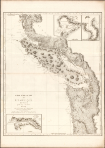
Cote Nord-Ouest de L'Amerique Reconnue par le Cape. Vancouver. 3e. Partie.
sold
- Digital Map Information
- Suitable for large format printing
- DPI: 600
- File Size: 1024.17 MB
- File Type: ZIP / TIFF
- ICC color profile embedded
- Delivered instantly via download link
This is the 1799 French edition of George Vancouver's 1799 nautical map of Vancouver Island, the Strait of Juan de Fuca, the mouth of the Columbia River, and Queen Charlotte Sound, extending from Cape Lookout (in modern-day Oregon) to Cape Swaine (Alaska). It is considered to be the great navigator George Vancouver's most important and influential map, among those he produced in his foundational reconnaissance of the northwest coast of America (1791 - 1795). (more details)
Unique proof state of a survey of Honolulu with connections to the Hawaiian Revolution.
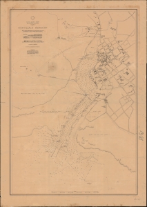
North Pacific Ocean, Hawaiian Islands, Oahu, Honolulu Harbor.
sold
- Digital Map Information
- Suitable for large format printing
- File Size: 1595.22 MB
- File Type: ZIP / TIFF
- ICC color profile embedded
- Delivered instantly via download link
A fascinating 1892 proof-state of the first U.S. survey of Honolulu Harbor, Hawaii, completed under Captain Gilbert Wiltse in 1892. Replete with manuscript corrections and annotations, this map offers unique insight into the processes behind U.S. Navy Hydrographic office survey publication. Historically, this map appeared within the context of potential U.S.-Hawaiian Annexation and the 1893 Hawaiian Revolution - in which Wiltse played a role. (more details)
Quite simply the largest, most beautiful, and most important early map of Hawaii ever published.
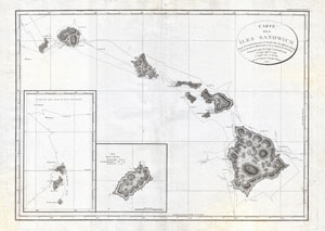
Carte des Iles Sandwich d'apres la reconnoissance qui en a ete faite dans les differentes relaches de la corvette La Decouverte et de sa conserve Le Chatham commandes par le Capt. Vancouver en 1792, 1793 et 1794.
sold
- Digital Map Information
- Suitable for large format printing
- DPI: 300
- File Size: 16.94 MB
- File Type: ZIP / TIFF
- ICC color profile embedded
- Delivered instantly via download link
A seminal map. This is a fine example of George Vancouver's 1799 map of the Hawaiian Islands, considered the largest, most important, and most beautiful map of Hawaii to appear in the 18th century. George Vancouver first sighted Hawaii on January ... (more details)
Rare cartographic documentation of Japanese life in Hawaii - Japantown Honolulu!
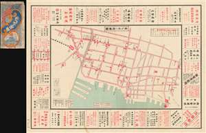
Map of Honolulu. / ホノル 府要圖
sold
- Digital Map Information
- Suitable for large format printing
- File Size: 89.92 MB
- File Type: ZIP / TIFF
- ICC color profile embedded
- Delivered instantly via download link
The only known example of this exceptional 1906 or Meiji 39 Takei Nekketsu (武居熱血) Japanese map the old Japantown of Honolulu, Hawaii. The map roughly corresponds to Honolulu's modern day Downtown and Chinatown districts, but at the time, this area was the center of Japanese life on the islands. The map identifies and advertises utilities, Japanese businesses, government offices, the Japanese consulate, banks, railroads, and more. (more details)
Signed multiple times by Tribunal.
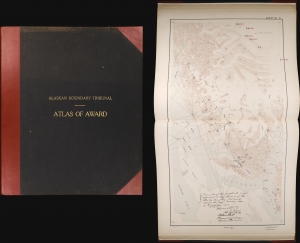
Atlas of Award Twenty-five sectional maps and index map showing the line fixed by the Tribunal / Senate Document No. 162. 58th Congress, 2d Session.
sold
An exceptional item, this atlas recounting the work and decision of the 1903 Alaska Boundary Tribunal is signed multiple times by the members of the tribunal. The dispute, instigated by the Klondike Gold Rush, was a sore spot in Canada-U.S. relations for years. Its resolution in favor of the U.S., with the deciding vote cast by a British member of the tribunal, simultaneously resolved the conflict and improved Anglo-American relations. (more details)
The first map to focus specifically on the Pacific Coast of North America.
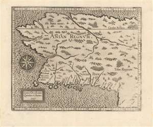
Limes Occidentis Quiuira et Anian. / Anian Regnum.
sold
- Digital Map Information
- Suitable for large format printing
- DPI: 600
- File Size: 8.73 MB
- File Type: ZIP / TIFF
- ICC color profile embedded
- Delivered instantly via download link
A strong example of Cornelis van Wytfliet's 1597 Anian Regnum; this is the first separate map to focus on the Pacific Northwest. The map presents the area now occupied by most of the west coast of the United States, Canada, and Alaska, in spite of this region having been beyond the ken of European explorers and geographers for centuries to come. The westward-reaching land mass bears a serendipitous resemblance to Alaska, although the area depicted is far more massive. (more details)
The map that disproved the Northwest Passage.
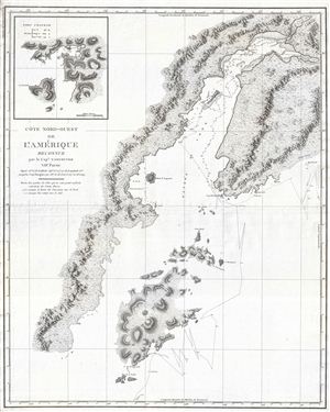
Cote Nord-Ouest de L'Amerique Reconnue par le Cape. Vancouver. VIIe Partie.
sold
- Digital Map Information
- Suitable for large format printing
- DPI: 300
- File Size: 17.73 MB
- File Type: ZIP / TIFF
- ICC color profile embedded
- Delivered instantly via download link
One of the great navigator George Vancouver's most important and influential maps, this is Vancouver's 1799 mapping of Kodiak Island and Cook Inlet, Alaska. Centered on the entrance to Cook Inlet, this map covers from Knik Arm and Turnagain Arm ... (more details)
The first English mappings of San Diego and San Francisco Bays.
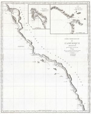
Cote Nord-Ouest de L'Amerique Reconnue par le Cape. Vancouver. 1e Partie.
sold
- Digital Map Information
- Suitable for large format printing
- DPI: 300
- File Size: 13.42 MB
- File Type: ZIP / TIFF
- ICC color profile embedded
- Delivered instantly via download link
One of the great navigator George Vancouver's most important and influential maps, this is Vancouver's 1799 mapping of the California coastline roughly from San Francisco Bay in the north to Santo Domingo, Mexico. Vancouver's exploration of ... (more details)
Bellin puts it all together...

Remarques sur la Carte reduite de l'océan septentrional, compris entre l'Asie et l'Amérique, suivant les découvertes qui ont été faites par les Russes; dressée au Dépôt des cartes et plans de la Marine, pour le service des vaisseaux du roi, par ordre de M. le duc de Praslin, ministre d'etat, ayant le département de la Marine.
sold
- Digital Map Information
- Suitable for large format printing
- DPI: 600
- File Size: 38.06 MB
- File Type: ZIP / TIFF
- ICC color profile embedded
- Delivered instantly via download link
A beautiful example of Bellin's splendidly engraved 1766 map of the Pacific Northwest, Alaska, the Bering Strait and Siberia. This map is significant as a reactionary piece to the waves of cartographic speculation about the American Pacific Northwest that defined the first half of the 18th-century. Bellin, the premier hydrographer of his generation, here attempts make sense of it all, bringing together the speculations of the previous generation, his own geographical expertise, and issuing, for the first time on a French map, Frederick Muller's revolutionary cartography relating to the discoveries of Vitus Bering and Aleksei Chirikov. (more details)
First map to name Alaska and the first specific published map of Alaska as American territory.

North Western America showing the territory ceded by Russia to the United States.
sold
- Digital Map Information
- Suitable for large format printing
- File Size: 38.22 MB
- File Type: ZIP / TIFF
- ICC color profile embedded
- Delivered instantly via download link
A seminal production, this is the first map to name Alaska and the first specific published map of Alaska as an American territory. Centered on the Bering Strait, the map covers all of Alaska as well as parts of adjacent Russia (as far as the Sea of Okhotsk) and Canada. Offers inland detail, especially along the coasts, as well as topography and a breakdown of Russian and Inuit settlements. (more details)
Unusual map illustrating the discoveries of Russian fur traders in the Aleutian Islands after Bering's expedition but before Cook.
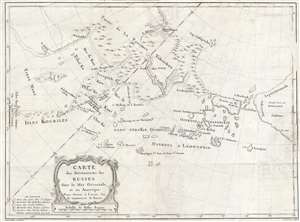
Carte des Découverts des Russes dans la Mer Orientale, et en Amerique Pour Servir à L'essai, Sur le commerce de Russie.
sold
- Digital Map Information
- Suitable for large format printing
- DPI: 300
- File Size: 9.14 MB
- File Type: ZIP / TIFF
- ICC color profile embedded
- Delivered instantly via download link
This is a rare and unusual 1777 map of the north Pacific in the vicinity of Alaska, the Bering Straits, and northeastern Siberia based upon Russian Promyshlenniki (trader) exploration. The map post-dates Russian state sponsored Vitus Bering ... (more details)
A monument to speculative cartography showing the Sea of the West and mythical discoveries of De Fonte.
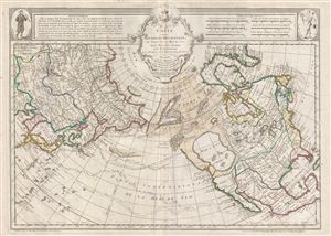
Carte Des Nouvelles Decouvertes au Nord de la Mer de Sud, tant a l'Est de la Syberie et du Kamtchatka, qu'a L'Ouest de la Nouvelle France.
sold
- Digital Map Information
- Suitable for large format printing
- DPI: 300
- File Size: 20.31 MB
- File Type: ZIP / TIFF
- ICC color profile embedded
- Delivered instantly via download link
The 1789 Dezauche edition of Joseph Nicolas De l'Isle's extraordinary 1752 map of North America, Siberia, the Arctic, and the North Pacific. J. N. De L'Isle and Buache drew this map to illustrate their speculations on the feasibly of a ... (more details)
From lost Russian sources.
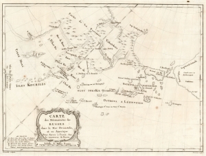
Carte des Découvertes des Russes dans la Mer Orientale, et en Amerique Pour Servir à L'essai, Sur le commerce de Russie.
sold
- Digital Map Information
- Suitable for large format printing
- DPI: 600
- File Size: 38.36 MB
- File Type: ZIP / TIFF
- ICC color profile embedded
- Delivered instantly via download link
This is a rare and unusual 1777 map of the North Pacific in the vicinity of Alaska, the Bering Strait, and northeastern Siberia based upon Russian Promyshlenniki (trader) exploration. It appeared accompanying one of the earliest works on Russian commerce, the M. de Marbault's Essai sur le Commerce de Russie, avec l'Histoire de ses Decouvertes. (more details)
A crew member's sketch of the voyages of the U.S.S. Salt Lake City throughout WWII.
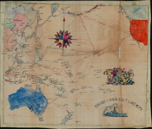
Cruise of the U.S.S. Salt Lake City.
sold
- Digital Map Information
- Suitable for large format printing
- File Size: 40.59 MB
- File Type: ZIP / TIFF
- ICC color profile embedded
- Delivered instantly via download link
This is a unique 1945 manuscript map of the U.S.S. Salt Lake City's World War II cruises, covering from February 1942 until August 4, 1945. It was hand drawn on cloth by Ralph Bennett, a crewman. (more details)
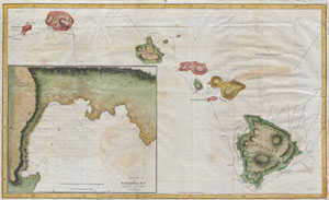
Chart of the Sandwich Islands.
sold
- Digital Map Information
- Suitable for large format printing
- DPI: 300
- File Size: 3.97 MB
- File Type: ZIP / TIFF
- ICC color profile embedded
- Delivered instantly via download link
Offered here is an extraordinary and important map of the Hawaiian Islands (Sandwich Islands) printed by G. Nicol and T. Cadell for the 1785 edition of Captain James Cook and James King's, A Voyage to the Pacific Ocean…in the Years ... (more details)
The first accurate map of the southern Alaska coastline.
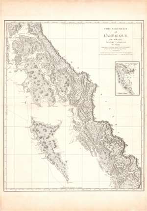
Cote Nord-Ouest de L'Amerique Reconnue par le Cape. Vancouver. IVe Partie.
sold
- Digital Map Information
- Suitable for large format printing
- DPI: 600
- File Size: 100.84 MB
- File Type: ZIP / TIFF
- ICC color profile embedded
- Delivered instantly via download link
One of George Vancouver's most important and influential charts, this is a 1799 mapping of the coast from (Prince) Frederick Sound and Prince of Wales Island to Haida Gwaii (or the Queen Charlotte Islands), now on the border between Alaska and Canada. It was the first truly accurate and detailed reconnaissance of this forbidding coastline. (more details)
Honolulu in all of its pictorial glory!
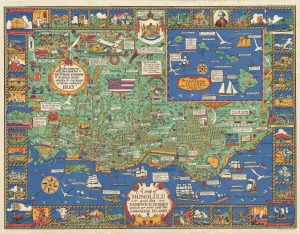
A Map of Honolulu and the Sandwich Islands, which we now call the Hawaiian Islands.
sold
- Digital Map Information
- Suitable for large format printing
- File Size: 23.99 MB
- File Type: ZIP / TIFF
- ICC color profile embedded
- Delivered instantly via download link
This is a whimsical 1927 Alexander Samuel MacLeod pictorial map of Honolulu, Hawaii, issued during the Golden Age of American Pictorial Maps (c. 1920 - 1960). In its own words, the map attempted to depict 'in a pictorial fashion the history, landmarks, and customs of these colorful Isles.' (more details)
Japanese propaganda view illustrating Pearl Harbor Attack.
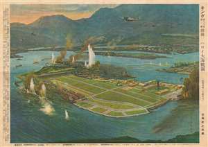
Hawaii Ocean Battlefield Map. / ハワイ大海戦圖
sold
- Digital Map Information
- Suitable for large format printing
- File Size: 44.34 MB
- File Type: ZIP / TIFF
- ICC color profile embedded
- Delivered instantly via download link
A rare World War II Japanese view propagandizing the December 7, 1941 attack on Pearl Harbor, Hawaii. The view, by the artist Matsushima was issued on December 10, 1941 (Showa 16), just three days after the fateful attack which precipitated U.S. involvement in World War II. The view looks on the naval base at Ford Island (Pearl Harbor) and 'Battleship Row' from an elevated position northwest of the Island and is based upon a famous photo taken by a Japanese plane during the attack. Japanese fighter and bomber planes fill the sky and U.S. battleships appear in ruins while the naval port burns. (more details)
Remarkable map showing Alaska as an Island.
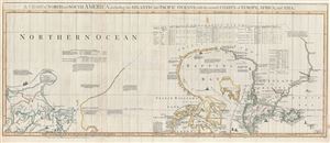
A Chart of North and South America, including the Atlantic and Pacific Oceans, with the nearest Coasts of Europe, Africa, and Asia. Chart containing part of the Icy Sea with the adjacent Coast of Asia and America. Chart comprizing Greenland with the Countries and Islands about Baffins Bay and part of Hudsons Bay.
sold
- Digital Map Information
- Suitable for large format printing
- DPI: 300
- File Size: 28.3 MB
- File Type: ZIP / TIFF
- ICC color profile embedded
- Delivered instantly via download link
A wonderful 1775 map of the Arctic regions of the Western Hemisphere by John Green or Braddock Mead. Focusing on Alaska (Bering Strait) and the Canadian Arctic, map covers from the Sea of Okhotsk (Penschinaska Guba) to Iceland and ... (more details)