
Greece - Balkans (sold)
Earliest acquirable copperplate map of Crete.
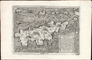
Candido lectori. Haec est illa insignis insula Creta in medio Ponto sita... hodie Candia... cujus circuitus octo et quinquaginta supra quingenta miliaria habet...
sold
- Digital Map Information
- Suitable for large format printing
- Full resolution TIFF file
- ICC color profile embedded
- Delivered instantly via download link
This beautifully engraved Lafreri-school work is Sebastiano di Re's 1559 map of Crete, the earliest engraved map of the island acquirable by the collector. It derives from Crete as represented in Nicolaos Sophianos' foundational map of Greece. (more details)
Unique First State.
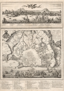
Candie/ La Ville de Candie pour la 3e. sois attaquee de L'armée Ottomane, et deffendue par Celle de la Serenissime Rep: de Venise... 1667, 68 et 69.
sold
- Digital Map Information
- Suitable for large format printing
- DPI: 600
- File Size: 109.01 MB
- File Type: ZIP / TIFF
- ICC color profile embedded
- Delivered instantly via download link
This is an extremely rare, likely unique, separately published 1668 broadsheet plan of the port of Heraklion / Candia, Crete, incorporating a striking panoramic view of the city. This broadsheet illustrates Venetian-controlled Heraklion during the final years of its 21-year-long Ottoman siege. It was privately commissioned and engraved to lionize the efforts of French nobleman Alphonse-Louis, Chevalier d’Harcourt, who perceived himself not only a defender of Crete, but as a latter-day crusader defending Christianity itself. (more details)
First Edition, First State of a later censured Map of Hungary.
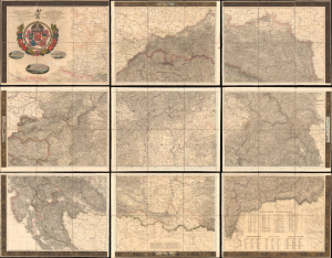
Magyar Ország, Horvát, Tót, Dalmát, és Erdély Országok, a tenger mellék és a végőri videkék kőzonséges pśták és útak főldabrosza... / Vollstaendige General Posten- und Strassen-Karte des Königreichs Ungran, der Königreiche Croatien, Slavonien, Dalmatien, des Grossfürstenth. Siebenbürgen, des Küstenlandes und der Militair-Grenze...
sold
- Digital Map Information
- Suitable for large format printing
- File Size: 591.44 MB
- File Type: ZIP / TIFF
- ICC color profile embedded
- Delivered instantly via download link
This is Blaschnék Sámuel and Schedius Lajos' lavish, very large-format bilingual (Hungarian-German) c. 1836 folding map of the Kingdom of Hungary, here in its first-edition first-state. It depicts the kingdom in the wake of the Napoleonic Wars, when it was in the midst of a reform movement, and represents the most detailed and up-to-date mapping of the kingdom in the first half of the 19th century. (more details)
A colossal map oof the Ottoman Europe at the moment of its collapse.
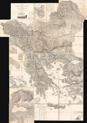
Carte der Europaeischen Tuerkey nebst einem Theile von Kleinasien in XXI. Blattern.
sold
A monumental composite map of European Turkey consisting of 21 linen-backed sheets contained within its original handsome box. This 1829 Franz von Weiss map of 'European Turkey' (Greece, the Balkans, Bulgaria), produced under the auspices of the Austrian military. It is an extraordinary work of military intelligence, made just as the Ottoman Empire's European holdings were collapsing and neighboring powers, including Austria, sought to craft a reaction. (more details)
Unrecorded Venetian map of the Morea War.
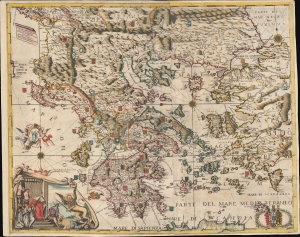
Grecia, et Arcipelago Descrizzione Topografica di P.Pier Anto. Pacifico di S. Toma Consecrata All'Altezze Serenissime de Carlo Filippi, e Christiano Lodovio Marchesi di Brandemburg, e c.
sold
- Digital Map Information
- Suitable for large format printing
- DPI: 600
- File Size: 107 MB
- File Type: ZIP / TIFF
- ICC color profile embedded
- Delivered instantly via download link
A spectacular map c. 1694 Pietro Antonio Pacifico map of Greece and the Balkans issued in Venice during the Morea War (1684 - 1699). The map is uncatalogued, this being only the 2nd known example, but exhibits the extensive Venetian contribution to the mapping of Greece in during the Second Venation Occupation of Greece, part of the larger Great Turkish War (1683 - 1699). (more details)
The earliest printed map of Crete.
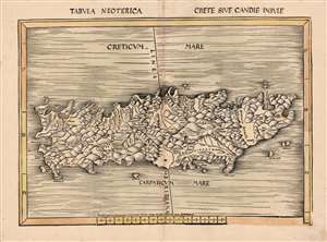
Tabula Neoterica Crete Sive Candie Insule.
sold
- Digital Map Information
- Suitable for large format printing
- Full resolution TIFF file
- ICC color profile embedded
- Delivered instantly via download link
This is Martin Waldseemüller's 1513 map of the island of Crete - the first specific map of the island, and the first detailed depiction of the island not strictly based on the precedent of Claudius Ptolemy. Crete was of course depicted among the other Greek islands on printed Ptolemaic maps as early as 1477. But, this map, appearing among the modern maps added to Waldseemüller and Ringmann's 1513 Geographia, was the first map dedicated entirely to the island. (more details)
Lafreri-school Map of Crete.
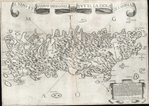
El Vero et Nuovo Disegno di Tutto la Isola di Candia.
sold
- Digital Map Information
- Suitable for large format printing
- DPI: 600
- File Size: 24.36 MB
- File Type: ZIP / TIFF
- ICC color profile embedded
- Delivered instantly via download link
This is a 1564 first-state Lafreri School map of Crete, engraved by Paolo Forlani and published by Giovanni Camocio. This north-oriented map illustrates the island's topography based on the late model exhibited first in the 1513 Waldseemüller map and introduced to Venice via Matteo Pagano's 1538 map. Waldseemüller's model was sufficiently authoritative to make it the prototype for all maps of the island until the 1563 map of the Cretan Calapoda became available. (more details)
A superb, untrimmed example.
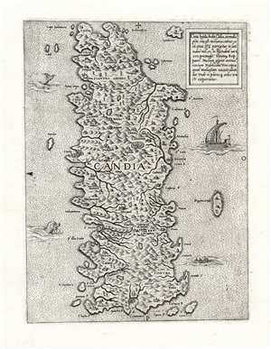
Creta Insula, hodie Cādia, in medio pōto sita est.
sold
- Digital Map Information
- Suitable for large format printing
- Full resolution TIFF file
- ICC color profile embedded
- Delivered instantly via download link
This is an immaculate example of a rare map of the Island of Crete, attributed to Antonio Lafreri. The east-oriented map illustrates the island's topography based on the late model exhibited first in the 1513 Waldseemuller map, and introduced to Venice via Matteo Pagano's 1538 map. (more details)
One of the largest and most beautiful maps of Crete.
Isola e regno di Candia.
sold
- Digital Map Information
- Suitable for large format printing
- DPI: 600
- File Size: 166.62 MB
- File Type: ZIP / TIFF
- ICC color profile embedded
- Delivered instantly via download link
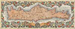
This is a brilliantly-colored example of Vincenzo Coronelli's monumental, two-sheet 1696 map of the Island and Kingdom of Crete. It divides the island into the four regions of Canea, Rettimo, Candia, and Setia. (more details)
The Balkans on the cusp of their independence of the Ottoman Empire.
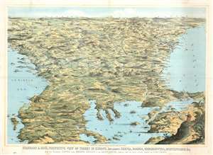
Stannard and Son's, Perspective View of Turkey in Europe, Including Servia, Bosnia, Herzegovina, Montenegro, and c, with the Adjoining Countries more Immediately Interested in the Eastern Question, Compiled from the Latest Official Sources, by Alfred Concanen.
sold
- Digital Map Information
- Suitable for large format printing
- File Size: 52.56 MB
- File Type: ZIP / TIFF
- ICC color profile embedded
- Delivered instantly via download link
An impressive 1876 William Stannard and Alfred Concanen bird's-eye perspective view of the Balkans during the Great Eastern Crises (1875 - 1878). The view centers on Sofia, Bulgaria, with coverage extending from the Adriatic to the Black Sea and from Odessa and Belgrade to Thessaly (Greece), embracing modern day Bulgaria, the Sea of Marmora, the Dardanelles, Montenegro, Bosnia, Serbia, Herzegovina, and Albania. (more details)
First scientific map of Slovenia, Croatia, Bosnia-Herzegovina, and Montenegro.
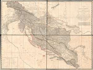
Carte des Provinces Illyriennes Comprenant La Bosnie L'Herzegovine le Monténéro et quelques pays adjacens.
sold
- Digital Map Information
- Suitable for large format printing
- Full resolution TIFF file
- ICC color profile embedded
- Delivered instantly via download link
This detailed and expansive 1812 Gaetan Palma map of the short-lived Illyrian Provinces, a Napoleonic subordinate state embracing modern day Slovenia, Croatia, Bosnia-Herzegovina, and Montenegro. Coverage extends along the Adriatic from Venice to Albania and inland as far as Serbia and Hungary. It is the first specific map of this region to be compiled based on a detailed trigonometrical survey. The map is one of two commissioned by Marshal August de Marmont (1774 - 1852), first Governor-General of the Illyrian Provinces, in anticipation of a Napoleonic invasion of the Ottoman Empire. (more details)
Best 19th century general map of the Ottoman Empire.
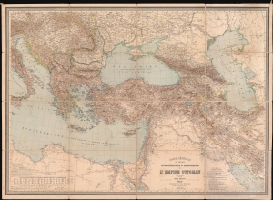
Carte Générale des Provinces Européennes et Asiatiques de l'Empire Ottoman (sans l'Arabie).
sold
- Digital Map Information
- Suitable for large format printing
- File Size: 150.63 MB
- File Type: ZIP / TIFF
- ICC color profile embedded
- Delivered instantly via download link
This is an 1892 Heinrich Kiepert wall map of the Ottoman Empire. The work of Europe's finest cartographer, this is without question the best large scale general map of the Ottoman dominions to appear in the 19th century. (more details)
Centuries of War.
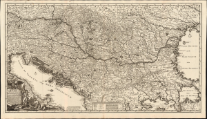
Novissima tabula regni Hungariae et regionum quondam ei unitarum ut Transilvaniae, Valachiae, Moldaviae, Serviae, Romaniae, Bulgariae, Bessarabiae, Croatiae, Bosniae, Dalmatiae, Slavoniae, Morlachiae et reipublicae Ragusanae...
sold
- Digital Map Information
- Suitable for large format printing
- File Size: 44.02 MB
- File Type: ZIP / TIFF
- ICC color profile embedded
- Delivered instantly via download link
Joachim Ottens' rare, large, and beautifully engraved c. 1700 map of the lands about the Danube captures the region in the wake of the 1699 Treaty of Karlowitz, which brought the Great Turkish War (1683 - 1699) to a close. Ottens' map encompasses the theatre of that war and records key battles in that region, stretching back to the 14th century. (more details)
Crete and Heraklion during the Longest Siege of the Great Turkish War.
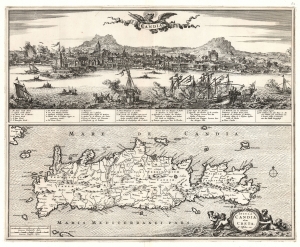
Candia. / Insula Candia olim Creta. N. Visscher exc.
sold
- Digital Map Information
- Suitable for large format printing
- File Size: 26.23 MB
- File Type: ZIP / TIFF
- ICC color profile embedded
- Delivered instantly via download link
This is Nicolas Visscher's 1670 map of Crete, accompanied by a dramatic panorama of the famous Siege of Candia (Heraklion). (more details)
Stunningly engraved early map of Crete by Boschini.
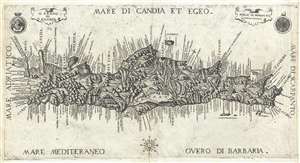
Il Regno di Candia.
sold
- Digital Map Information
- Suitable for large format printing
- DPI: 300
- File Size: 4.42 MB
- File Type: ZIP / TIFF
- ICC color profile embedded
- Delivered instantly via download link
A rare, stunningly engraved, and important 1651 map of Crete by Marco Boschini. The map covers the island in full with rich, almost organically engraved topography. The Lion of St. Mark, a symbol of Venice appears in the upper left surmounted by a crown. A ... (more details)
Mapping the Balkans in Revolt. Likely the best map of the region to appear in the 19th century.
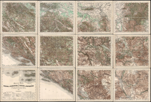
General Karte von Bosnien, der Hercegovina, von Serbien und Montenegro...
sold
- Digital Map Information
- Suitable for large format printing
- File Size: 467.78 MB
- File Type: ZIP / TIFF
- ICC color profile embedded
- Delivered instantly via download link
This monumental, scarce, 12-sheet map of the Balkans was produced by Austria-Hungary's Imperial-Royal Military Geographical Institute. Published in early to mid-1876, this meticulously detailed military map captures the Balkans during the Great Eastern Crisis (1875 - 1878), which culminated in the Monarchy's absorption of Bosnia and Herzegovina pursuant to the 1878 Treaty of Berlin. When issued, it was the most detailed published general map of this geographically and politically multifaceted region. (more details)
Philanthropy in the Face of Atrocity.
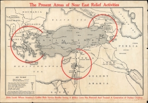
The Present Areas of Near East Relief Activities.
sold
- Digital Map Information
- Suitable for large format printing
- File Size: 25.46 MB
- File Type: ZIP / TIFF
- ICC color profile embedded
- Delivered instantly via download link
A scarce c. 1922 map of the Near East, produced by Near East Relief, an organization tasked with assisting refugees, particularly Armenians and Greeks, fleeing from Turkey. It was produced in the wake of one of the worst atrocities, the Burning of Smyrna, which destroyed the Greek and Armenian quarters. The efforts of the New East Relief saved over a million lives and are considered of the most successful humanitarian efforts of the 20th century. (more details)
First detailed, printed map of Albania.
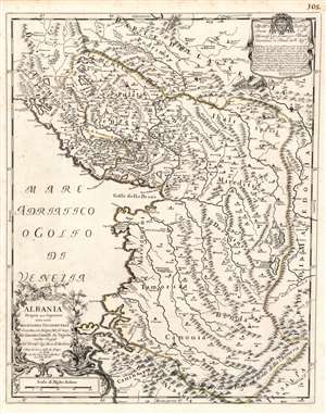
Albania Propria overo Superiore detta anche Macedonia Occidentale descritta, con Disegni fatti sul luogo. . .
sold
- Digital Map Information
- Suitable for large format printing
- DPI: 600
- File Size: 23.16 MB
- File Type: ZIP / TIFF
- ICC color profile embedded
- Delivered instantly via download link
This is a rare 1689 Cantelli da Vignola map of Albania - the first reasonably accurate printed map of Albania. The map incorporates most of modern-day Montenegro and part of Macedonia. This is the only specific map of Albania produced in the 17th century, predated only by the 1572 Camocio map. Lissus on the coast corresponds with modern Lezhë at the mouth of the Drin. The modern capital of Tirana appears here as Terrana. The city of Vlorë appears, using its Italian name Valona (and the Greek Aulon.) To the southwest of Terrana is noted Petrela, a supposed birthplace of Alexander the Great. The mountainous terrain is pictorially depicted, showing in particular the forbidding mountain ranges forming the country's natural borders with Greece, Macedonia, and Kosovo. (more details)
Ancient monastery of paramount cultural significance.
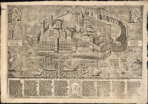
[Vatopedi on Mount Athos].
sold
- Digital Map Information
- Suitable for large format printing
- DPI: 600
- File Size: 144.85 MB
- File Type: ZIP / TIFF
- ICC color profile embedded
- Delivered instantly via download link
Here is a very rare and intricate engraving of the Eastern Orthodox Vatopedi Monastery on Mount Athos in Greece, printed in 1792 in Venice by Antionio Bortoli. Colloquially known as the 'Holy Mountain,' Mount Athos and Vatopedi specifically have been important religious sites for centuries and Vatopedi remains a home for ascetic monks, ancient religious relics, ornate architecture, intricate frescoes, and an important library. (more details)
Specially-assembled folding map of Bosnia-Herzegovina.
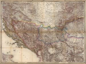
Bosnia, Herzegovina etc. (title on slipcase)
sold
- Digital Map Information
- Suitable for large format printing
- File Size: 122.3 MB
- File Type: ZIP / TIFF
- ICC color profile embedded
- Delivered instantly via download link
This elegant and detailed Austrian map of Bosnia and Herzegovina, likely a unique production, was mounted and sold by Artaria, c. 1878. It is a compilation of sheets II, III, V and VI from Joseph von Scheda's General-Karte der Europaeischen Turkei und des Konigreiches Griechenland; of the 13 sheets of this mammoth map, these were the four that centered on Bosnia and Herzegovina - which had been awarded to Austria - Hungary by the terms of the Treaty of Berlin in 1878. Hence, the immediate relevance of the map as presented here. (more details)
Ethnic cleansing in the Balkans.
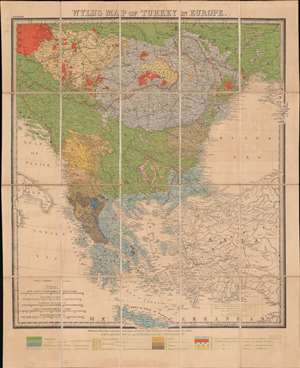
Wyld's Map of Turkey in Europe.
sold
- Digital Map Information
- Suitable for large format printing
- Full resolution TIFF file
- ICC color profile embedded
- Delivered instantly via download link
A most intriguing c. 1878 ethnographic and infographic map of Greece and the Balkans issued by James Wyld against the backdrop of the Russo-Turkish War and systematic ethnic genocide. Coverage extends from the Gulf of Venice to the Crimea and from Vienna to Crete. Overprinting illustrates the region's complex ethnic and religious mélange. The map breaks down areas according to both ethnicity and religion, also indicating those areas where different groups live side by side, and those areas occupied by the Ottomans. The region's religious diversity, as well as ancient ethnic rivalries, has led to a long history of ethnic warfare. (more details)
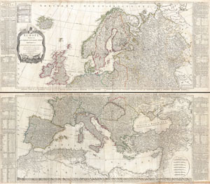
Europe Divided into its Empires, Kingdoms, States Republics, & c.
sold
- Digital Map Information
- Suitable for large format printing
- DPI: 300
- File Size: 78.51 MB
- File Type: ZIP / TIFF
- ICC color profile embedded
- Delivered instantly via download link
A large and dramatic 1794 wall map of Europe on two panels. Published by Laurie and Whittle based the work of the important cartographer J. B. B. D'Anville. Upper sheet covers from Iceland to Russia and from the Arctic to Calais and Astrakhan. The ... (more details)
Scarce, Large, Beautifully Engraved.
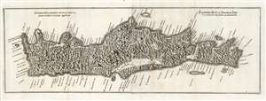
Genuina delineatio insulæ Cretæ, quam moderni Candiam appelant.
sold
- Digital Map Information
- Suitable for large format printing
- DPI: 600
- File Size: 49 MB
- File Type: ZIP / TIFF
- ICC color profile embedded
- Delivered instantly via download link
This is a beautiful example of Caspar Merian's 1652 map of Crete. Of the 16th century maps of Crete, it is among the scarcest and most visually striking. (more details)
The Balkans on the Brink.
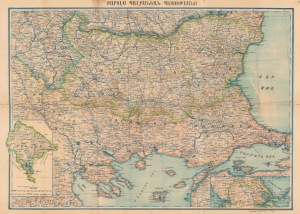
Քարտէս Պալքանէան Պետութեանց / [Map of the Balkan States].
sold
- Digital Map Information
- Suitable for large format printing
- File Size: 56.99 MB
- File Type: ZIP / TIFF
- ICC color profile embedded
- Delivered instantly via download link
This is an extremely rare c. 1898 Armenian-language map of the Balkans prepared by Stepan Agayan and published by the Iqbal Bookshop in Constantinople (Istanbul). It depicts the region at the turn of the 20th century, following the Russo-Turkish War of 1877 - 1878 but before the Balkan Wars that helped set the stage for World War I (1914 - 1918). (more details)
Making the Mediterranean a British Lake.
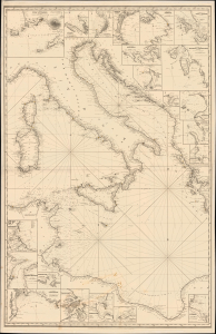
[A General Chart of the Mediterranean, Adriatic and Black Seas together with the Grecian Archipelago... Second Sheet].
sold
- Digital Map Information
- Suitable for large format printing
- File Size: 57.52 MB
- File Type: ZIP / TIFF
- ICC color profile embedded
- Delivered instantly via download link
This is John Norie's impressive, large-format 1850 nautical chart of the central Mediterranean Sea, Adriatic Sea, and Ionian Sea, covering the waters around the Italian Peninsula and the North African coasts of Tunisia and Libya. Produced late in the Age of Sail, the chart was both a product of and contributor to increasing British commercial and military dominance of the Mediterranean. (more details)
First accurate survey of the interior of Montenegro.
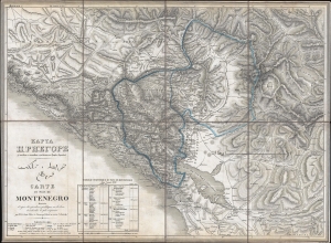
КАРТА ЦРНЕГОРЕ. قرطاغ مملكت خريط. Carte du Pays de Montenegro dressée d'après des opérations géodétiques sur les lieux et recherches les plus soigneuses.
sold
- Digital Map Information
- Suitable for large format printing
- DPI: 300
- File Size: 18.92 MB
- File Type: ZIP / TIFF
- ICC color profile embedded
- Delivered instantly via download link
This is an 1838 Count Fedor von Karacsay tri-lingual map of Montenegro - considered the first broadly accurate map of Montenegro. The map is a product of Montenegrin Vladika Petar II Petrović-Njegoš's ongoing efforts to modernize and reform Montenegro. (more details)
The celebrated 'Sarajevo Survival Map'.
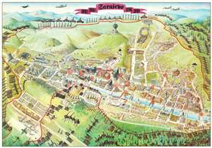
The internationally celebrated 'Sarajevo Survival Map', this is a 1996 FAMA pictorial map of Sarajevo, Bosnia and Herzegovina, illustrating the Siege of Sarajevo. The map depicts Sarajevo, resting in the valley of the Miljacka River. On the high ground surrounding the city, tanks, howitzers, and other artillery threaten the city and its inhabitants. The Siege of Sarajevo lasted from April 5, 1992 through February 29, 1996, a total of 1,425 days, making it the longest siege of a capital city in the history of modern warfare. (more details)
The Paradisiacal Vale of Tempe, in the Coastal Mountains of Greece
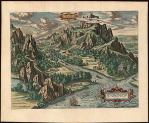
Tempe.
sold
- Digital Map Information
- Suitable for large format printing
- DPI: 600
- File Size: 24.52 MB
- File Type: ZIP / TIFF
- ICC color profile embedded
- Delivered instantly via download link
This is a lush example of Ortelius' 1590 engraving of the Vale of Tempe in Greece, overshadowed by Mount Olympus. The narrow valley of Tempe, or Témbi as it is now known, is a river valley situated on the coast of the Aegean Sea, and pierces the mountainous border between ancient Macedonia to the north and Thessaly to the south. The view centers on the river Pineiós (Peneus on the view) and its tributaries, and is oriented to the west. To the south is depicted mount Ossa; to the north, mighty mount Olympus towers over the valley. The mountains and their forbidding cliffs frame the beautifully wooded river Pineiós, emptying into the Aegean. In legend, this rift was formed by an earthquake caused by a blow from Poseidon's trident. (Geologists call it a fracture ravine, caused by the action of the river and its tributaries.) The verdant beauty of the valley - and it is still so - led the ancient Greeks to dedicate the valley to the cult of Apollo. (Ortelius has also included a temple to Jove, at the mouth of the river.) Along the banks, in the woods and in meadows are shown groups of people offering burned sacrifice, dancing, playing music, and plunging naked into the stream. Ortelius describes the scene as a place 'where people dwell, meet in companies, and having done divine service and ceremonies in due form and manner, they banquet and make merry.' (more details)
Capital of the Short-Lived Kingdom of Illyria.
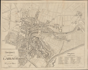
Grundriss der Haupt-Stadt Laibach im Königreiche Illyrien.
sold
- Digital Map Information
- Suitable for large format printing
- File Size: 25.23 MB
- File Type: ZIP / TIFF
- ICC color profile embedded
- Delivered instantly via download link
A highly detailed 1827 city plan or map of Ljubljana (Laibach), Slovenia by Franz Deschmann. (more details)
Created after the Ottomans conquered Crete, removing it from Venice's overseas empire.
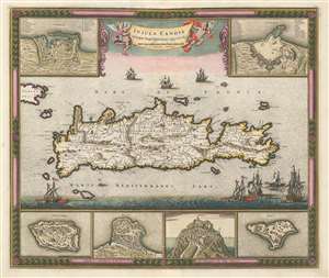
Insula Candia Ejusque Fortificatio.
sold
- Digital Map Information
- Suitable for large format printing
- DPI: 600
- File Size: 29.76 MB
- File Type: ZIP / TIFF
- ICC color profile embedded
- Delivered instantly via download link
This is a c. 1680 Frederik de Wit map of Crete only years after the end of the Cretan War, which is also known as the Fifth Ottoman-Venetian War. Based on a map created by Sébastien Pontault de Beaulieu, the map depicts the entire island after the end of the Siege of Candia, a 24-year long siege of a fortress on Crete. Candia, along with myriad other cities, towns, and villages are labeled all across Crete, and roads, rivers, and mountain ranges are also illustrated. Six inset maps are placed along the borders that focus on Crete's fortresses at Canea, Candia, Spina Longa, Retimo, Thine, and Suda, a natural inclusion since Pontault de Beaulieu is known for his work illustrating Mediterranean fortifications. (more details)
Supposed Aegean Theater of the Morean War.
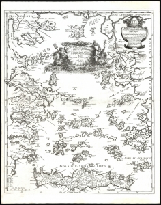
Arcipelago Mar Egeo con le Coste del Medesimo.
sold
- Digital Map Information
- Suitable for large format printing
- File Size: 21.44 MB
- File Type: ZIP / TIFF
- ICC color profile embedded
- Delivered instantly via download link
This is the beautiful 1685 Cantelli da Vignola map of the Greek Islands in the Aegean Sea. It was issued at the beginning of the 1684-1699 Morean War between Venice and the Ottoman Empire. (more details)
Crete and the Greek Islands, as known to the Ancients.
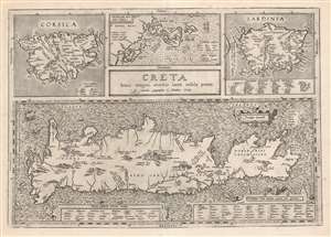
Creta Jovis Magni Medio Iacet Insula Ponto.
sold
- Digital Map Information
- Suitable for large format printing
- DPI: 600
- File Size: 56.85 MB
- File Type: ZIP / TIFF
- ICC color profile embedded
- Delivered instantly via download link
This is Abraham Ortelius' 1595 map of Crete and other Mediterranean islands as they were understood in antiquity and Greek mythology. The engraving is comprised of four separate maps of Corsica, Sardinia, Crete, and the Ionian Islands. (more details)