
Shanghai (sold)
The largest and most decorative map of Shanghai!
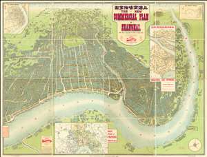
The New Commercial Plan of Shanghai (with which is incorporated the Wharf and Godown Plan). Surveyed, constructed and designed by the Far Eastern Geographical Establishment 6 Kiukiang Road Shanghai.
sold
- Digital Map Information
- Suitable for large format printing
- File Size: 300.62 MB
- File Type: ZIP / TIFF
- ICC color profile embedded
- Delivered instantly via download link
The greatest and most impressive map of Shanghai we have yet seen. Issued in 1915, this is the Far Eastern Geographical Establishment / Edwin John Dingle / H. J. Fruin pictorial view and map of Shanghai. The map is a staggering 83 x 63 inches. The view looks on Shanghai from the east, at a high point across the Huangpu River in what is today the hip Pudong district. In includes the Bund, the Shanghai International Settlement, and the British and French Concessions, as well as the old Chinese City at left. It was issued shortly after the shortly after the 1911 Xinhai Revolution. One can follow Wusong Creek westward into the Horizon, which is illustrated with clouds. Inset maps detail Shanghai and Environs, Road Plan of Shanghai, The Nantao District, and The Rubicon District. (more details)
One of the earliest printed maps of Shanghai and the first Japanese map of Shanghai.
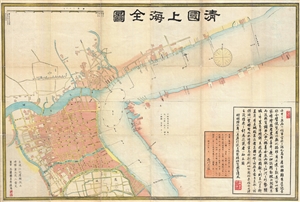
清國上海全圖 / Shinkoku shanhai zenzu. / Qīng guó shànghǎi quán tú. / Qing Shanghai Full Map.
sold
- Digital Map Information
- Suitable for large format printing
- File Size: 29.06 MB
- File Type: ZIP / TIFF
- ICC color profile embedded
- Delivered instantly via download link
An extraordinary discovery, this is the first Japanese map of Shanghai, China, and one of the earliest printed maps of Shanghai. Published in 1873, or Meiji 6, this large format map covers Qing Shanghai's old foreign district. From the conflux of the Huangpu ... (more details)
Extraordinary Shanghai Harbor infrastructure map.
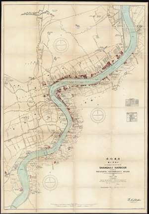
Shanghai Harbour Published by the Whangpoo Conservancy Board.
sold
- Digital Map Information
- Suitable for large format printing
- File Size: 116.98 MB
- File Type: ZIP / TIFF
- ICC color profile embedded
- Delivered instantly via download link
A massive and previously unknown 1927 separate issue dissected wall map of Shanghai, China published by E. C. Stacker and Y. Utne for the Whangpoo Conservancy Board. Centered on the Shanghai Bund, the map details development along the Huangpu River (黄浦江, Whangpoo) from, roughly, the modern district of East Gate (小东门), south to Longhuacun (龙华村). While the focus is on riverside development, wherein individual buildings, docks, diplomatic offices, public utilities, parks, and business are noted; major inland roads are also identified in both English and Chinese. (more details)
Remarkable photographic archive illustrating Pre-War China from the perspective of an American navy man. Includes historically unknown images of graphic war events, General Chiang Kai-shek, and Chinese life.
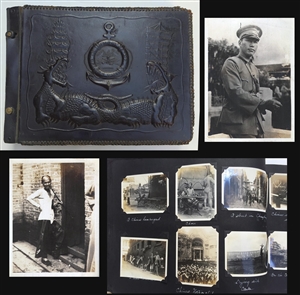
A unique photographic archive covering China and the Philippines in the years of 1927 – 1931, just prior to World War II. The photo archive contains hundreds of photos, loosely arranged thematically and chronologically, following the oriental tour of the ... (more details)
1861 Battle of Shanghai.
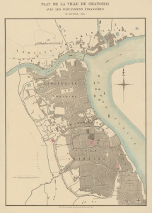
Plan de la Ville de Shanghai avec Les Concessions Étrangères 31, Octobre, 1861.
sold
- Digital Map Information
- Suitable for large format printing
- File Size: 32.6 MB
- File Type: ZIP / TIFF
- ICC color profile embedded
- Delivered instantly via download link
A rare French-language map of Shanghai, China, published in 1861 in the wake of the Battle of Shanghai, the Second Opium War, and the Taiping Rebellion. (more details)
Rare city planning map of Shanghai with mansucript additions of prospective new streets.
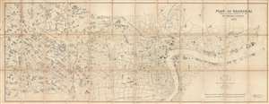
Plan of Shanghai Published under Authority of the Municipal Council. 1923
sold
- Digital Map Information
- Suitable for large format printing
- File Size: 46.17 MB
- File Type: ZIP / TIFF
- ICC color profile embedded
- Delivered instantly via download link
An extremely rare and important 1923 large format map of Shanghai issued by the Shanghai Municipal Council. The map is enormous and extends from the Huangpu River westward as far as the Tianshan Road Residential District. It is in this area that several ... (more details)
Guide for White Russian refugees fleeing to Shanghai.
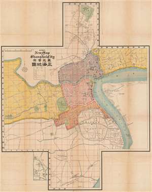
The New Map of Shanghai City / 最新實測上海地圖.
sold
- Digital Map Information
- Suitable for large format printing
- File Size: 153.36 MB
- File Type: ZIP / TIFF
- ICC color profile embedded
- Delivered instantly via download link
This is a rare and intriguing c. 1920 guide and map of Shanghai published by the Russian firm Churin and Co. (Чурин и Ко) to accompany their Russian-language Guide to Shanghai (Путеводитель по Шанхаю). The map is exceptional in several respects, most obviously in its cross-shaped layout. Moreover, although the travel guide is in Russian, the map itself is a combination of Japanese, Chinese, English, and French, reflecting both the cosmopolitan nature of treaty port and this map's ad hoc production process. (more details)
One-of-a-kind map documenting the buildup to the May Thirtieth Movement, the birth of organized labor in modern China, and the beginning-of-the-end of the Unequal Treaties!
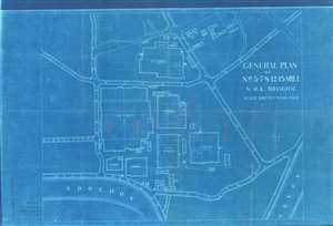
General Plan of No.n 5-7-8-12-15 Mill N.W.K. Shanghai.
sold
- Digital Map Information
- Suitable for large format printing
- File Size: 25.08 MB
- File Type: ZIP / TIFF
- ICC color profile embedded
- Delivered instantly via download link
Recording the beginnings of the May Thirtieth Movement, a pivotal moment in the rise of labor unions and communism, as well as the end of the Unequal Treaties, in pre-war China, this is a striking 1925 cyanotype map of the Nagai Wata Kaisha Cotton Mills (NWK) in Shanghai, just south of Suzhou Creek (or Soochow Creek). Dating to May of 1925, the map focuses on those NWK Mills attached to a series of historic labor strikes against Japanese operated textile mills operating in Shanghai. In specific, manuscript annotations refer to the May 15th event, an armed engagement between workers and Japanese management in which a young Chinese worker, Ku Cheng-hung (顧正紅), was mortally injured. The partially successful strikes led to only marginally improved labor conditions, but can be considered to represent the first stirrings of Communism in Shanghai. The fact that this map is a cyanotype underscores its role as a highly ephemeral production, likely produced to deal with the violence of the strikes. Given the limitations of the cyanotype technique, only about 10 -15 of these were likely made - representing an ephemeral but fundamental moment in Shanghai history. (more details)
First guidebook to Hong Kong, w/ Maps.
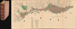
The Treaty Ports of China and Japan. A Complete guide to the Open Ports of Those Countries, Together with Peking, Yedo, Hong Kong and Macao.
sold
- Digital Map Information
- Suitable for large format printing
- Full resolution TIFF file
- ICC color profile embedded
- Delivered instantly via download link
This is the 1867 first edition of Nicholas Belfield Dennys' (c. 1813 - 1899) detailed guide to the Treaty Ports of China and Japan, including a dramatic large map of Victoria, Hong Kong. Intended both for new residents and travelers, it is the first commercially distributed handbook to the post-Opium War Treaty Ports. There are an impressive 29 excellent maps, most fold out, all engraved in Hong Kong. Like the maps, the book was typeset in China, where place names and other content could be set in both English and Chinese. (more details)
Earliest serious British attempt to map the area around Shanghai, China. Surveyed by 'Chinese Gordon' during the Taiping Rebellion.
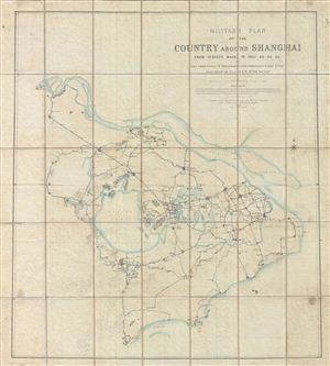
Military Plan of the Country Around Shanghai from Surveys Made in 1862, 63, 64, 65.
sold
- Digital Map Information
- Suitable for large format printing
- File Size: 63.93 MB
- File Type: ZIP / TIFF
- ICC color profile embedded
- Delivered instantly via download link
An extremely scarce 1865 case map illustrating the country around Shanghai, China. This map, by British military officer Charles George Gordon (a.k.a. 'Chinese Gordon'), covers from the mouth of the Yangtze River south to the Tsien Tan River (Fushun ... (more details)
The Shanghai of tomorrow envisioned!
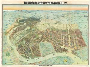
Aerial View of the Construction Design of the New City of Shanghai. / 大上海新都市建設計畫鳥瞰圖
sold
- Digital Map Information
- Suitable for large format printing
- File Size: 97.14 MB
- File Type: ZIP / TIFF
- ICC color profile embedded
- Delivered instantly via download link
An outstanding 1941 / Minguo 30 / Showa 16 bird's-eye view map of 'Greater Shanghai', a massive-scale redevelopment of Shanghai proposed between 1927 and 1945. The view by Yoshida Feng (吉田豐) looks southward on Shanghai from an assumed highpoint above modern day Binjaing Forest Park, near where the Huangpu River empties into the Baoshan Waterway. The original intention of 'Greater Shanghai' was to replace the foreign-run concession zone with a larger spectacular new Chinese-governed city that would act as Shanghai's economic and political hub. In line with these values, Greater Shanghai, appearing in the foreground, presents a well laid out and commodious modern city, with an enormous port, monumental architecture, spacious gardens, and comfortable residential areas. By contract, the foreign concession area, appearing in the distance, seems diminished, small, and crowded. (more details)
The author's personal copy of an iconic Shanghai hunting map.
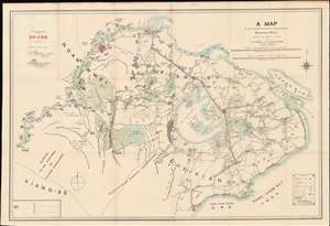
A Map of the Shooting Districts Lying Between Shanghai and Wuhu.
sold
- Digital Map Information
- Suitable for large format printing
- Full resolution TIFF file
- ICC color profile embedded
- Delivered instantly via download link
This Robert Alexis de Villard's own copy of his important 1893 hunting map of Shanghai and its environs. The map was created by de Villard in partnership the renowned sportsman Henling Thomas Wade, for use by expatriate hunting clubs in Shanghai. The map's coverage is expansive, bounded on the north and west by the main course of the Yangtze River, and on the east by Hangchow Bay. It includes from Nanjing (Nanking) and Zhenjiang (Chin-Kiang) to Hangzhou. Most locations are identified in English with Romanized Chinese. Some larger cities and towns, such as Nanjing (Nanking), Zhenjiang (Chin-Kiang), and Hangzhou (Hang-Chow), are also noted in Chinese. (more details)
Iconic Shanghai hunting map.
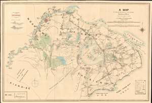
A Map of the Shooting Districts Lying Between Shanghai and Wuhu.
sold
- Digital Map Information
- Suitable for large format printing
- Full resolution TIFF file
- ICC color profile embedded
- Delivered instantly via download link
This is Robert Alexis de Villard and Henling Thomas Wade's important 1893 hunting map of Shanghai and its environs. The map was created by de Villard in partnership the renowned sportsman Henling Thomas Wade, for use by expatriate hunting clubs in Shanghai. The map's coverage is expansive, bounded on the north and west by the main course of the Yangtze River, and on the east by Hangchow Bay. It includes from Nanjing (Nanking) and Zhenjiang (Chin-Kiang) to Hangzhou. Most locations are identified in English with Romanized Chinese. Some larger cities and towns, such as Nanjing (Nanking), Zhenjiang (Chin-Kiang), and Hangzhou (Hang-Chow), are also noted in Chinese. (more details)
Only known example! Shows the development of the French Concession!
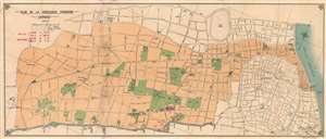
Plan de la Concession Francaise Changhai.
sold
- Digital Map Information
- Suitable for large format printing
- File Size: 15.6 MB
- File Type: ZIP / TIFF
- ICC color profile embedded
- Delivered instantly via download link
Here in its only known example, this is a c. 1920 map of the Shanghai French Concession. Published in Shangahi by the T'ou-sè-wè Orphanage and Mission Press, this map's coverage extends form the Hunagpu River and the French Bund, westward to Huashan Lu (Haig Avenue), and from the British Concession to the northern part of the Chinese City (Old Shanghai). The map illustrates street development, important building, docs, and more. A red over stamp in the upper right features day and night phone numbers for the police and fire department. Parks are highlighted in green. (more details)
Fifty photogravures of Old Shanghai.
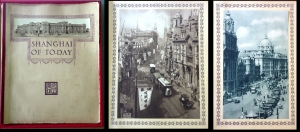
Shanghai of To-day. A Souvenir Album of Fifty Vandyke Gravure Prints of the 'Model Settlement'
sold
An unusual discovery, this is the 1930 third edition of Shanghai of To-day. A Souvenir Album of Thirty-eight Vandyke Prints of the 'Model Settlement' . Following a short introduction by F. L. Hawkes Pott, the book features 50 tipped in photogravures ... (more details)
The Shanghai War.
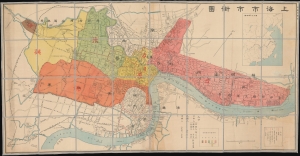
Shanghai City Street Map. / 上海市市街圖
sold
- Digital Map Information
- Suitable for large format printing
- File Size: 103.7 MB
- File Type: ZIP / TIFF
- ICC color profile embedded
- Delivered instantly via download link
An impressively proportioned bi-lingual map of Shanghai, China, issued by Jichisan Shōkai (ジーチーサン商會) in 1932, during the January 28 Incident (Shanghai War) - a precursor to the Second Sino-Japanese War (1937 - 1945). (more details)
Unique view of the Bund from Broadway Mansions.
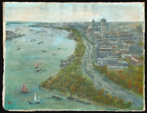
A striking 1987 L. C. Baron impressionist watercolor view of the Shanghai Bund. The view looks south on the Bund from a high point just to the north, across the Wusong River - likely from a high floor in the Broadway Mansions building. Many of the Bund's most famous buildings, including the Peace Hotel and the Bank of China Building, are recognizable. The Huangpu River is full of traditional Chinese Junks. We have been unable to trace the undeniably skilled artist. A Chinese seal appears in the lower left. (more details)
Shanghai 2.0.
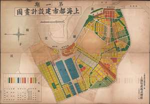
Shanghai Urban Construction Design Map. / 上海都市建設計畫圖
sold
- Digital Map Information
- Suitable for large format printing
- File Size: 30.14 MB
- File Type: ZIP / TIFF
- ICC color profile embedded
- Delivered instantly via download link
An outstanding 1938 / Minguo 28 / Showa 14 urban planning map of 'Greater Shanghai', a massive-scale redevelopment of Shanghai proposed between 1927 and 1945. Published by the Shanghai-Hengshen Company, this map illustrates the proposed Japanese version of the Greater Shanghai Plan. The map is oriented to the east with the Hunagpu River at center. Color-coding illustrates a rigidly zoned urban center, with industrial areas, docks, commercial areas, parks, mixed use, and residential zones. (more details)
Battle of Shanghai field commander's map with manuscript annotations describing the fighting.
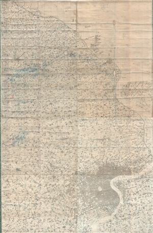
[Greater Shanghai]
sold
- Digital Map Information
- Suitable for large format printing
- File Size: 55.03 MB
- File Type: ZIP / TIFF
- ICC color profile embedded
- Delivered instantly via download link
An enormous map of great historical importance, this is a large format c. 1937 Japanese field commander's map of the greater Shanghai area with original manuscript annotations relating to troop losses, movement, and strategy during the Battle of ... (more details)
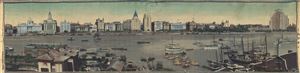
The Bund, Shanghai
sold
- Digital Map Information
- Suitable for large format printing
- File Size: 67.84 MB
- File Type: ZIP / TIFF
- ICC color profile embedded
- Delivered instantly via download link
An exceptional discovery, this is a woven silk illustration or view of Shanghai China's Bund. The Bund, which runs along Zhongshan Road on the western side of the Huangpu River, was once part of the Shanghai International Settlement and was ... (more details)
Shanghai at the moment of the Shanghai Ceasefire Agreement in which the city became a demilitarized zone.
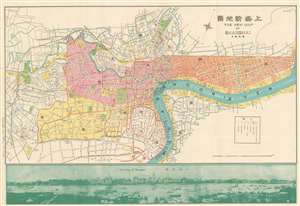
New Map of Shangahi. / 上海新地圖
sold
- Digital Map Information
- Suitable for large format printing
- File Size: 36.6 MB
- File Type: ZIP / TIFF
- ICC color profile embedded
- Delivered instantly via download link
An extremely rare bi-lingual Chinese/English map of Shanghai, China, here in its second edition, issued by the Shanghai-Japanese cartographer Sugie Fusazō (杉江房造) in February of 1932, or Showa 7. The map follows the January 28 Incident, also known as the Shanghai Incident (January 28 - March 3, 1932), a conflict in the Shanghai International Settlement between the Republic of China and the Empire of Japan. This is also the second of Sugie Fusazō's maps to include a panorama of the city (more specifically the Bund), and the first to depict the bund from across the Huangpu River, a convention coped from the 1932 Cross House map (Shanghai-crosshouse-1932) of Shanghai, and one that would be followed in many later editions of the map. The map focus is on the extraterritorial Foreign Concessions huddled around the confluence of the Hunagpu River (Whangpoo) and Soochow Creek (Suzhou). The Japanese area is highlighted in orange, the British in red, the American in Pink, and the large separate French Concession in Yellow. The map extends westward along the Extraterritorial Roads, also administered by the Concessions, as far as the Jessfield Road (Zhongshan) Toyoda Factory, precursor of the modern conglomerate Toyota. (more details)
Issued in the wake of the April 1927 anti-Communist Shanghai Massacre.
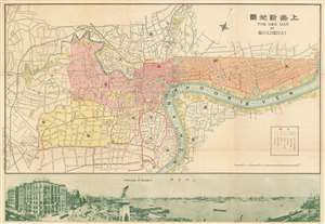
New Map of Shangahi. / 上海新地圖
sold
- Digital Map Information
- Suitable for large format printing
- File Size: 38.8 MB
- File Type: ZIP / TIFF
- ICC color profile embedded
- Delivered instantly via download link
An extremely rare bi-lingual Chinese/English map of Shanghai, China, here in its first edition, issued by the Shanghai-Japanese cartographer Sugie Fusazō (杉江房造) in May of 1927, or Showa 2. This map was produced in the wake of the pro-Nationalist anti-Communist Shanghai Massacre of April 1927, considered the beginning of the Chinese Civil War (國共內戰; 1927 - 1945). This is also the first of Sugie Fusazō's maps to include a panorama of the city (more specifically the Bund), a convention that would be followed in some later editions of the map. The map focuses on the extraterritorial Foreign Concessions huddled around the confluence of the Hunagpu River (Whangpoo) and Soochow Creek (Suzhou). The Japanese area is highlighted in orange, the British in red, the American in Pink, and the large separate French Concession in Yellow. The map extends westward along the Extraterritorial Roads, also administered by the Concessions, as far as the Jessfield Road (Zhongshan) Toyoda Factory, precursor of the modern conglomerate Toyota. (more details)
During the 1932 Shanghai Incident.
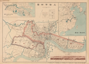
上海市街圖 / Shanghai Street Map.
sold
- Digital Map Information
- Suitable for large format printing
- File Size: 59.72 MB
- File Type: ZIP / TIFF
- ICC color profile embedded
- Delivered instantly via download link
A rare large-format 1932 (Showa 7) bilingual Japanese-English map of Shanghai with a photo of the Bund in the lower right. It was issued in the midst of hostilities between Imperial Japan and the Republic of China, a brief war known as the January 28 Incident or Shanghai Incident. (more details)
Iconic photo record of Old Shanghai.
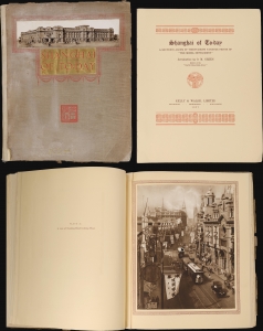
Shanghai of To-day. A Souvenir Album of Thirty-Eight Vandyke Gravure Prints of the 'Model Settlement'.
sold
This is the 1927 First Edition of Kelly and Walsh's Shanghai of To-day. A Souvenir Album of Thirty-Eight Vandyke Prints of the 'Model Settlement'. The volume of large format photos captures evocative images of Shanghai's pre-war golden age, when it was a center of global commerce, art, political intrigue, and international cosmopolitanism. (more details)
Shanghai Bund during the boisterous pre-war period.

Panoramic View of the Bund Shanghai. August 1929.
sold
- Digital Map Information
- Suitable for large format printing
- File Size: 83.75 MB
- File Type: ZIP / TIFF
- ICC color profile embedded
- Delivered instantly via download link
A stunning large-format 1929 panoramic photographic view of the Shanghai Bund. The view looks upon the Bund from Pudong, on the east side of the Huangpu River. The Bund, at the time, was the heart of the Shanghai International Settlement, a consolidated extraterritorial zone administered by a British dominated council. This image captures Shanghai at the height of its pre-war glory, when it was a haven in the midst of social and political strife, a hub of vice and crime, and a global trade center. (more details)
The cultural root of Shanghai.
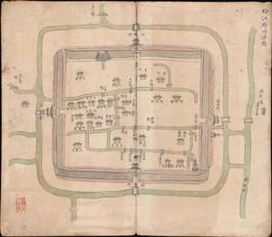
松江府川沙縣 / Songjiang Fucheng County.
sold
- Digital Map Information
- Suitable for large format printing
- Full resolution TIFF file
- ICC color profile embedded
- Delivered instantly via download link
A rare Qing Dynasty, c. 1820, manuscript map of Songjiang, Shanghai. Before the founding of Shanghai as a concession city, Songjiang (松江鎮) was the largest city and town seat of Songjiang County, and as such, is considered the cultural root of Shanghai. As the foreign concessions grew and developed, Shanghai became the dominant regional center. Songjiang, located just to the southwest of central Shanghai, is today a historic suburb, Songjiang District. Like many ancient Chinese cities in the Yangtze delta region, this map reveals Songjiang as a city of canals, which served as key transportation infrastructure. Of the walls shown here, constructed in 751 AD, about 4.5 km remain - the rest were demolished between 1930 and 1982. (more details)
Bears manuscript field strategy notes relating to the 1932 January 28 Incident (Shanghai Incident).
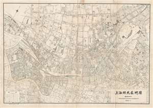
上海閘北區地圖 / Map of Shanghai Zhabei District.
sold
- Digital Map Information
- Suitable for large format printing
- File Size: 45.45 MB
- File Type: ZIP / TIFF
- ICC color profile embedded
- Delivered instantly via download link
A rare and historically significant 1932 field commander's map of Zhabei District, Shanghai, with manuscript strategy annotations relating to the January 28th Incident of Shanghai Incident of 1932. The map covers the Zhabei district from ... (more details)
Shanghai just days after the 1932 Shanghai Incident.
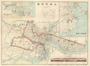
上海市街圖 / Shanghai Street Map.
sold
- Digital Map Information
- Suitable for large format printing
- File Size: 79.57 MB
- File Type: ZIP / TIFF
- ICC color profile embedded
- Delivered instantly via download link
A rare 1932 (Showa 7) bilingual map of Shanghai with a photo of the Bund in the lower tight. This map was issued shortly following Shanghai Ceasefire Agreement, which ended hostilities between Imperial Japan and Qing China following the January 29 Incident or Shanghai Incident. The map focuses not on hostilities, but rather on manufacturing, with the 'East' and 'West' 'textile manufacturing zones' highlighted in red. Numerous textile mills and warehouses in both areas are named with English text. Inset maps in the upper right and left quadrants detail the general area and the Yangtze Delta, respectively. (more details)
A Scarce, Early Western Map of Shanghai.
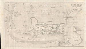
Shanghai and Its Suburbs.
sold
- Digital Map Information
- Suitable for large format printing
- File Size: 6.08 MB
- File Type: ZIP / TIFF
- ICC color profile embedded
- Delivered instantly via download link
An important early map of Shanghai in the Treaty Port Era (1842 - 1943), this is L. M. Becker's 1861 overview of the city which appeared in Rev. William C. Milne's book Life in China. It is considered one of the earliest western maps of Shanghai, dating to the period just prior to the merging of British and American concessions ('grounds') to form the International Settlement. (more details)
Rare Chinese issued pre-war map of Shanghai.
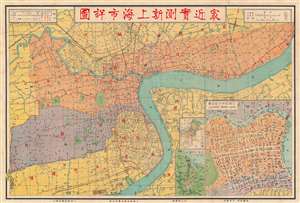
[Recent Detailed Survey Map of New Shanghai]. / 最近實測新上海市詳圖
sold
- Digital Map Information
- Suitable for large format printing
- File Size: 48.16 MB
- File Type: ZIP / TIFF
- ICC color profile embedded
- Delivered instantly via download link
This is a scarce c. 1927 map of Shanghai by the artist and book publisher Shen Shiqiu (沈士秋). It is one of the few Pre-war maps of Shanghai printed by a Chinese rather than Japanese publisher. The map details the central concession area shortly before the 1932 Japanese invasion. The various concession areas are highlighted, with orange indicating the International Settlement and purple the French Concession. An inset in the lower right details the main British Concession area and the Bund. Smaller insets detail the course of the Huang Pu River to is juncture with the Yangtze. (more details)
Rare pre-War map of Shanghai by a Chinese owned and operated publishing house.

Latest Map of Shanghai, Pocket Edition. / 袖珍最新上海地圖總圖例
sold
- Digital Map Information
- Suitable for large format printing
- File Size: 43.99 MB
- File Type: ZIP / TIFF
- ICC color profile embedded
- Delivered instantly via download link
A rare map of Shanghai, China, published in 1932 by the Shanghai branch of the Chung Hwa Book Company (中華書局有限公司). The map covers all of the concession areas, including the extra-settlement roads extending far to the west. This is one of the few pre-War maps of Shanghai published by a Chinese firm, as most maps at the time were issued by either British or Japanese interests. Interestingly, as a Chinese map, there is also a large inset in the Shanghai Old City, also called the Chinese City, the roughly circular formerly walled area located just south of the French Concession (purple). The map is scarce, probably owing to it being published in 1932, during or shortly after the January 28 Incident, the beginning of the end of concession era Shanghai. (more details)
Remarkable early map of Shanghai, China, advertising a western style hotel. Includes the French Concession and International Settlement.
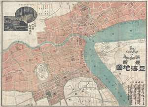
The New Map of Shanghai City. / 最新上海地圖
sold
- Digital Map Information
- Suitable for large format printing
- Full resolution TIFF file
- ICC color profile embedded
- Delivered instantly via download link
An extremely rare c. 1906 map of Shanghai, China prepared to promote the Japanese run western style hotel Matasuzaki (松崎洋行) , founded in 1882. Centered on the intersection of Suzhou Creek (Soochow Creek) and the Huangpu River ... (more details)