
Shanghai
First Municipal Council Maps - the origins of modern Shanghai.
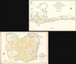
Plan of the English Settlement at Shanghae. / Plan of the Hong Kew (Hong Que.) or American Settlement, at Shanghae.
$45,000.00
Acquire
- Digital Map Information
- Suitable for large format printing
- Full resolution TIFF file
- ICC color profile embedded
- Delivered instantly via download link
The holy grail of Shanghai cartography, this 1866 map set is the most important, largest scale, and most beautiful early presentation of Shanghai. These are the first maps issued by the Shanghai Municipal Council, resulting from a landmark 1864-66 survey that followed the consolidation of the British Concession with the American Settlement. Their issue ended two decades of development lethargy and launched major urbanization and modernization projects that established Shanghai as the major gateway to China. As such, these maps, more than any other, represent the birth of Shanghai as a modern city. (more details)
First map of the American Concession in Shanghai?
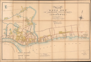
Plan of the Hong Kew (Hong Que.) or American Settlement, at Shanghae.
$19,000.00
Acquire
- Digital Map Information
- Suitable for large format printing
- File Size: 142.69 MB
- File Type: ZIP / TIFF
- ICC color profile embedded
- Delivered instantly via download link
A remarkable, rare, and highly detailed 1866 map of Hong Kew (Hongkou, 虹口区), or the American Concession in Shanghai - possibly the earliest known map to specifically illustrate the American Settlement. The map follows shortly after the formal establishment of the Concession and subsequent International Settlement in 1863 and details in manuscript the construction of subterranean drainage lines by the Shanghai Municipal Council. (more details)
Shanghai at the height of the 'Concession Period.'
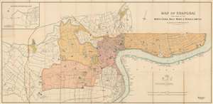
Map of Shanghai Published by the North-China Daily News and Herald, Limited.
$17,500.00
Acquire
- Digital Map Information
- Suitable for large format printing
- File Size: 62.63 MB
- File Type: ZIP / TIFF
- ICC color profile embedded
- Delivered instantly via download link
An extremely rare 1918 North-China Daily News and Herald map of Shanghai, China. Focusing on the Bund and the International Settlement, the map extends from the Shanghai Hangchow Ningpo Railroad in the west to Post Garden and the Standard Oil facility in the east. Derived roughly from the Municipal Council Map of the same year, this map is intensely detailed, with streets, businesses, clubs, parks, government offices, and civic institutions noted. Just outside the International Settlement boundary the Shanghai Jewish Club is noted. (more details)
Oldest map of any part of Shanghai.
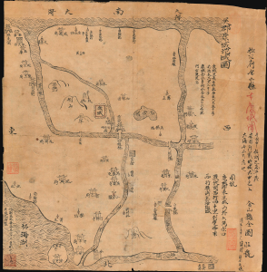
Regional map of Wujun Kangcheng. / 吳郡康城地域圖 / Full map of Jinshan County. 金山縣全圖
$12,000.00
Acquire
- Digital Map Information
- Suitable for large format printing
- File Size: 9.32 MB
- File Type: ZIP / TIFF
- ICC color profile embedded
- Delivered instantly via download link
This is an extraordinary Qing-era Chinese manuscript map by Huang Tingxi (黄廷熙) illustrating Jinshan County, today the Jinshan District of Shanghai Municipality, as it was c. 322 AD / CE. Much of the territory depicted here is underwater today, but this map nonetheless represents the earliest specific cartographic representation of the Shanghai region. (more details)
Issued in the final days of Old Shangai just after the January 28 Incident or Shanghai Incident.
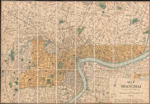
Map of Shanghai.
$9,000.00
Acquire
- Digital Map Information
- Suitable for large format printing
- File Size: 66.6 MB
- File Type: ZIP / TIFF
- ICC color profile embedded
- Delivered instantly via download link
An extremely rare 1933 North-China Daily News and Herald map of Shanghai. Focusing on the Bund and the International Settlement, the map extends from the Shanghai Hangchow Railroad in the west to the Shanghai Baptist College (now the University of Shanghai) in the east. Derived roughly from the Municipal Council Map of the same year, this map is in intensely detailed, with streets, businesses, clubs, parks, government offices, and civic institutions noted. This map was issued shortly after the 1932 Shanghai Incident in the final days of Shanghai's pre-war boomtime. (more details)
Two significant rarities - Saigon and Shanghai - back to back.
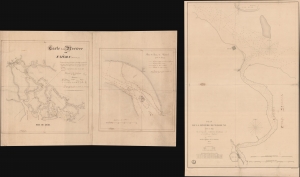
Carte de la Rivière de Saigon (Cochinchine). / Plan du Band de Corail (rivière de Saigon). / Plan de al Rivière de Woosung Levé en 1842 Par les Capitaines H. Kellet and R. Collinson, de la Marine Anglaise.
$7,500.00
Acquire
- Digital Map Information
- Suitable for large format printing
- Full resolution TIFF file
- ICC color profile embedded
- Delivered instantly via download link
This is a remarkable set of back-to-back maps - both are significant in different ways. The most interesting is a finely-executed c. 1860 manuscript chart detailing river approaches to Saigon (Ho Chi Min City). On the verso (or recto, depending) is an 1850 printed nautical chart of the approaches to Shanghai based on the cartography of the First Opium War (1839 - 1842). Both maps are significant, with the manuscript taking primacy as, in all likelihood, it is the first modern hydrographic survey of the Song Sai Gon Estuary. (more details)
Development of the Foreign Concessions in Shanghai.
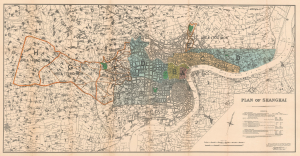
Plan of Shanghai.
$3,500.00
Acquire
- Digital Map Information
- Suitable for large format printing
- File Size: 46.42 MB
- File Type: ZIP / TIFF
- ICC color profile embedded
- Delivered instantly via download link
This is a rare 1928 large-format map of Shanghai, China, published by the Shanghai firm of Kelly and Walsh on behalf of the Shanghai Municipal Council. (more details)
Pursuing Peace in Shanghai
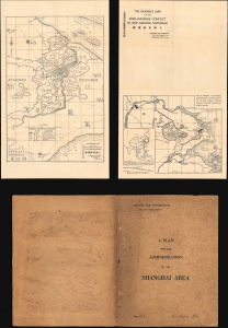
The Reader's Map of the Sino-Japanese Conflict In and Around Shanghai / A Plan for the Administration of the Shanghai Area.
$3,500.00
Acquire
- Digital Map Information
- Suitable for large format printing
- Full resolution TIFF file
- ICC color profile embedded
- Delivered instantly via download link
A unique discovery! This map produced during the 1932 Sino-Japanese conflict over Shanghai by Henry Monsel Cumine. It is accompanied by a 'private and confidential' plan, addressed to a French admiral, to end the conflict and establish Shanghai as a demilitarized zone. (more details)
Catholic missions around Shanghai. AND, a unique alluvial island.

Mission de la Compagnie de Jesus au Hiang-Nan (Chine). / Carte de Hai-Men (Dressee par le R.J Havret) 1887-89.
$2,500.00
Acquire
- Digital Map Information
- Suitable for large format printing
- File Size: 497.66 MB
- File Type: ZIP / TIFF
- ICC color profile embedded
- Delivered instantly via download link
This is a c. 1889 French Jesuit map of Nantong (南通), Hai-men (海门), and the island of Chongming (崇明岛), on the opposite side of the Yangtze River from Shanghai, China. It is one of the maps produced at the Xujiahui Library (Zi-ka-wei) by the Jesuit priest Henri Havret for his 1892 study of the historical formation and settlement of the alluvial Chongming (Tsong Ming) Island. The map also serves as a unique record of missionary activity near Shanghai, recording the sites of hundreds of new churches and missions. (more details)
Catholic Missions around Shanghai and Nanjing.
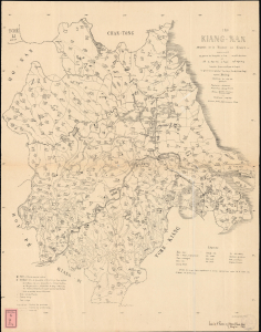
Kiang-Nan Mission de la Province de France comprenant la province du Kiang-Sou a l'est capitale Sou-tcheou et celle du Ngan Hoei a l'ouest captle Ngan-King lesquelles forment avec la prov. du Kiang-si le 'gouvernement general' des-deux Kiang (Leang-Kiang) capitale residence du vice roi.
$2,500.00
Acquire
- Digital Map Information
- Suitable for large format printing
- File Size: 41.69 MB
- File Type: ZIP / TIFF
- ICC color profile embedded
- Delivered instantly via download link
A rare 1879 Aloys Pfister French Jesuit missionary map of the Kiang-nan Vicariate, corresponding to the former Jiangnan Province (江南), China, produced by the Xujiahui Library (Zi-ka-wei), located just outside Shanghai. The map presents the state-of-the-art mission cartography of the vast Kiang-nan Vicariate, highlighting even small villages - all taken directly from firsthand missionary accounts. (more details)
50 photogravures of Old Shanghai.
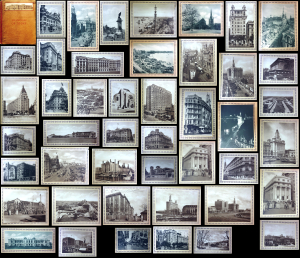
Shanghai of To-day. A Souvenir Album of Fifty Vandyke Gravure Prints of the 'Model Settlement'.
$2,200.00
Acquire
- Digital Map Information
- Suitable for large format printing
- Full resolution TIFF file
- ICC color profile embedded
- Delivered instantly via download link
This is the expanded 1930 third edition of Kelly and Walsh's Shanghai of To-day. A Souvenir Album of Fifty Vandyke Prints of the 'Model Settlement'. The volume of large-format photos captures evocative images of Shanghai's pre-war golden age, when it was a center of global commerce, art, political intrigue, and international cosmopolitanism. (more details)
Shanghai's French Concession amidst War.
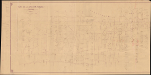
Plan de la Concession française Changhai.
$2,000.00
Acquire
- Digital Map Information
- Suitable for large format printing
- Full resolution TIFF file
- ICC color profile embedded
- Delivered instantly via download link
This is a large-format diazotype proof map of the Shanghai French Concession, produced by the Concession's administration in 1937, a period defined by the Battle of Shanghai (August 13 - November 26, 1937) and a refugee crisis. The verso is equally intriguing, though perhaps unrelated, and bears the handwritten Order of Battle of a German infantry division in French. (more details)
Shanghai at the moment of the Shanghai Ceasefire Agreement in which the city became a demilitarized zone.
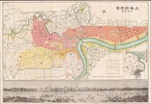
Shanghai New Map. / 上海新地圖
$1,900.00
Acquire
- Digital Map Information
- Suitable for large format printing
- Full resolution TIFF file
- ICC color profile embedded
- Delivered instantly via download link
A scarce March 5, 1932, map of Shanghai, China, issued by Osaka-based Cross-House publishing firm. The map was issued to illustrate the Shanghai Ceasefire Agreement (淞沪停战协定), a peace treaty between China and Japan that made Shanghai a demilitarized zone. It follows the January 28 Incident, also known as the Shanghai Incident (January 28 - March 3, 1932), a conflict in the Shanghai International Settlement between the Republic of China and the Empire of Japan. (more details)
1st Issue of an Iconic Map.
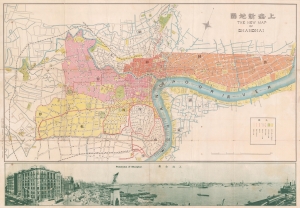
New Map of Shangahi. / 上海新地圖
$1,500.00
Acquire
- Digital Map Information
- Suitable for large format printing
- File Size: 39.75 MB
- File Type: ZIP / TIFF
- ICC color profile embedded
- Delivered instantly via download link
A rare bi-lingual Chinese/English map of Shanghai, China, here in its first edition, issued by the Shanghai-Japanese cartographer Sugie Fusazō (杉江房造) in June of 1926, or Showa 2. This is the first of Sugie Fusazō's maps to include a panoramic view of the city (more specifically, the Bund), a convention that followed in many later editions. (more details)
Shanghai's Pre-WWII Golden Age.
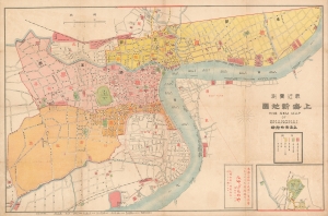
The Nem Map of Shanghai. / 'Recently Measured New Map of Shanghai.' / 最近实测上海新地图
$1,400.00
Acquire
- Digital Map Information
- Suitable for large format printing
- Full resolution TIFF file
- ICC color profile embedded
- Delivered instantly via download link
This is the 1917 bilingual 'Nem' map of Shanghai, China by Jin Feng She (金鳳社) / Chojiro Shimazu (島津長治郎). The map captures Shanghai's pre-WWII golden age, when it was a cosmopolitan center of international commerce, and a hotbed of wild excess. (more details)
Navigating Shanghai's Waters and Turbulent Politics.
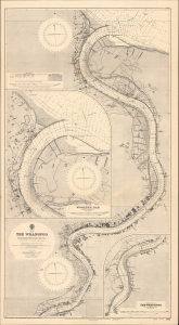
China The Whangpoo.
$1,200.00
Acquire
- Digital Map Information
- Suitable for large format printing
- Full resolution TIFF file
- ICC color profile embedded
- Delivered instantly via download link
This is a 1948 British Admiralty nautical chart or maritime map of the Huangpu (Whangpoo) River. It was produced during the Chinese Civil War (1927 - 1949), shortly after World War II (1939 - 1945), when Shanghai was in a state of turmoil, anxiety, and uncertainty. (more details)
By the self-made Chinese cartographer Tong Shiheng.
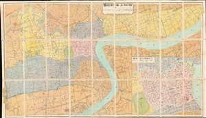
New Pocket Map of Shanghai.
$1,000.00
Acquire
- Digital Map Information
- Suitable for large format printing
- File Size: 38.68 MB
- File Type: ZIP / TIFF
- ICC color profile embedded
- Delivered instantly via download link
A rare and attractive 1927 map of Shanghai by the important Chinese cartographer Tong Shiheng (童世亨). The map is centered on the Shanghai Bund and fully illustrates the foreign concessions, including the British Concession (pink), French Concession (purple below British), American Concession areas (yellow), and the expanded British Concessions (yellow). In the lower right there is an inset map entitled, Shanghai Anglo-French Concession Map, detailing the central parts of the English and French concession areas on a scale of 1:10,000. The cartographer has highlighted three areas of special interest, annotating them with text blocks. (more details)
Ambitious plan to remake Shanghai.
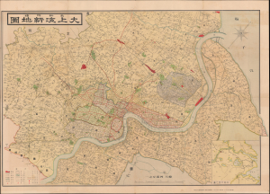
最新測繪大上海新地圖 / [Most Recent Survey Map of Greater Shanghai].
$950.00
Acquire
- Digital Map Information
- Suitable for large format printing
- Full resolution TIFF file
- ICC color profile embedded
- Delivered instantly via download link
This is a 1938 (Showa 13) Kimura Kesao city plan or map of the Great Shanghai Municipality. It was published soon after Japanese forces occupied the Chinese municipality in the Second Sino-Japanese War (World War II). It illustrates Japan's ambitious plan to relocate Shanghai's economic center farther north, into a completely new Japanese-built and designed city center. (more details)
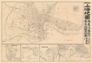
Map of Shanghai. / 上海地圖
$950.00
Acquire
- Digital Map Information
- Suitable for large format printing
- File Size: 6.24 MB
- File Type: ZIP / TIFF
- ICC color profile embedded
- Delivered instantly via download link
An extremely rare c. 1928 pre-war tourist map of Shanghai, China, issued in Shanghai by Jin Feng She (金鳳社). The map illustrates the core of Shanghai focused on the Foreign Concessions, the old Chinese Walled City, and the many business along the Hunagpu River. Ghosted dotted lines indicate streets under construction and are most commong in the International Settlement and in the periphery of the city. It extends westward to include the route of the Shanghai Hangchow Ningpo Railway. Electric tramways are highlighted with solid red lines. The dotted red lines illustrated the borders of the concessions. Fine dotted lines highlight railless electric trams. (more details)
Demilitarized concessions after the 1932 Shanghai War.
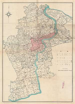
[Shanghai and Vicinity.]
$950.00
Acquire
- Digital Map Information
- Suitable for large format printing
- File Size: 53.49 MB
- File Type: ZIP / TIFF
- ICC color profile embedded
- Delivered instantly via download link
This is a scarce 1932 (Showa 7) Japanese map printed for the Shanghai Textile Company by the Fine Printing (Seiko) Company. It illustrates the vicinity of Shanghai shortly after the Shanghai Incident of 1932, which destroyed part of the city and set off a refugee crisis, presaging even greater upheaval five years later. (more details)
One of the earliest western maps of Shanghai.
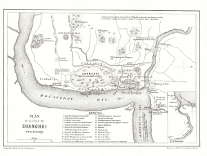
Plan de la Ville de Changhai et de ses Faubourgs.
$850.00
Acquire
- Digital Map Information
- Suitable for large format printing
- File Size: 2.25 MB
- File Type: ZIP / TIFF
- ICC color profile embedded
- Delivered instantly via download link
This 1858 map of Shanghai by W. S. Milne and Erhard illustrates the early days of the Treaty Port Era (1842 - 1943). Cartographically, it is one of the earliest Western representations of Shanghai, based on the L. M. Becker map of 1853, itself drawn and published in the 1857 first English edition of Milne's Life In China. This example is the 1858 French edition. Although printed in 1858, the cartography dates to the late 1840s or early 1850s, when Milne visited Shanghai, thus revealing the early stages of Concession development. (more details)
c. 1874 manuscript map of Shanghai.
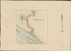
The Port of Shanghai. / 上海港洋子江入口圖
$750.00
Acquire
- Digital Map Information
- Suitable for large format printing
- File Size: 5.92 MB
- File Type: ZIP / TIFF
- ICC color profile embedded
- Delivered instantly via download link
A most unusual manuscript map of Shanghai dating to roughly 1874. Oriented to the south, the map follows the course of the Huangpu River from its confluence with the Yangtze River and the Baoshan Waterway. Although unattributed, the map is most likely the work of Sudo Katsuzō (湏藤 / 湏藤勝三), a Japanese diplomat and cartographer who served on a mission to Taiwan and China following the Mudan Incident of 1871. The goal of the mission was to negotiate reparations with the Qing for fifty-four cannibalized Ryūkyūan sailors. (more details)
Art-Deco Shanghai!
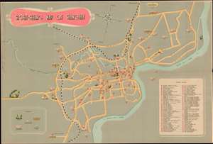
A charming c. 1955 art deco map of Shanghai, China, issued for tourists by the Shanghai People's Art Publishing House and the China International Tourist Service. The map centers on the historical business district of Shanghai, including the old concession area, but extends north as far as Chiang Wan, south to encompass Long Hua Airport, and west as far as what is described as 'West Suburban Park', which most likely corresponds to the modern day location of Shanghai Zoo. The map tackles the urban complexity of Shanghai with a minimalist aesthetic that removes unnecessary details (such as minor roads) but highlights important locations with indexed pictorial vignettes. There are some 95 indexed sites, but we are not sure how easy it would be to actually get to one of the locations cited using this map, especially those in Pudong, which are apparently inaccessible by any roadway. The map folds into its original binder which is illustrated with a sapan (Chinese sailboat) in front of the Bund. (more details)
An iconic map of Shanghai, China, featuring a dramatic panoramic photograph of the Bund.
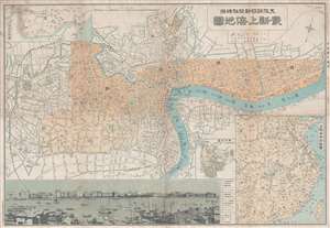
Saishin Shanhai chizu. Ōsaka Asahi Shinbunsha tokusen. / 大阪朝日新聞社特撰 . 最新上海地圖. / Osaka Asahi Shimbun Special Selection. Newest Map of Shanghai.
$600.00
Acquire
- Digital Map Information
- Suitable for large format printing
- File Size: 19.52 MB
- File Type: ZIP / TIFF
- ICC color profile embedded
- Delivered instantly via download link
This is a rare and attractive Showa 7 or 1932 Osaka Asahi Shimbun map of Shanghai, China. Printed in the 7th year of Hirohito's reign (Showa 7), it depicts downtown Shanghai including the Chinese Quarter, the French Concession, the English Quarter (along the Bund), etc. Important buildings along the Bund are carefully noted, including the first HSBC Bank, the British Club, the Palace Hotel (Swatch Art Peace Hotel), Sassoon House (Fairmont Peace Hotel), and the Customs House. There is also a lovely vintage panoramic photo of the Bund along the bottom of the map. A small inset map of Nanjing or Nanking is also included in the lower right quadrant of the map. Another larger inset shows a regional map. Most of the text is written in both Japanese and English. (more details)
Drawn to illustrate the first Shanghai Incident!
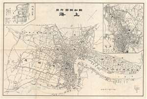
上海 : 揚子江東部一般圖 : 陸地測量部許可 : 報知新聞附錄 / Shanghai : Yōsukō tōbu ippan-zu : Rikuchi Sokuryōbu kyoka : Hōchi Shinbun furoku
$600.00
Acquire
- Digital Map Information
- Suitable for large format printing
- File Size: 22.95 MB
- File Type: ZIP / TIFF
- ICC color profile embedded
- Delivered instantly via download link
This Showa 7 or June of 1932 map depicts the city of Shanghai, China. This map was issued as a supplement to Hōchi Shinbun (報知新聞) on the 11th of February, 1932. The first 'Shanghai Incident' between the Japanese and Chinese forces having begun on days ... (more details)
The end of extraterritoriality.
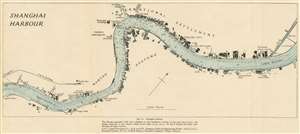
Shanghai Harbour.
$300.00
Acquire
- Digital Map Information
- Suitable for large format printing
- File Size: 6.46 MB
- File Type: ZIP / TIFF
- ICC color profile embedded
- Delivered instantly via download link
This is a 1945 Royal Naval Intelligence Division map of Shanghai Harbor and the Huangpu (Whangpoo) River in Shanghai, China. The map was issued to as part of a British intelligence report to commissioned assess the future of Chinese-British relations. With the concessions retroceded to China and an violent civil war raging through the countryside, the future of Shanghai as an international hub of commerce was very much in question. Centered on the Bund, International Settlement, and French Concession, the map depicts the Huangpu from Lunghwa Point to Point Island. Numerous buildings appear along both riverbanks, but only a handful of these are identified. The British consulate, French Consulate, and Customs House appear, as do several different docks, the Shanghai Waterworks Company, and the Riverside power station. The numbers along both banks reference specific wharves. (more details)