
War Maps
Most comprehensive record of the My Lai Massacre in private hands.
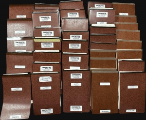
This is a 37-volume archive of documents from the 1971 My Lai Massacre court-martial of Colonel Oran K. Henderson. Henderson was the highest-ranking officer tried in connection with My Lai, one of the most horrific events in American military history, and the last soldier to face a court-martial. The court-martial lasted 62 days and on December 17, 1971, Henderson was found not guilty. Henderson's court-martial ties for the longest court-martial in U.S. Army history with that of Lieutenant William Calley, the only member of the U.S. Army found guilty in connection with My Lai. (more details)
Bockscar's in-flight navigation map of Nagasaki Bombing.
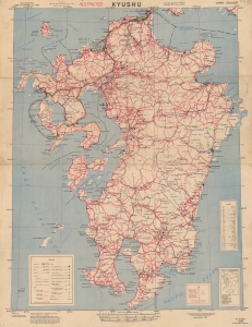
Recording one of the most significant moments in the 20th century, this is a 1945 U.S. Army Corps of Engineers 'Special Strike Map' of Kyushu, Japan, featuring manuscript notations tracing the inbound flight path of Bockscar during 'Fat Man' atomic bombing attack on Nagasaki, Japan, on August 9, 1945. This map was likely used by Bockscar's in-flight navigator James Van Pelt (1918 - 1994) to redirect the mission from the primary target, Kokura, to the secondary target, Nagasaki. (more details)
Unobtainable first state of one of the most influential maps of New England ever made.
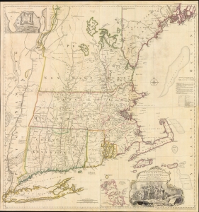
A MAP of the most INHABITED part of NEW ENGLAND, containing the PROVINCES of MASSACHUSETS BAY and NEW HAMPSHIRE, with the COLONIES of KONEKTIKUT AND RHODE ISLAND. Divided into Counties and Townships: The whole composed of Actual Surveys and its situation adjusted by ASTRONOMICAL OBSERVATIONS.
$55,000.00
Acquire
- Digital Map Information
- Suitable for large format printing
- File Size: 35.46 MB
- File Type: ZIP / TIFF
- ICC color profile embedded
- Delivered instantly via download link
This is the rare 1755 first state of Braddock Mead's French and Indian War Era map of New England - one of the most significant and iconic American maps ever produced. It is one of the first large-format regional maps of any part of North America and was the most comprehensively researched and detailed map of contemporary New England. (more details)
Battle for the Fate of the Levant.
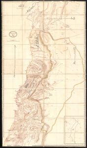
ردشمنلوا میسرت كنویامه هیرب هناخسدنهم هطیرح وبشا [This map was drawn by the Imperial Engineering Office].
$20,000.00
Acquire
- Digital Map Information
- Suitable for large format printing
- Full resolution TIFF file
- ICC color profile embedded
- Delivered instantly via download link
An extraordinary, one-of-a-kind large-format manuscript folding map of Ottoman Syria produced by the sultan's Imperial Engineering Office c. 1832. It was made in the context of the First Egyptian Ottoman War (1831 - 1833), which saw the region temporarily come under Egyptian rule. (more details)
'The Father of Waters again goes unvexed to the sea.'
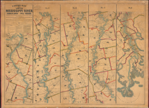
Lloyd’s Map of the Lower Mississippi River From St. Louis to the Gulf of Mexico. Compiled from Government Surveys in the Topographical Bureau...
$17,000.00
Acquire
- Digital Map Information
- Suitable for large format printing
- File Size: 104.66 MB
- File Type: ZIP / TIFF
- ICC color profile embedded
- Delivered instantly via download link
This is James T. Lloyd's engrossing 1863 large-format map of the Mississippi River, produced during the U.S. Civil War (1861 - 1865). It provides a comprehensive overview of the economically vital and strategically critical waterway, then a hotly contested theater of war vital to both the Union and the Confederacy. (more details)
African-American Creoles in Britain's Atlantic Empire.
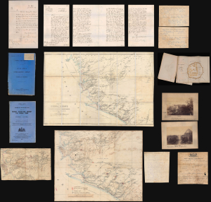
A remarkable find, this is an archive of maps, intelligence documents, and correspondence produced by the British War Office and Sir Francis de Winton relating to the 1887 Yoni Expedition in Sierra Leone, which de Winton led. This war had profound implications for the futures of freed African-American slaves settling in Freetown. The British launched this punitive military campaign against the Yoni to protect allied tribes in Sierra Leone's interior. Though a minor colonial conflict, the Yoni Expedition had wider significance as part of the 'Scramble for Africa'. Moreover, it included the British 1st West India Regiment, composed of descendants of enslaved people from Britain's North American colonies, including those who had joined the British during the American Revolution. (more details)
Best neutral-perspective map of the French and Indian War.
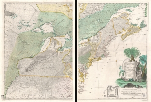
Theatrum belli in America Septentrionali. II. foliis comprehensum jussu Acad. Reg. Scient. et Eleg. Litt. exhibet I. C. Rhode Ac: Geogr. Berger, sculpsit berol.
$14,000.00
Acquire
- Digital Map Information
- Suitable for large format printing
- Full resolution TIFF file
- ICC color profile embedded
- Delivered instantly via download link
An important separately issued c. 1761 Johann Christoph Rhode map of eastern North America published in Berlin is considered the most important neutral perspective map of the French and Indian War (1754 - 1763). Rhode's map is little known and often overlooked by collectors, surprising as it is unquestionably the most exceptional map of the Theater of the French and Indian War published in any country other than the belligerent nations. (more details)
Imperial Struggle for the Manchu Homeland
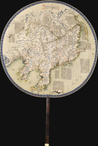
東三省俄部邊防全省圖說 / [Illustrated Description of the Russian Section of the Three Eastern Provinces for Border Defense].
$11,000.00
Acquire
- Digital Map Information
- Suitable for large format printing
- Full resolution TIFF file
- ICC color profile embedded
- Delivered instantly via download link
This is a stunning c. 1900 manuscript fan map of Manchuria prepared by a group of Qing military officers led by one surnamed Ren. Demonstrating astonishingly fine and meticulous workmanship, it covers the border region of Manchuria at a time when Qing rule of their Manchu homeland was greatly imperiled by both the Russian Empire and Imperial Japan. (more details)
When Germany chose Fascism.
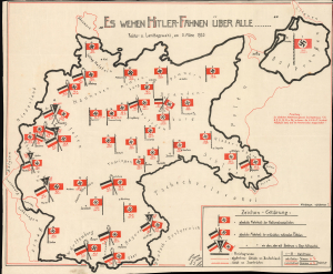
Es wehen Hitler-Fahnen über alle... / [Hitler Flags are Waving Above Everything ... ]
$8,000.00
Acquire
- Digital Map Information
- Suitable for large format printing
- Full resolution TIFF file
- ICC color profile embedded
- Delivered instantly via download link
A 1933 German propaganda map capturing one of the most pivotal moments in 20th-century history - the popular election of the Nazi Party into power in Germany and continental Europe's sharp turn towards fascism. Within months of the March 1933 election, the Nazi Party and its allies dismantled the Weimar Republic's federalist check-and-balance system and centralized political power into the hands of Adolf Hitler. From this moment, World War II (1939 - 1945) and the Holocaust were inevitable. This is the only known surviving example. (more details)
Cold War Era Soviet Plan to Repel an American Arctic Invasion.

Организация и ведение противодесантной операции на морском побережье во взаимодействии с военно-морским флотом / [Organization and Conduct of an Anti-Amphibious Operation on the Seacoast in Coordination with the Navy].
$7,500.00
Acquire
This is a one-of-a-kind 1952 Cold War Era top-secret report with maps, prepared for the Operations Directorate of the Northern Military District of the Armed Forces of the Soviet Union. The booklet discusses detailed plans to repel a much-feared 'Anglo-American imperialist' invasion of the Soviet Union from the Arctic. It offers unique insight into the Soviet perspective and defensive planning at the height of the Cold War (1947 - 1991). (more details)
Unique historical record.
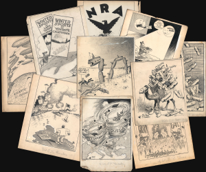
A collection of 30 manuscript political cartoons, many with cartographic content, drawn by Frank 'Ket' Kettlewell for the Oakland Tribune. As a group, they constitute a unique comic record of world events c. 1916 - 1935. Each hand-drawn cartoon is a visually striking San Francisco-centric commentary on domestic or international affairs. 'Ket' has signed each, with many most featuring his signature tiny bird (which occasionally comments). (more details)
Most Detailed Ottoman Map of Montenegro Ever Produced.
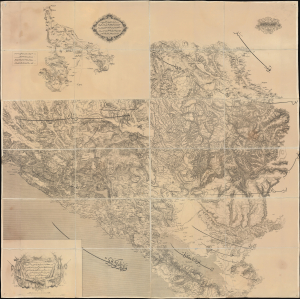
... ١٨٦٩ سنه سی اوستريا دولتی جغرافيا جمعيت عسكريه سی واسطه سيله تنظيم قلنان قره طاغ وجوارينك خريطه سی اولوب / [This is a map of Montenegro and its Surroundings, prepared by means of the Austrian Militärgeographisches Institut in the year 1869...].
$6,000.00
Acquire
- Digital Map Information
- Suitable for large format printing
- Full resolution TIFF file
- ICC color profile embedded
- Delivered instantly via download link
This is a rare 1875 Ottoman Turkish large-format folding map of Montenegro produced by the Erkân-ı Harbiye Dairesi, the General Staff Department of the Ottoman military, based on an earlier 1869 Austrian map prepared by the Militärgeographisches Institut. Combining Austrian and Ottoman cartographic knowledge, largely gained during the Ottoman-Montenegrin War (1861 - 1862), it is the most detailed Ottoman map of Montenegro produced before the kingdom's independence. (more details)
Produced by Poland's Nazi-Hunting Commission.
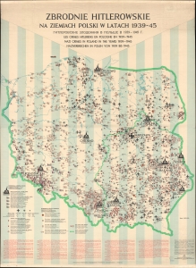
Zbrodnie Hitlerowskie na Ziemiach Polski w Latach 1939-45. [Hitler's Crimes in Poland 1939-45.]
$6,000.00
Acquire
A chilling 1971 wall map documenting Hitler's war crimes in Poland published for the Polish commission established to hunt and prosecute Nazi war criminals. The map's scope, focus, and execution transcend the purely geographic in illustrating the horrors of the Holocaust. Its extreme significance reflects broad efforts by scholars, mapmakers, and other researchers throughout the 1960s-70s to record and preserve knowledge of the Holocaust. It is ever more poignant in the light of modern revisionist historical research that has re-evaluated the Polish role in the Holocaust, as well as efforts by the current Polish government to legislate and control the historical record. (more details)
Uniquely British Cheap Print: Earliest printed representation of Wellington's victory at the Battle of Vitoria.
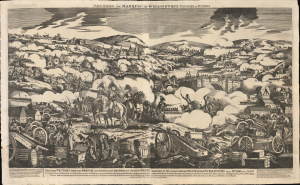
Field Marshal the Marquis of Wellington's Victory of Vittoria.
$5,000.00
Acquire
- Digital Map Information
- Suitable for large format printing
- Full resolution TIFF file
- ICC color profile embedded
- Delivered instantly via download link
The only known surviving example of this large-format woodcut 'cheap print' issued by George Thompson in 1813, celebrating the Duke of Wellington's stunning triumph over French forces at the Battle of Vitoria (June 21, 1813), a decisive battle in the years-long Peninsular War (1808 - 1814). It is likely the earliest printed representation of the battle, being a news-as-it-happened publication. The victory helped to solidify Wellington's stature as the ablest British commander of land forces, earning him the rank of field marshal and later the title of Duke. The 'cheap print' is a uniquely British form of graphic news publishing issued for distribution among the uneducated but engaged populace. (more details)
First Anglo-Afghan War.
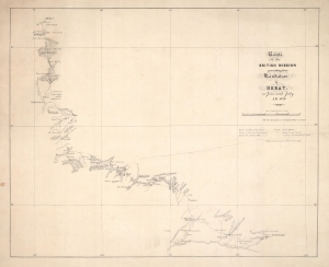
Route of the British Mission proceeding from Kandahar to Herat in June and July A.D. 1839.
$4,500.00
Acquire
- Digital Map Information
- Suitable for large format printing
- DPI: 600
- File Size: 14.01 MB
- File Type: ZIP / TIFF
- ICC color profile embedded
- Delivered instantly via download link
This is an 1839 James Bedford and H.M. Smith 'Great Game' map of Afghanistan, covering from Kandahar to Herat in the first few months of the First Angl-Afghan War (1838 - 1842). This map and the attendant conflicts mark the beginning of the Great Game. (more details)
One of the Earliest Obtainable Maps of the American Revolution
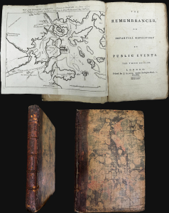
Map of the Environs of Boston. Drawn at Boston in June 1775. / The Remembrancer, or Impartial Repository of Public Events.
$4,500.00
Acquire
This is the scarce 1775 first volume of John Almon's The Remembrancer, which includes one of the earliest published maps of Boston following the Battle of Bunker Hill. Almon, who was a well-connected and informed reporter on the British Parliament, placed himself in danger of being fined or imprisoned by responding to public interest in events in America and publishing this work. (more details)
Internal WWII power struggle between the Japanese Navy and Army.
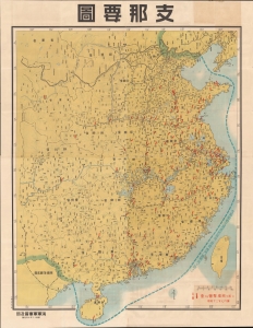
支那要圖 / [Map of China].
$4,000.00
Acquire
- Digital Map Information
- Suitable for large format printing
- File Size: 237.76 MB
- File Type: ZIP / TIFF
- ICC color profile embedded
- Delivered instantly via download link
This enormous 1938 wall map of China was produced by the propaganda arm of the Imperial Japanese Navy to document bombing raids. It is also propaganda vehicle related to the power struggle between the Japanese Army and Navy and their tussle for influence with the government, the Supreme War Council (軍事参議院), and the Emperor. The outcome of this struggle - in favor of the navy - ultimately came to define the Japanese Pacific War strategy. Of note, given this map's rarity and lack of publication information typical of the period (indicating both printing and publication dates), it is evident that this map was produced exclusively for internal naval use. (more details)
Soviet-themed anti-Nazi propaganda in Poland.
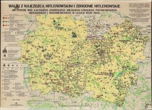
Walki z Najeźdźcą Hitlerowskim i Zbrodnie Hitlerowskie na Terenie Woj.: Kaliskiego, Konińskiego, Miejskiego Łódzkiego, Piotrkowskiego, Sieradzkiego i Skierniewickiego w Latach 1939 - 1945. / Armed Struggle Against the Nazi Invader and Nazi Crimes in Kalisz, Konin, Łódź, Poitrków Tryb., Sieradz and Skierniewice Voivodeships in the Years 1939 - 1945.
$4,000.00
Acquire
A chilling 1971 wall map detailing Hitler's crimes and the fight against the Nazi invasion and occupation in the voivodeships of Kalisz, Konin, Łódź, Piotrków Tryb., Sieradz and Skierniewice in central Poland. It was published by the Provincial Committees for the Protection of Monuments to Struggle and Martyrdom. It is ever more poignant in the light of modern revisionist historical research that has re-evaluated the Polish role in the Holocaust, as well as efforts by the current Polish government to legislate and control the historical record. All text on this piece is in Polish, Russian, English, French, and German.The map depicts the 6 voivodeships east of Warsaw. Icons detail Nazi crimes. The largest marks Chełmno, the first Nazi extermination camp. Two others mark concentration camps for children. Black Iron Crosses mark mass execution sites, with the size of the cross corresponding to the magnitude of the massacre. The largest crosses, such as those in Łódź and near Kazimierz Bisk and Gołuchów, symbolize massacres of over 10,000 individuals. Corresponding symbols mark towns that were destroyed and their populace exterminated, towns that were partially destroyed and exterminated, and towns where the population was deported. Small red shovels surrounded by barbed wire identify forced labor camps. Symbols also mark prisoner-of-war camps and sites of crimes committed against Polish and Soviet Prisoners of War. (more details)
Targeting map for the invasion of Iwo Jima.
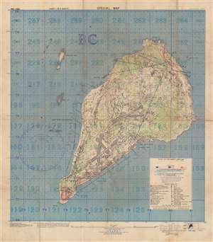
Special Air and Gunnery Target Map. Iwo Jima.
$4,000.00
Acquire
- Digital Map Information
- Suitable for large format printing
- File Size: 94.09 MB
- File Type: ZIP / TIFF
- ICC color profile embedded
- Delivered instantly via download link
This is a 1944 U.S. Navy map of Iwo Jima prepared for the American Invasion of Iwo Jima - one of the most hard-fought battles in World War II's Pacific Theater. The map is the smaller but broader of two maps issued by the U.S. Navy for the invasion, and in this case, is intended as a gunnery and targeting map. The smaller size, likely made it more practical in the field, while the larger scope, allowed for a wider targeting range. (more details)
Indian Army's Showcase Campaign in the Great War.
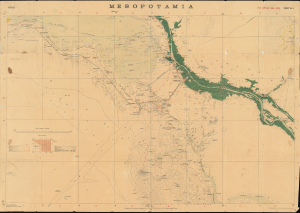
Mesopotamia. Sheet No. 1. Basrah. No.888 D.D.D. 1917 (2.D.O.) S.I. 2000.
$3,500.00
Acquire
- Digital Map Information
- Suitable for large format printing
- Full resolution TIFF file
- ICC color profile embedded
- Delivered instantly via download link
This is a rare 1917 Survey of India map focusing on the key strategic regions of Basra-Zubair in south-eastern Iraq and the adjacent Khorramshahr area of Persia, and it is one of the first maps to show Abadan, the first oil boomtown of the Middle East. It was also a showcase theater for the employment of units of the Indian Army, whose officers were given charge of the campaign at the beginning of the war. (more details)
The Spirit of America turns the tides of WWI.
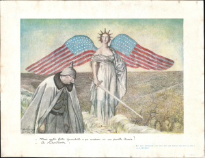
Mais quelle flotte formidable a pu conduire ici une pareille armée? - Le Lusitania. / [But! What tremendous fleet could ever have brought over such an army? - the LUSITANIA.]
$3,500.00
Acquire
- Digital Map Information
- Suitable for large format printing
- Full resolution TIFF file
- ICC color profile embedded
- Delivered instantly via download link
A striking 1918 Jules Abel Faivre French broadside celebrating the United States' entry into World War I (1914 - 1918). The broadside was issued shortly after the American Expeditionary Force landed some 1.2 million soldiers in Europe, marking a turning point toward inevitable Allied victory. The image is centered on Winged Liberty representing the 'Spirit of America'. Her wings take the form of American Flags, and she carries a sword in her right hand, ready to defend liberty. Her eyes are frozen white and distant, underscoring both detachment and purity. Behind her march endless troops of the American Expeditionary Forces (AEF). In the foreground, the German Kaiser, Wilhelm II (1859 - 1941), looks on despondently, aware of his impending and inevitable defeat. (more details)
Planning Operation Hailstone - the World War II U.S. Navy attack on Truk Atoll.
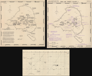
Truk Atoll. Major Fortifications. / Truk - Air Target Folder II. Truk Islands. Target Area Map - Truk Islands. / [Untitled Aviation Chart of the East Caroline Islands.]
$3,500.00
Acquire
- Digital Map Information
- Suitable for large format printing
- Full resolution TIFF file
- ICC color profile embedded
- Delivered instantly via download link
This important archive, compiled days after the World War II Battle of Kwajalein and weeks before Operation Hailstone, includes three 1944 U.S Navy maps of Truk Atoll (Chuuk Lagoon, Micronesia): two 1944 Joint Intelligence Center Pacific Ocean Areas (JICPOA) maps of Truk Atoll, and an aviation chart of the same. The map archive offers unique insights into the U.S. Navy's preparations to assault one of Japan's most formidable bases in the South Pacific. Truk Atoll was Imperial Japan's main naval base in the South Pacific, considered the 'Gibraltar of the Pacific'. (more details)
Pursuing Peace in Shanghai
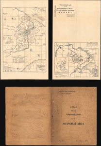
The Reader's Map of the Sino-Japanese Conflict In and Around Shanghai / A Plan for the Administration of the Shanghai Area.
$3,500.00
Acquire
- Digital Map Information
- Suitable for large format printing
- Full resolution TIFF file
- ICC color profile embedded
- Delivered instantly via download link
A unique discovery! This map produced during the 1932 Sino-Japanese conflict over Shanghai by Henry Monsel Cumine. It is accompanied by a 'private and confidential' plan, addressed to a French admiral, to end the conflict and establish Shanghai as a demilitarized zone. (more details)
Nazi crimes near Kielce and Radom.
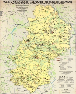
Walki z Najeźdźcą Hitlerowskim i Zbrodnie Hitlerowskie na Terenie Województw Kieleckiego i Radomskiego w Latach 1939 - 1945. Armed Struggle Against the Nazi Invader and Nazi Crimes in Kielce and Radom Voivodeships in the Years 1939 - 1945.
$3,500.00
Acquire
A chilling 1977 Polish wall map detailing Hitler's crimes and the fight against the invasion and occupation in the voivodeships of Kielce and Radom. It was published by Kielce's Provincial Citizens' Committee for the Protection of Monuments of Struggle and Martyrdom. It is ever more poignant in the light of modern revisionist historical research that has re-evaluated the Polish role in the Holocaust, as well as efforts by the current Polish government to legislate and control the historical record. All text on the piece is in Polish, Russian, English, French, and German. (more details)
Nazi crimes around Gdańsk during World War II.
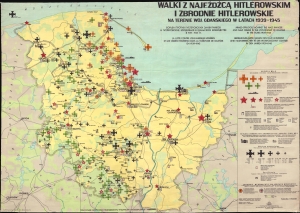
Walki z Najeźdźcą Hitlerowskim i Zbrodnie Hitlerowskie na Terenie Woj. Gdańskiego w Latach 1939 - 1945. Armed Struggle Against the Nazi Invader and Nazi Crimes in the Voivodeship of Gdańsk in the Years 1939 - 1945.
$3,500.00
Acquire
A chilling 1968 Polish wall map chronicling Hitler's war crimes and the fight against the invasion and occupation of the voivodeship of Gdańsk. It was published by the Provincial Citizens' Committee for the Protection of Monuments of Struggle and Martyrdom in Gdańsk. It is ever more poignant in the light of modern revisionist historical research that has re-evaluated the Polish role in the Holocaust, as well as efforts by the current Polish government to legislate and control the historical record. All text on this piece is in Polish, Russian, English, French, and German. (more details)
Capitalizing on British interest in the American Civil War.
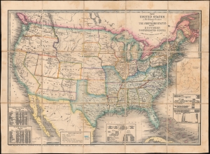
The United States and Relative Position of the Northern States and the Southern Confederated States.
$3,200.00
Acquire
- Digital Map Information
- Suitable for large format printing
- Full resolution TIFF file
- ICC color profile embedded
- Delivered instantly via download link
This is an 1861 James Wyld map of the United States depicting the Union and Confederacy at the outset of the American Civil War (1861 - 1865). It was published in Great Britain to capitalize on British interest in the conflict, which threatened their booming textile industry and thus national economic stability. The 'Southern Confederated States' are shaded blue. Keeping current to the fast-paced events, Wyld remarkably includes the ephemeral Confederate state of Arizona. (more details)
Ottoman Preparations for the 'Last Stand' in the Levant.

يلديرم اردولر غروپى نزد مؤسسه مؤسسات صحيه و حيوانيهسى مشروحدور / [The medical and veterinary institutions and establishments attached to the Yıldırım Army Group are detailed here].
$3,000.00
Acquire
- Digital Map Information
- Suitable for large format printing
- Full resolution TIFF file
- ICC color profile embedded
- Delivered instantly via download link
This is a rare and likely unique c. 1918 large-format Ottoman military resource map of the Levant prepared by the Yıldırım Orduları Grubu (Lightning Armies Group), the elite field command established to halt the advancing British Empire and its Arab allies during the final stages of World War I (1914-1918). Combining printed cartography with handstamps and manuscript annotations, the map inventories the region's strategic infrastructure, emphasizing hospitals, medical depots, supply centers, transportation networks, and other critical military resources essential to sustaining Ottoman operations. Intended for high-level logistical planning rather than tactical battlefield use, such a comprehensive assessment of military assets would have been among the Ottoman Empire's most closely guarded wartime documents, offering an extraordinary glimpse into the administrative and logistical foundations of the Palestine Campaign. (more details)
Mapping Taiwan, with an Eye towards Expansion.
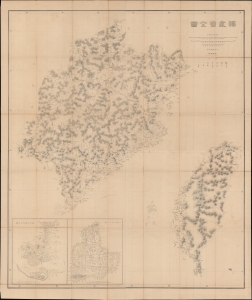
福建省全圖 / [Complete Map of Fujian Province].
$3,000.00
Acquire
- Digital Map Information
- Suitable for large format printing
- Full resolution TIFF file
- ICC color profile embedded
- Delivered instantly via download link
This is a rare c. 1882 large-format folding map of Fujian and Taiwan, produced by the General Staff of the Japanese Imperial Army. Made in the wake of Japan's 1874 Punitive Expedition to Taiwan, this map presages the 1895 conquest and colonization of Formosa. (more details)
A British officer's experience of the American Revolution.
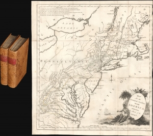
Map for the Interior Travels through America delineating the March of the Army. / Travels through the interior parts of America. In a series of letters. By an officer.
$3,000.00
Acquire
- Digital Map Information
- Suitable for large format printing
- File Size: 9.95 MB
- File Type: ZIP / TIFF
- ICC color profile embedded
- Delivered instantly via download link
A fine example of Thomas Conder's 1789 map of the American colonies and the accompanying 2-volume Thomas Anburey travelogue. The fascinating work, Travels Through the Interior Parts of America. In a Series of Letters. By an Officer, records Anburey's travels in Canada and the former British Colonies in North America. (more details)
Bringing aerial destruction to Nazi-dominated Europe.
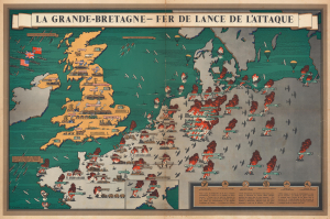
La Grande-Bretagne - Fer de Lance de l'Attaque.
$2,500.00
Acquire
- Digital Map Information
- Suitable for large format printing
- Full resolution TIFF file
- ICC color profile embedded
- Delivered instantly via download link
This is a 1943 F. Donald Blake French-language pictorial propaganda map of Great Britain and continental Europe at the height of World War II (1939 - 1945). The map's message is clear: the tide of war has turned, and British RAF forces are taking a heavy toll on Nazi-dominated Europe. (more details)
Best map of the region, used by both sides in WWI.
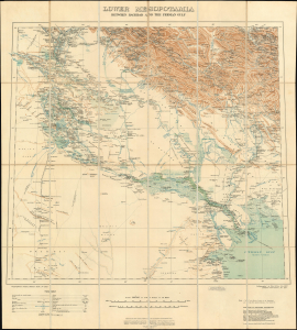
Lower Mesopotamia Between Baghdad and the Persian Gulf.
$2,500.00
Acquire
- Digital Map Information
- Suitable for large format printing
- Full resolution TIFF file
- ICC color profile embedded
- Delivered instantly via download link
This is a 1915 edition of the British War Office map of Lower Mesopotamia, the authoritative map of Central and Southern Iraq, Kuwait, and Khuzestan (Iran). This map was first issued in 1907, at which time it was considered the most accurate regional map. This edition, updated to 1915, was used by both sides in World War I (1914 - 1918). (more details)
18 Days before the Siege of Paris.
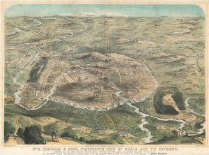
No. 8. Stannard and Son's, Perspective View of Paris and its Environs, Shewing All the Fortifications and Redoubts, Together with the Lines of Defense Recently Thrown Up, and the Roads, Rivers, and Railways Communication with the Interior.
$2,500.00
Acquire
- Digital Map Information
- Suitable for large format printing
- File Size: 61.46 MB
- File Type: ZIP / TIFF
- ICC color profile embedded
- Delivered instantly via download link
This 1870 Alfred Concanen view of Paris details the city's elaborate defensive works just 18 days before the beginning of the Franco-Prussian War Siege of Paris (September 17, 1870 - January 28, 1871). In this engagement, the enormous Enceinte de Thiers (Thiers Wall), constructed at extraordinary expense and believed to be impregnable, proved little more than a king's folly. (more details)