
War Maps (sold)
Unique manuscript record of the War of the Quadruple Alliance. Author's own copy.
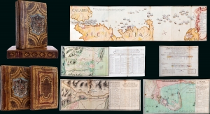
Guerra De Cerdeña Ysicilia, En Los Años De 1717, 18, 19, Y 1720. Con Reflexiones Militares Del Marquèsde La Mina Conde De Pezuela.
sold
This is an extraordinary 2-volume 1755-57 manuscript account of the War of the Quadruple Alliance, fought over Sicily, drafted by a participant, the II Marques de la Mina, Jaime Miguel de Guzmán Davalos y Spinola. It is Mina's personal copy, emblazoned with his arms, rich with masterfully executed foldout manuscript maps and tables, and features exceptional provenance. At the time of writing, this work was suppressed in Spain, as the loss of the Spanish fleet at the Battle of Cape Passaro was a royal embarrassment, leading to it remaining unpublished for more than 140 years. The War of the Quadruple Alliance here represented, while not well known, had global ramifications, as it significantly diminished the Spanish navy, giving the British largely unopposed free reign on the colonial stage, particularly in the Americas. (more details)
A most important Civil War map of Washington D.C.
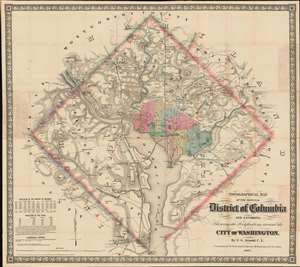
Topographical Map of the Original District of Columbia and Environs: Showing the Fortifications around the City of Washington.
sold
- Digital Map Information
- Suitable for large format printing
- File Size: 51.63 MB
- File Type: ZIP / TIFF
- ICC color profile embedded
- Delivered instantly via download link
Known as 'The Arnold Map', this is the most important Civil War era map of Washington D.C. and vicinity. This map was issued by Edward Greene 'Aloha Vivarttas' Arnold and G. W. Colton in 1862, just after the Second Battle of Bull Run. Centered on the White House, the map illustrates the 'original' ten-mile-square diamond-shaped land allocation set aside for the District of Columbia. As a cartographic piece, Arnold's map exceeded in quality all previous maps of the region, noting roads, canals, turnpikes, railroads, and mills, as well offering a meticulous presentation of topography. Significantly, it illustrates the 51 fortifications, army hospitals, and dozens of small batteries - all critical wartime reconnaissance. (more details)
First map to name the United States and a contemporaneous illustration of the American Revolutionary War.
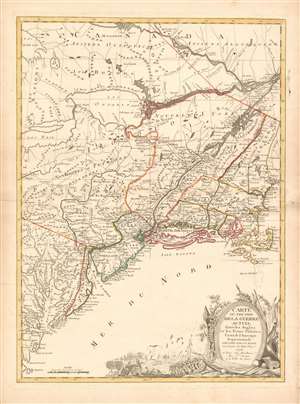
Carte du Théatre de la Guerre actuel entre les Anglais et les Trieze Colonies Unies de l'Amerique Septentrionale dressée par J. B. Eliot Ingénieurs des Etats Unis 1778.
sold
- Digital Map Information
- Suitable for large format printing
- DPI: 600
- File Size: 30.62 MB
- File Type: ZIP / TIFF
- ICC color profile embedded
- Delivered instantly via download link
A 1778 first edition American Revolutionary War era map of the northeastern United States by J. B. Elliot, considered to be of extreme significance. This is generally regarded as the earliest map to use the name 'United States', or in this case, 'Etats Unis'. Drawing on previously unused sources, Eliot's map illustrates the events of the Revolutionary War contemporaneously with the action, making it, essentially a living account of the War of Independence. Margaret Pritchard and Henry Taliaferro, published an essay on this map in Degrees of Latitude, Map 58, describing its significance in great detail, of which this is a short excerpt,
The map of the theater of war between Great Britain and America by J.B. Eliot is important because of its title, Les Treize Colonies Unies de l'Amerique Septentrionale, may include the first reference on a map to the United States. The cartographer was identified as Ingenieurs des Etats Unis. On November 15, 1777, the Continental Congress selected 'The United States of America,' as the name of the thirteen colonies that formed a government under the Articles of Confederation. One month later, French authorities learned of the victory at Saratoga and decided to recognize American independence. By January 8, French foreign minister, Charles Gravier, Comte de Vergennes, informed American envoys that France was ready to engage in an alliance. It is not surprising that the name United States was first mentioned on a map published in Paris in 1778.A decorative cartouche in the lower right incorporates a battle scene wherein British soldiers bombard a small town - possibly Valley Forge? (more details)
… It is also curious that he did not indicate on the map the general's 1777 winter headquarters at Valley Forge, misspelled Walay Forge. What Eliot did illustrate were the lines' march taken by the British and American forces during the campaign in 1777, including Lieutenant Colonel Barry St. Ledger's unsuccessful diversionary expedition down the Mohawk Valley, Burgoyne's march from Crown Point to Albany, and Howe's campaign to take Philadelphia.
… As was usually the case, Eliot appears to have borrowed from several sources in compiling the geography. Some areas were designated by French place-names while others are predominantly English, specifically in the northwestern territories that the French knew best. It is clear they were aware of the latest intelligence relating to the Revolutionary War.
Comparing a Viet Cong POW and US Army analysis of Vietnam War battle.
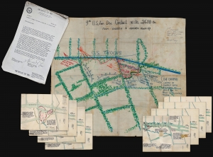
9th U.S. Inf. Div. Contact with 261. B Bn From 111255H to 120600H March 69.
sold
- Digital Map Information
- Suitable for large format printing
- Full resolution TIFF file
- ICC color profile embedded
- Delivered instantly via download link
A one-of-a-kind archive of manuscript maps accompanied by a report by Viet Cong prisoner of war, Pham Xuan Quy, and the U.S. Army 9th Infantry Division Col. Ira Hunt, to illustrate conflicting perspectives on the 1969 Vietnam War Battle of Thanh Phu, fought in the Mekong Delta southwest of Saigon. The collection consists of a large manuscript map, drawn by the Vietnamese Kot Mai, that provides an overview of the battle from start to finish, supplemented by 8 smaller manuscript maps detailing the battle's progression. The archive is significant for being a comparison of both the western and the Viet Cong perspective on the same battle - both of which are preserved in this, the Harris Report. (more details)
Cavalry field map for the Atlanta Campaign of the American Civil War.
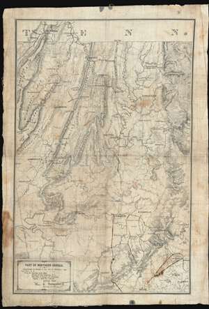
Map of Northern Georgia.
sold
- Digital Map Information
- Suitable for large format printing
- File Size: 32.27 MB
- File Type: ZIP / TIFF
- ICC color profile embedded
- Delivered instantly via download link
'Printed in the Field, Chattanooga, Tenn.', this map of northwestern Georgia is a remarkable artifact of the American Civil War (1861 - 1864) issued by William E. Merrill and William C. Margendant days before the launching of the Atlanta Campaign (May 7, 1863 - Sep 2, 1864). Printed on muslin specifically for Union Calvary officers, this map covers the northeastern part of Georgia, from Chattanooga and the Tennessee border south as far as Dallas and east to include Kennesaw. There can be little doubt that this map saw action in the field, with period manuscript annotations marking routes after May 17th, when Sherman split Union forces south of Adairsville into three separate armies headed by Maj. Generals John Schofield, George H. Thomas, and James B. McPherson. (more details)
Russian Cold War plans for a nuclear attack on Phoenix.
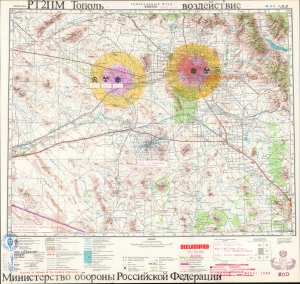
ГЕНЕРАЛЬНЫЙ ШТАБ ФИНИКС. РТ2ПМ Тополь. Воздействие. / GENERAL HEADQUARTERS PHOENIX. RT-2PM-Topol. Impact.
sold
A chilling and thought-provoking 1982 Soviet Cold War map of Phoenix, Arizona, illustrating Russian plans for a nuclear ICBM attack. Two impacts targets are illustrated in manuscript: downtown Phoenix and the Palo Verde Generating Station, one of the largest nuclear power plants in the United States. The map bears the signature of Viktor Chebrikov (Виктор Михайлович Че́бриков; 1923 - 1999), then head of the KGB, as well as stamps showing that it was obtained and translated by American intelligence. (more details)
Mars, the God of War, look on as Fame proclaims the of the Birth of the United States.
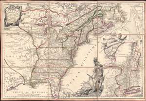
Carte de l'Amerique Septle. pour Servir a l'Intelligence de la Guerre Entre les Anglois et les Insurgents.
sold
- Digital Map Information
- Suitable for large format printing
- Full resolution TIFF file
- ICC color profile embedded
- Delivered instantly via download link
This is a rare 1777 Jean-Baptiste Jacques de Beaurain map of the United States during the American Revolutionary War, issued in anticipation of French entry into the war on the side of the revolutionaries. The map includes a bold illustration of the goddess Ossa (fame) unrolling an expansive map of the Theater of War in the Hudson corridor, proclaiming the newly formed United States. Mars, the god of War, looks on, shield and torch in hand, his arsenal ready - much like France itself. This map is thus an instrument of propaganda intended to prepare the public for French participation in the American Revolution - an event which followed in early 1778. (more details)
One of the rarest and finest Revolutionary War era maps of Charleston, South Carolina.
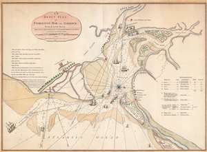
An Exact Plan of Charleston Bar and Harbour From an Actual Survey.
sold
- Digital Map Information
- Suitable for large format printing
- Full resolution TIFF file
- ICC color profile embedded
- Delivered instantly via download link
This is the 1791 Robert Sayer map of Charleston, South Carolina, one of the rarest and best Revolutionary War maps of that city. The map was issued to illustrate the 1776 Battle of Sullivan's Island, the first decisive American victory over the seemingly invincible British Royal Navy - the achievement shocked the world and protected Charleston during a critical early stage of the American Revolution (1775 - 1783). The British did not again attempt to retake the southern colonies until 1778. Moreover, unlike smaller plans by Faden which illustrate only the Attack on Fort Sullivan, this plan provides a detailed account of the British movements throughout the battle and captures significantly more information. (more details)
A rare limited edition serio comic map of Europe just after the outbreak of World War II.
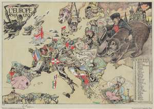
L'Europe en Sept. 1939.
sold
- Digital Map Information
- Suitable for large format printing
- Full resolution TIFF file
- ICC color profile embedded
- Delivered instantly via download link
This is a striking 1939 André Vlaanderen serio-comic map of 'Europe in September 1939' just after the outbreak of World War II - hand colored and signed by the author in a limited release of 150 (this is no. 10). Vlaanderen adopts the serio-comic map genre to convey the violence, chaos, and fear then enveloping Europe. He pays tribute to Fred Rose, the popularizer of the serio-comic map, by drawing Norway and Sweden (Nos. 13 and 14) as dogs, following Rose's 1899 Angling in Troubled Waters. Instead of providing our own explication of this map, we offer Vlaanderen's words in translation from a French version of the accompanying typewritten Dutch text. (more details)
The first printing of the most authoritative and influential map of the siege of the British Legation in Peking (Beijing) during the Boxer Rebellion. Printed in Beijing!
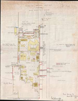
Plan of British Legation Peking shewing defences June to August 1900.
sold
- Digital Map Information
- Suitable for large format printing
- File Size: 6.79 MB
- File Type: ZIP / TIFF
- ICC color profile embedded
- Delivered instantly via download link
An otherwise unobtainable rarity of the utmost historical importance produced in Beijing in the aftermath of the 1900 Boxer Rebellion (Yihetuan Movement, 義和團運動). This is the first, largest, and best official map Beijing's British Legation to illustrate the events of the Boxer Rebellion (1899 - 1901) and the siege of the Legation Quarter.
The map is the product of meticulous on-site surveys and post-siege interviews conducted by British Engineer Henry Edward Colvin Cowie. When the Boxer Rebellion laid siege to the Beijing Legation Quarter, Cowie was drafted from his civilian position with the Indian Public Works Department and sent to Beijing as part of the Bombay Sappers and Miners contingent of the China Relief Expedition. The map was printed on site and bears the Bo. S. and M. (Bombay Sapper's and Miners) imprint, suggesting it was printed with field lithography equipment carried with the Relief Expedition. This is thus the first printing of Cowie's important map and is the source of several subsequent editions which appeared in various influential books and articles on the Boxer Rebellion.
Lithograph signatures of both Lieut. H.E.C. Cowie, and his superior, Lieutenant Colonel George Kenneth Scott-Moncrieff, appear in the lower right. It is also signed in manuscript by Captain Francis Garden Poole (1870 - 1950), an important figure in the defense of the British Legation, this providing the map with an excellent provenance. (more details)
The map is the product of meticulous on-site surveys and post-siege interviews conducted by British Engineer Henry Edward Colvin Cowie. When the Boxer Rebellion laid siege to the Beijing Legation Quarter, Cowie was drafted from his civilian position with the Indian Public Works Department and sent to Beijing as part of the Bombay Sappers and Miners contingent of the China Relief Expedition. The map was printed on site and bears the Bo. S. and M. (Bombay Sapper's and Miners) imprint, suggesting it was printed with field lithography equipment carried with the Relief Expedition. This is thus the first printing of Cowie's important map and is the source of several subsequent editions which appeared in various influential books and articles on the Boxer Rebellion.
Lithograph signatures of both Lieut. H.E.C. Cowie, and his superior, Lieutenant Colonel George Kenneth Scott-Moncrieff, appear in the lower right. It is also signed in manuscript by Captain Francis Garden Poole (1870 - 1950), an important figure in the defense of the British Legation, this providing the map with an excellent provenance. (more details)
The first, best, and earliest map of the Defense of the Legation Quarter during the Boxer Rebellion - original Cyanotype printed in Beijing shortly after the events described.
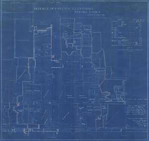
Defence of Foreign Legations, Peking, China, June 20th to Aug. 14th, 1900.
sold
- Digital Map Information
- Suitable for large format printing
- File Size: 26.9 MB
- File Type: ZIP / TIFF
- ICC color profile embedded
- Delivered instantly via download link
A rarity of the utmost historical importance produced in Beijing in the aftermath of the 1900 Boxer Rebellion (Yihetuan Movement, 義和團運動). This is the first, largest, and best official map Beijing's Legation Quarter (Dong Jiaomin Xiang / 東交民巷) to illustrate the events of the Boxer Rebellion (1899 - 1901) and the siege of the Foreign Legations. The map was prepared by the American military engineer Harley Bascom 'Fergie' Ferguson, who was sent to Beijing in 1900 as part of the China Relief Expedition, a multinational emergency force mustered to liberate the besieged legations and suppress the Boxer Rebellion. Produced in cyanotype (blueprint) with Ferguson's own manuscript annotations, this map was issued in miniscule quantities intended only for distribution among military and civilian officials in Beijing – there are only three surviving examples known. Due to the meticulousness and accuracy in illustrating daily progression of the battle, Ferguson's map is today the basis for all subsequent maps of the Legation Quarter's defense. (more details)
Remarkable book with a railroad magnate's appended manuscript maps and annotations relating to the Battle of Gettysburg. Also, an unrecorded early printed map of the Battle of Gettysburg.
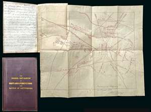
A remarkable discovery, this is a fine example of Michael Jacob's scarce 1864 book on the Confederate invasion of Pennsylvania and the Battle of Gettysburg. While the book itself is uncommon and interesting, the most exciting aspects of the piece are manuscript notes, tipped-in maps, and annotations, by railroad magnate Robert S. Hollins, describing the Battle of Gettysburg and its aftermath. Along with the usual map that accompanies this book, the present example contains additional two tipped-in maps. One a unique manuscript dated to August of 1863, making it one of the earliest known maps of the battle, drawn just days after the conflict. The other is a small but previously unknown printed map of the town and battlefield published by Andrew J. Cross, a clergyman of Baltimore. The extensive manuscript notes, by Baltimore railroad man Robert S. Hollins, describe horse thievery by New Jersey soldiers from Pennsylvania farmers shortly after the battle as well as the acquisition of the maps. (more details)
Only Known Surviving Examples of WWI 'balloonatic' Views.
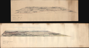
Panoramic View. La Bassee (Canal) to Loos. No 30. Balloon Section. 21:2:1917. / Panoramic View from Q 24a0.0: Lens to Vimy.
sold
- Digital Map Information
- Suitable for large format printing
- Full resolution TIFF file
- ICC color profile embedded
- Delivered instantly via download link
An extraordinary survival, this is a pair of manuscript panoramic views of part of the Western Front in northeastern France during World War I (1914 - 1918). These views were drawn by members of the Royal Naval Air Service and the Royal Flying Corps who rode in baskets beneath hydrogen-filled balloons thousands of feet above the front lines to observe enemy movements and direct artillery fire. Known as kite balloons, these were legitimate military targets, earning the 'balloonatics' had a very high mortality rate. (more details)
First modern map of China.
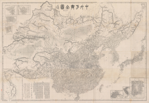
中外方輿全圖 / [Complete Map of China and Neighboring Countries].
sold
- Digital Map Information
- Suitable for large format printing
- File Size: 259.51 MB
- File Type: ZIP / TIFF
- ICC color profile embedded
- Delivered instantly via download link
A remarkable find, this scarce, huge map of China and East Asia was prepared in 1894 by Kishida Ginkō at the start of the First Sino-Japanese War (1894 - 1895). This is Kishida's masterwork, being his largest and most detailed map, significant on many levels. It is the first modern map of China, a sophisticated composite of Western and Chinese maps augmented by Kishida's own survey work. When issued, it was the largest, most accurate, and most comprehensive map of China and East Asia. As the best regional map of its period, this work's influence on both the First Sino-Japanese War and its aftermath cannot be overstated. In all, the map marks a transformative moment in East Asian history, upending the traditional Sino-centric order and establishing Japan as a world power. (more details)
Nazi General's presentation atlas of Operation Barbarossa - before it all went to hell.
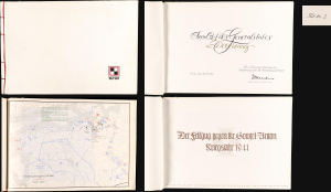
Der Feldzug gegen die Sowiet-Union / Kriegsjahr 1941 / Bearbeitet in der Führungsabteilung des Oberkommandos der Heeresgruppe Nord.
sold
A proof-state white-kid-bound 1941 World War II German general's presentation atlas, here in its only known example, chronicling the first 6 months of Operation Barbarossa. It was lavishly published on Christmas Eve 1941 by the General Staff of Army Group North as a gift to members of Army Group North's General Staff participating in the invasion. This atlas appeared at a high point in the Nazi campaign to conquer the Soviet Union, and the bravado that accompanied their early successes is evident. The present example, 'proof no. 2', is the only known surviving copy. (more details)
Unabashed Japanese ambitions in WWI.
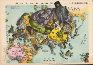
The Illustration of the Graet European War. No. 16. A Humoros Atlas of the World. / 歐洲大戰亂畫報(其十六)滑稽欧亜外交地図.
sold
- Digital Map Information
- Suitable for large format printing
- File Size: 28.45 MB
- File Type: ZIP / TIFF
- ICC color profile embedded
- Delivered instantly via download link
An exceptional September 13, 1914, Japanese serio-comic map of Asia and Europe at the outbreak of World War I. The masterfully drawn chromolithograph map unabashedly illustrates Japanese aspirations to exploit the war in Europe, with underpinning elements of cultural supremacy, imperial ambitions towards China, concern over but contempt for Russia, and grudging respect towards the United States. (more details)
Eccentric genius cryptanalysist L. D. Callimahos' pedagogical puzzle, 'The Zendian Problem,' representing a 'Top Secret' proxy war game anticipating the invasion of Cuba.
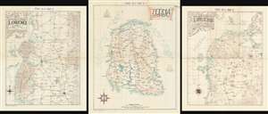
Zendia Respubliko (ASAS 60-2 MAP A)/ Norda Parto de la Provinco Loreno (ASAS 60-2 MAP B)/ Centra Parto de la Provinco Loreno (ASAS 60-2 MAP C).
sold
These three maps are extraordinary relics of a top-secret (now declassified) U.S. Army Cold War program to train code-breakers and invade Cuba, devised by the flamboyant maverick genius cryptanalyst Lambros D. Callimahos. Here in the only known surviving examples, this is a set of three, undated maps of the fantasy nemesis Republic of Zendia, with the northern part, and the central part of the Zendian province of Loreno. It has been argued, by Charles Varga and others, that Zendia is a proxy of the Isle of Pines (Cuba), and that the 'Zendian Problem', as it was known, was a training exercise for the 1961 Cold War invasion of Cuba (see below). (more details)
Propaganda from both sides of the Vietnam War.
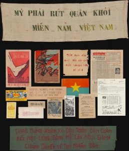
This is an extraordinary archive of Vietnam War (1955 - 1975) propaganda from the estate of Major General Ira A. Hunt Jr. It is a comprehensive retrospective on the propaganda produced by both sides of the long and nuanced war. The collection includes 41 items ranging from Viet Cong produced anti-American pieces to propaganda distributed among the Viet Cong by American Psychological Operations (PSYOPS). (more details)
Japanese war propaganda.
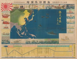
海國日本圖繪 紀元二千六百年紀念 / [Depiction of Maritime Japan, to Commemorate the 2600th Anniversary of the Imperial Family].
sold
- Digital Map Information
- Suitable for large format printing
- File Size: 477.31 MB
- File Type: ZIP / TIFF
- ICC color profile embedded
- Delivered instantly via download link
A rare, huge, and brilliantly-colored propaganda work issued by the Imperial Japanese Navy (IJN) on the eve of the Pearl Harbor attack, this 1940 map celebrates the history of Japan's maritime ventures and the strength of the IJN. It also celebrates the 2600th anniversary of the Japanese imperial family that year, which was accompanied by an outpouring of hypernationalist propaganda. (more details)
The Civil War - big and bold.
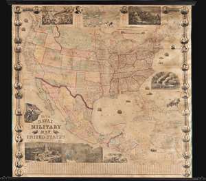
This is a rare 1863 wall map of the United States at the height of the American Civil War (1861 - 1865). The map was issued by John Calvin Smith and Robert Persall Smith during the Civil War to capitalize on general interest in the war among the northern elite. At roughly 70 inches square, this enormous and lavishly produced map covers all of the United States and Mexico. The early state and territory configuration includes the ephemeral Confederate State of Arizona. It is surrounded by images of Union officers and politicians - including Lincoln, Fremont, Wilkes, and Scott. Curiously, these do not include General Grant, as the map's publication in early January of 1863 predates his assumption of overall command on January 29, 1863. The map features multiple vignette scenes including the victory of the Monitor over the Merrimac, the allegorical 'Rescue of the Union', an illustration of 'Camp Life', the Capitol building in Washington, and an overview of the 'Birth of the Union' at Bunker Hill. Of note, the Pacific Telegraph Route is noted running parallel to the Pony Express Route, which is also illustrated. (more details)
A previously undiscovered Japanese Serio-Comic Map! Possibly the first!
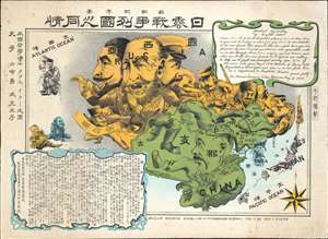
New Commemorative Print of Various Countries Sympathies in the Russo Japanese War. / 崭新纪念画 日露戰爭列國义同情
sold
- Digital Map Information
- Suitable for large format printing
- Full resolution TIFF file
- ICC color profile embedded
- Delivered instantly via download link
The only known example of a 1904 (Meiji 37) Japanese serio-comic style map of Asia illustrating foreign perspectives on the Russo-Japanese War (1904 - 1905). Although previously unknown, if the May 3rd 1904 date is to be believed, this is the second Japanese serio-comic map in the Russo-Japanese War series. The map covers all of Asia and although it does not include Europe, illustrates several western European powers, including France, England, and Germany. (more details)
Resplendent primary-source manuscript illustrating the Kandahar theater fo the First Anglo-Afghan War.
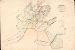
Districts of Kundahar 1840.
sold
- Digital Map Information
- Suitable for large format printing
- DPI: 600
- File Size: 26.75 MB
- File Type: ZIP / TIFF
- ICC color profile embedded
- Delivered instantly via download link
An exquisitely drafted manuscript map of the Kandahar Region, Afghanistan, during the First Anglo-Afghan War (1839 - 1942). Resplendently drafted and colored by the Indian Quartermaster General's Office (QMG), the map incorporates traditional Bengali handmade inks. During this conflict, Kandahar was the most important British base in Afghanistan, and the surrounding region was a theater of fierce and constantly evolving guerrilla war. The present map is the result of direct field mapping, completed under onerous war-footing, yet nonetheless represents one of the earliest broadly accurate maps of the Kandahar region. The map is roughly centered on the city of Kandahar and presents a stellar overview of the surrounding region, extending from Girishk and the Helmand Valley, in the west, to Qalati Giliji, in the east, covering parts of the modern Afghan provinces of Helmand, Kandahar, Uruzgan and Zabol. It is, moreover, one of very few surviving original manuscript maps from First Anglo-Afghan War, the first (not the last) major western foray into Afghanistan. (more details)
The only known example of Japan's second Serio-Comic map.
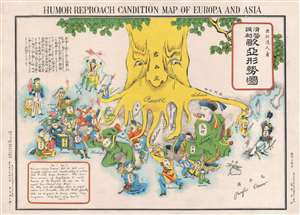
Humor Reproach Candition Map of Europa and Asia. / 滑稽諷刺歐亞形勢圖
sold
- Digital Map Information
- Suitable for large format printing
- File Size: 6.6 MB
- File Type: ZIP / TIFF
- ICC color profile embedded
- Delivered instantly via download link
A previously unknown Meiji 37 or 1904 Japanese broadsheet serio-comic map relating to the Russo-Japanese War. This map was issued in May 28 of 1904, immediately following Japan's successful siege and bombardment Russian held Port Arthur (Dalian). Of the four Japanese serio-comic maps associated with the Russo-Japanese war, this is the second, predated only by Kisaburō Ohara's April 1904 A Humorous Diplomatic Atlas of Europe and Asia. (more details)
Turning Point of the Civil War.
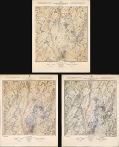
Map of the Battle Field of Gettysburg. July 1st, 2nd, 3rd 1863. First Day's Battle / Second Day's Battle / Third Day's Battle.
sold
- Digital Map Information
- Suitable for large format printing
- Full resolution TIFF file
- ICC color profile embedded
- Delivered instantly via download link
This is John Badger Bachelder's foundational 1876 set of three large-format maps of the Battle of Gettysburg, the definitive turning point of the American Civil War (1861 - 1865). Bachelder had dedicated much of the 13 years since the battle had taken place to researching it, making him the foremost authority on it, resulting in these maps being the definitive contemporaneous account. (more details)
The only known example of Japan's second Serio-Comic map.
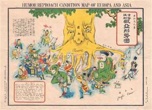
Humor Reproach Candition Map of Europa and Asia. / 滑稽諷刺歐亞形勢圖
sold
- Digital Map Information
- Suitable for large format printing
- File Size: 7.78 MB
- File Type: ZIP / TIFF
- ICC color profile embedded
- Delivered instantly via download link
A previously unknown Meiji 37 or 1904 Japanese broadsheet serio-comic map relating to the Russo-Japanese War. This map was issued in May 28 of 1904, immediately following Japan's successful siege and bombardment Russian held Port Arthur (Dalian). Of the four Japanese serio-comic maps associated with the Russo-Japanese war, this is the second, predated only by Kisaburō Ohara's April 1904 A Humorous Diplomatic Atlas of Europe and Asia. (more details)
Extraordinary manuscript satirical map of Europe during World War II with Chinese Text.
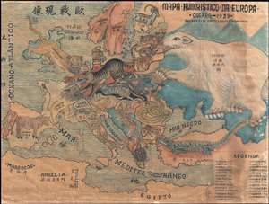
Mapa Humoristico Da Europa - Guerra - 1939 / 歐戰现像
sold
- Digital Map Information
- Suitable for large format printing
- File Size: 8.5 MB
- File Type: ZIP / TIFF
- ICC color profile embedded
- Delivered instantly via download link
An exceptional zoomorphic satirical map of Europe in 1939, here in manuscript form with all text translated into Chinese. This map is based upon a map drawn by the artist António Soares and published by Livraria Franco just weeks after the October 1939 outbreak ... (more details)
Pre-invasion manuscript planning map of Guadalcanal - a decisive WWII battle.
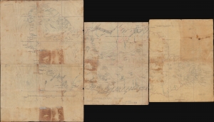
Guadalcanal Island.
sold
- Digital Map Information
- Suitable for large format printing
- Full resolution TIFF file
- ICC color profile embedded
- Delivered instantly via download link
This is a 1942 four-sheet manuscript World War II map of Guadalcanal, Solomon Islands, prepared ship-board in anticipation of the decisive August 7, 1942, landing on Guadalcanal that began the Guadalcanal Campaign. It is one of the few surviving maps from the ad hoc Marine effort to gather critical reconnaissance on Guadalcanal days before the impending invasion. It is thus unique record of one of the most decisive and pivotal battles in the World War II (1939 - 1945) Pacific Theater. (more details)
Manuscript notations tracing the battle from the landings to the final day.
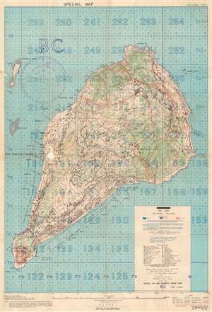
Iwo Jima Volcano Islands.
sold
- Digital Map Information
- Suitable for large format printing
- File Size: 43.45 MB
- File Type: ZIP / TIFF
- ICC color profile embedded
- Delivered instantly via download link
This is a 1944 U.S. Navy map of Iwo Jima. Depicting the entirety of the island, Iwo Jima's terrain is illustrated in detail, with contour lines emphasizing changes in elevation while color highlights changes in vegetation. Both airfields are identified and thirty-four symbols mark locations of Japanese positions, including pillboxes, radar, anti-tank guns, and machine guns. Unfortunately for the Marines landing on Iwo Jima, these installations were identified in November 1944, three months before the invasion in February 1945, meaning that this map is likely inaccurate. The invasion beaches are noted along the southern coasts of the island and their codenames, including Yellow 1 and Yellow 2, are provided. A grid meant to be used for directing airstrikes, artillery fire, and bombardment from naval vessels is superimposed over the entire map and instructions for how to direct this fire are provided. (more details)
The most iconic view of the Battle of Gettysburg.
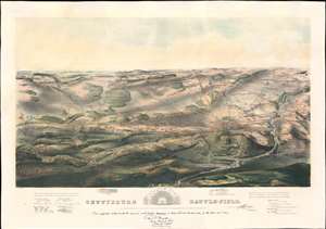
Gettysburg Battle-Field.
sold
- Digital Map Information
- Suitable for large format printing
- File Size: 43.53 MB
- File Type: ZIP / TIFF
- ICC color profile embedded
- Delivered instantly via download link
A remarkable and scarce 1863 proof state of the most iconic view of the American Civil War Battle of Gettysburg printed. This bird's eye view of the Battle of Gettysburg was issued by John Bachelder just months after the actual event. Within days of the battle, Bachelder arrived in Gettysburg where he spent the subsequent 84 days completing a meticulous study of both the battle and the battlefield. Bachelder walked the field daily, interviewed thousands of recovering soldiers on both sides, both commanders and enlisted men, and reconstructed all three days of the battle. (more details)
The most iconic view of the Battle of Gettysburg.
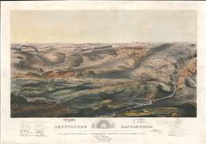
Gettysburg Battle-Field.
sold
- Digital Map Information
- Suitable for large format printing
- File Size: 48.93 MB
- File Type: ZIP / TIFF
- ICC color profile embedded
- Delivered instantly via download link
A remarkable and scarce 1863 proof state of the most iconic view of the American Civil War Battle of Gettysburg printed. This bird's-eye view of the Battle of Gettysburg was issued by John Bachelder just months after the actual event. Within days of the battle, Bachelder arrived in Gettysburg where he spent the subsequent 84 days completing a meticulous study of both the battle and the battlefield. Bachelder walked the field daily, interviewed thousands of recovering soldiers on both sides, both commanders and enlisted men, and reconstructed all three days of the battle. (more details)
One of only 2 Japanese serio-comic maps illustrating World War I.
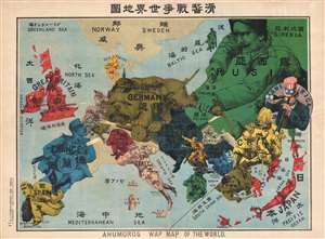
Kokkei Sensou Sekai Chizu. / Ahumoros Wap Map of the World. / 滑馨戰争世界地圖
sold
- Digital Map Information
- Suitable for large format printing
- File Size: 17.14 MB
- File Type: ZIP / TIFF
- ICC color profile embedded
- Delivered instantly via download link
A very rare Japanese broadsheet serio-comic map of Europe and Asia drawn just following the outbreak of World War I. This map was drawn by Ryōzō Tanaka and published by the Shobido Company of Tokyo. The map covers all of Europe and parts of East Asia. All ... (more details)
An original manuscript map detailing events during the first year of the Russo-Turkish War of 1735-1739 - most likely the template for several reduced atlas maps.
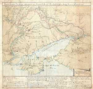
General-Carten der Kriegs Operationen am Donn und Dnieper, Irho Rußish Kayßerl: Merijl: Glorieusen Armée Ao. 1736.
sold
- Digital Map Information
- Suitable for large format printing
- DPI: 300
- File Size: 20.4 MB
- File Type: ZIP / TIFF
- ICC color profile embedded
- Delivered instantly via download link
This is the original 1736 manuscript map of Ukraine and the Crimean Peninsula that inspired reduced atlas editions by Joseph Nicolas de L'Isle and Matthäus Seutter, among others, and illustrates the events of the first year of the Russo-Turkish War of ... (more details)