
Mercator, Gerard (sold)
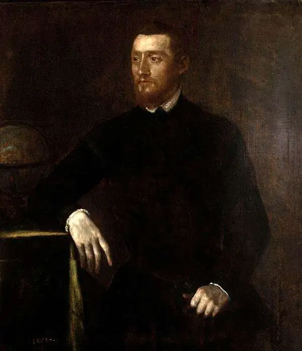
Gerard Mercator (March 5, 1512 - December 2, 1594) is a seminal figure in the history of cartography. Mercator was born near Antwerp as Gerard de Cremere in Rupelmonde. He studied Latin, mathematics, and religion in Rupelmonde before his Uncle, Gisbert, a priest, arranged for him to be sent to Hertogenbosch to study under the Brothers of the Common Life. There he was taught by the celebrated Dutch humanist Georgius Macropedius (Joris van Lanckvelt; April 1487 - July 1558). It was there that he changed him name, adapting the Latin term for 'Merchant', that is 'Mercator'. He went on to study at the University of Louvain. After some time, he left Louvain to travel extensively, but returned in 1534 to study mathematics under Gemma Frisius (1508 - 1555). He produced his first world map in 1538 - notable as being the first to represent North America stretching from the Arctic to the southern polar regions. This impressive work earned him the patronage of the Emperor Charles V, for whom along with Van der Heyden and Gemma Frisius, he constructed a terrestrial globe. He then produced an important 1541 globe - the first to offer rhumb lines. Despite growing fame and imperial patronage, Mercator was accused of heresy and in 1552. His accusations were partially due to his Protestant faith, and partly due to his travels, which aroused suspicion. After being released from prison with the support of the University of Louvain, he resumed his cartographic work. It was during this period that he became a close fried to English polymath John Dee (1527 - 1609), who arrived in Louvain in 1548, and with whom Mercator maintained a lifelong correspondence. In 1552, Mercator set himself up as a cartographer in Duisburg and began work on his revised edition of Ptolemy's Geographia. He also taught mathematics in Duisburg from 1559 to 1562. In 1564, he became the Court Cosmographer to Duke Wilhelm of Cleve. During this period, he began to perfect the novel projection for which he is best remembered. The 'Mercator Projection' was first used in 1569 for a massive world map on 18 sheets. On May 5, 1590 Mercator had a stroke which left him paralyzed on his left side. He slowly recovered but suffered frustration at his inability to continue making maps. By 1592, he recovered enough that he was able to work again but by that time he was losing his vision. He had a second stroke near the end of 1593, after which he briefly lost speech. He recovered some power of speech before a third stroke marked his end. Following Mercator's death his descendants, particularly his youngest son Rumold (1541 - December 31, 1599) completed many of his maps and in 1595, published his Atlas. Nonetheless, lacking their father's drive and genius, the firm but languished under heavy competition from Abraham Ortelius. It was not until Mercator's plates were purchased and republished (Mercator / Hondius) by Henricus Hondius II (1597 - 1651) and Jan Jansson (1588 - 1664) that his position as the preeminent cartographer of the age was re-established.
First Modern Atlas Map of the British Isles in its First State.
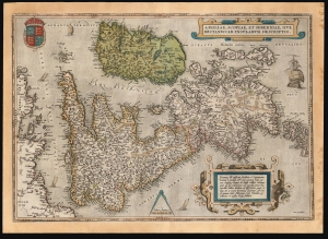
Angliae, Scotiae, et Hiberniae, Sive Britannicar: Insularum Descriptio.
sold
- Digital Map Information
- Suitable for large format printing
- Full resolution TIFF file
- ICC color profile embedded
- Delivered instantly via download link
This is Abraham Ortelius' 1570 map of the British Isles, the first atlas map of the British Isles, in a handsome example of the first state of the map, printed in 1571. (more details)
Silk Road Caravans and Caspian Sturgeon
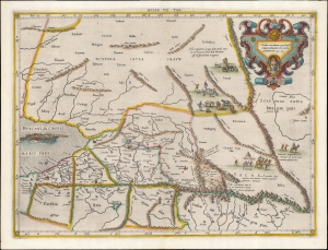
Asiae VII Tab.
sold
- Digital Map Information
- Suitable for large format printing
- DPI: 600
- File Size: 36.51 MB
- File Type: ZIP / TIFF
- ICC color profile embedded
- Delivered instantly via download link
This is an edition of Gerard Mercator's superb Ptolemaic map of central Asia and the Silk Road. The seventh Asian map from Ptolemy's Geography, it depicts the lands in Central Asia, east of the Caspian Sea. These were occupied in the 1st and 2nd centuries CE by the Sogdiana, an ancient Iranian civilization that at different times included territory located in present-day Kazakhstan, Tajikistan, and Uzbekistan. To the north are shown the lands of the nomadic Scythians. (more details)
Superb example of the most finely-engraved Ptolemy, with beautiful original color.
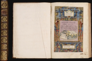
Cl Ptolemaei Alexandrini Geographiae libri octo: recognitiiam diligenter emendati cum tabulis geographicis ad mentem auctoris restitutis ac emendatis, per Gerardum Mercatorem.
sold
This is a superb example of Gerard Mercator's Cl Ptolemaei Alexandrini Geographiae Libri Octo: the 1584 first edition of the full proto-atlas, featuring Willibald Pirckheimer's translation of Claudius Ptolemy's text edited by Arnold Mylius, accompanied by 28 maps in rich, original color. Moreover, the present volume is bound with Mercator's contemporary atlas of France and the Low Countries, Galliae Tabule Geographicae. These volumes were probably joined in the 18th century when this volume was bound. The book thus presents Mercator's earliest published books in a superb, unique example. It is one of the few of Mercator's books to be published in his lifetime. (more details)
Most finely-engraved Ptolemaic map of Arabia.
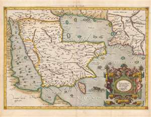
Asiae VI Tab.
sold
- Digital Map Information
- Suitable for large format printing
- Full resolution TIFF file
- ICC color profile embedded
- Delivered instantly via download link
This is Gerard Mercator's map of the Arabian Peninsula, based on the second-century mapping of Claudius Ptolemy (c. 100 - 170), the progenitor of modern geography. Mercator executed this map for his 1578 Duisberg edition of Ptolemy's Geographia, intended to be the definitive edition of that foundational work. (more details)
One of the earliest issues of Mercator's Asia.
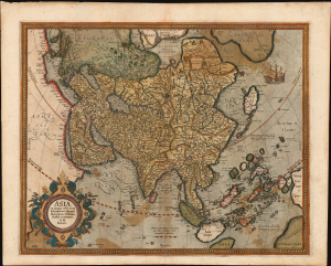
Asia ex magna orbis terre. descriptione Gerardi Mercatoris desumpta studio et industria G. M. Iunioris.
sold
- Digital Map Information
- Suitable for large format printing
- Full resolution TIFF file
- ICC color profile embedded
- Delivered instantly via download link
This is an original color, early example of Gerard Mercator's 1595 map of Asia, the second map of the continent to appear in an atlas. It presents Asia as it was understood at the beginning of the Dutch effort to extend power into the Spice Islands, and at the dawn of the drive to discover alternative routes to the East Indies that would bypass the Portuguese stranglehold on the Asia trade. This map exhibits a fine early strike, with strong, clear lines and bold paper/ink contrast. (more details)
Influential mapping of Africa, in its first state, by 'The Ptolemy of His Age'.
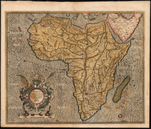
Africa Ex magnus orbis terre descriptione Gerardi Mercatoris desumpta. Studio and industria G.M. Iunioris.
sold
- Digital Map Information
- Suitable for large format printing
- Full resolution TIFF file
- ICC color profile embedded
- Delivered instantly via download link
This is the 1595 first edition of Gerard Mercator's map of Africa - a classic, early Dutch depiction of the continent derived from Gerard Mercator's 1569 wall map of the world. It was engraved by the illustrious Gerard's grandson, Gerard the Younger, whose command of the engravers' craft is brilliantly apparent. (more details)
Only America map of the Mercator Atlas.
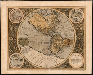
America, siue, India Nova : ad magnae Gerardi Mercatoris aui vniversalis imitationem in compendium redacta.
sold
- Digital Map Information
- Suitable for large format printing
- Full resolution TIFF file
- ICC color profile embedded
- Delivered instantly via download link
This is Mercator's 1595 America, one of the most visually arresting maps of the Western Hemisphere. It is the only map of America to appear in an atlas directly connected to the great Gerard Mercator, here in a first Atlas edition of 1595. (more details)
First edition Mercator Asia.
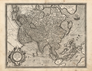
Asia ex magna orbis terre. descriptione Gerardi Mercatoris desumpta studio et industria G. M. Iunioris.
sold
- Digital Map Information
- Suitable for large format printing
- Full resolution TIFF file
- ICC color profile embedded
- Delivered instantly via download link
This is a fine first edition example of Gerard Mercator's 1595 map of Asia, the second map of the continent to appear in an atlas. It presents Asia as it was understood at the beginning of the Dutch effort to extend power into the Spice Islands, and at the dawn of the drive to discover alternative routes to the East Indies that would bypass the Portuguese stranglehold on the Asia trade. This map exhibits a fine early strike, with strong clear lines and bold paper/ink contrast. (more details)
First edition of Mercator's Map of Denmark.
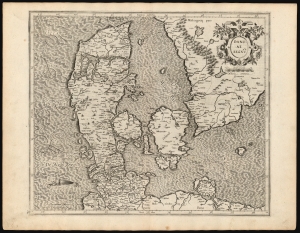
Daniae Regnū.
sold
- Digital Map Information
- Suitable for large format printing
- DPI: 600
- File Size: 56.73 MB
- File Type: ZIP / TIFF
- ICC color profile embedded
- Delivered instantly via download link
This is a superb example of Gerard Mercator's 1595 map of the kingdom of Denmark, in its first edition. It shows the kingdom during the prosperous 16th century, during which it controlled both sides of the entrance to the Baltic Sea. (more details)
First Atlas Issue of the Map of Europe by the Premier Mapmaker of his Age
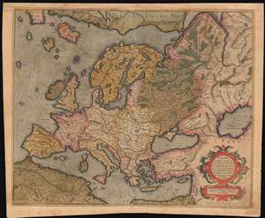
Europa, ad magnae Europae Gerardi Mercatoris P. imitationem, Rumoldi Mercatoris F. cura edita, servato tamen initio longitudinis ex ratione magnetis, quod Pater in magna sua universali posuit.
sold
- Digital Map Information
- Suitable for large format printing
- DPI: 600
- File Size: 24.98 MB
- File Type: ZIP / TIFF
- ICC color profile embedded
- Delivered instantly via download link
The 1595 first atlas issue of Mercator's general map of Europe. It appeared in his Atlas Sive Cosmographia, published in Duisberg. The map's geography is drawn from Mercator's wall map - likely not his lost 1554 Europe, but his 1569 World map. This map includes the ... (more details)
Mercator's Europe, Updated with Zeno's Revelations.
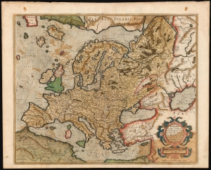
Europa, ad magnae Europae Gerardi Mercatoris P. imitationem, Rumoldi Mercatoris F. cura edita, servato tamen initio longitudinis ex ratione magnetis, quod Pater in magna sua universali posuit.
sold
- Digital Map Information
- Suitable for large format printing
- Full resolution TIFF file
- ICC color profile embedded
- Delivered instantly via download link
This is the 1595 first atlas edition of Gerard Mercator's map of Europe. It also Mercator's mapping of Muscovy, Tartary, and the distant north of Europe. The map reaches east beyond the River Ob and the Caspian Sea; it encompasses the Mediterranean Sea and reaches north to Mercator's theorized Arctic islands. (more details)
Mercator's Europe, Updated with Zeno's Revelations.
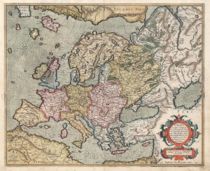
Europa, ad magnae Europae Gerardi Mercatoris P. imitationem, Rumoldi Mercatoris F. cura edita, servato tamen initio longitudinis ex ratione magnetis, quod Pater in magna sua universali posuit.
sold
- Digital Map Information
- Suitable for large format printing
- Full resolution TIFF file
- ICC color profile embedded
- Delivered instantly via download link
This is the 1595 first atlas edition of Gerard Mercator's map of Europe. It also Mercator's mapping of Muscovy, Tartary, and the distant north of Europe. The map reaches east beyond the River Ob and the Caspian Sea; it encompasses the Mediterranean Sea and reaches north to Mercator's theorized Arctic islands. (more details)
First edition of the the second map of Iceland based on local information.
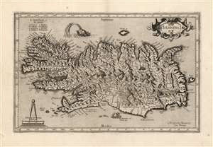
Islandia.
sold
- Digital Map Information
- Suitable for large format printing
- Full resolution TIFF file
- ICC color profile embedded
- Delivered instantly via download link
This is a beautiful strike of Gerhard Mercator's map of Iceland, in a beautiful 1595 first edition example. It is the second map of Iceland to appear in a modern atlas, and the second map overall of Iceland based on data originating from an Icelander, placing it among the first accurate maps of the island. Mercator's map first appeared in 1595, only five years after Abraham Ortelius' famous map; both maps shared the same ultimate source: Guðbrandur Þorláksson, Bishop of Holar. (more details)
First map specifically of the Grand Duchy of Lithuania.
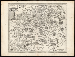
Lithuania.
sold
- Digital Map Information
- Suitable for large format printing
- DPI: 600
- File Size: 46.98 MB
- File Type: ZIP / TIFF
- ICC color profile embedded
- Delivered instantly via download link
This is a superb example of Gerard Mercator's 1595 map of the Grand Duchy of Lithuania, the first issue of the first map dedicated specifically to Lithuania. (more details)
Battle for the Baltic.
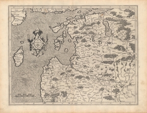
Livonia.
sold
- Digital Map Information
- Suitable for large format printing
- Full resolution TIFF file
- ICC color profile embedded
- Delivered instantly via download link
A beautifully engraved 1595 map of Livonia (modern-day Latvia and Estonia) that appeared in Gerardus Mercator's Atlas. It was published in the wake of a long conflict, known as the Livonian War (1558 - 1583), which drew in the nearby powers of Poland-Lithuania, Sweden, and Denmark-Norway, to prevent a Russian takeover of the region. (more details)
The foundation for the seventeenth century mapping of Russia.
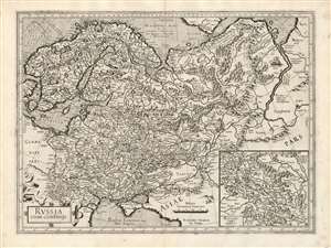
Russia cum confinijs.
sold
- Digital Map Information
- Suitable for large format printing
- Full resolution TIFF file
- ICC color profile embedded
- Delivered instantly via download link
This is a fine example of Gerard Mercator's first map of Russia, in its first atlas edition of 1595. It is overall the second atlas map of Russia, following the 1570 Ortelius, and is in virtually every respect superior to that precursor. Its detail set the standard for maps of Russia, to the extent that Tsarevich Fyodor Godunov would base his own map on it - and his map provided the basis for the maps of Hessel Gerritz and Isaac Massa, which would dominate the 17th century. (more details)
First edition of the most accurate map of Scandinavia of its day.
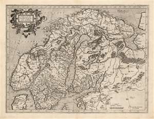
Suecia Et Norvegia cum confinijs.
sold
- Digital Map Information
- Suitable for large format printing
- Full resolution TIFF file
- ICC color profile embedded
- Delivered instantly via download link
This is a superb example of the 1595 first atlas edition of Gerard Mercator's map of Scandinavia. Among the maps of the north parts of Europe produced in the sixteenth century, this is the first to focus narrowly on Scandinavia. Ginsberg, typically laconic in praise, notes that the map 'gave the Scandinavian peninsula its correct form' and 'became the model for nearly all subsequent maps of Scandinavia.' This basic model would stand until supplanted in the mid-seventeenth century by the work of Anders Bure. (more details)
Setting a New Standard for Scottish Geography.
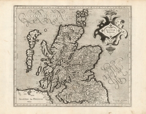
Scotia, Regnum.
sold
- Digital Map Information
- Suitable for large format printing
- Full resolution TIFF file
- ICC color profile embedded
- Delivered instantly via download link
This is a superb 1595 first-edition of Gerard Mercator's map of Scotland. It is the second printed map specifically of Scotland to appear in an atlas, the first being the 1573 Ortelius Scotiae Tabula. This present map, however, replaced all earlier representations of Scotland. Rodney Shirley observed that 'this was to remain the standard outline, apart from minor improvements by Speed, until a new map of Scotland by Robert Gordon was published in 1654'. (more details)
First atlas issue of Mercator's map of the lands of the Crimean Tatars.
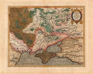
Taurica Chersonesus. Nostra aetate Przecopsca et Gazara dicitur.
sold
- Digital Map Information
- Suitable for large format printing
- Full resolution TIFF file
- ICC color profile embedded
- Delivered instantly via download link
This is the 1595 first state of Mercator's map of the Crimea, still known to geographers by its Ptolemaic name of Taurica Chersonesus. The engraving is bold and sharp - a product of the youth of the copperplate - and the rich hand color has aged to an attractive patina. Many recognizable place names can be found on this detailed map, including Moscow, Smolensk, Kiev, and Chernobyl. The primary focus of this map, however, is Russia’s extremely fluid southeastern border with the Crimean Tatars. The border garrisons of Ryazan (Rezan on the map) and the Crimea suffered yearly assaults from the steppes. Moscow’s response – the annual raising of an army of tens of thousands to patrol this border – was instrumental in developing the centralized power of the Tsar in the 16th and 17th centuries. (more details)
First edition of Mercator's British Isles.
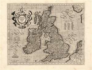
Anglia, Scotia et Hibernia.
sold
- Digital Map Information
- Suitable for large format printing
- Full resolution TIFF file
- ICC color profile embedded
- Delivered instantly via download link
This is a superb example of the 1595 first atlas edition of Gerard Mercator's map of the British Isles, the definitive map of the British Isles for many subsequent decades. (more details)
Anglesey, Wight and the Channel Islands from Contemporary Sources.
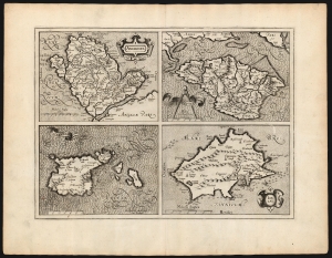
Anglesey/ Wight Vectis olim/ Garnesay/ Jarsey.
sold
- Digital Map Information
- Suitable for large format printing
- DPI: 600
- File Size: 53 MB
- File Type: ZIP / TIFF
- ICC color profile embedded
- Delivered instantly via download link
This is the 1595 first edition of Gerard Mercator's map of the Isle of Wight, Anglesey, Guernsey and Jersey. It was the first map to provide detailed focus on these islands to appear in a general atlas. All four maps are sharply detailed, with towns and topography indicated throughout; each individual map is provided its own scale, and each is titled within an elegant cartouche. The seas around Anglesey and Jersey are stippled, while those around Wight and Guernsey are hachured: the composition overall thus gives a pleasing checkerboard effect. (more details)
First acquirable Mercator World Map.
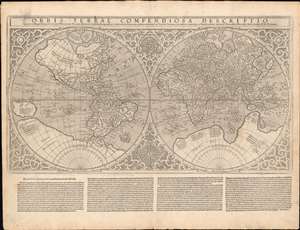
Orbis Terrae Compendiosa Descriptio...
sold
- Digital Map Information
- Suitable for large format printing
- Full resolution TIFF file
- ICC color profile embedded
- Delivered instantly via download link
This is Gerard and Rumold Mercator's 1587 double-hemisphere map of the world, in a handsome, untrimmed example in its first atlas edition. It is the only acquirable world map directly associated with the elder Mercator (his 1578 world map depicts only Ptolemaic knowledge). The map was executed by Gerard Mercator's son, Rumold, using a novel double-hemisphere format rather than his father's famous projection. The complex mathematics used to make the Mercator Projection may well have overtaxed Rumold's abilities - although it seems likely that the elder Mercator would have at least had some role in the production of this work: he was alive when it was completed and made its appearance in the 1587 Strabo. Whatever the reason for this decision, Maps using the Mercator Projection would not appear again for many years, but even so, the elder geographer's stamp is undeniable. (more details)
Reformation and Revolution.
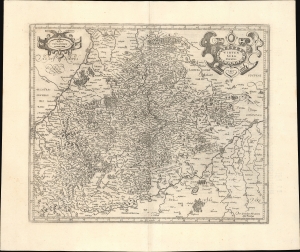
Wirtenberg Ducatus.
sold
- Digital Map Information
- Suitable for large format printing
- Full resolution TIFF file
- ICC color profile embedded
- Delivered instantly via download link
This is a c. 1595 Gerard Mercator first edition, first state map of the Duchy of Württemberg in today's Germany. (more details)
Foundational map of Scotland.

Scotiae regnum.
sold
- Digital Map Information
- Suitable for large format printing
- Full resolution TIFF file
- ICC color profile embedded
- Delivered instantly via download link
This is a superb 1595 first-edition of Gerard Mercator's 2-sheet map of Scotland. Mercator's mapping replaced all earlier representations of Scotland, and while the details of Mercator's single-sheet Scotia Regnum agree with this one, the greater area afforded this two-sheet map permit the inclusion of much more detail. So while this and the smaller map clearly share the same source, the present work was able to present its information in the most complete form of what Rodney Shirley would declare, 'this was to remain the standard outline, apart from minor improvements by Speed, until a new map of Scotland by Robert Gordon was published in 1654'. (more details)
Ireland in at the time of the Nine Year's War.
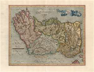
Irelandia regnum.
sold
- Digital Map Information
- Suitable for large format printing
- DPI: 600
- File Size: 32.34 MB
- File Type: ZIP / TIFF
- ICC color profile embedded
- Delivered instantly via download link
This is a very attractive 1595 map of Ireland by Gerard Mercator. It is one of the earliest maps of Ireland, only the second to appear in an atlas. It is Mercator's first map of the island. Oriented to the west, the map covers the Emerald Isle in considerable detail, noting numerous towns, rivers, lakes, forests, mountains and a host of additional topographic features. Mountains and forests are beautifully rendered in profile. The map divides Ireland into the four provinces of Ulster, Connaught, Leinster and Munster. (more details)
Couching modern geography in a Christian context.
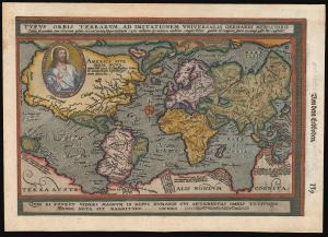
Typus Orbis Terrarum, ad Imitationem Universalis Gerhardi Mercatoris.
sold
- Digital Map Information
- Suitable for large format printing
- File Size: 8.18 MB
- File Type: ZIP / TIFF
- ICC color profile embedded
- Delivered instantly via download link
This is an attractive example of Matthias Quad's 1596 map of the world, modeled on Mercator's 1569 wall map. Quad's reduction is one of the first maps to use the projection bearing Mercator's name, and of these, it is the one that does so the most precisely. In addition, Quad's map relates to Abraham Ortelius' world map by using at the bottom the Latin quotation from Cicero, similarly decorating Ortelius' work: 'For what can seem important in human affairs to someone who is aware of all eternity and the size of the whole world?' Quad has also added the image of Christ in a medallion in the upper left quadrant of the map, bearing the Latin legend 'Our Lord Jesus Christ the founder, redeemer and future judge of the whole world'. (more details)
One of the Earliest Maps on the Mercator Projection.
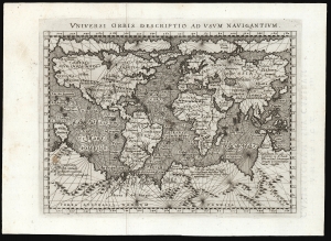
Universi Orbis Descriptio Ad Usum Navigantium.
sold
- Digital Map Information
- Suitable for large format printing
- Full resolution TIFF file
- ICC color profile embedded
- Delivered instantly via download link
This beautifully engraved world map is the 1596 first edition of Giovanni Magini's reduction of Mercator's 1569 world wall map. It is among the first commercial maps not by Mercator himself to employ the projection. (more details)
Capturing the Geography of the Virtually Unobtainable First State Mercator Arctic.
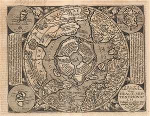
Polus Arcticus sive Tractus Septentrionalis.
sold
- Digital Map Information
- Suitable for large format printing
- DPI: 600
- File Size: 19.18 MB
- File Type: ZIP / TIFF
- ICC color profile embedded
- Delivered instantly via download link
This is a scarce 1600 Matthias Quad map of the Arctic, a beautifully engraved reduction of Gerard Mercator's seminal 1595 Septentrionalium Terrarum descriptio. The timing of the engraving is of great importance: Quad's model was not the relatively ubiquitous 1606 edited version of Mercator's map, but the extremely rare 1595 first state. Although the smaller size of Quad's copperplate necessitated the excision of some place names in Greenland, Norway and Russia, the central Arctic details of the map are very faithfully preserved from the Mercator original - thus making a virtually unobtainable map's cartography available to the more casual collector. Despite the flaws of many of Mercator's sources, his map (and Quad's faithful rendition of it here) presents a fascinating portrait of the best 16th century European conceptualization of the north parts of the world. (more details)
Important early map of Mexico.

Hispaniae Novae Nova Descriptio.
sold
- Digital Map Information
- Suitable for large format printing
- DPI: 300
- File Size: 12.49 MB
- File Type: ZIP / TIFF
- ICC color profile embedded
- Delivered instantly via download link
This is a rare and often under appreciated 1606 mapping New Spain by Hondius and Mercator. Covering the viceroyalty granted to Hernan Cortez following his conquest of the Aztec Empire, this map details, roughly, from Mexico City westward to the Pacific coast and ... (more details)
Key Caribbean islands.
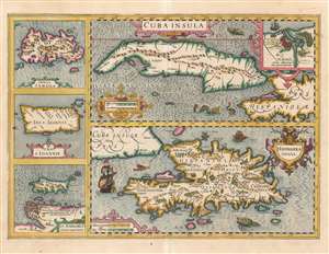
Cuba Insula. / Hispaniola Insula. / Insula Jamaica. / Ins. J. Ioannis. / I.S. Margareta Cum Confiniis.
sold
- Digital Map Information
- Suitable for large format printing
- Full resolution TIFF file
- ICC color profile embedded
- Delivered instantly via download link
This is Jodocus Hondius's 1609 map of Cuba and Hispaniola, with inset maps of Jamaica, Puerto Rico, and Margarita Island. Hondius' geographical information was drawn from the 1569 Mercator wall map of America, which also informed the Mercator map of the western hemisphere that would appear in the early editions of the Mercator-Hondius atlas. Neither it nor Hondius' own 1606 map of the Americas showed the Caribbean islands in sharp detail, and so this sheet was engraved to provide sharper focus on these significant islands. A map focusing on the West Indies as a whole would not be added to the Mercator-Hondius atlas until 1636, so for the first thirty years of the atlas this map - or more precisely, this collection of five maps on a single sheet - represented the most detailed depiction of these islands in the atlas. Tellingly, its last appearance in the book was in a 1638 Latin text edition. Apparently Hondius and Jansson decided a full map of the Caribbean Islands was preferable, and thus did not rework the plate. (more details)
Key Caribbean islands.
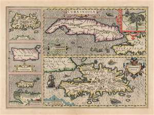
Cuba Insula. / Hispaniola Insula. / Insula Jamaica. / Ins. J. Ioannis. / I.S. Margareta Cum Confiniis.
sold
- Digital Map Information
- Suitable for large format printing
- DPI: 600
- File Size: 67.48 MB
- File Type: ZIP / TIFF
- ICC color profile embedded
- Delivered instantly via download link
This is a superb, original color example of Jodocus Hondius's 1609 map of Cuba and Hispaniola, with inset maps of Jamaica, Puerto Rico, and Margarita Island. It is a beautifully engraving, whose rich detail, ships and sea monsters make it a most desirable work. (more details)
Foundational Map of the Southeast.
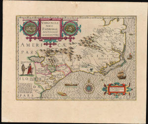
Virginiae Item et Floridae Americae Provinciarum, nova Descriptio.
sold
- Digital Map Information
- Suitable for large format printing
- Full resolution TIFF file
- ICC color profile embedded
- Delivered instantly via download link
This is a beautiful, original color example of Jodocus Hondius's long-lived and influential map of the American southeast: the region spanning from northern Florida to the Chesapeake Bay. By combining in one map Theodore De Bry's 1590 Virginia after John White, and his 1591 Florida after Jacques le Moyne, Hondius' map incorporated in one sheet the most detailed and state-of-the-art firsthand depictions available of the explored parts of the North American east coast. The map's content would be reproduced with virtually no change on maps throughout the 17th century, and elements found on this map would continue to appear on maps well beyond. '...its influence, both direct and indirect, extended into the middle of the eighteenth century' (Cumming). (more details)
Realities in conflict.
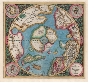
Septentrionalium Terrarum descriptio.
sold
- Digital Map Information
- Suitable for large format printing
- Full resolution TIFF file
- ICC color profile embedded
- Delivered instantly via download link
This is the second state of Gerard Mercator's 1606 map of the North Pole or Arctic, one of the great cartographer's most interesting and important maps. This map marks a significant step forward in the cartographic understanding of the high Arctic, more importantly, is a groundbreaking transition between mediaeval and modern cosmographical perspectives. (more details)
Map In Transition.
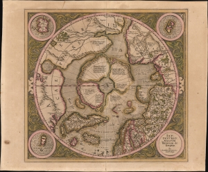
Septentrionalium Terrarum descriptio.
sold
- Digital Map Information
- Suitable for large format printing
- Full resolution TIFF file
- ICC color profile embedded
- Delivered instantly via download link
This is the 1606 second Hondius state of Gerard Mercator's map of the North Pole or Arctic, one of the great cartographer's most interesting and important maps. This map marks a significant step forward in the cartographic understanding of the high Arctic, representing the transition between medieval and modern cosmographical perspectives. (more details)
A gorgeous map of Ireland oriented to the East.
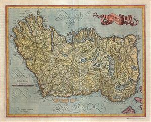
Irelandia regnum.
sold
- Digital Map Information
- Suitable for large format printing
- DPI: 300
- File Size: 11.13 MB
- File Type: ZIP / TIFF
- ICC color profile embedded
- Delivered instantly via download link
This is a beautiful 1606 map of Ireland by Gerard Mercator. Oriented to the East, the map covers the Emerald Isle in considerable detail, noting numerous towns, rivers, lakes, forests, mountains and a host of additional topographic features. Mountains and ... (more details)
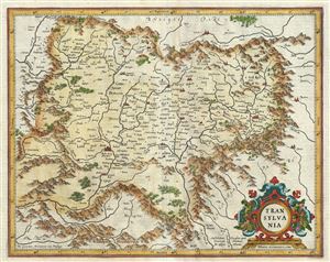
Transylvania.
sold
- Digital Map Information
- Suitable for large format printing
- DPI: 300
- File Size: 9.82 MB
- File Type: ZIP / TIFF
- ICC color profile embedded
- Delivered instantly via download link
This is a beautiful 1606 map of Transylvania (present day Romania) by Gerard Mercator. It covers what is today the northern part of Romania and from the Kerezbanya east as far as Totros. The map notes several towns, rivers, forests, mountains and a host ... (more details)
The most important and influential map of Virginia and Carolina to appear in the 17th century.
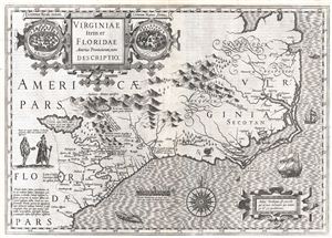
Virginiae Item et Floridae Americae Provinciarum, nova Descriptio.
sold
- Digital Map Information
- Suitable for large format printing
- DPI: 300
- File Size: 12.17 MB
- File Type: ZIP / TIFF
- ICC color profile embedded
- Delivered instantly via download link
Published in 1606 by the Mercator – Hondius firm, this is the most influential map of the southeastern part of North America to emerge in the 17th century and the first map to depict by Virginia and Florida. entitled, 'Virginiae Item et Floridae', ... (more details)
The most important and influential map of Virginia and Carolina to appear in the 17th century.
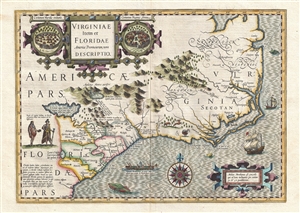
Virginiae Item et Floridae Americae Provinciarum, nova Descriptio.
sold
- Digital Map Information
- Suitable for large format printing
- DPI: 300
- File Size: 9.36 MB
- File Type: ZIP / TIFF
- ICC color profile embedded
- Delivered instantly via download link
Published in 1606 by the Mercator/Hondius firm, this is the most influential map of the southeastern part of North America to emerge in the 17th century and the first map to depict Virginia and Florida. Entitled, Virginiae Item et Floridae , ... (more details)
The most important and influential map of Virginia and Carolina to appear in the 17th century.
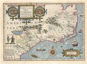
Virginiae Item et Floridae Americae Provinciarum, nova Descriptio.
sold
- Digital Map Information
- Suitable for large format printing
- DPI: 300
- File Size: 10.86 MB
- File Type: ZIP / TIFF
- ICC color profile embedded
- Delivered instantly via download link
Published in 1606 by the Mercator – Hondius firm, this is the most influential map of the southeastern part of North America to emerge in the 17th century and the first map to depict by Virginia and Florida. entitled, 'Virginiae Item et ... (more details)
The most important and influential map of Virginia and Carolina to appear in the 17th century.
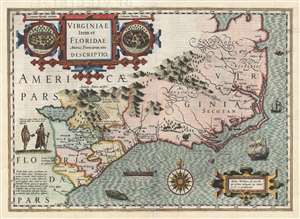
Virginiae Item et Floridae Americae Provinciarum, nova Descriptio.
sold
- Digital Map Information
- Suitable for large format printing
- DPI: 300
- File Size: 7.92 MB
- File Type: ZIP / TIFF
- ICC color profile embedded
- Delivered instantly via download link
Published in 1606 by the Mercator/Hondius firm, this is the most influential map of the southeastern part of North America to emerge in the 17th century and the first map to depict Virginia and Florida. Entitled, Virginiae Item et ... (more details)
Important second edition of Mercator and Hondius' Map of the Arctic showing a break with 16th century cartographic convention.
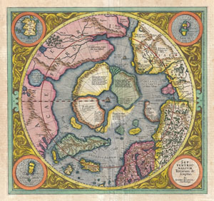
Septentrionalium Terrarum descriptio.
sold
- Digital Map Information
- Suitable for large format printing
- DPI: 300
- File Size: 10.52 MB
- File Type: ZIP / TIFF
- ICC color profile embedded
- Delivered instantly via download link
This is the second edition of Gerard Mercator's map of the North Pole or Arctic, one of the great cartographer's most interesting and important maps. Mercator's Arctic projection has its roots in his magnificent 1569 wall map of ... (more details)
Important second edition of Mercator and Hondius' Map of the Arctic showing a break with 16th century cartographic convention.
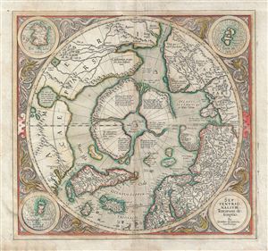
Septentrionalium Terrarum descriptio.
sold
- Digital Map Information
- Suitable for large format printing
- DPI: 300
- File Size: 12.89 MB
- File Type: ZIP / TIFF
- ICC color profile embedded
- Delivered instantly via download link
This is the second edition of Gerard Mercator's map of the North Pole or Arctic, one of the great cartographer's most interesting and important maps. Mercator's Arctic projection has its roots in his magnificent 1569 wall map of ... (more details)
Important second edition of Mercator and Hondius' Map of the Arctic showing a break with 16th century cartographic convention.
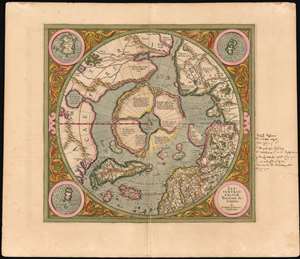
Septentrionalium Terrarum descriptio.
sold
- Digital Map Information
- Suitable for large format printing
- DPI: 600
- File Size: 23.59 MB
- File Type: ZIP / TIFF
- ICC color profile embedded
- Delivered instantly via download link
This is the second state of Gerard Mercator's 1606 map of the North Pole or Arctic, one of the great cartographer's most interesting and important maps. Mercator's Arctic projection has its roots in a magnificent 1569 wall map of the world in which Mercator first introduces his revolutionary projection. As regards the Arctic, the difficulty with the Mercator Projection is that to accurately depict the Polar Regions, a map would have to be infinitely tall. Mercator compensated for this by including a polar projection, very similar to the map shown here, in the lower-left hand corner of his great map. This may rightly be considered to be the world's first specific map of the North Pole. Mercator later reissued this map in an expanded format for his 1595 atlas. Following a number of important expeditions to the Arctic in subsequent 10 years, Mercator's successor Jodocus Hondius reissued the original 1595 map with a number of revolutionary and highly significant changes. (more details)
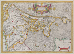
Hollandt comitatus Vtricht episcope
sold
- Digital Map Information
- Suitable for large format printing
- Full resolution TIFF file
- ICC color profile embedded
- Delivered instantly via download link
A rare and beautiful 1606 map of Holland ( Netherlands ) by Gerard Mercator. Amsterdam appears at the center and the map extends south as far as Harderwyck and west as far as Rhenen and Rotterdam. The Zunder Zee, now a damned ... (more details)
One of the earliest published thematic maps.
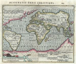
Designatio Orbis Christiani.
sold
- Digital Map Information
- Suitable for large format printing
- DPI: 300
- File Size: 1.98 MB
- File Type: ZIP / TIFF
- ICC color profile embedded
- Delivered instantly via download link
One of the earliest known thematic maps, this is a fine example of the 1607 Mercator- Hondius map of the World showing different religions. The world is presented on a hemispherical projection with Europe and Africa at ... (more details)
Stunning Atlas, Old Color, Distinguished Provenance.

Fasciculus geographicus complectens praecipuarum totius orbis regionum tabulas circiter centum, unà cum earundem enarrationibus.
sold
This is Matthias Quad's geographical atlas in its expanded 1608 edition, with 87 maps in superb original color and a distinguished provenance connecting it to the Lord Wardington Collection. Quad's atlas provided, in a small folio, a compilation of the most state-of-the-art maps of his era - some engraved by Quad himself, the bulk having been engraved by publisher Johan Bussemacher. The richly-colored atlas is beautifully bound in contemporary vellum and is the finest example of this work known. (more details)
By 'The Ptolemy of His Age'.
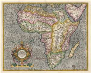
Africa Ex magnus orbis terre descriptione Gerardi Mercatoris desumpta. Studio and industria G.M. Iunioris.
sold
- Digital Map Information
- Suitable for large format printing
- DPI: 600
- File Size: 52.95 MB
- File Type: ZIP / TIFF
- ICC color profile embedded
- Delivered instantly via download link
This is an attractive Hondius edition of Gerard Mercator's 1595 map of Africa. The map is a classic, early Dutch depiction of the continent derived from the Gerard Mercator's 1569 wall map of the world. It was engraved by the illustrious Gerard's grandson, Gerard the Younger, whose command of the engravers' craft is brilliantly apparent. (more details)
A map of Sri Lanka during the time of Portuguese rule.
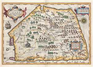
Ins. Ceilan quae incolis Tenarisin dicitur.
sold
- Digital Map Information
- Suitable for large format printing
- DPI: 300
- File Size: 7.92 MB
- File Type: ZIP / TIFF
- ICC color profile embedded
- Delivered instantly via download link
This is a 1609 Gerard Mercator and Jodocus Hondius map of Sri Lanka. The map, which is oriented from the east, depicts the entire island. Cartographically it remains vaguely defined in an unusual five-sided form – ... (more details)
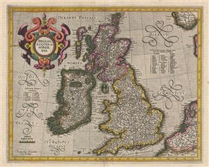
Anglia, Scotia et Hibernia.
sold
- Digital Map Information
- Suitable for large format printing
- DPI: 300
- File Size: 13.14 MB
- File Type: ZIP / TIFF
- ICC color profile embedded
- Delivered instantly via download link
A beautiful old color example of the Mercator Hondius map of the British Isles. This map was first issued in 1595, one year after Mercator's death. Mercator's plates were acquired by Jodocus Hondius who, in 1606, ... (more details)
The only America map of the Mercator Atlas.
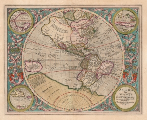
America, siue, India Nova. Ad magnae Gerardi Mercatoris aui vniversalis imitationem in compendium redacta.
sold
- Digital Map Information
- Suitable for large format printing
- DPI: 600
- File Size: 51.54 MB
- File Type: ZIP / TIFF
- ICC color profile embedded
- Delivered instantly via download link
This is a beautifully colored 1613 Hondius edition of Mercator's America, one of the most visually arresting early maps of the Western Hemisphere. (more details)