
Unique espionage portrait Paraguay under the Lopez dictatorship.
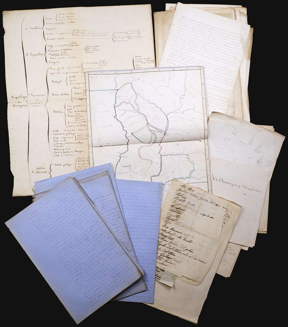
Le Paraguay: II Etat Actuel.
sold
This is an incomparable find: an unpublished manuscript set, dated approximately 1860, consisting of maps, surveys, charts, and research notes pertaining to Paraguay, written by French naval officer and hydrographer Ernest Amédée Barthélemy Mouchez (1821 - 1892). It describes in detail Paraguay's volatile situation under dictator Carlos Antonio López Ynsfrán (née 1792, ruled 1841 - 1862,) whose autocracy set the stage for the disastrous reign of his son, Francisco Solano López Carrillo. (1827 - 1870) (more details)
Made for blockade running.

Coast of the United States from Cape Fear to the Bahamas, with plans of the Principal Harbors on an Enlarged Scale; Compiled from the most Recent Surveys, Made by order of the United States Government, and Adjusted by the Latest Astronomical Observations.
sold
- Digital Map Information
- Suitable for large format printing
- File Size: 48.52 MB
- File Type: ZIP / TIFF
- ICC color profile embedded
- Delivered instantly via download link
This is a rare 1865 Civil War Era Charles Copley 'blockade runner's' nautical chart or maritime map of the southeastern coast of the United States extending roughly from Cape Fear, North Carolina, to Miami, Florida, and the northern Bahamas. (Miami does not yet exist, but the Miami River and the Cape Florida Light, built in 1860, are illustrated.) Insets within the peninsula of Florida detail the most important southern harbors: Charleston, Georgetown Harbor, the Savannah River, Jacksonville (St. John's River), Fernandina Harbor, Cape Canaveral, Turtle Harbor, and Cedar Keys. The northern Bahamas are covered in some detail, but the chart does not extend as far south as Nassau. (more details)
One of the most important American maps of the 19th century.
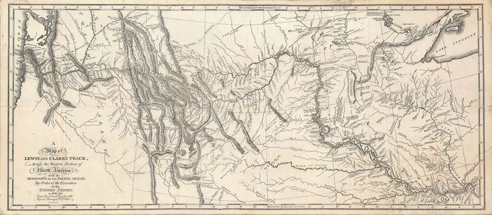
Map of Lewis and Clark's Track, Across the Western Portion of North America..
sold
- Digital Map Information
- Suitable for large format printing
- File Size: 47.16 MB
- File Type: ZIP / TIFF
- ICC color profile embedded
- Delivered instantly via download link
Among the most important maps in American history, this depiction of the Lewis and Clark Expedition completely changed Americans' understanding of the central and western part of the continent. Based on the sketches of William Clark, this is a c. 1870 reprint of the 1814 original map drafted by Samuel Lewis and engraved by Samuel Harrison, for inclusion in the History of the expedition under the command of Captains Lewis and Clark to the sources of the Missouri…. (more details)
Old Color Early Atlas Map of Europe.
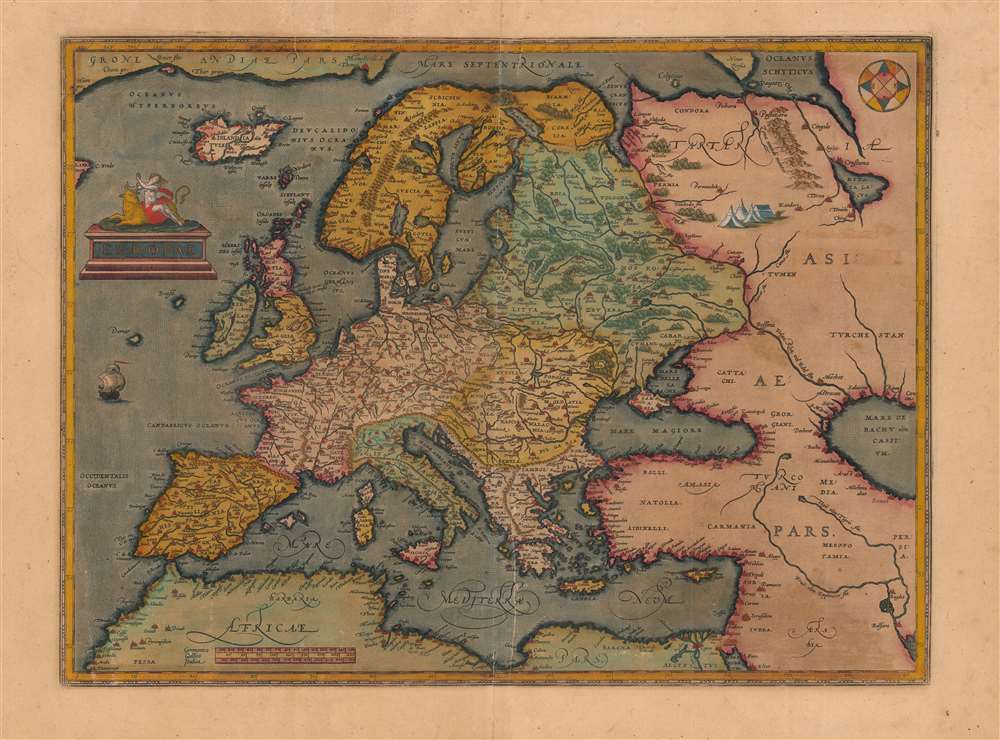
Europae.
sold
- Digital Map Information
- Suitable for large format printing
- DPI: 600
- File Size: 44.98 MB
- File Type: ZIP / TIFF
- ICC color profile embedded
- Delivered instantly via download link
This is a beautiful, original color example of Abraham Ortelius' general map of Europe. This is the second, 1584 plate of the map, notable for its superior engraving, and multiple corrections. The two are most easily distinguished by the calligraphic 'Africae Pars' labeling north Africa here (the first plate used Roman capitals instead.) (more details)
First map of the Granite State produced in the American Republic.
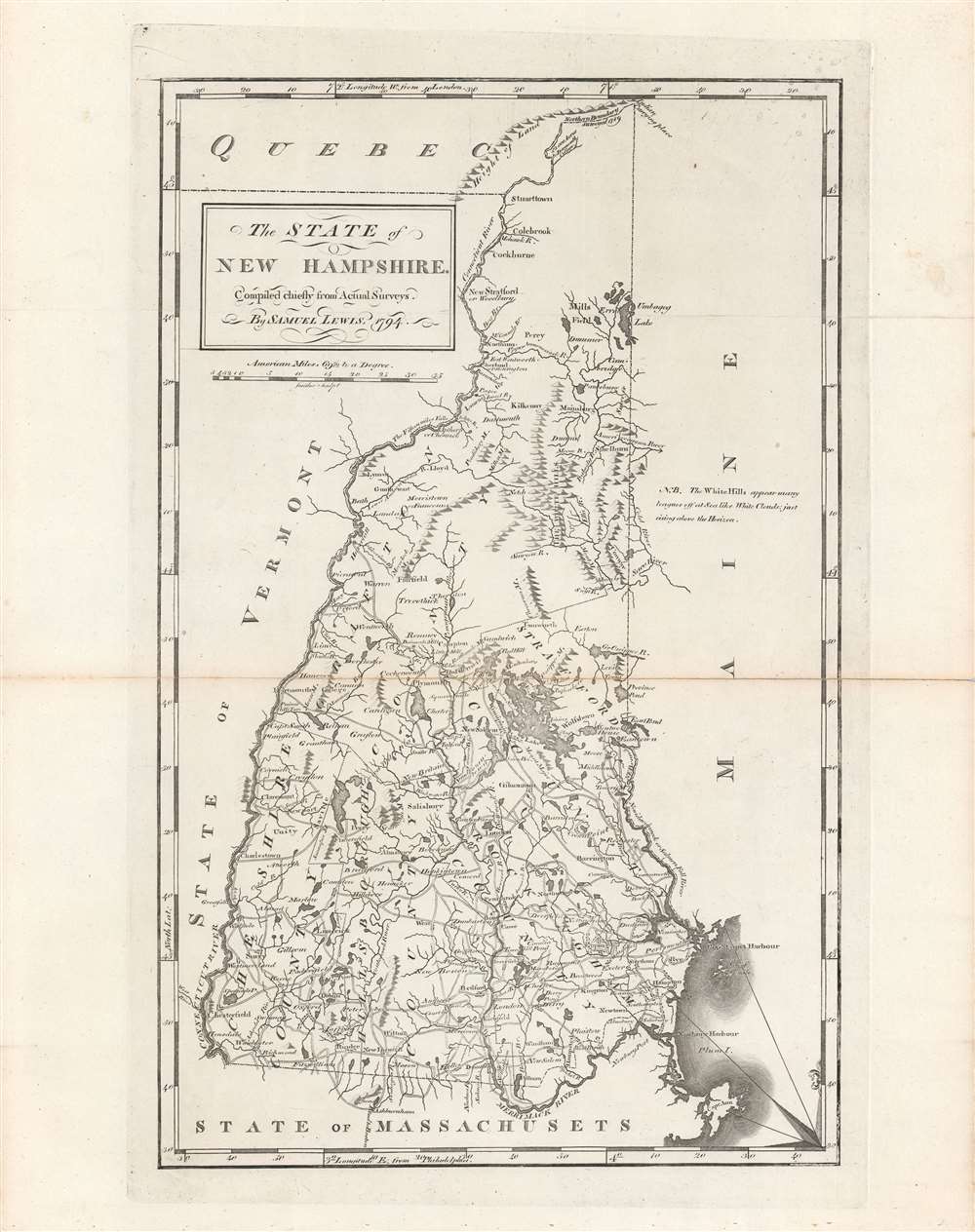
The state of New Hampshire, compared chiefly from actual surveys.
sold
- Digital Map Information
- Suitable for large format printing
- DPI: 600
- File Size: 32.14 MB
- File Type: ZIP / TIFF
- ICC color profile embedded
- Delivered instantly via download link
This is Samuel Lewis' 1794 map of New Hampshire, which appeared in Carey's General Atlas, the first atlas produced and published in the United States. It provides a wonderful snapshot of the state in the early days of the American Republic. (more details)
First edition of Mercator's British Isles.
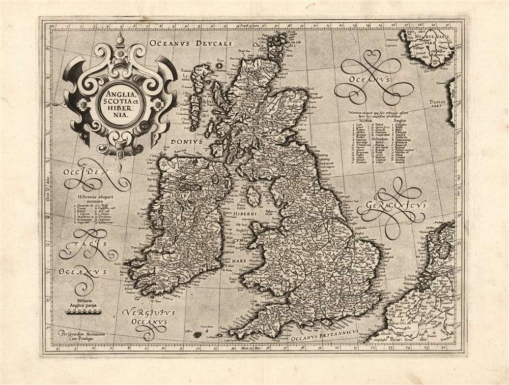
Anglia, Scotia et Hibernia.
sold
- Digital Map Information
- Suitable for large format printing
- Full resolution TIFF file
- ICC color profile embedded
- Delivered instantly via download link
This is a superb example of the 1595 first atlas edition of Gerard Mercator's map of the British Isles, the definitive map of the British Isles for many subsequent decades. (more details)
Settling the great northern wilderness.

Map of Maine, New Hampshire and Vermont, Compiled From The Latest Authorities.
sold
- Digital Map Information
- Suitable for large format printing
- Full resolution TIFF file
- ICC color profile embedded
- Delivered instantly via download link
This is an attractive 1826 folding map of Maine, New Hampshire, and Vermont produced by Anthony Finley, James H. Young, and David H. Vance. Though originally engraved for Finley's A New American Atlas, this is a rare separate issue. It portrays northern New England as the region was undergoing a population boom in the decades after independence. (more details)
'Typical scenes witnessed on Luzon in the I Corps zone of action'.
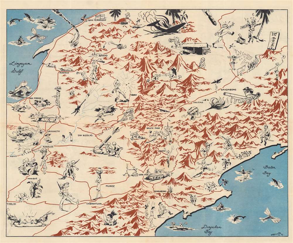
I Corps in the Philippines: Luzon Impressions.
sold
- Digital Map Information
- Suitable for large format printing
- Full resolution TIFF file
- ICC color profile embedded
- Delivered instantly via download link
This is a 1945 Information and Education Section pictorial map of central Luzon, the Philippines, drawn by H. R. Bennett. (more details)
The War of Jenkins' Ear.

Mappa geographica, complectens I. Indiae Occidentalis partem mediam circum Panamensem II. Ipsumq. isthmum III. Ichnographiam praecipuorum locorum et portuum ad has terras pertinentium. / Carte des Isles de L'Amerique et Deplusieurs Pays de Terre Ferme situes su devant de ces Isles et autour de Golfe de Mexique.
sold
- Digital Map Information
- Suitable for large format printing
- DPI: 600
- File Size: 62.38 MB
- File Type: ZIP / TIFF
- ICC color profile embedded
- Delivered instantly via download link
This is a 1740 Homann Heirs map of Florida, the West Indies, and Central America, published to highlight the major theater of conflict during the War of Jenkins' Ear. It is based upon the cartography of Jean Baptiste Bourguignon d'Anville, but features several relevant maps compiled into a single sheet. (more details)
Yosemite to Candlestick Park and everything in between.

Home Federal Country. Eureka! The Golden State.
sold
This is a 1973 Darrel Millsap pictorial map of California. Entertaining and comical vignettes present California's history and its natural wonders. Miners, complete with long white beards, toil in the mountains near Squaw Valley, one of whom is unsuccessfully fighting with a mule. A man joyfully crushing grapes marks Sonoma Valley, and a skull represents the fate of those unfortunate enough to get lost in Death Valley. Block letters of varying size and color proclaim place names from Lava Beds National Monument to Chula Vista and Tijuana, with the largest identifying San Diego, Los Angeles, San Francisco, and Yosemite. Disneyland, the Rose Bowl, Candlestick Park, the San Diego Zoo, and Balboa Park also make an appearance. The Salton Sea, a salt lake situated on the San Andreas Fault, is marked by a lake and an overturned salt shaker. Created for the Home Federal Savings and Loan Association, the title cartouche proclaims California to be 'Home Federal Country,' which is seemingly cut out of a redwood tree. . (more details)
The costly battle for Charleston Harbor.

The siege of Charleston.
sold
- Digital Map Information
- Suitable for large format printing
- Full resolution TIFF file
- ICC color profile embedded
- Delivered instantly via download link
A wonderful example of Charles Currier and James Ives' print depicting the 1863 siege of Charleston during the U.S. Civil War. It shows Charleston Harbor, including Fort Sumter, where the war had begun more than two years before, as Union forces attempted to seize fortifications around the harbor and eventually the city itself. (more details)
The shifting fortunes of empires in Eastern Europe.
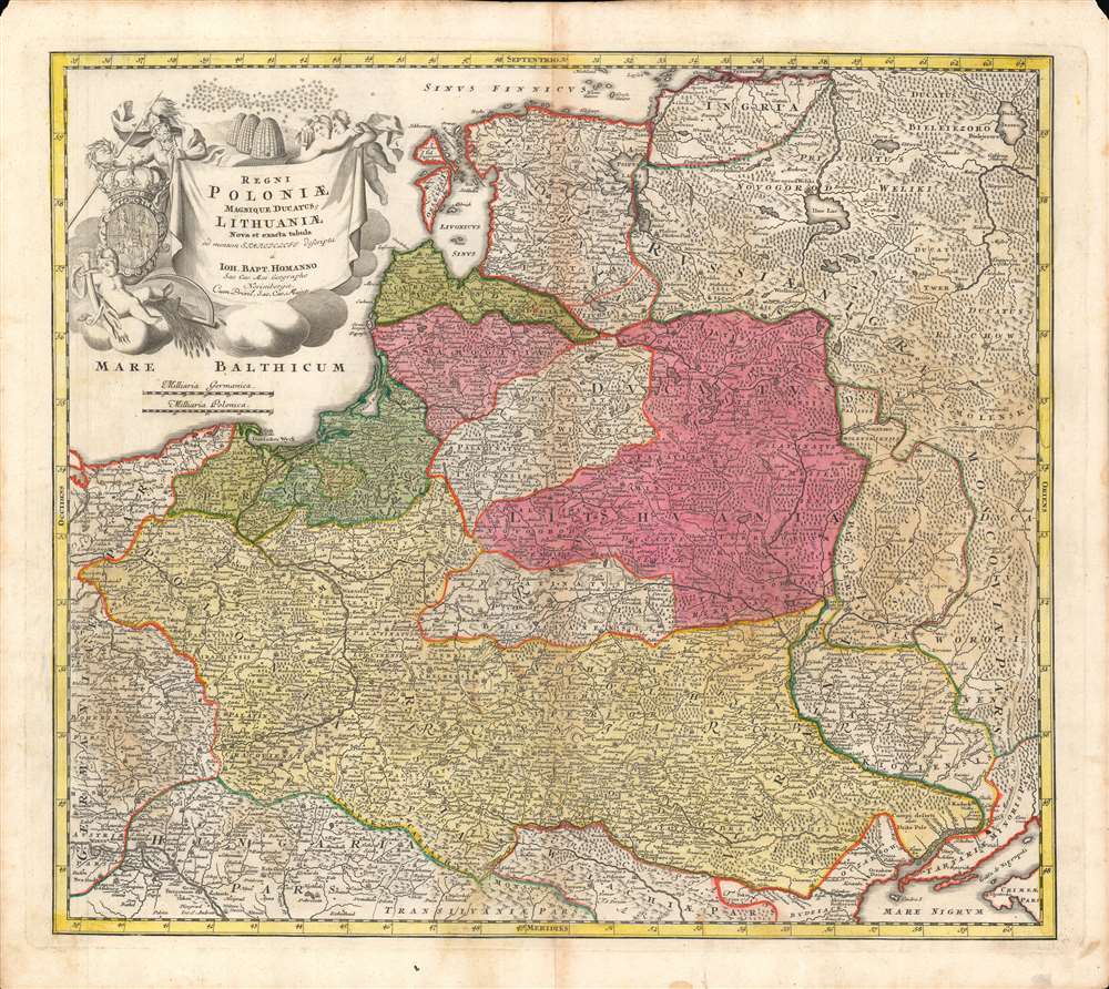
Regni Poloniae magnique Ducatus Lithuaniae...
sold
- Digital Map Information
- Suitable for large format printing
- DPI: 600
- File Size: 59.32 MB
- File Type: ZIP / TIFF
- ICC color profile embedded
- Delivered instantly via download link
Here is a fine example of Johann Baptist Homann's c. 1720 map of the Polish-Lithuanian Commonwealth, covering most of Eastern Europe. It was produced during a transition in the relative balance of power in the region, with Poland-Lithuania itself, Sweden, and the Ottoman Empire waning, and Russia, Prussia, and Austria on the rise. (more details)
Gilded Age planned summer community near Bar Harbor.
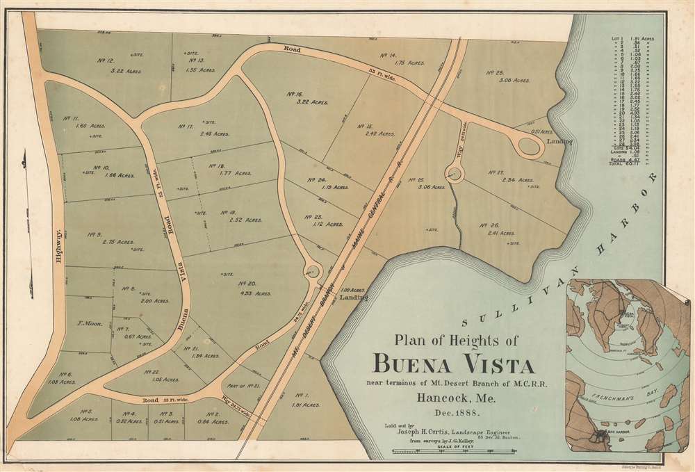
Plan of Heights of Buena Vista near terminus of Mt. Desert Branch of M.C.R.R. Hancock, Me. Dec. 1888.
sold
- Digital Map Information
- Suitable for large format printing
- File Size: 22.66 MB
- File Type: ZIP / TIFF
- ICC color profile embedded
- Delivered instantly via download link
A curious 1888 real estate map promoting the planned summer community of Buena Vista on Hancock Point, on Frenchman's Bay, near Sullivan Harbor and Mount Desert Island. Although apparently never constructed, the development looks impressive, with expansive lots ranging from one to 5 acres, winding roadways, and easy access to the highway, railroad, and boat landings in Sullivan Harbor. The entire development covered some 60 acres, including roads. (more details)
Early state survey of Volusia County.

Gray's Map of Volusia County Showing Range Township and Section Lines.
sold
- Digital Map Information
- Suitable for large format printing
- Full resolution TIFF file
- ICC color profile embedded
- Delivered instantly via download link
This is a 1929 C. J. Gray map of Volusia County, Florida. Likely meant as a real estate map, Gray presents the county's range, township, and section lines. Red overprinting highlights land owned by real estate developers, such as Daytona Park Properties and Harry E. Prettyman, Inc. Properties. Gray also uses red overprinting to emphasize railroad lines, highways, and roads. Cities, including Daytona Beach, De Land, and New Smyrna, are illustrated. A close observer will notice plots that do not conform with the Range, Township, and Section lines. These are old estates predating Florida's annexation. (more details)
Where all the people live.
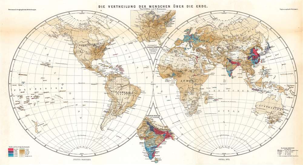
Die Vertheilung der Menschen über die Erde.
sold
- Digital Map Information
- Suitable for large format printing
- File Size: 24.68 MB
- File Type: ZIP / TIFF
- ICC color profile embedded
- Delivered instantly via download link
An effective combination of statistics and geography, this is Ernst Behm and Fr. Henemann's map of global population density, published in an 1873 supplement to Petermann's geographische Mittheilungen. It displays the world divided into hemispheres and uses chromolithographic printing to differentiate areas of high and low population density. (more details)
Souvenir of Occupation.

Bavaria - Hesse. Wurtemberg - Baden. US Zone.
sold
- Digital Map Information
- Suitable for large format printing
- File Size: 35.98 MB
- File Type: ZIP / TIFF
- ICC color profile embedded
- Delivered instantly via download link
A striking c. 1948 Kurt Desch pictorial map of the U.S. Occupation Zone in southern Germany following World War II. It portrays a bucolic peaceful land, with pictographs representing the region's products and industries. Illustrations of buildings and/or armorial crests represent Munich, Frankfurt, Hamberg (Hamburg), Darmstadt, Augsburg, Bayreuth, Stuttgart, etc. The whole features a military themed border of stylized epaulets. (more details)
Pictorial fun in Pre-War London!
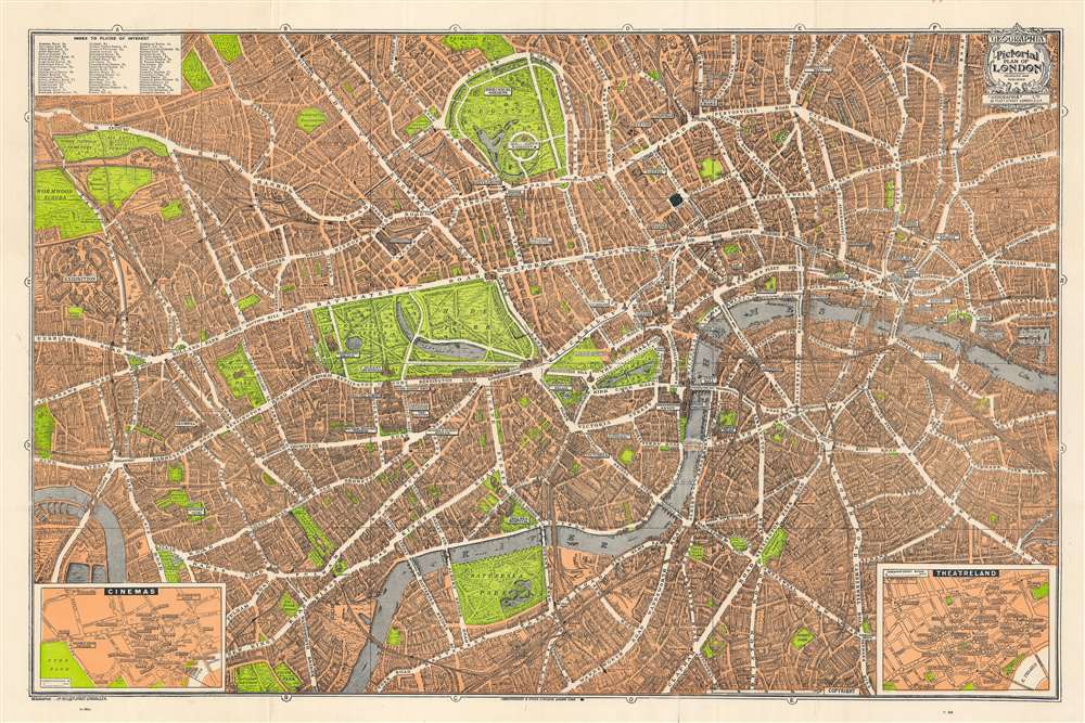
Geographia Pictorial Map of London.
sold
- Digital Map Information
- Suitable for large format printing
- Full resolution TIFF file
- ICC color profile embedded
- Delivered instantly via download link
This is a wonderful pocket map of London published in August of 1934 by Geographia Ltd. It covers downtown London from the Hammersmith Bridge and Wormwood scrubs eastward past Hyde Park and Buckingham Place to Whitechapel Road and the London Docks. Unlike most English city plans of the period, this map replicates the pictorial style which popular in Paris during the early part of the 20th century. (more details)
An Early Woodcut Map of the Holy Land.

[Woodcut map of the Eastern Mediterranean Sea, Cyprus and the Holy Land.
sold
- Digital Map Information
- Suitable for large format printing
- DPI: 600
- File Size: 14.68 MB
- File Type: ZIP / TIFF
- ICC color profile embedded
- Delivered instantly via download link
This is a Sebastian Münster's woodcut map of the Holy Land and Cyprus, from a German edition of his masterwork, Cosmographia. The map contextualizes the Holy Land with the whole Levant, from Egypt to the coast of Asia Minor. The map includes the track of the Israelites from Egypt to Canaan. The Arabian city of Medina appears at the southernmost extent of the map.
The image first appeared in the expanded 1550 editions of Munster's Cosmographia, a work which for more than half a century provided the European literate layperson their best source of information about the world. The map's detail may have been largely drawn from Waldseemüller's Ptolemaic map of the Holy Land and the Fertile Crescent but focusing specifically on the Biblical lands and narrowing the selection of place names to reflect the Biblical era. It is interesting the Münster retains the northern orientation of the Ptolemaic Quarta Asia Tabula rather than adopting the eastern orientation of the medieval Sanuto-Vesconte, which would dominate the mapping of these lands well into the eighteenth century. That orientation allows for the inclusion of the island of Cyprus, set amongst the waves of the Mediterranean Sea. There is also a sea monster and a sailboat. (more details)
The image first appeared in the expanded 1550 editions of Munster's Cosmographia, a work which for more than half a century provided the European literate layperson their best source of information about the world. The map's detail may have been largely drawn from Waldseemüller's Ptolemaic map of the Holy Land and the Fertile Crescent but focusing specifically on the Biblical lands and narrowing the selection of place names to reflect the Biblical era. It is interesting the Münster retains the northern orientation of the Ptolemaic Quarta Asia Tabula rather than adopting the eastern orientation of the medieval Sanuto-Vesconte, which would dominate the mapping of these lands well into the eighteenth century. That orientation allows for the inclusion of the island of Cyprus, set amongst the waves of the Mediterranean Sea. There is also a sea monster and a sailboat. (more details)
Visit Tennessee, enjoy its natural wonders, and visit the American Museum of Atomic Energy.

'Chuckle' Map of Tennessee.
sold
- Digital Map Information
- Suitable for large format printing
- Full resolution TIFF file
- ICC color profile embedded
- Delivered instantly via download link
This is a c. 1949 Bill Dyer pictorial map of Tennessee. Doubling as a highway map, cartoon vignettes appear throughout the state and sometimes mark important landmarks, such as the University of Tennessee or the state capitol building in Nashville. One such landmark, the Oak Ridge National Laboratory, which played a critical role in the Manhattan Project, appears only as a big white building with a gigantic black question mark on the side. However, mostly these illustrations are meant to provide amusement. A 'wild turkey' near Grimsley fires two pistols with abandon, a miner rides a minecart near Huntsville, and a bear stands behind a tourist as they both gaze at the Great Smoky Mountains. People are seen dancing, playing music, sunbathing, hunting, and enjoying Tennessee's amazing natural wonders. (more details)
The VOC's Secret Map of the South China Sea.
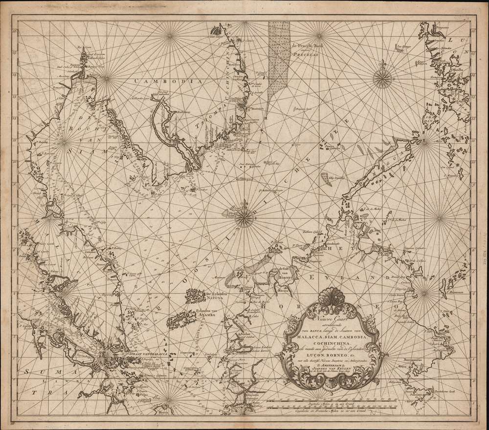
Nieuwe Caart strekkende van Banca, langs de kusten van Malacca, Siam, Cambodia, Cochinchina, als meede een gedeelte van de Eylanden Luçon, Borneo, et c. met alle dresslss Havens, Dieptens en Ankergronden.
sold
- Digital Map Information
- Suitable for large format printing
- DPI: 600
- File Size: 580.26 MB
- File Type: ZIP / TIFF
- ICC color profile embedded
- Delivered instantly via download link
The rare 1753 Johannes II van Keulen / Jan de Marre nautical map of the South China Sea compiled for the sixth volume of the Zee-Fakkel - the legendary Dutch East India Company (VOC - Vereenigde Oostindische Compagnie) 'Secret Atlas.' The map covers the South China Sea and Gulf of Thailand - thus embracing Singapore, Malaya, southern Thailand (Siam), Cambodia, southern Vietnam, most of Borneo, and parts of the Philippines. The map illustrates the most important waters and most dangerous sea passages in the East Indies. It was an essential navigational reference for VOC ships sailing from Malacca, through the Straits of Singapore, or north from Batavia for Siam (Bangkok), Laauwec (Cambodia), Nagasaki, Canton (Guangzhou), Macao, or Manila. (more details)