
Introduction to fort construction, assault, and defense.
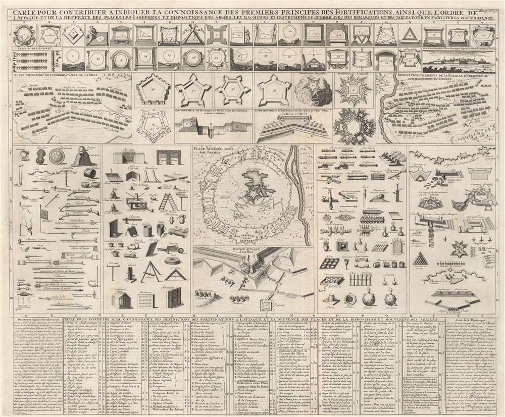
Carte pour contribuer a indiquer la connoissance des premiers principes des fortifications, ainsi que l'ordre de l'attaque, et de la defence des places, les campemens et dispositions des armées, les machines et instrumens de guerre, avec des remarques et des tables pour en faciliter la connoissance.
sold
- Digital Map Information
- Suitable for large format printing
- DPI: 600
- File Size: 69.57 MB
- File Type: ZIP / TIFF
- ICC color profile embedded
- Delivered instantly via download link
This is a 1720 Henri Abraham Chatelain chart of fortification design and armament, created as an introduction to the principles of fortification. The first forty-one illustrations present elements of fort construction along with six different designs, one of which utilizes the local terrain to reinforce defenses. Below to the left is a diagram detailing the different parts of a fort in practice, revealing how the pieces work together. Plans illustrating the Battle of Landen and the Battle of Hochstet occupy space to the left and right. Diagrams illustrating hand weapons, offensive works, artillery, and defensive works occupy the middle third of the sheet, presenting the more active aspects of attack and defense. (more details)
A record-setting Antarctic expedition.
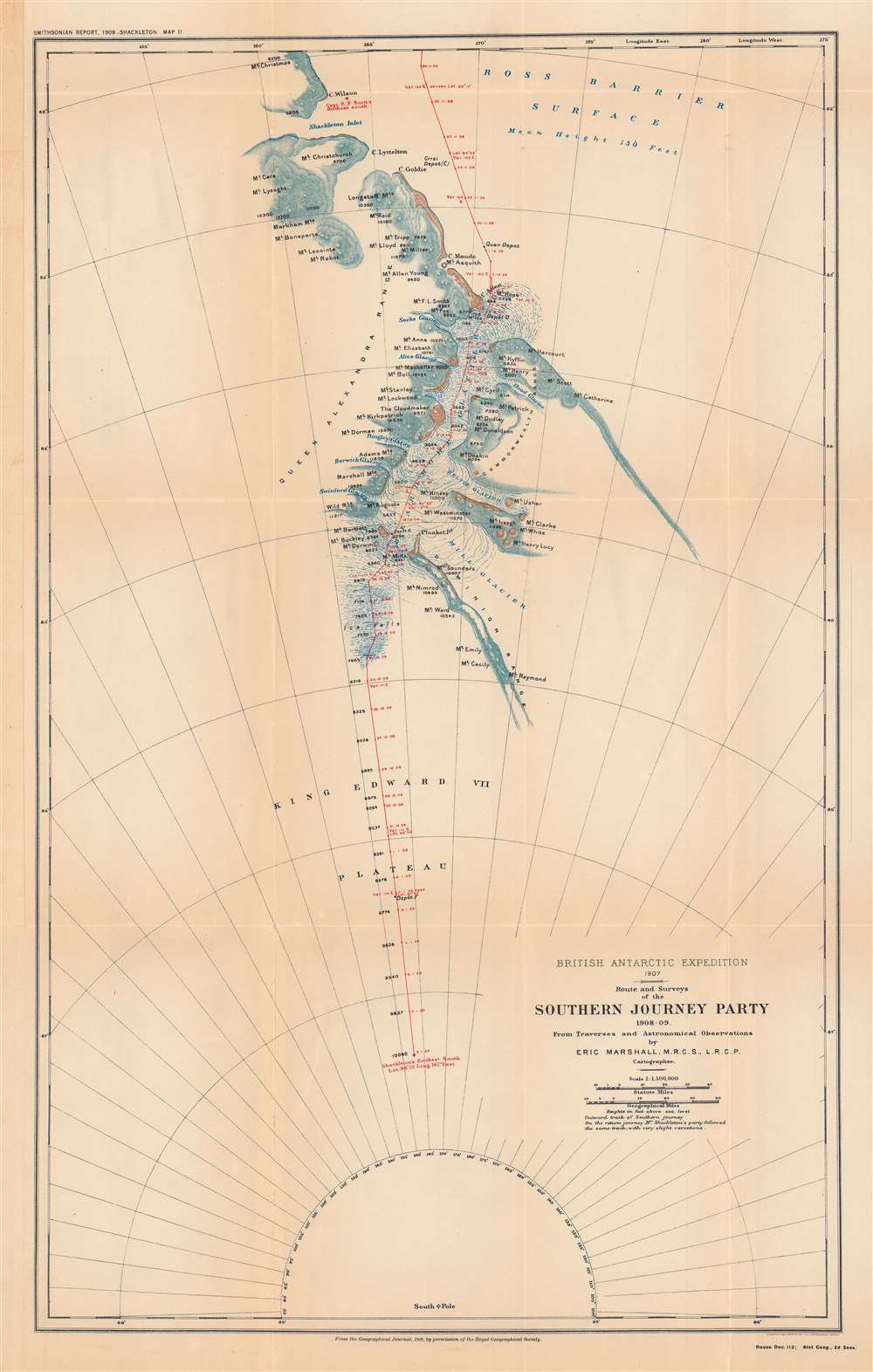
British Antarctic expedition, 1907: route and surveys of the Southern Journey Party, 1908-09.
sold
- Digital Map Information
- Suitable for large format printing
- File Size: 47.2 MB
- File Type: ZIP / TIFF
- ICC color profile embedded
- Delivered instantly via download link
This is a map of the course of the Southern Party of the 1907 - 1909 British Antarctic Expedition, also known as the Nimrod Expedition, after the ship used to reach the Antarctic, or the Shackleton Expedition, named after the expedition's leader, Ernest Shackleton. The Southern Party, led by Shackleton, traveled to a further latitude south than any previous expedition and nearly reached the South Pole before having to turn back to ensure the group's survival. (more details)
The two first railroads in Florida.
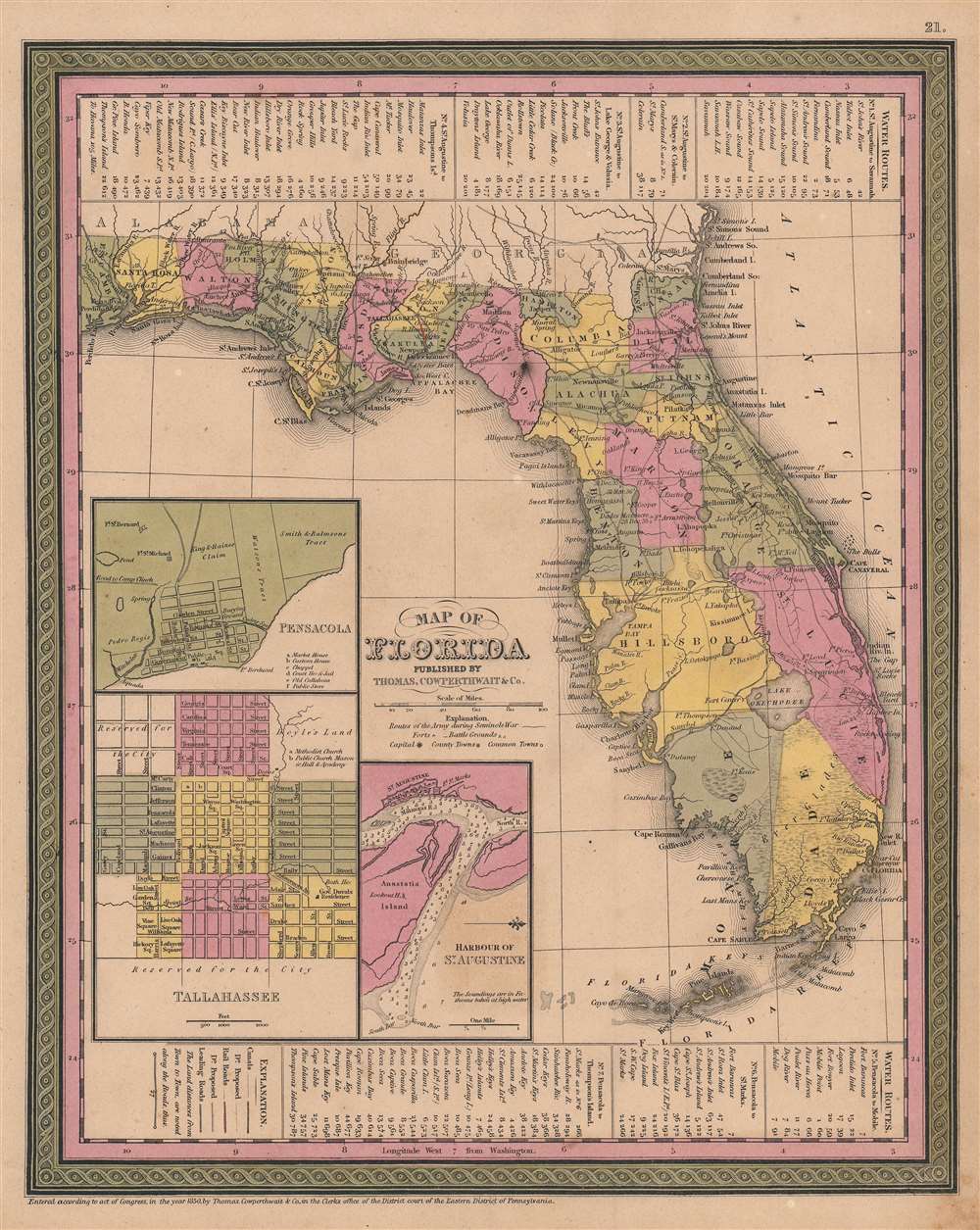
Map of Florida.
sold
- Digital Map Information
- Suitable for large format printing
- Full resolution TIFF file
- ICC color profile embedded
- Delivered instantly via download link
This is an 1850 Samuel Augustus Mitchell Sr. / Thomas Cowperthwait map of Florida. The map falls in the Tanner / Mitchell tradition, wherein original 1830s maps of Tanner were updated regularly to about 1858. In addition to meeting the standard cartographic conventions established in the Mitchell/Tanner tradition, this map includes multiple historically significant elements easily missed. Red manuscript highlights two railroads in the Florida Panhandle: the Tallahassee Railroad (see below) and the 'Lake Wimico and St. Joseph Canal and Railroad' - the first railroads in Florida. As well, dates in Marion, Benton, and St. Lucie counties mark battles of the Second Seminole War (1835 - 1842). (more details)
The early days of British Aden.
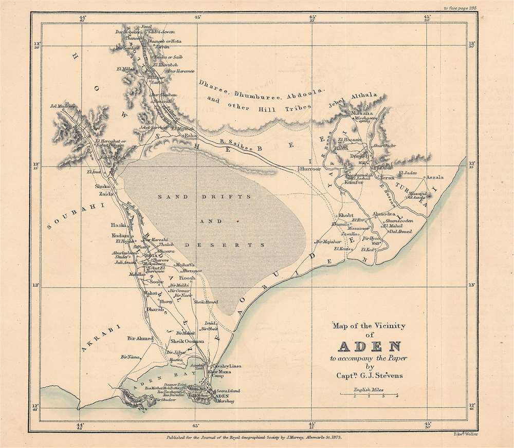
Map of the vicinity of Aden to accompany the paper by Captn. G. J. Stevens.
$350.00
Acquire
- Digital Map Information
- Suitable for large format printing
- File Size: 10.78 MB
- File Type: ZIP / TIFF
- ICC color profile embedded
- Delivered instantly via download link
This is an 1873 map of Aden, Yemen and its surroundings engraved by Edward Weller and published by the firm John Murray for the The Journal of the Royal Geographical Society. The map accompanied an article written by Captain G. J. Stevens of his travels through these lands. (more details)
One of California's great scenic drives.
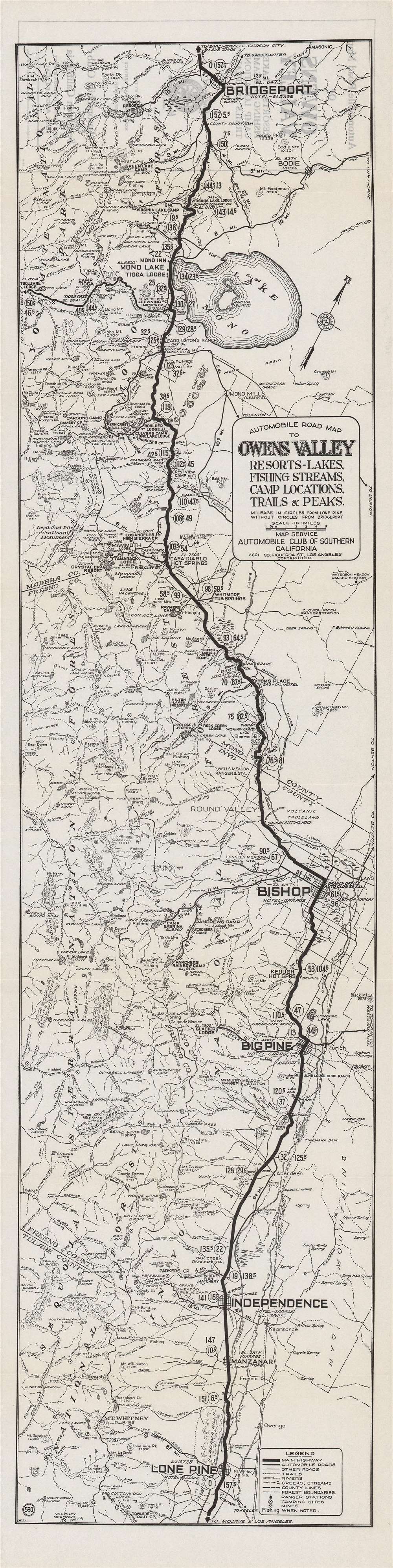
Automobile road map of Owens Valley : resort, lakes, fishing streams, camp locations, trails and peaks.
sold
- Digital Map Information
- Suitable for large format printing
- Full resolution TIFF file
- ICC color profile embedded
- Delivered instantly via download link
This is a rare c. 1930 Automobile Club of Southern California 'strip map' of the Owens Valley and nearby areas between Mono Lake and the Mojave Desert. It highlights the route to the beautiful scenery of the Sierra Nevada Mountains, which was becoming an increasingly popular and accessible tourist destination. (more details)
El Camino Sierra.
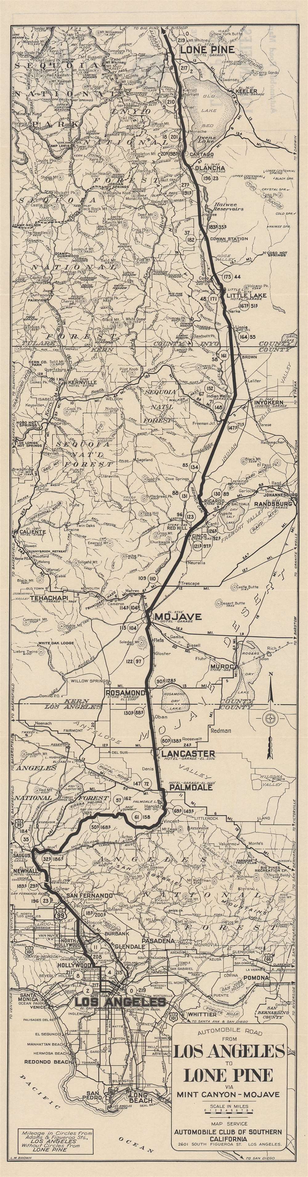
Automobile road from Los Angeles to Lone Pine via Mint Canyon-Mojave.
sold
- Digital Map Information
- Suitable for large format printing
- Full resolution TIFF file
- ICC color profile embedded
- Delivered instantly via download link
This is a c. 1935 'strip map' of the automobile route from Los Angeles to Lone Pine, a town in the Owens Valley, tucked between the Sierra Nevada, White, and Inyo Mountains. The map reflects both the growing automobile infrastructure in rural California and increased interest in California's natural beauty. (more details)
Mars, the God of War, look on as Fame proclaims the of the Birth of the United States.
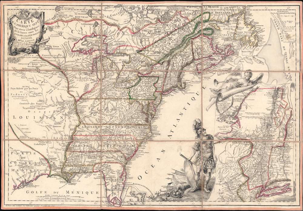
Carte de l'Amerique Septle. pour Servir a l'Intelligence de la Guerre Entre les Anglois et les Insurgents.
sold
- Digital Map Information
- Suitable for large format printing
- Full resolution TIFF file
- ICC color profile embedded
- Delivered instantly via download link
This is a rare 1777 Jean-Baptiste Jacques de Beaurain map of the United States during the American Revolutionary War, issued in anticipation of French entry into the war on the side of the revolutionaries. The map includes a bold illustration of the goddess Ossa (fame) unrolling an expansive map of the Theater of War in the Hudson corridor, proclaiming the newly formed United States. Mars, the god of War, looks on, shield and torch in hand, his arsenal ready - much like France itself. This map is thus an instrument of propaganda intended to prepare the public for French participation in the American Revolution - an event which followed in early 1778. (more details)
First European map of Korea.
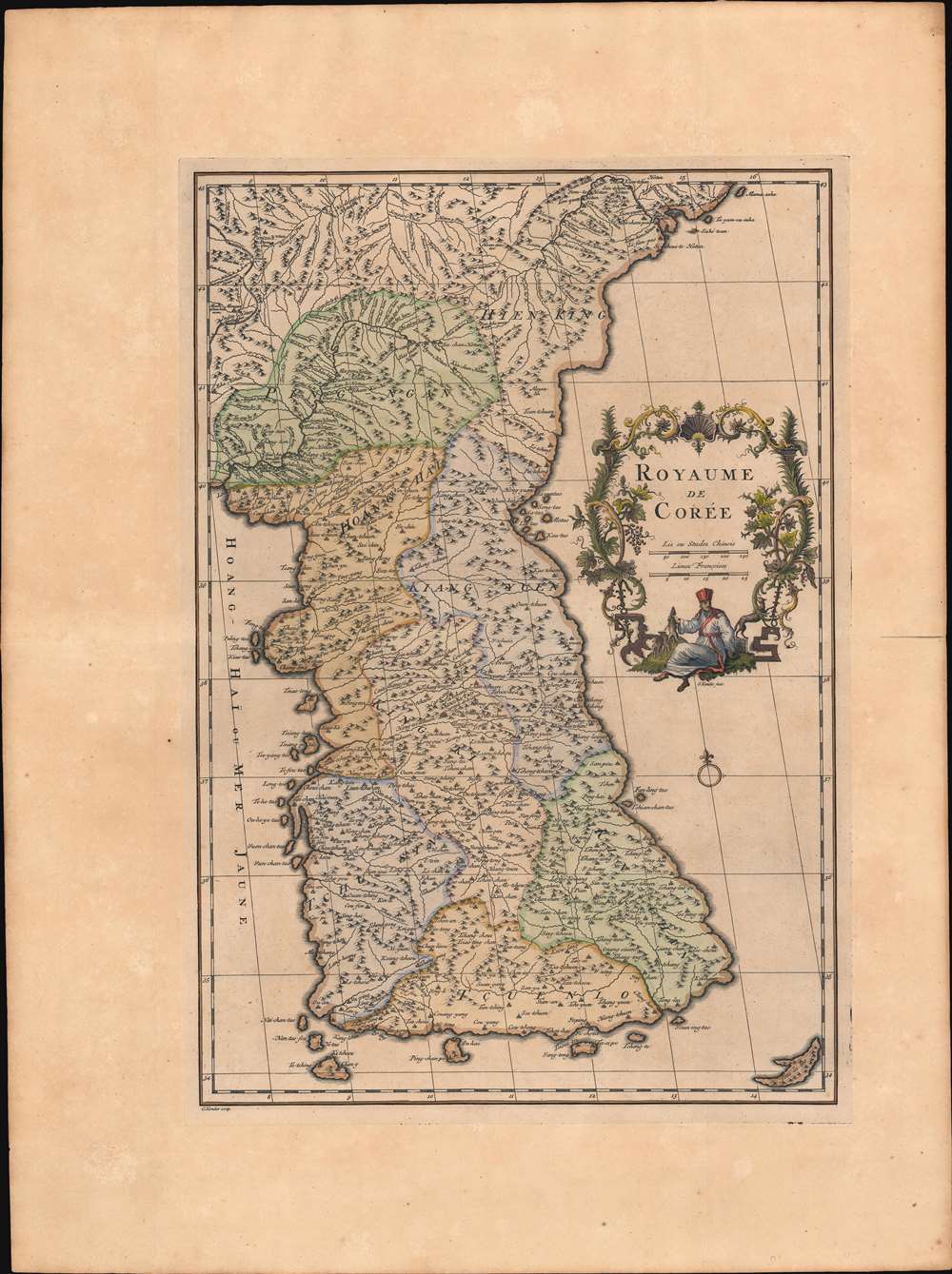
Royaume de Corée.
sold
- Digital Map Information
- Suitable for large format printing
- Full resolution TIFF file
- ICC color profile embedded
- Delivered instantly via download link
This is Jean Baptiste Bourguignon d'Anville's landmark 1737 map of Korea - the first map to introduce Korea to Europe. It is the first European published map to provide detailed cartographic data on Korea including a breakdown of Korean provinces with a reasonably accurate nomenclature. It further provides valuable references relating to the Dokdo / Ulleungdo dispute between Korea and Japan. (more details)
The first map of the Balearic Islands based on firsthand knowledge.
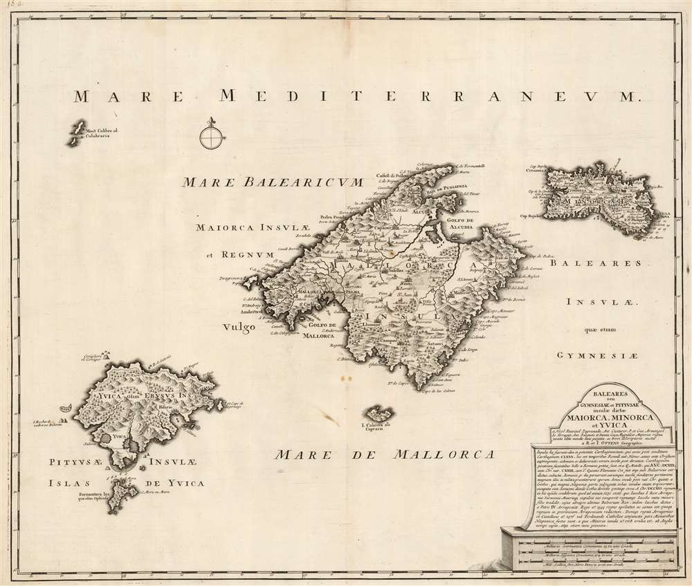
Baleares seu Gymnesiae et Pityusae insulae dictae Maiorca, Minorca et Yvica.
sold
- Digital Map Information
- Suitable for large format printing
- DPI: 600
- File Size: 55.98 MB
- File Type: ZIP / TIFF
- ICC color profile embedded
- Delivered instantly via download link
This is a superbly detailed map of the Balearic Islands by Renard and Josua Ottens, in what appears to be a scarce early state, as early as 1720. The map is oriented to the north, and includes the major islands of Mallorca, Menorca, Ibiza, and Formentera as well as the smaller Cabrera, Dragonera, and Monte Colibre. Mallorca and Menorca, in particular, are superbly detailed. All the major islands' terrain is richly and expertly engraved, illustrating topography, forests, and cultivated areas pictorially. Roads, cities, salt flats, and fortifications are depicted. Anchorages are indicated, in several cases with depth soundings. The elegant, spare cartouche features a brief history of the rulers of the islands, up to the English capture and occupation of Menorca in 1708. (more details)
Theatre of the First Anglo-Afghan War: The Beginning of the Great Game and the scene of the Disaster in Afghanistan.
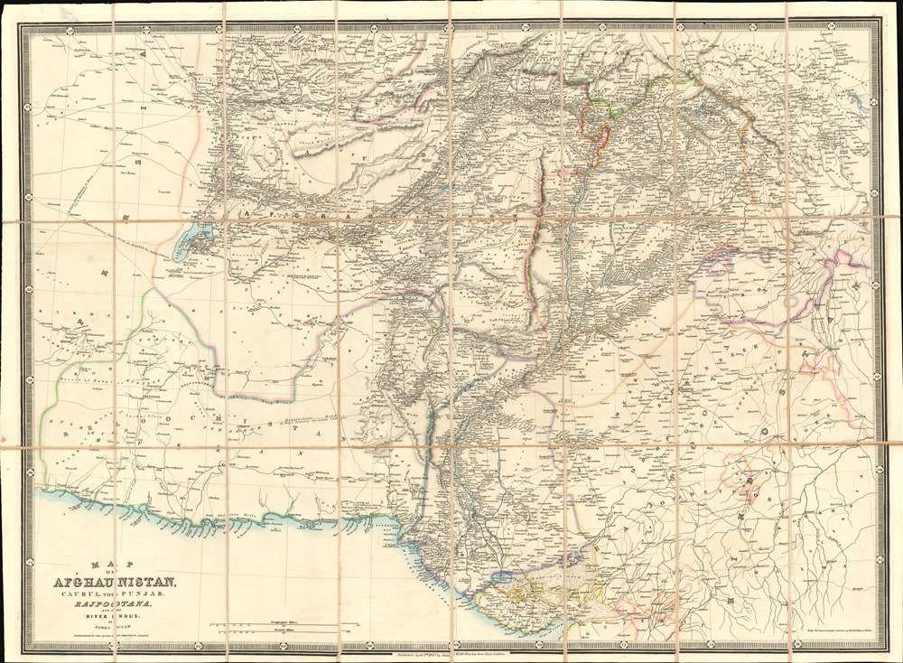
Map of Afghaunistan, Caubul, the Punjab, Rajpootana, and the River Indus.
sold
- Digital Map Information
- Suitable for large format printing
- Full resolution TIFF file
- ICC color profile embedded
- Delivered instantly via download link
This is an 1842 Wyld map of Afghanistan and its surrounds, illustrating the theatre of the First Anglo-Afghan War: the first major conflict of 'The Great Game' for British control of India. It was printed just three months after the disastrous Retreat from Kabul. Though the debacle is not specifically referred to here, the passes between Kabul and Peshawar are depicted with sufficient detail (surpassing other contemporaneous maps of the area ) that it seems clear that the map reflects the best British understanding of Afghanistan's geography at the time of the conflict. These include Gandamak - the pass approaching Jalalabad in which the massacre of Elphinstone's army took place between January 6 and January 13, 1842. (more details)
New Zealand on the cusp of an immigration boom.
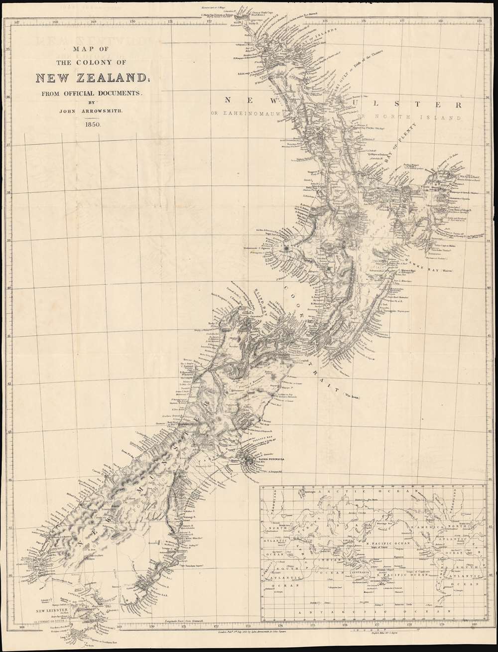
Map of the colony of New Zealand, from official documents.
sold
- Digital Map Information
- Suitable for large format printing
- DPI: 600
- File Size: 58.33 MB
- File Type: ZIP / TIFF
- ICC color profile embedded
- Delivered instantly via download link
This is a striking 1850 map of New Zealand by John Arrowsmith. It shows the colony in the early days of a surge of immigration from Britain and other British colonies that would drastically alter New Zealand society and environment. (more details)
A detailed map of India as it came under company rule.
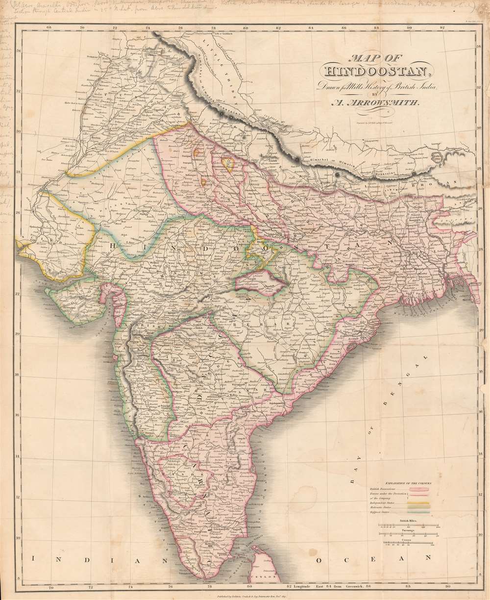
Map of Hindoostan drawn for Mill's History of British India.
sold
- Digital Map Information
- Suitable for large format printing
- DPI: 600
- File Size: 70.34 MB
- File Type: ZIP / TIFF
- ICC color profile embedded
- Delivered instantly via download link
Here is a vivid 1817 map of India made by Aaron Arrowsmith and engraved by Sidney Hall for the first edition of James Mill's The History of British India. This map was made as the British East India Company (E.I.C.) was quickly acquiring territory in India, mostly at the expense of the Maratha Confederacy, and gaining allies (protectorates) among the smaller 'princely states.' (more details)
A map for the roadmap to peace.

Map of the Interim Agreement between Israel and the Palestinians 09-28-95 / [מפת הסכם הביניים בין ישראל והפלסטינים 28.9.95].
sold
This is a map of the West Bank, Israel / Palestine, illustrating the 'Oslo II' Accords, signed in Taba, Egypt in 1995, following the Oslo Accord (Oslo I) two years earlier. It illustrates the bewildering complexity of trying to create distinct Israeli and Palestinian areas, the latter of which moved towards a degree of self-government following the agreements. (more details)
The diverse plant and animal life of the Pacific region.

Pageant of the Pacific. Plate II: The Flora and Fauna of the Pacific.
sold
- Digital Map Information
- Suitable for large format printing
- File Size: 156.16 MB
- File Type: ZIP / TIFF
- ICC color profile embedded
- Delivered instantly via download link
This is a 1940 Miguel Covarrubias pictorial map of the Pacific. (more details)
The bay and fortifications of Saint Martin.
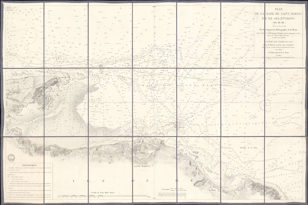
Plan de la Rade de Saint Martin et de ses Environs. (Ile de Ré).
$650.00
Acquire
- Digital Map Information
- Suitable for large format printing
- File Size: 38.53 MB
- File Type: ZIP / TIFF
- ICC color profile embedded
- Delivered instantly via download link
This is an 1867 French Dépôt de la Marine nautical chart or maritime map of Saint Martin Bay, Ile de Ré, France. Depicting the north shore of the Ile de Ré from Loix to La Flotte, hundreds of depth soundings populate the bay. Saint Martin appears at bottom center, with the city's fortifications illustrated in detail. (more details)
Promotes tourism to Alaska in the 1930s.

Territory of Alaska. The All-American Route - Alaska Steamship Company - Serving All of Alaska!
sold
- Digital Map Information
- Suitable for large format printing
- File Size: 139.02 MB
- File Type: ZIP / TIFF
- ICC color profile embedded
- Delivered instantly via download link
This is a first edition 1936 Frank McCaffrey map of Alaska created for the Alaska Steamship Company. Sea routes between Seattle and cities and towns in Alaska are highlighted, including the route up the Inside Passage. Juneau, Sitka, Anchorage, Fairbanks, Dutch Harbor, and Nome are all labeled, as are numerous smaller towns and villages. Mt. McKinley (Denali) National Park, and Glacier Bay National Park are noted. The Alaska Highway is also noted, as are gold placers and oil fields. (more details)
Peace in Vietnam?
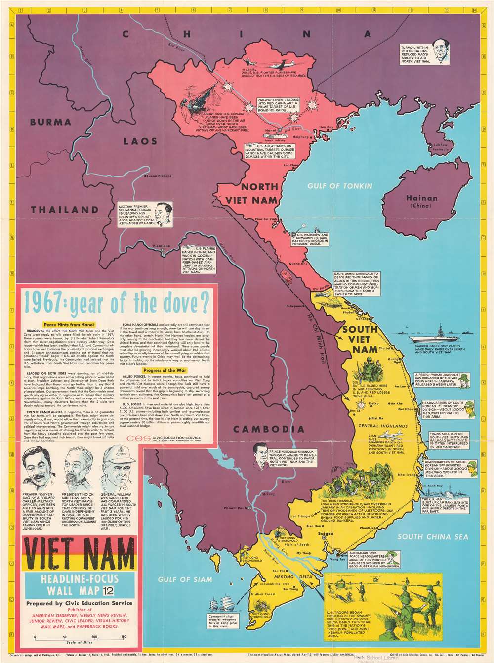
Vietnam. Headline-Focus Wall Map 12.
sold
This is a 1967 Civic Education Service pictorial map of Vietnam during the Vietnam War. Pictorial vignettes illustrate American, South Korean, and Australian forces fighting in South Vietnam, along with American bombing raids and North Vietnamese antiaircraft guns in North Vietnam. Text boxes provide short summaries of events. Text in the lower-left summarizes Vietnam in early 1967 with an emphasis that North Vietnam and the United States could soon enter peace talks. (more details)
One of the earliest detailed maps of New Zealand, following Cook's first voyage.
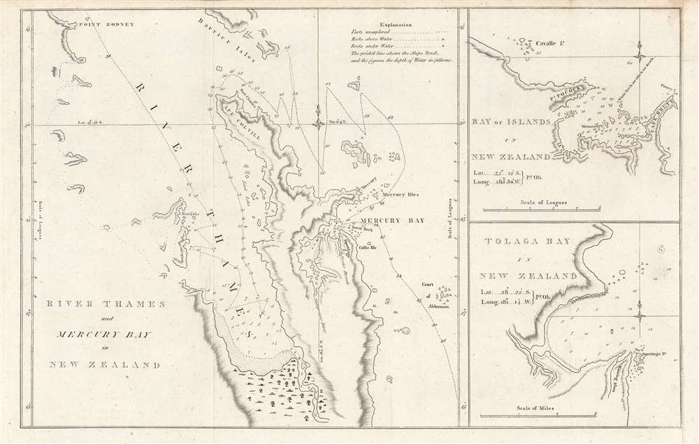
River Thames and Mercury Bay..., Bay of Islands..., Tolaga Bay...
sold
- Digital Map Information
- Suitable for large format printing
- DPI: 600
- File Size: 23.73 MB
- File Type: ZIP / TIFF
- ICC color profile embedded
- Delivered instantly via download link
This is an important map of the bays of northern New Zealand (Mercury, Tolaga, Bay of Islands, and the Firth of Thames) published by John Hawkesworth in his An account of the voyages undertaken, a 1773 book recounting recent British voyages to the Pacific, including the first voyage of Captain James Cook. The map is based on Cook's papers and sketches and constitutes the first detailed map of these bays. (more details)
Mauch scouts out the Mozambican interior.
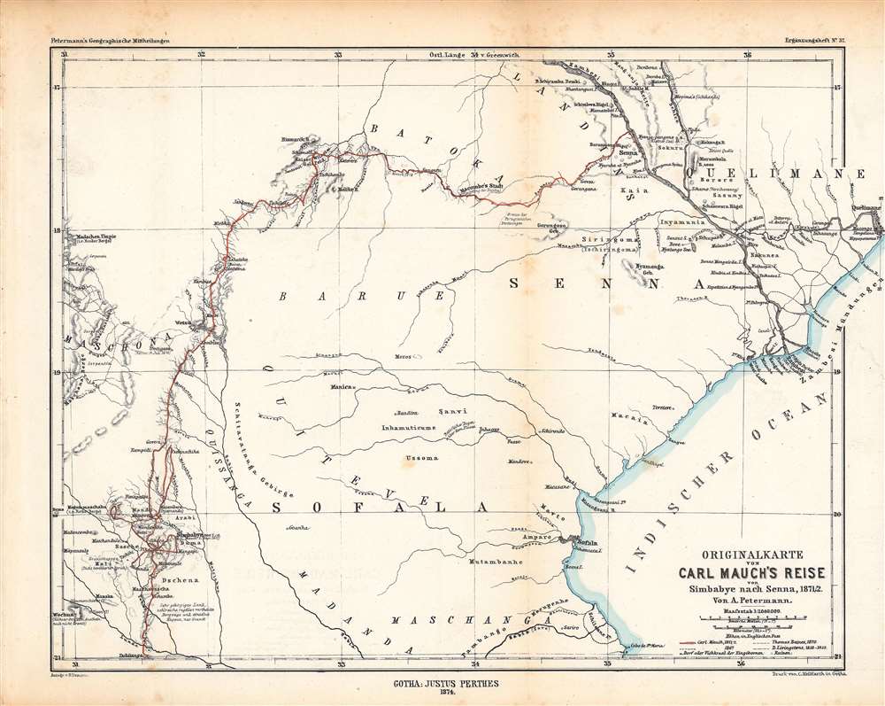
Originalkarte von Carl Mauch·s Reise von Simbabye nach Senna, 1871/72.
$350.00
Acquire
- Digital Map Information
- Suitable for large format printing
- File Size: 16.81 MB
- File Type: ZIP / TIFF
- ICC color profile embedded
- Delivered instantly via download link
This is an 1874 Augustus Petermann map of central Mozambique, tracing the journey of Carl (or Karl) Mauch, a German explorer. It depicts the area between the Zambezi and Save Rivers, where the Portuguese had long maintained a coastal presence with more tenuous control inland. (more details)
From the sea to the Sudan.
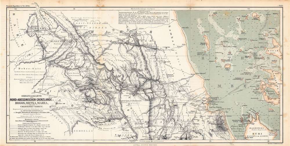
Originalkarte der Nord-Abessinischen Grenzlande Bogos, Mensa, Marea und der umliegenden Gebiete...
$350.00
Acquire
- Digital Map Information
- Suitable for large format printing
- File Size: 37.15 MB
- File Type: ZIP / TIFF
- ICC color profile embedded
- Delivered instantly via download link
This is an 1864 Augustus Petermann and Bruno Hassenstein map of what is today Eritrea, including a nautical chart of the Red Sea along the Eritrean coast. It illustrates the routes of mid-19th century European explorers from the Red Sea westwards to the Sudan. (more details)