
One of only a handful of maps to show Leigh Read County.
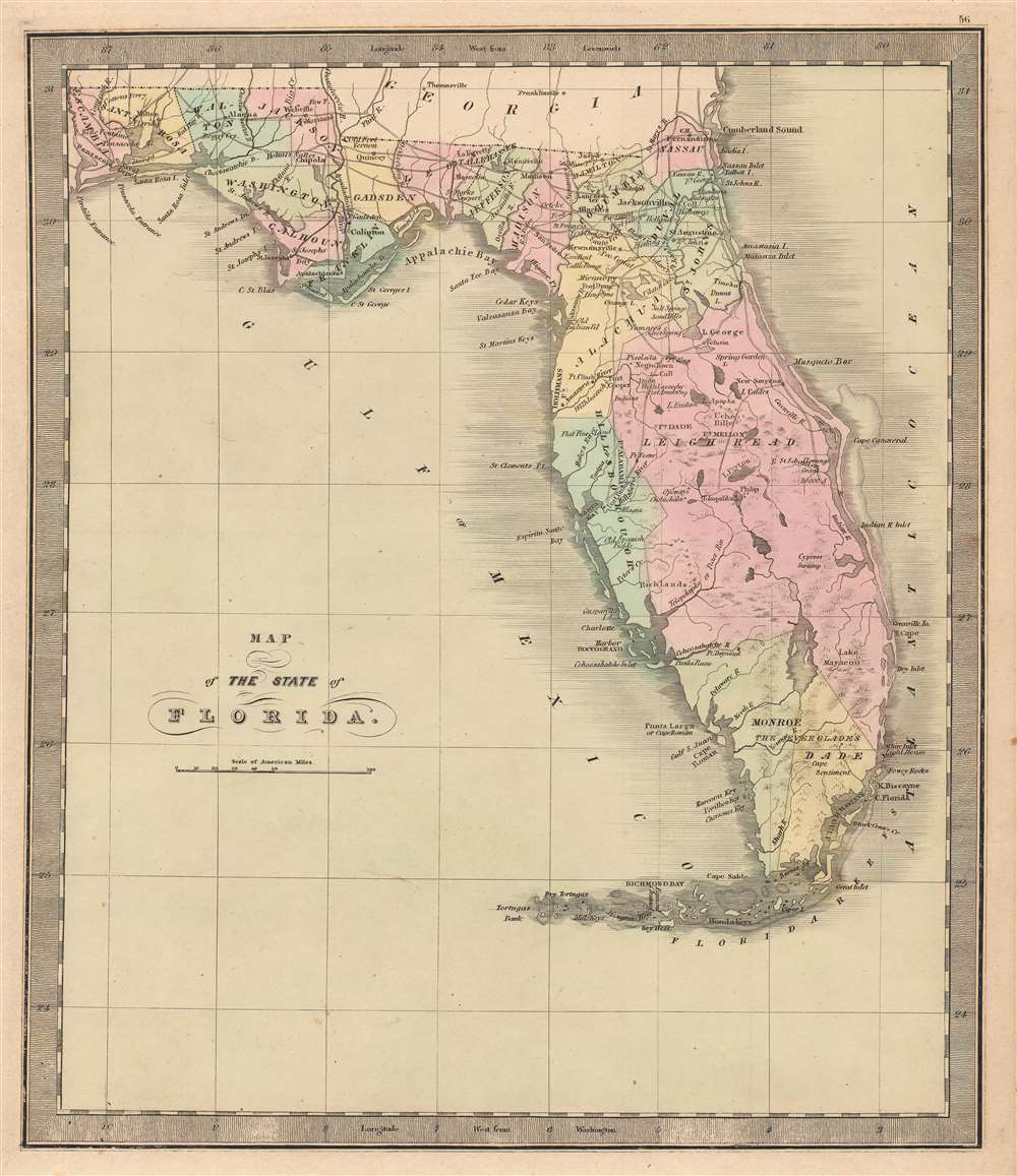
Map of the State of Florida.
sold
- Digital Map Information
- Suitable for large format printing
- DPI: 600
- File Size: 23.84 MB
- File Type: ZIP / TIFF
- ICC color profile embedded
- Delivered instantly via download link
This is Jeremiah Greenleaf’s 1848 map of Florida, notable as being one of the few maps to include the ephemeral Leigh Read County (Mosquito County). The map depicts Florida in full, from the Perdido River to the Atlantic Ocean and from Georgia and Alabama to Key West. Roads connecting the towns, forts, and other settlements are illustrated, along with railroads (there were only 2 at the time) and canals. In addition, the map includes 'Fleming's Grant' on the San Sabastian River, considered a potential new homeland for Irish displaced by the Potato Famine (1845 - 1849). (more details)
A view of West Point published by the U.S. Military Academy.
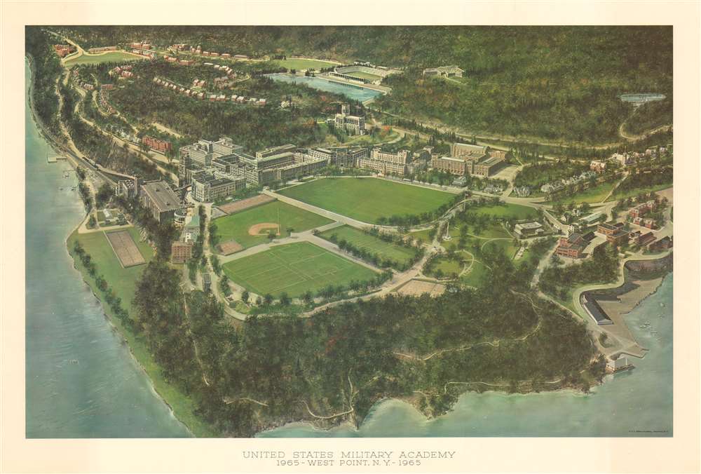
United States Military Academy 1965 - West Point, N.Y. - 1965.
sold
This is a 1965 view of the United States Military Academy at West Point, New York. Overlooking campus from the northeast above the Hudson River, West Point's soccer and baseball field are easily recognized, as is The Plain, the site of the longest continually occupied U.S. Army garrison. The statue of Revolutionary War General Tadeusz Kościuszko is recognizable in the foreground overlooking the Hudson, as is the Battle Monument just north of The Plain, which was dedicated on May 30, 1897 by surviving American Civil War veterans. Behind The Plain is Washington Hall, and further in the background along the side of a hill is an ornate building, a classic example of gothic revival architecture, which is the West Point Cadet Chapel. Other points of interest include Fort Putnam, used as a military garrison during the Revolutionary War, Lusk Reservoir, and Michie Stadium. (more details)
Cowboys and Cold War propaganda.

アメリカ合衆國 主要地方資源產物及び風景絵入り地図 / [Pictorial Map of the United States of America Showing Principal Regional Resources, Products and Natural Features].
sold
- Digital Map Information
- Suitable for large format printing
- File Size: 129.51 MB
- File Type: ZIP / TIFF
- ICC color profile embedded
- Delivered instantly via download link
This is a c. 1954 Japanese language pictorial map of the United States published by the U.S. Department of State and distributed by the U.S. Information Agency (U.S.I.A.). It was likely intended both for Japanese travelers to the United States and for consumption within Japan to increase knowledge about the U.S. Although outwardly rather innocuous, it was a product of a wider Cold War information war meant to improve the perception of the U.S. in foreign countries. (more details)
An early voyage of exploration in the North Pacific.
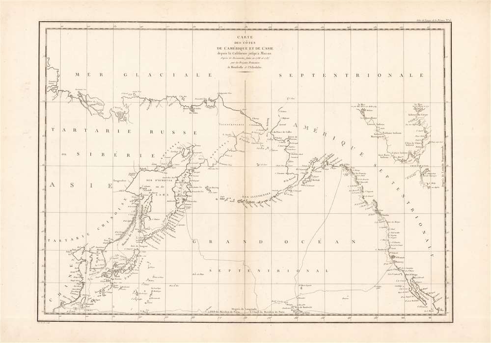
Carte des cotes de l'Amerique et de l'Asie...
$800.00
Acquire
- Digital Map Information
- Suitable for large format printing
- Full resolution TIFF file
- ICC color profile embedded
- Delivered instantly via download link
This is a wonderful example of La Perouse's important 1786 mapping of the North Pacific. When drawn in 1786 La Perouse's map was the only available map of much of this region not based on the survey work of Captain Cook. (more details)
A one-of-a-kind pictorial watercolor Nazi German map of Europe during World War II.

[German Manuscript Map of Europe During World War II].
sold
- Digital Map Information
- Suitable for large format printing
- Full resolution TIFF file
- ICC color profile embedded
- Delivered instantly via download link
This is a two sheet c. 1943 Nazi German manuscript map of Europe during World War II. (more details)
The best early wall map of Hartford County, Connecticut.
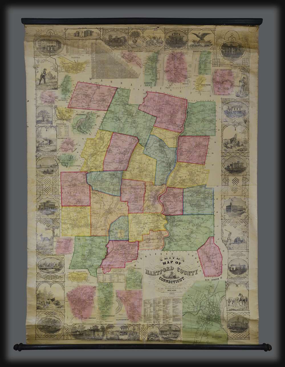
Smith's Map of Hartford County Connecticut.
sold
This is a rare and spectacular 1855 wall map of Hartford County, Connecticut by Edgar M. Woodford. Centered on the city of Hartford and the Connecticut River, this map covers the entire county and is color coded by township. Countless individual property holders and homes are identified throughout. The map features a wide decorative border with images of the State House in Hartford, State Normal School in New Britain, Connecticut Literary Institution in Suffield, the home of Col. A. G. Hazard in Enfield, the elegant Residence of Wm. H. Jones with View of Silk Factory, the Charter Oak, wildlife, and an Indian Warrior. Twenty insets surrounding the map are large and detailed town plans of Hartford, Farmington, Rockyhill, New Britain, Wethersfield, Glastonbury (Glastenbury), South Glastonbury (Glastenbury), Windsor Locks, Thompsonville, Broad Brook, Warehouse Point, Plainville, Cheneyville, Southington, Unionville, Collinsville, Hazardville, Plantsville, and Berlin. (more details)
Japanese New York in the 1990s.

五番街マキ特製ニユーヨークのアフテー5フアイブ地図 / [Fifth Avenue Maki Special New York After Five Map].
sold
This is a unique and whimsical Japanese-language map of Manhattan made by the now-closed Japanese luxury department store, Maki Fifth Avenue (五番街マキ). It was designed to highlight a wide variety of attractions around Manhattan (south of 59th St.) for shoppers to engage in after visiting the Maki store. (more details)
Pretty mountains and political violence.
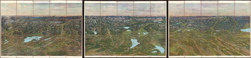
Relief-Karte vom Bayerischen Hochland.
sold
- Digital Map Information
- Suitable for large format printing
- Full resolution TIFF file
- ICC color profile embedded
- Delivered instantly via download link
This is a beautiful c. 1935 chromolithograph view of the Bavarian Highlands (or Bavarian Alps) illustrated by Zeno Diemer in three sheets. It was made to promote tourism to the region, which had seen extreme political turmoil in the preceding years, even by the standards of interwar Germany. (more details)
A colorful map of the Mississippi River System highlighting efforts at flood control following the devastating floods of 1945.
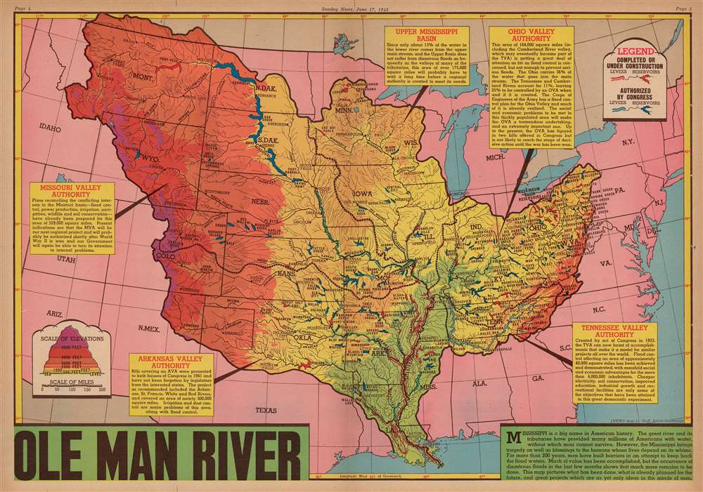
Ole Man River.
sold
- Digital Map Information
- Suitable for large format printing
- File Size: 76.44 MB
- File Type: ZIP / TIFF
- ICC color profile embedded
- Delivered instantly via download link
This is a 1945 Edwin L. Sundberg map of the Mississippi River System in the United States. After the region suffered one of its worst floods in recorded history, attention focused on measures being taken to prevent such disasters. Red and blue notations highlight levees and reservoirs used in flood control, with red levees and reservoirs representing projects that had been completed or were currently under construction and blue ones noting future projects that had already been approved by Congress. This vast undertaking not only prevented citizens from losing their homes to floodwaters, but also held numerous other benefits, such as 'power production, irrigation, navigation, and wildlife and soil conservation' in the Missouri Valley. Similar projects in the Arkansas Valley were meant to help with irrigation and dust control. Each reservoir, no matter whether it was completed or proposed, is identified by name. Shading is used to illustrate the changes in elevation throughout the system, which provides a much broader image for the reader. Text boxes about the Missouri Valley Authority, the Arkansas Valley Authority, the Tennessee Valley Authority, the Ohio Valley Authority, and the Upper Mississippi Basin contain information about each authority. (more details)
Splendid pictorial map of Paris and its monuments.
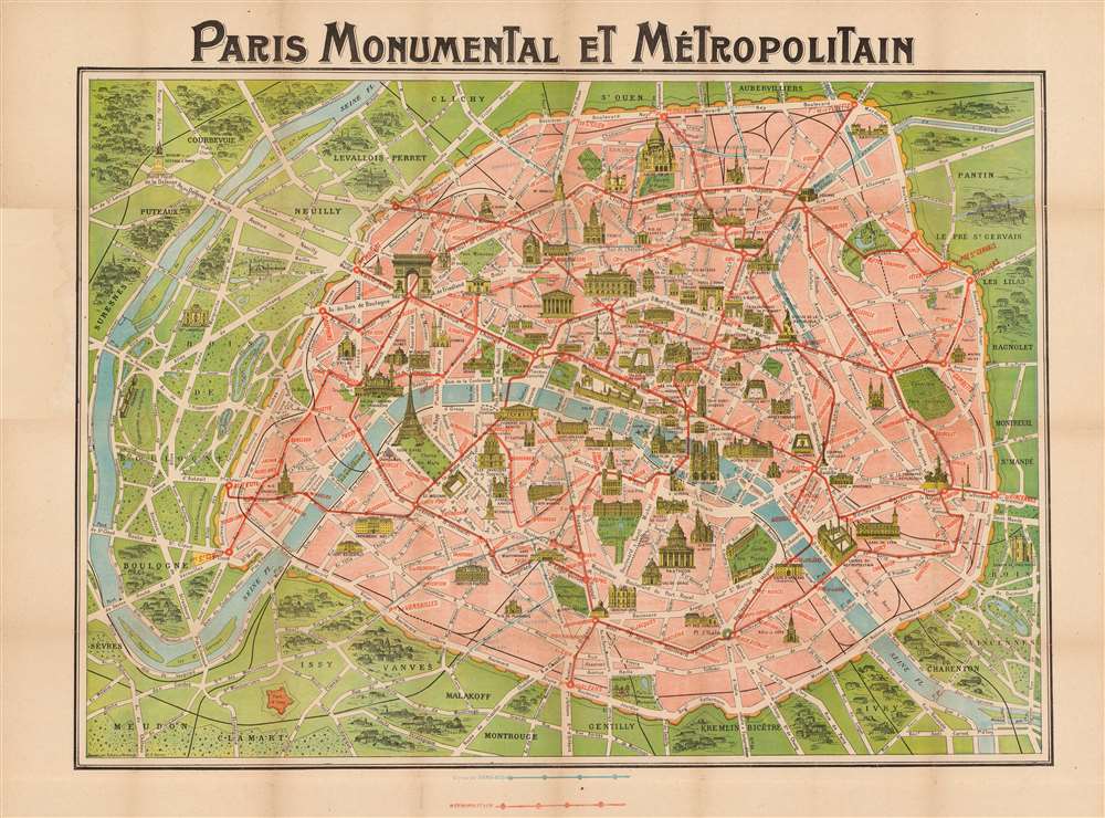
Paris Monumental et Métropolitain.
sold
- Digital Map Information
- Suitable for large format printing
- File Size: 134.43 MB
- File Type: ZIP / TIFF
- ICC color profile embedded
- Delivered instantly via download link
This extremely appealing c. 1913 pocket map of Paris, France by Robelin, combines the virtues of a map and a view. Designed with the tourist in mind, this map illustrates the embastilled center of Paris and its immediate vicinity. Paris proper is colored in appealing pastels and exhibits more 'map-like' qualities in the layout of the streets, trains, and bridges. Various monuments, including the Eiffel Tower, the Arc de Triomphe, Sacre-Coeur, the Pantheon, and others are illustrated in profile. Major streets, subway lines, and subway stations are also noted. Paris is surrounded in green, including the Bois de Boulogne and the Bois de Vincennes. Several of the surrounding villages are labeled as well. (more details)
Hottest place on Earth.
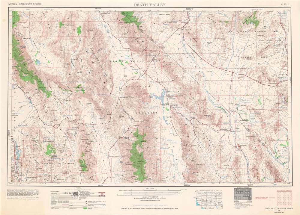
Death Valley.
sold
This is a 1961 U.S. Army Map Service map of Death Valley National Monument (now a National Park), with surrounding mountain ranges and valleys along the California-Nevada border in the Mojave Desert. This map reflects the history of the region, which has been inscribed onto the landscape in the form of Native American settlements, abandoned mines, federally protected land, and military testing sites, including nuclear testing sites. (more details)
The first scientific mapping of the entire region
based on actual observation. - Martin and Martin
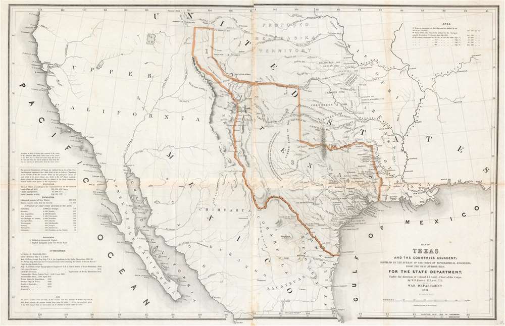
Map of Texas and the Countries Adjacent: Compiled in the Bureau of the Corps of Topographical Engineers; From The Best Authorities, for the State Department, Under the Direction of Colonel J. J. Albert, Chief of the Corps; by W. H. Emory, 1St. Lieut. T.E.
sold
- Digital Map Information
- Suitable for large format printing
- DPI: 600
- File Size: 29.71 MB
- File Type: ZIP / TIFF
- ICC color profile embedded
- Delivered instantly via download link
A seminal production, this 1844 large-format edition map of the Republic of Texas by the U.S. Topographical Engineer, W. H. Emory, is the most important pre-war map of Texas. Centered on the vast claims of the Republic of Texas, Emory's map offers expansive coverage extending from the Pacific to west Florida and from South Pass (modern day Wyoming) to Tampico, Mexico. This map is significant on a number of levels. First, it is the first scientifically surveyed map of the Texas region. Second, it serves as the official U.S. acknowledgement of the full territorial claims of the Republic of Texas. Third, it is a vital reconnaissance of the Texas region in anticipation of the breakout of the Mexican-American War (1846 - 1848). Fourth, it establishes the Texas claims that would be fought over during the Mexican-American War. Fifth and finally, it lays down the Texas borders that would later be copied by Disturnell in his 'Treaty Map' of 1847, formalizing the U.S-Mexican border. (more details)
Pedagogical tool - The Empire of Things.
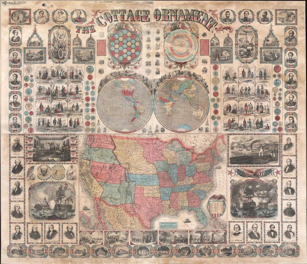
The Cottage Ornament.
sold
- Digital Map Information
- Suitable for large format printing
- File Size: 145.31 MB
- File Type: ZIP / TIFF
- ICC color profile embedded
- Delivered instantly via download link
An impressive pedagogical tool, this is Ensign, Bridgman and Fanning's 1857 wall map of the United States with a densely informative surround. The complex and dense wall map was designed to address pedagogical issues of the mid-19th century, when the westward expansion and homesteading led to increased rural populations without access to educational infrastructure. It is intended to be a textbook at-a-glance, able teach American history, science, and geography, as well as inspire patriotic optimism. The overall organization and pictorial richness mean the reader need not even be literate to absorb the map's messages. (more details)
The Second Age of Discovery summarized in a game.
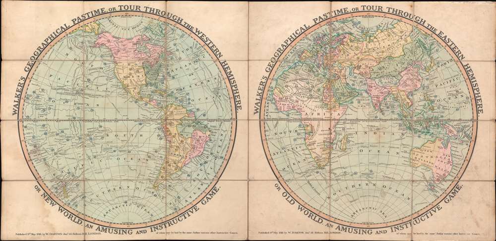
Walker's Geographical Pastime, or Tour Through the Western Hemisphere, or New World. An Amusing and Instructive Game. Walker's Geographical Pastime, or Tour Through the Eastern Hemisphere, or Old World. An Amusing and Instructive Game.
sold
- Digital Map Information
- Suitable for large format printing
- Full resolution TIFF file
- ICC color profile embedded
- Delivered instantly via download link
This is an 1816 William Darton game map of the world in two hemispheres. The map emerged early in the 19th century during a period of global optimism, curiosity, and romanticism following the well-publicized voyages of Cook, Perouse, and Vancouver. It celebrates expanded geographical curiosity, while serving as a didactic tool to educate on matters of geography, history, and culture. (more details)
First year of the American Civil War.
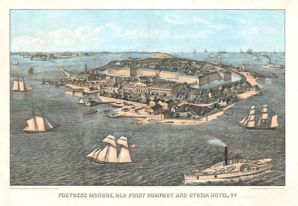
Fortress Monroe, Old Point Comfort and Hygeia Hotel, Va.
sold
- Digital Map Information
- Suitable for large format printing
- File Size: 52.72 MB
- File Type: ZIP / TIFF
- ICC color profile embedded
- Delivered instantly via download link
This is an 1861 Edward Sasche bird's-eye view map of Fort Monroe, Virginia. Published at the beginning of the American Civil War (1861 - 1865), the view overlooks Fort Monroe from the southeast, with the Hygeia Hotel in the foreground. A moat surrounds the fort, with buildings and soldiers drilling within the fort. Sailing and steamships fill the Hampton Roads and Chesapeake Bay. (more details)
Kyiv as a Soviet metropolis.

Київ схематичний план / [Kyiv Schematic Plan].
sold
This is a charming and extremely rare c. 1961 Ukrainian-language map of Kyiv, then capital of the Ukrainian Soviet Socialist Republic. It exhibits the city's revival after the horrors of the Second World War (1939 - 1945), when Kyiv was almost completely destroyed, and its postwar boom, driven by Cold War defense industries. (more details)
The Danube below Vienna.
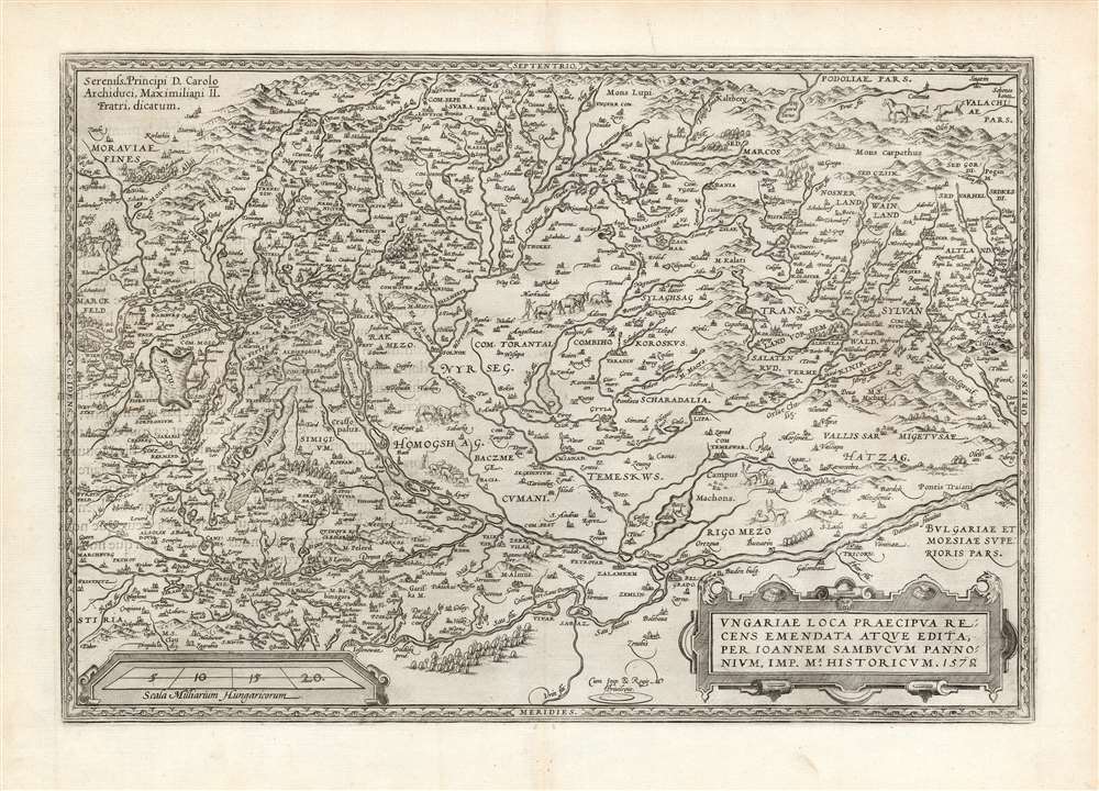
Ungariae Loca Praecipua Recens Emendata Atque Edita, per Ioannem Sambucum Pannonium, Imp. Ms. Historicum. 1579.
sold
- Digital Map Information
- Suitable for large format printing
- DPI: 600
- File Size: 47.53 MB
- File Type: ZIP / TIFF
- ICC color profile embedded
- Delivered instantly via download link
This is Ortelius' updated map of Hungary, derived from the similarly-titled and unacquirable 1571 map of János Zsámboky aka Johannes Sambucus. This new map supplemented Ortelius' earlier map of Hungary, based on the much older (1556) map of Wolfgang Lazio. (more details)
Italian edition of the Authoritative Mapping of the Southern British Colonies in North America.
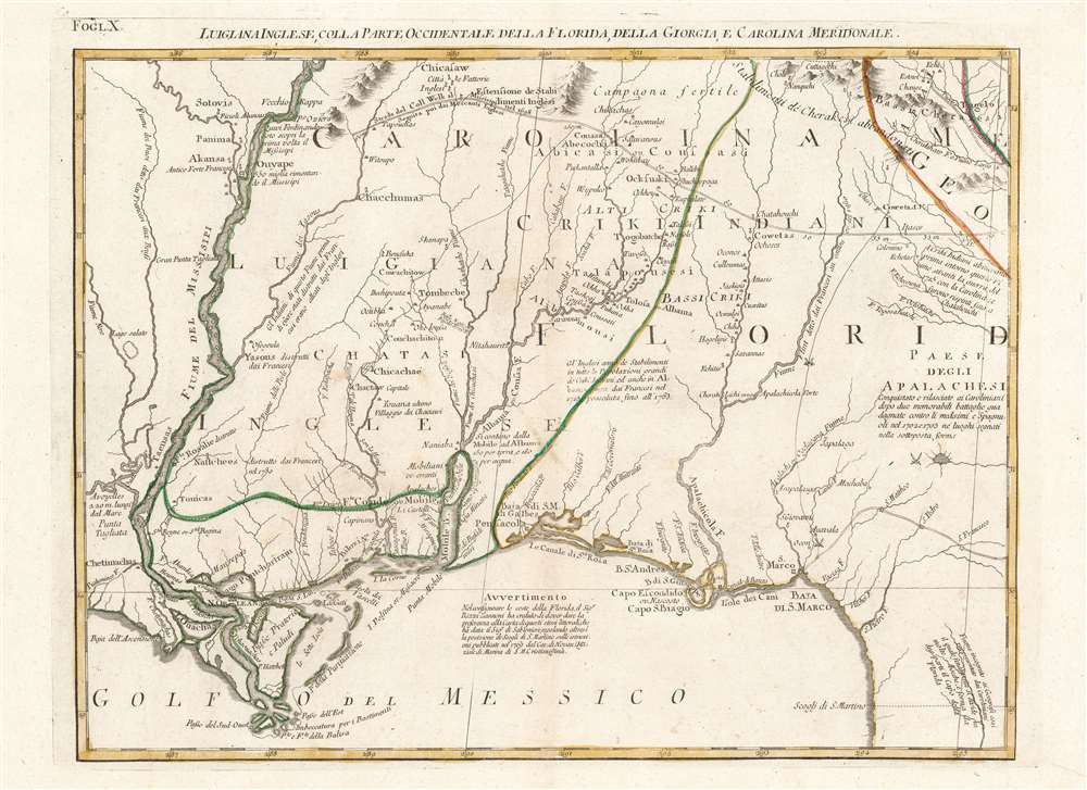
Luigiana Inglese, colla Parte Occidentale della Florida, della Giorgia, e Carolina Meridonale.
sold
- Digital Map Information
- Suitable for large format printing
- Full resolution TIFF file
- ICC color profile embedded
- Delivered instantly via download link
This is an attractive and fascinating 1778 Antonio Zatta map of the Gulf Coast from Louisiana to Florida, encompassing the region inclusive of modern-day Mississippi, Alabama and Georgia. The geography is drawn from John Mitchell's foundational 1755 A map of the British and French dominions in North America, the most important map of North America published in the 18th century. It remained so authoritative that it was used to draft the borders of the United States following Independence, and consulted for border disputes as recently as the 1980s. The present sheet hails from Zatta's Italian edition of the Mitchell, which faithfully copied the original in translation. (more details)
Cold War cartography.

Соединенные Штаты Америки / [United States of America].
sold
This is a 1979 Cold War Era Russian-language map of the United States of America published by the Main Administration of Geodesy and Cartography of the Soviet Union (known by the anglicized form of its Russian initials GUGK). Assisting GUGK with this map was the geographer Veniamin Maksovich Gokhman, one of the most knowledgeable experts on American economic geography in the U.S.S.R. The map and its insets highlight the industrial and economic geography of the U.S., valuable information for the Soviets about their Cold War adversaries. (more details)
Unrecorded chart of Florida and the Greater Antilles.
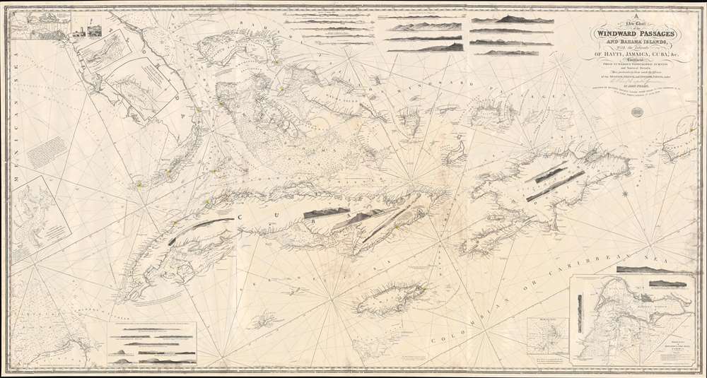
A New Chart of the Windward Passages and Bahama Islands, With the Islands of Hayti, Jamaica, Cuba, etc.
sold
- Digital Map Information
- Suitable for large format printing
- DPI: 600
- File Size: 81.76 MB
- File Type: ZIP / TIFF
- ICC color profile embedded
- Delivered instantly via download link
A rare and unusual 1848 John Purdy / Richard Holmes Laurie Blueback nautical chart or maritime map of Florida, the Bahamas, and the Greater Antilles - here in its only known surviving example. Oriented sharply to the northeast, the chart offers expansive coverage, embracing all of peninsular Florida, Cuba, the Bahamas, Hispaniola (Santo Domingo / Haiti), Jamaica, and Puerto Rico. The map exhibits some manuscript nautical annotations regarding lighthouses in the Bahamas and Cuba, but it is faded and unreadable. Insets detail important ports, including Havana, New Providence (Nassau), Matanzas, Guantanamo, the Morant Kays, and Kingston (Jamaica). (more details)