
Printed by the Army publication Stars and Stripes in the middle of the Korean War.
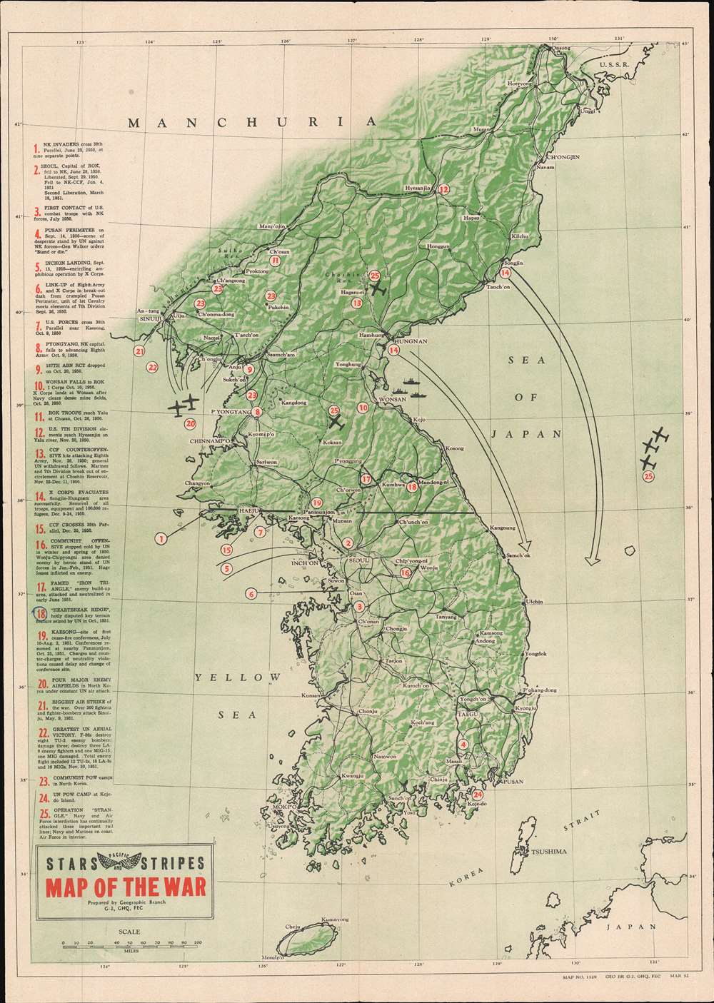
Map of the War.
sold
- Digital Map Information
- Suitable for large format printing
- File Size: 24.62 MB
- File Type: ZIP / TIFF
- ICC color profile embedded
- Delivered instantly via download link
This is a 1952 Pacific Stars and Stripes map of the Korean War. The map depicts the region from Manchuria to Japan and from the Yellow Sea to the Sea of Japan. Tracing events from the North Korean invasion of South Korea on June 25, 1950 through Operation Strangle, a sustained attack on North Korean communication and supply lines in late August 1951. Twenty-five different locations are numerically identified, these include U.N. attacks, North Korean or Chinese counterattacks, air strikes, 'Heartbreak Ridge', U.N. and Communist POW camps, and the site of the first ceasefire talks at Kaesong. Each action or location corresponds with an index along the left border. Major cities throughout both North and South Korea are labeled, as is the Yalu River (the border between North Korea and China). The 38th parallel, the border the North Koreans crossed to start the war, is highlighted by a solid black line. (more details)
The first scientific mapping of the entire region based on actual observation. - Martin and Martin
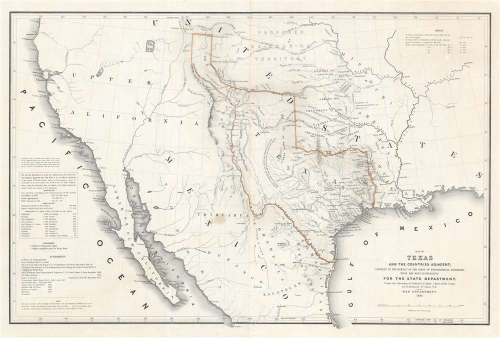
Map of Texas and the Countries Adjacent: Compiled in the Bureau of the Corps of Topographical Engineers; From The Best Authorities, for the State Department, Under the Direction of Colonel J. J. Abert, Chief of the Corps; by W. H. Emory, 1St. Lieut. T.E.
sold
- Digital Map Information
- Suitable for large format printing
- DPI: 600
- File Size: 28.42 MB
- File Type: ZIP / TIFF
- ICC color profile embedded
- Delivered instantly via download link
A seminal production, this 1844 large-format edition map of the Republic of Texas by the U.S. Topographical Engineer, W. H. Emory, is the most important pre-war map of Texas. Centered on the vast claims of the Republic of Texas, Emory's map offers expansive coverages extending from the Pacific to west Florida and from South Pass (modern day Wyoming) to Tampico, Mexico. This map is significant on a number of levels. First, it is the first scientifically surveyed map of the Texas region. Second, it serves as the official U.S. acknowledgement of the full territorial claims of the Republic of Texas. Third, it is a vital reconnaissance of the Texas region in anticipation of the breakout of the Mexican-American War (1846 - 1848). Fourth, it establishes the Texas claims that would be fought over during the Mexican-American War. Fifth and finally, it lays down the Texas borders that would later be copied by Disturnell in his 'Treaty Map' of 1847, formalizing the U.S-Mexican border. (more details)
One of the earliest maps of Taipei published during the Japanese occupation of Taiwan.
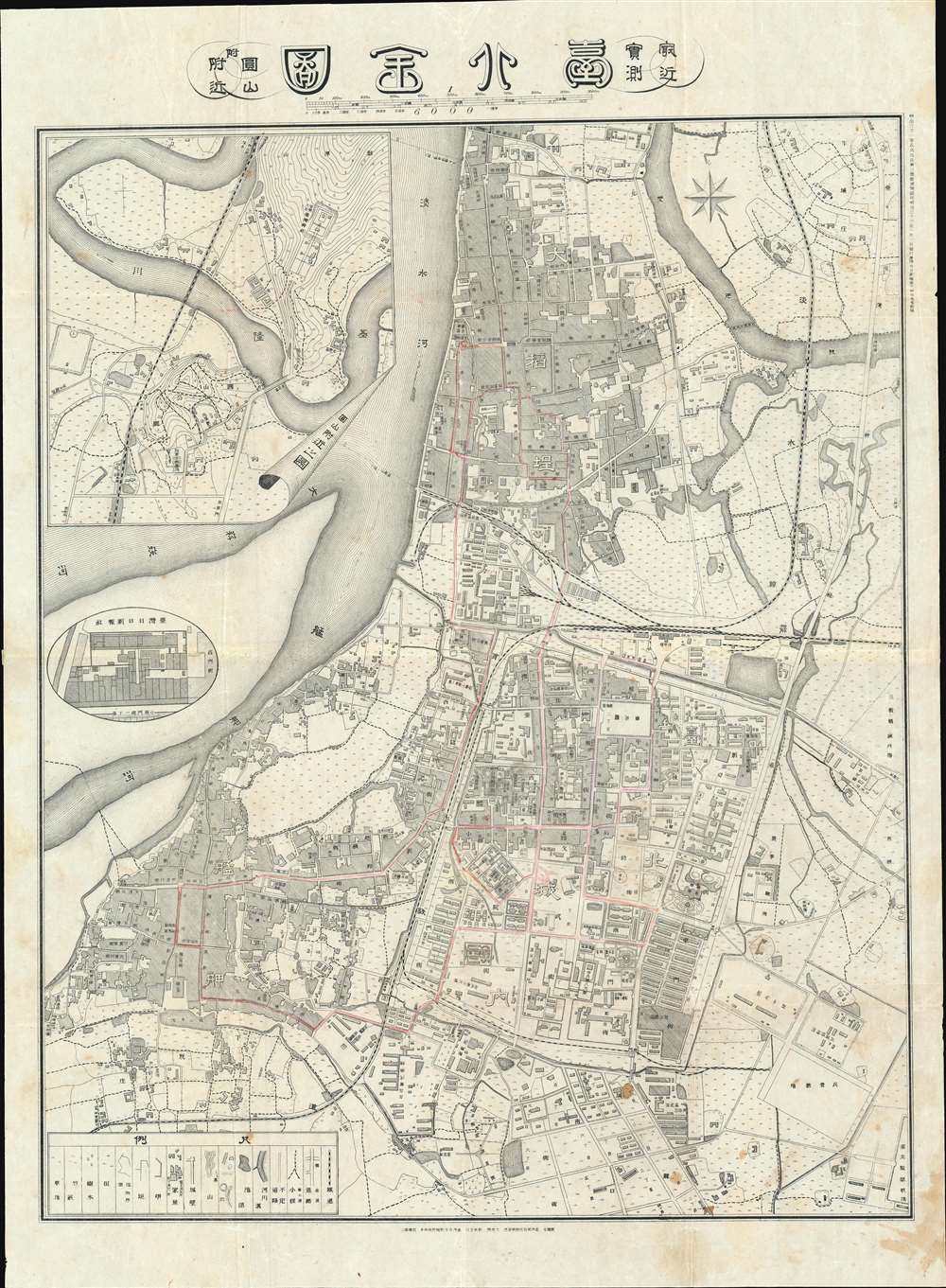
Comprehensive Map of Taihoku, from the Latest Survey. / 台北全図 : 最近実測
sold
- Digital Map Information
- Suitable for large format printing
- File Size: 45.74 MB
- File Type: ZIP / TIFF
- ICC color profile embedded
- Delivered instantly via download link
An extremely rare 1903 Meiji 36 Hikari Okura and Taiwan Nichi Nichi Shinpō map of Taipei city, Taiwan. This is one of the earliest maps of Taipei issued during the Japanese occupation of Taiwan in the early 20th century. It depicts Taipei's three-city area, including the old walled city and the extramural settlements of Mengjia (Bangka) and Dadaocheng. The map exhibits considerable advancement over earlier maps issued between 1895 and 1900, illustrating the extensive modernization and urban development projects going on throughout the city. A circular inset to the left of the urban center illustrates the Taiwan Nichi Nichi Shinpō newspaper's headquarters. Subtle manuscript highlights some streets referencing the growing Taipei tram system. (more details)
First Atlas Map of the Caribbean, and Northwestern Mexico.

Culiacanae, America Regionis Descriptio./ Hispaniolae, Cubae, Aliarumque Insularum Circumiacentium, Delineatio./ Cum Imp. et Regio./ privilegio decennali 1579.
sold
- Digital Map Information
- Suitable for large format printing
- DPI: 600
- File Size: 19.89 MB
- File Type: ZIP / TIFF
- ICC color profile embedded
- Delivered instantly via download link
This is an attractive, original-color example of Ortelius' 1579 map of the Viceroyalty of Culiacan in Northwestern Mexico, and Ortelius' map of Cuba and the Caribbean. While Ortelius is generally most esteemed as an editor and compiler of maps, he was an accomplished mapmaker in his own right, and this map is among those of his Theatrum of his own composition, synthesizing data drawn from Mercator's 1569 world map, Gutierrez's 1562 America map and Alonso de Santa Cruz's 1560 Isolario (sources now unobtainable by the collector). These maps, both of essential areas of recent exploration in the New World, exemplify Ortelius' trail-blazing cartographic work. (more details)
Rare map of New Haven showing original grantees!
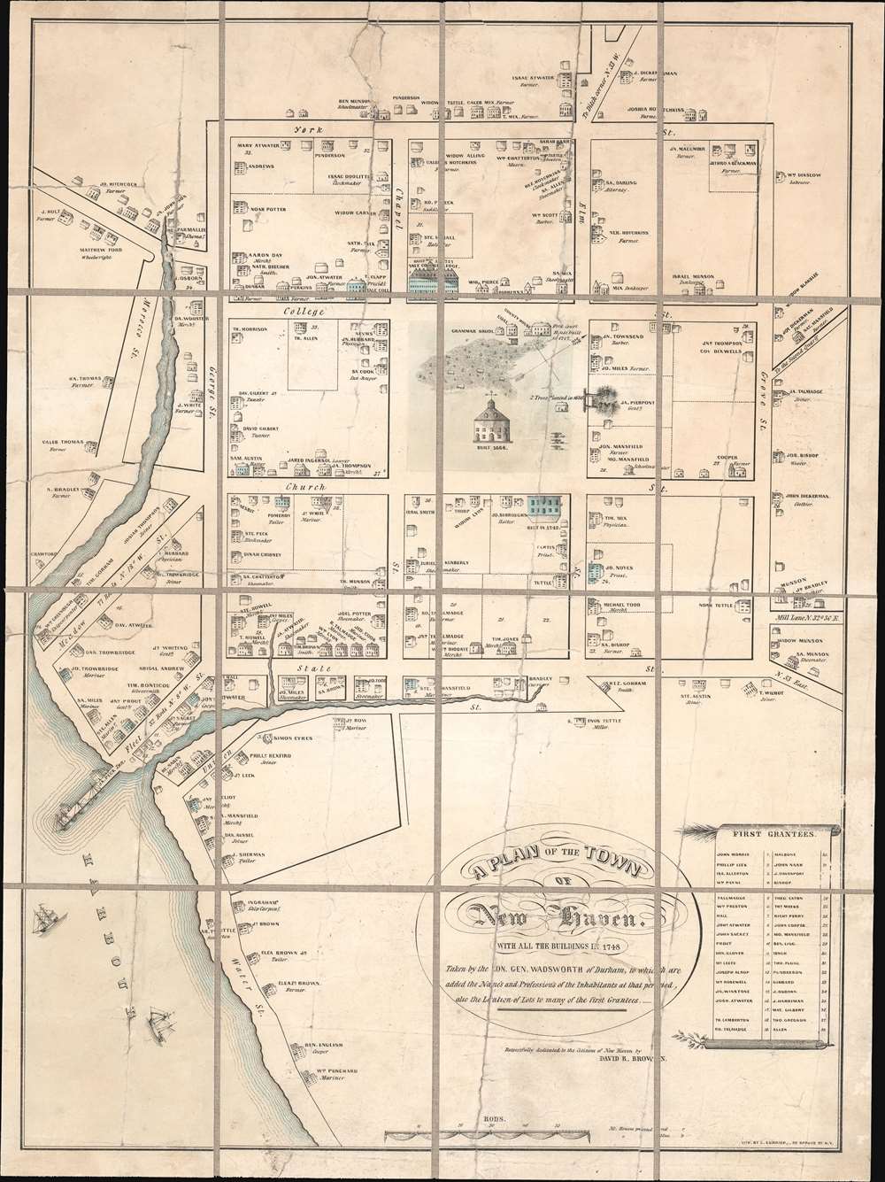
A Plan of the Town of New Haven. With all the Buildings in 1748 Taken by the Hon. Gen. Wadsworth of Durham, To Which Are Added The Name's and Profession's of the Inhabitants at that period, also the Location of Lots to many of the first Grantees.
sold
- Digital Map Information
- Suitable for large format printing
- File Size: 16.17 MB
- File Type: ZIP / TIFF
- ICC color profile embedded
- Delivered instantly via download link
This is a c. 1865 Charles Currier and David R. Brown lithographic reissue of the 1806 Thomas Kensett / James Wadsworth map of New Haven, Connecticut, as it appeared in 1748. The Kensett / Wadsworth map is considered to be the earliest map of New Haven. The map is oriented roughly to the northwest and covers the 9 city blocks surrounding the New Haven Green. It further extends to incorporate the harbor and nearby waterways, most of which have since been altered by landfill projects. The identifies Yale University (built in 1717), the city hall (constructed in 1668), and two trees on the Green plated in 1686. It further notes the location of various c. 1748 private residences, noting the owner's name and profession. In the lower right quadrant, there appears a list of the original 38 grantees, most of which also appear on the map. (more details)
Cook's Journeys In Search of the Southern Continent.
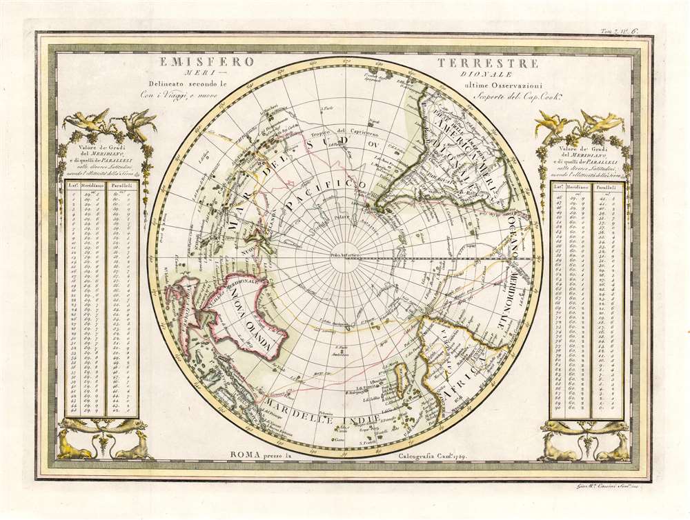
Emisfero Terrestre Meridionale Delineato secondo le ultime Osserrvazioni Con i Viaggi, e nuove Scoperte del Cap. Cook.
sold
- Digital Map Information
- Suitable for large format printing
- DPI: 600
- File Size: 13.41 MB
- File Type: ZIP / TIFF
- ICC color profile embedded
- Delivered instantly via download link
A superb example for Giovanni Maria Cassini's elegantly engraved map of the Southern Hemisphere. The map shows the tracks of all four of Captain Cook's famous voyages, including the return track taken by his survivors after his 1779 death in Hawaii. The map shows Cook's mapping of Australia and New Zealand (from his first voyage of 1768 - 1771) and his circumnavigation of the Antarctic Circle, in search of the still-undiscovered southern continent (Terre Australis). The map is flanked with tables (decorated with birds, beasts and vines) giving the distances between meridians at different latitudes. (more details)
Diplomatic ploy that may have contributed the Qing cession of Taiwan/Formosa to Japan.
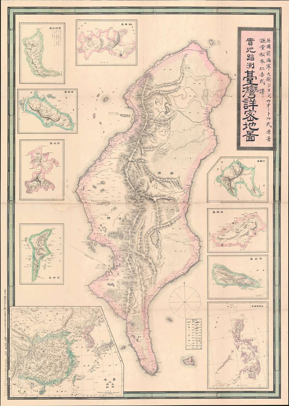
Detailed Map of Taiwan Field Survey. / 實地踏測台灣詳密地圖
sold
- Digital Map Information
- Suitable for large format printing
- Full resolution TIFF file
- ICC color profile embedded
- Delivered instantly via download link
The first Japanese printed map of Taiwan and the birth certificate of Japanese-occupied Formosa. An extremely scarce and important 1895 or Meiji 28 large-scale map of Taiwan or Formosa issued near the end of the First Sino-Japanese War (August 1, 1894 - April 17, 1895), prior to the Treaty of Shimonoseki (April 17, 1895) and the Japanese invasion of Taiwan (May 29, 1895 - October 21, 1895). This map was likely a diplomatic and propaganda ploy prepared in anticipation of the Shimonoseki treaty negotiations, which included an Imperial Japanese demand for the Qing cession of Formosa/Taiwan. The map illustrates Taiwan/Formosa with a striking malformed shoreline and inaccurate interior, expanding Tainan and Hsinchu harbors into vast bites, adding corresponding projections to eastern Formosa, and shifting the Central mountains west. The deviations from established Formosa cartography, much of which was available to the Japanese, indicate an insidious intent - a diplomatic deception intended to diminish the territorial significance of Qing administered Formosa, then limited to the coastal lowlands west of the Central Mountain Range, while at the same time exaggerating the eastern ungoverned tribal regions and retaining the island's overall area. (more details)
How the dollar became the world's dominant currency.
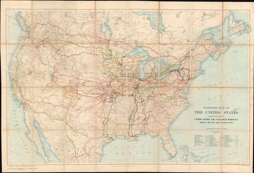
Stanford's Map of the United States showing the principal United States and Canadian Railways quoted in the Daily Stock Exchange Lists.
sold
- Digital Map Information
- Suitable for large format printing
- Full resolution TIFF file
- ICC color profile embedded
- Delivered instantly via download link
Illustrating a little-known chapter of railroad history, this is an exceptional large-format 1901 Stanford map of the United States illustrating the growth and development of the American railroad system through the eyes of European investors. Embracing the whole of the United States, from Atlantic to Pacific, the nation is presented in a light sepia with multi-color overprinting illustrating the development of 31 different railroads. As the title suggests, the map is made for European investors, who financed more than 50% of American railroad growth. The leveraging of staggering amount of foreign investment, almost all in U.S. dollars, to construct the transcontinental railroad system, laid the foundations of American global economic dominance in the early 20th century. (more details)
French invasion of Dominica during the American Revolutionary War.
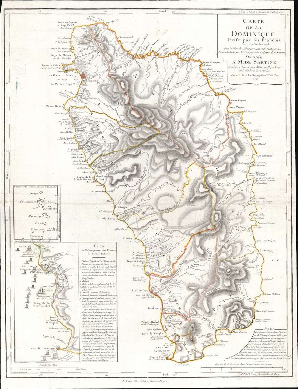
Carte de la Dominique Prise par les Francois Le 7 septembre 1778...
sold
- Digital Map Information
- Suitable for large format printing
- DPI: 600
- File Size: 22.83 MB
- File Type: ZIP / TIFF
- ICC color profile embedded
- Delivered instantly via download link
This is a 1778 Phillipe Buache map of Dominica. An inset situated on the lower left details the September 7, 1778, French invasion of the island, complete with illustrations of the French fleet and British defenses. The large central map depicts the entire island, illustrating the island's coastline and labeling bays, points, and other coastal features. The two largest settlements, Le Roseau (the colonial capital) and Portsmouth are both labeled, along with several smaller villages. Rivers snake their way from the island's central mountains to the ocean, and a handful of roads make their way across the island. (more details)
Communist Chinese propaganda published weeks after the Tet Offensive.

战斗的越南 / Fighting Vietnam.
sold
This is a 1968 Communist Chinese propaganda poster map of Vietnam published weeks after the Viet Cong launched the Tet Offensive, one of the most dramatic turning points of the Vietnam War. Maps of Vietnam are printed on both sides of the sheet, each focusing on different aspects of the war. (more details)
Published less than a month after the outbreak of the Crimean War.
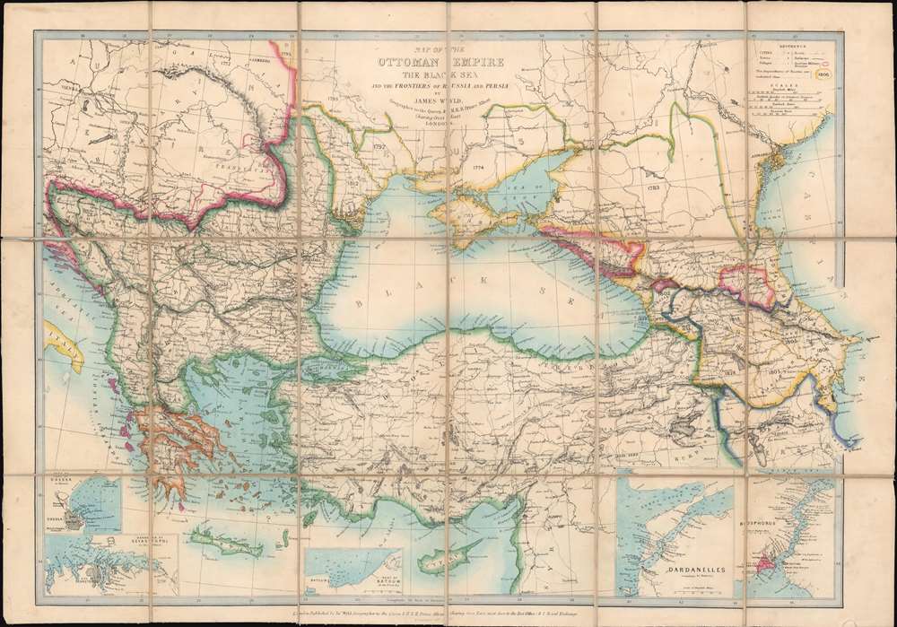
Map of the Ottoman Empire the Black Sea and the Frontiers of Russia and Persia.
sold
- Digital Map Information
- Suitable for large format printing
- DPI: 600
- File Size: 21.19 MB
- File Type: ZIP / TIFF
- ICC color profile embedded
- Delivered instantly via download link
This is an 1853 James Wyld map of Turkey, the Balkans, and the Ottoman Empire at the outbreak of the Crimean War. Published less than a month after the beginning of the war, the map depicts the region from Vienna and the Adriatic Sea to the Caspian Sea and from Russia and Eastern Europe to Cyprus and Syria. Although the genesis of the Crimean War is unclear, one of the factors that led to the war was Russian expansion around the Black Sea. Here, Wyld highlights five regions to the north and east of the Black Sea that Russia gained between 1774 and 1812, including Crimea (still being fought over to this day) and Bessarabia. A printed notation in the eastern Black Sea reads, 'the Russians merely possess the Forts on this Coast.' A close reading of this infers that the Russians only hold the region's defenses, but do not have the loyalty of its people. An intriguing assertion, coming from a British source. Insets along the bottom border focus on some of the region's strategically important areas, including the Bosporus, the Dardanelles, and the Black Sea ports of Odessa, Sevastopol, and Batoum. (more details)
The Anglo-French rivalry over Coromandel.
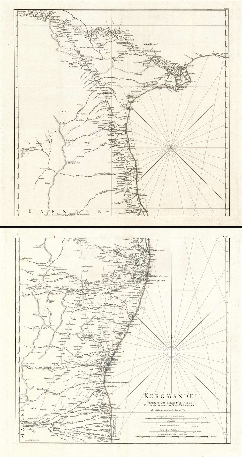
Koromandel.
sold
- Digital Map Information
- Suitable for large format printing
- Full resolution TIFF file
- ICC color profile embedded
- Delivered instantly via download link
This is a monumental and highly detailed map 1789 map of the Coromandel Coast, India by Franz Anton Schrämbl. This map, on two separate sheets, covers the southeastern coast of India from Nagapattinam (Nega-Patnam) north as far as Narsapur and inland as far as Tiruchirappalli and Hyderabad. Schrämbl derived this map from the influential French cartographer Jean-Baptiste Bourguignon d' Anville's similar map of 1753, which here has been re-engraved, updated, and translated into German. It offers excellent coverage of the Coromandel Coast of India naming port cities, including Chennai (Madras), Nagappattinam (Negapatam), Puducherry (Pondicherry), Pazhaverkadu (Pulicat), etc. Several important rivers, towns, villages, roads and other topographical features are also noted throughout. Mountain ranges are rendered in profile. (more details)
French Edition of some of New Zealand's First European Anchorages.
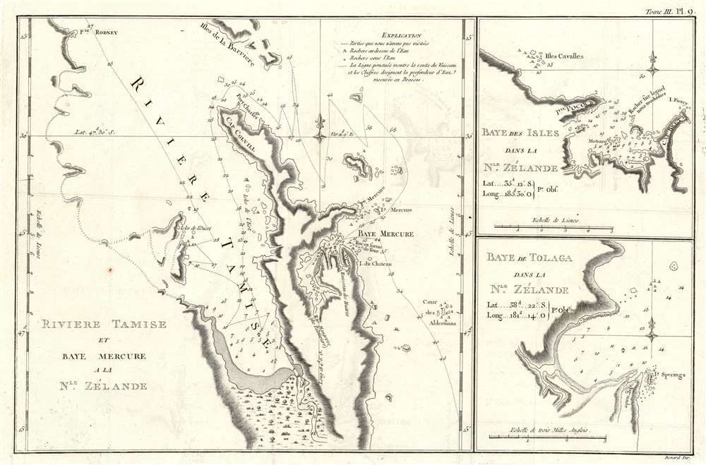
Riviere Tamise de Baye Mercure a la Nle. Zélande/ Baye des Isles dans la Nle. Zélande. / Baye de Tolaga dans la Nle. Zélande.
sold
- Digital Map Information
- Suitable for large format printing
- DPI: 600
- File Size: 8.51 MB
- File Type: ZIP / TIFF
- ICC color profile embedded
- Delivered instantly via download link
This is the 1774 first French edition of the first map of New Zealand's North Island, navigated by then-Lieutenant James Cook during his first voyage of discovery aboard the H.M.S. Endeavor. (more details)
Details the ethnic tensions that resulted in World War I.

Diagrammatic Map of Slav Territories East of the Adriatic.
sold
- Digital Map Information
- Suitable for large format printing
- File Size: 9.82 MB
- File Type: ZIP / TIFF
- ICC color profile embedded
- Delivered instantly via download link
This is a 1916 Arthur Evans ethnographic map of Yugoslavia. Depicting the region from Italy and the Adriatic Sea to Belgrade and from Graz to Albania, Evans employs color coding to identify areas inhabited by different ethnic groups. He differentiates between Serbo-Croats, Slovenes, Germans, Magyars, Italians, Roumans, and Albanians. Red lettering also marks regions by the dominant religions: Islam, Orthodox, and Roman Catholicism. Ethnic and religious strife had roiled this region since at least the late 19th century and, along with nationalistic desires, directly led to the outbreak of World War I. (more details)
Highlights coal deposits across the U.S.
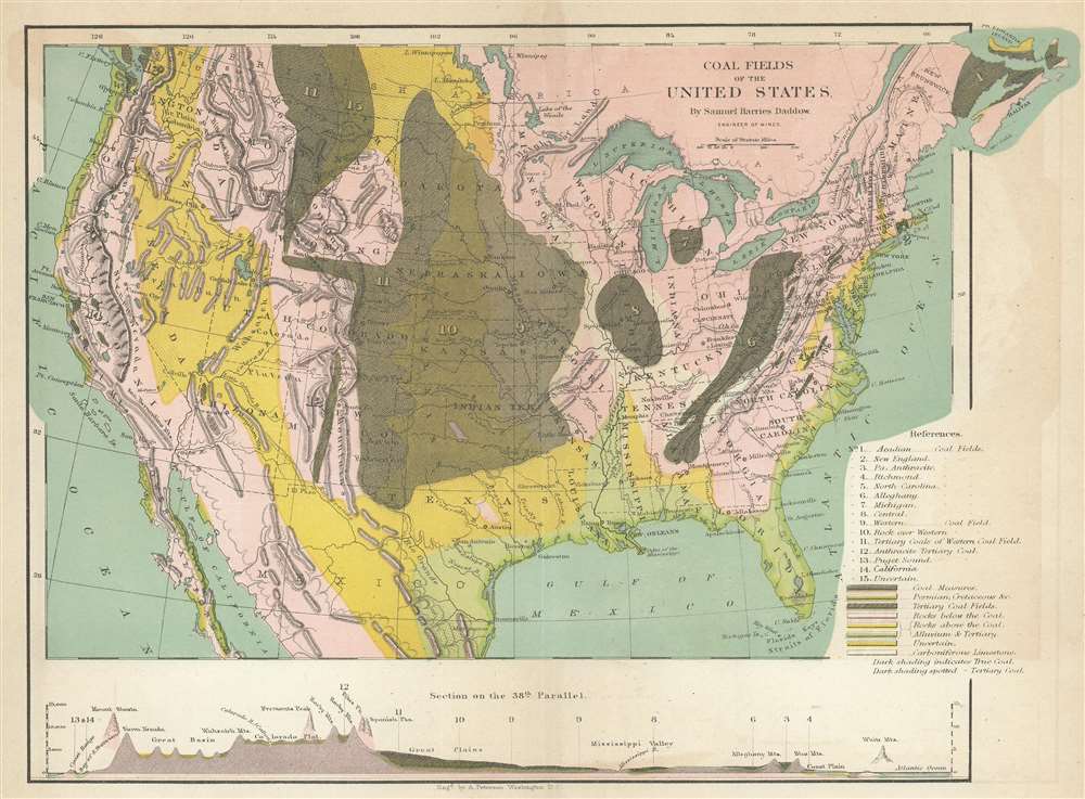
Coal Fields of the United States.
sold
- Digital Map Information
- Suitable for large format printing
- File Size: 6.42 MB
- File Type: ZIP / TIFF
- ICC color profile embedded
- Delivered instantly via download link
This is an 1866 Samuel Harries Daddow map of the United States illustrating its coal fields. Depicting the entire continental United States, fifteen different types of coal fields are numerically identified, including Pennsylvania Anthracite. Colors indicate other deposits, including tertiary coal fields, carboniferous limestone, and areas of uncertain deposits. A profile view of the altitudes along the 38th Parallel presents the wide range of topography from coast to coast, highlighting the Sierra Nevada Mountains, Rocky Mountains, the Great Plains, the Mississippi Valley, and the White Mountains. (more details)
Arguably, the finest 17th century large-scale map of the Holy Land.

[Situs Terrae Promissionis.]
sold
- Digital Map Information
- Suitable for large format printing
- Full resolution TIFF file
- ICC color profile embedded
- Delivered instantly via download link
An extraordinary and rare map, this is the 1662 Johannes Jansson and Georgius Hornius six sheet map of the Holy Land. Divided into six panels and oriented to the east, this map covers Israel or the Holy Land from the southern tip of the Dead Sea and Edom to the Golan Heights and modern-day Lebanon. This map is an expansion and enlargement of a smaller plan of the same general area issued by Christian van Adrichem around 1590. Jansson expanded and embellished Adrichem's map in order to illustrate the text composed by Georgius Hornius (George Horn) for volume six of his Novus Atlas, Accuratissimia Orbis Antiqui Delineatio. Consequently some refer to this map, which is as a whole untitled, as the 'Hornius Map.' As a whole this map is embellished with countless vignettes and other images drawn from Biblical tradition. The smoking ruins of Sodom and Gomorra appear in the Dead Sea, Jonas is drawn being devoured by the whale, Jesus is shown being tempted by Satan (for the third time) atop a mountain, etc. Each of the tribes of Israel are named and associated with their lands. Mountains and forests and shown in profile. (more details)
The earliest obtainable example of the influential Goerck-Mangin Plan of New York City - published while it was still relevant.
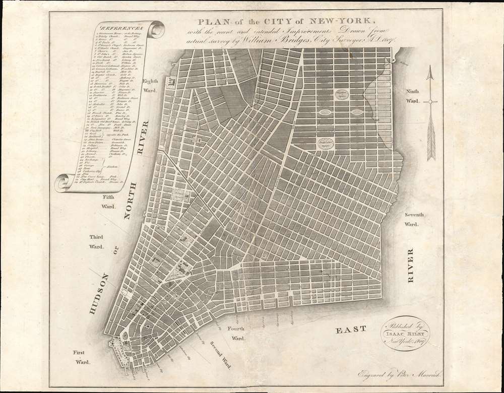
PLAN of the CITY OF NEW-YORK, with the recent and intended Improvements. New York, 1807.
sold
- Digital Map Information
- Suitable for large format printing
- DPI: 600
- File Size: 12.92 MB
- File Type: ZIP / TIFF
- ICC color profile embedded
- Delivered instantly via download link
This is a highly unusual piece with a confused and complex history. The map was published in 1807 by Isaac Riley, William Bridges, and Peter Maverick. It depicts lower Manhattan from roughly Bank Street (current West Village) to the Bowery, but is cartographically unusual as it follows the Mangin-Goerck Plan, a much larger c. 1801 map also engraved by Peter Maverick. That, plan, like the present map, proposed extensive landfill projects and new streets intended to generate clean neat lines and sharp right angles throughout. It is of note that this map pre-dates the 1811 Commissioner's Plan, and thus represents the definitive plan of New York City at the time of publication. This map is thus the only obtainable examples of one of the most important founding cartographic documents relating to the development of New York's street grid, publishing while the Mangin-Goerck map was still relevant. (more details)
First State, First Latin Edition of one of the Most Desirable Africa Maps.
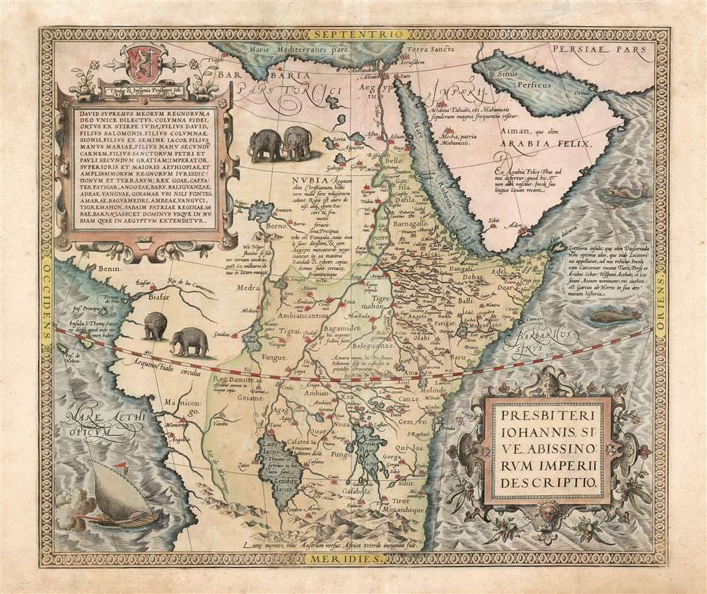
Presbiteri Iohannis, Sive, Abissionrum Imperii Descriptio.
sold
- Digital Map Information
- Suitable for large format printing
- Full resolution TIFF file
- ICC color profile embedded
- Delivered instantly via download link
This is Ortelius' famous map of the Kingdom of Prester John, in its first Latin edition of 1573 and original color. The map covers from the Bight of Benin to the Indian Ocean and from Arabia and the Red Sea to Mozambique. It includes two decorative cartouches as well as stylized images of African elephants. While the African coast exhibits considerable advances over earlier maps of the region, the interior reveals a cartography primarily based on the literature of antiquity and little changed from the days of Ptolemy. Superimposed on these speculative lands is the legendary Kingdom of Prester John (Presbiteri Ioannis) - a persistent and popular figure in European myth. Cartographically the map is derived from Gastaldi's 1564 eight-sheet wall map of Africa. (more details)
A rare broadside promoting the Pennsylvania Railroad's iconic structures and amazing American scenery.
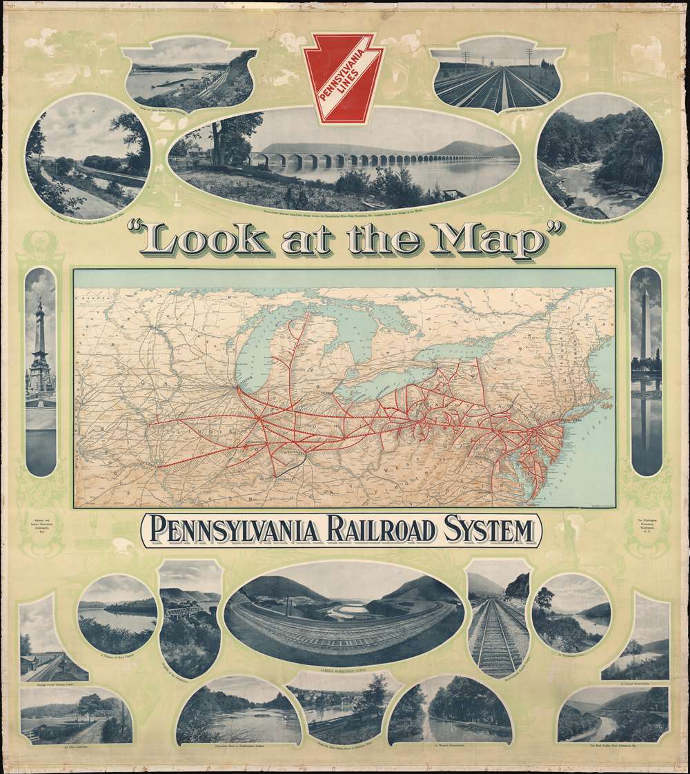
'Look at the Map'. Pennsylvania Railroad System.
sold
- Digital Map Information
- Suitable for large format printing
- File Size: 169.88 MB
- File Type: ZIP / TIFF
- ICC color profile embedded
- Delivered instantly via download link
This c. 1910 Pennsylvania Railroad wall map of the United States promotes the natural beauty of the United States, and the ease of access to that beauty granted by the Pennsylvania Railroad. A map of the Pennsylvania's rail network occupies the center and thick red lines highlight its routes. White dots mark most of the stations and thin black lines mark major connecting railroads. Printed photographs surround the map and provide views of the vistas offered to the Pennsylvania's passengers, including mountain streams, major rivers, wooded hillsides, and open farmland. Other photos highlight the Pennsylvania's iconic infrastructure, such as the 'famous horseshoe curve' or the Pennsylvania Railroad four-track bridge across the Susquehanna River at New Harrisburg, Pennsylvania. Photos of the Washington Monument in Washington, D.C. and the Soldiers' and Sailors' Monument in Indianapolis flank the central map. Faint green illustrations fill the rest of the background and depict landmarks such as the Statue of Liberty and the Brooklyn Bridge alongside vignettes of workers in factories and idyllic countryside scenes. (more details)
Uses the indigenous name of Australia - Ulimaora! and New Zealand
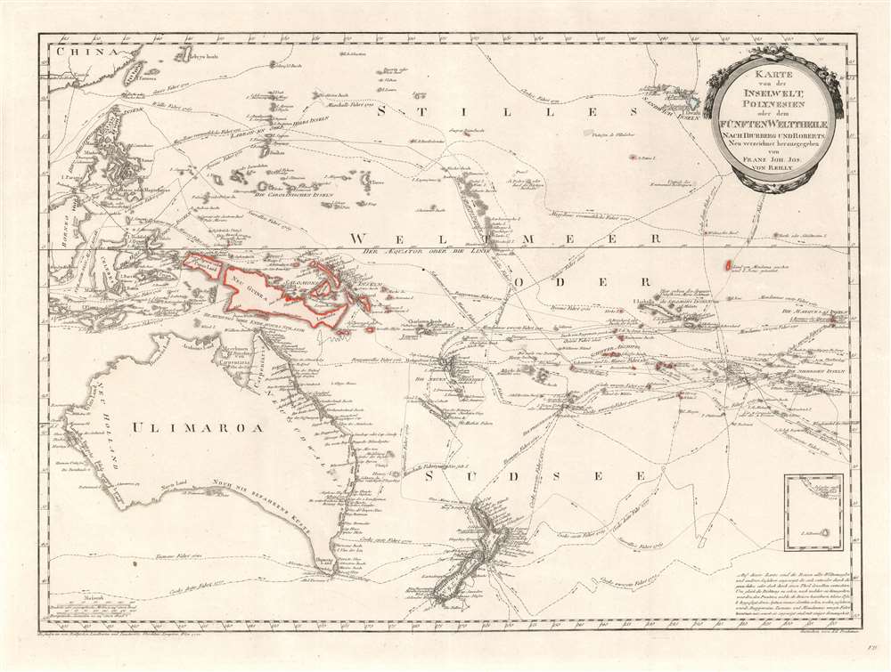
Karte von der Inselwelt, Polynesien oder dem Fünften Welttheile Nach Djurberg unde Roberts.
sold
- Digital Map Information
- Suitable for large format printing
- DPI: 600
- File Size: 21.59 MB
- File Type: ZIP / TIFF
- ICC color profile embedded
- Delivered instantly via download link
This important 1796 map of Australia and Polynesia is one of the very few maps to use the indigenous terms for Australia and New Zealand: Ulimaora (Australia), Tavai-Poenammoo (New Zealand South Island) and Ealiei-Nomauwe (North Island). All three of these terms are extracted from accounts of Cook's voyages. (more details)