
Asia (whole) (sold)
First Japanese Printed Map to show European geographical information with Buddhist world-view.
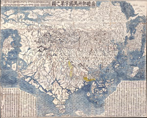
Nansenbushu Bankoku Shoka No Zu (Outline Map of All Countries of the Universe)
sold
- Digital Map Information
- Suitable for large format printing
- Full resolution TIFF file
- ICC color profile embedded
- Delivered instantly via download link
A seminal map. This is the first Japanese printed map to depict the world, including Europe and America, from a Buddhist cosmographical perspective. Printed by woodblock in 1710 (Hoei 7), this map was composed by the Buddhist monk Rokashi Hotan. Inspired by ... (more details)
The first Japanese map of the world from a Buddhist cosmographical perspective - a seminal map.
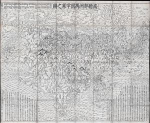
Nansenbushu Bankoku Shoka No Zu (Outline Map of All Countries of the Universe)
sold
- Digital Map Information
- Suitable for large format printing
- DPI: 300
- File Size: 91.94 MB
- File Type: ZIP / TIFF
- ICC color profile embedded
- Delivered instantly via download link
A seminal map of extreme significance. This is the first Japanese printed map to depict the world, including Europe and America, from a Buddhist cosmographical perspective. Printed by woodblock in 1710 (Hoei 7), this map was composed by the Buddhist monk ... (more details)
Most Desirable Edition of Bünting's Biblical Geography.
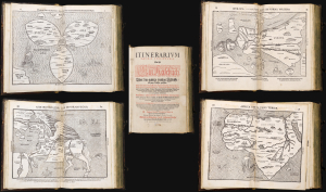
Itinerarium Sacrae Scripturae Das ist/ Ein Reisebuch, Uber die gantze heilige Schrifft in zwey Bücher getheilet. Das Erste Theil begreifft alle Reisen der lieben Patriachen/ Richter/ Könige/ Propheten ... Das Ander/ gehet auff das Newe Testament ... Zuuor gemehret mit einem büchlein DE MONETIS ET MENSVRIS... Insonderheit aber mit einer feinen nützlichen erklerung des Buchs Josua/ Durch M. Henricum Bünting/ Pfarherr der Kirchen zu Grunaw im Lande zu Brunshweig. Mit einer Vorrede des Herrn D. Martini Chemnitij.
sold
- Digital Map Information
- Suitable for large format printing
- Full resolution TIFF file
- ICC color profile embedded
- Delivered instantly via download link
This is a superb example of Heinrich Bünting's 1587 Itinerarium Sacrae Scripturae, the first complete work of biblical geography. This 1587 edition is the first to contain its full complement of figured maps of the continents. Africa, Europa Regina, and Asia-as-a-Pegasus first appear in this edition. Along with the famous cloverleaf world map, Die ganze Welt in einem Kleberblat, it is largely these figural maps for which this work is today most admired. Thus, this is the most desirable form in which this influential and long-lived book appears. (more details)
Nansenbushu: First Japanese Printed Map to show European geographical information with Buddhist world-view.
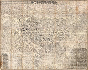
Nansenbushu Bankoku Shoka No Zu (Outline Map of All Countries of the Universe)
sold
- Digital Map Information
- Suitable for large format printing
- DPI: 300
- File Size: 330.31 MB
- File Type: ZIP / TIFF
- ICC color profile embedded
- Delivered instantly via download link
A seminal map of extreme significance. This is the first Japanese printed map to depict the world, including Europe and America, from a Buddhist cosmographical perspective. Printed by woodblock in 1710 (Hoei 7), this map was composed by the Buddhist monk ... (more details)
The updated world and continents maps from the dominant geographical source for its day.
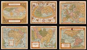
Die erst General Tafel... Ptolemeisch General Tafel... Europa... Asia... Africa... Die newen Inseln.
sold
- Digital Map Information
- Suitable for large format printing
- DPI: 600
- File Size: 76.61 MB
- File Type: ZIP / TIFF
- ICC color profile embedded
- Delivered instantly via download link
This is a beautiful, 6-map set of maps of the world and continents executed for 1588 and later editions of Sebastian Münster's magnum opus, Cosmographia Universalis, entitled in these later editions Cosmographey: das ist, Beschreibung Aller Länder, Herrschafften vnd fürnemesten Stetten des gantzen Erdbodens, sampt ihren Gelegenheiten, Eygenschafften, Religion, Gebräuchen, Geschichten vnd Handtierungen, [et]c. Beginning in 1544, this work would be the primary source of information for anyone who wished to know about the rest of the world: consequently its maps would have had a disproportionate impact, providing the first glimpse of remote and newly-discovered parts World to literate laypeople in Europe for more than half a century. (more details)
Remarkable log book of the China Station flagship during and after the Boxer Rebellion.
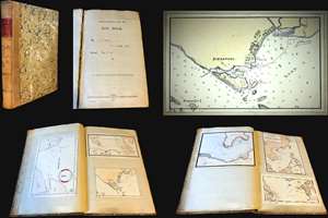
Logbook for use of Junior Officers Afloat. C. V. L. N. / Log Book. Mr. C. V. L. Norcock / H.M.S. Hannibal Glory.
sold
An exceptional and important 1900 – 1902 British naval logbook penned by Charles Vernon Lowcay Norcock (1884 - 1963), an officer in the Royal Navy, recording his experience as a Midshipman on the HMS Glory, flagship of the China Station, in the years of and immediately following the Boxer Rebellion (1899 - 1901). The full logbook covers three ships, recording the voyages of the HMS Hannibal from May to November of 1900; Norcock's subsequent service on the HMS Glory, flagship of the China Station from October of 1900 to January of 1902; and his return voyage to England on the HMS Aurora, from January to February of 1902 - thus covering Norcock's full tour of duty. The content of this volume is exceptionally rich, surpassing most other logbooks, with numerous original manuscript maps of important East Asian ports including Hong Kong, Shanghai, Singapore, Kowloon, Nagasaki, Suez, Valetta, Wusong (Shanghai), Nagasaki, and more. (more details)
1st map to show the results of the Bering Expedition; 1st map to show any part of Alaska, 1st map of the Russian Empire printed in Russia.
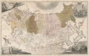
Imperii Russici tabula generalis quo ad fieri potuit accuratissime descripta opera et studio Ioannis Kyrilow.
sold
- Digital Map Information
- Suitable for large format printing
- DPI: 600
- File Size: 70.85 MB
- File Type: ZIP / TIFF
- ICC color profile embedded
- Delivered instantly via download link
An incredibly rare and important map, this is Ivan Kirilov's 1734 large format map of the Russian Empire. Printed in Petropoli, Russia, this is the first scientifically accurate map of the Russian Empire printed in Russia. It is also the first printed map to show the cartographic results if Vutys Bering's First Kamchatka Expedition (1727 - 1730) AND the first appearance of any part of Alaska (St. Lawrence Island) on a printed map. The map's coverage extends from the Black Sea to the Bering Strait, and from the north pole to the Persia, Korea, Japan, and the Yangze River. Decorative cartouche work adorns all four comers and underscores the Tzardom's wealth and power. (more details)
A previously undiscovered Japanese Serio-Comic Map! Possibly the first!
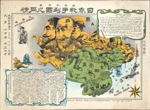
New Commemorative Print of Various Countries Sympathies in the Russo Japanese War. / 崭新纪念画 日露戰爭列國义同情
sold
- Digital Map Information
- Suitable for large format printing
- Full resolution TIFF file
- ICC color profile embedded
- Delivered instantly via download link
The only known example of a 1904 (Meiji 37) Japanese serio-comic style map of Asia illustrating foreign perspectives on the Russo-Japanese War (1904 - 1905). Although previously unknown, if the May 3rd 1904 date is to be believed, this is the second Japanese serio-comic map in the Russo-Japanese War series. The map covers all of Asia and although it does not include Europe, illustrates several western European powers, including France, England, and Germany. (more details)
The only known example of Japan's second Serio-Comic map.
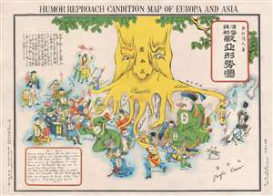
Humor Reproach Candition Map of Europa and Asia. / 滑稽諷刺歐亞形勢圖
sold
- Digital Map Information
- Suitable for large format printing
- File Size: 6.6 MB
- File Type: ZIP / TIFF
- ICC color profile embedded
- Delivered instantly via download link
A previously unknown Meiji 37 or 1904 Japanese broadsheet serio-comic map relating to the Russo-Japanese War. This map was issued in May 28 of 1904, immediately following Japan's successful siege and bombardment Russian held Port Arthur (Dalian). Of the four Japanese serio-comic maps associated with the Russo-Japanese war, this is the second, predated only by Kisaburō Ohara's April 1904 A Humorous Diplomatic Atlas of Europe and Asia. (more details)
Extremely rare, highly influential, and very important foundational map of the North Pacific showing Sea of the West and the apocryphal discoveries of Admiral de Fonte.
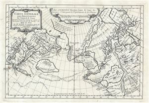
Carte General Des Decouvertes De L'Amiral de Fonte Et autres Navigateurs Espagnols, Anglois, et Russes, pour la recherche du Passage a la Mer du Sud.
sold
- Digital Map Information
- Suitable for large format printing
- DPI: 300
- File Size: 6.51 MB
- File Type: ZIP / TIFF
- ICC color profile embedded
- Delivered instantly via download link
An object of extreme historical importance and rarity, this map was the center of one of the most heated cartographic debates in history. This is an unrecorded state of Joseph-Nicolas de L'Isle's (Delisle) map of the Northern Pacific Ocean and Arctic. ... (more details)
Previously unknown Japanese serio-comic map.
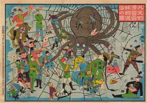
外交的滑稽露蜘蛛退治の圖 / [Image of the Diplomatic Hilarity of Exterminating the Spider].
sold
- Digital Map Information
- Suitable for large format printing
- File Size: 125.97 MB
- File Type: ZIP / TIFF
- ICC color profile embedded
- Delivered instantly via download link
This is a 1904 serio-comic tour de force, with vivid colors and rich symbolism, made by Enomoto Matsunosuke, satirizing the geopolitics of the day in the opening phase of the Russo-Japanese War. While cheering on Japan in the conflict, Enomoto is also having a laugh at the alliances and efforts required to exterminate the 'spider' of Tsarist Russia. This comic was part of an outpouring of popular patriotic images, poetry, songs, and other cultural production in Japan after the start of the war. Enomoto was prescient in his portrayal of the Russian Empire as tottering, beset by domestic unrest and surrounded by unfriendly powers. (more details)
The only known example of Japan's second Serio-Comic map.
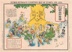
Humor Reproach Candition Map of Europa and Asia. / 滑稽諷刺歐亞形勢圖
sold
- Digital Map Information
- Suitable for large format printing
- File Size: 7.78 MB
- File Type: ZIP / TIFF
- ICC color profile embedded
- Delivered instantly via download link
A previously unknown Meiji 37 or 1904 Japanese broadsheet serio-comic map relating to the Russo-Japanese War. This map was issued in May 28 of 1904, immediately following Japan's successful siege and bombardment Russian held Port Arthur (Dalian). Of the four Japanese serio-comic maps associated with the Russo-Japanese war, this is the second, predated only by Kisaburō Ohara's April 1904 A Humorous Diplomatic Atlas of Europe and Asia. (more details)
Rarest and most poignant Russo-Japanese War serio-comic map!

New Funny Map Asia Europa. / 亞細亞歐羅巴嶄新滑稽地圖
sold
- Digital Map Information
- Suitable for large format printing
- File Size: 31.38 MB
- File Type: ZIP / TIFF
- ICC color profile embedded
- Delivered instantly via download link
The holy grail of Japanese Russo-Japanese War (1904 - 1905) chromolithograph serio-comic maps, this is Haru EiDō's July 1904 map lionizing Japanese victories and staging Japan as a major world power and the 'protector' of Asia. This is one of four serio-comic style maps issued sequentially from April through July, 1904, to illustrate and propagandize Japan's near-continuous victories over Russian forces. Unlike some of the others, which also included English content, and therefore were presumably intended for distribution both within and without Japan, this map was intended exclusively for Japanese audiences. (more details)
One of only 2 Japanese serio-comic maps illustrating World War I.
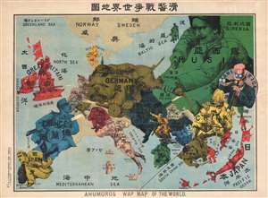
Kokkei Sensou Sekai Chizu. / Ahumoros Wap Map of the World. / 滑馨戰争世界地圖
sold
- Digital Map Information
- Suitable for large format printing
- File Size: 17.14 MB
- File Type: ZIP / TIFF
- ICC color profile embedded
- Delivered instantly via download link
A very rare Japanese broadsheet serio-comic map of Europe and Asia drawn just following the outbreak of World War I. This map was drawn by Ryōzō Tanaka and published by the Shobido Company of Tokyo. The map covers all of Europe and parts of East ... (more details)
Rare map illustrating Japanese concerns over Russian and American expansionism.
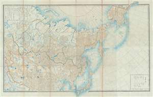
[Russia, China, Japan, Korea, Alaska]
sold
- Digital Map Information
- Suitable for large format printing
- File Size: 50.29 MB
- File Type: ZIP / TIFF
- ICC color profile embedded
- Delivered instantly via download link
This is a highly unusual 1867 or Keiō 3 Japanese lithograph map of Asia and Alaska. The map covers from the Caspian Sea and Nova Zembla to Alaska as far as Prince of Wales Island and Sitka. It embraces most of the Russian Empire in Asia including ... (more details)
Extremely rare Japanese perspective satirical 'Octopus Map' of Asia.
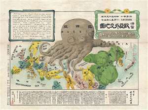
A Humorous Diplomatic Atlas of Europe and Asia. / 滑稽欧亜外交地図 / Kokkei Ō-A Gaikō Chizu.
sold
- Digital Map Information
- Suitable for large format printing
- File Size: 13.3 MB
- File Type: ZIP / TIFF
- ICC color profile embedded
- Delivered instantly via download link
A wonderful example of the rare 1904 Kisaburō Ohara / Shingo Nakamura satirical 'Octopus Map' of Europe. Composed at the outbreak of the Russo-Japanese War (1904 - 1905), Ohara here follows the conventions established by J. J. van Brederode ( Humoristische-Oorlogskaart, 1870) and Fred Rose (Serio-Comic War Map, 1877). These two maps established the convention of satirizing Russian expansionism as a menacing Kraken-like 'Black Octopus.' Whereas Brederode and Rose confine their images to Russia, Ohara has here expanded the idea to encompass all of Eurasia. Russia's eight grasping tentacles extend across Europe and Asia; on many countries they already have a firm grip. Finland, Poland, Crimea, and the Balkan nations are represented as skulls, while tentacles grasp Turkey around the foot and waist, Persia about the neck, and Tibet by the arm. The Trans-Siberian Railway and the South Manchuria Railway, represented by the rightmost tentacle, had by this time extended Russian influence into Manchuria as far as the valuable ice-free Russian stronghold of Port Arthur. As this map was issued in March of 1904, the struggle between Russian and Japan over control of Port Arthur was ongoing. Port Arthur was surrendered to the Japanese, who defeated the Russian Fleet in December of 1905, several months after this map was printed. Ohara sums up the situation in his English language descriptions of the map, printed in the upper left,
Black Octopus is a name newly given to Russia by a certain prominent Englishman. For the black octopus is so avaricious, that he stretches out his eight arms in all directions, and seizes up every thing that comes within his reach. But as it sometimes happens he gets wounded seriously even by a small fish, owing to his too much covetousness. Indeed, a Japanese proverb says: 'Great avarice is like unselfishness.' We Japanese need not to say much on the cause of the present war. Suffice it to say that the further existence of the Black Octopus will depend entirely upon how he comes out of this war. The Japanese fleet has already practically annihilated Russia's naval powers in the Orient. The Japanese army is about to win a signal victory over Russia in Corea and Manchuria. And when ... St. Petersburg? Wait and see! The ugly Black Octopus! Hurrah! Hurrah! for Japan.Certainly the map had a strong message, but who saw it? (more details)
Extremely rare Japanese perspective satirical 'Octopus Map' of Asia.
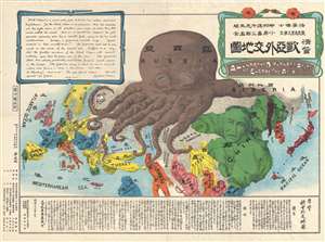
A Humorous Diplomatic Atlas of Europe and Asia. / 滑稽欧亜外交地図 / Kokkei Ō-A Gaikō Chizu.
sold
- Digital Map Information
- Suitable for large format printing
- File Size: 13.69 MB
- File Type: ZIP / TIFF
- ICC color profile embedded
- Delivered instantly via download link
A wonderful example of the rare 1904 Kisaburō Ohara / Shingo Nakamura satirical 'Octopus Map' of Europe. Composed at the outbreak of the Russo-Japanese War (1904 - 1905), Ohara here follows the conventions established by J. J. van Brederode ( Humoristische-Oorlogskaart, 1870) and Fred Rose (Serio-Comic War Map, 1877). These two maps established the convention of satirizing Russian expansionism as a menacing Kraken-like 'Black Octopus.' Whereas Brederode and Rose confine their images to Russia, Ohara has here expanded the idea to encompass all of Eurasia. Russia's eight grasping tentacles extend across Europe and Asia; on many countries they already have a firm grip. Finland, Poland, Crimea, and the Balkan nations are represented as skulls, while tentacles grasp Turkey around the foot and waist, Persia about the neck, and Tibet by the arm. The Trans-Siberian Railway and the South Manchuria Railway, represented by the rightmost tentacle, had by this time extended Russian influence into Manchuria as far as the valuable ice-free Russian stronghold of Port Arthur. As this map was issued in March of 1904, the struggle between Russian and Japan over control of Port Arthur was ongoing. Port Arthur was surrendered to the Japanese, who defeated the Russian Fleet in December of 1905, several months after this map was printed. Ohara sums up the situation in his English language descriptions of the map, printed in the upper left,
Black Octopus is a name newly given to Russia by a certain prominent Englishman. For the black octopus is so avaricious, that he stretches out his eight arms in all directions, and seizes up every thing that comes within his reach. But as it sometimes happens he gets wounded seriously even by a small fish, owing to his too much covetousness. Indeed, a Japanese proverb says: 'Great avarice is like unselfishness.' We Japanese need not to say much on the cause of the present war. Suffice it to say that the further existence of the Black Octopus will depend entirely upon how he comes out of this war. The Japanese fleet has already practically annihilated Russia's naval powers in the Orient. The Japanese army is about to win a signal victory over Russia in Corea and Manchuria. And when ... St. Petersburg? Wait and see! The ugly Black Octopus! Hurrah! Hurrah! for Japan.Certainly the map had a strong message, but who saw it? (more details)
Extremely rare Japanese perspective satirical 'Octopus Map' of Asia.
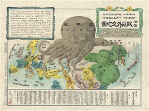
A Humorous Diplomatic Atlas of Europe and Asia. / 滑稽欧亜外交地図 / Kokkei Ō-A Gaikō Chizu.
sold
- Digital Map Information
- Suitable for large format printing
- File Size: 13 MB
- File Type: ZIP / TIFF
- ICC color profile embedded
- Delivered instantly via download link
A wonderful example of the rare 1904 Kisaburō Ohara / Shingo Nakamura satirical 'Octopus Map' of Europe. Composed at the outbreak of the Russo-Japanese War (1904 - 1905), Ohara here follows the conventions established by J. J. van Brederode ( Humoristische-Oorlogskaart, 1870) and Fred Rose (Serio-Comic War Map, 1877). These two maps established the convention of satirizing Russian expansionism as a menacing Kraken-like 'Black Octopus.' Whereas Brederode and Rose confine their images to Russia, Ohara has here expanded the idea to encompass all of Eurasia. Russia's eight grasping tentacles extend across Europe and Asia; on many countries they already have a firm grip. Finland, Poland, Crimea, and the Balkan nations are represented as skulls, while tentacles grasp Turkey around the foot and waist, Persia about the neck, and Tibet by the arm. The Trans-Siberian Railway and the South Manchuria Railway, represented by the rightmost tentacle, had by this time extended Russian influence into Manchuria as far as the valuable ice-free Russian stronghold of Port Arthur. As this map was issued in March of 1904, the struggle between Russian and Japan over control of Port Arthur was ongoing. Port Arthur was surrendered to the Japanese, who defeated the Russian Fleet in December of 1905, several months after this map was printed. Ohara sums up the situation in his English language descriptions of the map, printed in the upper left,
Black Octopus is a name newly given to Russia by a certain prominent Englishman. For the black octopus is so avaricious, that he stretches out his eight arms in all directions, and seizes up every thing that comes within his reach. But as it sometimes happens he gets wounded seriously even by a small fish, owing to his too much covetousness. Indeed, a Japanese proverb says: 'Great avarice is like unselfishness.' We Japanese need not to say much on the cause of the present war. Suffice it to say that the further existence of the Black Octopus will depend entirely upon how he comes out of this war. The Japanese fleet has already practically annihilated Russia's naval powers in the Orient. The Japanese army is about to win a signal victory over Russia in Corea and Manchuria. And when ... St. Petersburg? Wait and see! The ugly Black Octopus! Hurrah! Hurrah! for Japan.Certainly the map had a strong message, but who saw it? (more details)
The Russian Empire at its height of expansion just before the Napoleonic Invasion.
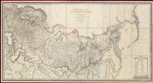
ГЕНЕРАЛЬНАЯ КАРТА РОССIЙСКОЙ ИМПЕРIИ HA ПЯТДЕСЯТЪ ГУБЕРНIЙ РАЗДЂЛЕННОЙ, съ ПОКАЗАНIЕМЪ СОСЕДСТВЕННЫХЪ ВЛАДЂНІЙ и большихъ дорогъ. / A General Map of the Russian Empire Divided into the Fifty Provinces, Showing Neighboring Domains and Highways.
sold
- Digital Map Information
- Suitable for large format printing
- DPI: 600
- File Size: 112.48 MB
- File Type: ZIP / TIFF
- ICC color profile embedded
- Delivered instantly via download link
An exceptionally rare 1809 large-format map of the Russian Empire by Alexsandr Dmitrievich Savinkov. This is the largest and most important map published during Savinkov's tenure at the Saint Petersburg Imperial Map Depot. Presented on a conic equidistant projection, Savinkov's map covers the Russian Empire in all of its expansiveness, from Finland, annexed into Russia in the year this map was made, to Russian Alaska, and from the Arctic to Mongolia. It is dedicated to Savinkov's patron, Tsar Alexander I or Alexander Pavlovich (1777 - 1825), who ruled from 1801 to 1825. The whole exhibits Savinkov's distinctive and exceptional fine engraving style. (more details)
Extremely rare Japanese perspective satirical 'Octopus Map' of Asia.
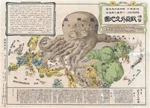
A Humorous Diplomatic Atlas of Europe and Asia. / 滑稽欧亜外交地図 / Kokkei Ō-A Gaikō Chizu.
sold
- Digital Map Information
- Suitable for large format printing
- File Size: 15.14 MB
- File Type: ZIP / TIFF
- ICC color profile embedded
- Delivered instantly via download link
A wonderful example of the rare 1904 Kisaburō Ohara / Shingo Nakamura satirical 'Octopus Map' of Europe. Composed at the outbreak of the Russo-Japanese War (1904 - 1905), Ohara here follows the conventions established by J. J. van Brederode ( Humoristische-Oorlogskaart, 1870) and Fred Rose (Serio-Comic War Map, 1877). These two maps established the convention of satirizing Russian expansionism as a menacing Kraken-like 'Black Octopus.' Whereas Brederode and Rose confine their images to Russia, Ohara has here expanded the idea to encompass all of Eurasia. Russia's eight grasping tentacles extend across Europe and Asia; on many countries they already have a firm grip. Finland, Poland, Crimea, and the Balkan nations are represented as skulls, while tentacles grasp Turkey around the foot and waist, Persia about the neck, and Tibet by the arm. The Trans-Siberian Railway and the South Manchuria Railway, represented by the rightmost tentacle, had by this time extended Russian influence into Manchuria as far as the valuable ice-free Russian stronghold of Port Arthur. As this map was issued in March of 1904, the struggle between Russian and Japan over control of Port Arthur was ongoing. Port Arthur was surrendered to the Japanese, who defeated the Russian Fleet in December of 1905, several months after this map was printed. Ohara sums up the situation in his English language descriptions of the map, printed in the upper left,
Black Octopus is a name newly given to Russia by a certain prominent Englishman. For the black octopus is so avaricious, that he stretches out his eight arms in all directions, and seizes up every thing that comes within his reach. But as it sometimes happens he gets wounded seriously even by a small fish, owing to his too much covetousness. Indeed, a Japanese proverb says: 'Great avarice is like unselfishness.' We Japanese need not to say much on the cause of the present war. Suffice it to say that the further existence of the Black Octopus will depend entirely upon how he comes out of this war. The Japanese fleet has already practically annihilated Russia's naval powers in the Orient. The Japanese army is about to win a signal victory over Russia in Corea and Manchuria. And when ... St. Petersburg? Wait and see! The ugly Black Octopus! Hurrah! Hurrah! for Japan.Certainly the map had a strong message, but who saw it? (more details)
Classic Dutch Cartes-à-Figures Map of Asia.
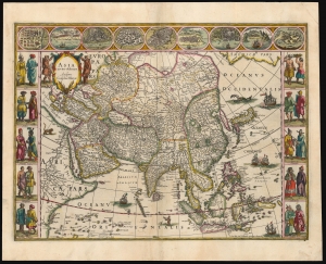
Asia noviter delineata. Auctore Guiljelmo Blaeuw.
sold
- Digital Map Information
- Suitable for large format printing
- Full resolution TIFF file
- ICC color profile embedded
- Delivered instantly via download link
This is a lovely, original-color example of Willem Blaeu's atlas map of Asia. It is one of the most desirable maps of the Dutch Golden Age of mapmaking. It represents a sharp improvement on the maps of Ortelius, Mercator and Hondius, reflecting the strides that the Dutch had made in understanding the geography of the East beginning at the end of the 16th century. The southern coast shows the benefit of the Dutch East India Company's forays to the Spice Islands; the north and east parts of Asia would remain obscure until the latter part of the century. (more details)
Classic Dutch Gold Age Map of Asia: Old Color highlighted with Gold!
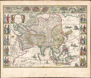
Asia noviter delineata. Auctore Guiljelmo Blaeuw.
sold
- Digital Map Information
- Suitable for large format printing
- Full resolution TIFF file
- ICC color profile embedded
- Delivered instantly via download link
This is a lovely, original-color example of Willem Blaeu's 1630 map of Asia in its 1640 atlas edition. It is among the most sought-after maps of the Dutch Golden Age of cartography, marking a significant advancement over the works of Ortelius, Mercator, and Hondius. It reflects the considerable progress the Dutch had made in their understanding of Eastern geography beginning in the late 16th century. The southern coast shows the benefit of the Dutch East India Company's forays to the Spice Islands; the north and east parts of Asia would remain obscure until the latter part of the century. (more details)
Extremely rare Japanese perspective satirical 'Octopus Map' of Asia.
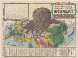
A Humorous Diplomatic Atlas of Europe and Asia. / 滑稽欧亜外交地図 / Kokkei Ō-A Gaikō Chizu.
sold
- Digital Map Information
- Suitable for large format printing
- File Size: 12.9 MB
- File Type: ZIP / TIFF
- ICC color profile embedded
- Delivered instantly via download link
A wonderful example of the rare 1904 Kisaburō Ohara / Shingo Nakamura satirical 'Octopus Map' of Europe. Composed at the outbreak of the Russo-Japanese War (1904 - 1905), Ohara here follows the conventions established by J. J. van Brederode ( Humoristische-Oorlogskaart, 1870) and Fred Rose (Serio-Comic War Map, 1877). These two maps established the convention of satirizing Russian expansionism as a menacing Kraken-like 'Black Octopus.' Whereas Brederode and Rose confine their images to Russia, Ohara has here expanded the idea to encompass all of Eurasia. Russia's eight grasping tentacles extend across Europe and Asia; on many countries they already have a firm grip. Finland, Poland, Crimea, and the Balkan nations are represented as skulls, while tentacles grasp Turkey around the foot and waist, Persia about the neck, and Tibet by the arm. The Trans-Siberian Railway and the South Manchuria Railway, represented by the rightmost tentacle, had by this time extended Russian influence into Manchuria as far as the valuable ice-free Russian stronghold of Port Arthur. As this map was issued in March of 1904, the struggle between Russian and Japan over control of Port Arthur was ongoing. Port Arthur was surrendered to the Japanese, who defeated the Russian Fleet in December of 1905, several months after this map was printed. Ohara sums up the situation in his English language descriptions of the map, printed in the upper left,
Black Octopus is a name newly given to Russia by a certain prominent Englishman. For the black octopus is so avaricious, that he stretches out his eight arms in all directions, and seizes up every thing that comes within his reach. But as it sometimes happens he gets wounded seriously even by a small fish, owing to his too much covetousness. Indeed, a Japanese proverb says: 'Great avarice is like unselfishness.' We Japanese need not to say much on the cause of the present war. Suffice it to say that the further existence of the Black Octopus will depend entirely upon how he comes out of this war. The Japanese fleet has already practically annihilated Russia's naval powers in the Orient. The Japanese army is about to win a signal victory over Russia in Corea and Manchuria. And when ... St. Petersburg? Wait and see! The ugly Black Octopus! Hurrah! Hurrah! for Japan.Certainly the map had a strong message, but who saw it? (more details)
Earliest obtainable modern chart of the Maldives.
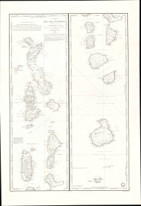
Carte des Iles Maldives. No. 942.
sold
- Digital Map Information
- Suitable for large format printing
- File Size: 28.83 MB
- File Type: ZIP / TIFF
- ICC color profile embedded
- Delivered instantly via download link
This is a rare large-format 1841 French Dépôt-général de la Marine nautical chart of the Maldives Islands in the Indian Ocean. Based on a now-unobtainable 1838 British chart by Robert Moresby, the first modern hydrographic survey of the islands, this is the earliest obtainable specific modern chart of the Maldives. (more details)
First Edition, First State.
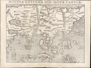
India Extrema, XIX Nova Tabula.
sold
- Digital Map Information
- Suitable for large format printing
- Full resolution TIFF file
- ICC color profile embedded
- Delivered instantly via download link
This is the rare 1540 first-edition first-state of Sebastian Münster's map of Asia, the first printed map of that continent based on contemporary data and the earliest obtainable map of the continent overall. This attractive and evocative map was broadly influential: for more than 30 years during the age of discovery, this map was the predominant representation of Asia available to Europeans. (more details)
A foundational map and the single most influential map of the the Pacific Northwest issued in the middle of the 18th Century.
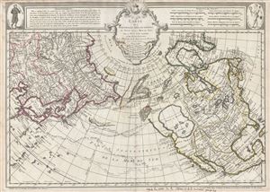
Carte Des Nouvelles Decouvertes au Nord de la Mer de Sud, tant a l'Est de la Syberie et du Kamtchatka, qu'a L'Ouest de la Nouvelle France.
sold
- Digital Map Information
- Suitable for large format printing
- DPI: 300
- File Size: 17.62 MB
- File Type: ZIP / TIFF
- ICC color profile embedded
- Delivered instantly via download link
Rare first edition of Joseph Nicolas De l'Isle's extraordinary 1752 map of North America, Siberia, the Arctic, and the North Pacific. J. N. De L'Isle and Buache drew this map to illustrate their speculations on the feasibly of a Northwest Passage. ... (more details)
The steam age.
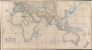
Map Showing the Steam Communication and Overland Routes between England, India, China and Australia.
sold
- Digital Map Information
- Suitable for large format printing
- Full resolution TIFF file
- ICC color profile embedded
- Delivered instantly via download link
A striking 1853 large-scale map by W. H. Allen detailing both overland and steamship routes between England, India, Australia, and East Asia. It illustrates the height of the steamship trade between far-flung British colonies in the decades before the construction of the Suez Canal. The present example features numerous manuscript updates, some in pencil, tracing additional steamship lines run by Oriental-Lloyds-Shanghai and Eastern Atlantic. In addition, further highlighting in red illustrates telegraph lines. (more details)
Fascinating Allegorical Asia.
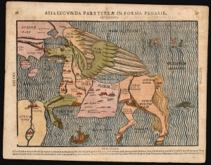
Asia Secunda Pars Terrae In Forma Pegasir.
sold
- Digital Map Information
- Suitable for large format printing
- Full resolution TIFF file
- ICC color profile embedded
- Delivered instantly via download link
This is one of the most famous cartographic curiosities: Heinrich Bünting's 1587 map of Asia in the form of the mythological winged horse, Pegasus. The horse's head is Asia Minor; its front legs form the Arabian Peninsula. Persia resembles a horse blanket. The hind legs represent the Indian and Malay peninsulas, while the spreading wings cover the northern steppe of Scythia and Tartaria. This beautiful woodcut appeared in Bünting's Itinerarium Sacrae, the first and, for many years, the only complete work of biblical geography. (more details)
First cartobibliography of the Northwest Passage.
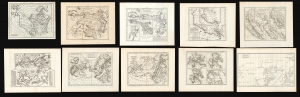
Carte des parties nord et oust de L'Amerique/ Carte des parties Nord et est de L'Asie/Nouvelle représentation Des Côtes Nord et Est de l'Asie/ Carte de la Californie et des Pays Nord-Ouest separés de l'Asie par le détroit d'Anian./ Carte de la Californie Suivant.../ Carte des Nouvelles Decouvertes dressée par Phil. Buache/ Carte Générale des Découvertes de l'Amiral de Fonte…/ Carte Generale des Découvertes de l'Amiral de Fonte ... Jefferys/ Carte qui Représente les différentes connoissances que l'on a eues des Terres Arctiques depuis 1650 jusqu'en 1747 / Partie de la Carte du Capitaine Cluny…
sold
This is Robert de Vaugondy's seminal 1772 map series exploring the mapping of North America, Asia, and specifically the Northwest Passage, summarizing three centuries of cartography. Included as a supplement to Diderot's 1772 Encyclopédie, this was among the first studies in comparative cartography committed to print. The cartographic survey embraced some of the most important topics in 18th-century geography and might justifiably be proposed as the first cartobibliography.
(more details)
(more details)
'The Fifth Part of the World'.
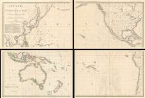
Océanie ou Cinquième Partie du Monde Comprenant L'Archipel d'Asie, L'Australasie et la Polynésie (ou le Continent de la Nouvelle-Hollande et les Îles du Grand Ocean.) en outre Une Grande Partie de L'Amérique et des Còtes de L'Asie.
sold
- Digital Map Information
- Suitable for large format printing
- Full resolution TIFF file
- ICC color profile embedded
- Delivered instantly via download link
A striking large scale 1814 map of the Pacific by Adrian-Hubert Brué. This is one of the earliest general maps of the Pacific to be offered commercially - partially responsible for introducing the vastness of Oceania to the general European public. It is moreover the first map to coin the term Océanie for the Pacific Islands - previously it was known as Océanique. (more details)
The first printed map of the Pacific Northwest.
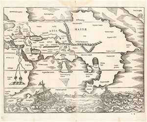
[Africa/ Asia Maior/ Terra incognita]
sold
- Digital Map Information
- Suitable for large format printing
- Full resolution TIFF file
- ICC color profile embedded
- Delivered instantly via download link
This is a rare 1538 map of Asia, executed by Sebastian Münster for inclusion in his edition of Solinus' Polyhistor. It predates by two years the map of Asia in Münster's 1540Geographia. Although it is not entirely a modern work, it is the earliest printed map focusing on the continent of Asia. It also contains the first printed representation of the Pacific Northwest, more than thirty years prior to the Ortelius map generally granted that laurel. (more details)
Awe inspiring nautical chart of th north Pacific Ocean.
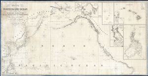
Chart of the North Pacific Ocean, Exhibiting the Eastern Shores of Asia and the Western Coast of North America from the Equator to Behring's Strait with plan, on an enlarge scale, of the Principal Island and Harbours.
sold
- Digital Map Information
- Suitable for large format printing
- DPI: 300
- File Size: 86.53 MB
- File Type: ZIP / TIFF
- ICC color profile embedded
- Delivered instantly via download link
A spectacular and massive 1849 James Imray nautical chart or maritime map of the northern Pacific. Roughly centered on Hawaii, this sprawling chart covers from Hainan and Borneo eastwards to Columbia and Panama, and from the Behring Strait to the Moluccas and the Galapagos Islands (the Equator). The chart is rendered on a Mercator Projection with latitude measured from Greenwich, England. Like most nautical charts, the cartographer offers very little inland detail, but a wealth of maritime data. This includes the identification of various ports and harbors, coastal topography, shoals and other undersea dangers, and countless depth soundings in fathoms. Additionally, the cartographer has noted aspects of various islands that may have been of importance to the mariner, for example Christmas Island has 'Plenty of Turtle, no fresh Water.'
This map is decorated with ten inset maps, from top center, Victoria Harbor (British Columbia), Awatska Bay on the east coast of Kamtschatka, the Mariana or Ladrones Islands (including Guam), the Hawaiian or Sandwich Islands (with four sub-insets: Waiakea or Byron Bay, Hanalei Bay (Kauai), Honolulu Harbor, and Kailua Bay), San Francisco Bay, the Mouth of the Columbia River (including the Fort Astoria settlement), and the Philippine Islands. (more details)
This map is decorated with ten inset maps, from top center, Victoria Harbor (British Columbia), Awatska Bay on the east coast of Kamtschatka, the Mariana or Ladrones Islands (including Guam), the Hawaiian or Sandwich Islands (with four sub-insets: Waiakea or Byron Bay, Hanalei Bay (Kauai), Honolulu Harbor, and Kailua Bay), San Francisco Bay, the Mouth of the Columbia River (including the Fort Astoria settlement), and the Philippine Islands. (more details)