
Persuasive Cartography (sold)

First State, First Latin Edition of one of the Most Desirable Africa Maps.
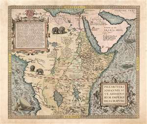
Presbiteri Iohannis, Sive, Abissionrum Imperii Descriptio.
sold
- Digital Map Information
- Suitable for large format printing
- Full resolution TIFF file
- ICC color profile embedded
- Delivered instantly via download link
This is Ortelius' famous map of the Kingdom of Prester John, in its first Latin edition of 1573 and original color. The map covers from the Bight of Benin to the Indian Ocean and from Arabia and the Red Sea to Mozambique. It includes two decorative cartouches as well as stylized images of African elephants. While the African coast exhibits considerable advances over earlier maps of the region, the interior reveals a cartography primarily based on the literature of antiquity and little changed from the days of Ptolemy. Superimposed on these speculative lands is the legendary Kingdom of Prester John (Presbiteri Ioannis) - a persistent and popular figure in European myth. Cartographically the map is derived from Gastaldi's 1564 eight-sheet wall map of Africa. (more details)
Controversial Map.
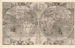
Benedict Arias Montanus Sacrae Geographiae Tabulam Ex Antiquissimorum Cultor.
sold
- Digital Map Information
- Suitable for large format printing
- Full resolution TIFF file
- ICC color profile embedded
- Delivered instantly via download link
This is a scarce and important 1571 map of the world by Benedict Arias Montanus. Finely engraved and prepared for the eight-volume Plantin Polyglot Bible, this elegant map was intended to bring the new discoveries of the Americas into a coherent religious context. It further established the Native American population as Hebrew descendants of Noah, and thus Children of God whom the dedicatee of the Polyglot, Philip II of Spain, was obliged to convert. Although its alleged revelations of Australian geography have long been the map's cause celebre, these are overshadowed by the map's actual significance as a cartographic justification of Spanish Imperialism. (more details)
Controversial pre-discovery 'Australia;' Religious argument for Spanish imperialism.
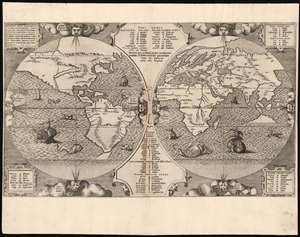
Benedict Arias Montanus Sacrae Geographiae Tabulam Ex Antiquissimorum Cultor.
sold
- Digital Map Information
- Suitable for large format printing
- Full resolution TIFF file
- ICC color profile embedded
- Delivered instantly via download link
This is a scarce and important 1571 map of the world by Benedict Arias Montanus. Finely engraved and prepared for the eight-volume Plantin Polyglot Bible, this elegant map was intended to bring the new discoveries of the Americas into a coherent religious context. It further established the Native American population as Hebrew descendants of Noah, and thus Children of God whom the dedicatee of the Polyglot, Philip II of Spain, was obliged to convert. Although its alleged revelations of Australian geography have long been the map's cause celebre, these are overshadowed by the map's actual significance as a cartographic justification of Spanish Imperialism. (more details)
Most Unique Early Map of the World.
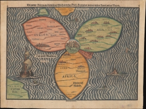
Die gantze Welt in ein Kleberblat, Welches ist der Stadt hannover / meines lieben Vaterlandes Wapen.
sold
- Digital Map Information
- Suitable for large format printing
- Full resolution TIFF file
- ICC color profile embedded
- Delivered instantly via download link
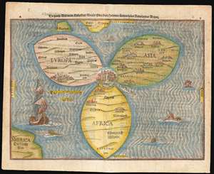
This is Heinrich Bünting's c. 1581-1585 iconic map of the world, dramatically presented as a clover leaf. This beautiful woodcut appeared in Bünting's Itinerarium Sacrae, the first and for many years the only complete work of biblical geography. (more details)
The Most Unique Early Map of the World
Die gantze Welt in ein Kleberblat, Welchs ist der stadt hannover, meines lieben Vaterlandes Wapen.
sold
- Digital Map Information
- Suitable for large format printing
- DPI: 600
- File Size: 12.76 MB
- File Type: ZIP / TIFF
- ICC color profile embedded
- Delivered instantly via download link
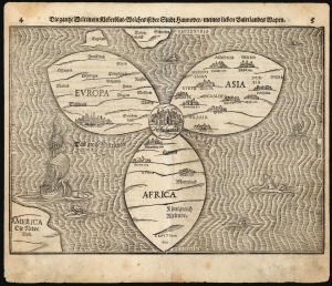
This is Heinrich Bünting's map of the world, dramatically presented as a clover leaf. No other early map utilized this configuration. This beautiful woodcut appeared in Bünting's Itinerarium Sacrae, the first and for many years the only complete work of biblical geography. As such, this map's central positioning of Jerusalem and the Red Sea - recalling medieval mappamundae - is appropriate. The map's puzzling trefoil shape, with Asia, Africa and Europe each given a leaf, invokes Ptolemy's three parts of the world, as well as the medieval T-O map's tripartite form. The map's title, however, gives insight to Bünting's motivation for producing so singular an image: Die gantze Welt in ein Kleeberblat, welches ist der Stadt Hannover, Meines lieben Vaterlandes Wapen translates to:
The Whole World in a Cloverleaf, Which is the Arms of my Dear Fatherland, Hanover.Bünting is using the centerpiece map of his book to tip his hat to his home town. (more details)
The Most Unique Early Map of the World.
Die gantze Welt in ein Kleberblat, Welches ist der Stadt hannover / meines lieben Vaterlandes Wapen.
sold
- Digital Map Information
- Suitable for large format printing
- Full resolution TIFF file
- ICC color profile embedded
- Delivered instantly via download link
This is Heinrich Bünting's 1585 / 1597 iconic map of the world, dramatically presented as a clover leaf. This beautiful woodcut appeared in Bünting's Itinerarium Sacrae, the first and for many years the only complete work of biblical geography. (more details)
Biblical visions presented cartographically.
[Untitled Map of the World].
sold
- Digital Map Information
- Suitable for large format printing
- DPI: 600
- File Size: 23.67 MB
- File Type: ZIP / TIFF
- ICC color profile embedded
- Delivered instantly via download link
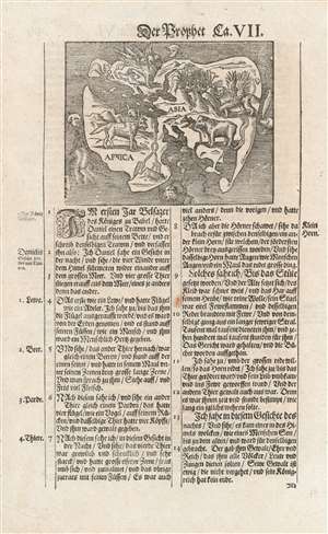
This is a bold, untrimmed strike of Hans Lufft's Wittenberg world map, also known the 'Daniel's Dream Map.' This woodcut illustrates the visions of the prophet Daniel, framed in a rudimentary map of Europe, Asia, and Africa. In Daniel's apocalyptic visions, the grim fates of the world's empires were revealed allegorically in the form of the beast depicted on the map. (more details)
One of the earliest published thematic maps.
Designatio Orbis Christiani.
sold
- Digital Map Information
- Suitable for large format printing
- DPI: 300
- File Size: 1.98 MB
- File Type: ZIP / TIFF
- ICC color profile embedded
- Delivered instantly via download link
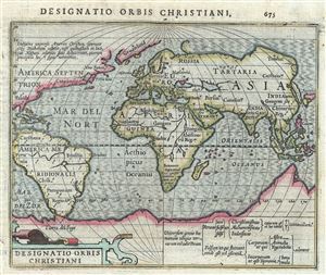
One of the earliest known thematic maps, this is a fine example of the 1607 Mercator- Hondius map of the World showing different religions. The world is presented on a hemispherical projection with Europe and Africa at center. Various symbols are sued to ... (more details)
Rosicrucian Vision of Knowledge, God, and the Universe.
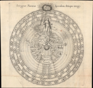
Integrae Naturae Speculum, Artisque Imago.
sold
- Digital Map Information
- Suitable for large format printing
- Full resolution TIFF file
- ICC color profile embedded
- Delivered instantly via download link
This is a rare 1617 Rosicrucian hierarchical diagram organizing the divine, cosmic, natural, and human experience into a structured, symbolic system. It was designed by the English Rosicrucian and alchemist Robert Fludd, who sought to condense the hermetic, Neoplatonic, and alchemical worldviews into a coherent vision of reality. Although rooted in Rennaissance thought, this image offers an enduring visual metaphor for the search for meaning, reflecting the impulse to systematically rationalize human experience. (more details)
Leo Belgicus, in a desirable edition.
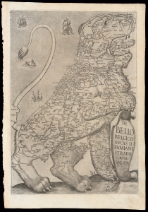
De Bello Belgico Decas II Famiani Stradae Rom. Soc. Iesu
sold
- Digital Map Information
- Suitable for large format printing
- DPI: 600
- File Size: 20.56 MB
- File Type: ZIP / TIFF
- ICC color profile embedded
- Delivered instantly via download link
This 1632/1647 map of the Netherlands is an exemplar of one of the most distinctive heraldic geographical motifs: the famous Leo Belgicus. This depiction of the Low Countries in the form of a lion rampant appeared as the title page in the first, Rome edition of Famiano Strada's 1632 history of the Dutch Revolt. While later editions of Strada featured a Leo in their frontispieces, the plate employed in the 1632 first volume and the 1647 second volume of the first edition was the largest and most beautifully engraved, and among the most desirable. This image's appearance during the course of the Eighty Years' War (c. 1566/1568 - 1648) has led to it being hailed as a cartographic expression of national pride - in spite of its origin being firmly rooted in histories of the war produced predominantly from a Spanish perspective. (more details)
One of the first scientific-thematic maps of Southeast Asia - here illustrating the hydro-geographic theories of Athanasius Kircher.
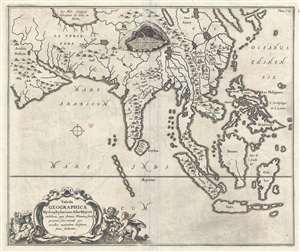
Tabula Geographica Hydrophylacium Asiae Majoris exhibens, quo Omnia Flumina sive proximè sive remotè per occultos meandros Originem suam sortiuntur.
sold
- Digital Map Information
- Suitable for large format printing
- Full resolution TIFF file
- ICC color profile embedded
- Delivered instantly via download link
A fine example of Athanasius Kircher's 1665 map of Asia. Centered on India, this map covers from the Arabian Peninsula to the Philippines and from the Caspian Sea and Japan to java. It is one of several maps prepared by Kircher to illustrate his unique ... (more details)
One of the first scientific-thematic maps of Africa - here illustrating the hydro-geographic theories of Athanasius Kircher.
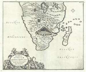
Hydrophylacium Africae precipuum, in Montibus Lunae Situm, Lacus et Flumina praecipua fundens, ubi et nova inventio Originis Nili describitur.
sold
- Digital Map Information
- Suitable for large format printing
- DPI: 300
- File Size: 6.08 MB
- File Type: ZIP / TIFF
- ICC color profile embedded
- Delivered instantly via download link
A fine example of Athanasius Kircher's 1665 map of southern Africa. The map covers Africa roughly from the Congo south to the Cape of Good Hope, including the Island of Madagascar. Cartographically the map is primitive, even for its time, but Sofala ... (more details)
The most complete illustration of Kircher's revolutionary hydro-geographic theories.
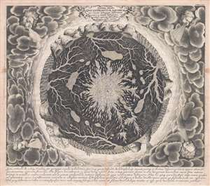
Systema Ideale Qvo Exprimitur, Aquarum per Canales hydragogos subterraneos ex mari et in montium hydrophylacia protrusio, aquarumq. subterrestrium per pyragogos canales concoctus.
sold
- Digital Map Information
- Suitable for large format printing
- DPI: 300
- File Size: 11.39 MB
- File Type: ZIP / TIFF
- ICC color profile embedded
- Delivered instantly via download link
This is one of the 17th century polymath Athanasius Kircher's most iconic and graphically intense maps. This map illustrates the subterranean world and is one of the maps included in Kircher's 1665 cosmography Mundus Subterranous . Inspired by two ... (more details)
The most complete illustration of Kircher's revolutionary hydro-geographic theories.
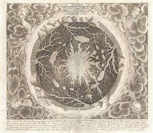
Systema Ideale Qvo Exprimitur, Aquarum per Canales hydragogos subterraneos ex mari et in montium hydrophylacia protrusio, aquarumq. subterrestrium per pyragogos canales concoctus.
sold
- Digital Map Information
- Suitable for large format printing
- DPI: 300
- File Size: 35.14 MB
- File Type: ZIP / TIFF
- ICC color profile embedded
- Delivered instantly via download link
This is one of the 17th century polymath Athanasius Kircher's most iconic and graphically intense maps. This map illustrates the subterranean world and is one of the maps included in Kircher's 1665 cosmography Mundus Subterranous . Inspired by two ... (more details)
The most complete illustration of Kircher's revolutionary hydro-geographic theories.
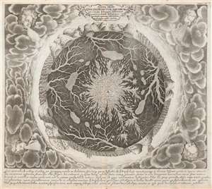
Systema Ideale Qvo Exprimitur, Aquarum per Canales hydragogos subterraneos ex mari et in montium hydrophylacia protrusio, aquarumq. subterrestrium per pyragogos canales concoctus.
sold
- Digital Map Information
- Suitable for large format printing
- DPI: 600
- File Size: 26.53 MB
- File Type: ZIP / TIFF
- ICC color profile embedded
- Delivered instantly via download link
This is one of the 17th century polymath Athanasius Kircher's most iconic and graphically intense maps. Situated amidst dense clouds with Aeolus, or wind heads, at the corners, the Earth appears as a gigantic fiery orb. Around the perimeter, we can recognize the oceans, mountains, land, whirlpools, and even a few sailing ships. The center of the Earth is a great fire. Beyond the flaming core, artery-like networks of subterranean seas and rivers connect great reservoirs hidden under mighty mountains. (more details)
The Italian polymath Kircher's iconic map of the Earth's Volcanic Systems.
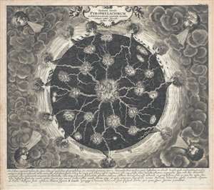
Systema Ideale Pyrophylaciorum Suberraneorum, quorum montes Vulcanii, veluti spiracula quaedam existant.
sold
- Digital Map Information
- Suitable for large format printing
- DPI: 300
- File Size: 13.04 MB
- File Type: ZIP / TIFF
- ICC color profile embedded
- Delivered instantly via download link
This is one of the 17th century polymath Athanasius Kircher's most iconic and graphically intense maps. This map illustrates Earth's volcanic system and is one of the maps included in Kircher's 1665 cosmography Mundus Subterranous . Inspired by ... (more details)
The Italian polymath Kircher's iconic map of the Earth's Volcanic Systems.
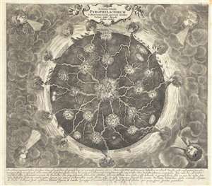
Systema Ideale Pyrophylaciorum Suberraneorum, quorum montes Vulcanii, veluti spiracula quaedam existant.
sold
- Digital Map Information
- Suitable for large format printing
- DPI: 300
- File Size: 12.66 MB
- File Type: ZIP / TIFF
- ICC color profile embedded
- Delivered instantly via download link
This is one of the 17th century polymath Athanasius Kircher's most iconic and graphically intense maps. This map illustrates Earth's volcanic system and is one of the maps included in Kircher's 1665 cosmography Mundus Subterranous . Inspired by ... (more details)
The Italian polymath Kircher's iconic map of the Earth's Volcanic Systems.
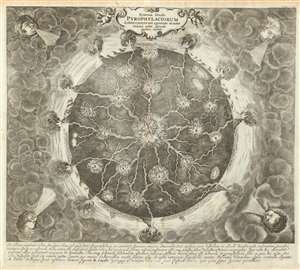
Systema Ideale Pyrophylaciorum Suberraneorum, quorum montes Vulcanii, veluti spiracula quaedam existant.
sold
- Digital Map Information
- Suitable for large format printing
- DPI: 600
- File Size: 31.49 MB
- File Type: ZIP / TIFF
- ICC color profile embedded
- Delivered instantly via download link
This is one of the 17th century polymath Athanasius Kircher's most iconic and graphically intense maps. The map illustrates the interior of the Earth postulates cohesive global volcanic system tied to a fiery core. Situated amidst dense clouds with Aeolus, or wind heads, at the corners, the Earth appears as a gigantic fiery orb. Along the circumference, we can recognize the oceans, mountains, land, and even a few sailing ships. The center of the Earth is a great fire. Beyond the flaming core, artery-like networks of subterranean channels direct the heat of the core to volcanoes on the Earth's surface. (more details)
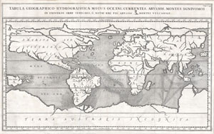
Tabula Geographico-Hydrographica Motus Oceani, Currentes, Abyssos, Montes Igniuomus in Universo Orbe Indicans Notat Haec Fig. Abyssos Montes Vulcanios.
sold
- Digital Map Information
- Suitable for large format printing
- DPI: 300
- File Size: 5.28 MB
- File Type: ZIP / TIFF
- ICC color profile embedded
- Delivered instantly via download link
A rare and spectacular 1665 map of the world by the extraordinary Germany scholar Athanasius Kircher. This is most likely the first world map to depict the oceans currents. Shows the entire world in accordance with Kircher's hydro-geographic ... (more details)
Unique First State.
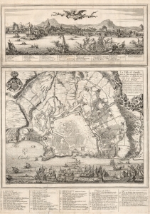
Candie/ La Ville de Candie pour la 3e. sois attaquee de L'armée Ottomane, et deffendue par Celle de la Serenissime Rep: de Venise... 1667, 68 et 69.
sold
- Digital Map Information
- Suitable for large format printing
- DPI: 600
- File Size: 109.01 MB
- File Type: ZIP / TIFF
- ICC color profile embedded
- Delivered instantly via download link
This is an extremely rare, likely unique, separately published 1668 broadsheet plan of the port of Heraklion / Candia, Crete, incorporating a striking panoramic view of the city. This broadsheet illustrates Venetian-controlled Heraklion during the final years of its 21-year-long Ottoman siege. It was privately commissioned and engraved to lionize the efforts of French nobleman Alphonse-Louis, Chevalier d’Harcourt, who perceived himself not only a defender of Crete, but as a latter-day crusader defending Christianity itself. (more details)
Lost Continent of Atlantis: Found?
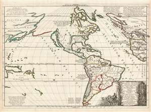
Nicolao Sanson antiquitati restituta ; nunc demum majori forma delineata, et in decem regna, iuxta decem Neptuni filios distributa : Praeterea insualae, nostraeqr. contenentis regiones quibus imperavere Atlantici reges ; aut quas armis tentavere ex conatibus geographicus.
sold
- Digital Map Information
- Suitable for large format printing
- DPI: 600
- File Size: 55.65 MB
- File Type: ZIP / TIFF
- ICC color profile embedded
- Delivered instantly via download link
This is a beautiful, first state example of Nicolas and Guillaume Sanson's map of America, proposing that the continent and the legendary lost continent of Atlantis were one and the same. (more details)
The mystery of sunspots.
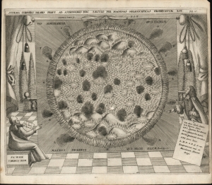
Schema corporis solaris prout ab astronomis hoc saeculo per machinas helioscopicas observatum est.
sold
- Digital Map Information
- Suitable for large format printing
- Full resolution TIFF file
- ICC color profile embedded
- Delivered instantly via download link
A finely engraved 1685 map of the Sun by Athanasius Kircher and Johann Zahn. The map provides a dramatic image of the Sun based upon the revolutionary 1665 work of the Jesuit polymath Athanasius Kircher (1602 - 1680). (more details)
A Celebrated Victory.
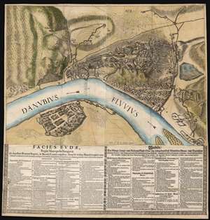
Facies Budae, Regiae Metropolis Hungariae Ab Aquilinis Romani Imperii, et Bavarici Leonis unguibus, simul et viribus Brandeburgicis unanimiter coadunatis, belli flammis undique deformatae, et Infidelium manibus, auxiliante gratiâ Divinâ, victricibus demúm armis ereptae. Die 2. Sept. Anno 1686.
sold
- Digital Map Information
- Suitable for large format printing
- DPI: 600
- File Size: 80.64 MB
- File Type: ZIP / TIFF
- ICC color profile embedded
- Delivered instantly via download link
This is an extremely rare political broadsheet map of Budapest, Hungary. It was engraved by Michael Wening to celebrate the September 2, 1686 victory of combined Holy League forces led by the Duke of Lorraine and the Elector of Bavaria over the Turkish forces occupying Buda, Hungary. (more details)
Documenting and propagandizing a scorched-earth campaign in the Nine Years' War.
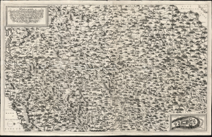
New Inventirte Land Carte Eines theil des Königreichs Franckreichs und darinn gelegenen Vornemsten Stätt und Vestungen: Samt deßen Conquesten Lothring, Franche Conte, Elsas, Pfaltz am Rhein, Mosel-Strohm und in NiderLand: Wie auch des angrentzende Saphoyen, Piemont, Schweitz, Schwartzwald, Würtenberg, Pfaltz am Rhein, und Wetterau, und angelegnen Ländern.
sold
- Digital Map Information
- Suitable for large format printing
- File Size: 39.6 MB
- File Type: ZIP / TIFF
- ICC color profile embedded
- Delivered instantly via download link
This is a 1691 proof state of Johann Hoffman's large, beautiful, and rare separately-issued map of France's frontiers during the Nine Years' War (1688 - 1697), produced as part of an anti-French propaganda scheme at the height of Louis XIV's scorched earth campaign. As described in the map's title, the map portrays part of France, 'Including its Conquests of Lorraine, Franche-Comté, Alsace, the Palatinate on the Rhine, the Moselle-Strohm, and the Netherlands...' The map details the heavily-fortified French border extending from the port of Dunkirk to the German frontier along the Rhine River, then to the frontiers of Switzerland, Piedmont, and Savoy: a defensive front stretching from the English Channel to the Mediterranean. (more details)
Lost Continent of Atlantis: Found?
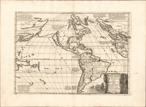
Atlantis Insula a Nicolao Sanson antiquitati restituta nunc demum majori forma delineata et in decem regna iuxta decem Neptuni filios distributa Praeterea insualae. nostraeqr contenentis regiones quibus imperavere Atlantici reges aut quas armis tentavere ex conatibus geographicus.
sold
- Digital Map Information
- Suitable for large format printing
- Full resolution TIFF file
- ICC color profile embedded
- Delivered instantly via download link
This is a beautiful example of Nicolas and Guillaume Sanson's map of America as the lost continent of Atlantis. The present examples is a scarce 1694 Italian edition, finely engraved and printed with strong inks on beautiful Italian paper - à la Coronelli. It is visually and physically superior to Sanson's own earlier editions. (more details)
Propaganda for Spotswood's settlement of Germans in Virginia: First State.
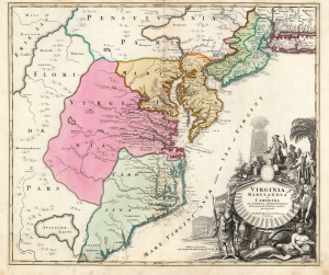
Virginia Marylandia et Carolina in America Septentrionali Britannorum industria excultae…
sold
- Digital Map Information
- Suitable for large format printing
- Full resolution TIFF file
- ICC color profile embedded
- Delivered instantly via download link
A striking example of Johann Baptist Homann's c. 1715 map of Virginia, Carolina, Maryland, and New Jersey, considered one of the most important maps of this region to appear in the 18th century, here in its first state. Homann drew this map to advocate for Virginia Lieutenant-Governor Alexander Spotswood's 1714 - 1717 plan to settle the little-known interior of Virginia with German immigrants. Shown here is the first mapping of 'Germantown Teutsche Statt' (Germanna) on the Rapidan River, a fork of the Rappahannock River, Fort Christanna (Christ Anna Fort) on the Makharing River, and 'Miester Krugs Plantasie' on the James River. The omission of Spotswood's connection to this map has long led it to be misunderstood and dismissed by scholars. (more details)
Propaganda for Spotswood's settlement of Germans in Virginia.
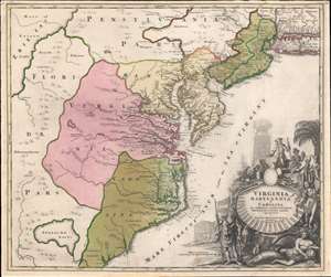
Virginia Marylandia et Carolina in America Septentrionali Britannorum industria excultae…
sold
- Digital Map Information
- Suitable for large format printing
- Full resolution TIFF file
- ICC color profile embedded
- Delivered instantly via download link
A very handsome example of Johann Baptist Homann's c. 1715 map of Virginia, Carolina, Maryland, and New Jersey; considered one of the most important and decorative maps of this region to appear in the 18th century. Homann drew this map to advocate for Virginia Lieutenant-Governor Alexander Spotswood's 1714 - 1717 plan to settle the little-known interior of Virginia with German immigrants. Shown here is the first mapping of 'Germantown Teutsche Statt' (Germanna) on the Rapidan River, a fork of the Rappahanock River, Fort Christanna (Christ Anna Fort) on the Makharing River, and 'Miester Krugs Plantasie' on the James River. Omission of Spotswood's connection to this map have long led it to being misunderstood or outright dismissed by scholars. Coverage extends from New York City and Long Island south along the Atlantic Cost as far as modern-day Georgia, and as far west as Lake Erie. (more details)
Propaganda for Spotswood's settlement of Germans in Virginia.
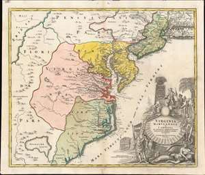
Virginia Marylandia et Carolina in America Septentrionali Britannorum industria excultae…
sold
- Digital Map Information
- Suitable for large format printing
- Full resolution TIFF file
- ICC color profile embedded
- Delivered instantly via download link
A very handsome example of Johann Baptist Homann's c. 1715 map of Virginia, Carolina, Maryland, and New Jersey; considered one of the most important and decorative maps of this region to appear in the 18th century. Homann drew this map to advocate for Virginia Lieutenant-Governor Alexander Spotswood's 1714 - 1717 plan to settle the little-known interior of Virginia with German immigrants. Shown here is the first mapping of 'Germantown Teutsche Statt' (Germanna) on the Rapidan River, a fork of the Rappahanock River, Fort Christanna (Christ Anna Fort) on the Makharing River, and 'Miester Krugs Plantasie' on the James River. Omission of Spotswood's connection to this map have long led it to being misunderstood or outright dismissed by scholars. Coverage extends from New York City and Long Island south along the Atlantic Cost as far as modern-day Georgia, and as far west as Lake Erie. (more details)
Propaganda for Spotswood's settlement of Germans in Virginia.
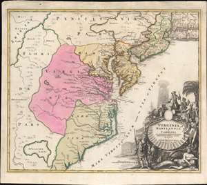
Virginia Marylandia et Carolina in America Septentrionali Britannorum industria excultae…
sold
- Digital Map Information
- Suitable for large format printing
- Full resolution TIFF file
- ICC color profile embedded
- Delivered instantly via download link
A very handsome example of Johann Baptist Homann's c. 1715 map of Virginia, Carolina, Maryland, and New Jersey; considered one of the most important and decorative maps of this region to appear in the 18th century. Homann drew this map to advocate for Virginia Lieutenant-Governor Alexander Spotswood's 1714 - 1717 plan to settle the little-known interior of Virginia with German immigrants. Shown here is the first mapping of 'Germantown Teutsche Statt' (Germanna) on the Rapidan River, a fork of the Rappahanock River, Fort Christanna (Christ Anna Fort) on the Makharing River, and 'Miester Krugs Plantasie' on the James River. Omission of Spotswood's connection to this map have long led it to being misunderstood or outright dismissed by scholars. Coverage extends from New York City and Long Island south along the Atlantic Cost as far as modern-day Georgia, and as far west as Lake Erie. (more details)
Map used to promote investment in John Law's Compagnie d'Occident (Mississippi Bubble) and the first map to show Le Maire's discoveries.
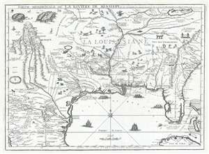
Partie Meridionale De La Riviere De Missisipi, et ses Environs dan L'Amerique Septentrionale.
sold
- Digital Map Information
- Suitable for large format printing
- DPI: 300
- File Size: 15.98 MB
- File Type: ZIP / TIFF
- ICC color profile embedded
- Delivered instantly via download link
A seminal map of the utmost importance and rarity, this is Nicolas de Fer's 1718 map of the Mississippi River Valley drawn to promote the Compagnie d'Occident . Essentially mirroring the coverage of De L'Isle's map of 1703, the map covers ... (more details)
Map used to promote investment in John Law's Compagnie d'Occident (Mississippi Bubble) and the first map to show Le Maire's discoveries.
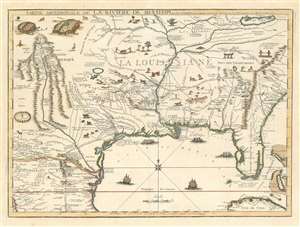
Partie Meridionale De La Riviere De Missisipi, et ses Environs dan L'Amerique Septentrionale.
sold
- Digital Map Information
- Suitable for large format printing
- DPI: 600
- File Size: 23.29 MB
- File Type: ZIP / TIFF
- ICC color profile embedded
- Delivered instantly via download link
A seminal map of the utmost importance and rarity, this is Nicolas de Fer's 1718 map of the Mississippi River Valley drawn to promote the Compagnie d'Occident. Essentially mirroring the coverage of De L'Isle's map of 1703, the map covers from just west of the Rio Grande (Rio del Norte) eastward as far as Charleston, north to include Lake Erie, and south as far as Cuba and the Gulf of Mexico. Per its title, the map is centered on the Mississippi Valley and was intended to illustrate the lush richness of this region. (more details)
An 18th century stock bubble...
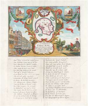
Afbeeldinge van't zeer vermearde Eiland Geks-Kop.
sold
- Digital Map Information
- Suitable for large format printing
- Full resolution TIFF file
- ICC color profile embedded
- Delivered instantly via download link
An important and charming 1720 satirical allegory map, commonly known as the 'Fools Head' or 'Fools Cap,' intended to illustrate the dangers and pitfalls of 'bubble economies.' After the bursting of the Dot-Com Bubble and the more disastrous United States Housing Bubble (and subsequent sub-prime mortgage crises) most will find the themes of this 18th century map taunting the speculators in the Mississippi Scheme - poverty, sorrow, and despair - quite familiar. (more details)
Earliest and most desirable printed map of Taiwan / Formosa.
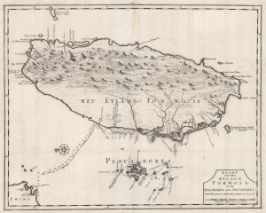
Kaart van het Eyland Formosa en de Eylanden van Piscadores.
sold
- Digital Map Information
- Suitable for large format printing
- DPI: 600
- File Size: 45.16 MB
- File Type: ZIP / TIFF
- ICC color profile embedded
- Delivered instantly via download link
Printed in 1726 by Francois Valentijn, this is the earliest and most desirable printed map of Taiwan or Formosa. It is considered the first specific printed map of Formosa. Oriented to the east, with north at the left, Valentijn's map covers the entire island was well as the nearby Pescadores, now known as the Penghu Islands, and the nautical route to the Chinese coastal province of Fujian. Soundings appear around the Pescadores, along the west coast of Taiwan, and extend to the Chinese coast. (more details)
Thorough, early defense of the Sea of the West and the Northwest Passage.
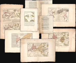
Exposé des Découvertes au Nord de la Grande Mer...
sold
- Digital Map Information
- Suitable for large format printing
- Full resolution TIFF file
- ICC color profile embedded
- Delivered instantly via download link
This is an extremely rare example of Philippe Buache's 1753 Exposé des Découvertes au Nord de la Grande Mer, the essential maps published to support the astonishing geographical theories of Philippe Buache and Joseph Nicolas De l'Isle, presented in August 1752 to the Paris Academie des Sciences. It was then the most complete cartographical defense of Nicolas De l'Isle's 'exposé' of Russian cartographic advances, along with Buache's synthesis of several mappings of the Pacific Northwest, revealing compelling (if ultimately false) evidence of a viable Northwest Passage. These maps were later included in the 1753-1755 Considérations Géographiques, 'the magnum opus of the Delisle-Buache theory of the layout of lands in the North Pacific space,' (Lada-Mocarski, 1969) appearing there in their second states. These six sheets are all first state examples, indicating that the Exposé enjoyed an earlier publication, spurred perhaps by the novelty of Buache and De l'Isle's arguments and the urgency with which the two geographers wished to assuage and rebut critics of their presentation to the Academie. (more details)
The Fall of French Power in America on the Eve of the Seven Years' War.
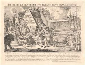
British Resentment, or, the French fairly Coopt at Louisbourg.
sold
- Digital Map Information
- Suitable for large format printing
- Full resolution TIFF file
- ICC color profile embedded
- Delivered instantly via download link
This is an English 1755 satirical cartoon celebrating and encouraging the British to take up arms against France in North America, and lampooning France' waning power during the buildup of what would become the French and Indian War (1754 - 1763). The 'resentment of the British', as in the title, refers to British annoyance at French interference in their sphere of influence in the Americas, and French attacks on British Colonists; the Scottish motto above Britannia's throne (Nemo me impune lacessit, no one attacks me with impunity) reiterates the justification for war. But while referencing many points of conflict between the two powers throughout the prospective theatre of war, this work is most specifically in reference to the action of June 8, 1755 - a controversial British naval victory over the French which contributed to the 1756 declaration of war. Hostilities between French and British colonial forces were already underway in 1754 over control of the Ohio River Valley and Nova Scotia, and both Britain and France were rushing troops to reinforce their respective colonial interests. The British Navy sent a fleet (under the command of Vice Admiral Edward Boscawen) to the Gulf of St. Lawrence to intercept French ships en route to Quebec City, but for the most part the French eluded the blockade, landing ships at Louisbourg in Nova Scotia. (more details)
Mars, the God of War, look on as Fame proclaims the of the Birth of the United States.
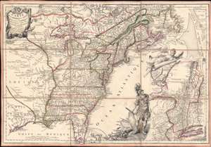
Carte de l'Amerique Septle. pour Servir a l'Intelligence de la Guerre Entre les Anglois et les Insurgents.
sold
- Digital Map Information
- Suitable for large format printing
- Full resolution TIFF file
- ICC color profile embedded
- Delivered instantly via download link
This is a rare 1777 Jean-Baptiste Jacques de Beaurain map of the United States during the American Revolutionary War, issued in anticipation of French entry into the war on the side of the revolutionaries. The map includes a bold illustration of the goddess Ossa (fame) unrolling an expansive map of the Theater of War in the Hudson corridor, proclaiming the newly formed United States. Mars, the god of War, looks on, shield and torch in hand, his arsenal ready - much like France itself. This map is thus an instrument of propaganda intended to prepare the public for French participation in the American Revolution - an event which followed in early 1778. (more details)
Essential Map Bringing the American Revolution to a French Audience.
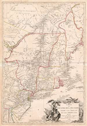
Carte du Theatre de la Guerre entre les Anglais et Les Americains.
sold
- Digital Map Information
- Suitable for large format printing
- DPI: 600
- File Size: 37.33 MB
- File Type: ZIP / TIFF
- ICC color profile embedded
- Delivered instantly via download link
This is a scarce, separately published American Revolutionary War map of New York and New England. First issued by Brion de la Tour in 1777, this map was intended to illustrate the important events at the height of the war. Brion de la Tour's map covers from the Delaware and Chesapeake Bays northward as far as Quebec City, inclusive of New York (with modern day Vermont), New Jersey, Massachusetts, Connecticut, New Hampshire, and parts of Pennsylvania, Maryland, Delaware, Maine, and Canada. It offers both political and topographical detail including mountains, rivers, roadways, regional boundaries, American Indian nations, towns, and cities. (more details)
The world's first zoological map!
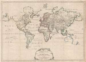
Tabula Mundi Geographico Zoologica sistens Quadrupedes hucusque notos sedibus suis adscriptos editit E. A. W. Zimmerman
sold
- Digital Map Information
- Suitable for large format printing
- Full resolution TIFF file
- ICC color profile embedded
- Delivered instantly via download link
This 1783 map by E. A. W. Zimmermann is the first thematic map of the world focused on zoology. Presented on a Mercator Projection and encompassing some 380 degrees of the sphere, Zimmermann's map ignores political boundaries to focus on ... (more details)
Among the Earliest Maps of North America Published after the Revolution.
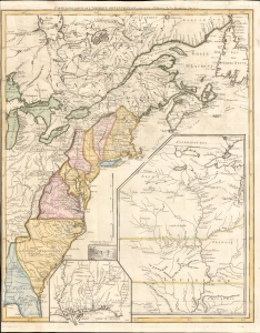
Carte d'une partie de l'Amérique Septentrionale, pour servir à l'histoire de la dernière guerre.
sold
- Digital Map Information
- Suitable for large format printing
- Full resolution TIFF file
- ICC color profile embedded
- Delivered instantly via download link
An example of Louis Le Rouge's 1787 map of North America, prepared soon after the conclusion of the American Revolutionary War (1775 - 1783), making it among the earliest published maps of the new country. It is notable for some curious cartographic choices on the part of Le Rouge, as well as the inclusion of many Native American tribes and settlements on the American frontier. (more details)
A scatological map of England and France.
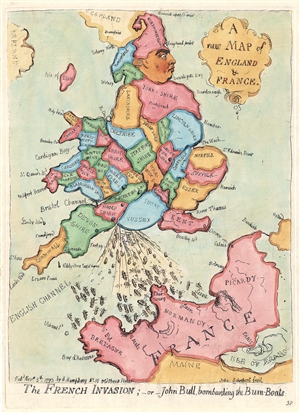
A new Map of England & France. / The French Invasion; or John Bull, bombarding the Bum-Boats.
sold
- Digital Map Information
- Suitable for large format printing
- DPI: 300
- File Size: 2.95 MB
- File Type: ZIP / TIFF
- ICC color profile embedded
- Delivered instantly via download link
A wonderful example of the 1851 George Bohn restrike of James Gillray's 1793 satirical caricature map of England, Wales, and France. An expression of the political tensions of the era, this map takes the form of George III of England, facing to the right and boldly railing his right foot (Kent), to stamp on France, itself taking the form of a face. The King is wearing a fool's cap composed of 'Northumberland.' Wales represents the king's flying coattails. The map illustrates, in the words of a Tate London Cataloger, George III crapping
vigourously on the coast of France, dispersing a number of tiny gunboats (…) The image is gross, but the King’s evacuations are heroic, patriotic and contemptuous, expressing the feelings of the brutish but uncensored John Bull, whom he here embodies.The map of course illustrates the pervading fear in England of a Napoleonic invasion. Among George III expulsions are the words 'British Declaration', referring to George's promise to return Toulon (held by Royalists aided by British and Spanish forces) to French on the restoration of the Bourbon monarchy. (more details)
Scatological map of England and France.
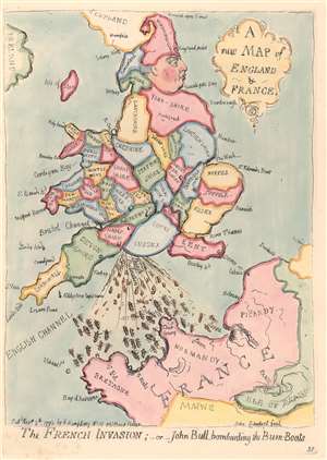
A New Map of England and France. / The French Invasion; or John Bull, bombarding the Bum-Boats.
sold
- Digital Map Information
- Suitable for large format printing
- DPI: 300
- File Size: 1.97 MB
- File Type: ZIP / TIFF
- ICC color profile embedded
- Delivered instantly via download link
A wonderful example of the 1851 George Bohn restrike of James Gillray's 1793 satirical caricature map of England, Wales, and France. An expression of the political tensions of the era, this map takes the form of George III of England, facing to the right and boldly raising his right foot (Kent), to stamp on France, itself taking the form of a face. The King is wearing a fool's cap composed of 'Northumberland.' Wales represents the king's flying coattails. The map illustrates, in the words of a Tate London Cataloger, George III
crapping vigorously on the coast of France, dispersing a number of tiny gunboats (…) The image is gross, but the King’s evacuations are heroic, patriotic and contemptuous, expressing the feelings of the brutish but uncensored John Bull, whom he here embodies.The map of course illustrates the pervading fear in England of a Napoleonic invasion. Among George III's expulsions are the words 'British Declaration', referring to George's promise to return Toulon (held by Royalists aided by British and Spanish forces) to the French on the restoration of the Bourbon monarchy. (more details)
18th-century 'abolitionist colonialism' in West Africa.
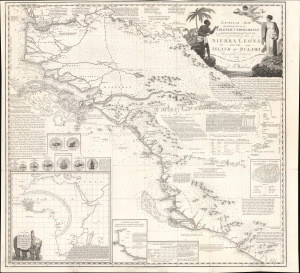
Nautical Map Intended for the use of Colonial Undertakings on the W. Coast of Africa from Lat. 5°.30' to Lat. 14°.N. but more particularly those of Sierra Leona and the Island of Bulama. Respectfully Dedicated to the Humane and disinterested Promoters of those and similar Establishments by C. B. Wadstrom.
sold
- Digital Map Information
- Suitable for large format printing
- Full resolution TIFF file
- ICC color profile embedded
- Delivered instantly via download link
This is Swedish-British abolitionist Carl Bernhard Wadström's extraordinary 1795 map of Sierra Leone and the Upper Guinea Coast, extending from modern-day Senegal and The Gambia through Guinea-Bissau, Guinea, and Sierra Leone to northern Liberia. Rich in geographical, ethnographic, and commercial detail, the map promotes Wadström's ambitious scheme to transform one of West Africa's principal slave-trading regions into an abolitionist mercantile empire founded on agriculture, natural resources, free labor, and so-called 'legitimate commerce.' More than a map, it is a manifesto on Enlightenment abolitionism, experimental colonization, African exploration, and the effort to replace the Atlantic slave trade with a new - yet still deeply imperial and paternalistic - commercial order. (more details)
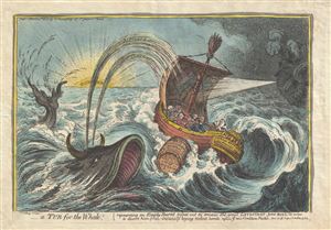
A Tub for the Whale; representing an Empty Barrel tossed out to amuse the great Leviathan - John Bull, in order to divert him from instantly laying violent hands upon ye new Coalition Packet.
sold
- Digital Map Information
- Suitable for large format printing
- Full resolution TIFF file
- ICC color profile embedded
- Delivered instantly via download link
This is a scarce 1806 hand color aquatint and etching of a Tub for the Whale, by James Gillray. The lengthy title references the preface of Jonathan Swift's satire A Tale of a Tub , published in 1704. In the etching, we see a whale ... (more details)
The earliest obtainable example of the influential Goerck-Mangin Plan of New York City - published while it was still relevant.
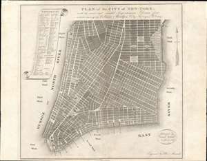
PLAN of the CITY OF NEW-YORK, with the recent and intended Improvements. New York, 1807.
sold
- Digital Map Information
- Suitable for large format printing
- DPI: 600
- File Size: 12.92 MB
- File Type: ZIP / TIFF
- ICC color profile embedded
- Delivered instantly via download link
This is a highly unusual piece with a confused and complex history. The map was published in 1807 by Isaac Riley, William Bridges, and Peter Maverick. It depicts lower Manhattan from roughly Bank Street (current West Village) to the Bowery, but is cartographically unusual as it follows the Mangin-Goerck Plan, a much larger c. 1801 map also engraved by Peter Maverick. That, plan, like the present map, proposed extensive landfill projects and new streets intended to generate clean neat lines and sharp right angles throughout. It is of note that this map pre-dates the 1811 Commissioner's Plan, and thus represents the definitive plan of New York City at the time of publication. This map is thus the only obtainable examples of one of the most important founding cartographic documents relating to the development of New York's street grid, publishing while the Mangin-Goerck map was still relevant. (more details)
First Cartographic Celebration of Gustatory France.
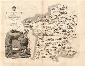
Carte Gastronomique de la France.
sold
- Digital Map Information
- Suitable for large format printing
- Full resolution TIFF file
- ICC color profile embedded
- Delivered instantly via download link
This 1809 map of France, beautifully drawn and engraved by Jean François Tourcaty for author Charles Louis Cadet de Gassicourt, is the earliest instance of a carte gastronomique - a map devised not to show its subject country's cities or topography, but to show the foods characteristic to it. Perhaps unsurprisingly given the topic, the map is of France. It presents an open outline map of the country, with simply hachured coastlines. Rivers are shown in order to contextualize the regions and the chief cities but the bulk of the detail shown in the map are attractive pictorial vignettes each region's main produce. These range from the salt pans of the western coasts, fisheries, cattle, fowl (both before and after plucking), wheels of cheeses, and beehives. But overwhelmingly, wine and spirits dominate the map in a multiplicity of vineyards, stills, barrels and bottles. At a glance, one can characterize any one of the regions on the map by what one might find there to eat, in broad variety. (more details)
The Blue Map of China - one of the most important and beautiful maps ever made.
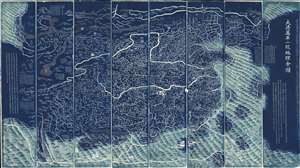
DaQing Wannian Yitong Tianxia Quantu / 大清万年一统天下全图 / All-Under-Heaven Complete Map of the Everlasting Unified Qing Empire
sold
- Digital Map Information
- Suitable for large format printing
- Full resolution TIFF file
- ICC color profile embedded
- Delivered instantly via download link
The legendary Blue Map of China under the Great Qing, one of the rarest, largest, and most aesthetically magnificent Chinese maps ever made. Published in 1811 (Jiaqing 16) in the Qing Dynasty, this Chinese map by Huang Qianren (黃千人, 1694–1771) is of utmost significance. Although ostensibly a map of China, the coverage of this map in fact extends to all lands touched by the influence Qing Empire, including England, Holland, Southeast Asia, Arabia, and Africa. As such it can be considered a political manifesto lionizing the unity and majesty of Qing China as well as a functional administrative document. (more details)
Dutch version of the most popular caricature of Napoleon Bonaparte - denouncing his villiany!
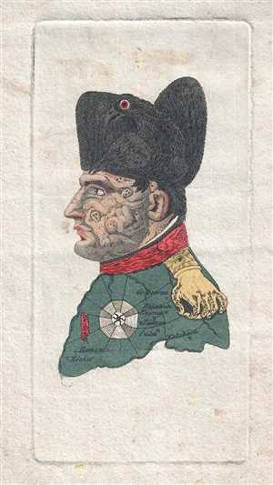
Eigenaardige Afbeelding des geweldenaars.
sold
- Digital Map Information
- Suitable for large format printing
- DPI: 300
- File Size: 0.48 MB
- File Type: ZIP / TIFF
- ICC color profile embedded
- Delivered instantly via download link
This is an 1814 Evert Maaskamp caricature of Napoleon and political broadside attacking the violence and death perpetrated by the power-hungry despot. The caricature is based upon a portrait sketched by a Hanoverian artist named ... (more details)
Extremely rare Amish or Pennsylvania Dutch allegorical broadside printed in Lancaster, PA.
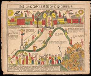
Das ewige Leben und die ewige Verdammniss. (Eternal Life and Eternal Damnation)
sold
- Digital Map Information
- Suitable for large format printing
- DPI: 300
- File Size: 7.47 MB
- File Type: ZIP / TIFF
- ICC color profile embedded
- Delivered instantly via download link
A rare c. 1820 Amish or Pennsylvania Dutch allegorical fraktur or broadside illustrating the paths to heaven and hell. This broadside was issued in Lancaster, PA, by Herman W. Villee. The view appears to be a woodblock ... (more details)
Ceremonial and Administrative Embodiment of the Qing.
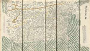
DaQing Wannian Yitong Tianxia Quantu / 大清万年一统天下全图 / All-Under-Heaven Complete Map of the Everlasting Unified Qing Empire
sold
- Digital Map Information
- Suitable for large format printing
- Full resolution TIFF file
- ICC color profile embedded
- Delivered instantly via download link
A seminal 1821 (Daoguang 1) Qing Dynasty Chinese map of utmost importance and rarity, this is Huang Qianren's (黃千人, 1694–1771) grand and spacious map of the Great Qing Empire of China. Although ostensibly a map of China, the coverage of this map in fact extends to all lands touched by the influence Qing Empire, including England, Holland, Southeast Asia, and Africa. As such it can be considered a political manifesto lionizing the unity and majesty of Qing China as well as a functional administrative document. This edition of the map, 1821, was issued to memorialize the reign of the Jiaqing Emperor and celebrate the coming Daoguang reign. (more details)
The earliest chart to depict the heights of mountains and the lengths of rivers together in one illustration' - Rumsey
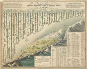
New and Improved View of the Comparative Heights, of the Principal Mountains and Lengths of the Principal Rivers in the World.
sold
- Digital Map Information
- Suitable for large format printing
- DPI: 300
- File Size: 5.78 MB
- File Type: ZIP / TIFF
- ICC color profile embedded
- Delivered instantly via download link
A groundbreaking convention establishing map of extreme scarcity, this is William Darton and W. R. Gardner's 1823 comparative mountains and rivers of the world chart. According to Rumsey this is the first known example ... (more details)