
Wall Maps (sold)
The Blue Map of China - one of the most important and beautiful maps ever made.
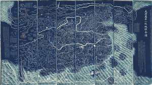
DaQing Wannian Yitong Tianxia Quantu / 大清万年一统天下全图 / All-Under-Heaven Complete Map of the Everlasting Unified Qing Empire
sold
- Digital Map Information
- Suitable for large format printing
- Full resolution TIFF file
- ICC color profile embedded
- Delivered instantly via download link
The legendary Blue Map of China under the Great Qing, one of the rarest, largest, and most aesthetically magnificent Chinese maps ever made. Published in 1811 (Jiaqing 16) in the Qing Dynasty, this Chinese map by Huang Qianren (黃千人, 1694–1771) is of utmost significance. Although ostensibly a map of China, the coverage of this map in fact extends to all lands touched by the influence Qing Empire, including England, Holland, Southeast Asia, Arabia, and Africa. As such it can be considered a political manifesto lionizing the unity and majesty of Qing China as well as a functional administrative document. (more details)
Oldest surviving rubbing of the Dili Tu. /《墬理图》现存最古老碑拓
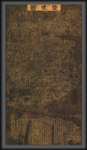
Dili tu. / 墬理圖
sold
- Digital Map Information
- Suitable for large format printing
- File Size: 57.31 MB
- File Type: ZIP / TIFF
- ICC color profile embedded
- Delivered instantly via download link
An outstanding discovery, this is the legendary c. 1247 Dili tu (墬理圖) terrestrial map of China. This is the earliest surviving example of one of the earliest known maps of China produced in the Common Era. The map was drawn by the Chinese polymath Huang Shang (黃裳). Huang's original wood carving, produced around 1194, has long been lost, but the map was engraved in stone in 1247 by Wang Zhiyuan (王致遠). This rubbing comes from that stone and dates to sometime between 1493 and 1602 - making it the oldest known extent rubbing of the Dili tu of China. The present map has been carbon-dated as having been created between 1493 and 1602, with supplementary ink testing verifying the results (these documents are available upon request and accompany the item). (more details)
A cartographic expression of the Qing tribute system, this is the earliest known printed example of the 'Tianxia Quantu' map of Qing China.
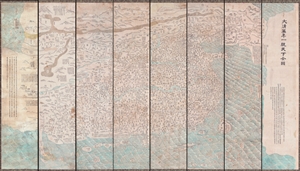
DaQing Wannian Yitong Tianxia Quantu / 大清万年一统天下全图 / All-Under-Heaven Complete Map of the Everlasting Unified Qing Empire
sold
- Digital Map Information
- Suitable for large format printing
- File Size: 89.96 MB
- File Type: ZIP / TIFF
- ICC color profile embedded
- Delivered instantly via download link
A seminal 1806 (Jiaqing 11) Qing Dynasty Chinese map of utmost importance and rarity, this is the earliest known printing of Huang Qianren's (黃千人, 1694–1771) grand and spacious map of the Great Qing Empire of China. Huang Qianren first drew this map ... (more details)
Seminal map of Georgia.
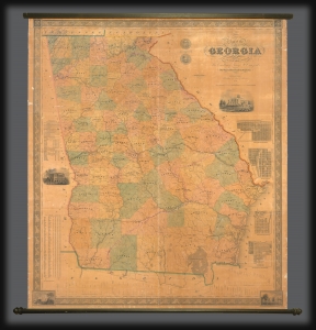
Map of the State of Georgia compiled under the direction of His Excellency George W. Crawford by Wm. G. Bonner, Civil Engineer.
sold
- Digital Map Information
- Suitable for large format printing
- DPI: 600
- File Size: 122.68 MB
- File Type: ZIP / TIFF
- ICC color profile embedded
- Delivered instantly via download link
An excellent example of William G. Bonner's rare, important, and monumental 1847 map of Georgia, here in its first edition, first state. When issued, this was the first major map of the state to appear in almost 20 years, and thus the first to represent Georgia with some approximation of its modern borders. It is, moreover, the first major map to illustrate the westward expansion of Georgia in the 1830s and 40s, with the annexation of Creek and Cherokee territory. It is also one of the few maps to clearly delineate the Georgia-Florida border dispute. (more details)
Ceremonial and Administrative Embodiment of the Qing.
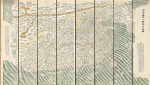
DaQing Wannian Yitong Tianxia Quantu / 大清万年一统天下全图 / All-Under-Heaven Complete Map of the Everlasting Unified Qing Empire
sold
- Digital Map Information
- Suitable for large format printing
- Full resolution TIFF file
- ICC color profile embedded
- Delivered instantly via download link
A seminal 1821 (Daoguang 1) Qing Dynasty Chinese map of utmost importance and rarity, this is Huang Qianren's (黃千人, 1694–1771) grand and spacious map of the Great Qing Empire of China. Although ostensibly a map of China, the coverage of this map in fact extends to all lands touched by the influence Qing Empire, including England, Holland, Southeast Asia, and Africa. As such it can be considered a political manifesto lionizing the unity and majesty of Qing China as well as a functional administrative document. This edition of the map, 1821, was issued to memorialize the reign of the Jiaqing Emperor and celebrate the coming Daoguang reign. (more details)
The last great cartographic masterpiece of Ming China.
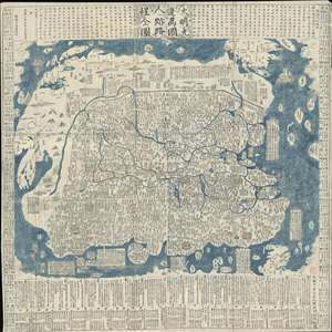
Complete Map of the Nine Border Towns of the Great Ming and of the Human Presence and Travel Routes of the Ten Thousand Countries. / 大明九邊萬國人跡路程全圖 / Dàmíng jiǔ biān wànguó rén jì lùchéng quán tú.
sold
- Digital Map Information
- Suitable for large format printing
- Full resolution TIFF file
- ICC color profile embedded
- Delivered instantly via download link
A rare and extraordinary 1663 (Kangxi 2) xylographic map of Ming China, and indeed the entire world, by Wáng Jūnfǔ (王君甫) issued during the reign of the Kangxi Emperor (1661 – 1722). This massively proportioned map focuses on China, which, bounded on ... (more details)
The last great cartographic masterpiece of Ming China.
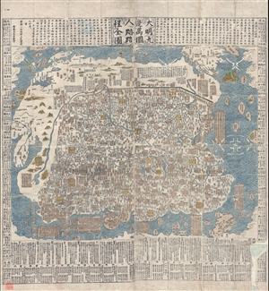
Complete Map of the Nine Border Towns of the Great Ming and of the Human Presence and Travel Routes of the Ten Thousand Countries. / 大明九邊萬國人跡路程全圖 / Dàmíng jiǔ biān wànguó rén jì lùchéng quán tú.
sold
- Digital Map Information
- Suitable for large format printing
- DPI: 300
- File Size: 70.8 MB
- File Type: ZIP / TIFF
- ICC color profile embedded
- Delivered instantly via download link
A rare and extraordinary 1663 (Kangxi 2) xylographic map of Ming China, and indeed the entire world, by Wáng Jūnfǔ (王君甫) issued during the reign of the Kangxi Emperor (1661 – 1722). This massively proportioned map focuses on China, which, bounded on ... (more details)
Largest map of the Philippines Printed in the Philippines w/ Distinguished Provenance.
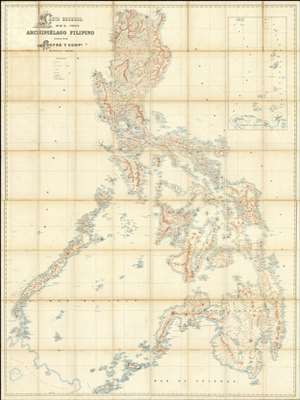
Carta General del Archipiélago Filipino.
sold
- Digital Map Information
- Suitable for large format printing
- File Size: 2002.83 MB
- File Type: ZIP / TIFF
- ICC color profile embedded
- Delivered instantly via download link
This is the only known example of Salvador Chofré's spectacular 1897 map of the Philippines - what must be considered the largest and most detailed Spanish map of the Philippines issued in the 19th century. The map was produced by Salvador Chofré, Manila's first lithographer at the height of his career, likely by government request in the face of the Philippine Revolution (1896 - 1898). The present example is likely a proof, as no other example or publishing history is known. What is known is that this example was acquired by American naval officer Henry Glass in 1898, when he participated in the invasion and surrender of Manila. The U.S. Navy reportedly reproduced it, very likely from this example, at a 50% reduced scale, although we have found no trace of said reproduction. The present map accompanied Glass when he returned to the United States, serving in San Francisco and attaining the rank of Rear Admiral, and was subsequently passed down through his family until we acquired it. (more details)
The last edition of Melish's iconic 'Manifest Destiny' map of the United State to be published in his lifetime.
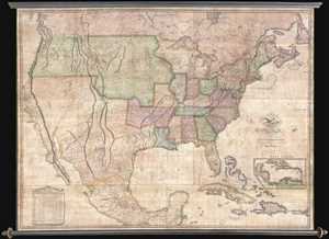
Map of the United States with the Contiguous British & Spanish Possessions Compiled from the latest & best authorities by John Melish . . . Improved to 1822.
sold
- Digital Map Information
- Suitable for large format printing
- DPI: 300
- File Size: 92.78 MB
- File Type: ZIP / TIFF
- ICC color profile embedded
- Delivered instantly via download link
An example of John Melish's important 1822 map of the United States. Melish's map is considered the most influential map of American published in the 19th century and is rivaled only by John Mitchell's 1755 map of North America as the single most influential ... (more details)
First Japanese Printed Map to show European geographical information with Buddhist world-view.
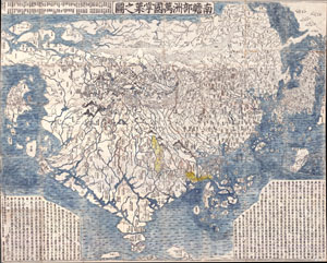
Nansenbushu Bankoku Shoka No Zu (Outline Map of All Countries of the Universe)
sold
- Digital Map Information
- Suitable for large format printing
- Full resolution TIFF file
- ICC color profile embedded
- Delivered instantly via download link
A seminal map. This is the first Japanese printed map to depict the world, including Europe and America, from a Buddhist cosmographical perspective. Printed by woodblock in 1710 (Hoei 7), this map was composed by the Buddhist monk Rokashi Hotan. Inspired ... (more details)
The first Japanese map of the world from a Buddhist cosmographical perspective - a seminal map.
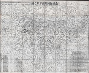
Nansenbushu Bankoku Shoka No Zu (Outline Map of All Countries of the Universe)
sold
- Digital Map Information
- Suitable for large format printing
- DPI: 300
- File Size: 91.94 MB
- File Type: ZIP / TIFF
- ICC color profile embedded
- Delivered instantly via download link
A seminal map of extreme significance. This is the first Japanese printed map to depict the world, including Europe and America, from a Buddhist cosmographical perspective. Printed by woodblock in 1710 (Hoei 7), this map was composed by the Buddhist monk ... (more details)
Ming cartographic heritage.

大明一統二京十三省図 / Great Ming Unification Two Capitals and Thirteen Provinces Map / Da Ming Yi Yong Er Jing Shi San Shen Tu
sold
- Digital Map Information
- Suitable for large format printing
- Full resolution TIFF file
- ICC color profile embedded
- Delivered instantly via download link
This previously unknown 1769 Chinese-language manuscript map of Ming China and Korea is among the most important East Asian cartographic discoveries to emerge in recent years. Monumental in scale and exceptionally detailed, it preserves official Ming Dynasty geographic knowledge long thought lost, likely produced in Tokugawa Japan by descendants of Chinese scholars who fled the fall of the Ming Dynasty in 1644. Rich with elegant calligraphy, extensive topographical and political detail, and numerous textual annotations, the map offers an unparalleled window into the geography, historical memory, and intellectual traditions of the Ming loyalist diaspora. As a unique manuscript with no known counterpart, it represents a once-in-a-lifetime opportunity to acquire an extraordinary artifact of Chinese cartography, Sino-Japanese cultural exchange, and the enduring legacy of the Great Ming. (more details)
The Ming and the Myriad Countries.
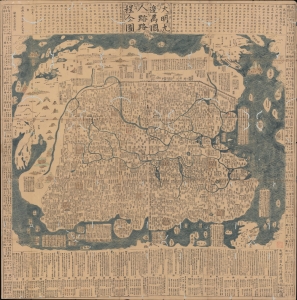
大明九邊萬國人跡路程全圖 / [Complete Map of the Nine Border Crossings of the Great Ming and of the Routes and Settlements of the Myriad Countries].
sold
- Digital Map Information
- Suitable for large format printing
- Full resolution TIFF file
- ICC color profile embedded
- Delivered instantly via download link
An extraordinary 1663 xylographic map of Ming China, and indeed the world by Wang Junfu (王君甫), issued in the second year of the reign of the Kangxi Emperor (r. 1661 – 1722) of the Qing Dynasty. Among other features, it is notable for being dated after the Qing had already displaced the Ming and established a new dynasty, suggesting that it was surreptitiously published and circulated among Ming Loyalists. (more details)
Nansenbushu: First Japanese Printed Map to show European geographical information with Buddhist world-view.
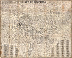
Nansenbushu Bankoku Shoka No Zu (Outline Map of All Countries of the Universe)
sold
- Digital Map Information
- Suitable for large format printing
- DPI: 300
- File Size: 330.31 MB
- File Type: ZIP / TIFF
- ICC color profile embedded
- Delivered instantly via download link
A seminal map of extreme significance. This is the first Japanese printed map to depict the world, including Europe and America, from a Buddhist cosmographical perspective. Printed by woodblock in 1710 (Hoei 7), this map was composed by the Buddhist monk ... (more details)
The only published map to exhibit the Jedediah Smith's seminal explorations in the American west.
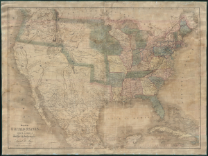
Map of the United States Of North America With parts of the Adjacent Countries.
sold
- Digital Map Information
- Suitable for large format printing
- DPI: 300
- File Size: 81.27 MB
- File Type: ZIP / TIFF
- ICC color profile embedded
- Delivered instantly via download link
This is David H. Burr's unobtainable 1839 wall map of the United States. Burr's map is significant as the only published example of Jedediah Smith's cartography, considered by C. I. Wheat a 'tour-de-force unprecedented and never equaled in the annals of Western exploration.' Smith's 'mountain man' cartography filled a gap in the mapping of the Transmississippi West - after Lewis and Clark (1804 - 06) but before the government-funded expeditions of Fremont (1840). (more details)
Best 19th century map of London.
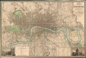
Map of London, from An Actual Survey made in the Years 1824, 1824 and 1826 by C. and J. Greenwood.
sold
- Digital Map Information
- Suitable for large format printing
- File Size: 284.14 MB
- File Type: ZIP / TIFF
- ICC color profile embedded
- Delivered instantly via download link
This is the rare 1830 second edition of Christopher and John Greenwood's large-scale map of London, here in a spectacularly preserved example. It is considered the largest and finest plan of London to appear in the 19th century. The present example is linen-backed and accompanied by its original green leather slipcase. (more details)
The best 19th century map of London.
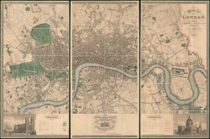
Map of London, from An Actual Survey made in the Years 1824, 1824 and 1826 by C. an J. Greenwood.
sold
- Digital Map Information
- Suitable for large format printing
- Full resolution TIFF file
- ICC color profile embedded
- Delivered instantly via download link
This is the rare first edition of Christopher and John Greenwood's large-scale 1827 map of London, here in a spectacularly preserved example. It is considered the largest and finest plan of London to appear in the 19th century. The present example is presented in three linen-backed folding sections, and is accompanied by its original leather slipcase. (more details)
The Colton Map - one of the largest and most beautiful maps of New York City pulished in the 19th century - in an unrecorded state.
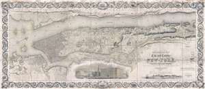
Topographical Map of the City and County of New-York, and the adjacent Country: With Views in the border of the principal Buildings and interesting Scenery of the Island.
sold
- Digital Map Information
- Suitable for large format printing
- DPI: 300
- File Size: 74.68 MB
- File Type: ZIP / TIFF
- ICC color profile embedded
- Delivered instantly via download link
Known as 'The Colton Map,' this is an unrecorded state of an 1840 map of New York City (Manhattan) by David H. Burr and John Hutchins Colton considered to be the finest and most decorative map of the city to appear in the 19th century. According to map ... (more details)
One of the most richly informative cartographic productions ever created.
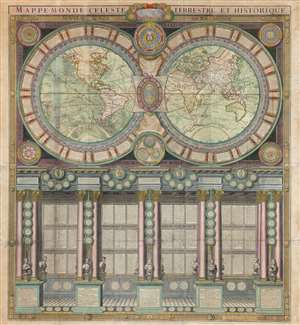
Mappe-Monde Celeste Terrestre et Historique.
sold
- Digital Map Information
- Suitable for large format printing
- DPI: 600
- File Size: 132.49 MB
- File Type: ZIP / TIFF
- ICC color profile embedded
- Delivered instantly via download link
A stunning large format wall map of the world in six panels issued in 1786 by Charles Desnos and Nicolas Jaugeon. Described by map historian Rodney W. Shirley as 'a veritable compendium of a map,' this is one of the most richly informative cartographic productions ever issued. The map consists of a double hemisphere map projection surrounded by no less than 60 Aeoli windheads, astronomical data on constellations, cosmic systems, and other charts - intentionally placing the world in the context of the greater cosmos. Its elegant presentation conveys confidence in the human capacity to describe not only the Earth, but the cosmos itself. The double hemisphere map rests upon Corinthian columns, underscoring the classical foundations of western scientific thought, here augmented by new discovery. The unique, neo-classical motif is carried through to the bottom half of the engraving, where panels of text are set within a portico supported by Corinthian columns. Completing the illusion are a coffered roof and a patterned tile floor. At the base of the columns there busts and accounts of the great explorers, among them Columbus, Magellan, and Vasco de Gama. (more details)
Slave-suppression Masterplan.
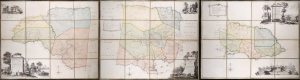
To the Right Honorable Robert Earl of Holdernesse, this map of the County of Cornwall, in the Island of Jamaica. (laid down from the papers, and under the direction of Henry Moore Esqr. His Majesty's Lieutenant Governor, and Commander in Chief of that Island, in the years 1756,-57,-58,-59,-60, and 61, and from a great number of actual surveys performed by the publishers) is humbly inscribed. / To the Right Honorable Wills Earl of Hillsborough, First Lord Commissioner of Trade and Plantations, this map of the County of Middlesex, in the Island of Jamaica. (laid down from the papers, and under the direction of Henry Moore Esqr. His Majesty's Lieutenant Governor and Commander in Chief of that Island in the years 1756,-57,-58,-59,-60, and 61, and from a great number of actual surveys performed by the publishers) is humbly inscribed. / To the Right Honorable George Grenville Esqr. First Lord Commissioner of the Treasury, Chancellor and under Treasurer of the Exchequers and c. and c. This map of the County of Surry, in the Island of Jamaica. (laid down from the papers and under the direction of Henry Moore Esqr. His Majesty's Lieutenant Governor and Commander in Chief of that Island in the years 1756,-57,-58,-59,-60, and 61, and from a great number of actual surveys performed by the publishers)is humbly inscribed.
sold
A seminal production, this is the 1763 Craskell-Simpson map of Jamaica, in three parts. It is the first broadly accurate map of Jamaica and the template for most subsequent representations of the island until the Roberston map of 1804. More importantly, the Craskell-Simpson map is best understood as a response to Tacky's Rebellion (April 1760 - October 1761) and, as such, is a masterplan for slave suppression. The map was commissioned by Henry Moore (1714 - 1769), who also, ironically, commissioned the Ratzer plan of New York, then likewise on the cusp of rebellion. It is the only work (either written or graphic) that records virtually every plantation and pen (large farms) in Jamaica at the height of the island's sugar boom, when it was the most valuable possession of the British Empire. (more details)
One of the most decorative maps of the 18th century - here in a pristine uncolored examples.
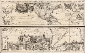
Carte très curieuse de la Mer du Sud, contenant des Remarques Nouvelles et très utiles non seulement sur des Ports et Îles de cette Mer, mais aussy sur les principaux Pays de l'Amerique tant Septentrionale que Méridionale en a été faite.
sold
- Digital Map Information
- Suitable for large format printing
- DPI: 600
- File Size: 2448.4 MB
- File Type: ZIP / TIFF
- ICC color profile embedded
- Delivered instantly via download link
One of the most spectacularly decorative maps of the 18th century, this is Henri Chatelain's magnificent 1719 map of the Americas and the Pacific. The map emerged on the cusp of a new age of global exploration wherein world-spanning trade routes offered Europeans unprecedented exposure to new cultures, peoples, and trade opportunities. It is no mistake that his map of America - as seen here, presents the continent as the center of a staggering array of trade networks reaching from Europe to America itself, the South Pacific, and Africa. (more details)
Enormous map of China identifying roads and bridges. Shows early Chinese claim to Senkaku / Diaoyu Islands .
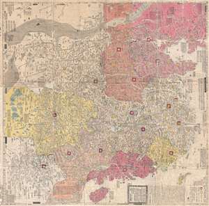
大淸廣輿圖 : 經天合地 : 境域 / Dai Shin kōyozu : keiten gōchi : nikyō jūshishō shii kyōiki. / Enlarged Terrestrial Map of the Great Qing: The Two Capitals, 14 Provinces, and 4 Provinces.
sold
- Digital Map Information
- Suitable for large format printing
- Full resolution TIFF file
- ICC color profile embedded
- Delivered instantly via download link
A rare and important Tenmei 5, Qianlong 50 or 1785 woodblock map of Qing Dynasty China printed in woodblock. This enormous Chinese language map covers from the Tibet and the Kunlun Mountains in western China to Taiwan and the East China Sea, and from ... (more details)
A Sumptuous Example of a Rare Map of the Americas and the Pacific
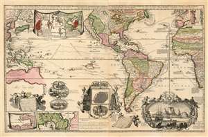
Carte Nouvelle de la Mer du Sud, dressee par Ordre des principaux Directeurs des Memoires les plus recents et des Relations des Navigateurs les plus Modernes.
sold
- Digital Map Information
- Suitable for large format printing
- Full resolution TIFF file
- ICC color profile embedded
- Delivered instantly via download link
A superb example of a rare map, by Hendrik De Leth, presenting the reader with a compendium of European exploration and discovery. Not confined to the Pacific Ocean - as suggested by the title - the map includes richly detailed mapping of the Americas and coastal Africa as well as the Pacific, Southeast Asia, and Australia. Though it is clearly based in part on de Fer's map of 1713 and the 1719 Chatelain, this finely engraved map is easily the match of its predecessors for the elegance of its decorative vignettes. These include - along the bottom center of the map - scenes depicting the manner of turtle-hunting on Pacific Islands, the operation of a sugar mill, gold mining and bird hunting in Mexico, the manner of human sacrifice in mezo America, and a depiction of Cortez destroying Mexican idols. To the lower right is a magnificent scene of the Cape Town settlement, filled with ships and surrounded by a magnificent frame decorated with lions, monkeys, and native figures. (more details)
Unrecorded first state of a foundational map with extensive manuscript additions relating to American Indian Reservations established in 1867-8.
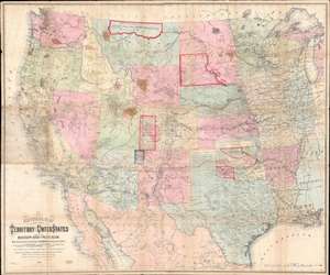
National Map of the Territory of the United States From The Mississippi River To The Pacific Ocean.
sold
- Digital Map Information
- Suitable for large format printing
- Full resolution TIFF file
- ICC color profile embedded
- Delivered instantly via download link
An extraordinary first-edition first-state example of William J. Keeler’s 1867 map of the Trans-Mississippi West - considered the finest post-Civil War railroad era map of the west - with unique manuscript annotations and additions relating to the American Indian Reservation System. This one of a kind historic document was likely the official example retained by the Indian Bureau, and possibly by Keeler himself, to administer and document the development of the American Indian Reservation system through the late 1860s. (more details)
One of the most beautiful and sumptuously illustrated maps of the 18th century.
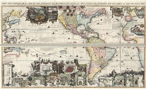
Carte très curieuse de la Mer du Sud, contenant des Remarques Nouvelles et très utiles non seulement sur des Ports et Îles de cette Mer, mais aussy sur les principaux Pays de l'Amerique tant Septentrionale que Méridionale en a été faite.
sold
- Digital Map Information
- Suitable for large format printing
- DPI: 300
- File Size: 52.8 MB
- File Type: ZIP / TIFF
- ICC color profile embedded
- Delivered instantly via download link
One of the most spectacularly decorative maps of the 18th century, this is Henri Chatelain's magnificent 1719 map of the Americas and the Pacific. This sumptuously engraved map is centered on the American continent, but extends west to include all of ... (more details)
One of the most beautiful and sumptuously illustrated maps of the 18th century.
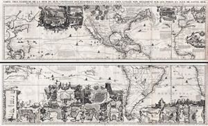
Carte très curieuse de la Mer du Sud, contenant des Remarques Nouvelles et très utiles non seulement sur des Ports et Îles de cette Mer, mais aussy sur les principaux Pays de l'Amerique tant Septentrionale que Méridionale en a été faite.
sold
- Digital Map Information
- Suitable for large format printing
- DPI: 300
- File Size: 76.5 MB
- File Type: ZIP / TIFF
- ICC color profile embedded
- Delivered instantly via download link
One of the most spectacularly decorative maps of the 18th century, this is Henri Chatelain's magnificent 1719 map of the Americas and the Pacific. This sumptuously engraved map is centered on the American continent, but extends west to include all of ... (more details)
Columbia - a life-sized chromolithograph.
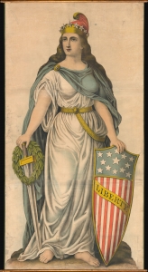
Liberty.
sold
- Digital Map Information
- Suitable for large format printing
- File Size: 188.09 MB
- File Type: ZIP / TIFF
- ICC color profile embedded
- Delivered instantly via download link
A spectacular full-height chromolithograph illustration of Columbia issued c. 1893 by Kurz and Allison, likely for the 1893 Chicago World's Fair or Columbia Exposition. Liberty appears here in full patriotic regalia, with a toga, blue cape, American flag shield, sword, laurel wreath, and Phrygian cap. (more details)
A landmark - a great cartographical achievement … -Wheat
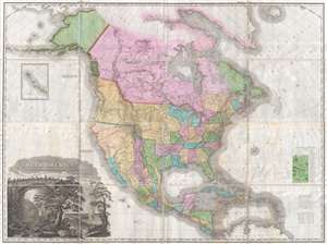
A Map of North America Constructed According to the Latest Information by H. S. Tanner.
sold
- Digital Map Information
- Suitable for large format printing
- DPI: 300
- File Size: 70.48 MB
- File Type: ZIP / TIFF
- ICC color profile embedded
- Delivered instantly via download link
An attractive example of Henry Schenk Tanner's remarkable 1825 landmark map of North America, considered to be the most important map of North America of the 19th century. Revolutionary in countless ways, this is the most accurate map of North ... (more details)
A landmark - a great cartographical achievement … -Wheat
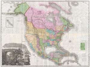
A Map of North America Constructed According to the Latest Information by H. S. Tanner.
sold
- Digital Map Information
- Suitable for large format printing
- DPI: 300
- File Size: 68.73 MB
- File Type: ZIP / TIFF
- ICC color profile embedded
- Delivered instantly via download link
An attractive example of Henry Schenk Tanner's remarkable 1825 landmark map of North America, considered to be the most important map of North America of the 19th century. Revolutionary in countless ways, this is the most accurate map of North ... (more details)
The best, largest, and most important map of Beijing made before World War II.
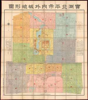
Surveyed Map of Inner City and Outer City, Beijing. /實測北平市内外城地形圖
sold
- Digital Map Information
- Suitable for large format printing
- Full resolution TIFF file
- ICC color profile embedded
- Delivered instantly via download link
The best, largest, and most important map of Beijing made before World War II. This is an astounding wall-sized Republic of China era administrative map of Beijing (Beiping) dating to January 1937 (Mingou 26). This map was issued just months before the Marco Polo Bridge Incident, the Battle of Beiping-Tianjin, the opening of the Second Sino Japanese War, and the subsequent Japanese occupation of Beijing. Measuring 85.5 x 79.5 in (217.17 x 201.93 cm), this enormous work is the largest and most detailed map of Beijing (or Beiping) yet produced. When commissioned by 21st Beijing mayor Yuan Liang (袁良, 1882–1953), more than 10 years had passed since the last major map of Beijing was issued - which was both on a smaller scale and inaccurate. (more details)
This is one of best early large maps of the United States and the premier map for its period.' - David Rumsey
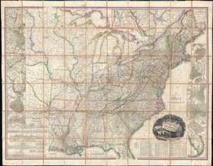
United States of America.
sold
- Digital Map Information
- Suitable for large format printing
- Full resolution TIFF file
- ICC color profile embedded
- Delivered instantly via download link
This, the first edition of Henry Schenck Tanner's 1829 wall map of the United States, is one of the most important American maps of the 19th century. The map covers from the Missouri river in the vicinity of Fort Mandan eastward to the ... (more details)
This is one of best early large maps of the United States and the premier map for its period.' - David Rumsey
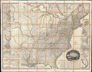
United States of America.
sold
- Digital Map Information
- Suitable for large format printing
- Full resolution TIFF file
- ICC color profile embedded
- Delivered instantly via download link
This, the first edition of Henry Schenck Tanner's 1829 wall map of the United States, is one of the most important American maps of the 19th century. The map covers from the Missouri river in the vicinity of Fort Mandan eastward to the ... (more details)