
United States Geological Survey (sold) (USGS)

The United States Geological Survey (1878 - Present), aka the U.S.G.S., is a scientific agency of the United States government, which was founded in 1879. USGS scientists study the landscape of the United States, its natural resources, and the natural hazards that threaten it. The organization has four major science disciplines: biology, geography, geology, and hydrology. It is a bureau of the United States Department of the Interior and is the department's only scientific agency.
United States Geological Survey (sold) is also known as: USGS
Gold, geology, and the Great Sioux War.
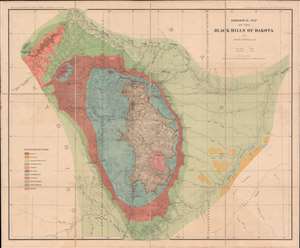
This is an 1879 Henry Newton geological atlas of the Black Hills, Dakota Territory (now South Dakota) published during the height of the Black Hills Gold Rush. Consisting of two maps and one view, the atlas provides some of the earliest detailed surveys of the region and particularly its geology, a matter of critical importance to miners. The present example, unlike any other we've seen, is handsomely dissected, laid on linen, and accompanies a custom original slipcase. (more details)
Dramatic view of the Black Hills during the height of the Black Hills Gold Rush!
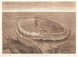
Bird's Eye View of the Black Hills to Illustrate the Geological Structure.
sold
- Digital Map Information
- Suitable for large format printing
- File Size: 13.97 MB
- File Type: ZIP / TIFF
- ICC color profile embedded
- Delivered instantly via download link
This is an 1879 Henry Newton view and map of the Black Hills during the height of the Black Hills Gold Rush. The Black Hills are a spectacular mountain range in the northern plains states of South Dakota and Wyoming. The view was designed by Newton to illustrate ... (more details)
Colorful Geological survey view of the Black Hills height of the Black Hills Gold Rush!
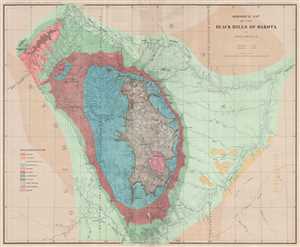
Geological Map of the Black Hills of Dakota.
sold
- Digital Map Information
- Suitable for large format printing
- File Size: 19.2 MB
- File Type: ZIP / TIFF
- ICC color profile embedded
- Delivered instantly via download link
This is an 1879 Henry Newton geological map of the Black Hills during the height of the Black Hills Gold Rush. The Black Hills are a spectacular mountain range in the northern plains states of South Dakota and Wyoming. Per Carl Wheat, the map depicts from 102 ... (more details)
Created by a U.S. Geological Survey expedition during the height of the Black Hills Gold Rush!
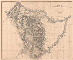
Map of the Black Hills of Dakota.
sold
- Digital Map Information
- Suitable for large format printing
- File Size: 29.55 MB
- File Type: ZIP / TIFF
- ICC color profile embedded
- Delivered instantly via download link
This is an 1879 Henry Newton map of the Black Hills during the height of the Black Hills Gold Rush. The Back Hills are a spectacular mountain range in the northern plains states of South Dakota and Wyoming. Per Carl Wheat, the map depicts from 102 degrees 10 ... (more details)
Early U.S. Geological Survey and Charles Sargent arboreal map of North America depicting oak trees.
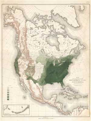
Map Showing the Distribution of the Genus Quercus (the Oaks) in North America Exclusive of Mexico.
sold
- Digital Map Information
- Suitable for large format printing
- File Size: 11.71 MB
- File Type: ZIP / TIFF
- ICC color profile embedded
- Delivered instantly via download link
This is an 1884 Charles Sprague Sargent arboreal thematic map of North America. The map depicts the continent of North America from the Arctic Ocean, Alaska, and Canada south to Mexico and Central America as well as the extreme northern reaches of South ... (more details)
Early U.S. Geological Survey and Charles Sargent arboreal map of North America depicting pine trees.
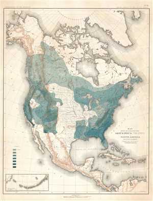
Map Showing the Distribution of the Genus Pinus (the Pines) in North America Exclusive of Mexico.
sold
- Digital Map Information
- Suitable for large format printing
- File Size: 11.66 MB
- File Type: ZIP / TIFF
- ICC color profile embedded
- Delivered instantly via download link
This is an 1884 Charles Sprague Sargent arboreal thematic map of North America. The map depicts the continent of North America from the Arctic Ocean, Alaska, and Canada south to Mexico and Central America as well as the extreme northern reaches of South ... (more details)
Early U.S. Geological Survey and Charles Sargent arboreal map of the U.S. depicting beech trees.
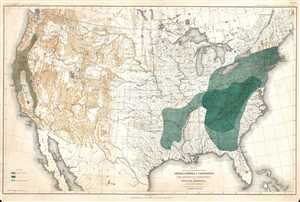
Map Showing the Distribution of the Genera Castanea and Castanopsis (The Chestnuts and Chinquapins) in North America. Exclusive of Mexico.
sold
- Digital Map Information
- Suitable for large format printing
- File Size: 12.51 MB
- File Type: ZIP / TIFF
- ICC color profile embedded
- Delivered instantly via download link
This is an 1884 Charles Sprague Sargent arboreal thematic map of North America. The map depicts the United States from Canada to Mexico and from the Pacific Ocean to the Atlantic Ocean. It was part of a portfolio entitled Sixteen Maps Accompanying ... (more details)
Early U.S. Geological Survey and Charles Sargent arboreal map of the U.S. depicting hickory trees and the California Laurel.
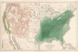
Map Showing the Distribution of the Genera Carya and Umberllularia (The Hickories and California Laurel) in North America Exclusive of Mexico.
sold
- Digital Map Information
- Suitable for large format printing
- File Size: 13.64 MB
- File Type: ZIP / TIFF
- ICC color profile embedded
- Delivered instantly via download link
This is an 1884 Charles Sprague Sargent arboreal thematic map of North America. The map depicts the United States from Canada to Mexico and from the Pacific Ocean to the Atlantic Ocean. It was part of a portfolio entitled Sixteen Maps Accompanying ... (more details)
Alaska's successive Gold Rushes.
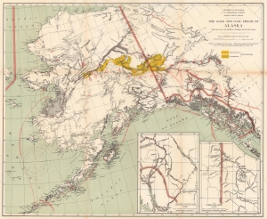
The Gold and Coal Fields of Alaska Together with the Principal Steamer Routes and Trails.
sold
- Digital Map Information
- Suitable for large format printing
- File Size: 82.64 MB
- File Type: ZIP / TIFF
- ICC color profile embedded
- Delivered instantly via download link
This is an 1898 U.S. Geological Survey map of Alaska highlighting gold and coal fields. Published two years after the initial gold discovery in the Klondike that ignited the Yukon Gold Rush, the map highlights gold fields across the state and the Yukon, along with coal deposits. (more details)
A Monumental, Detailed Map of Washington State highlighting its forestry industry, richness, and diversity.
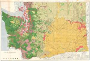
Map of Washington Showing Classification of Lands.
sold
- Digital Map Information
- Suitable for large format printing
- File Size: 150.99 MB
- File Type: ZIP / TIFF
- ICC color profile embedded
- Delivered instantly via download link
This is a large, colorful 1902 Map of Washington State showing the distribution and value of its forest lands - at the time, the primary moneymaker for the state. The map is printed in nine shades, showing unforested regions, cut and burned regions, and the density of forested areas. The map has been updated closely since its 1898 edition, showing dramatic re-growth in reserve areas - in particular, the Mount Rainier and the Olympic Jefferson Forest Reserves. Both of these had been established in 1897, and the dramatic changes shown on this map in comparison with the 1898 edition testify to the efficacy of the reserves in permitting the regrowth of heavily lumbered forest. Both of these areas would be made into National Forests in 1907. (more details)
Foundation of the City.
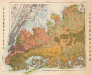
Soil Map New York Hempstead Sheet.
sold
- Digital Map Information
- Suitable for large format printing
- File Size: 156.53 MB
- File Type: ZIP / TIFF
- ICC color profile embedded
- Delivered instantly via download link
A colorful 1903 soil map of New York City and Nassau County, produced by the Bureau of Soils. It provides tremendous detail on the lands in and around the city, crucial information in the fact of break-neck urban development and industrialization. (more details)
The most geothermally active place in the Western Hemisphere - Yellowstone National Park!
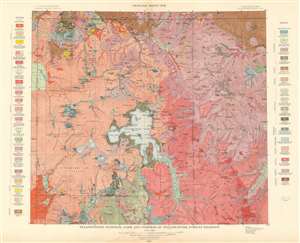
Yellowstone National Park and Portion of Yellowstone Forest Reserve. Geology Sheet XVII.
sold
- Digital Map Information
- Suitable for large format printing
- File Size: 55.72 MB
- File Type: ZIP / TIFF
- ICC color profile embedded
- Delivered instantly via download link
This is a 1904 Arnold Hague and U.S. Geological Survey geologic map of Yellowstone National Park, Wyoming. Centered on the Yellowstone Lake, the largest mountain lake in the United States, the map depicts the entirety of Yellowstone National Park, as well as part of the Yellowstone Forest Reserve. It is part of Hague's study of the region's unique geology and related geothermal activity. A legend situated on both the left and right sides details the geological formations illustrated throughout. Fault lines running throughout the park are traced using thin dashed black lines. (more details)
A beautiful part of North Carolina.
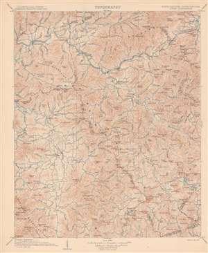
Topography. North Carolina - South Carolina. Cowee Quadrangle.
sold
- Digital Map Information
- Suitable for large format printing
- File Size: 24.64 MB
- File Type: ZIP / TIFF
- ICC color profile embedded
- Delivered instantly via download link
This is a 1907 U.S. Geological Survey topographic map of western North Carolina. Depicting from Bryson to Sapphire and from Waynesville to Highlands, contour lines present the region's topography in striking detail. Mountains throughout the area are identified and their elevations given. Creeks and rivers are illustrated. Towns and villages are labeled as well and dashed lines illustrate county borders. A small portion of Oconee County, South Carolina occupies the bottom right corner. (more details)
A record-setting Antarctic expedition.
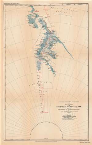
British Antarctic expedition, 1907: route and surveys of the Southern Journey Party, 1908-09.
sold
- Digital Map Information
- Suitable for large format printing
- File Size: 47.2 MB
- File Type: ZIP / TIFF
- ICC color profile embedded
- Delivered instantly via download link
This is a map of the course of the Southern Party of the 1907 - 1909 British Antarctic Expedition, also known as the Nimrod Expedition, after the ship used to reach the Antarctic, or the Shackleton Expedition, named after the expedition's leader, Ernest Shackleton. The Southern Party, led by Shackleton, traveled to a further latitude south than any previous expedition and nearly reached the South Pole before having to turn back to ensure the group's survival. (more details)
The first expedition to reach the South Magnetic Pole.
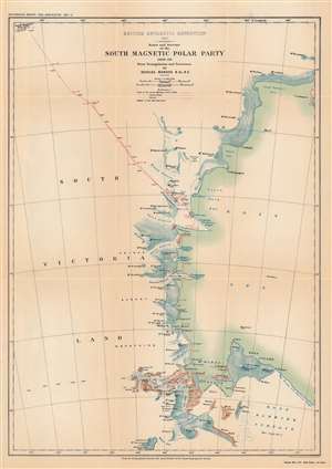
British Antarctic Expedition, 1907 : route and surveys of the South Magnetic Polar Party, 1908-09: from triangulation and traverses.
sold
- Digital Map Information
- Suitable for large format printing
- File Size: 33.12 MB
- File Type: ZIP / TIFF
- ICC color profile embedded
- Delivered instantly via download link
This is a map of the course of the Northern Party of the 1907 - 1909 British Antarctic Expedition, also known as the Nimrod Expedition, after the ship used to reach the Antarctic, or the Shackleton Expedition, named after the expedition's leader, Ernest Shackleton. The Northern Party, led by Edgeworth David, was the first to reach the approximate location of the South Magnetic Pole. (more details)
One of the most successful expeditions of Antarctic exploration.
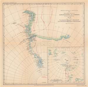
British Antarctic expedition, 1907 : general map showing the explorations and surveys of the expedition, 1907-09.
sold
- Digital Map Information
- Suitable for large format printing
- File Size: 33.24 MB
- File Type: ZIP / TIFF
- ICC color profile embedded
- Delivered instantly via download link
This is a map of the progress of the 1907 - 1909 British Antarctic Expedition, also known as the Nimrod Expedition, after the ship used to reach the Antarctic, or the Shackleton Expedition, named after the expedition's leader, Ernest Shackleton. One of the most notable expeditions of the 'Heroic Age of Antarctic Exploration,' the British Antarctic Expedition reached the furthest latitude south to that point (88° 23' S), within 100 nautical miles of the South Pole. The expedition's members were also the first to climb Mt. Erebus and the first to reach the approximate location of the South Magnetic Pole. (more details)
A geological tour de force!
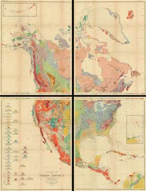
Geologic Map or North America.
sold
- Digital Map Information
- Suitable for large format printing
- File Size: 317.43 MB
- File Type: ZIP / TIFF
- ICC color profile embedded
- Delivered instantly via download link
A truly monumental piece, this is a 1911 U.S. Geological Survey four-section geologic wall map of North America. Depicting the entire continent from the Arctic Ocean to northern South America, along with Greenland, Iceland, and an inset of the Aleutian Islands, the map differentiates between forty-one different geologic formations. A detailed legend, containing explanations of each formation, appears on the lower left of the lower-left sheet. The impressive size and detail make this both academically fascinating and a striking display piece. (more details)
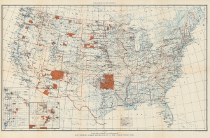
Detailed map of Indian Reservations across the U.S. - includes symbols indicating the number of schools on each reservation.
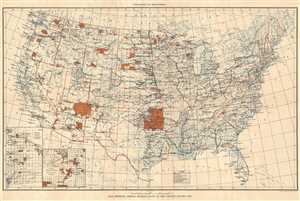
Map Showing Indian Reservations in the United States, 1915.
sold
- Digital Map Information
- Suitable for large format printing
- File Size: 10.86 MB
- File Type: ZIP / TIFF
- ICC color profile embedded
- Delivered instantly via download link
This is a 1915 U.S. Department of the Interior map of the United States. The map depicts the United States from the Pacific Ocean to the Atlantic Ocean and from Canada to Mexico and the Gulf of Mexico. Illustrated on the map are the Indian ... (more details)
Geology is SoCal.
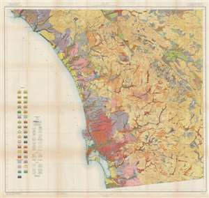
Soil Map. California. Reconnoissance Survey - San Diego Sheet.
sold
- Digital Map Information
- Suitable for large format printing
- File Size: 82.1 MB
- File Type: ZIP / TIFF
- ICC color profile embedded
- Delivered instantly via download link
This is a 1915 U.S. Department of Agriculture soil map of southern California, depicting from Dana Point and Mussel Cove to San Diego Bay, and from the Pacific Ocean to the San Felipe Valley. As a geological map, some thirty-five color and pattern combinations mark soil types and terrain is illustrated by hachure. Cities and towns are noted (including San Diego, Oceanside, and Carlesbad) and major roads appear. The region's Indian Reservations are delineated. (more details)
Depicts the location of communication technologies in Alaska - including radio stations and telegraph lines!
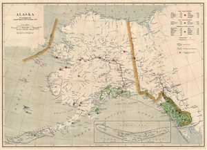
Alaska. To Accompany the Annual Report of the Governor.
sold
- Digital Map Information
- Suitable for large format printing
- File Size: 9.95 MB
- File Type: ZIP / TIFF
- ICC color profile embedded
- Delivered instantly via download link
This is a 1915 U.S. Geological Survey map of Alaska. The map depicts the territory of Alaska from the Bering Sea to the Yukon Territory and British Columbia in Canada and from the Arctic Ocean to the Gulf of Alaska and the Northern Pacific ... (more details)
Reservation System.
Map Showing Indian Reservations in the United States, 1916.
sold
- Digital Map Information
- Suitable for large format printing
- File Size: 25.6 MB
- File Type: ZIP / TIFF
- ICC color profile embedded
- Delivered instantly via download link
This is a 1916 U.S. Department of the Interior Map of Indian Reservations across the United States. In the early 20th century, the reservation system was a contentious network of territories that primarily served as a mechanism for the Federal government to control and assimilate tribes to Eurocentric cultural norms. (more details)
Building a monumental capital.
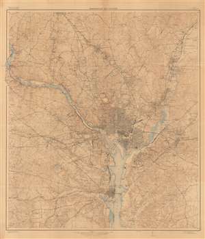
Washington and Vicinity.
sold
- Digital Map Information
- Suitable for large format printing
- File Size: 387.88 MB
- File Type: ZIP / TIFF
- ICC color profile embedded
- Delivered instantly via download link
This is a large and intricately detailed 1917 U.S. Geological Survey map of Washington, D.C., and surrounding areas. It depicts the city in the midst of a rapid expansion in the early 20th century, when it benefitted from an increased focus on public services and the growing writ of the federal government, in part due to World War I. (more details)
Foundation of the Florida Land Boom.
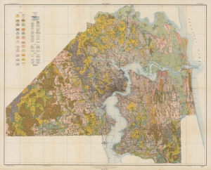
Soil map, Florida, Duval County sheet.
sold
- Digital Map Information
- Suitable for large format printing
- File Size: 88.15 MB
- File Type: ZIP / TIFF
- ICC color profile embedded
- Delivered instantly via download link
A scarce 1921 soil map of Duval County, Florida, produced by the U.S. Department of Agriculture's Bureau of Soils. It was published at the start of the Florida Land Boom, when Jacksonville was dubbed the 'Gateway to Florida' for tourists and migrants from northern states. (more details)
Gigantic geological map of Kentucky.
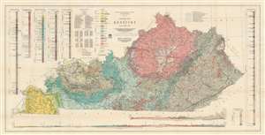
Geologic Map of Kentucky.
sold
- Digital Map Information
- Suitable for large format printing
- File Size: 81.68 MB
- File Type: ZIP / TIFF
- ICC color profile embedded
- Delivered instantly via download link
This is a gigantic 1929 Willard Rouse Jillson geological map of Kentucky. The map locates seventeen geological zones with distinct colors and patterns, each defined in legend in the upper right. Fault lines are also noted and traced in green. As are resources: coal mines, rock asphalt mines, and oil and gas fields. Oil and gas fields are numerically identified and correspond with an index in the upper left. Five different geologic cores are also included in the upper left and right. Two profile sections illustrating layered geological formations are included along the bottom border. (more details)
Gigantic geological map of Kentucky.
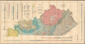
Geologic Map of Kentucky.
sold
- Digital Map Information
- Suitable for large format printing
- File Size: 83.35 MB
- File Type: ZIP / TIFF
- ICC color profile embedded
- Delivered instantly via download link
This is a gigantic 1929 Willard Rouse Jillson geological map of Kentucky. The map locates seventeen geological zones with distinct colors and patterns, each defined in the legend in the upper right. Fault lines are also noted and traced in green. As are resources: coal mines, rock asphalt mines, and oil and gas fields. Oil and gas fields are numerically identified and correspond with an index in the upper left. Five different geologic cores are also included in the upper left and right. Two profile sections illustrating layered geological formations are included along the bottom border. (more details)
Paving the Way for Generations of Tourists.
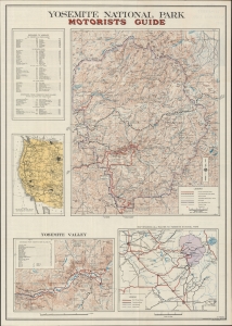
Yosemite National Park Motorists Guide. / Motorists Guide Yosemite National Park 1935.
sold
- Digital Map Information
- Suitable for large format printing
- Full resolution TIFF file
- ICC color profile embedded
- Delivered instantly via download link
A comprehensive guide to the roads and attractions of Yosemite National Park, drawn in 1934 by H. S. Teller and printed by the U.S. Geological Survey. (more details)
'A vast wilderness of rocks in a sea of light'.
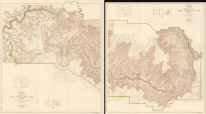
Topographic Map of the Grand Canyon National Park Arizona (West Half) / Topographic Map of the Grand Canyon National Park Arizona (East Half).
sold
- Digital Map Information
- Suitable for large format printing
- File Size: 182.26 MB
- File Type: ZIP / TIFF
- ICC color profile embedded
- Delivered instantly via download link
This is a stunning two-sheet, large-format, 1939 topographic map of the Grand Canyon National Park, issued by the U.S. Geological Survey. Based on surveys undertaken in the early 20th century, it captures the canyon in a period when it was transitioning from a storied but still largely inaccessible national treasure to a tourist site for the masses, aided by the completion of the Grand Canyon Railroad and early highways. (more details)
Rise of the Houston Freeway Era.
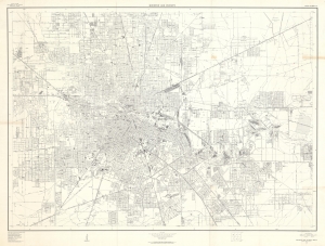
This is a huge 1957 U.S. Geological Survey city map of Houston, Texas. It is one of the largest and best mid-century maps of the city. It chronicles the development of Houston's epic freeway system as well as the post-war population boom. (more details)
Hottest place on Earth.
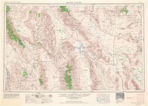
This is a 1961 U.S. Army Map Service map of Death Valley National Monument (now a National Park), with surrounding mountain ranges and valleys along the California-Nevada border in the Mojave Desert. This map reflects the history of the region, which has been inscribed onto the landscape in the form of Native American settlements, abandoned mines, federally protected land, and military testing sites, including nuclear testing sites. (more details)
Set of landmark maps of the Moon made for the Apollo 11 Lunar Landing.
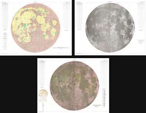
Engineer Special Study of the Surface of the Moon Generalized Photogeologic Map of the Moon. / Lunar Rays. / Physiographic Divisions of the Moon.
sold
- Digital Map Information
- Suitable for large format printing
- File Size: 358.37 MB
- File Type: ZIP / TIFF
- ICC color profile embedded
- Delivered instantly via download link
This is a set of three 1961 landmark maps of the Moon made by the U.S. Geological Survey in preparation for the Apollo 11 Lunar Landing Mission. All three represent the near side of the Moon on a scale of 1:3,800,000. Each map illustrates the Moon in a different spectacular monumentally proportioned manner and illustrates the physical geography of the moon, noting craters, seas, mountains, and other formations. (more details)
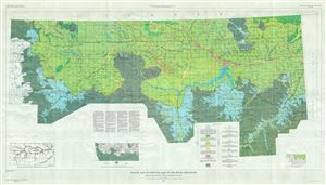
Glacial Map of Montana East if the Rocky Mountains.
sold
- Digital Map Information
- Suitable for large format printing
- File Size: 76.68 MB
- File Type: ZIP / TIFF
- ICC color profile embedded
- Delivered instantly via download link
This is a beautiful 1961 map of Montana by the U.S. Geological Survey. It covers Montana east of the Rocky Mountains, from Lewis and Clark National Forest east as far as Richland and the Montana state boundary. The map is highly detailed ... (more details)
Important Moon map made for the Apollo 11 Lunar Landing.
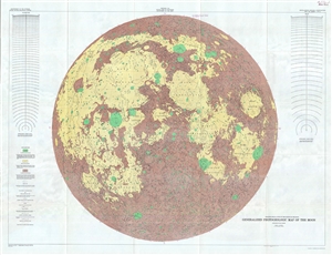
Engineer Special Study of the Surface of the Moon, Generalized Photogeologic Map of the Moon.
sold
- Digital Map Information
- Suitable for large format printing
- File Size: 60.87 MB
- File Type: ZIP / TIFF
- ICC color profile embedded
- Delivered instantly via download link
A 1961 landmark study of the Moon made by the U.S. Geological Survey in preparation for the Apollo 11 Lunar Landing Mission. Represents the near side of the Moon on a scale of 1:3,800,000. This spectacular monumentally proportioned map ... (more details)
Grand Tetons.
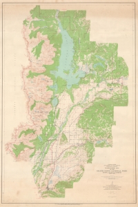
This is a 1963 U.S. Geological Survey map of Grand Teton National Park. The map illustrates a key development period where expanding tourism was presenting new challenges to the Park Service, which struggled to balance infrastructure, access, and development with environmental preservation. Among the most-visited national parks in the country, Grand Teton welcomes visitors all year and provides opportunities for numerous outdoor activities, including hiking and mountaineering, and is world-famous for trout fishing. (more details)
Striking map of Key West created from aerial photography.
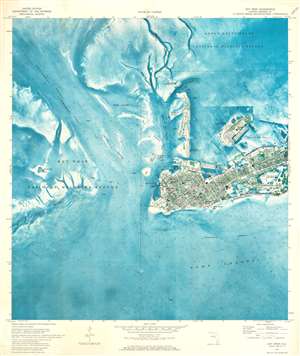
This is a 1971 U.S. Geological Survey topographic orthophotomap map of Key West, Florida. It depicts the region from Key West National Wildlife Refuge to Stock Island and from Great White Heron National Wildlife Refuge to the Intracoastal Waterway and Hawk Channel. Benefiting from the use of aerial photography, Key West appears in detail, with roads illustrated in black and highways, designated here as having four lanes, highlighted in red. Per the map, 'only landmark buildings are indicated in urban area', which includes the Key West International Airport, the courthouse, several post offices, and numerous U.S. military reservations. Coastal navigation lights are also noted and are abundant. Small nuances of its coastline are evident along with those on Dredger Key, Fleming Key, and Wisteria Island. Off Key West, the topography of the ocean floor is depicted in striking blue detail. Channels are labeled, as are shoals and the intracoastal waterway. (more details)
Polar ice on Mars.
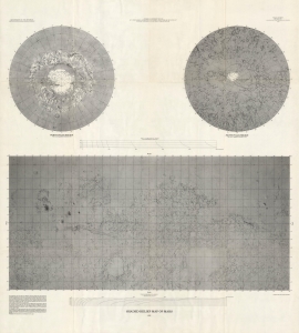
This is a striking 1972 terrestrial relief map of Mars issued from photogeological data collected by the Mariner 9 Mission. The map is a groundbreaking achievement of planetary mapping, completed through a collaborative effort from the Jet Propulsion Laboratory, the California Institute of Technology, and NASA. (more details)
Plantation Key - in detail.
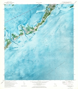
This is a 1973 U.S. Geological Survey map of Plantation Key in the Florida Keys. Coverages embraces from Islamorada to Tavernier Key. (more details)
Florida Keys and the Overseas Highway.
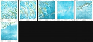
Marathon Quadrangle. Sevenmile Bridge Quadrangle. Big Pine Quadrangle. Summerland Key Quadrangle. Sugarloaf Key Quadrangle. Saddlebunch Keys Quadrangle.
sold
This is a strikingly beautiful set of 6 1973 U.S. Geological Survey maps of the Florida Keys. Coverage embraces roughly 40 miles of the western keys, from Saddleback No. 5 Channel and Similar Sound near Sugarloaf Key east to Fat Deer Key. (more details)
Kennedy Space Center the year the Space Shuttle entered testing.
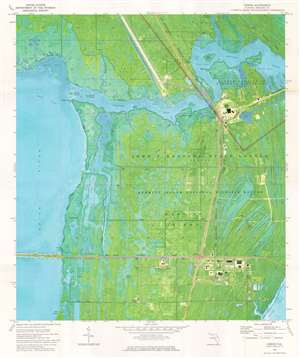
This is a 1976 U.S. Geological Survey topographic 'orthophotomap' map of John F. Kennedy Space Center in Florida. Sites around Kennedy Space Center are illustrated, including the Vehicle Assembly Building and the runway later used by the Space Shuttle. Launch Complex 39 is identified, along with the Crawler Causeway, but none of the launch pads themselves are within the depicted area. The visitor's center appears just below NASA Parkway West. Information concerning the map's creation is included below the bottom border. (more details)