
San Francisco in the heyday of streetcars.

Candrian's official double indexed street number guide : with car-o-grams and maps of San Francisco, Daly City...
sold
- Digital Map Information
- Suitable for large format printing
- Full resolution TIFF file
- ICC color profile embedded
- Delivered instantly via download link
This is an appealing c. 1920 map of San Francisco, San Mateo, and other nearby communities in the Bay Area, California, by Hermon Anton Candrian and Davenport Bromfield. It illustrates San Francisco following its recovery from the devastating 1906 earthquake and fire and its gradual expansion to the south and west. (more details)
The mining heartland of the Russian empire.
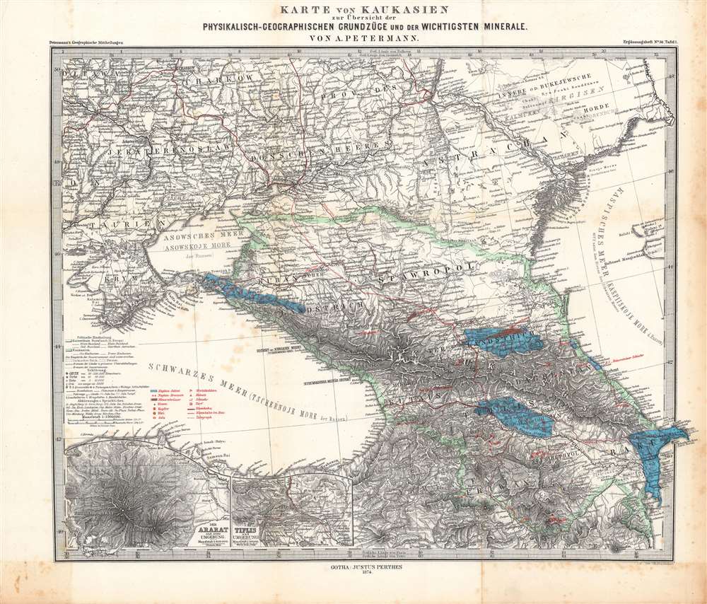
Karte von Kaukasien zur Übersicht der physikalisch-geographischen Grundzüge und der wichtigsten Minerale.
sold
- Digital Map Information
- Suitable for large format printing
- File Size: 50.46 MB
- File Type: ZIP / TIFF
- ICC color profile embedded
- Delivered instantly via download link
Here is a nicely engraved map of the Caucasus region drawn by Augustus Petermann and published by Justus Perthes in 1874. It highlights mineral deposits in a period when mining, railways, and the oil industry were rapidly developing and drastically changing the region. (more details)
Tracing the route of the Nile.
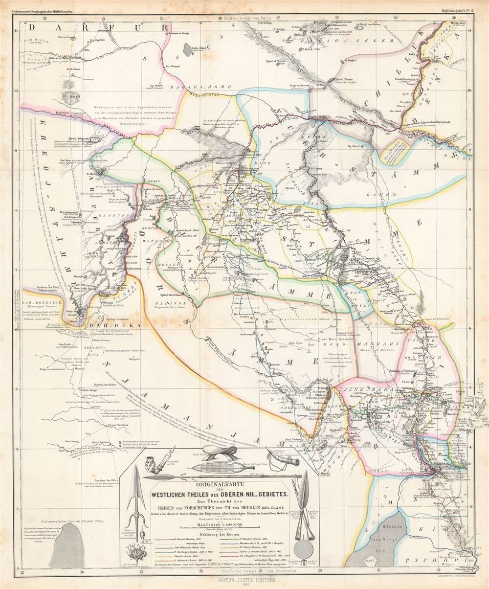
Originalkarte des westlichen Theiles des oberen Nil-Gebietes zur Übersicht der Reisen und Forschungen...
$275.00
Acquire
- Digital Map Information
- Suitable for large format printing
- File Size: 39.41 MB
- File Type: ZIP / TIFF
- ICC color profile embedded
- Delivered instantly via download link
This is a detailed 1865 Bruno Hassenstein map of the Upper White Nile, concurrent with the eastern part of today's South Sudan. It traces the routes of German and other European explorers of the mid-19th century, including those whose journeys had recently concluded in the months and years prior to publication. (more details)
Travel to Mount Desert Island via the Eastern Steamship Company.

Map of Eastern Steamship Co. Showing Approaches to Mount Desert.
sold
- Digital Map Information
- Suitable for large format printing
- File Size: 45.85 MB
- File Type: ZIP / TIFF
- ICC color profile embedded
- Delivered instantly via download link
This is a 1905 Rand Avery map of Mount Desert Island and coastal Maine illustrating the routes of the Eastern Steamship Company. Red overprinting highlights the routes of the Eastern Steamship Company's steamers to Mount Desert Island, along with its stops at Camden, Rockland, Belfast, and Blue Hill, among others. Roads between towns and post offices are identified. Many coastal islands are illustrated and labeled as well. An inset in the lower right depicts the Eastern Steamship Company's route between Boston and Bangor and Blue Hill and Mount Desert Island, emphasizing fast transit to Mount Desert Island, then a haven for wealthy New England elite. (more details)
Empire of an American scoundrel.

Territory Reached by the Eastern Steamship Company and its Connections.
sold
- Digital Map Information
- Suitable for large format printing
- File Size: 43.21 MB
- File Type: ZIP / TIFF
- ICC color profile embedded
- Delivered instantly via download link
This is a c. 1905 Rand Avery map of New England and the routes of the Eastern Steamship Company. (more details)
Letter from a ticket agent to a potential customer on verso.
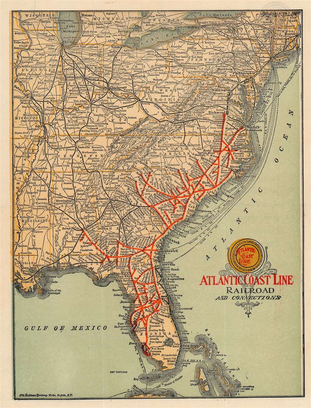
Atlantic Coast Line Railroad and Connections.
sold
- Digital Map Information
- Suitable for large format printing
- Full resolution TIFF file
- ICC color profile embedded
- Delivered instantly via download link
An outstanding c. 1916 Matthews-Northrup railroad map of the eastern United States highlighting the route of the Atlantic Coast Line. The map is essentially letterhead and features a letter on the verso from a ticket agent to a client. (more details)
L.A., between frontier town and suburban sprawl.
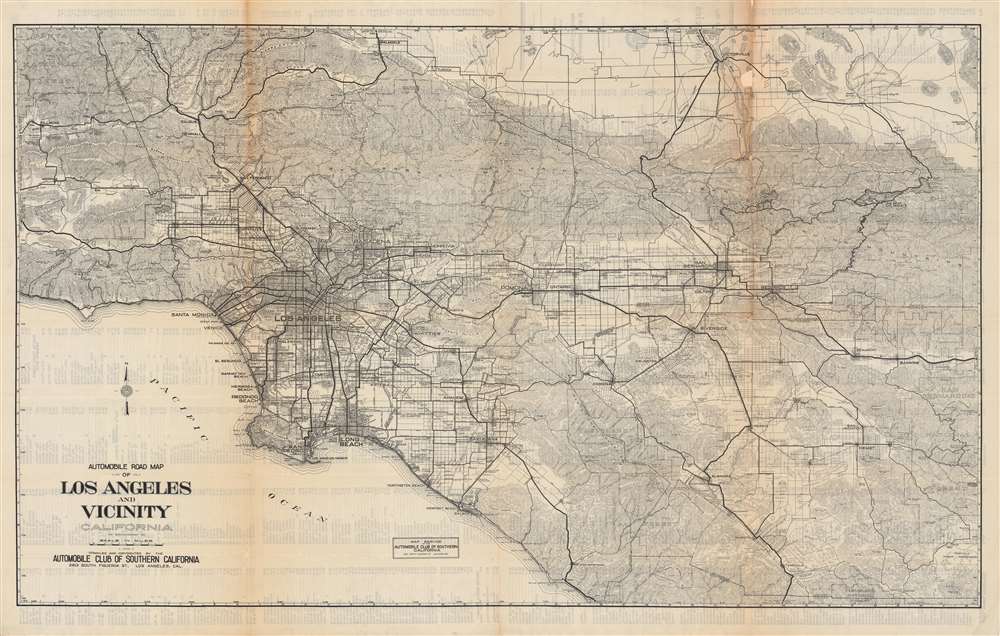
Automobile road map of Los Angeles and vicinity, California.
sold
- Digital Map Information
- Suitable for large format printing
- Full resolution TIFF file
- ICC color profile embedded
- Delivered instantly via download link
This is an impressive c. 1925 map of the Los Angeles area published by the Automobile Club of Southern California. Presaging the city's later sprawl, the map covers most of the present-day metropolitan region, including all or parts of Los Angeles, Ventura, San Bernardino, Riverside, and Orange Counties. (more details)
Best map of the Hudson Valley at the outset of the American Revolution.
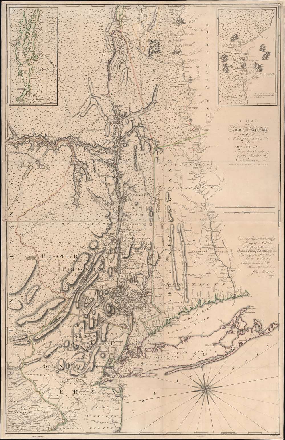
A Map of the Province of New-York, with Part of Pensilvania, and New England.
sold
- Digital Map Information
- Suitable for large format printing
- Full resolution TIFF file
- ICC color profile embedded
- Delivered instantly via download link
This is John Montresor's striking 1775 map of New York and the surrounding regions - considered the best and most authoritative map of the region at the beginning of the American Revolutionary War (1775 - 1783). (more details)
'The Fifth Part of the World'.
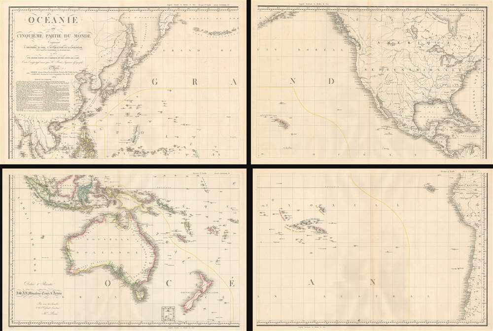
Océanie ou Cinquième Partie du Monde Comprenant L'Archipel d'Asie, L'Australasie et la Polynésie (ou le Continent de la Nouvelle-Hollande et les Îles du Grand Ocean.) en outre Une Grande Partie de L'Amérique et des Còtes de L'Asie.
sold
- Digital Map Information
- Suitable for large format printing
- Full resolution TIFF file
- ICC color profile embedded
- Delivered instantly via download link
A striking large scale 1814 map of the Pacific by Adrian-Hubert Brué. This is one of the earliest general maps of the Pacific to be offered commercially - partially responsible for introducing the vastness of Oceania to the general European public. It is moreover the first map to coin the term Océanie for the Pacific Islands - previously it was known as Océanique. (more details)
Expansion and urbanization.
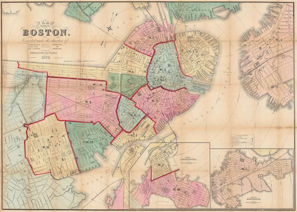
Plan of Boston Corrected under the direction of Charles W. Slack, Lewis Rice, Danl. J. Sweeney, Alderman, Com. Council, Committee on Printing, of 1867, by N. Henry Crafts, City Engineer.
sold
- Digital Map Information
- Suitable for large format printing
- Full resolution TIFF file
- ICC color profile embedded
- Delivered instantly via download link
An 1867 city map of Boston produced for the Boston City Engineer's Office. This map, updated regularly and based upon official engineering records, represents the finest mapping of Boston between 1860 and 1870 - Boston's most vibrant period of expansion, landfill development, urbanization, and modernization. (more details)
The earliest map of Pennsylvania published in the American Republic.
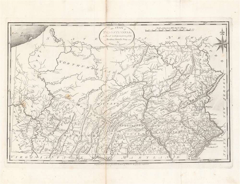
The State of Pennsylvania : reduced with permission from Reading Howell's map.
sold
- Digital Map Information
- Suitable for large format printing
- DPI: 600
- File Size: 35.23 MB
- File Type: ZIP / TIFF
- ICC color profile embedded
- Delivered instantly via download link
This is a fine first state example of Samuel Lewis’ 1795 map of Pennsylvania for Carey's General Atlas, the first atlas published in the young American Republic. It was an especially significant map as the producers of the atlas were based in Philadelphia, also the nation’s (temporary) capital at the time, which they used as the Prime Meridian throughout the atlas. (more details)
First edition of this incredible chart w/ original mailer.
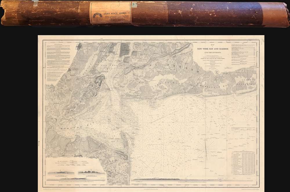
Map of New-York Bay and Harbor and the Environs.
sold
- Digital Map Information
- Suitable for large format printing
- DPI: 600
- File Size: 139.91 MB
- File Type: ZIP / TIFF
- ICC color profile embedded
- Delivered instantly via download link
This is the 1845 first edition of the U.S. Coast Survey nautical chart or maritime map of New York Bay and Harbor and its environs - uniquely accompanying its original mailing tube. The chart depicts from Newark to South Oyster Bay and from the City of New York to Sandy Hook and Black Point. (more details)
Stunning standing portrait of George Washington in front of Mount Vernon.

Washington.
sold
- Digital Map Information
- Suitable for large format printing
- File Size: 16.46 MB
- File Type: ZIP / TIFF
- ICC color profile embedded
- Delivered instantly via download link
An attractive and rare 1859 full length portrait of George Washington in military dress standing with Mount Vernon in the background. (more details)
Laying the French-Atlantic Cable.
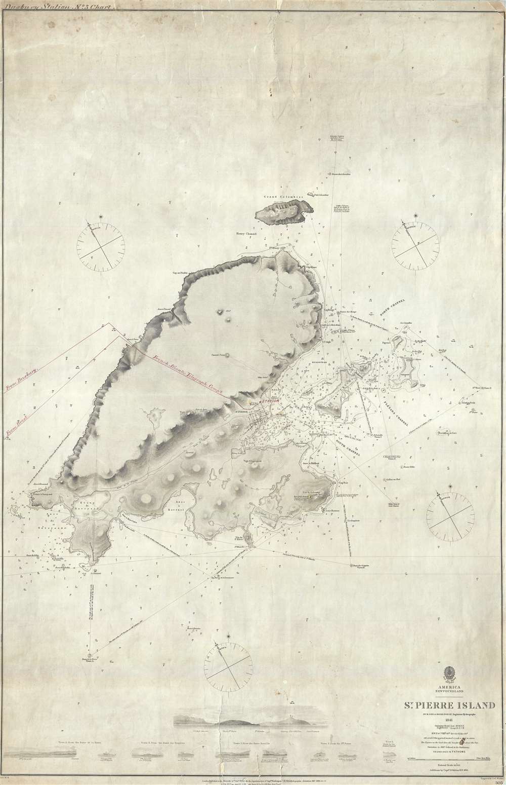
St. Pierre Island.
$750.00
Acquire
- Digital Map Information
- Suitable for large format printing
- File Size: 18.89 MB
- File Type: ZIP / TIFF
- ICC color profile embedded
- Delivered instantly via download link
A rare 1861 map of France's last colony in North America, the tiny island of St. Pierre of the coast of Newfoundland, with manuscript additions related to the French Atlantic Telegraph Company. This chart covers all of St. Pierre Island as well as the adjacent islands and the surrounding seas. The harbor community of St. Pierre is detailed with individual streets and buildings recognizable. This map is noteworthy not only for its rarity but also for the manuscript addition of the course of the French Atlantic Telegraph. (more details)
One of the first maps of Florida as a state.
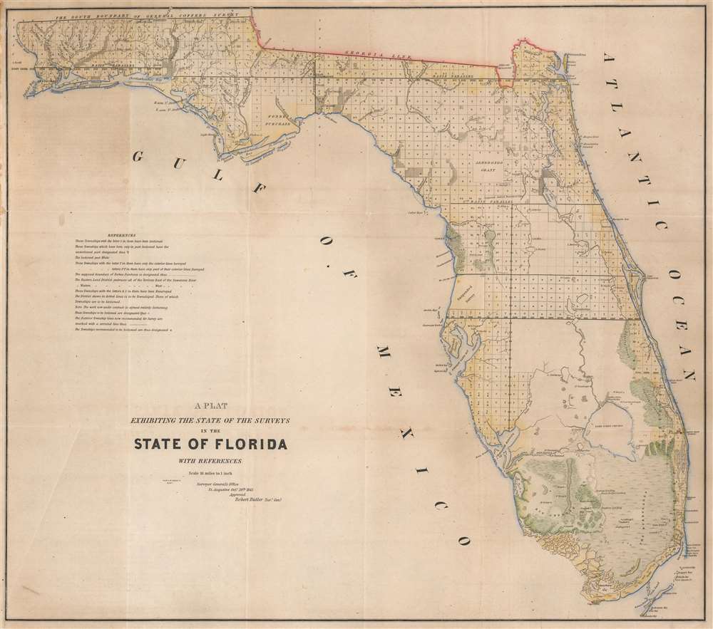
A Plat Exhibiting the State of the Surveys in the State of Florida with References.
$650.00
Acquire
- Digital Map Information
- Suitable for large format printing
- DPI: 600
- File Size: 66.93 MB
- File Type: ZIP / TIFF
- ICC color profile embedded
- Delivered instantly via download link
One of the first (if not the first) maps of Florida after it became a state, this is an 1845 Robert Butler map of Florida illustrating the progress of the Public Land Survey System in the newly admitted state. (more details)
Famous British Empire pictorial map.
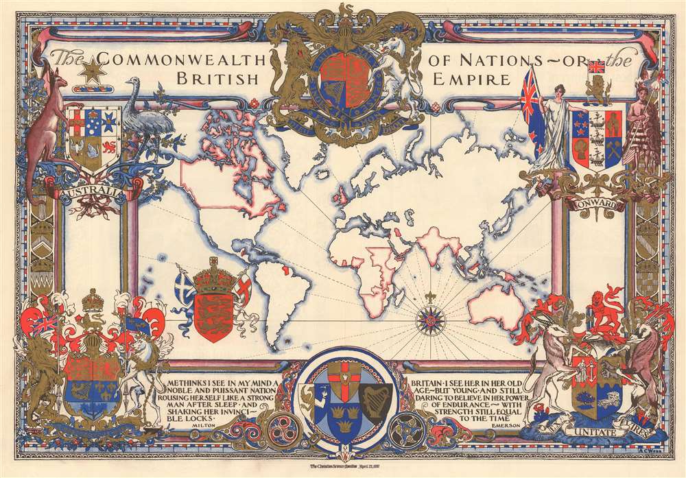
The Commonwealth of Nations - or the British Empire.
sold
- Digital Map Information
- Suitable for large format printing
- Full resolution TIFF file
- ICC color profile embedded
- Delivered instantly via download link
This is a stunning 1937 Alonzo C. Webb pictorial map of the world highlighting the British Empire. The map was drawn by Webb to celebrate King George VI's May 1937 coronation and published in a special color section of the Christian Science Monitor. It depicts the world on a Mercator Projection, with British territories, or the Commonwealth, highlighted in red. The whole is surrounded by elaborately gilded heraldic designs. Quotes from Milton and Emerson lionizing British achievement appear along the bottom border. The magnificent blue and red ink and the gilt work truly makes this an eye-catching piece. (more details)
Zambia, Malawi, and Zimbabwe.
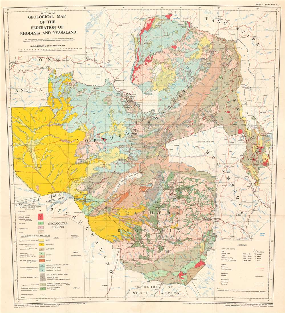
Provisional Geological Map of the Federation of Rhodesia and Nyasaland.
sold
This is a 1961 Government of the Federation of Rhodesia and Nyasaland geological map of Rhodesia and Nyasaland, which encompasses the modern-day countries of Malawi, Zambia, and Zimbabwe. Presented on a conic projection, the map depicts geological data in region from the Zambezi River to Lake Malawi (Lake Nyasa) and from Lake Tanganyika to South Africa. Twenty different geological formations are identified using fourteen colors which are delineated in the geological legend. The legend is divided between intrusive igneous rock formations and sedimentary and volcanic rock formations. Cities, towns, and villages throughout the Federation and in neighboring countries are labeled, with populations. (more details)
Capturing the Confederacy's largest city.

New Orleans in 1862 - The Federal Fleet at Anchor in the River, April 25...
sold
- Digital Map Information
- Suitable for large format printing
- Full resolution TIFF file
- ICC color profile embedded
- Delivered instantly via download link
This is a striking bird’s-eye view of New Orleans as it was captured by Union Naval forces in April 1862 during the American Civil War (1861 - 1865). The city’s surrender was a major morale boost to the Union and cut the Mississippi River off from the sea, marking a turning point in the war. (more details)
Beautiful North-Coast Maine.

Map of the Coast of Maine (Eastern Part).
sold
- Digital Map Information
- Suitable for large format printing
- Full resolution TIFF file
- ICC color profile embedded
- Delivered instantly via download link
This is a scarce 1893 map of the coast of Maine by George Walker and Company. It covers the eastern coast of Maine from Grand Manan Island west as far as Penobscot Bay and Vinalhaven Island and north as far as Vanceboro. The map offers detail throughout noting ... (more details)
Marks landmarks along with hotels throughout the two parks.
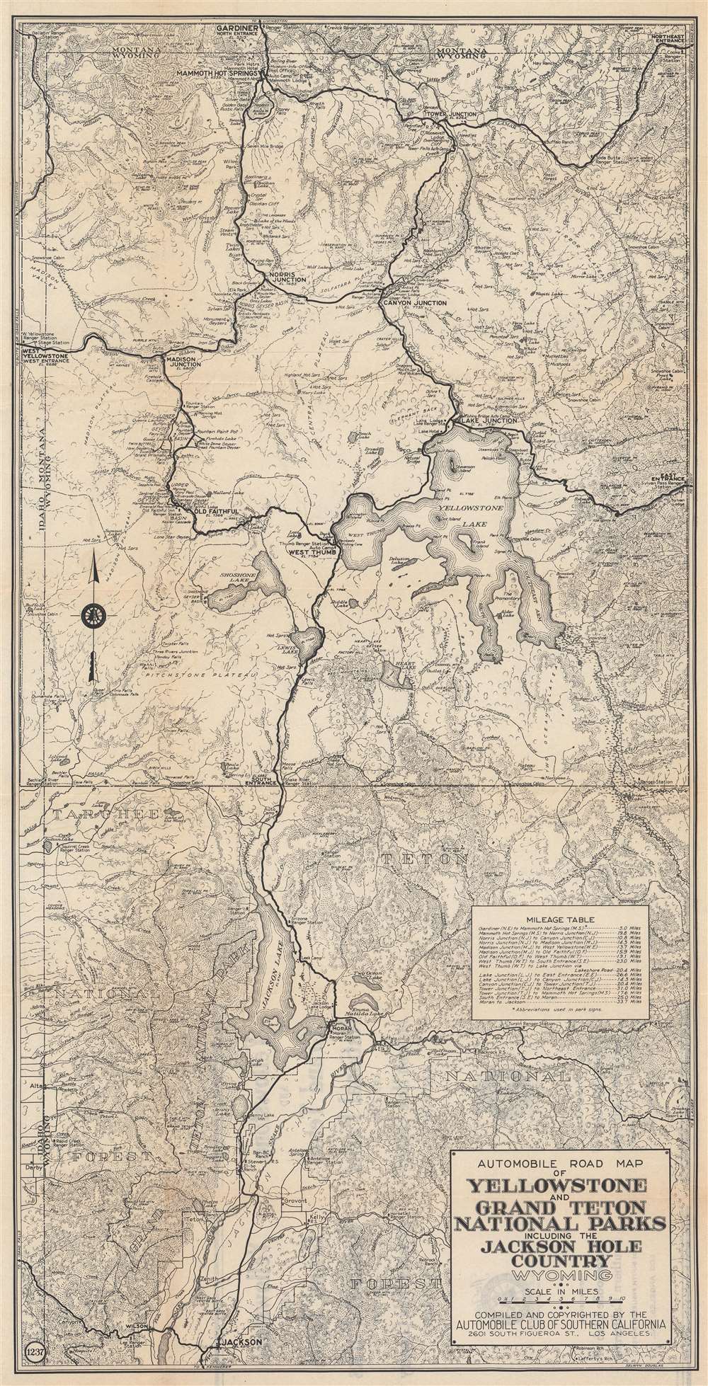
Automobile Road Map of Yellowstone and Grand Teton National Parks Including the Jackson Hole Country Wyoming.
sold
- Digital Map Information
- Suitable for large format printing
- Full resolution TIFF file
- ICC color profile embedded
- Delivered instantly via download link
This is a c. 1930 Automobile Club of Southern California road map of Yellowstone and Grand Teton National Parks. Famous landmarks throughout are identified, including Old Faithful, Mammoth Hot Springs, and Yellowstone and Jackson Lakes. Ranger stations, lodges, hotels, campsites, rivers, lakes, mudkettles, mudpots, hot springs, and other features of both parks are included. (more details)