
The beginning of the Napoleonic Wars.
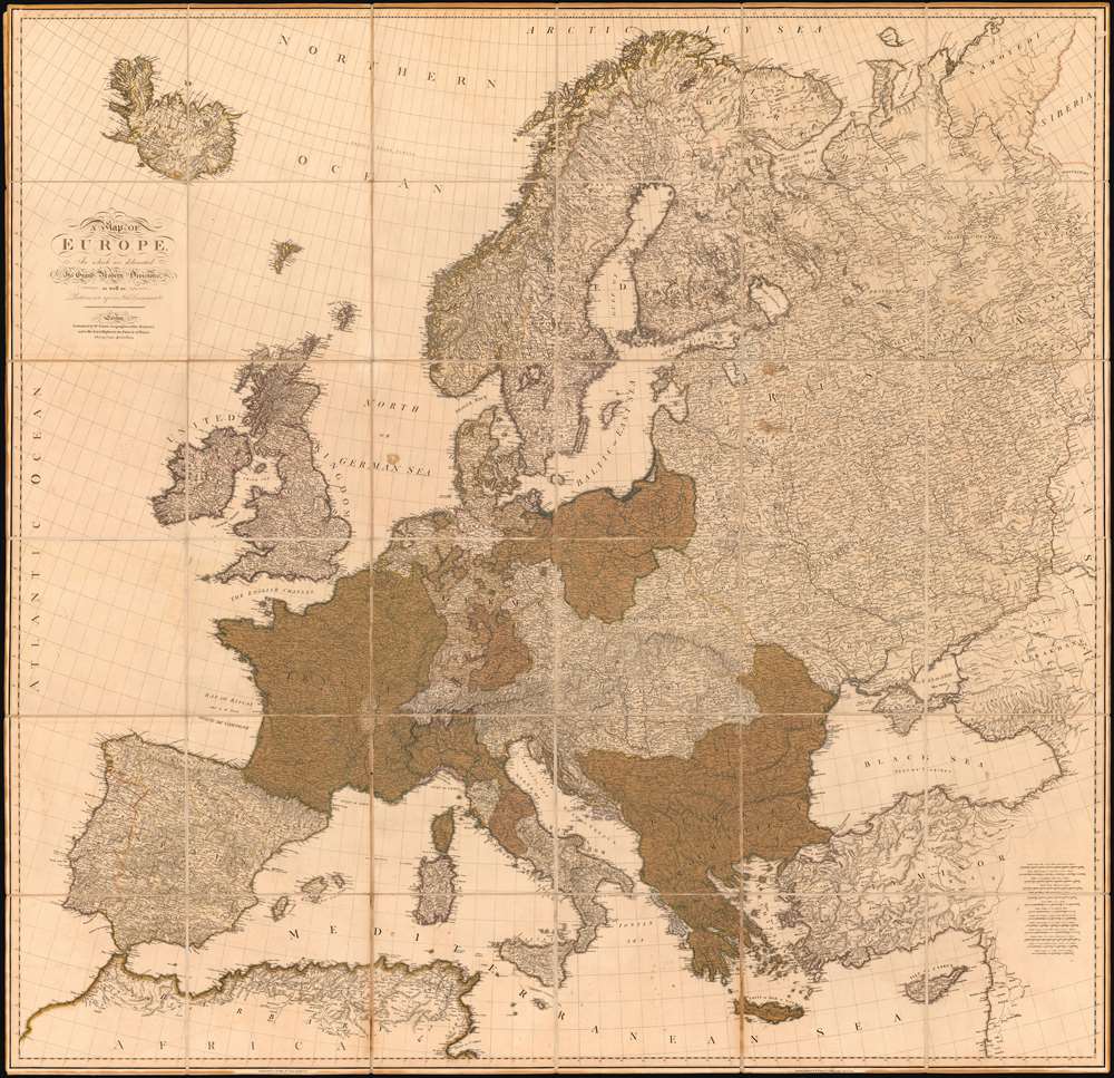
A Map of Europe In which are delineated its Grand Modern Divisions, as well as Partitions into inferior States Governments and C.
sold
- Digital Map Information
- Suitable for large format printing
- Full resolution TIFF file
- ICC color profile embedded
- Delivered instantly via download link
A rare tremendously proportioned 1804 William Faden wall map of Europe issued in the year Napoleon Bonaparte crowed himself Emperor of France - upending generations of dynastic tradition and transforming the continent's political and social landscape. This expansive map covers all of Europe, extending from Iceland to Cyprus and from Spain to the Ural Mountains. Features full old color throughout. (more details)
Muller's important map postulating a large peninsula in the North Atlantic.
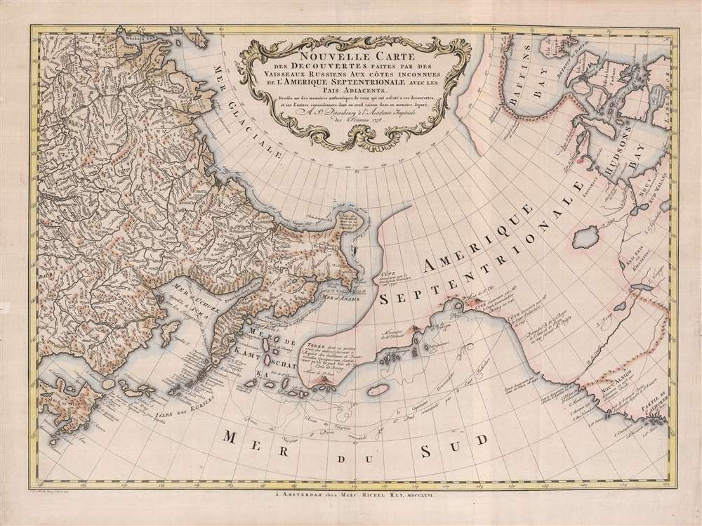
Nouvelle Carte des decouvertes Faites Par Des Vaisseaux Russiens Aux Côtes Inconnues de L'Amerique Septentrionale Avec Les Pais Adiacents.
$1,900.00
Acquire
- Digital Map Information
- Suitable for large format printing
- Full resolution TIFF file
- ICC color profile embedded
- Delivered instantly via download link
A beautiful example of Gerhard Friedrich Müller's important 1766 map of the Pacific Northwest, Alaska, the Bering Strait and Siberia, here in its rare Dutch second edition. Issued after the seminal explorations of Vitus Bering (1733 - 1743) on the Asia side of his namesake strait, but before the voyages of Captain James Cook similarly mapped the American side of the Bering Strait, this map is a smorgasbord of cartographic speculation – such as the exceptionally fine delineation of Friedrich Müller's Peninsula (Alaska / Aleutians). Centered on the Bering Strait, the map covers from Chinese Tartary to the Hudson Bay, and from the high Arctic, south as far as New Mexico, and Honshu (Japan). There is a striking contrast between the well explored Asiatic regions and the starkly bare and highly speculative mapping of America. (more details)
Plane Crazy in Australia!
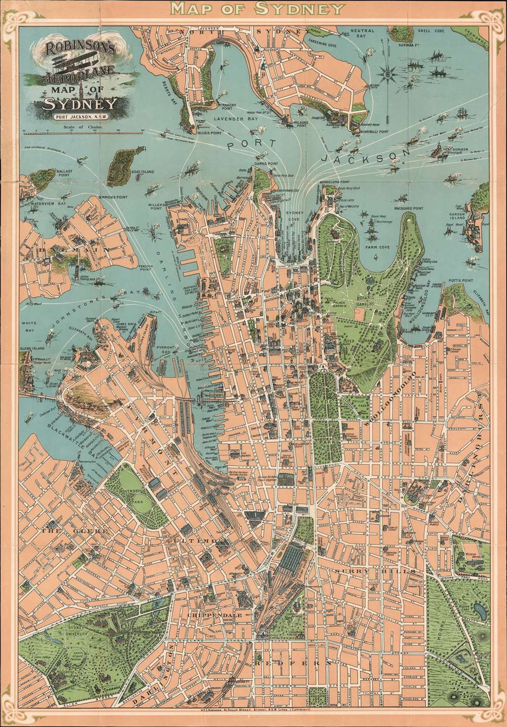
Robinson's Aeroplane Map of Sydney Port Jackson, N.S.W.
sold
- Digital Map Information
- Suitable for large format printing
- File Size: 37.5 MB
- File Type: ZIP / TIFF
- ICC color profile embedded
- Delivered instantly via download link
An interesting early aviation piece, this is Robinson's c. 1909 chromolithograph 'aeroplane' map of Sydney. Centered on the Sydney Town Hall, the map covers from Lavender Street in North Sydney to Victoria Park, and from Elizabeth Island to Potts Point. The map follows in the tradition of similar maps issued of Paris, London, and Rome around the same period, known collectively as 'monumental maps' wherein important buildings and monuments are illustrated in profile against an otherwise simple background. This technique was developed with tourism in mind, to make it easily to navigate to 'must see' sights without the distractions of an otherwise over dense map. The map is surrounded by a striking art nouveau style border. No doubt Robinson, an aviation enthusiast, hope to capitalize on the global fascination with the potential of air travel following the Wright brothers' ground-breaking flight. (more details)
The finest obtainable Colonial Era map of the Gulf Coast around the Mississippi Delta and Louisiana.
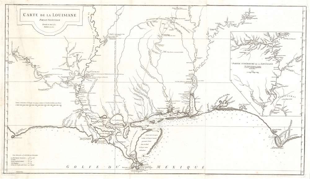
Carte de la Louisiane.
sold
- Digital Map Information
- Suitable for large format printing
- Full resolution TIFF file
- ICC color profile embedded
- Delivered instantly via download link
A lovely example of an important 1732/52 map of the Gulf coast and lower Mississippi River Valley by Jean Baptiste Bourguignon d'Anville. D'Anville's map covers from Sabine Pass (Cabo del Norte), Texas, past the Mississippi River Delta, Mobile Bay, and Pensacola Bay, to Saint Joseph Bay (Baye de St. Joseph) and Cabo Escondido (Cape San Blas), Florida. The map extends northwards along the Mississippi River as far as, roughly, Lake Providence, and northwards along the Alabama River (Riviere des Alibamons) as far as Fort Toulouse (modern day Wetumpka, Alabama). An inset in the upper right quadrant focuses on the upper Mississippi River Valley and includes much of the lower Missouri River as far as the Kansas River (Kansaz). Minimal topography is present as little was known, but the region's river courses, including the lower Mississippi, the Red, the Osage, and the lower Missouri, appear in some detail. presents Numerous depth soundings are indicated along the Gulf Coast and in the adjacent Bays. (more details)
Saloons and bars in New York.

Map of New York City to Accompany 'The Temperance Movement or the Conflict between Man and Alcohol.'
sold
- Digital Map Information
- Suitable for large format printing
- File Size: 13.92 MB
- File Type: ZIP / TIFF
- ICC color profile embedded
- Delivered instantly via download link
A fascinating 1887 persuasive map of New York City in which the locations of some 9000 licensed bars and saloons. The map covers Manhattan south of 115th street as well as adjacent parts of Jersey City, Hoboken, Brooklyn, and Queens. Cartographically it is a reduced version of J. H. Colton's map of New York City overprinted to illustrated licensed bars and saloons in Manhattan. The map was printed on behalf of Henry William Blair, a Republican senator from New Hampshire and ardent Temperance Movement advocate. It was intended to illustrated his book, The Temperance Movement or the Conflict between Man and Alcohol. As pointed out by map expert P. J. Mode, the book is heavy reading, but Blair's words (p. 363) at the end of the tome clarify the purpose of the map,
The eye is the chief inlet to knowledge, and the map of New York City which accompanies this book, upon which are located over 9000 of the 10,168 saloons and places where intoxicating liquor was for sale in that metropolis on the thirtieth day of June, 1886, looks like a chart of the capital city of the regions of despair.(more details)
Racecars!
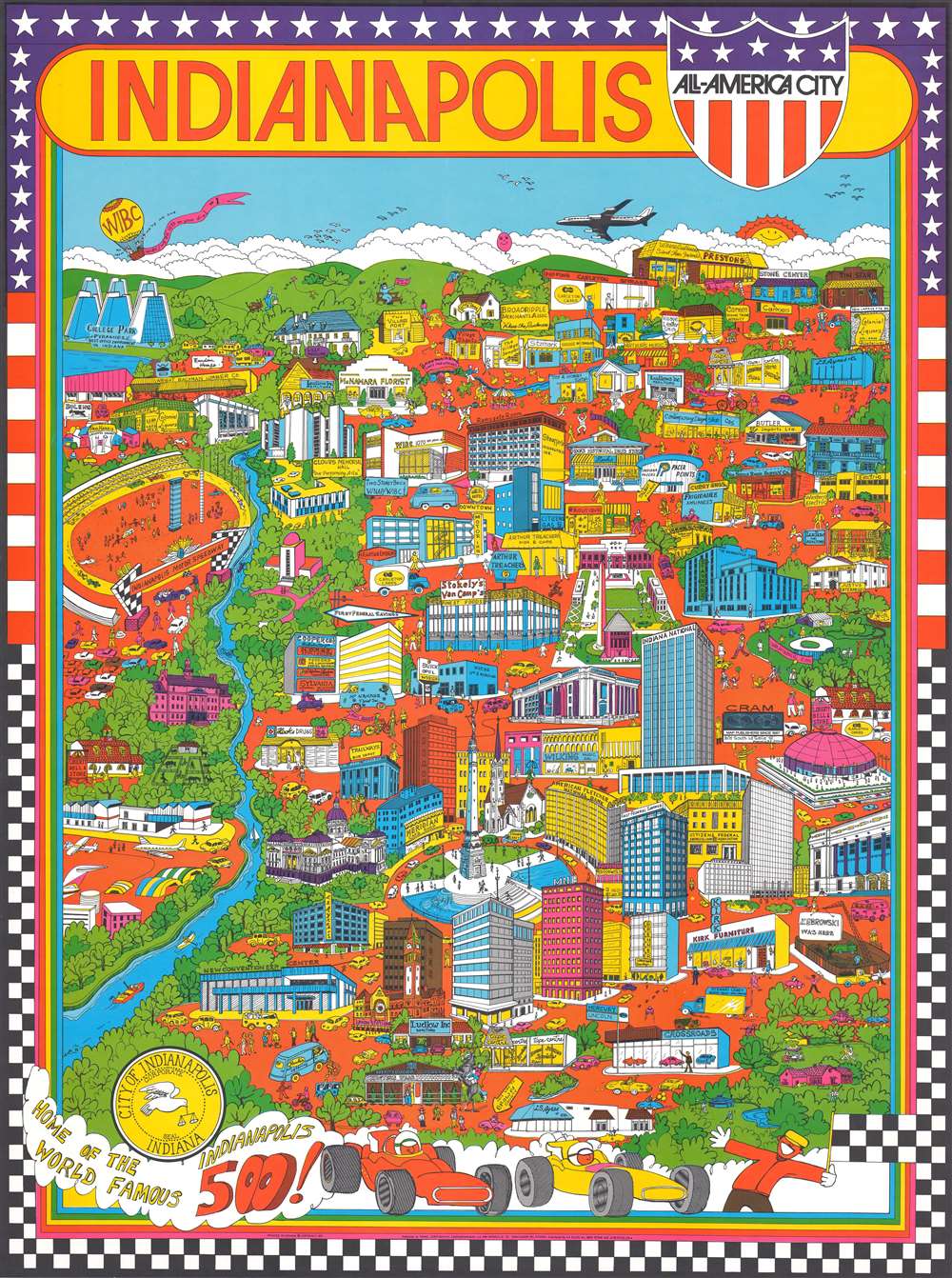
Indianapolis. All-America City.
sold
This is a 1971 Trans Continental Cartography pictorial map of Indianapolis, Indiana. The map depicts the city of Indianapolis in a nonconventional manner, leading to a highly decorative piece. Various Indianapolis landmarks are illustrated, including the Indianapolis Motor Speedway, the Indiana World War Memorial, the Indiana State Soldiers and Sailors Memorial, the Indiana State Capital building, the Indianapolis Zoo, and the Indiana State Fairgrounds Coliseum – home of the Indiana Pacers in 1971. Various other businesses, shops, hotels, banks, and WIBC radio station are also included. (more details)
Scarce, Large-format map of China.
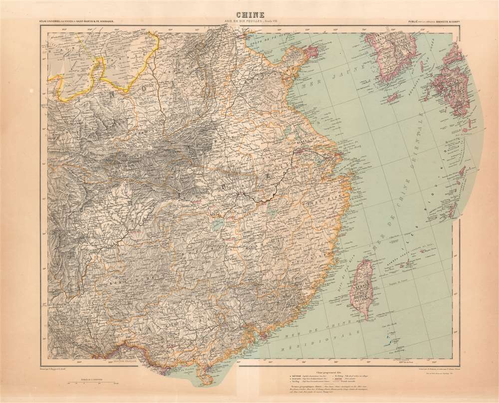
Chine / Asie en Dix Feuilles _ Feuille VIII.
sold
- Digital Map Information
- Suitable for large format printing
- File Size: 45.21 MB
- File Type: ZIP / TIFF
- ICC color profile embedded
- Delivered instantly via download link
This map of China was printed in 1911 as part of Schrader's ten sheet supplement on Asia, published by the French firm Hachette in the beginning of the 20th century to extend that firm's Atlas Universel originally under the direction of Louis Vivien de Saint - Martin. The other maps of the series are:
- 1. Asia Minor and the Caucasus
- 2. Turkestan
- 3. Mongolia
- 4. Japan, Korea and Manchuria
- 5. Arabia
- 6. Persia, Afghanistan and northwest India
- 7. Northeast India and Tibet
- 9. South India
- 10. India
Promotes Lauderdale Harbors - one of the city's most luxurious neighborhoods.
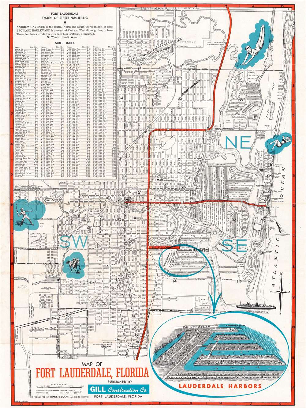
Lauderdale Harbors Map or Fort Lauderdale Florida.
sold
- Digital Map Information
- Suitable for large format printing
- Full resolution TIFF file
- ICC color profile embedded
- Delivered instantly via download link
This is a c. 1952 Arnold J. Waldsmith city plan or map of Fort Lauderdale, Florida, promoting Lauderdale Harbors (Lauderdale Harbors), a new subdivision in Fort Lauderdale. Streets throughout the city are illustrated, as are highways, and and bus lines. Pictorial vignettes highlight the luxuries of living in Florida, among them lounging, the beach, swimming, and fishing. The highlight is an inset view in the lower right of the then-new development, Lauderdale Harbors. Overlooking the neighborhood from the south, the view reinforces this new area's main attraction: private boat docks for every home. Built on islands surrounded by canals, every house has its own waterfront. In addition, the Lauderdale Yacht Club is just to the north. Full color illustrations on the verso reinforce the luxury and expertise a buyer would experience if they acquired one of the homes built in Lauderdale Harbors. Today Lauderdale Harbors remains a vibrant community popular with young professionals. (more details)
Miami and the surrounding area.
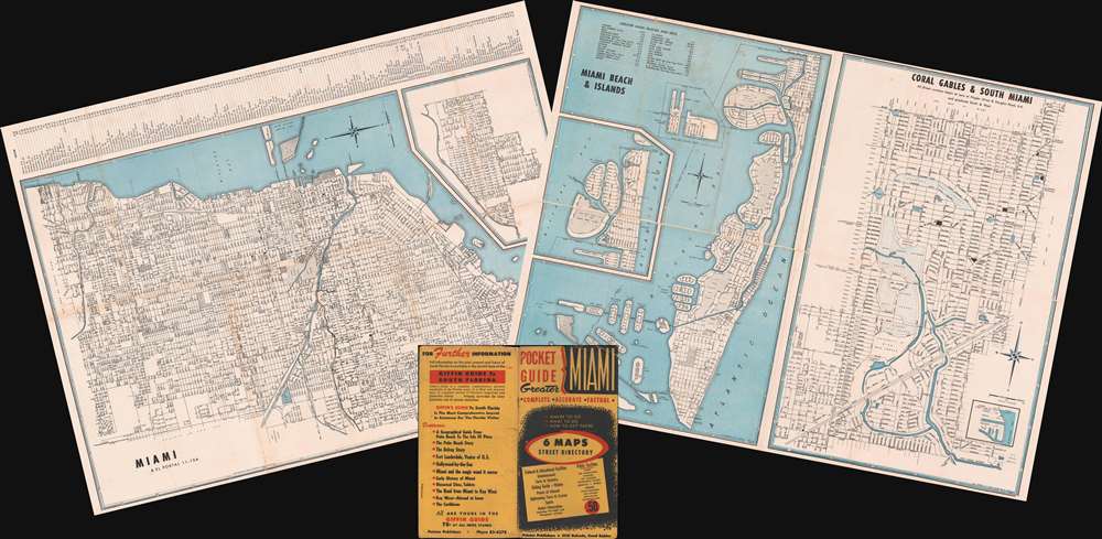
Miami Beach and Islands. / Coral Gables and South Miami. / Hialeah - Miami Springs. / Miami and El Portal. / North Dade County. / Greater Miami - Corporate Community Limits.
sold
- Digital Map Information
- Suitable for large format printing
- Full resolution TIFF file
- ICC color profile embedded
- Delivered instantly via download link
This is a set of two double-sided c. 1953 Rader Engineering Company city plans or maps of Miami, Florida, and vicinity. In total, the maps and insets, printed on two sides, cover Miami and El Portal, North Dade County, Greater Miami, Miami Beach and Islands, Coral Gables and South Miami, Hialeah - Miami Spring, and coastal Florida from North Miami Beach south to Florida City and Homestead Bayfront park. Miami and El Portal appear on one side of the first sheet and North Dade County and Greater Miami appear on the reverse. Coral Gables and South Miami and Miami Beach and Islands appear on one side of the second sheet and Hialeah-Miami Springs appears on the reverse. Each map identifies streets, avenues, and parks, among other locations. The Miami River and Miami Canal appear on the map of Miami and El Portal. Detailed indexes are included on three of the four sheets, some of which are divided by city. (more details)
First edition of Colton's Denmark.

Denmark.
sold
- Digital Map Information
- Suitable for large format printing
- File Size: 16.96 MB
- File Type: ZIP / TIFF
- ICC color profile embedded
- Delivered instantly via download link
This is a beautiful 1855 first edition example of J.H. Colton's map of Denmark. The map depicts all of Denmark inclusive of the Duchy of Holstein. Like most of Colton's Europe maps, this map was derived from an earlier wall map of the world produced by Colton and D. Griffing Johnson. Three inset maps add detail and focus on Iceland, the Faroe Islands, and Bornholm. An index situated along the upper left border identifies Iceland's twenty-one counties. At this point, Scandinavia was in the midst of a prolonged period of peace and prosperity that led to a cultural and population boom. Cities, towns, forts, rivers, rapids, mountain passes, fjords, and an assortment of additional topographical details appear throughout. The whole is surrounded by Colton's iconic spiral motif border. (more details)
Traces German exploration in East Africa between 1838 and 1862.

Originalkarte von Nord-Abessinien und den Ländern am Mareb, Barka und Anseba. Tafel 3a. (Ausgabe mit Colorit Übersicht der Reiserouten.)
$350.00
Acquire
- Digital Map Information
- Suitable for large format printing
- File Size: 19.56 MB
- File Type: ZIP / TIFF
- ICC color profile embedded
- Delivered instantly via download link
This is an 1864 Augustus map of East Africa. Depicting the region from the Red Sea and Mitsiwa (Massua), Eritrea west to Sudan, the routes of nine explorers though this region are traced. Spanning nearly twenty years, from 1838 to 1862, hand color highlights each route in a different color, allowing for easy differentiation and identification. Two of Werner Munzinger's expeditions through the region are illustrated, making his exploits the most thoroughly cataloged here. (more details)
First Atlas Map of the Western Hemisphere.
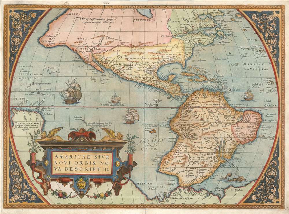
Americae Sive Novi Orbis Nova Descriptio.
sold
- Digital Map Information
- Suitable for large format printing
- Full resolution TIFF file
- ICC color profile embedded
- Delivered instantly via download link
This is Abraham Ortelius' map of the Western Hemisphere, considered to be the 'first map of the Americas to appear in a modern atlas' (Schwartz). Ortelius' success and the spread of his atlas made this fine map the standard - and best - representation of the Americas during the initial period its colonization. (more details)
Superb map relating to a seminal 'Captivity Tract.'

Jonathan Dickensons Ramspoedige Reystogt van Jamaika na Pensylvania nagespoord.
sold
- Digital Map Information
- Suitable for large format printing
- DPI: 600
- File Size: 7.35 MB
- File Type: ZIP / TIFF
- ICC color profile embedded
- Delivered instantly via download link
An exceptionally unusual and very rare separate-issue deluxe edition 1707 map of the east coast of America prepared by the Dutch cartographer Pieter van der Aa featuring unique elaborate border work. The map was prepared to illustrate the Dutch edition of journals describing the voyage, shipwreck, capture by Indians, and subsequent travels of Quaker merchant Jonathan Dickinson (1663 - 1722) and his family. Oriented to the east, Dickinson's map covers the eastern part of North America from roughly Lake Erie and New York south to Jamaica, including Virginia, Florida, the Carolinas, and Cuba. A dotted line indicates the path of Dickinson's travels from Port Royal, Jamaica, to Philadelphia, Pennsylvania. (more details)
Comet-Tail recapitulation of the events of 1853.

Passing Events, or the Tail of the Comet of 1853.
sold
- Digital Map Information
- Suitable for large format printing
- File Size: 9.92 MB
- File Type: ZIP / TIFF
- ICC color profile embedded
- Delivered instantly via download link
This is a rare and quirky 1854 George Cruikshank illustration of the events of 1853 densely compressed into the tail of a comet. There were no less than 4 comets in 1853 so this sketch is an apt medium for expressing the happenings of that year, which included the Australian Gold Rush, the European issue of Uncle Tom's Cabin, Smith's ascent of Mont Blanc, McCLure's transit of the Northwest Passage, the rise of the spiritualist craze, and more. It was drawn to serve as the frontispiece of the first issue of Cruikshank's publication, George Cruikshank’s Magazine. Cruikshank's magazine survived for only two issues before folding and is best remembered by this, its opening salvo. (more details)
Lake Shore Drive (then) 1889 and (now) 1934.

A Bird's-Eye View of Lake Shore Drive Chicago 1883 From the top of the Water Tower. Looking toward the Drive, 1934: A Present-Day View from the Water Tower.
sold
- Digital Map Information
- Suitable for large format printing
- File Size: 22.1 MB
- File Type: ZIP / TIFF
- ICC color profile embedded
- Delivered instantly via download link
This is a 1934 Chicago Sunday Tribune bird's-eye view of Lake Shore Drive in Chicago. The two separate views, presented on a single broadsheet, both look north on Lake Shore Drive from the Water Tower, but at different points in history, 1889 and 1934, respectively. The upper view is an aquatint issued by Raoul Varin in 1889. The bottom view is a photograph taken by the Tribune from the Water Tower in 1934. The differences provide an striking visual summary of Chicago's urban progression during the first few decades of the 20th century. (more details)
The 'Hero of the Two Worlds'.

G. Garibaldi.
sold
- Digital Map Information
- Suitable for large format printing
- File Size: 9.77 MB
- File Type: ZIP / TIFF
- ICC color profile embedded
- Delivered instantly via download link
This is a c. 1929 chromolithograph portrait of the Italian hero of solidarity Giuseppe Garibaldi. The chromolithograph is based on a photograph of Garibaldi taken by the Alinari Brothers c. 1866. He is illustrated wearing his trademark red shirt and poncho. His volunteers, the Garibaldini, wore red shirts in lieu of a uniform. (more details)
The largest lake in New Hampshire.

Map of Lake Winnipesaukee and Vicinity Reached by Boston and Maine R.R. and Steamer Mt. Washington.
sold
- Digital Map Information
- Suitable for large format printing
- File Size: 13.52 MB
- File Type: ZIP / TIFF
- ICC color profile embedded
- Delivered instantly via download link
This is an 1899 Rand Avery Supply Company and Boston and Maine Railroad map of Lake Winnipesaukee. Lake Winnipesaukee - in Abenaki 'smile of the Great Spirit' or 'beautiful water in a high place' - is the largest lake in New Hampshire and a popular resort area. Thick black lines trace the Boston and Maine Railroad's lines throughout. Dashed lines follow the course of the MS Mount Washington, a mail steamer operated by the Boston and Maine from 1872. The rival Eastern Railroad extended its services into Wolfeboro (Wolfeborough) in 1872. We speculate: given that the Boston and Maine started operating the MS Mount Washington that year, it is likely that the Boston and Maine leased the trackage from Eastern pending formal acquisition of the railroad in 1884. (more details)
Landmark map of an Amazon tributary.
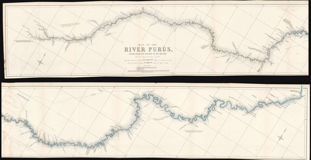
Map of the River Purûs, From Near its Source to its Mouth.
$300.00
Acquire
- Digital Map Information
- Suitable for large format printing
- File Size: 18.98 MB
- File Type: ZIP / TIFF
- ICC color profile embedded
- Delivered instantly via download link
This is landmark 1866 William Chandless map of the Purûs River in Brazil and Peri is he first accurate map of the river's 1,866-mile course. Chandless took measurements throughout his expedition, covering both the ascent and the descent of the river. He identifies tributaries, islands, and Indian villages, and includes a handful of comments concerning the river's depth and width. In the appendix to his article on the expedition, Chandless addresses the creation of the map:
This has been made from bearings and distances taken throughout the whole river, and from observations with sextant and artificial horizon (mercurial). Observations of latitude were taken at 79 points, and time observations for longitude by chronometer at about three-fourths of them. So far as was possible, time observations were repeated at the principal points on the down voyage, so as to be dependent on chronometer for a few days only.Even today the Purûs River basis is considered on of the most remote, biodiverse, and inaccessible parts of the Amazon Rainforest. In 2008, a previously unknown pre-Columbian civilization was discovered in the upper region of the river close to the Bolivian border. After much of the forest in the region was cleared for agricultural use, satellite pictures revealed the remains of large geometric earthworks. (more details)
Only a few years after the establishment of Peace Park.
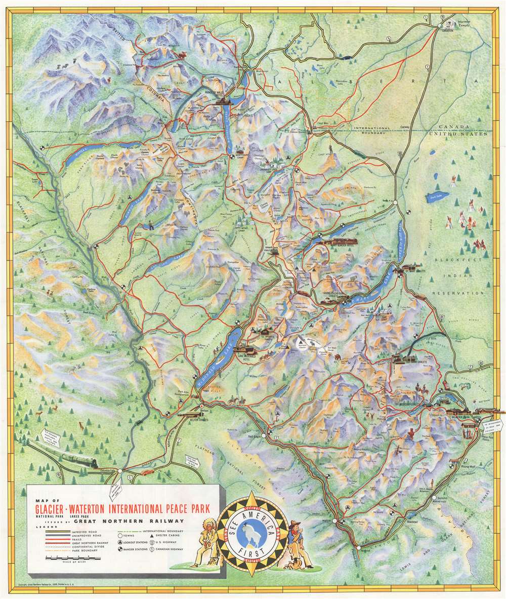
Map of Glacier - Waterton International Peace Park.
sold
- Digital Map Information
- Suitable for large format printing
- File Size: 71.09 MB
- File Type: ZIP / TIFF
- ICC color profile embedded
- Delivered instantly via download link
This is a 1939 Great Northern Railway pictorial map of Waterton-Glacier International Peace Park, commonly known as 'Glacier'. Formed by the union of Waterton Lakes National Park in Alberta, Canada, and Glacier National Park in Montana, United States, the map depicts from Cardston, Alberta south to Nimrod, Montana. Yellow lines bordered in black highlight paved roads, while red lines trace the park's trail network. Icons mark towns, lookout stations, ranger stations, and shelter cabins; and pictorial vignettes emphasize the chalets, hotels, and camps scattered throughout. Lakes shaded a brilliant blue stand out against the map's green landscape. Illustrations of some of the park's wildlife, including bighorn sheep, grizzly bears, mountain goats, and moose add charm. (more details)
Home to Memphre, a cryptid akin to the Loch Ness Monster.

Lake Memphremagog and About There.
sold
- Digital Map Information
- Suitable for large format printing
- File Size: 8.9 MB
- File Type: ZIP / TIFF
- ICC color profile embedded
- Delivered instantly via download link
This is an 1899 Rand Avery Supply Company and Boston and Maine Railroad map of Lake Memphremagog. Lake Memphremagog stretches across the U.S.-Canada border between Newport, Vermont and Magog, Quebec, Canada. Thick black lines trace the Boston and Maine Railroad's lines in the area, as well as the Canadian Pacific Railway. Roads throughout are illustrated. Towns identified include Magog, Sherbrooke, and Newport. The Owls Head Hotel, a ski resort today, is prominently identified. (more details)